
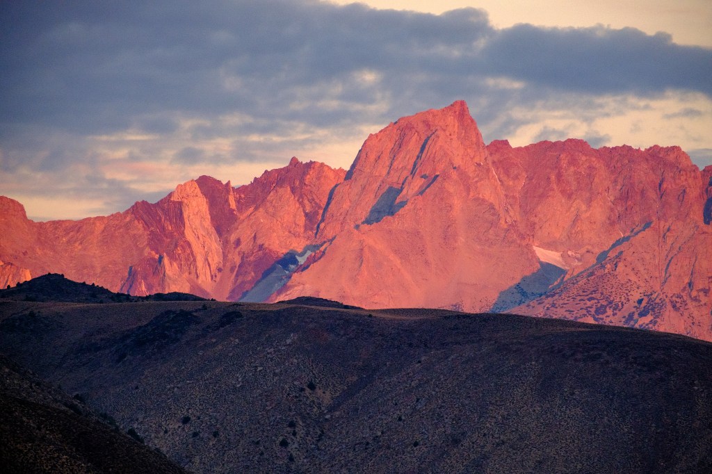
The Owens Valley is about 100 miles long and 10 miles wide. This long trench is oriented north to south. Bishop lies roughly in the center. The Sierra Nevada forms the west wall of this ditch, the Inyo and White Mountains form the east side. The Sierra Nevada has 12 summits higher than 14,000 feet. These high summits are 15 to 60 miles south of Bishop. From Bishop we can see only one summit higher than 14,000 feet: White Mountain Peak (14,252) in the White Mountains, to the northeast. West of Bishop is Mount Humphreys (13,992 ft), the highest Sierra Nevada summit below 14,000 feet in elevation.
I photographed mountains long before I started bird photography. On my bird walks, I continue to collect mountain images. One of the fun things about our walks is that the mountain scenery is always there, even if no birds appear. For this blog, I decided to focus (a pun!) on Mount Humphreys. I selected pictures that show how the appearance of this mountain is changed by snow, clouds, light conditions, and my vantage point. Photo locations range from 5 to 20 miles east of Humphreys’s summit.
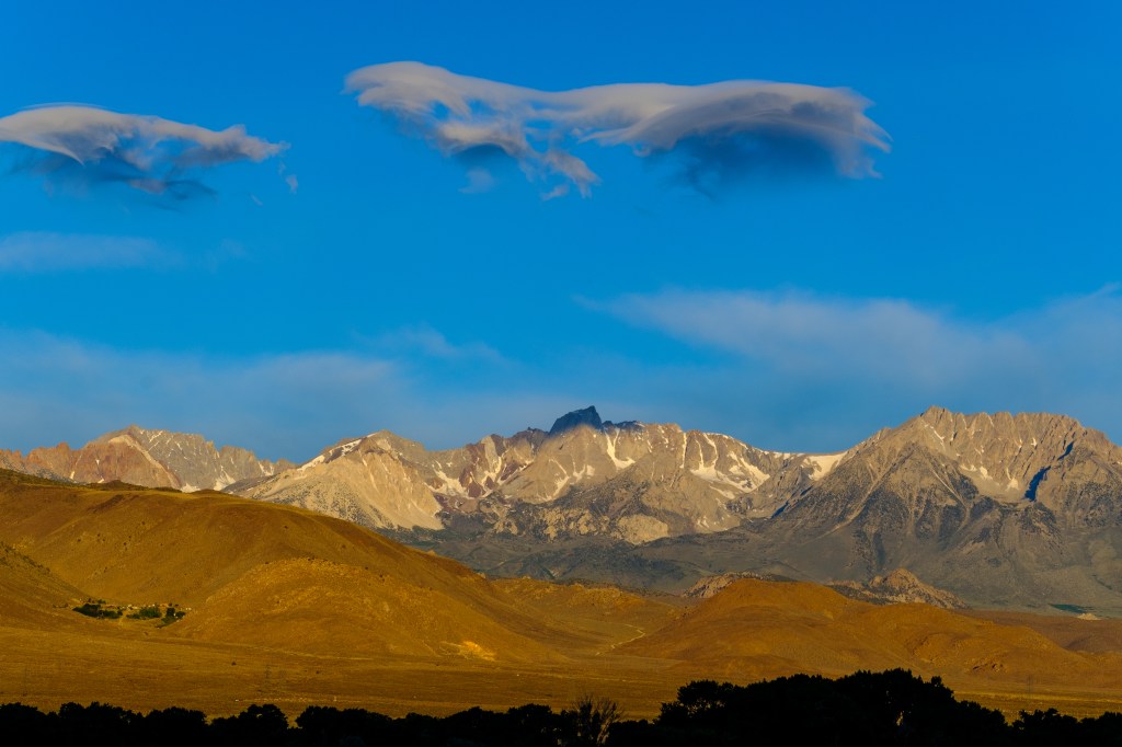
Mountain Panorama from Bishop
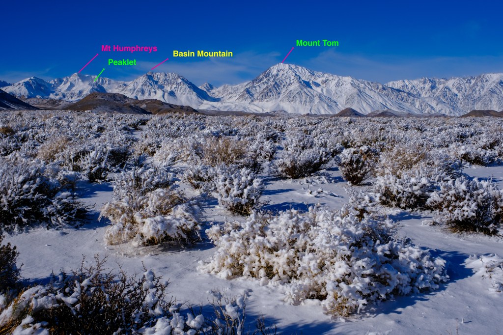
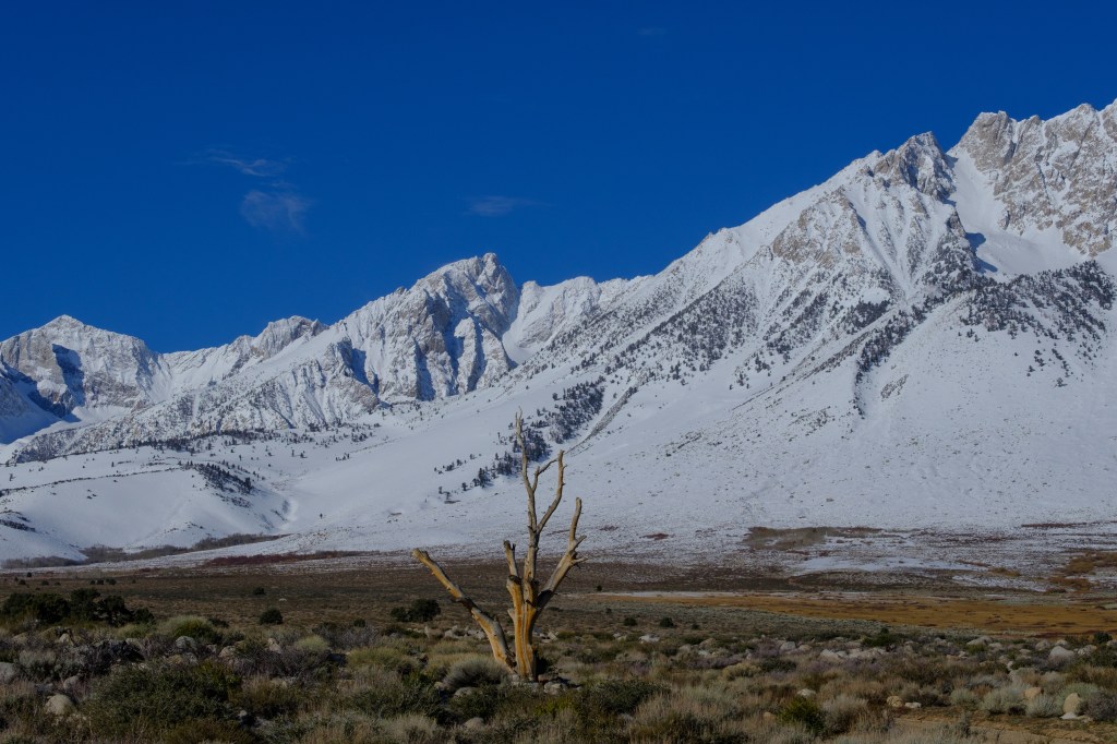
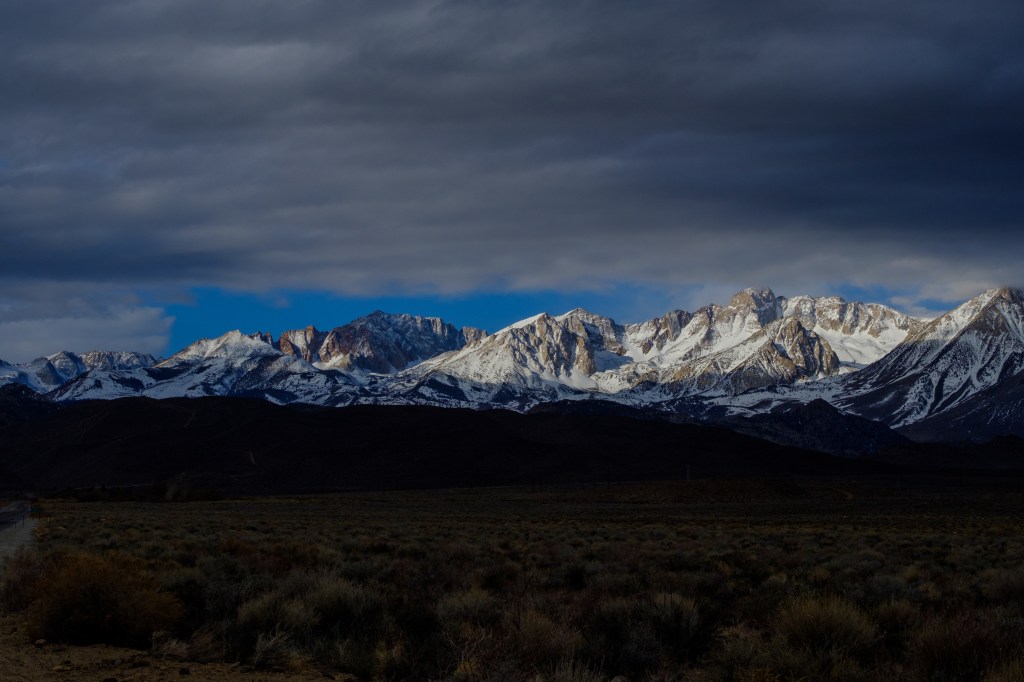
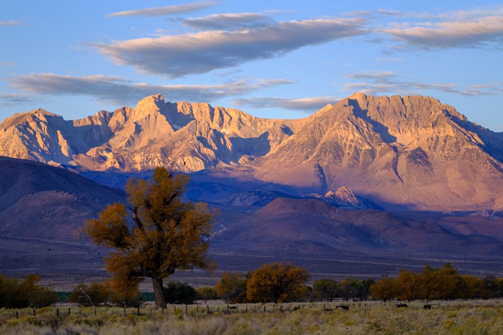
In the photo below, December snow covers sagebrush near Bishop. Mount Humphreys is in the left side of the picture. Basin Mountain (13,187 feet) and Mount Tom (13,658 feet) are lower summits, but they seem taller than Humphreys because they are closer to Bishop. I also labeled “Peaklet” (12,160 feet), a lesser summit that appears in many of my photos because it lies in front of Humphreys. Bishop’s elevation is 4000 feet, so the top of Humphreys is nearly two miles above us.
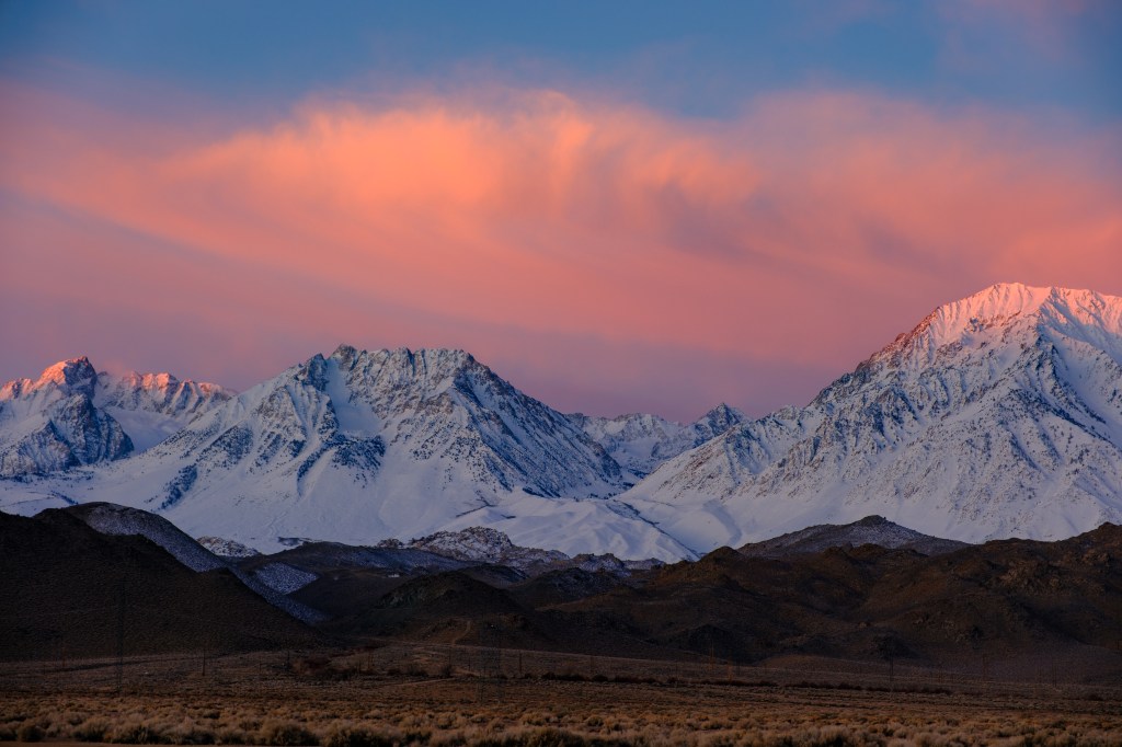
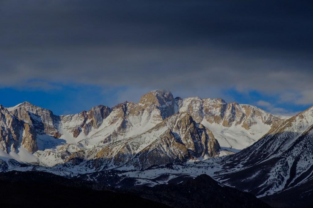
In January, dawn light (7am) touches the top of Humphreys on the left and Mount Tom on the right. Basin Mountain, left of center, is still in shadow because it is lower.
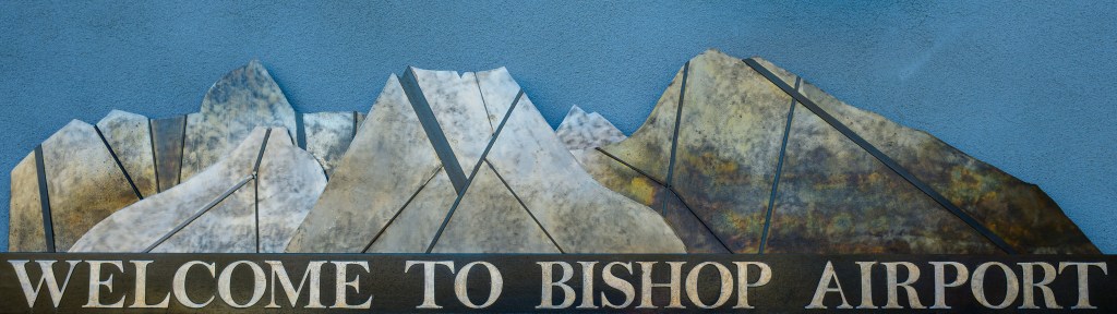
Welder Jon Vandehoven created a metal sculpture for the Bishop Airport, showing the three summits on the Bishop horizon. Even “Peaklet” appears in his design. His rendition seems a bit abstract at first, but he captures many details that you can see in my pictures.
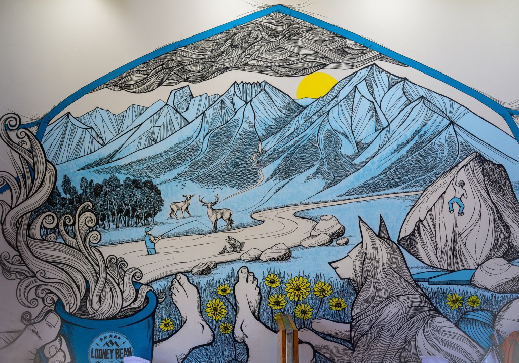
Artist David Titus imagined how these peaks look from the door of a tent; this fun painting covers a wall in Looney Bean of Bishop, a local coffee house.
Several years ago, the Bishop Chamber of Commerce had a contest for a short description of our town. The winning slogan was “Small Town with a Big Backyard.” Good choice.
Mount Humphreys was named for Andrew A. Humphreys, a Union General during the Civil War. He later became chief engineer of the United States Army. His many achievements in war and engineering are described in a Wikipedia article: https://en.wikipedia.org/wiki/Andrew_A._Humphreys. Three summits bear his name; the peak above Bishop, the highest mountain in Arizona, and a third in Yellowstone. He had no personal connection with any of these mountains. His name is entangled with the politics of military base titles. During World War I the Army established Camp A. A. Andrews in Virginia. Later, Congressman Howard A. Smith of Virginia, a pro-segregation Democrat, resented having a military base in his district named for a Union officer; he had the name changed to Fort Belvoir in 1935, honoring the large Belvoir slave planation that existed earlier on the same land.
Mount Humphreys was first climbed in 1904 by James and Edward Hutchinson, two brothers from San Francisco. This was a difficult and notable climb for that era.
I will group subsequent pictures according to the location from which they were taken and the approximate distance from Humphreys’s summit. I will give a date for each photo, but omit the year.
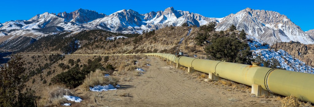
The Pipelines, 5 miles
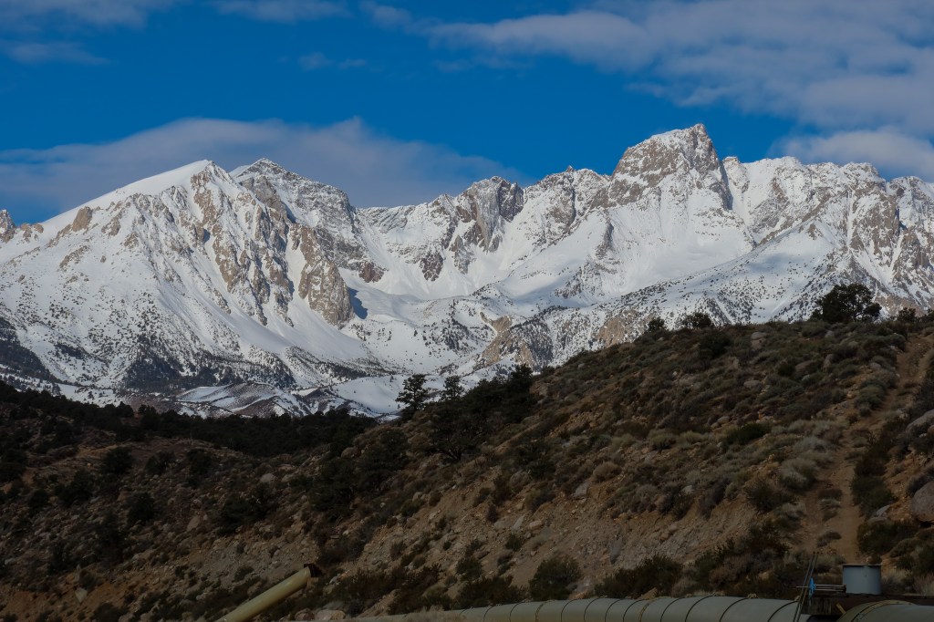
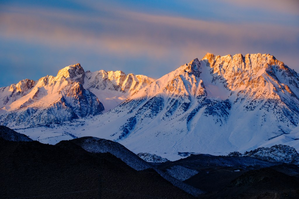
Water that drains from Mount Humphreys will eventually reach Los Angeles via the LA Aqueduct. Aside, of course, for a dribble that sustains Bishop. Los Angeles Department of Water and Power doesn’t care how that water gets to the valley; their intakes collect from all the streams. But Southern California Edison does care; they built large pipelines to move water from the slopes of Mount Humphreys into Bishop Creek, where it flows through power stations to create the juice that lights our town. The first set of photos was taken from roads near those pipelines. The shot below is from early November. Humphreys is just right of center. The pipeline is about six feet high.
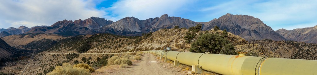
The second picture shows the same view in late November, after the first snow.
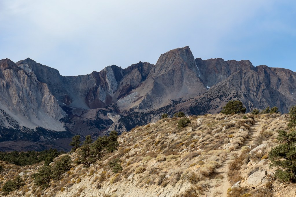
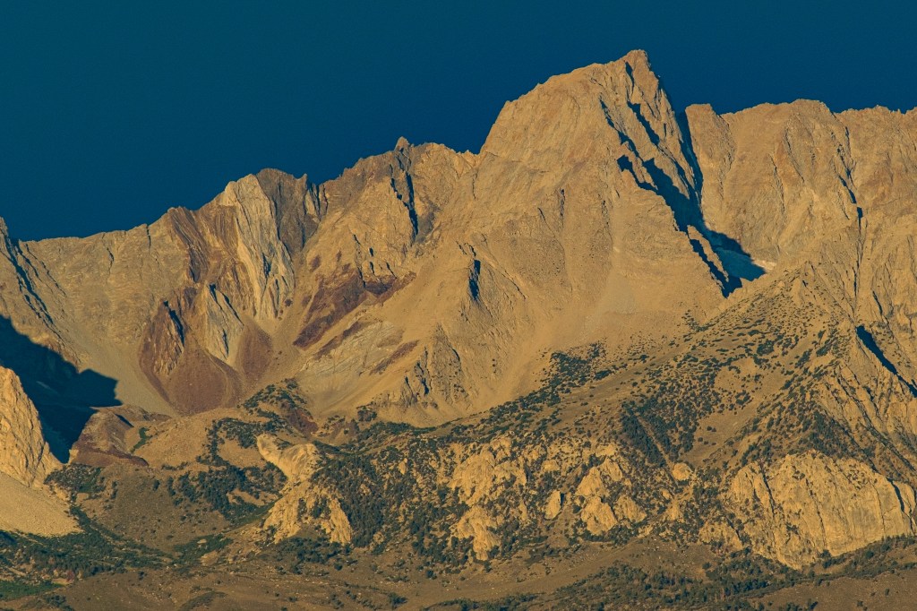
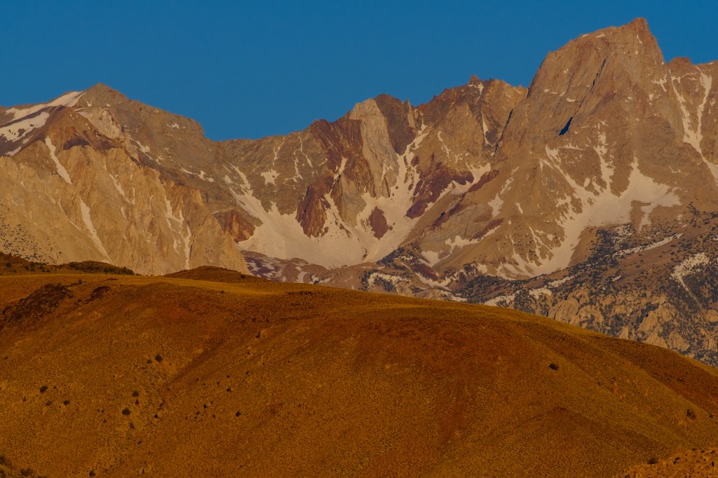
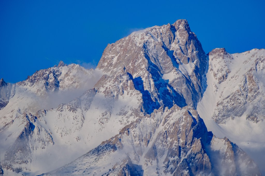
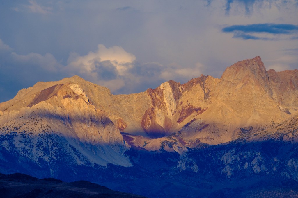
The next photo shows more detail of Humphreys before any snowfall. To the left of Humphreys, a massive tower of gray sedimentary rock reaches the skyline, sandwiched between layers of red rock. In some photos you can see the sedimentary layers have been upended ninety degrees. The Sierra is mostly granite, but throughout the range are slabs of layered rock that have been twisted by colossal forces.
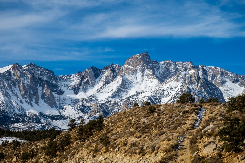
Below is the same view, with snow.
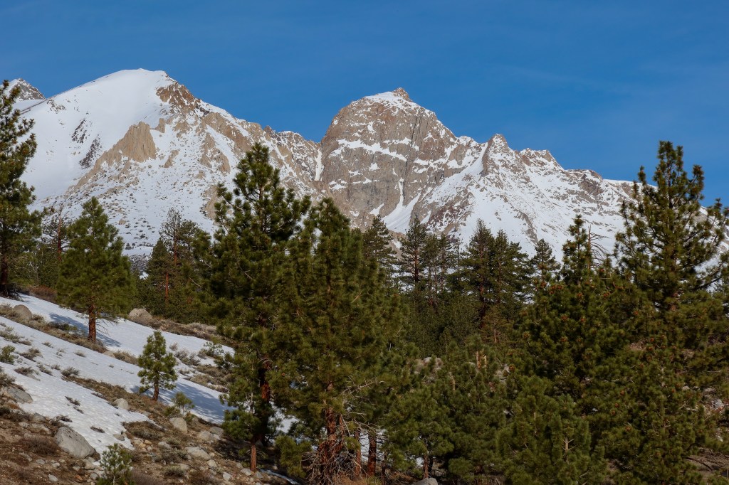
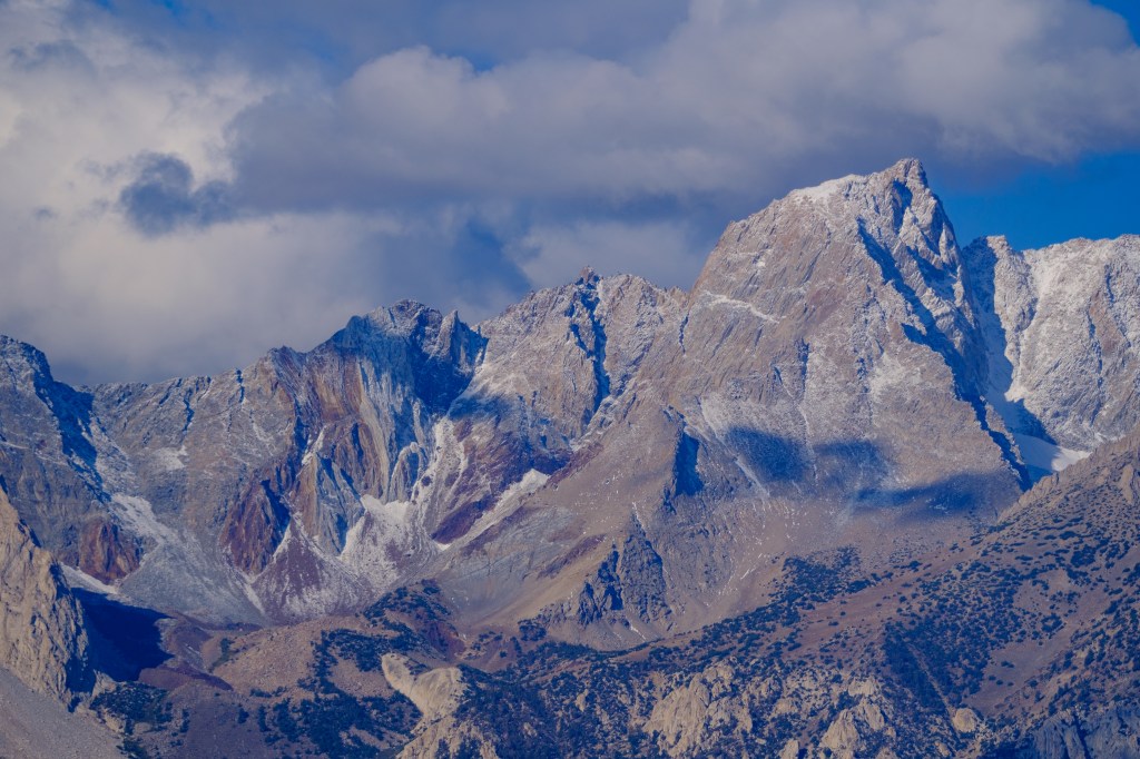
The next photo was taken further north from a higher spot. The red towers of the Piute Crags are on the left. Gray Mount Emerson is above them. In the center is Mount Locke. Humphreys is further right. From this vantage, Peaklet, on the far right, reaches the skyline.

The April view below is centered on the gray sedimentary tower.
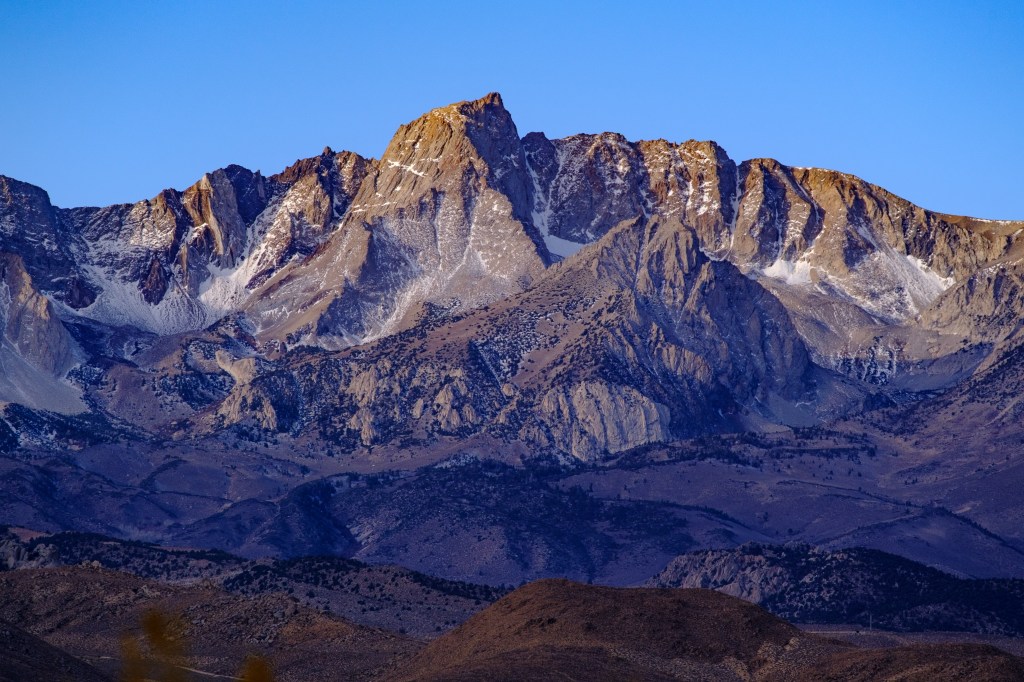
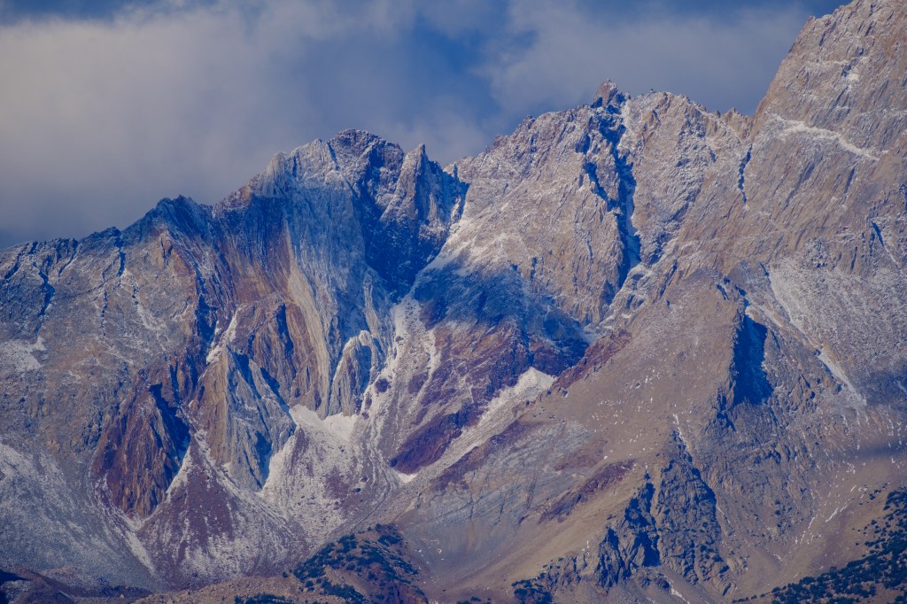
The last photo in this group was taken further south. Mount Humphreys is right of center and looks quite different from this angle.
Buttermilk Road, 5 miles
The sagebrush flat in the foreground is at 7500 feet on the Buttermilk Road. A view in April. Humphreys near the center, Basin Mountain on the far right. Peak on the far left is Checkered Demon.
Ed Powers Road, 12 miles
In winter, Roberta and I visited nearby Ed Powers Road to photograph the sunrise on Humphreys. I used a tripod for shots in low light. The first photo (7:03 am, January 3) shows, from left to right, Mount Emerson, Mount Locke, Checkered Demon, Humphreys and Basin.
At 7:08, there is more light on Humphreys. Peaklet is now in the light.

The 3rd image was at 7:13 am.
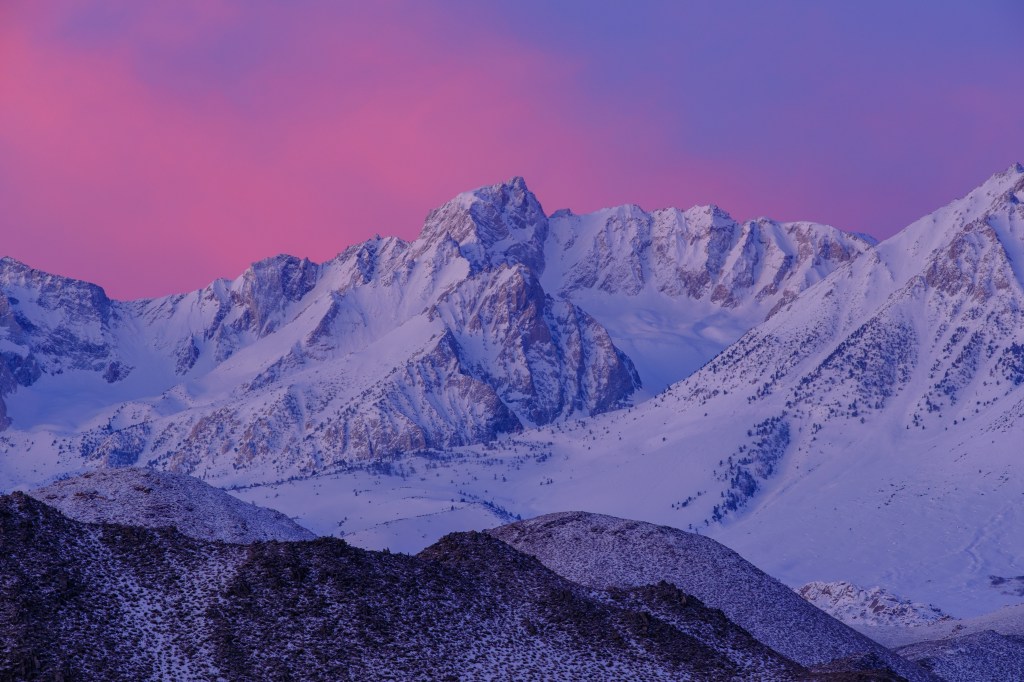
We returned on January 12. The first photo shows Peaklet at 6:53 am.
The sky turns pink at 7 am.
At 7:05 the light has almost reached Peaklet.

(Full disclosure: For years I thought Ed Powers was an early Bishop settler. I finally realized that the name refers to Southern California Edison, which operates the power plants near Bishop. So I am not always the sharpest tool in the shed.)
Riata Road, 13 miles
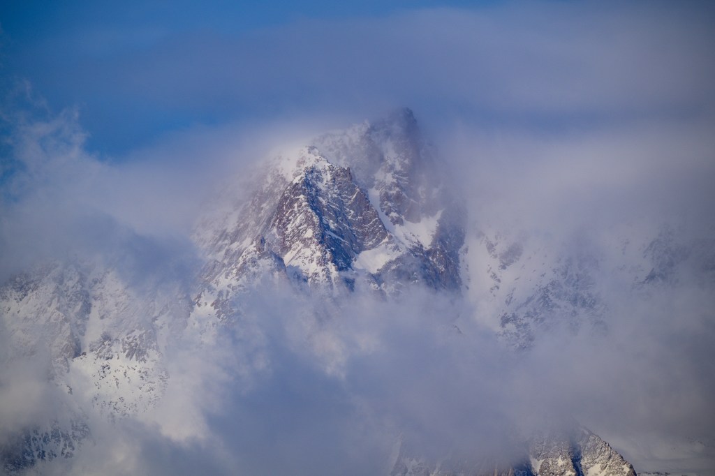
At 7:10 am in November, Humphreys was in clouds. The details on Peaklet were especially clear.
Barlow Lane, 15 miles
Two March photos at 8:52 am.
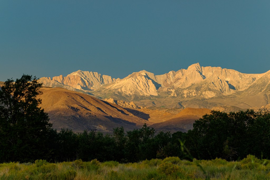
Conservation Open Space Area (COSA), 16 miles
The COSA is right downtown. In March I took shots of Humphreys and Peaklet.
Bishop Creek Canal, 18 miles
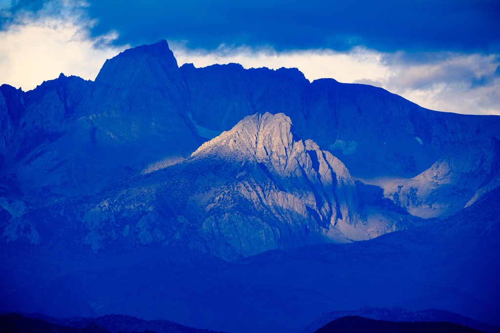
In June, dramatic clouds cast a shadow on Humphreys’s summit.
In September one year, wildfire smoke created a strange sky color in the next two photos.
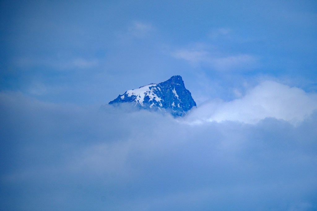
Morning clouds cast a shadow, but Peaklet remained in the spotlight below.
In November, cottonwoods were still yellow
December light below.
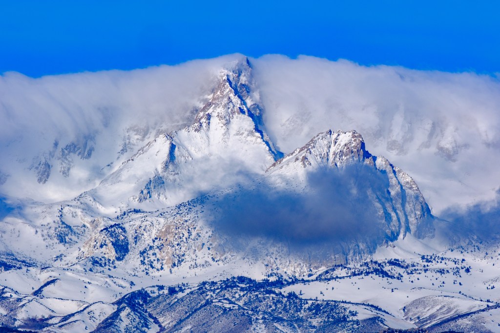
Fresh snow and clouds on Dec 31, 9:17 am.
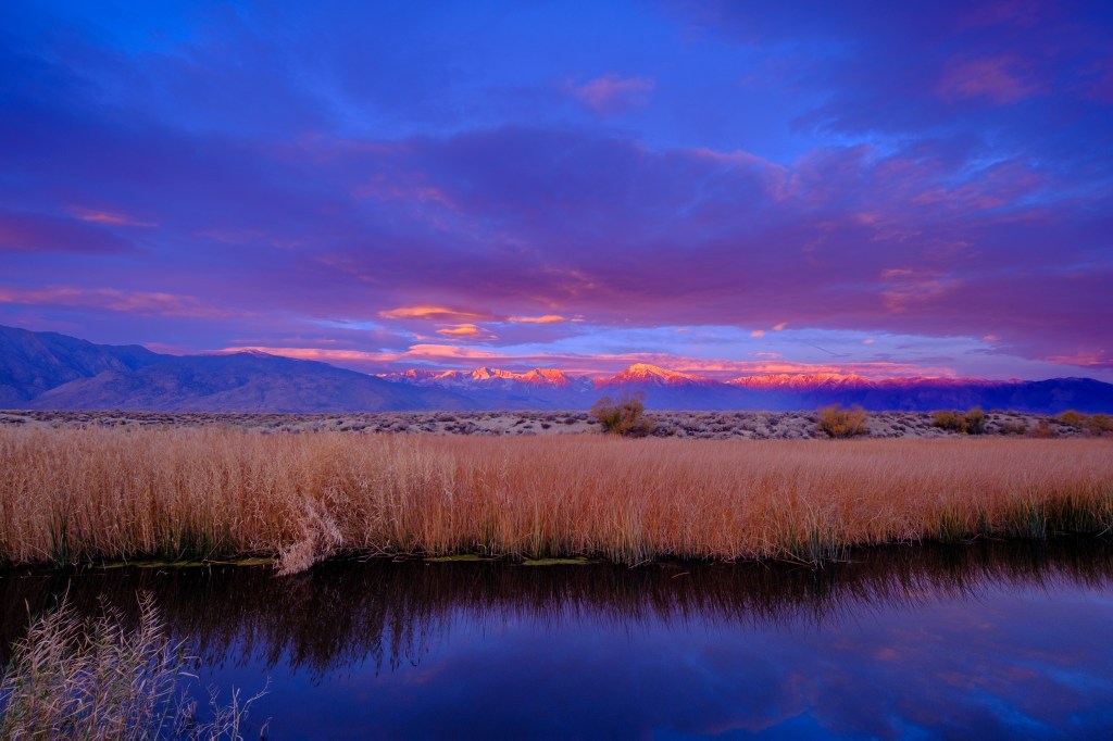
May 30, at 6:05 am, created yellow-golden light.
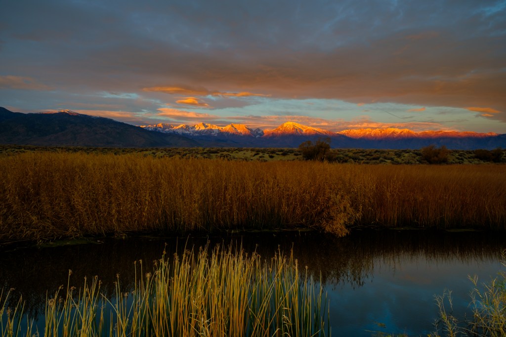
On June 30, at 5:37 am, the light was red. Foreground still in shadow.
Dixon Lane, 18 miles
Both photos below were taken in late April. The clouds and vantage point make Humphreys and Peaklet look mysterious and draw our attention to features that we might otherwise overlook.
Airport Road South, 19 miles.
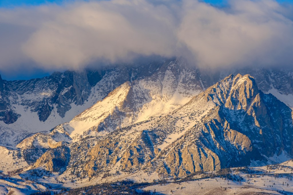
Three more images are affected by clouds. The first photo was taken in June.
The next two photos were from late March.

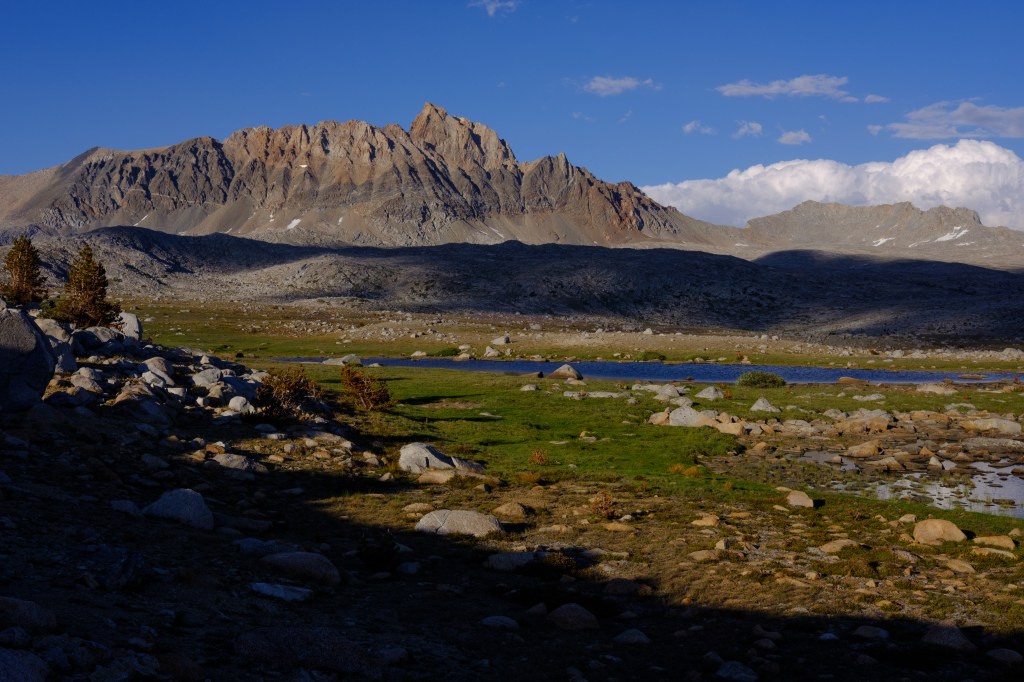
Buckley Ponds, 20 miles.
The Buckley Ponds are about 20 miles from Humphreys. It is amazing that a modern camera can capture so much detail through 20 miles of air. All these photos were taken without a tripod.
Below are the Ponds in late March at 9 am.
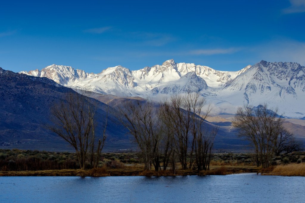
Next are the Ponds in early November. The birds in the water are American Coots; they hang here in winter. Several trees in this photo are now gone, ravaged by fire and beavers.

The next two images were taken using a wide-angle lens. I was just a little north of the Ponds on the Rawson Canal. Humphreys is visible, but the foreground and the sky dominate the pictures.
The next photo was shot in August at 6:37, as clouds built up.
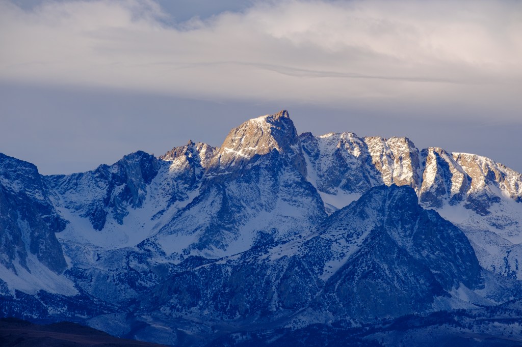
In late September I shot two pictures using my Nikon Z8 full-frame camera. The level of detail is outstanding.
On the day after Christmas, at 8:48 am, a wispy band of cloud hovers above the peak.
Humphreys with Birds
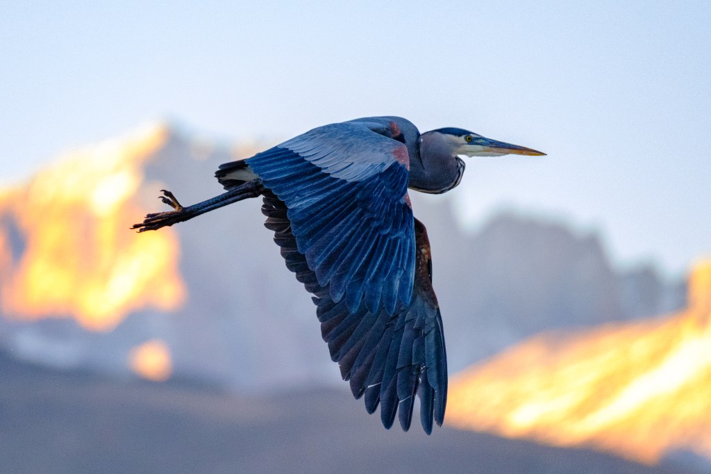
When I track a flying bird, the background sometimes includes distant peaks. In these pictures, the bird is perhaps a 100 yards away, while Humphreys is about 20 miles off. First, a Great Blue Heron flies near the Bishop Creek Canal.
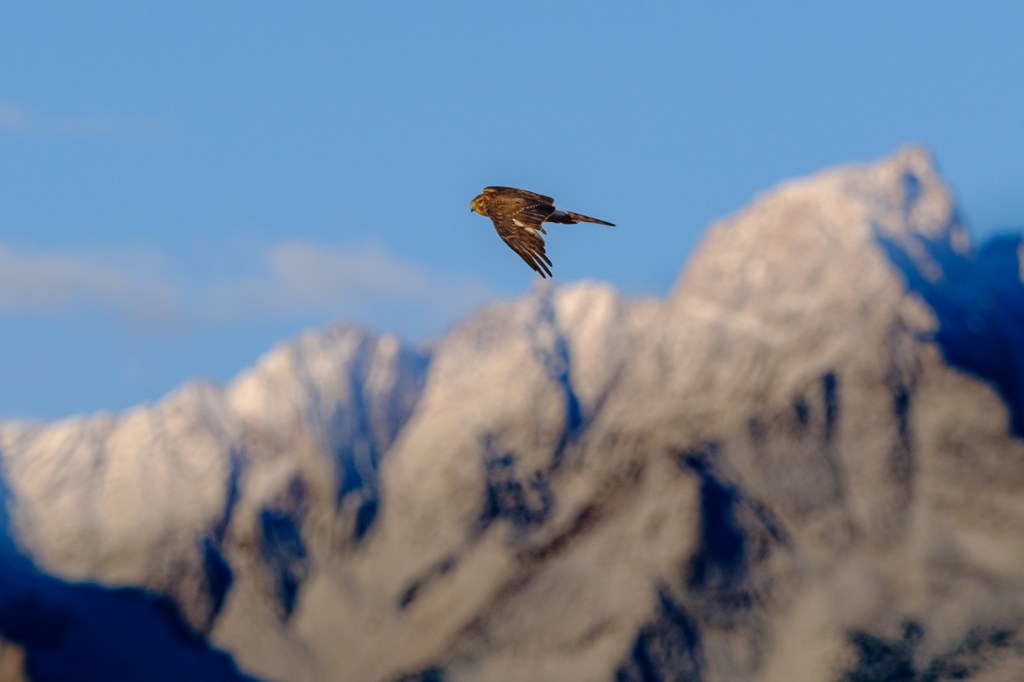
The next shot shows a female Northern Harrier at the Ponds.
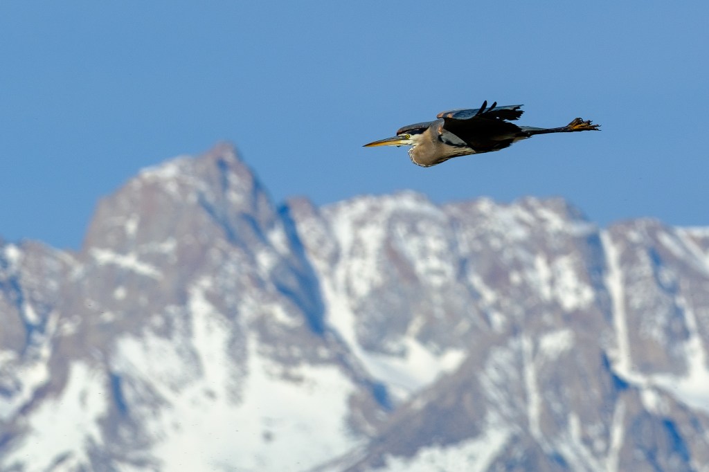
And the last shows a Great Blue Heron at the Ponds.
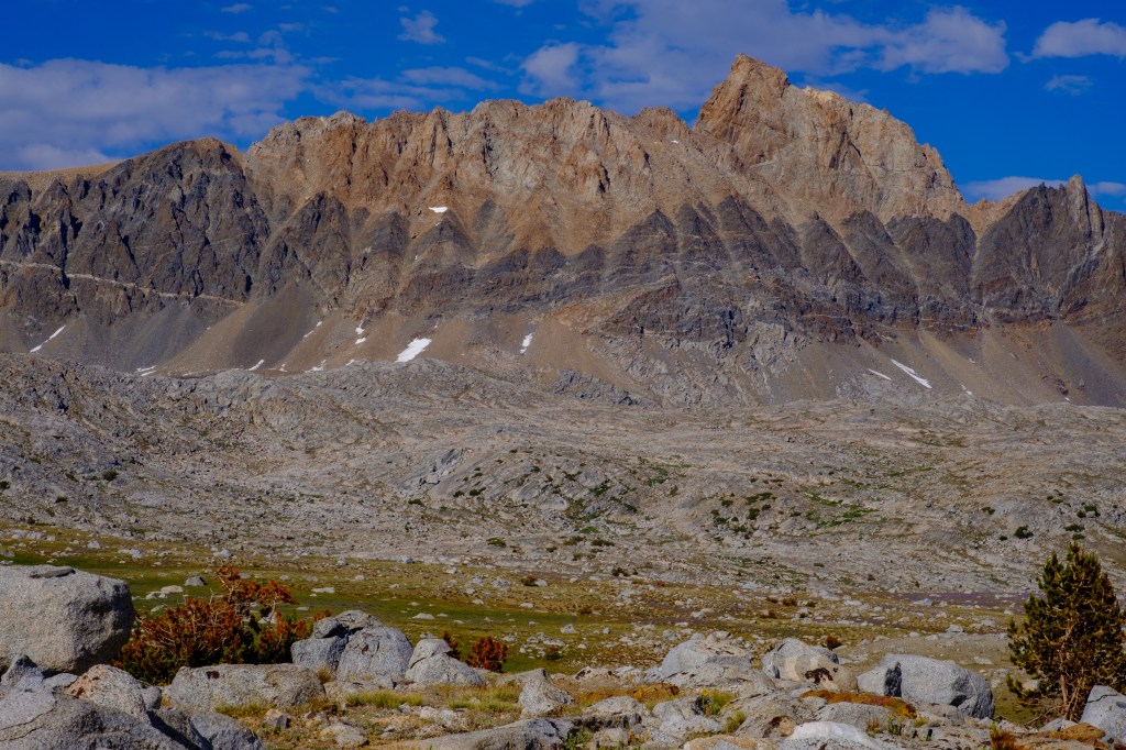
The West Side
To see the west side of Mount Humphreys, it is easiest to hike over Piute Pass and drop into Humphreys Basin, a tableland of lakes, rocks, and meadows. The first photo shows Humphreys near the center, at 7 pm.
A band of old, dark metamorphic rock, much of it loose, extends horizontally across the middle of the photo below. On the far right, partly hidden by a pine tree, is a purple field of lupine.
I climbed Humphreys in 1988 with my friend David Harden. We climbed the Southeast Buttress and then followed the south ridge to the top. Our ascent route is marked in green. Then we descended the Northwest Face and the Southwest Slope, following the red line. A fun day.

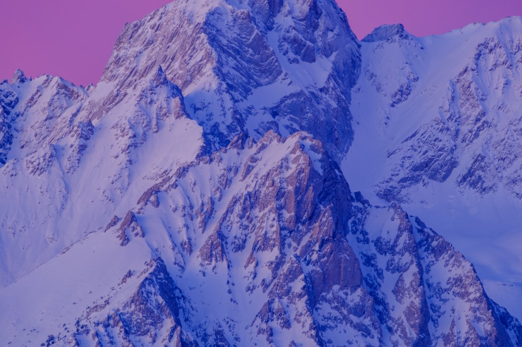
The last photo shows detail of the Northwest Face; this is the usual way up. We descended this face in 1988.

An anecdote: David and I downclimbed Humphreys without using a rope. As you can see in the previous photo, some cliffs near the top are steep. I got stuck part way down and asked David to help me find placements for my feet; he is a much better rock climber than I am. David wisecracked “Cummings, for someone who does so much climbing, you’d think you would be better at it.” I told this to Roberta; she thought David’s quip was harsh. I thought it was pretty funny. And true.
