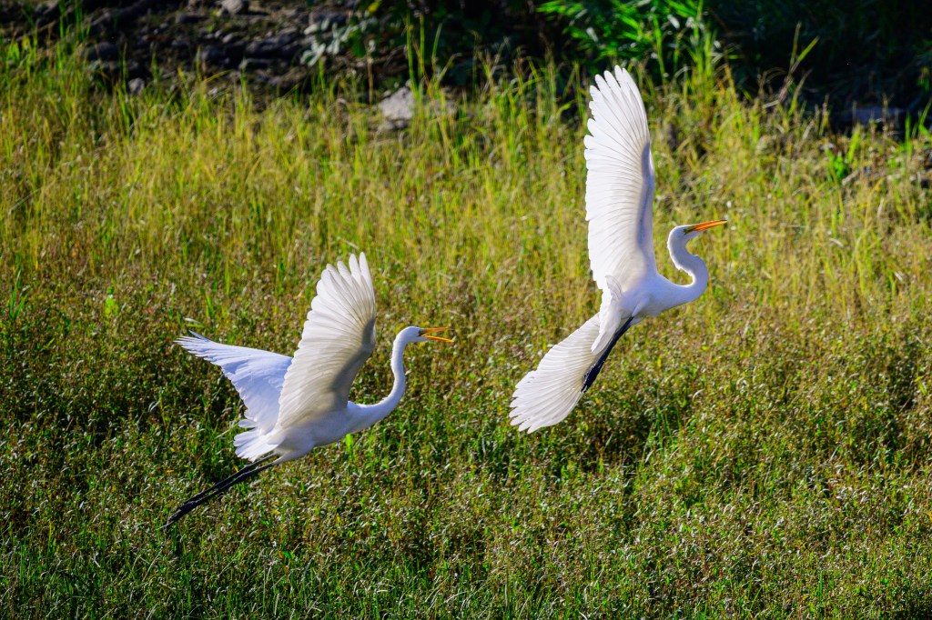
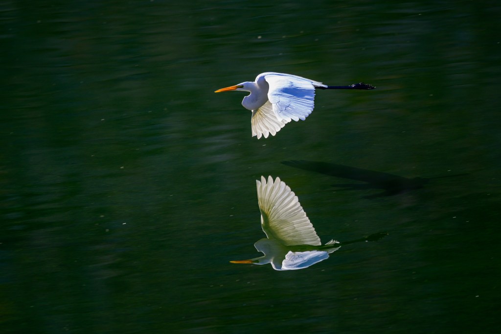
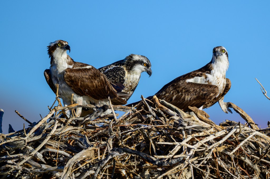
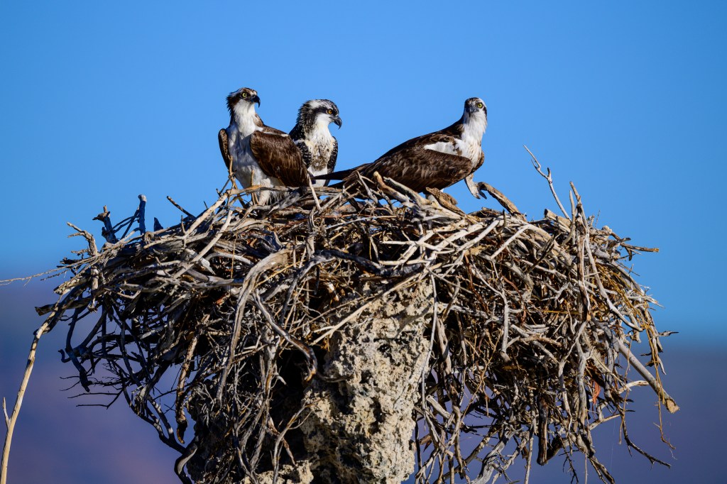
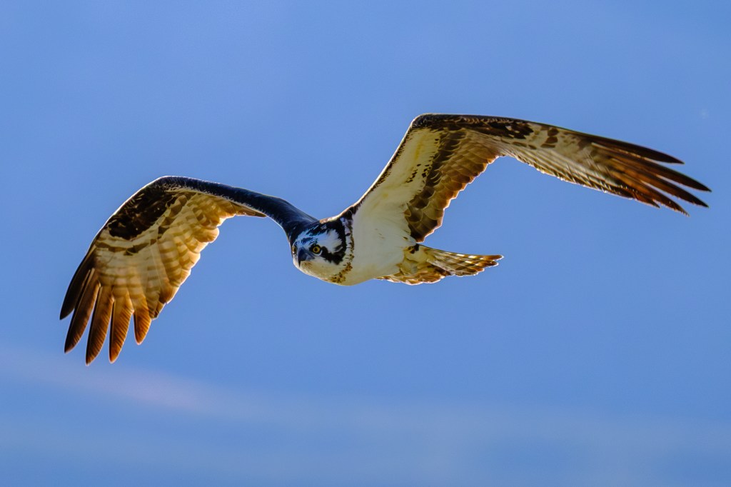
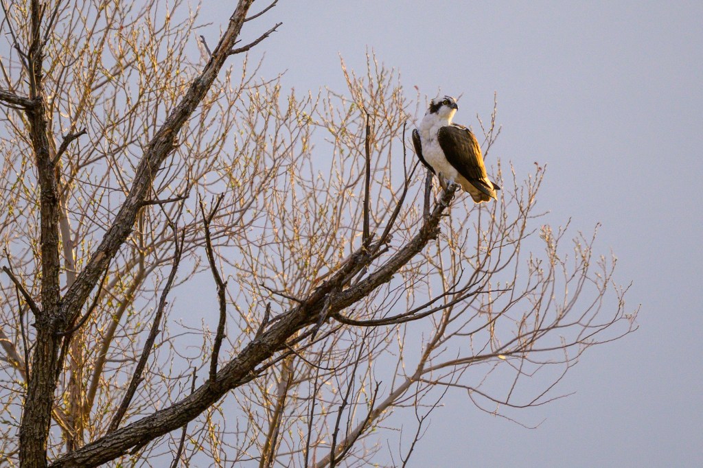
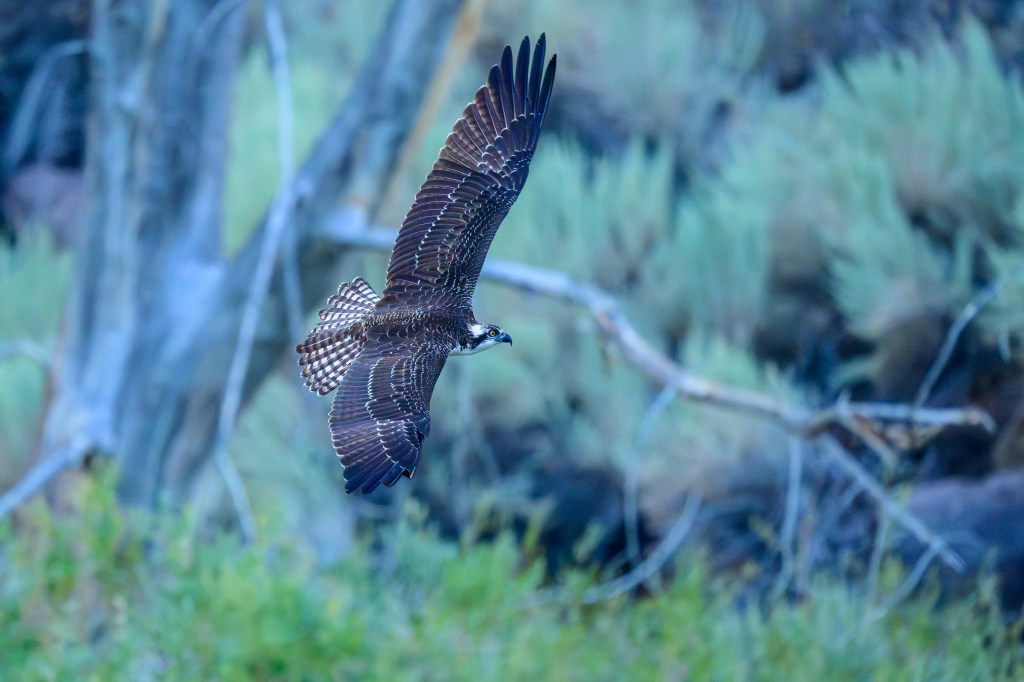
A selection of pictures, mostly of birds, taken in the Eastern Sierra during January, February, and March of 2026. I wanted to display the variety of creatures and sights in this area. I grouped pictures by species and used a minimum of text.
ANIMALS
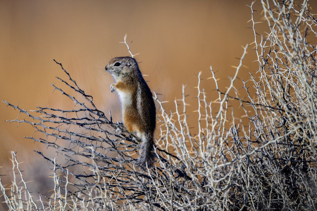
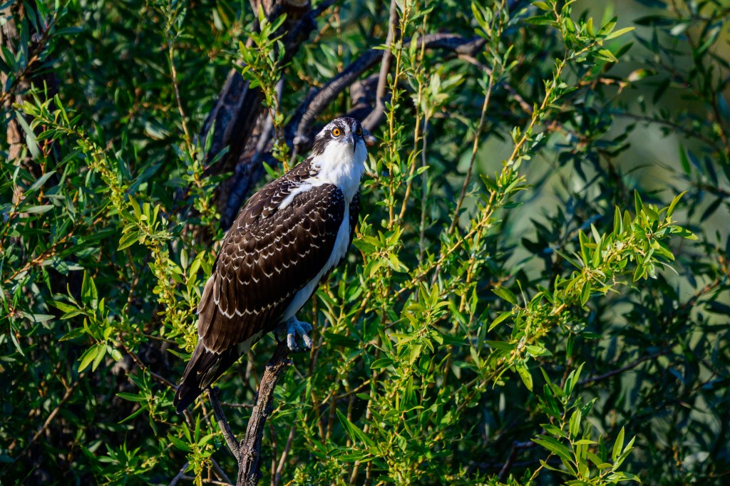
A White-tailed Antelope Squirrel at the Buckley Ponds. How did it get to this perch without being punctured to death by spines?
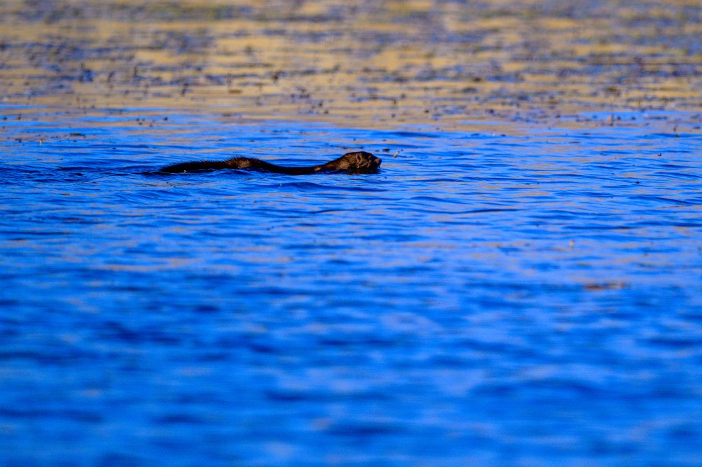
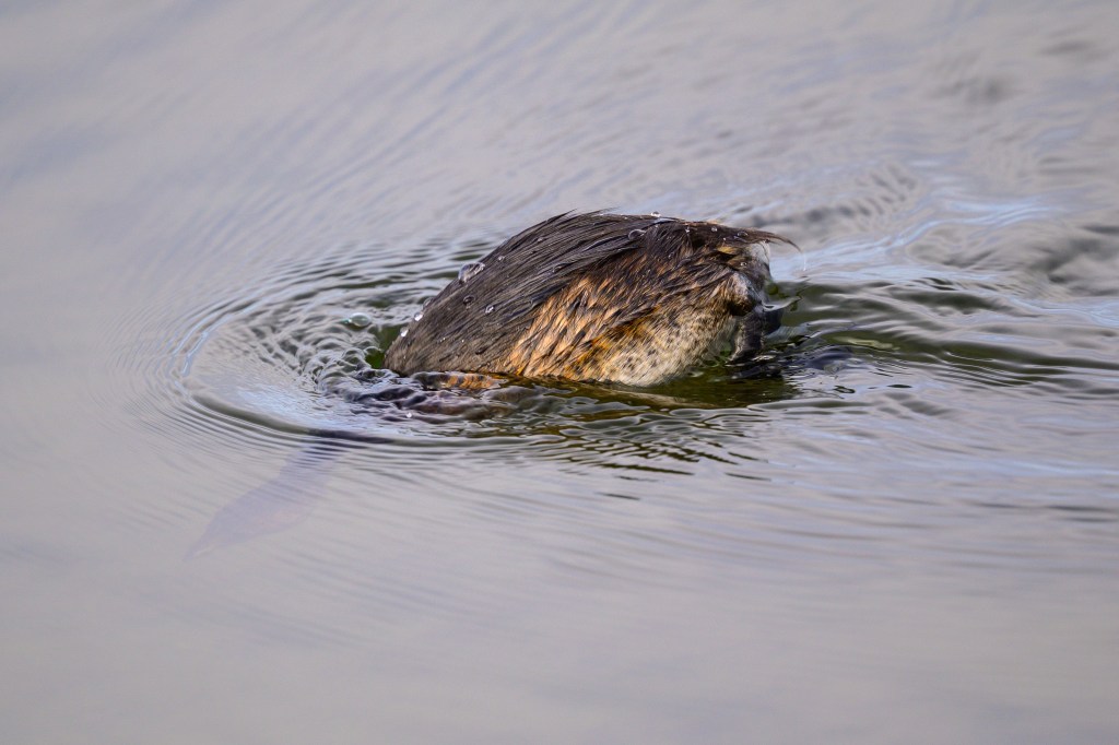
An American Mink swims at the Ponds in February.
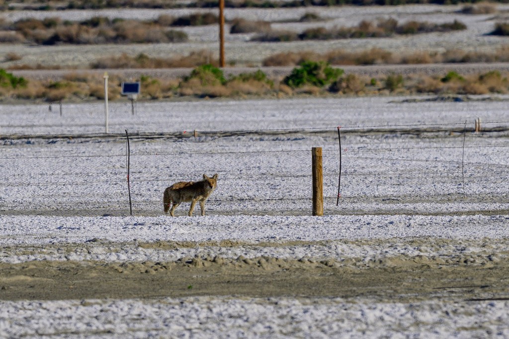
A Coyote watches me from afar on waterless section of Owens Lake.
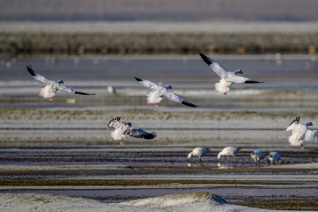
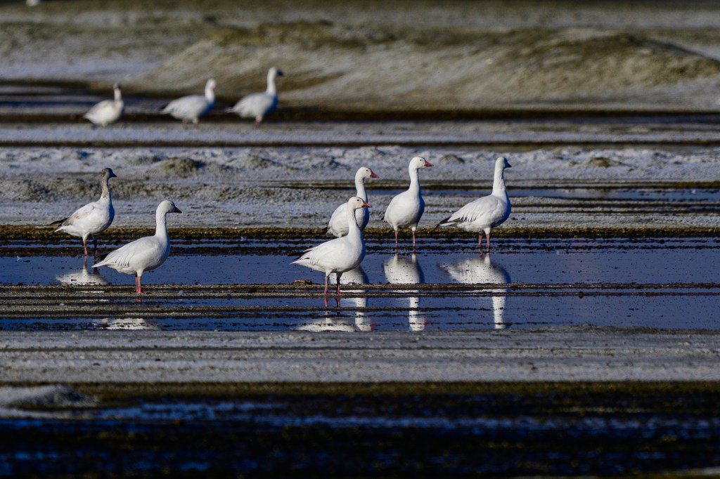
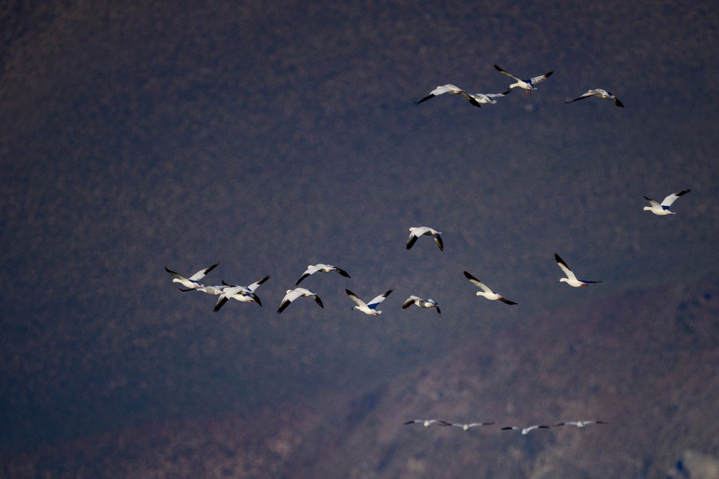
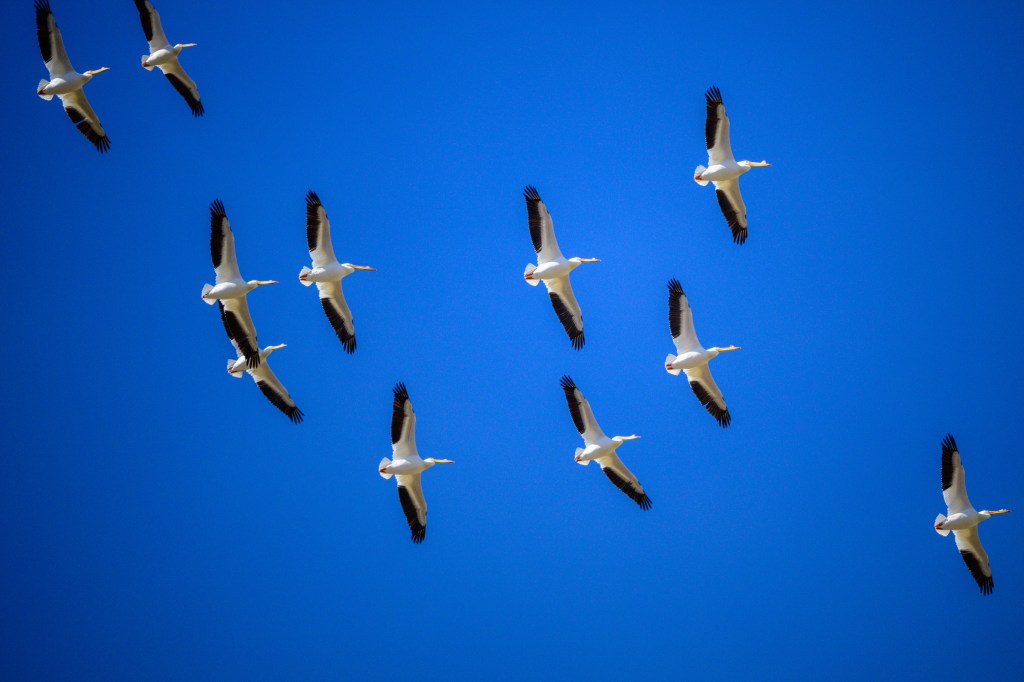
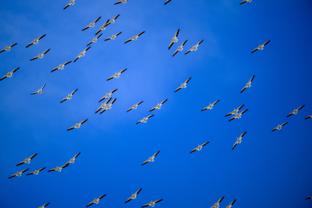
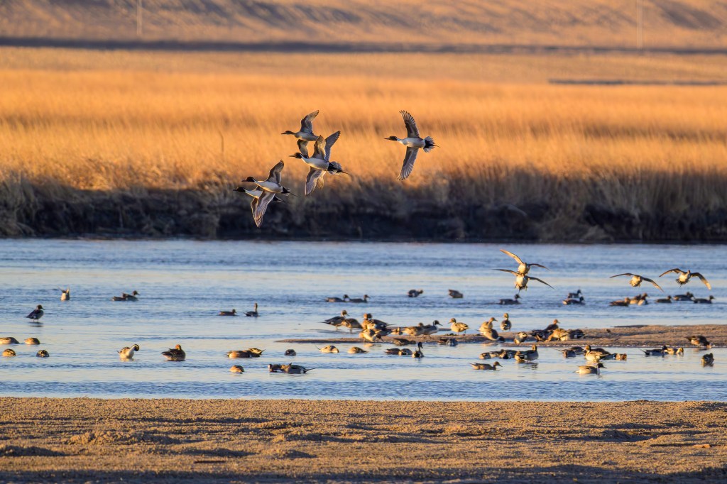
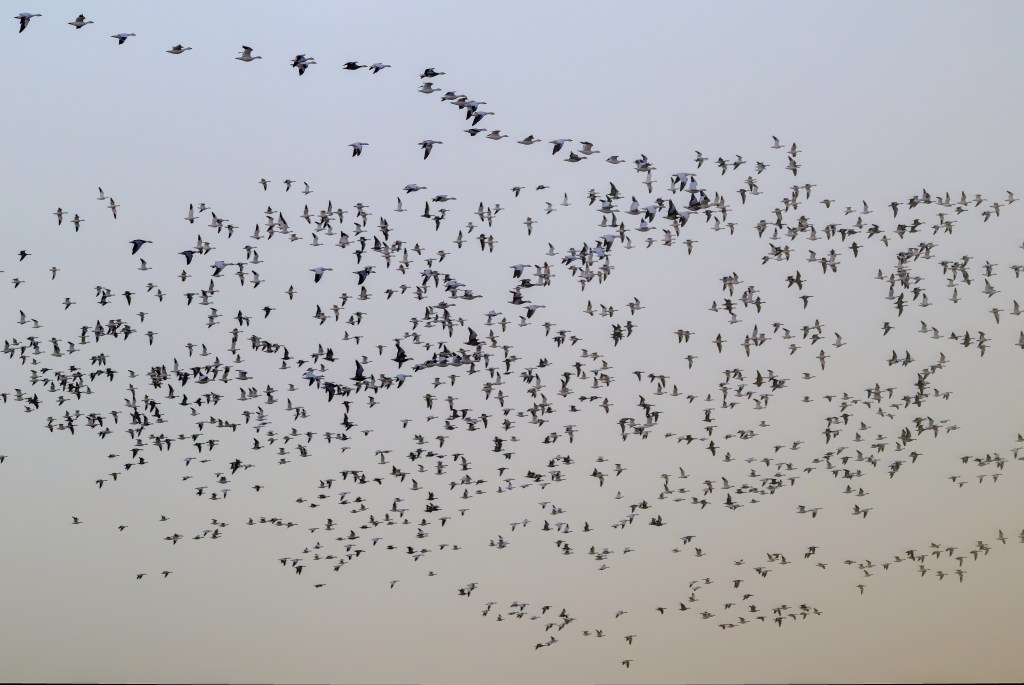
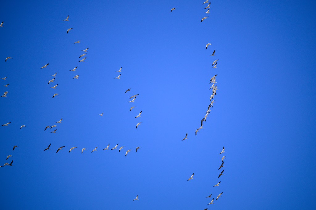
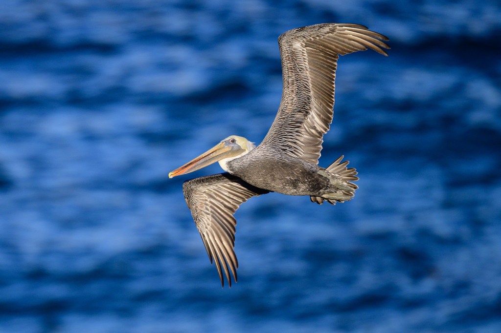
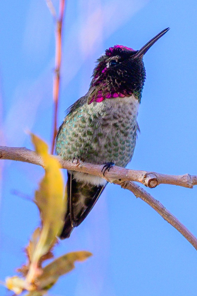
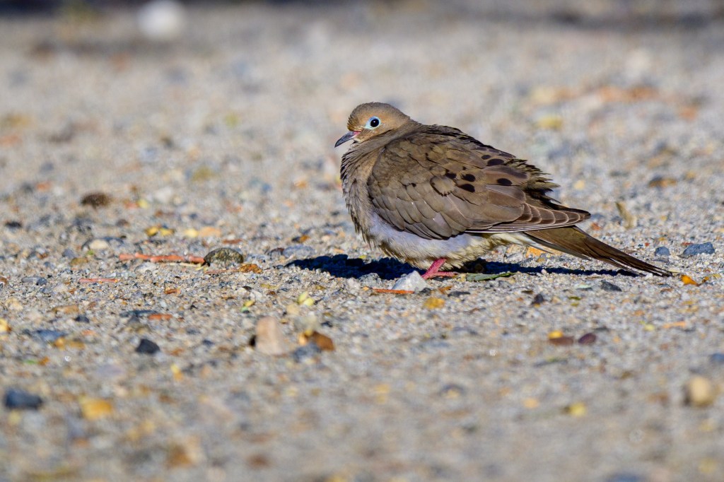
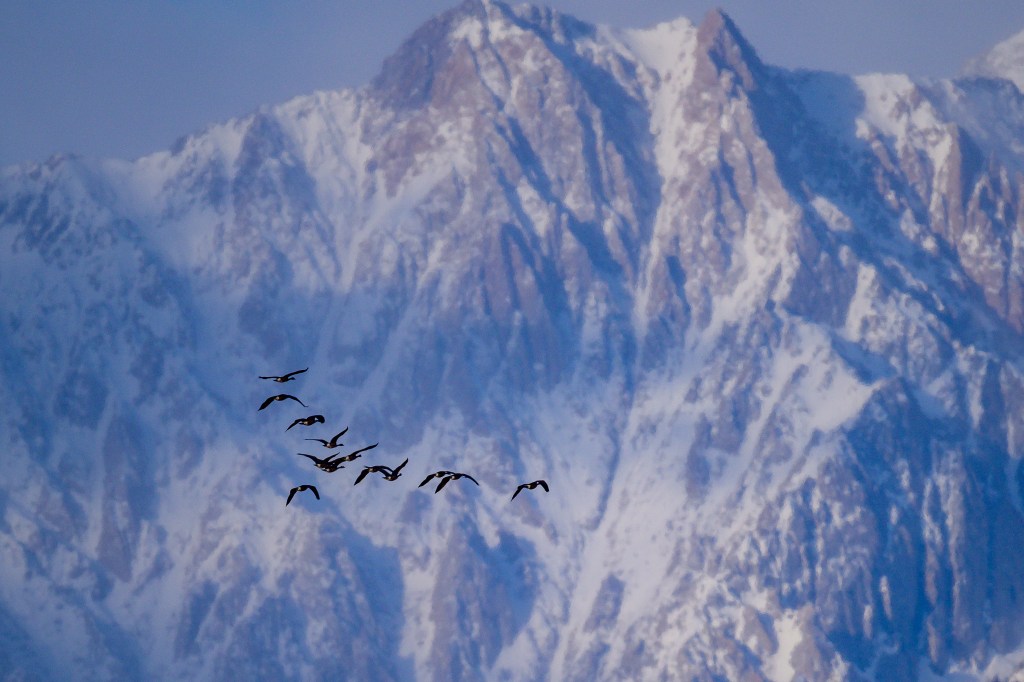
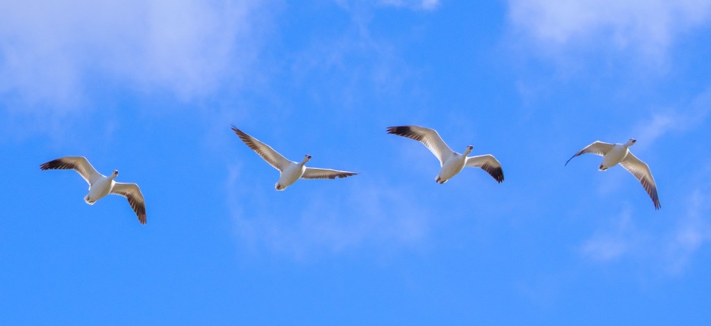
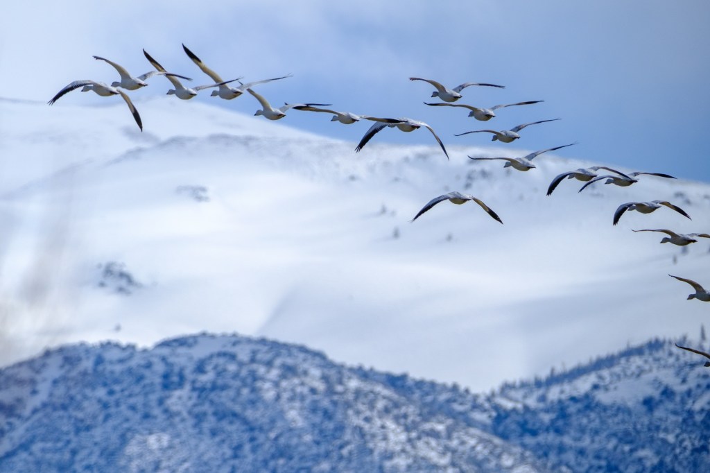
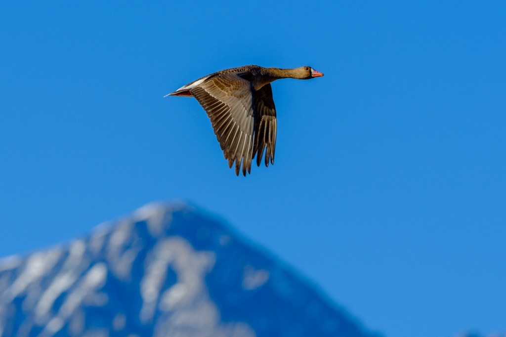
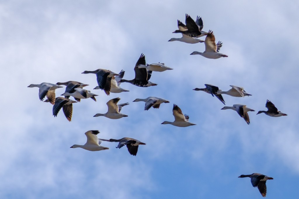
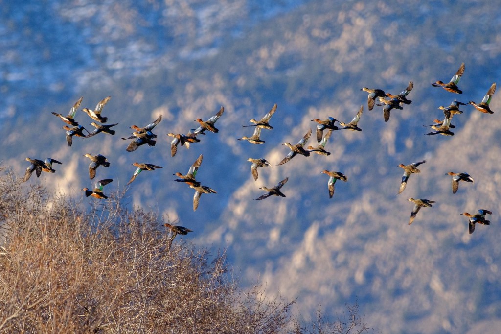
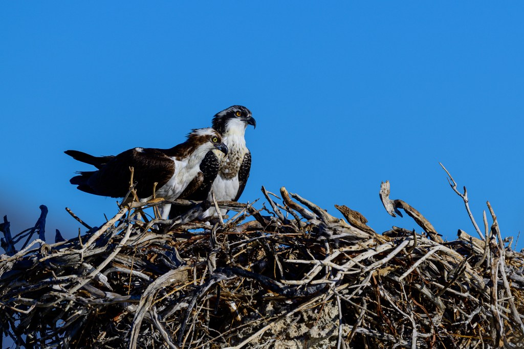
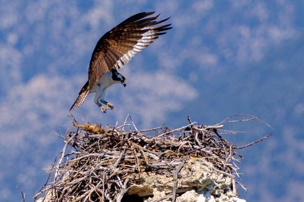
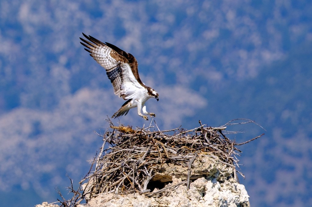
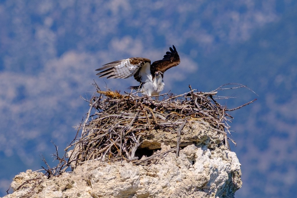
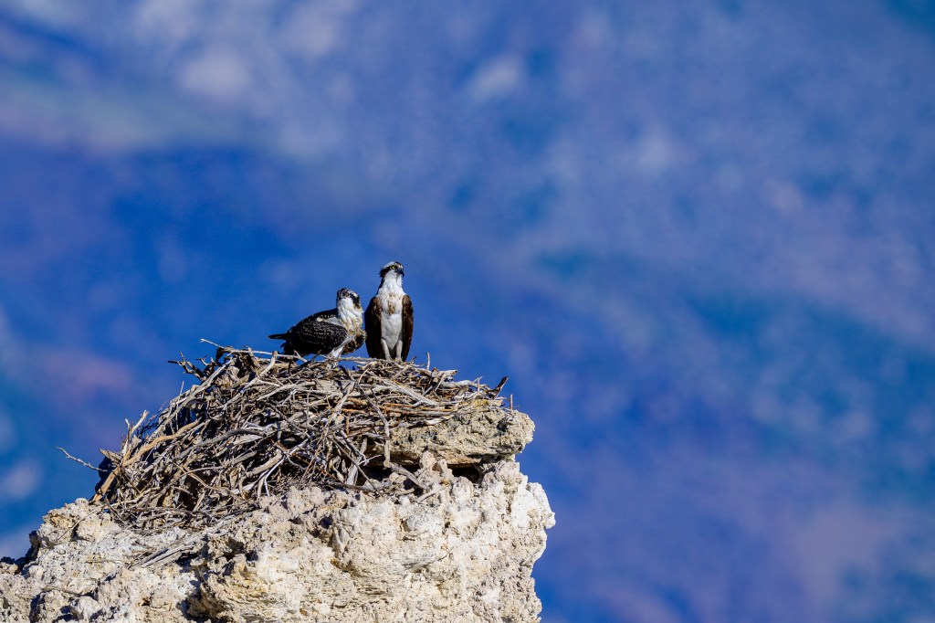
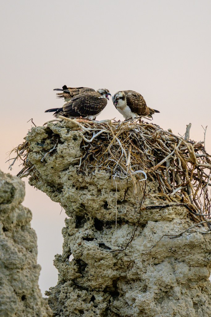
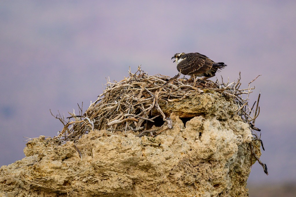
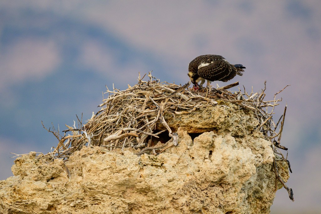
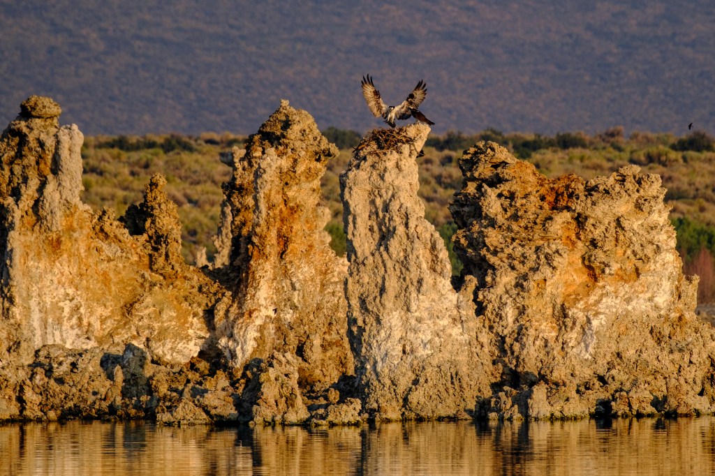
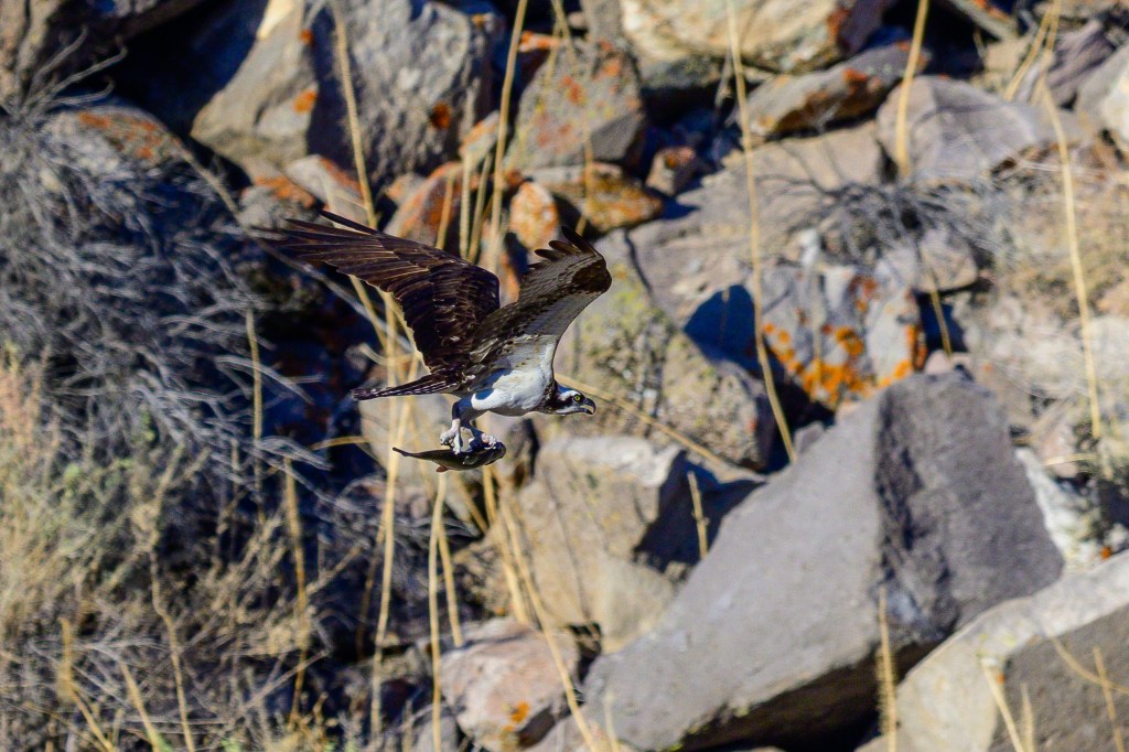
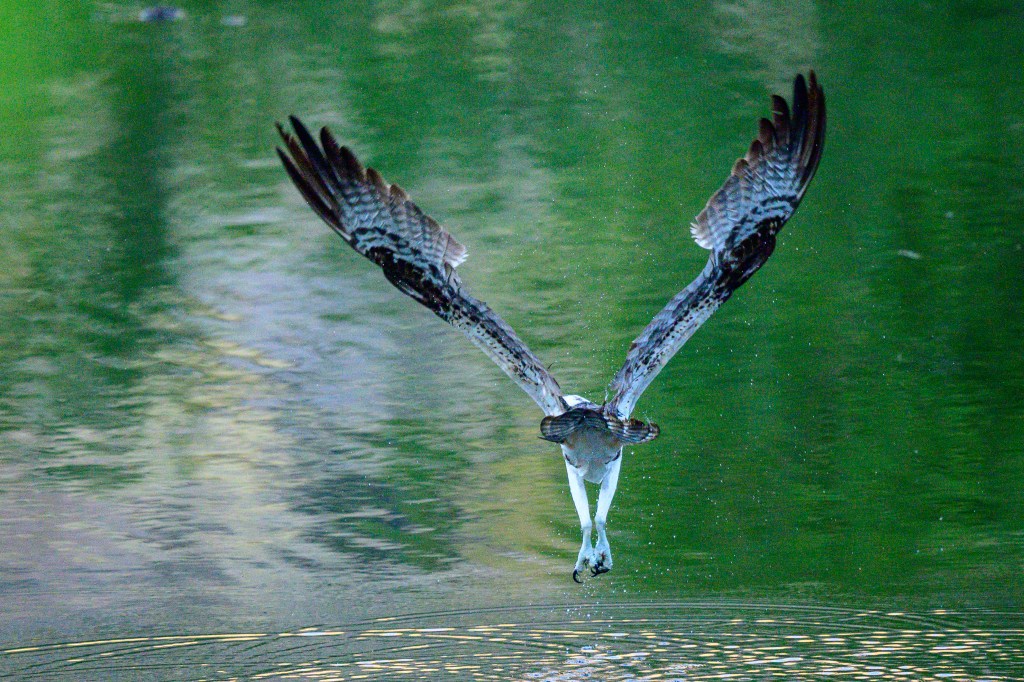
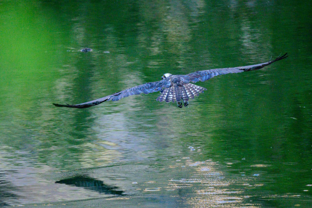
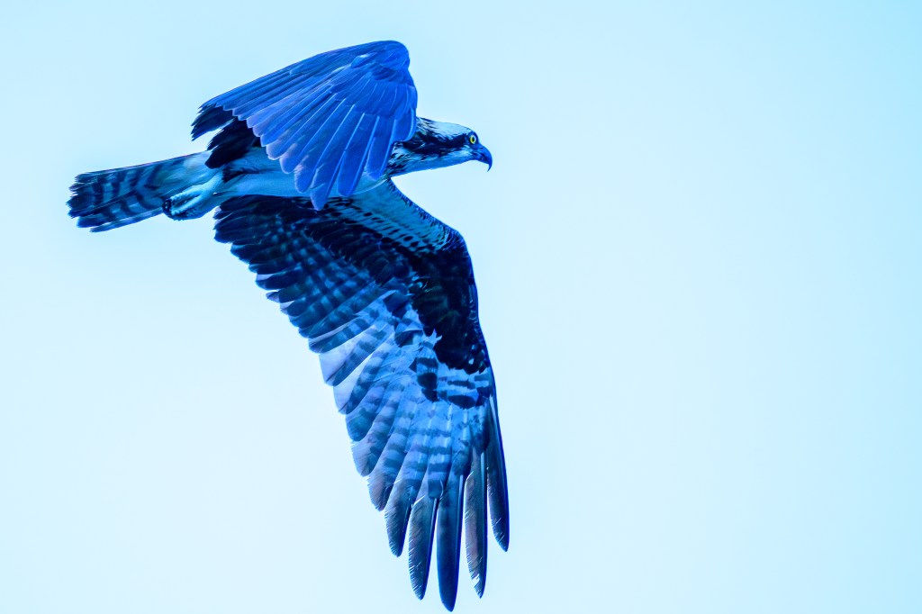
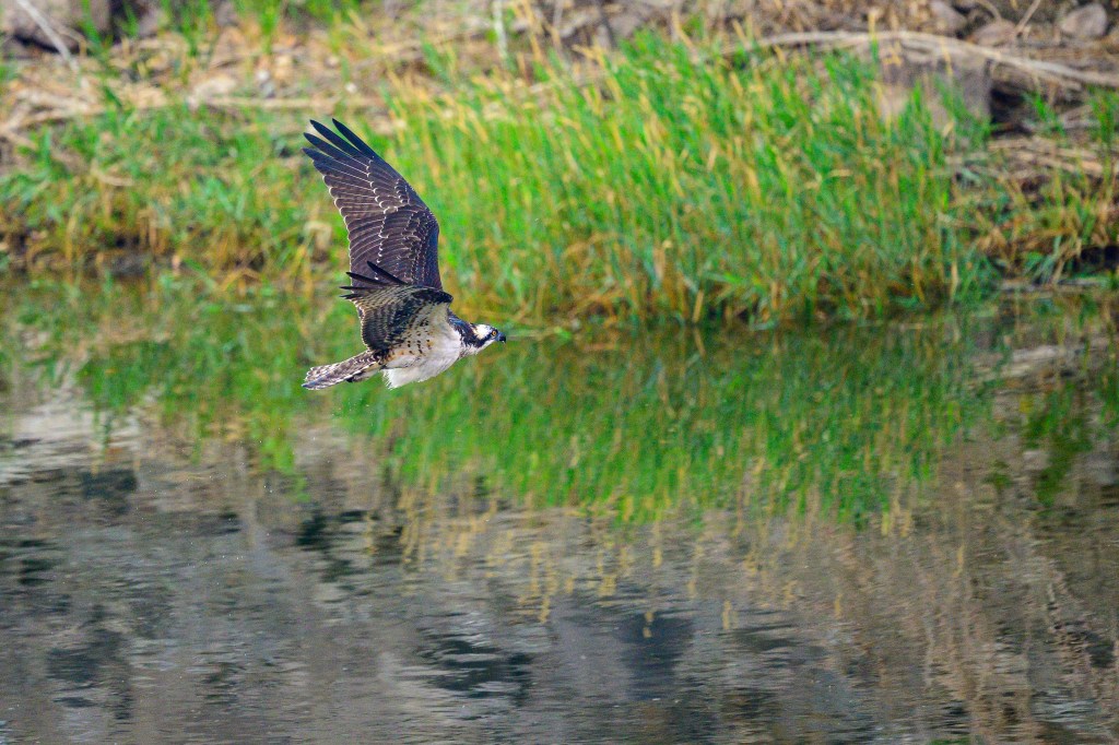
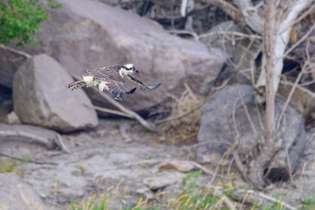
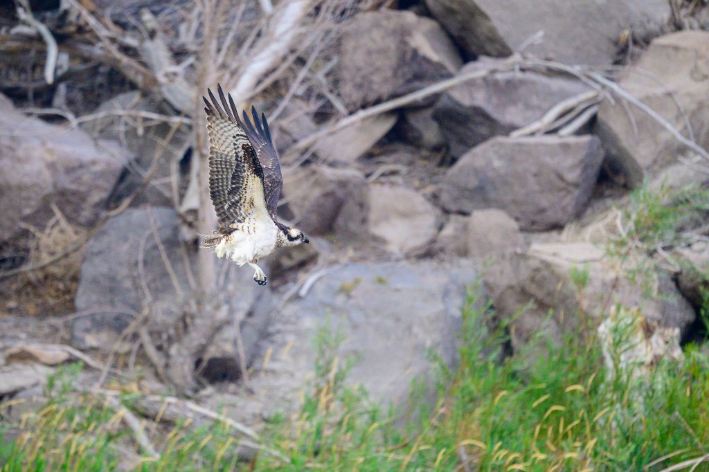
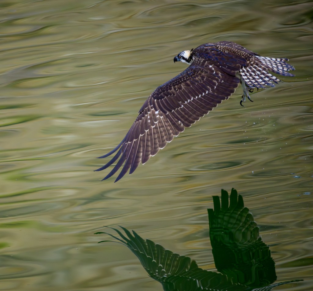
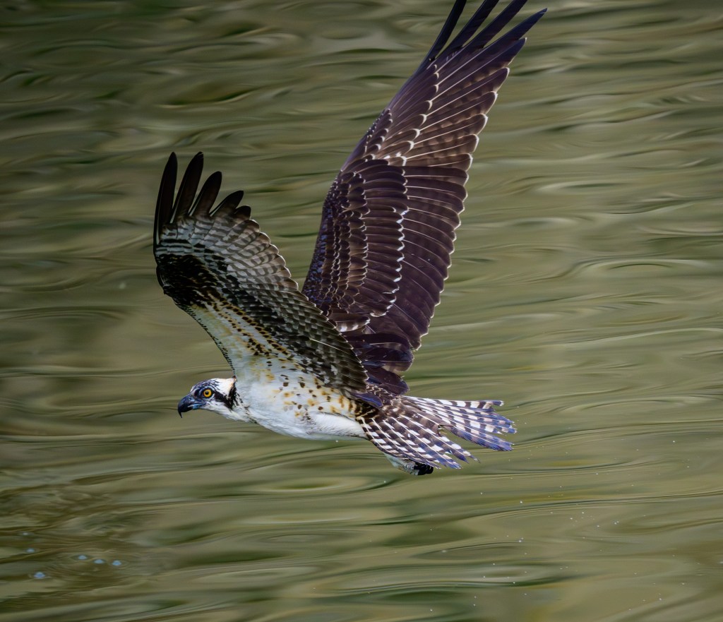
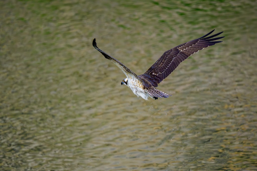
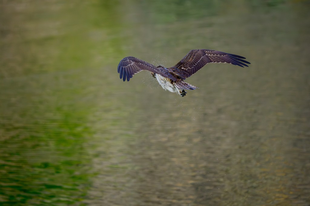
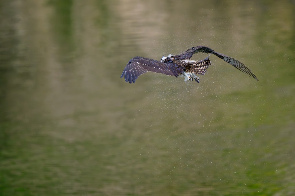
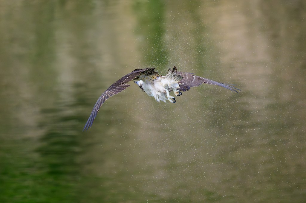
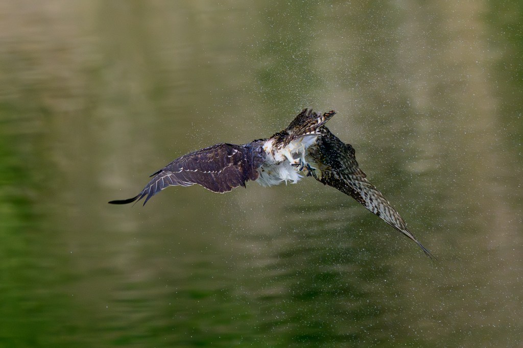
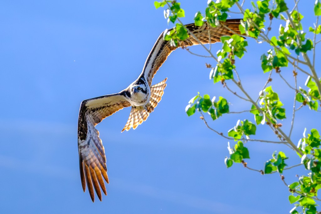
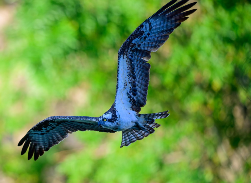
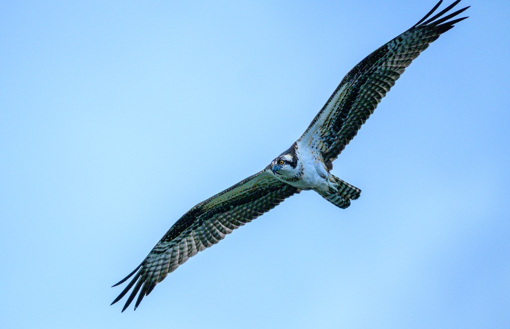
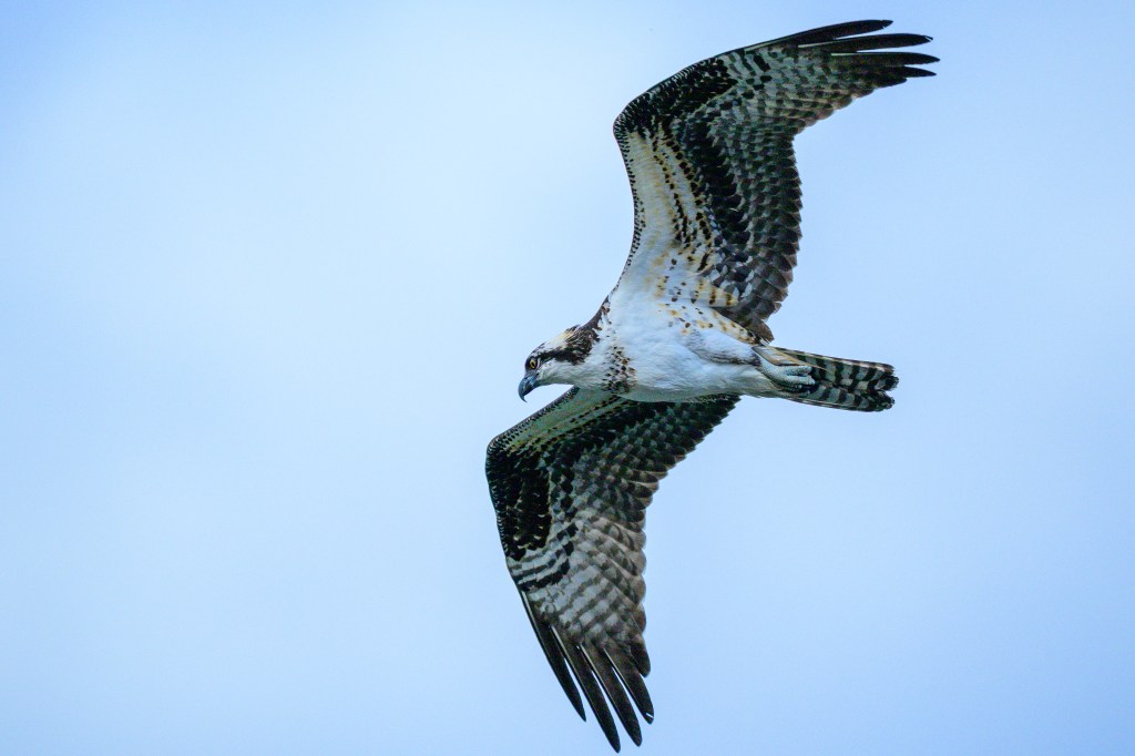
SNOW GOOSE
On March 24, we found 500 Snow Geese at the Owens Lake. Their long black primary feathers contrast nicely with their white plumage when they are in the air.
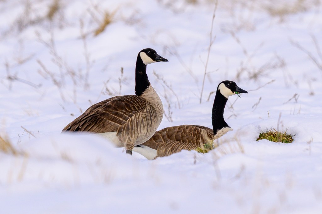
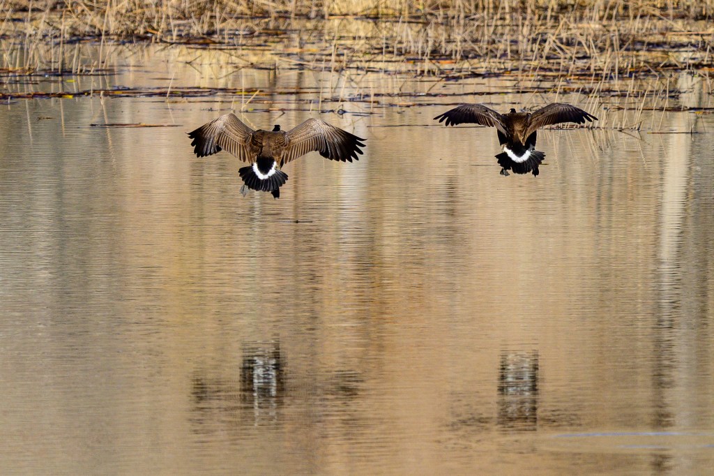
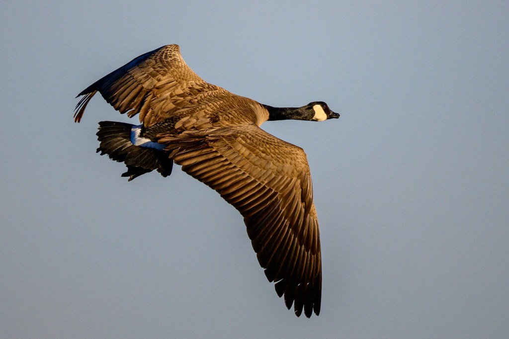
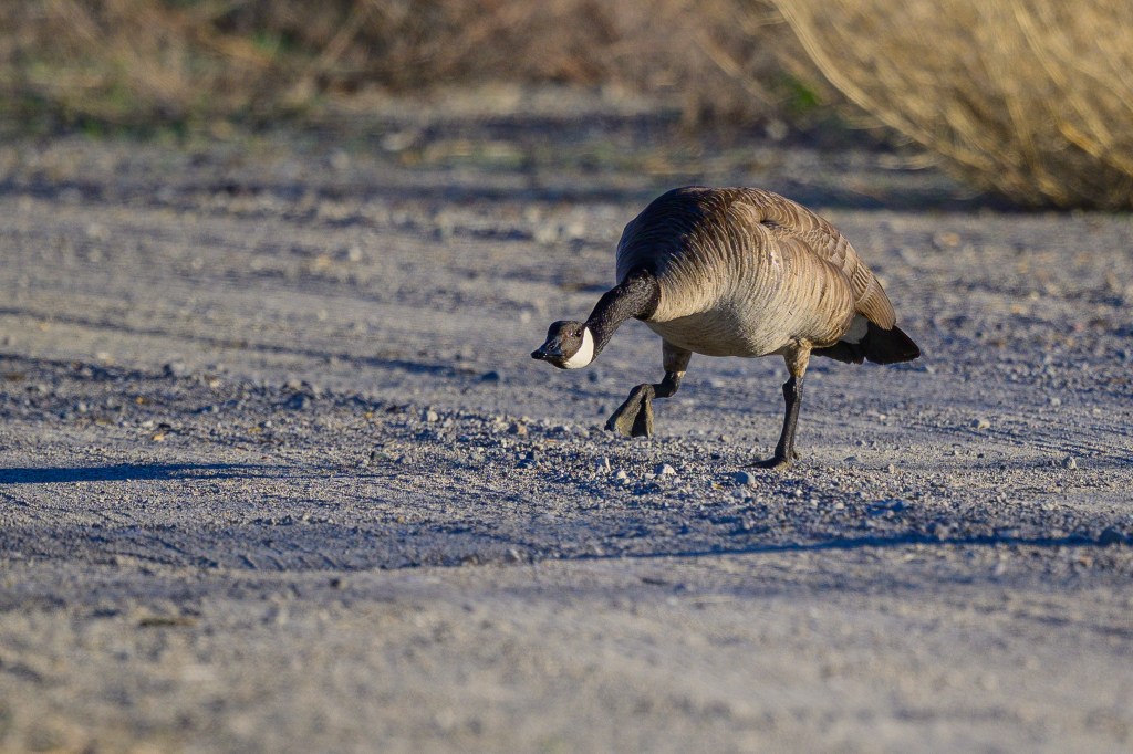
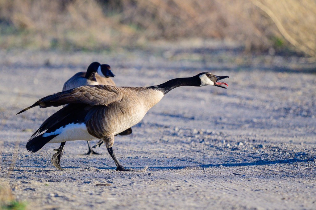
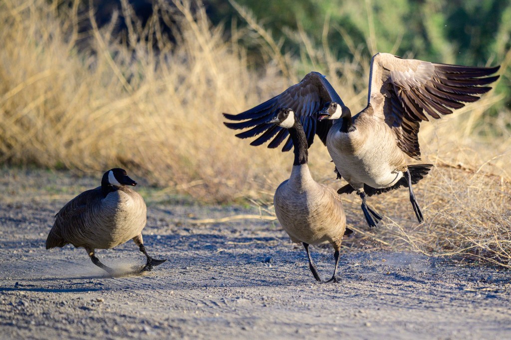
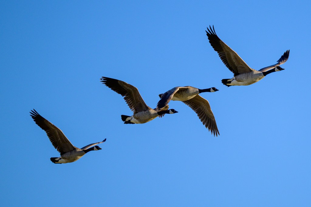
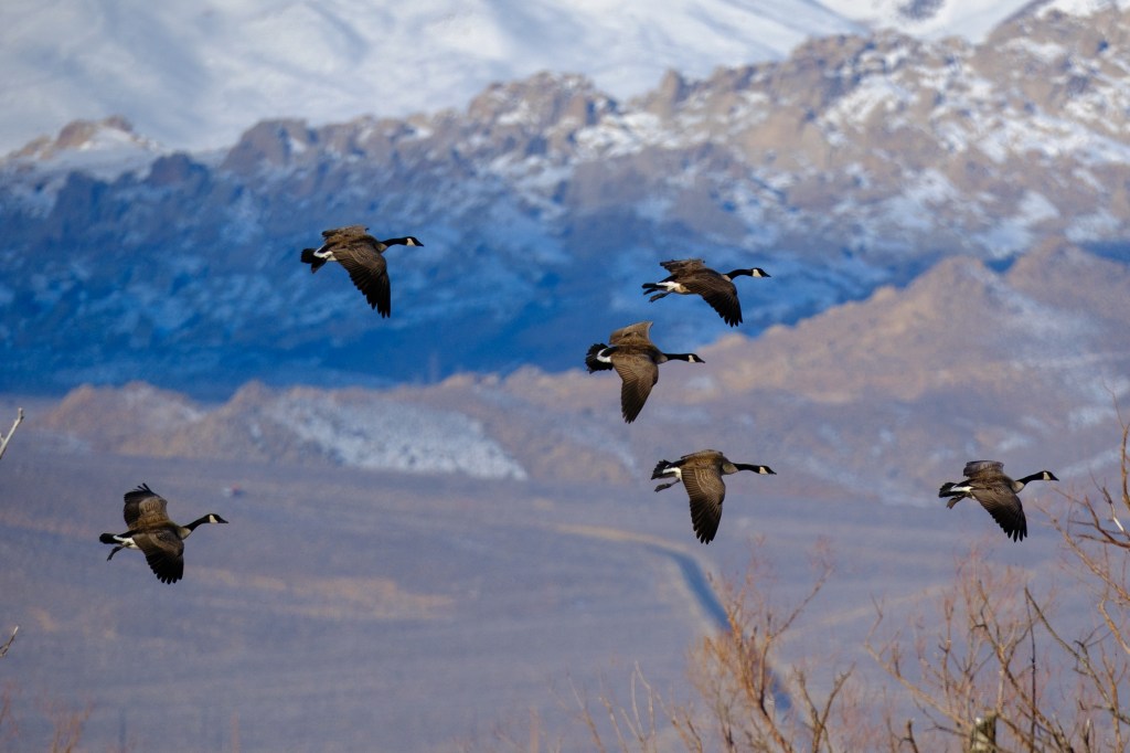
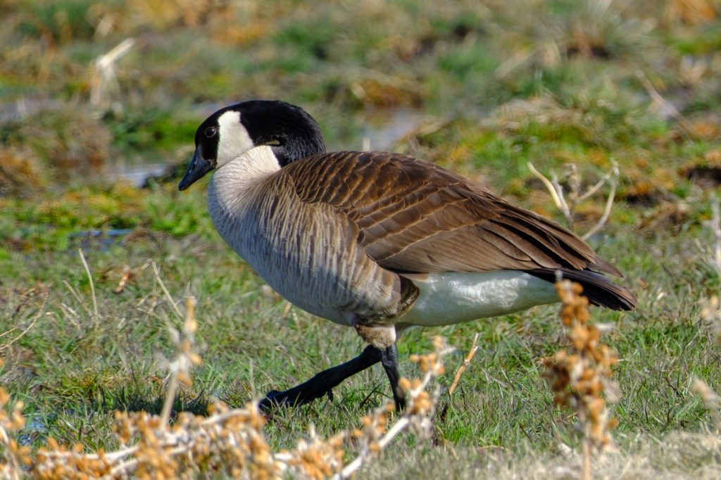
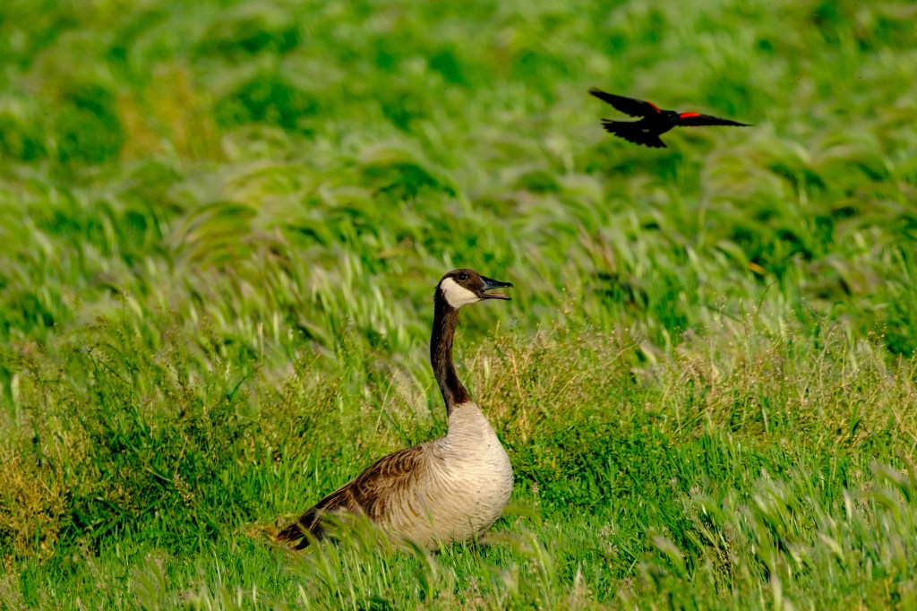
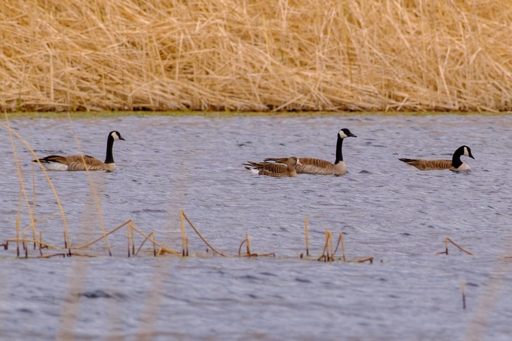
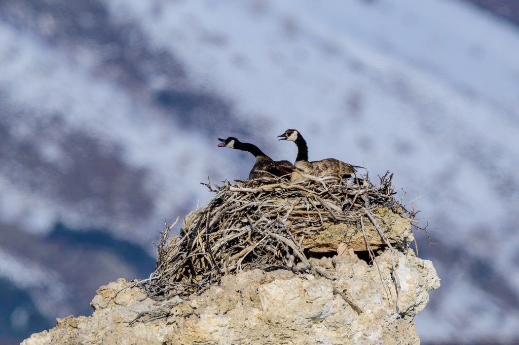
CANADA GOOSE
Geese feeding near Airport Road after a snowfall.
Two geese land on parallel runways at the Pleasant Valley Reservoir.
Morning sun lights up a goose at the Ponds.
Male geese brawl over a lady at the Ponds.
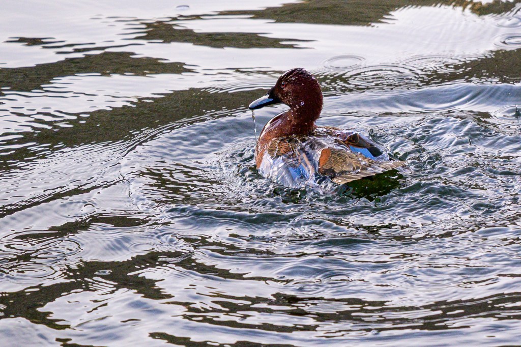
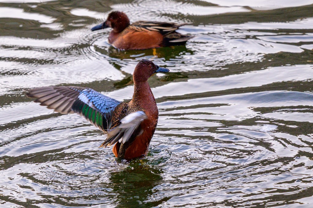
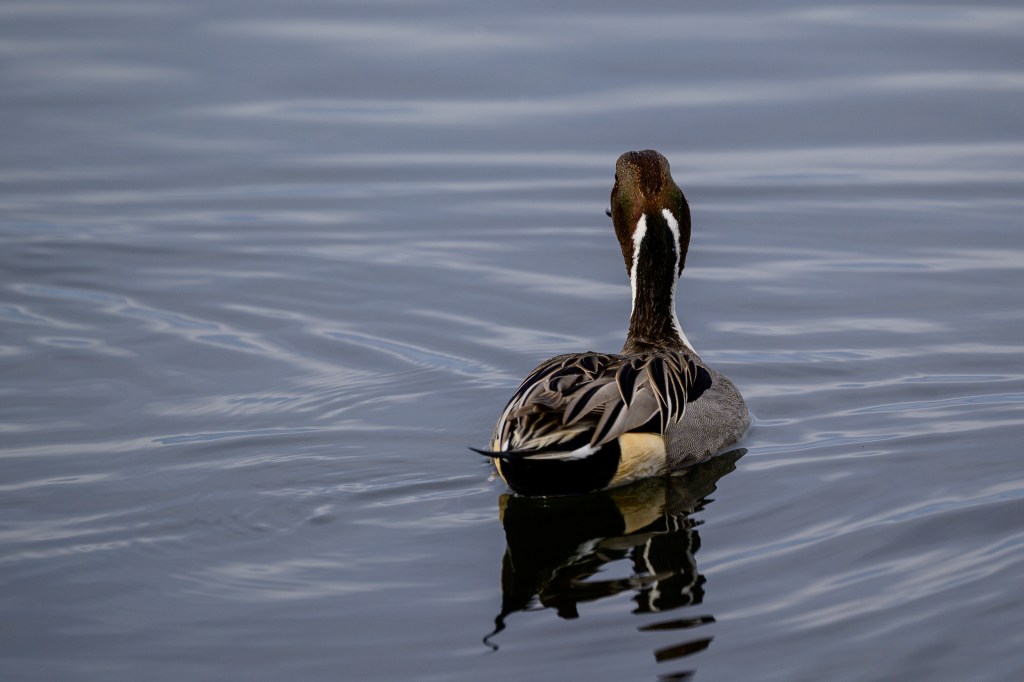
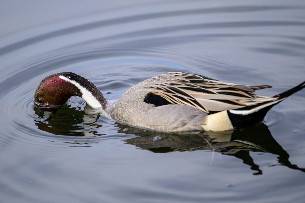
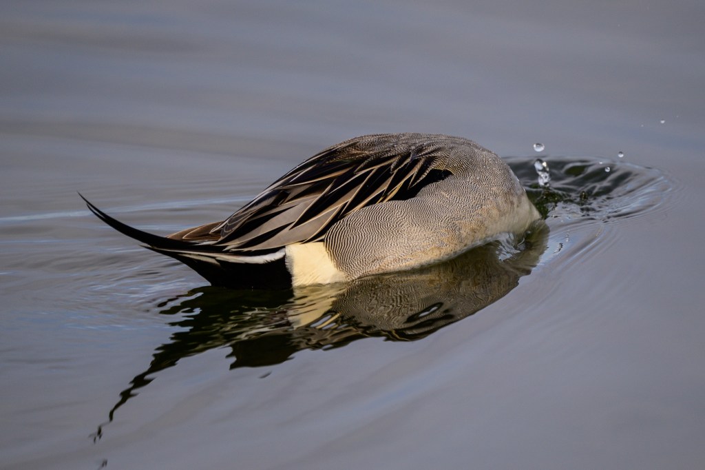
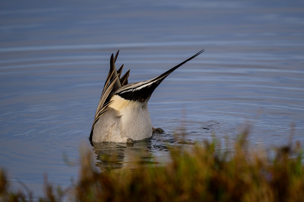
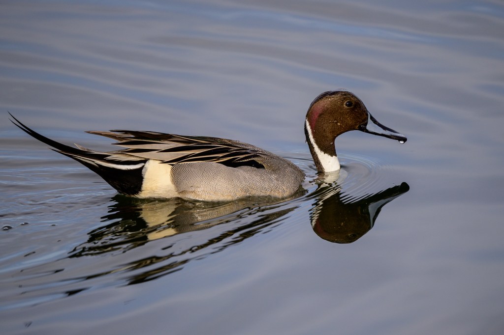
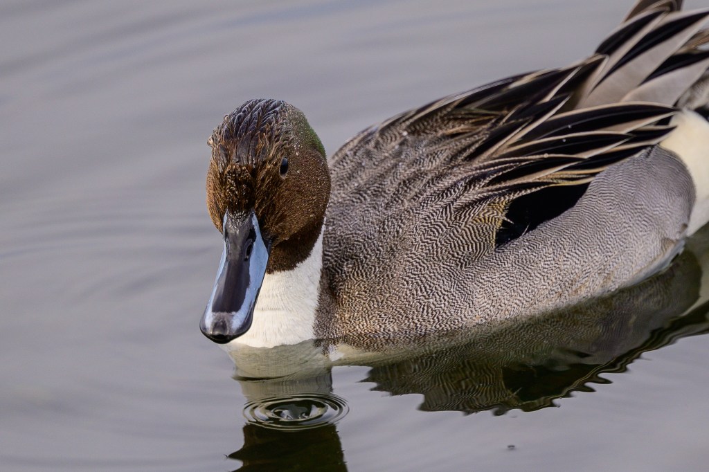
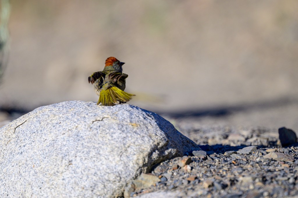
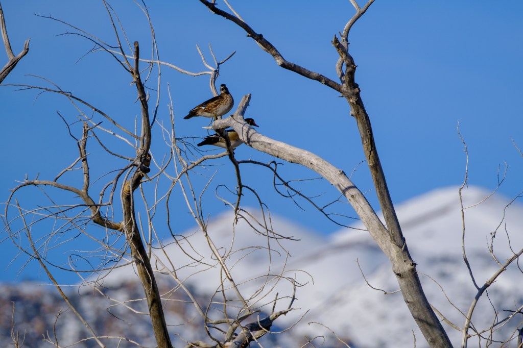
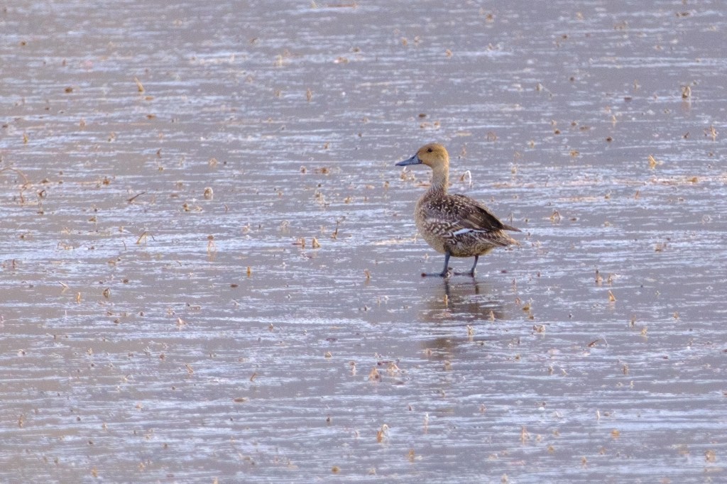
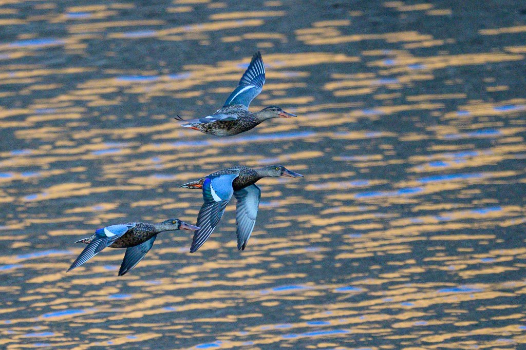
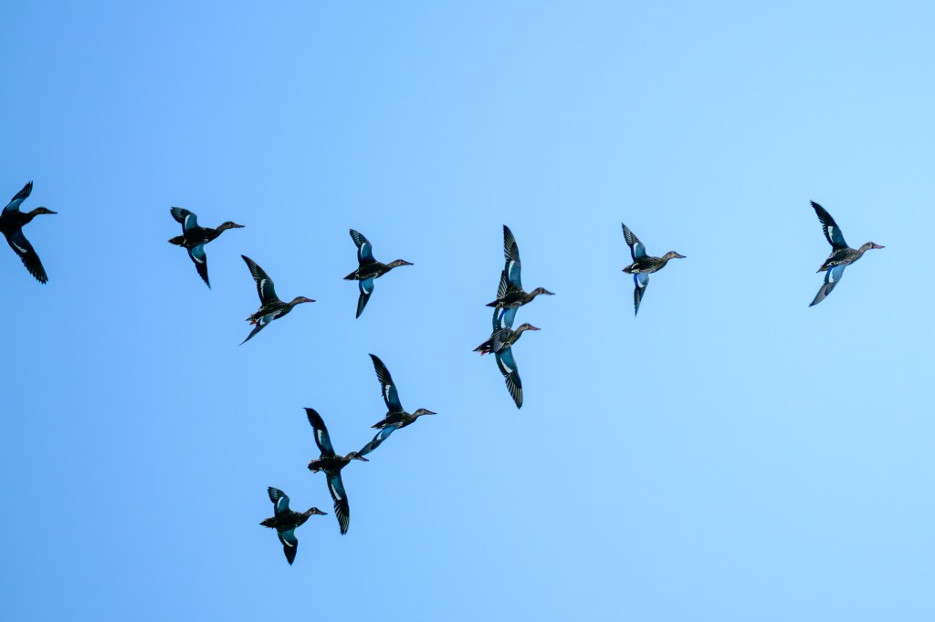
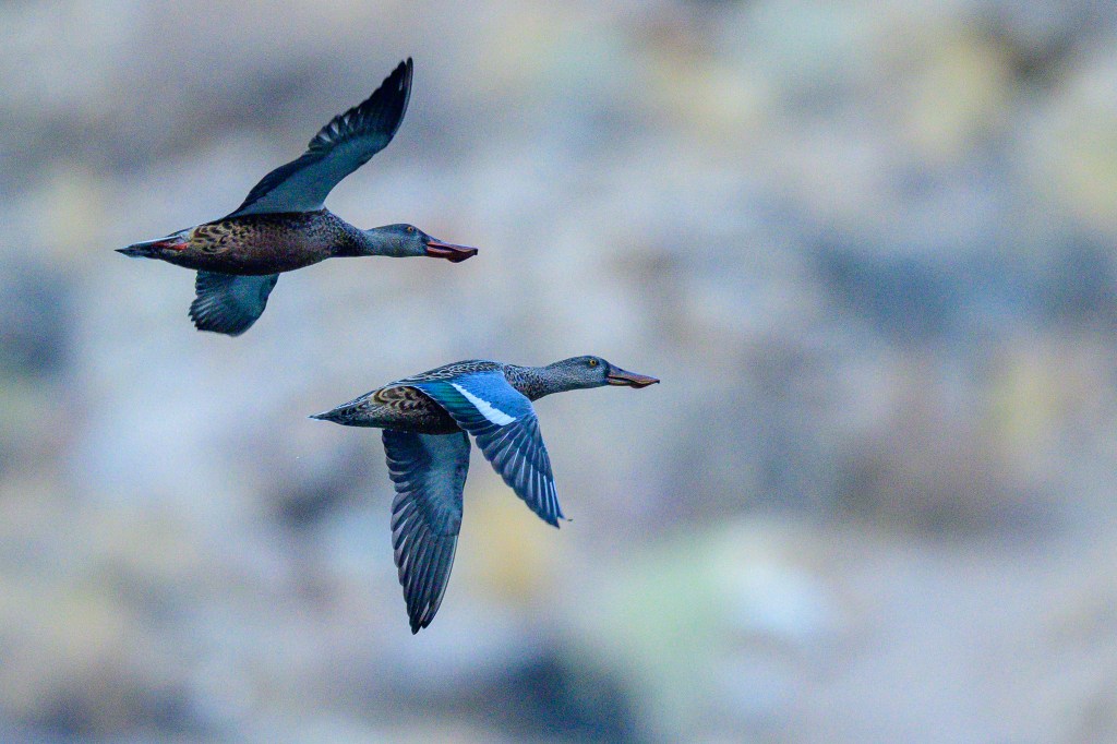
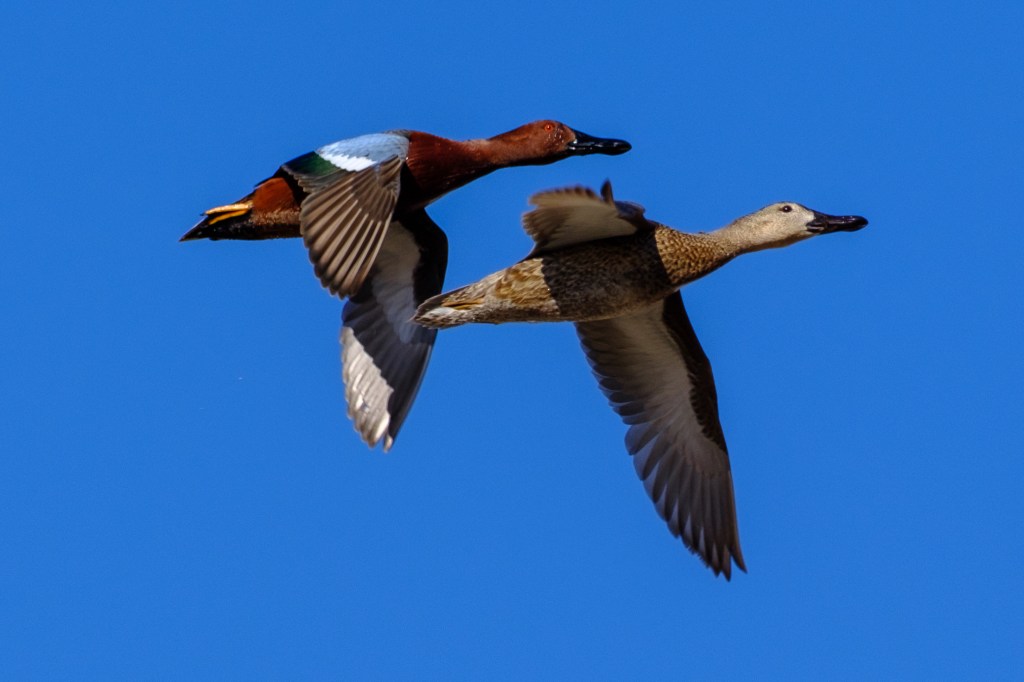
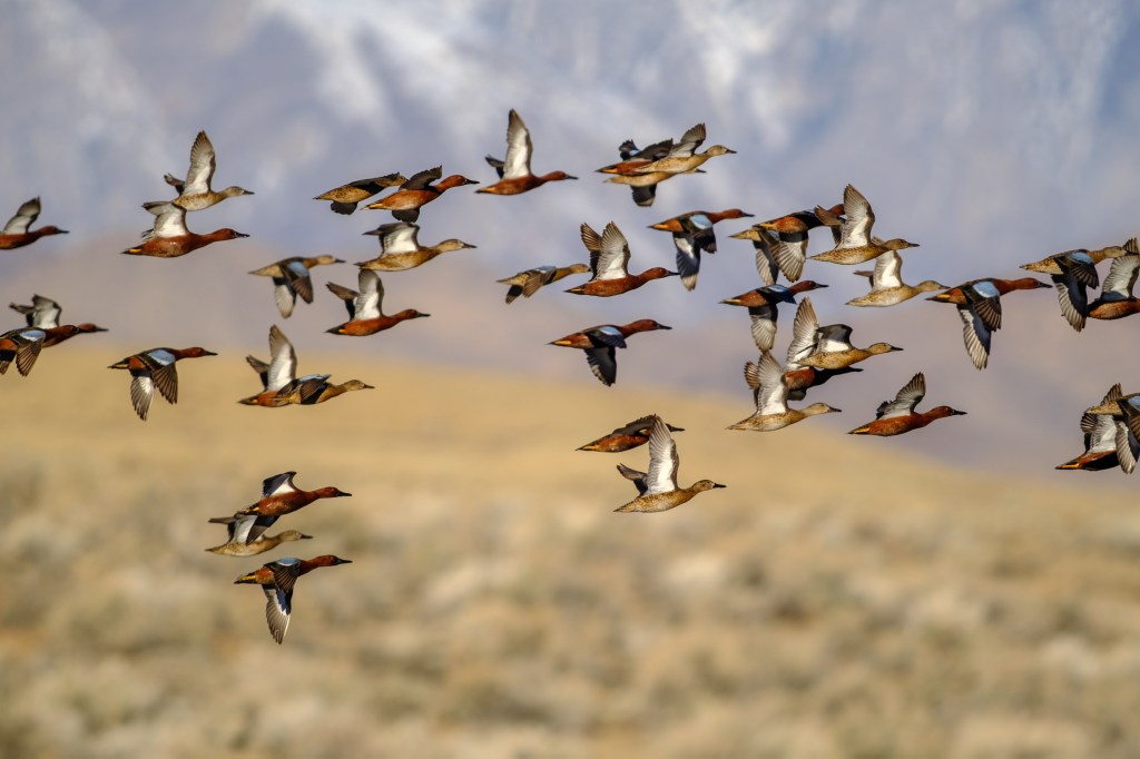
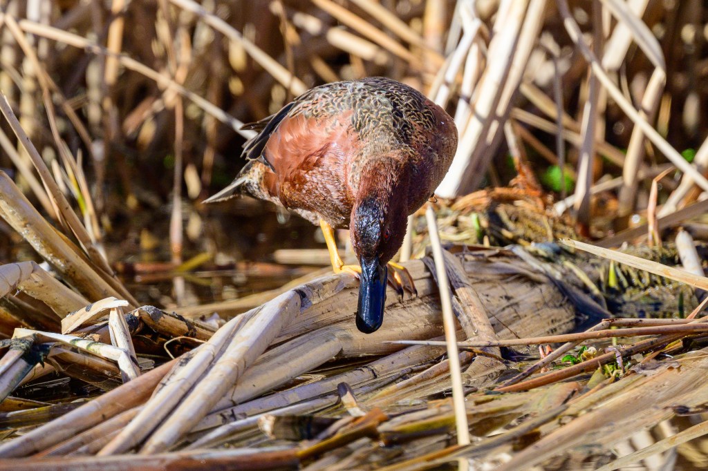
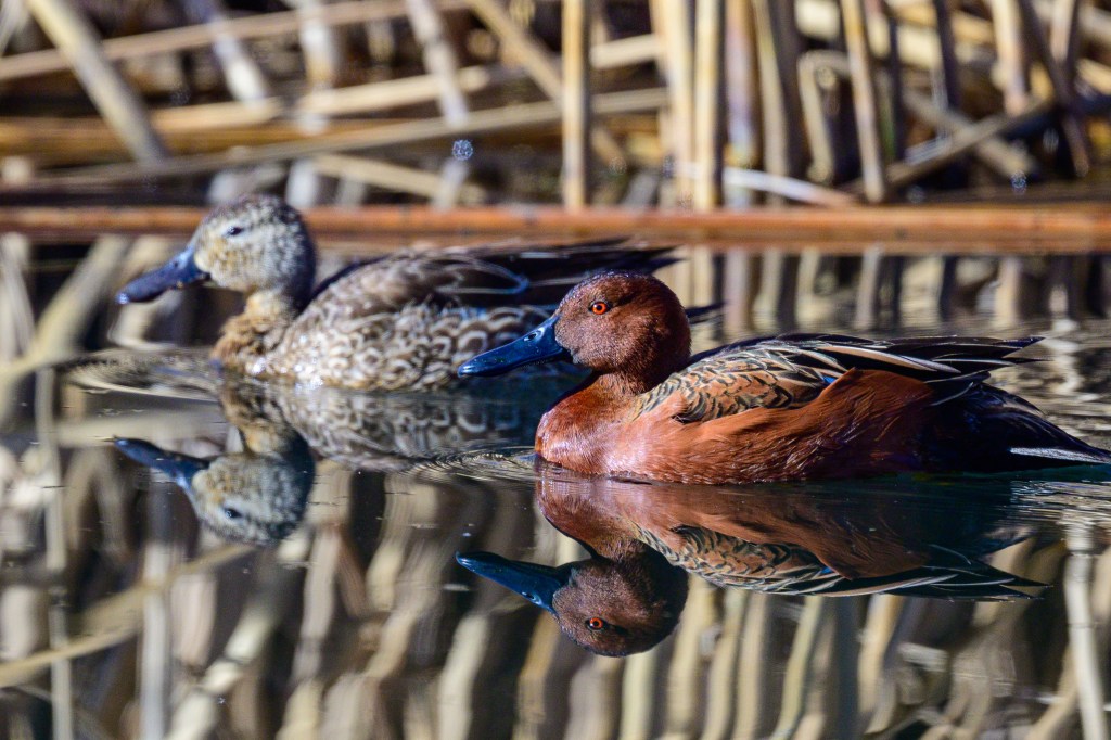
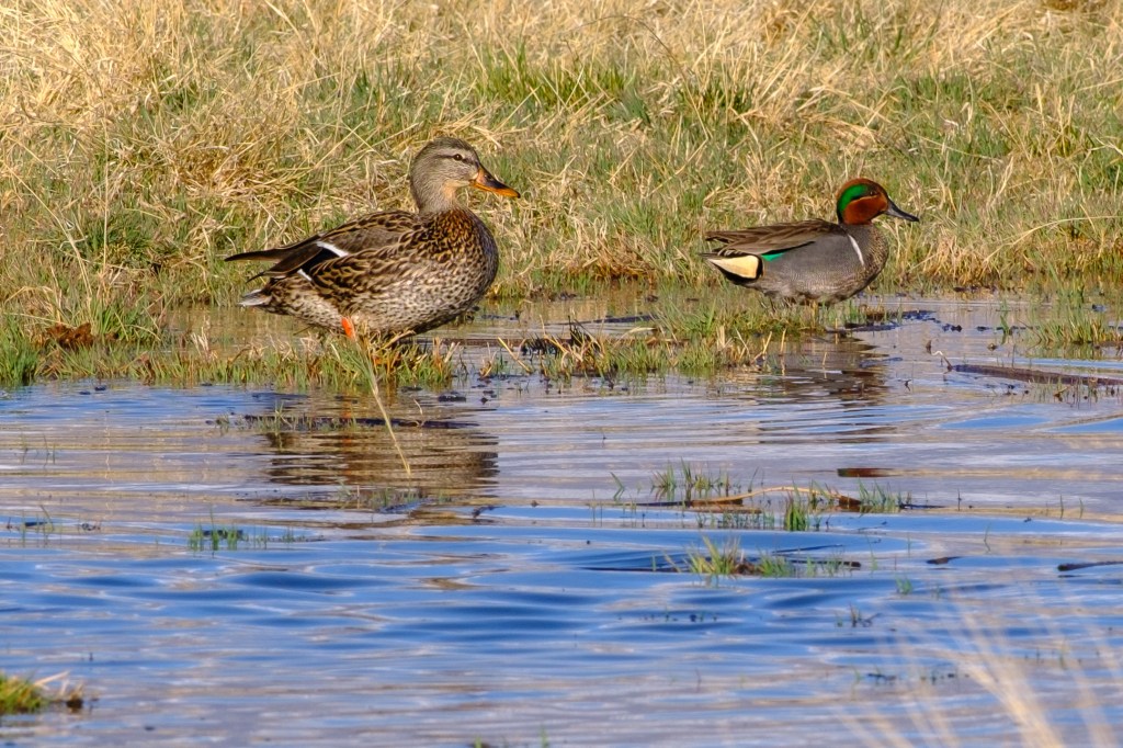
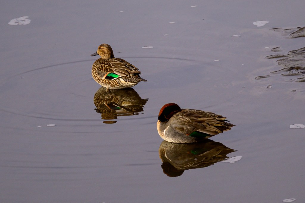
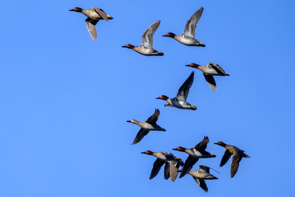
CINNAMON TEAL
A male Teal shows that water really does roll off a duck’s back.
These birds are colorful!
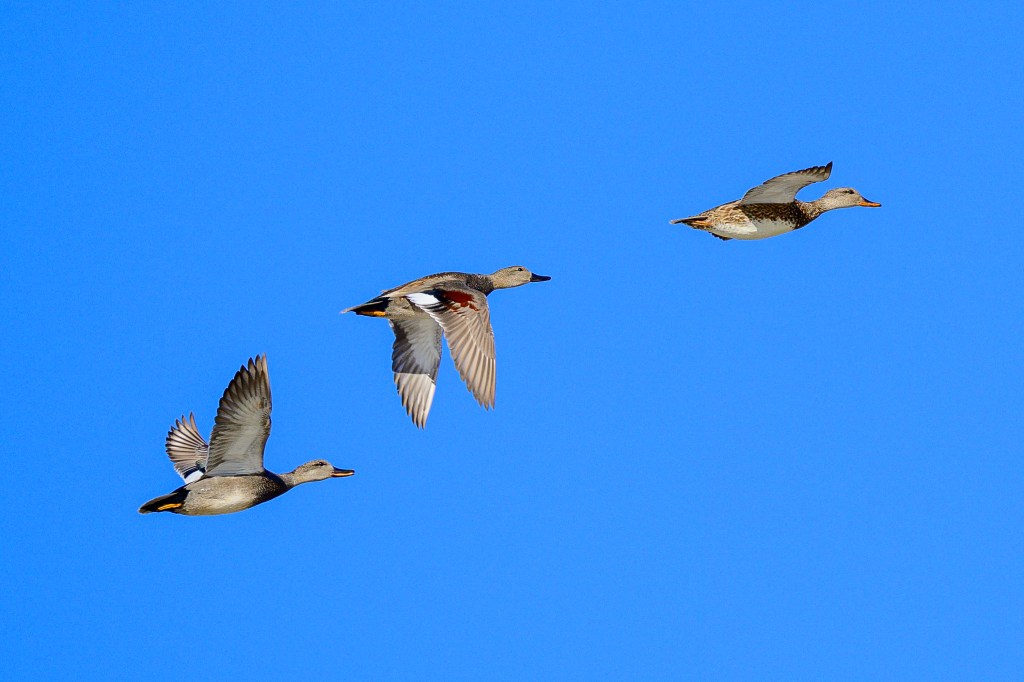
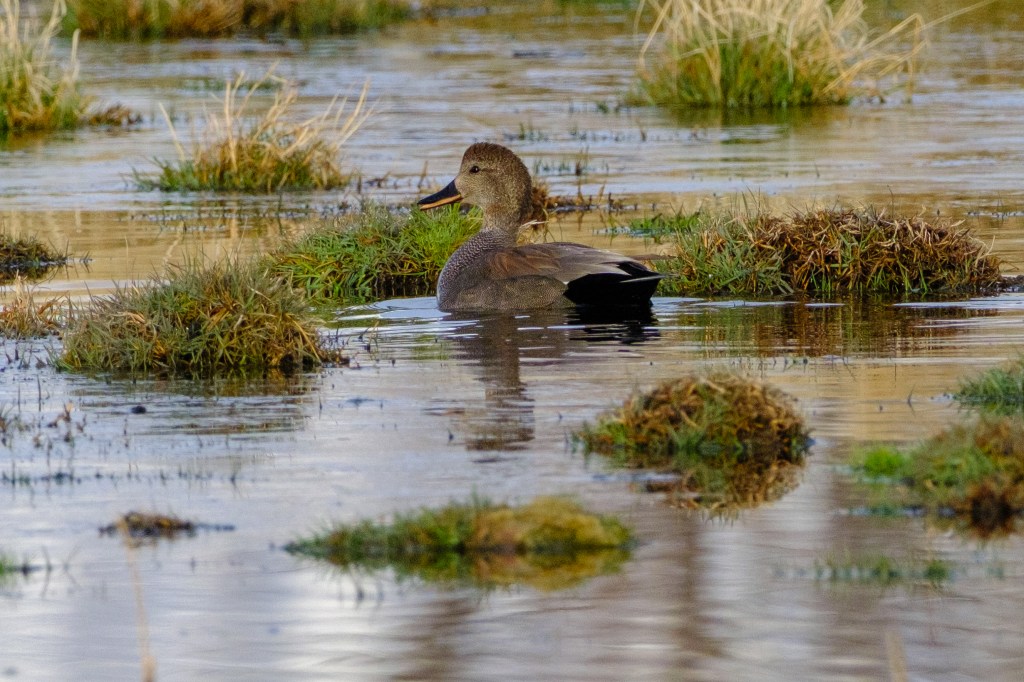
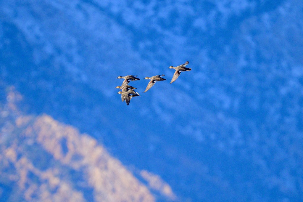
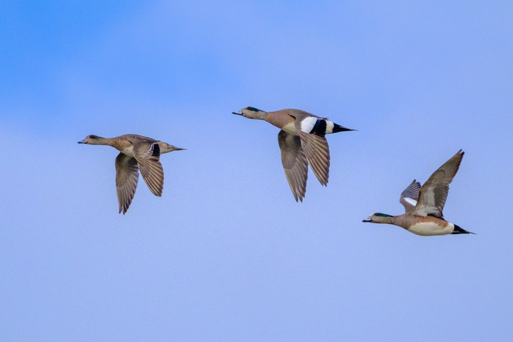
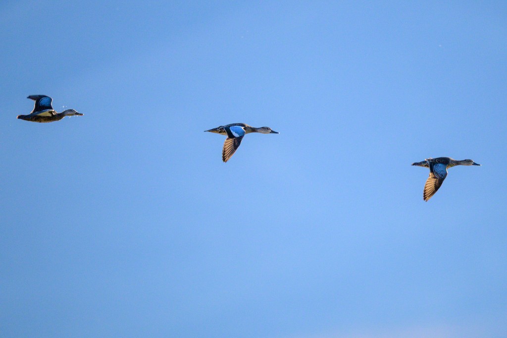
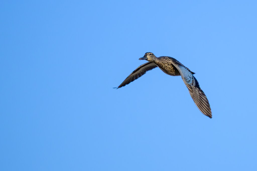
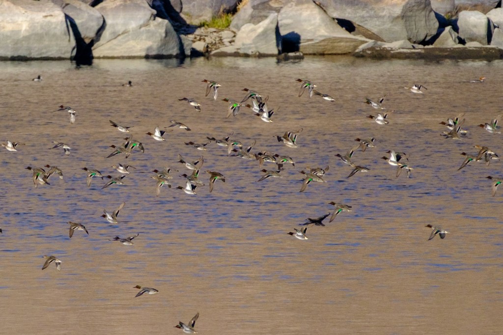
GADWALL
A Gadwall uses a wingtip to assist its landing.
Gadwalls fly over the Owens Lake.
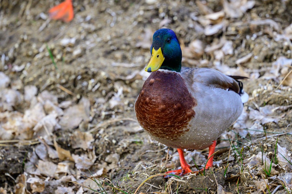
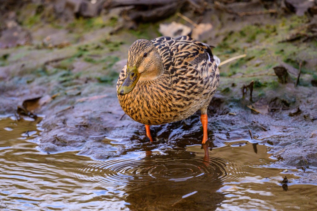
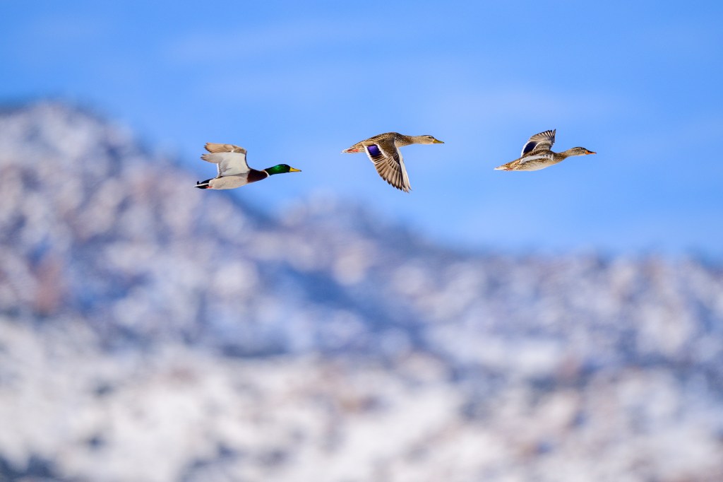
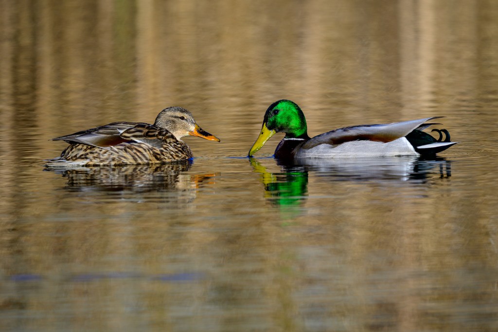
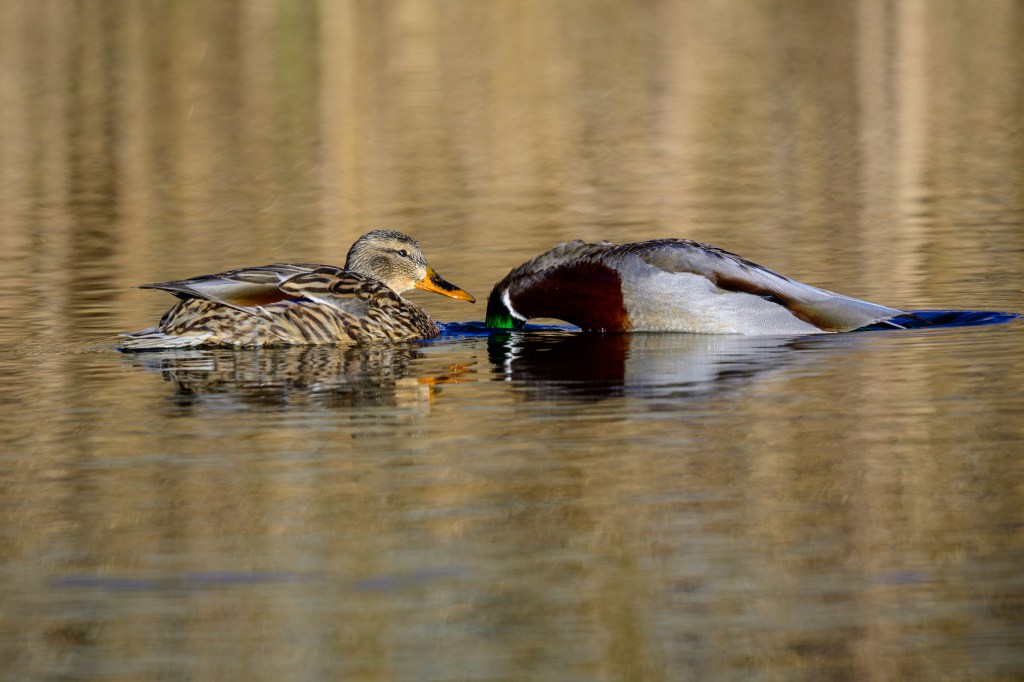
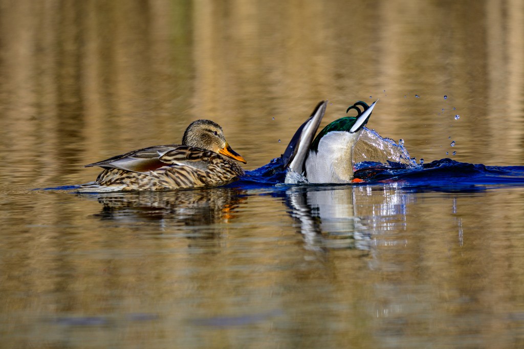
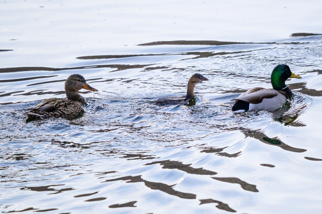
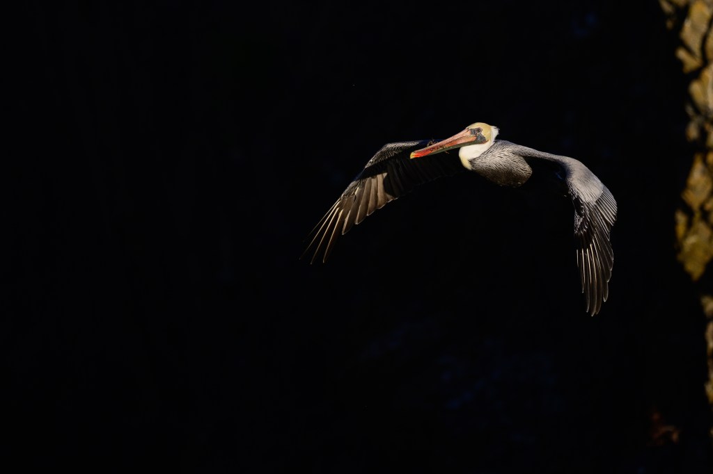
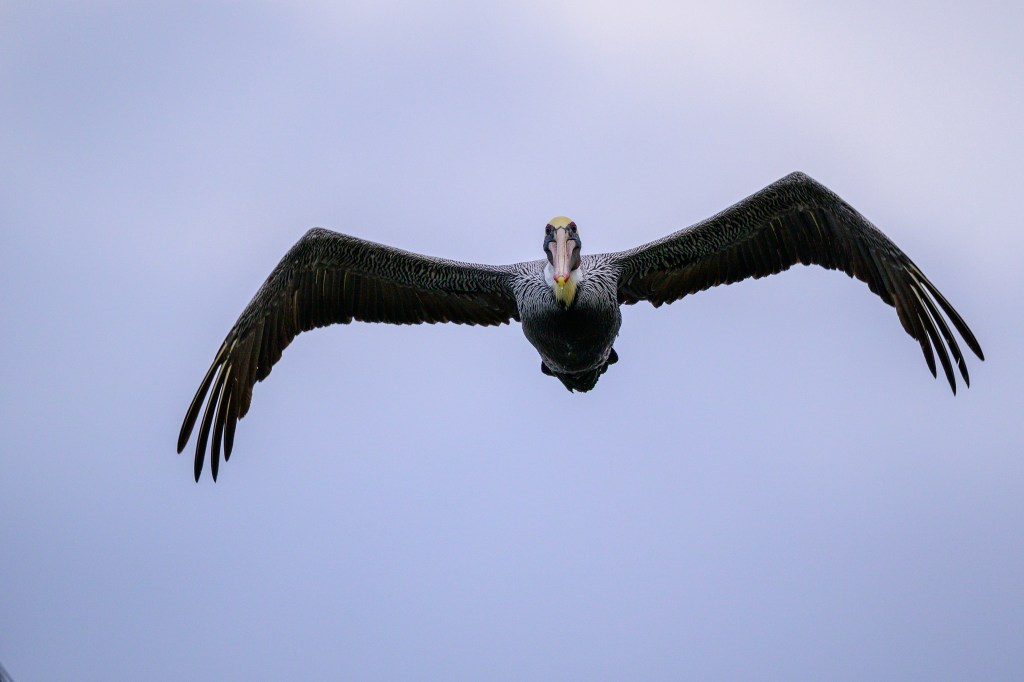
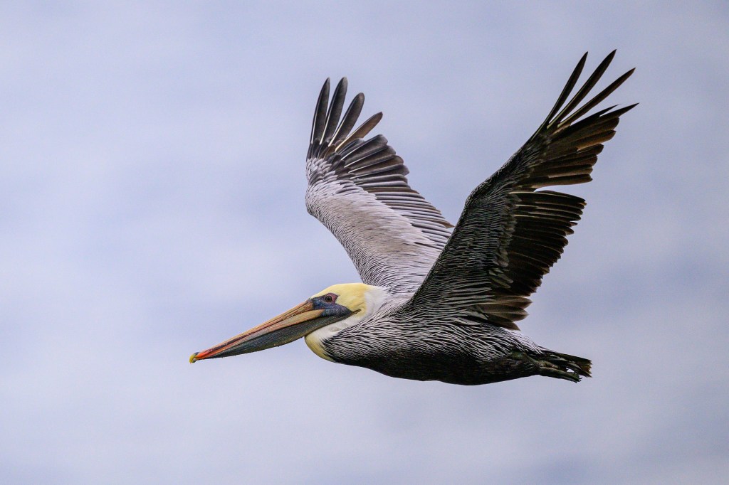
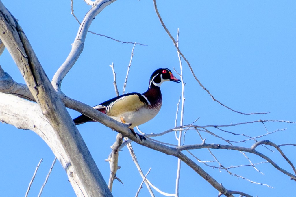
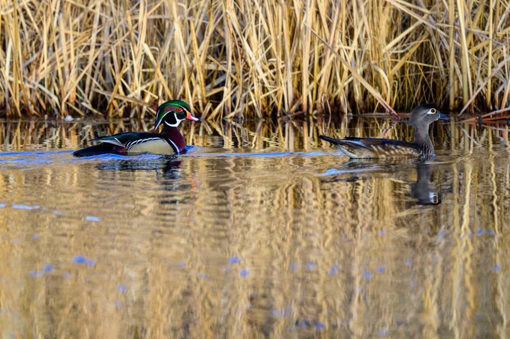
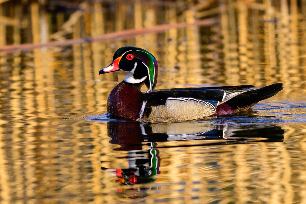
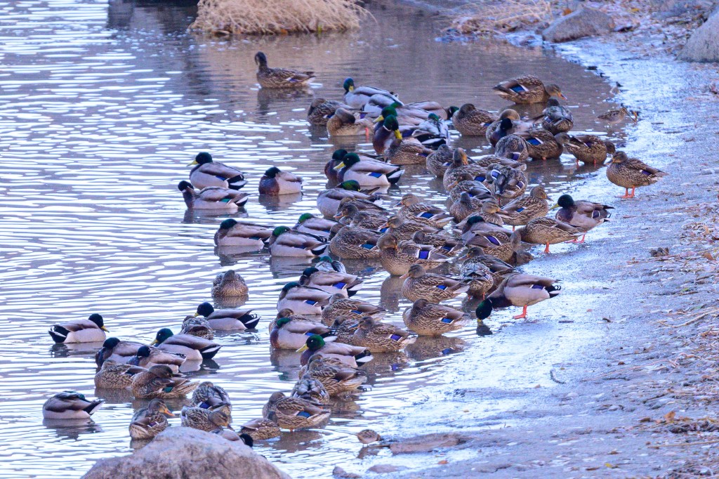
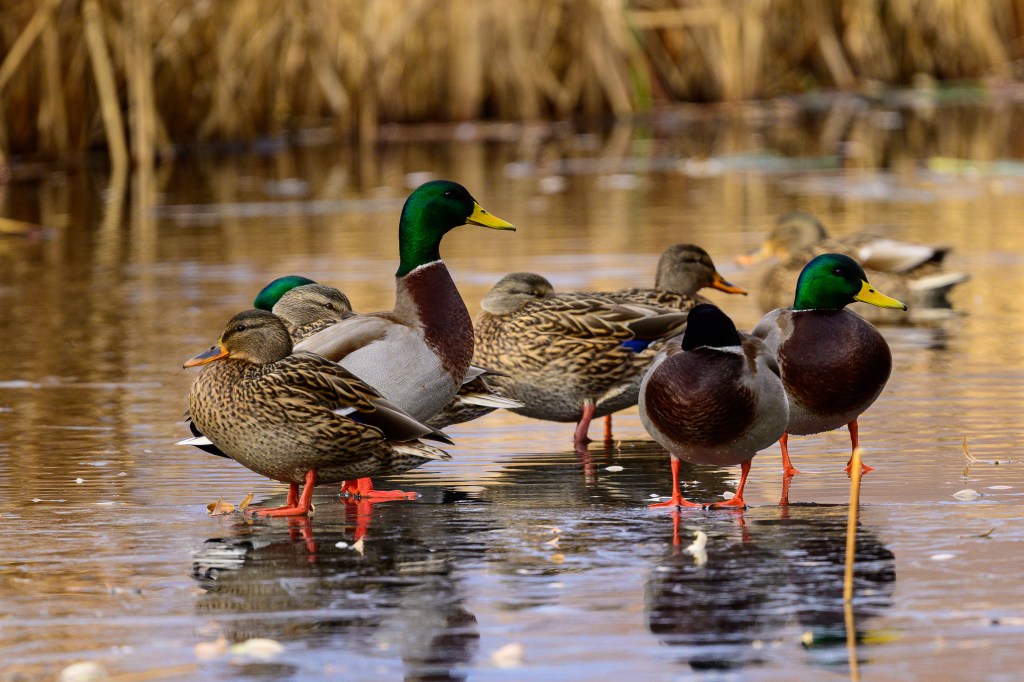
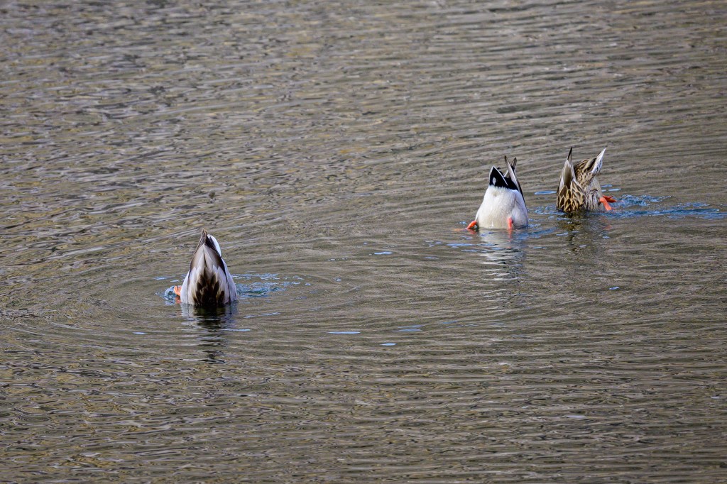
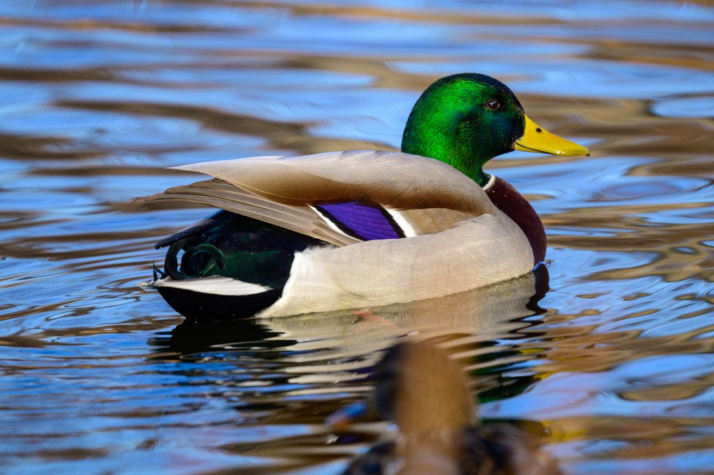
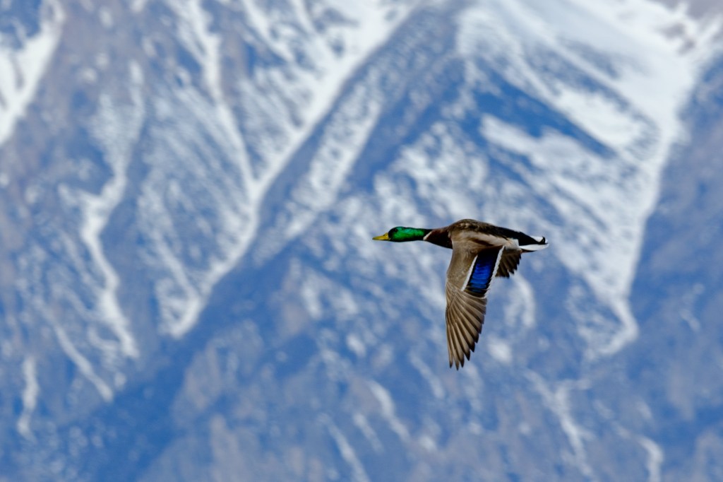
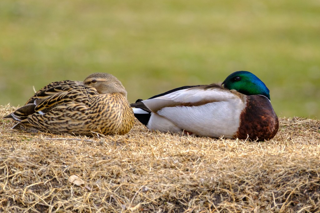
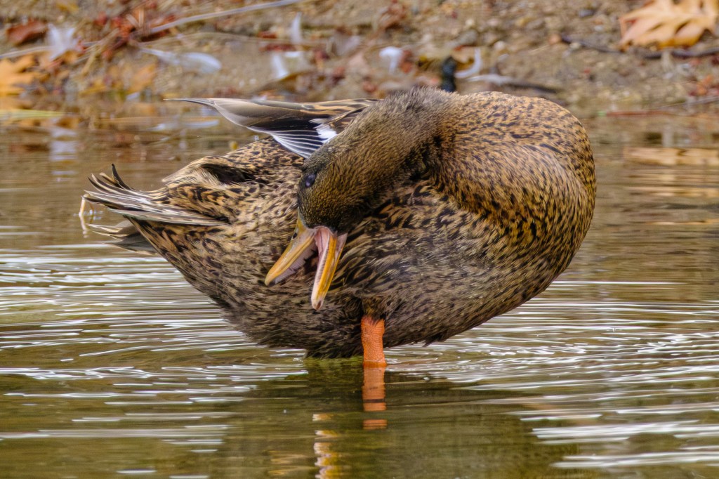
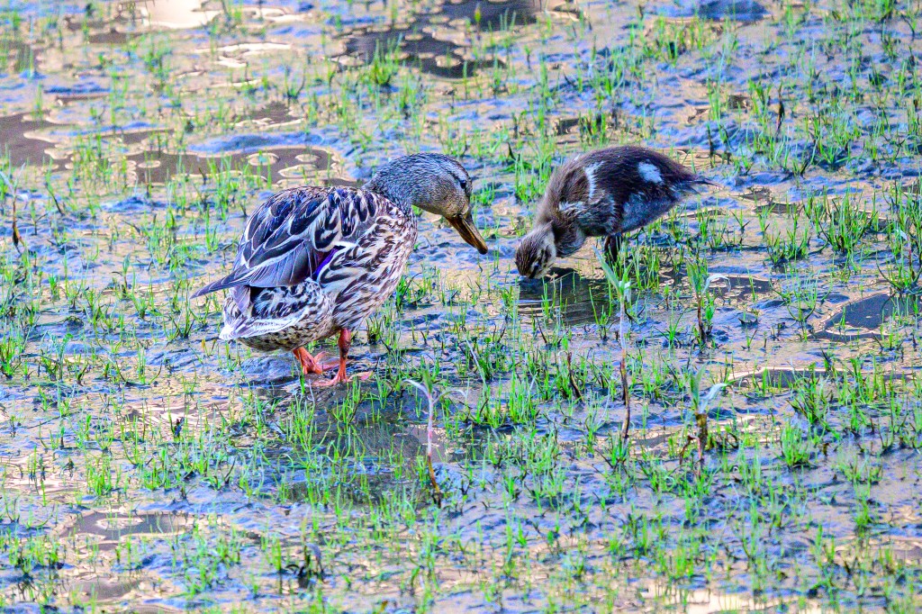
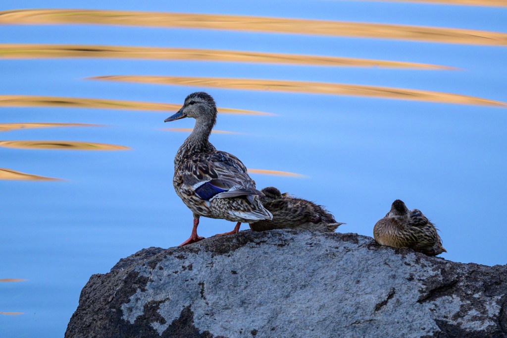
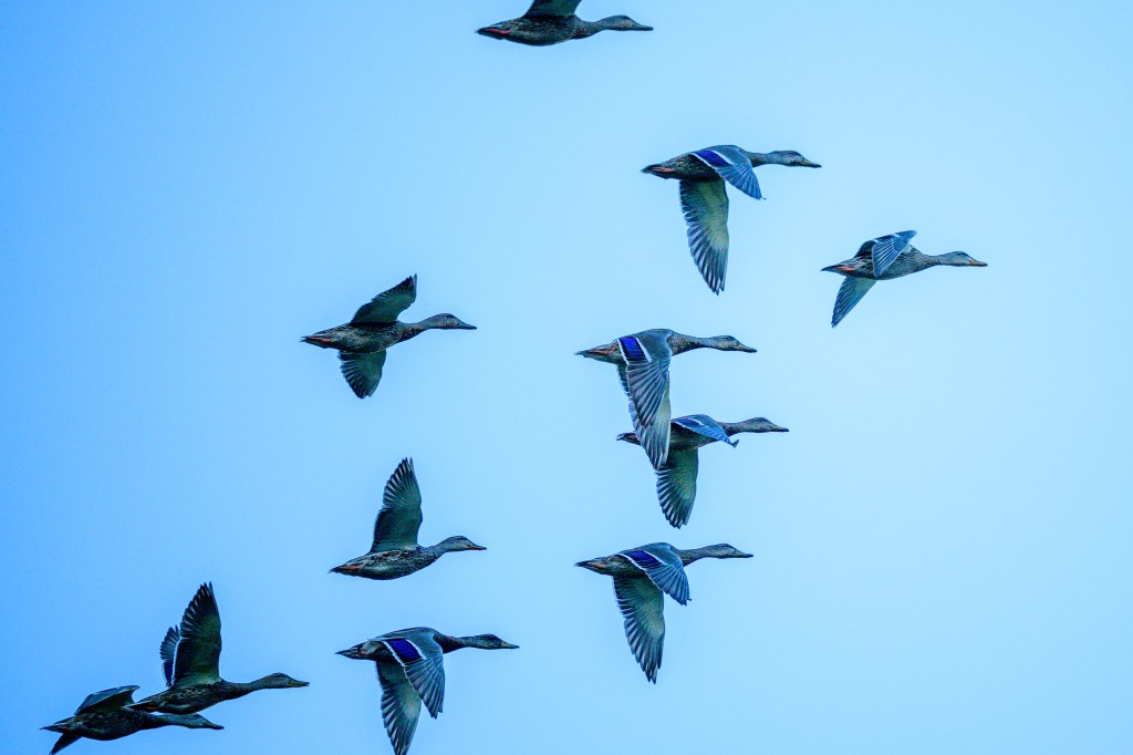
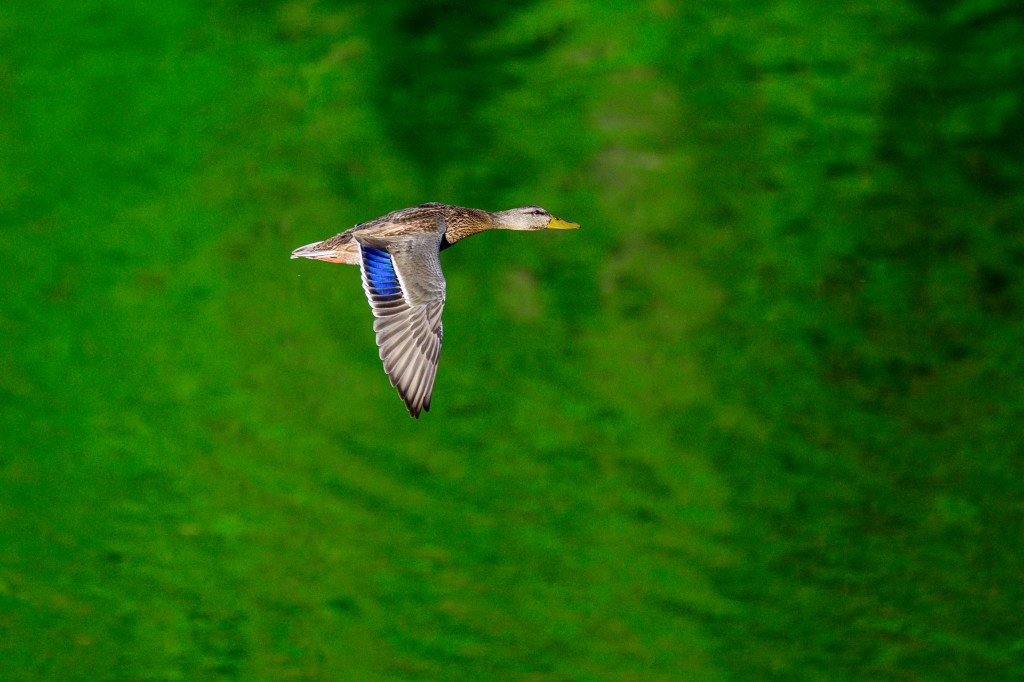
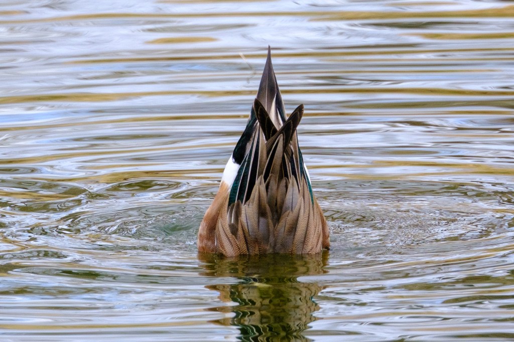
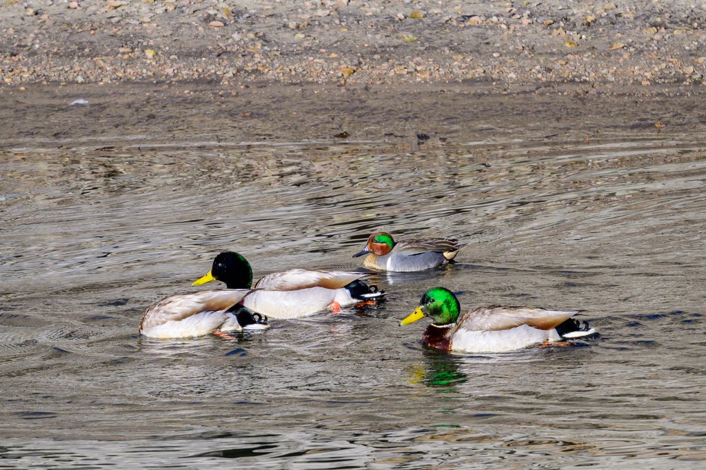
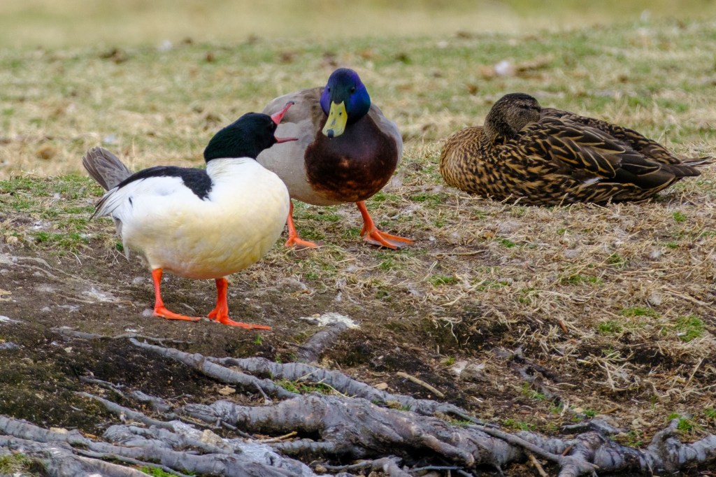
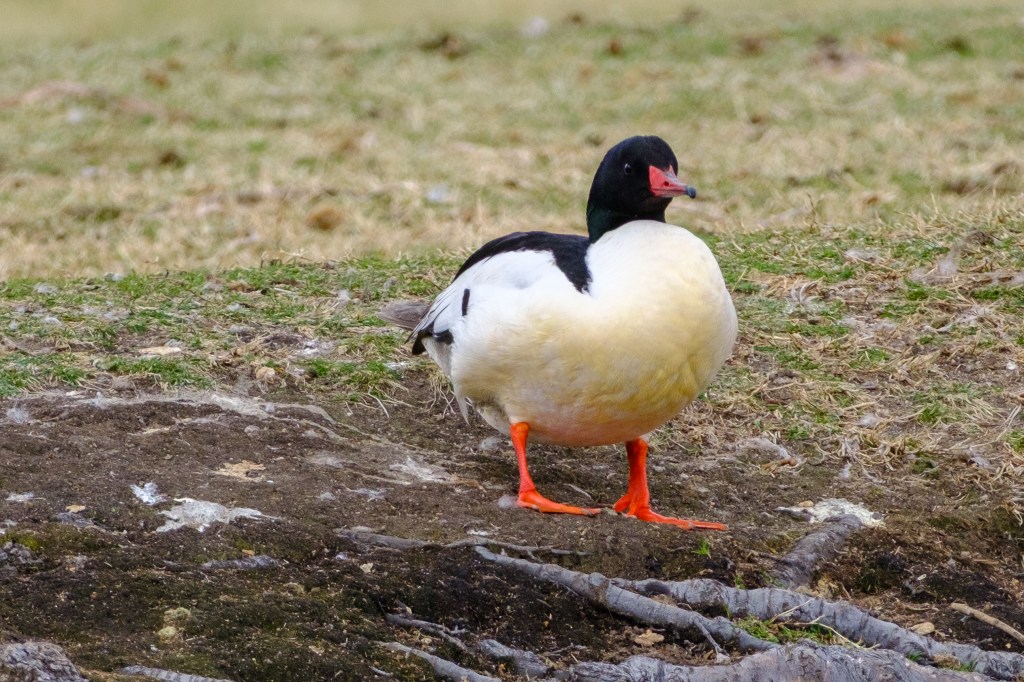
MALLARD
A male walks along a canal on the north side of Bishop.
A female does the same.
Flying in front of the Sierra.
A male and female Mallard chat at the Conservation Open Space Area (COSA). Then the male exhibits rude behavior.
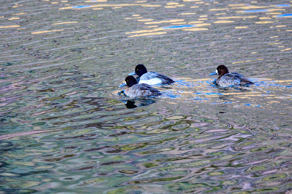
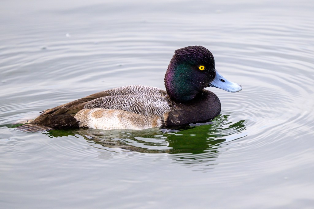
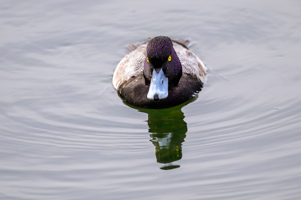
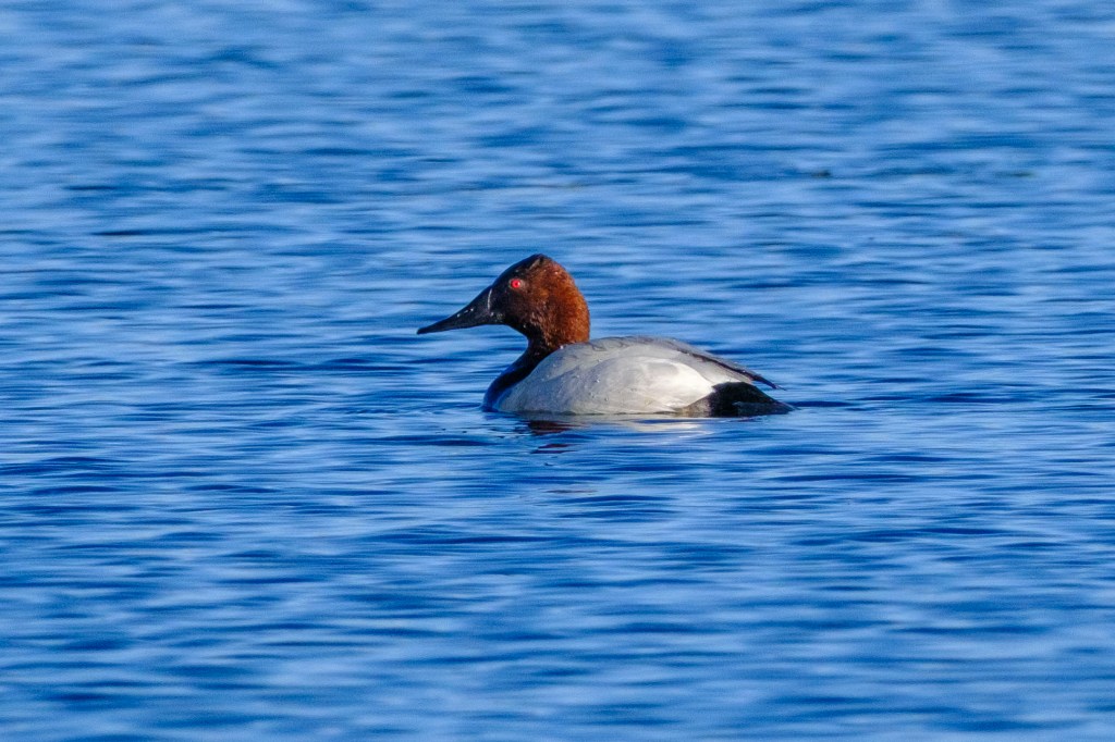
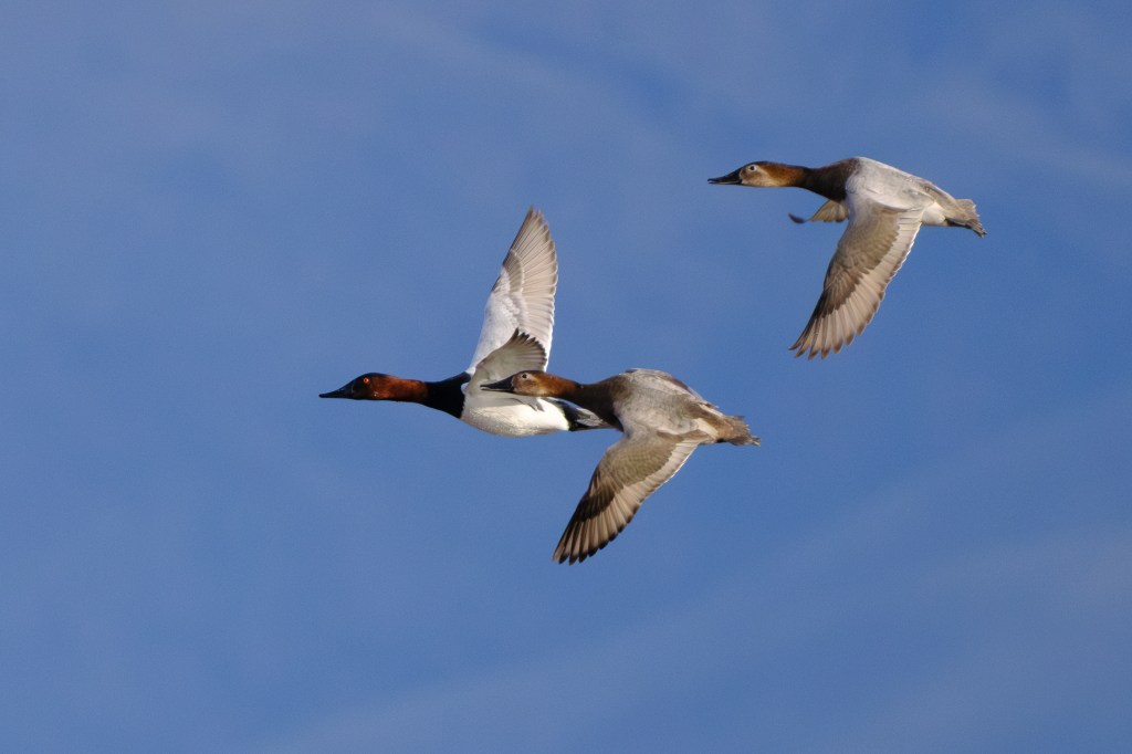
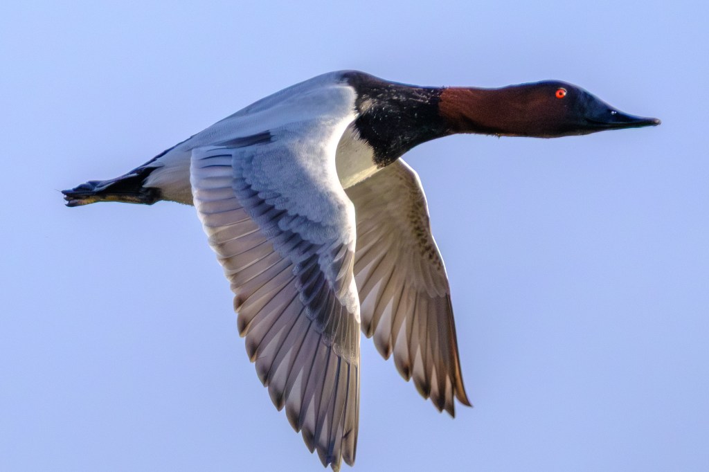
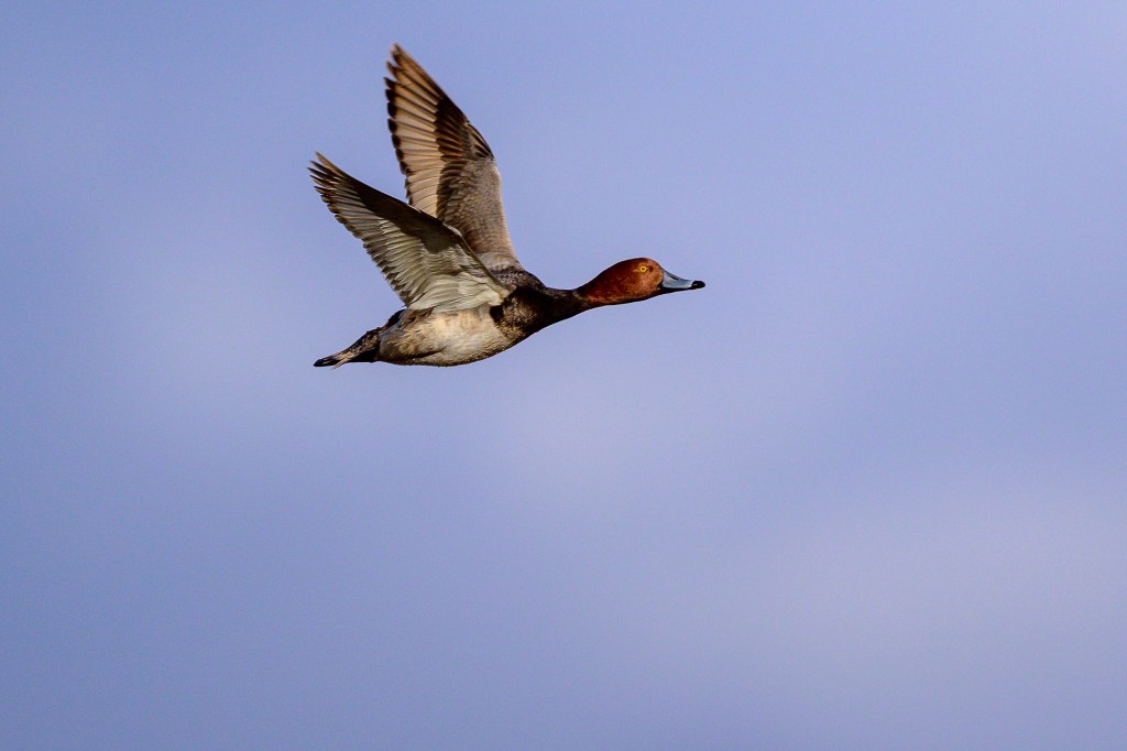
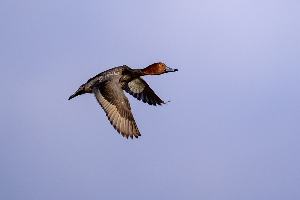
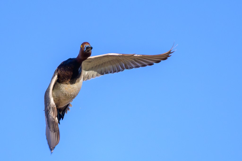
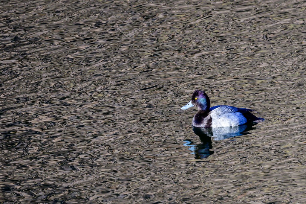
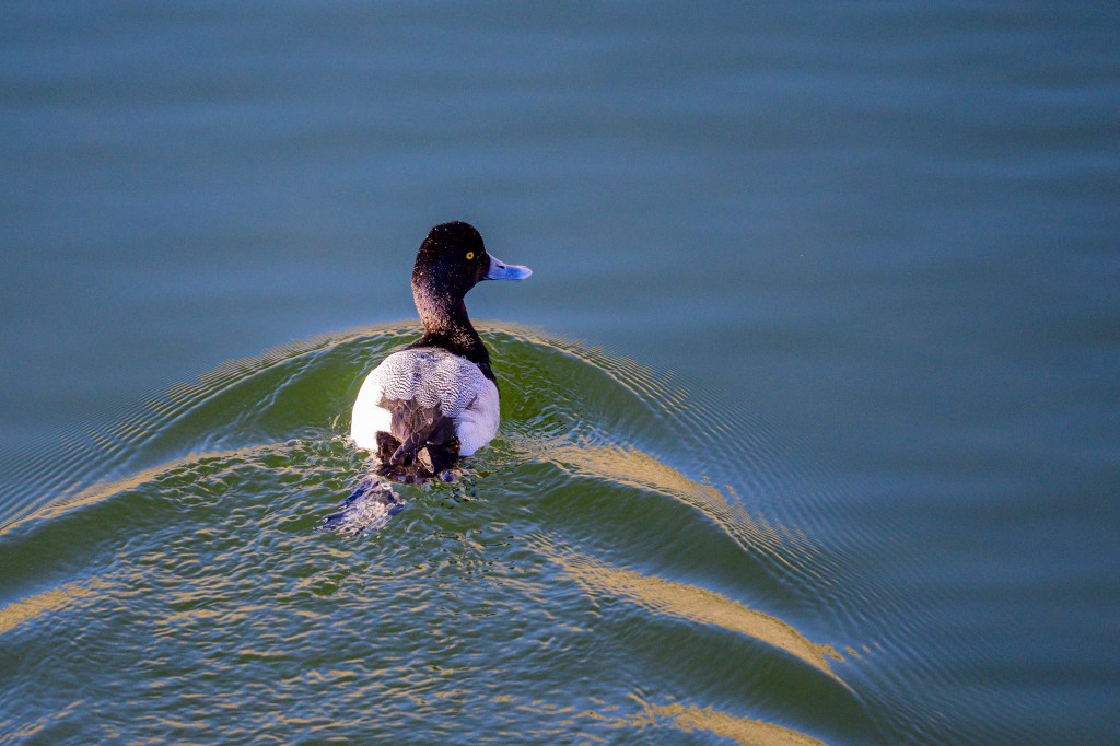
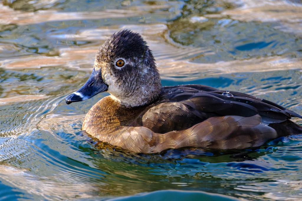
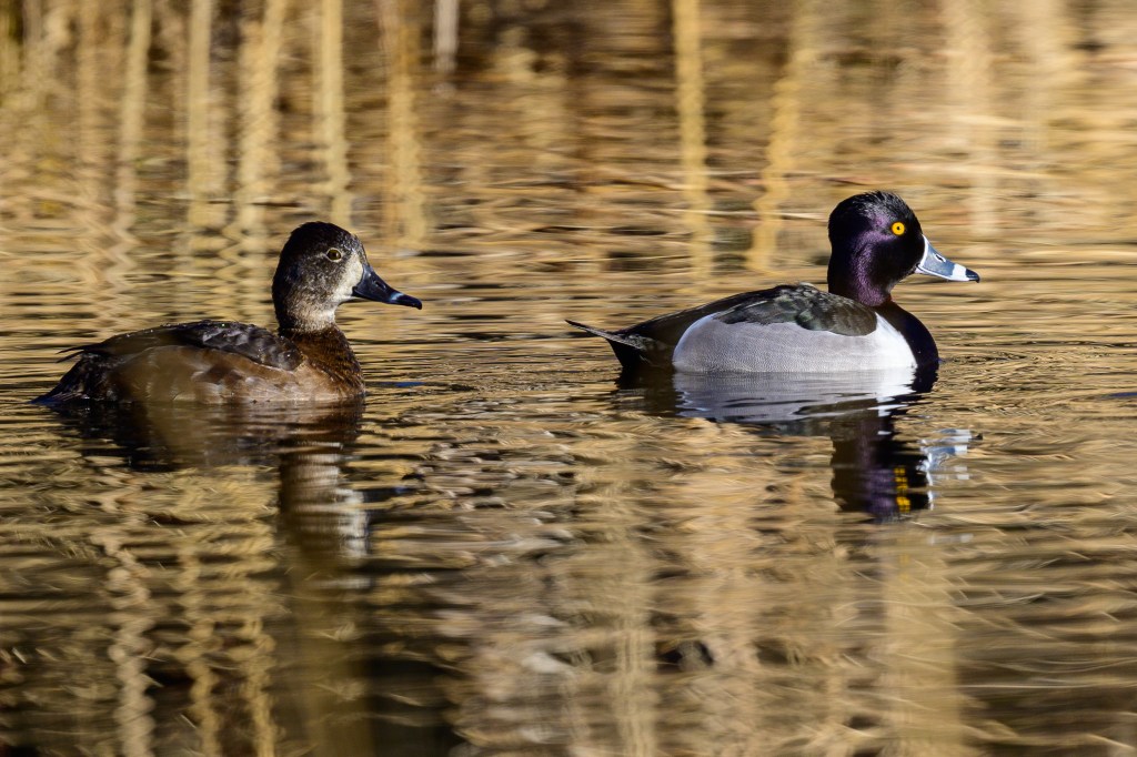
LESSER SCAUP
Scaups on the Pleasant Valley Reservoir.
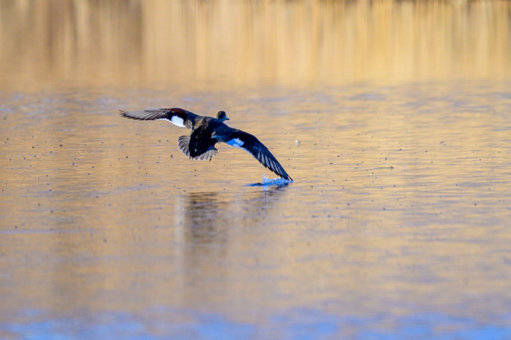
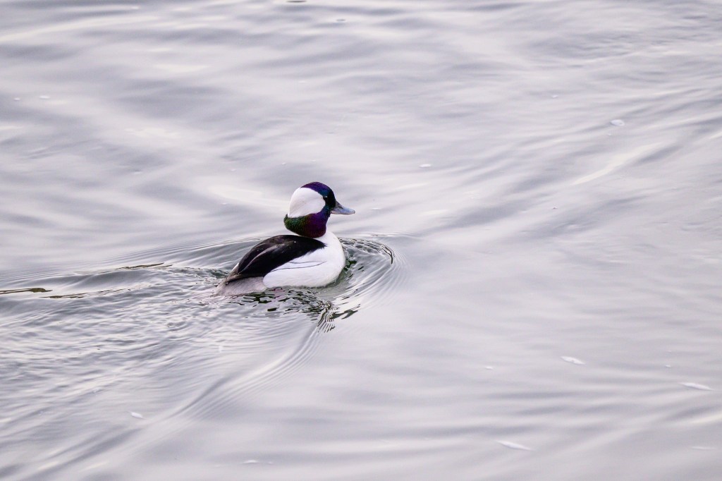
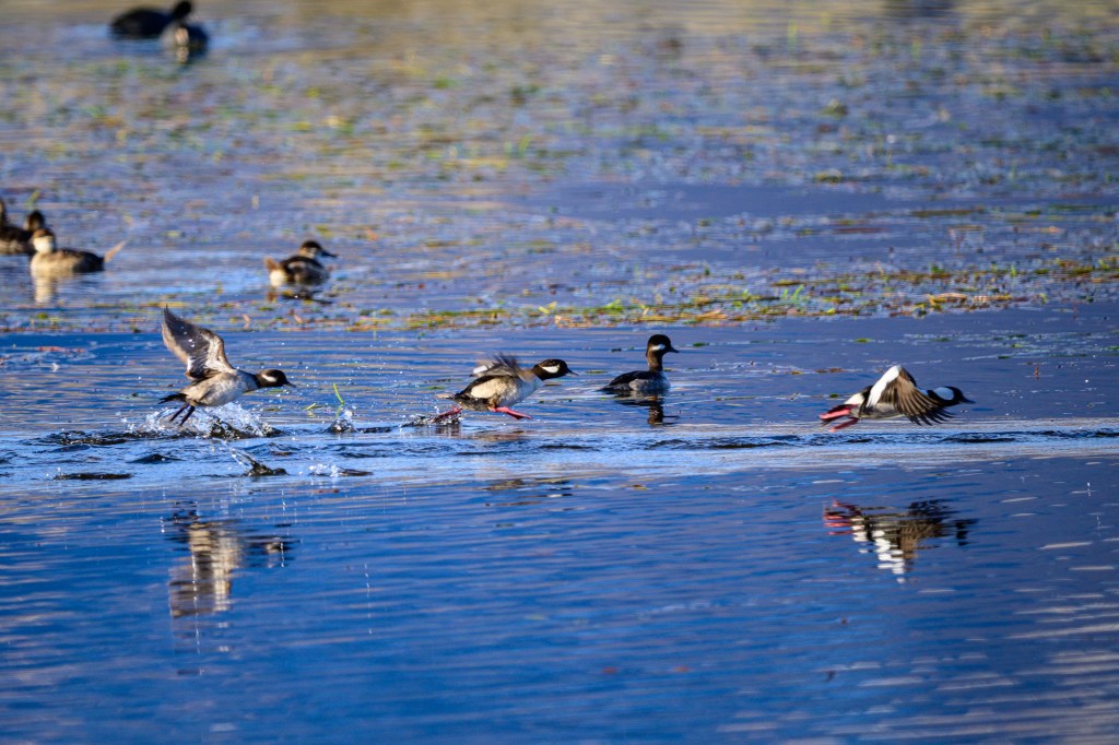
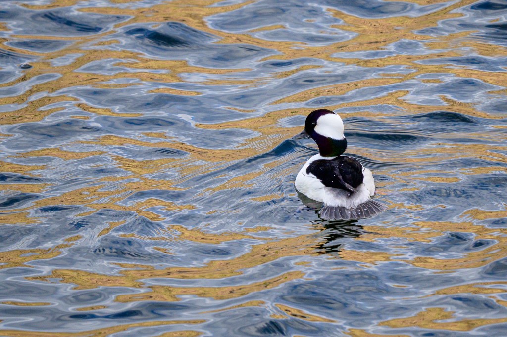
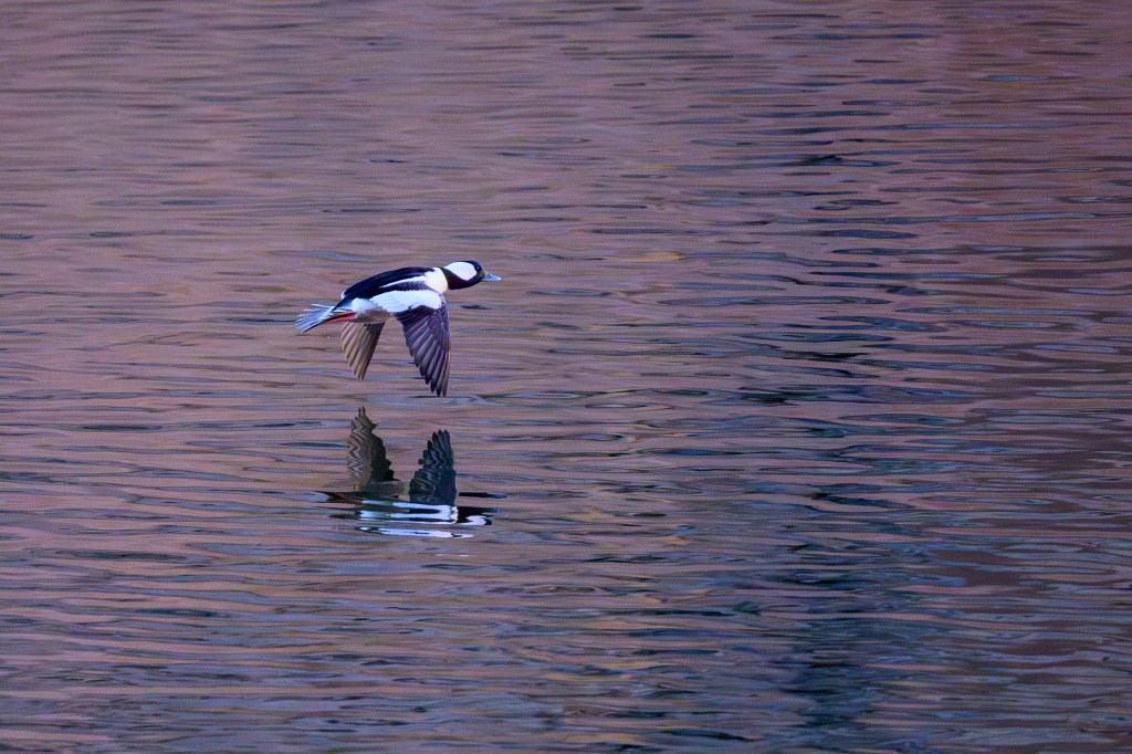
BUFFLEHEAD
A male at the Reservoir.
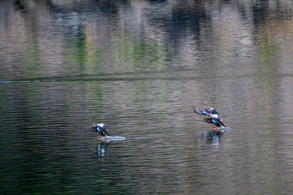
Buffleheads take off from the Ponds by pushing with their feet.
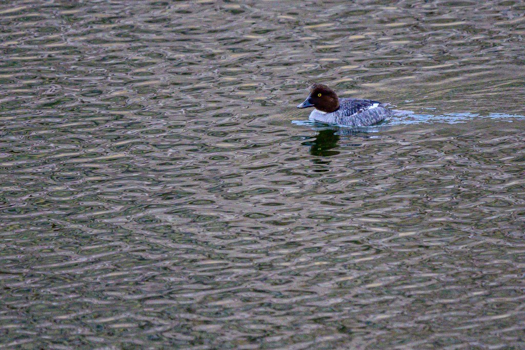
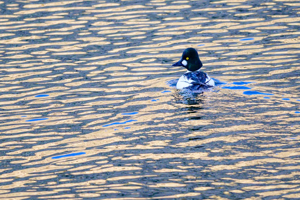
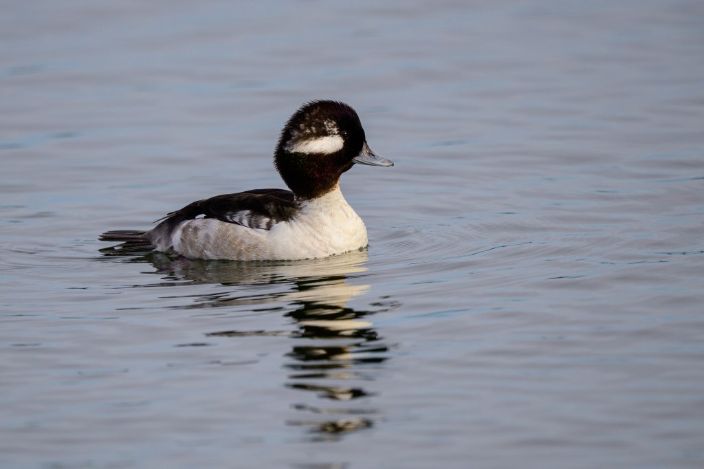
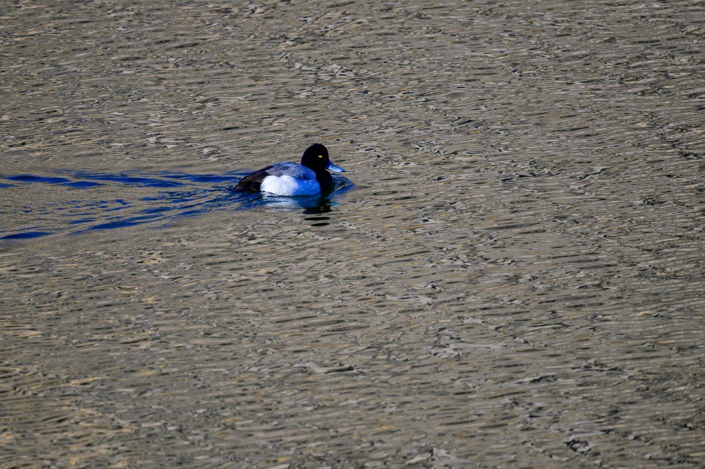
COMMON GOLDENEYE
A female at the Reservoir. The eye is … well, you know.
The green head of a male looks almost black in this light.
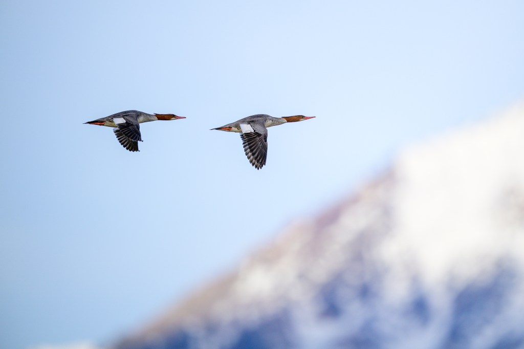
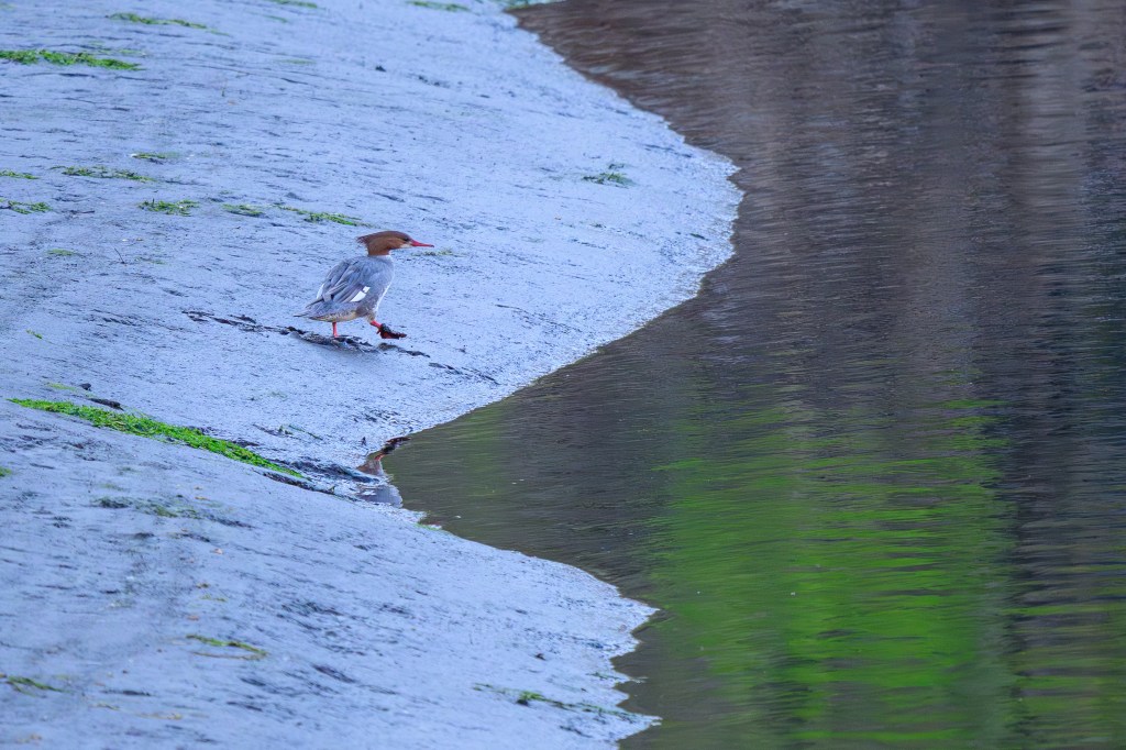
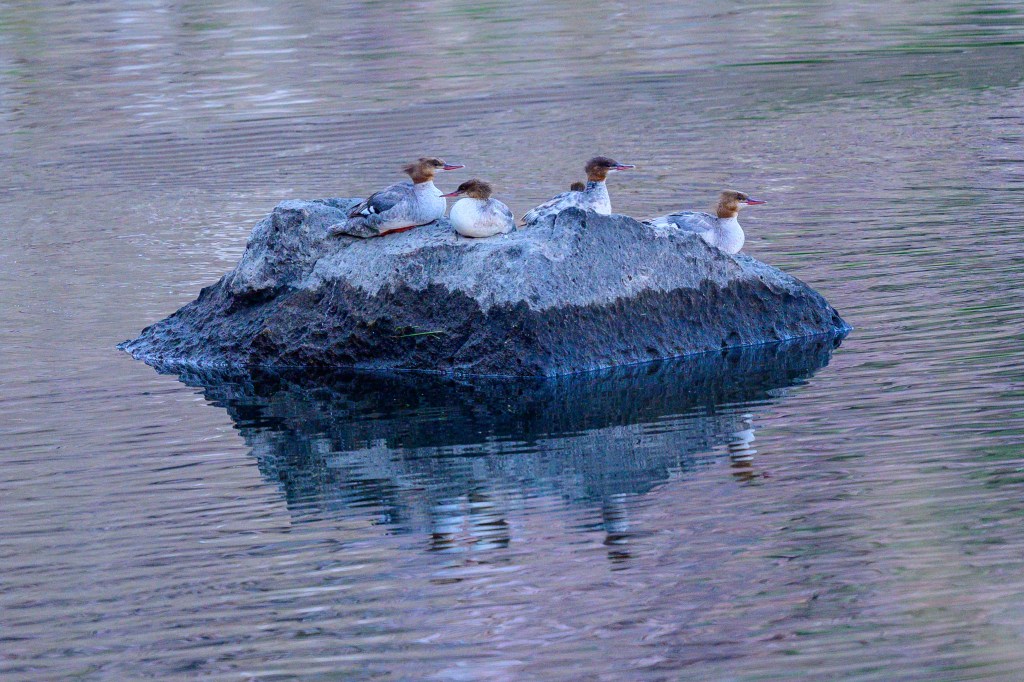
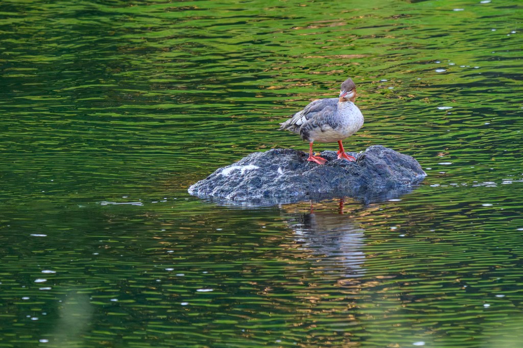
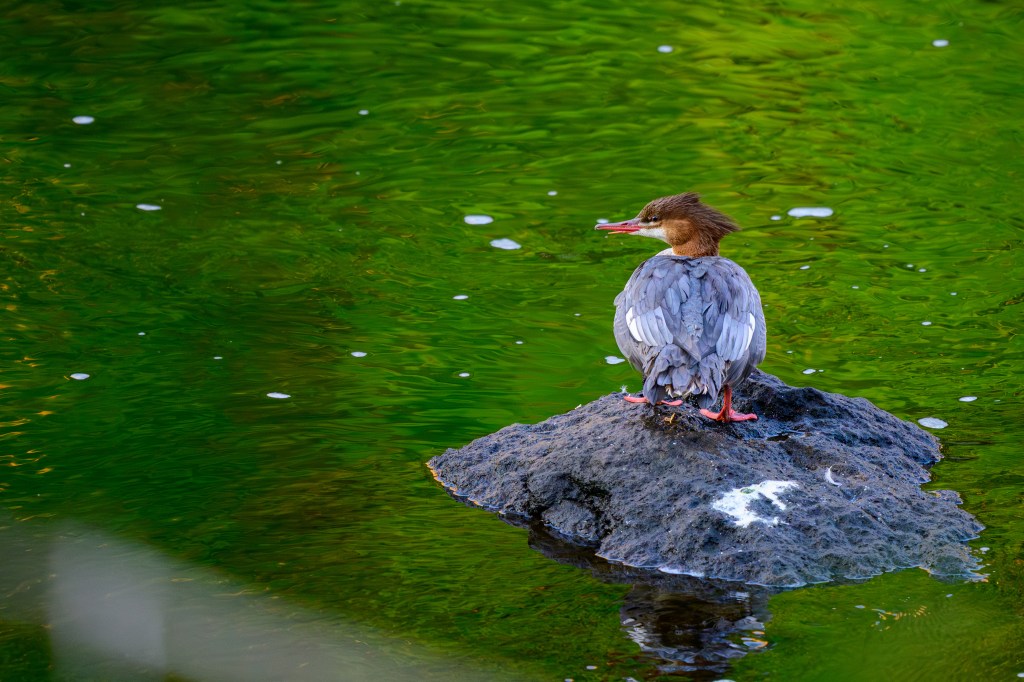
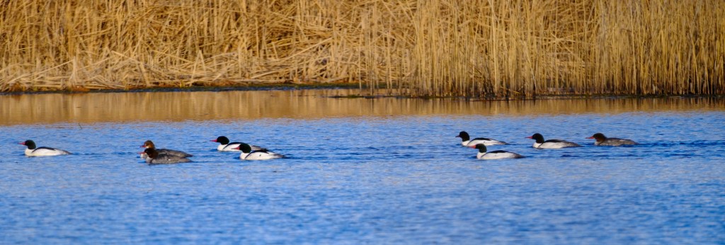
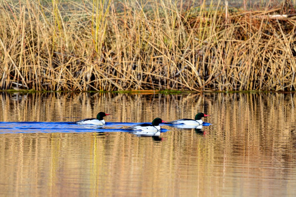
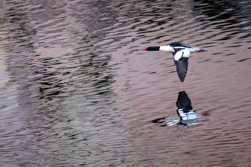
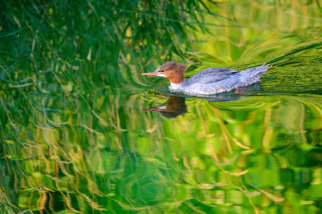
COMMON MERGANSER
Two females fly past Mt. Tom.
Walking through mud at the Reservoir.
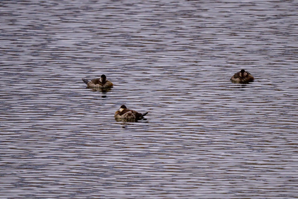
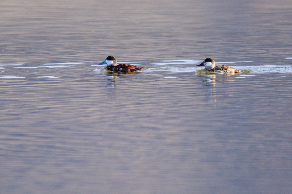
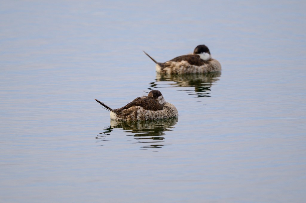
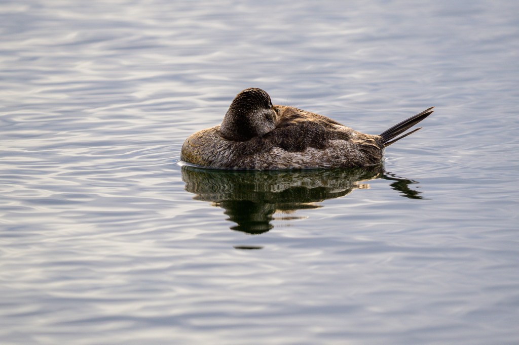
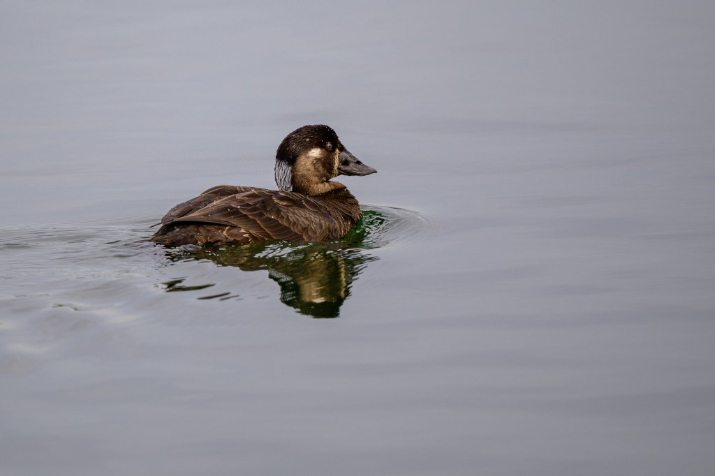
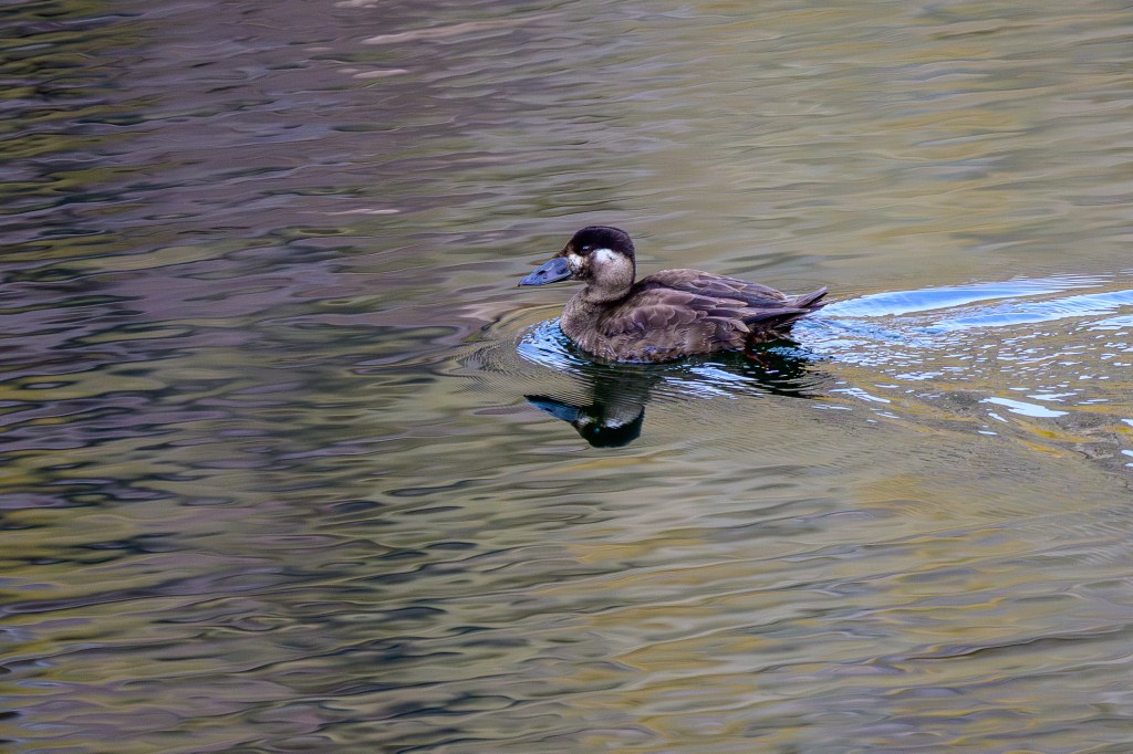
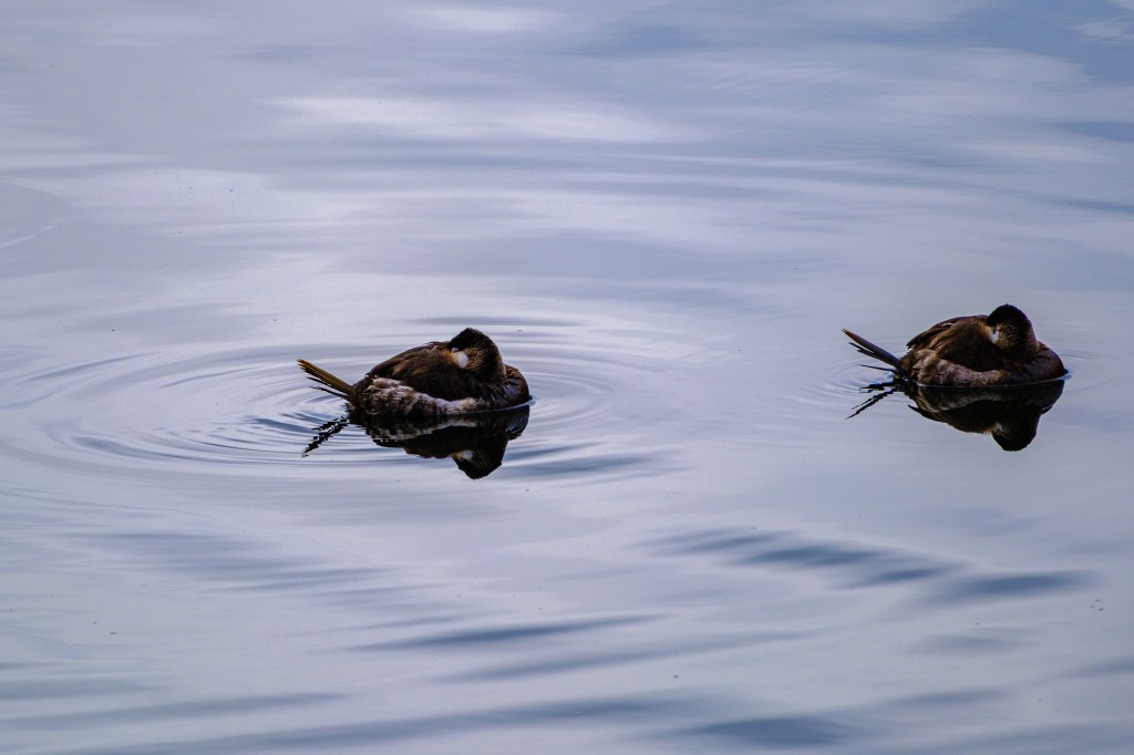
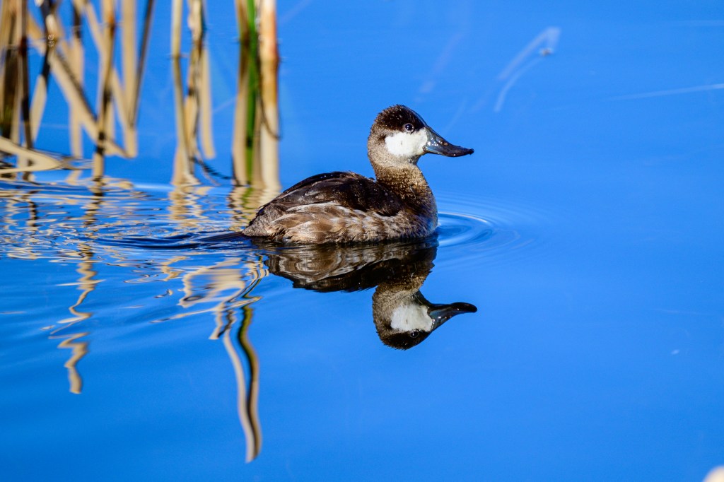
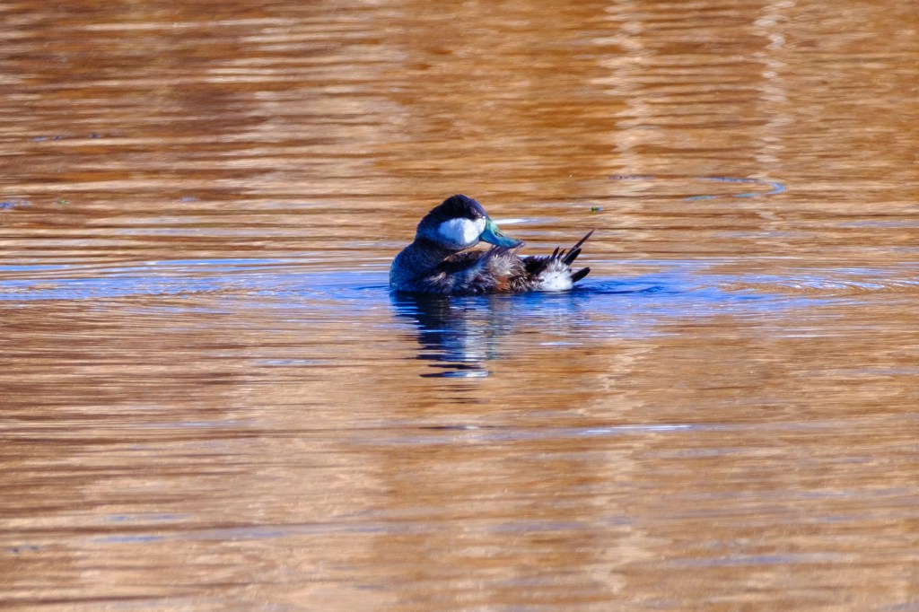
RUDDY DUCK
Three Ruddy Ducks nap at the Reservoir. They are called stifftails.
Two males at Owens Lake. The lead duck wears his breeding outfit, a blue bill and red feathers.
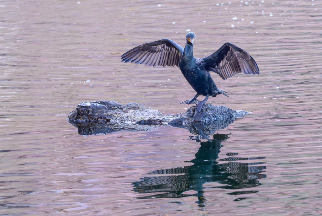
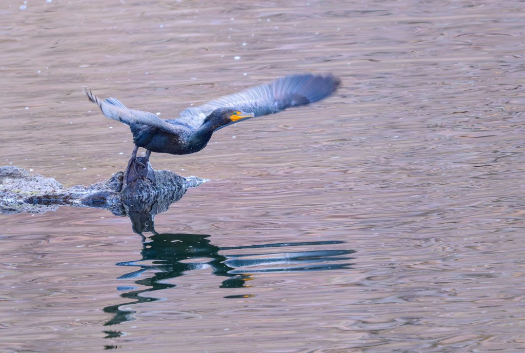
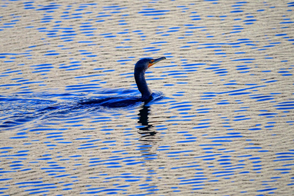
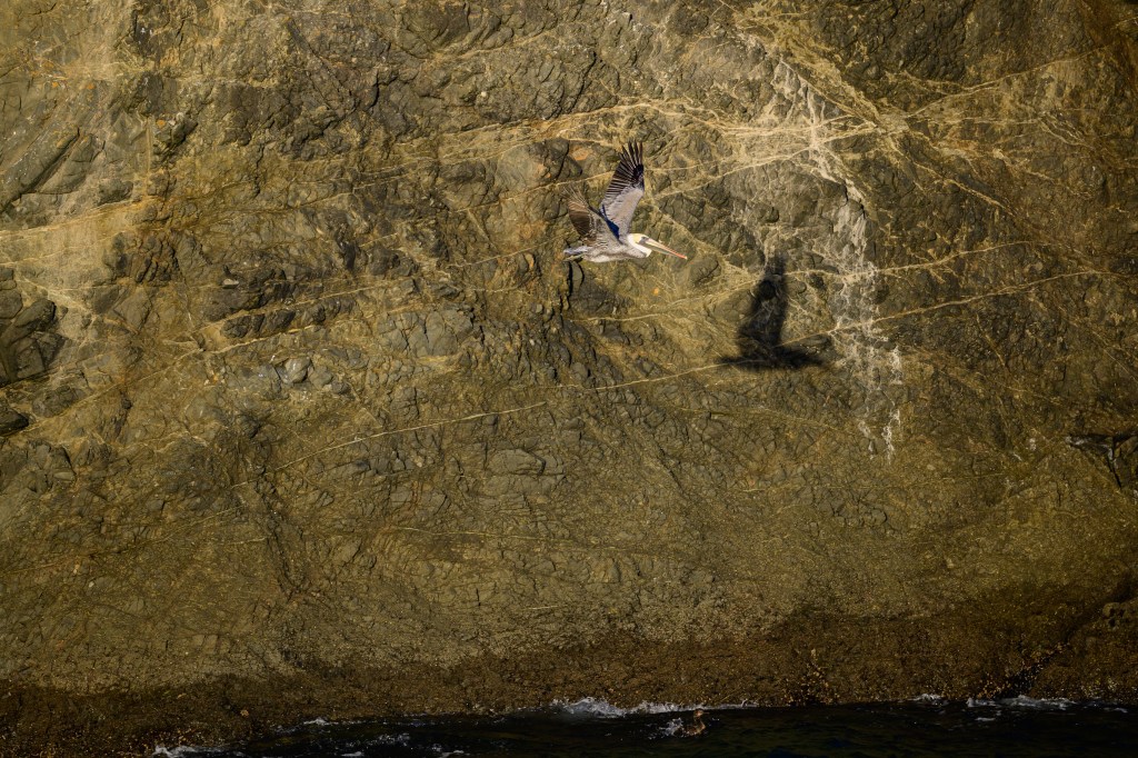
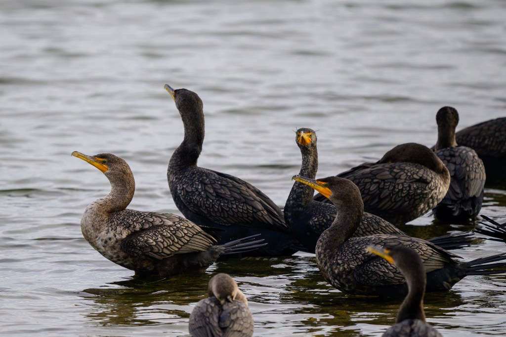
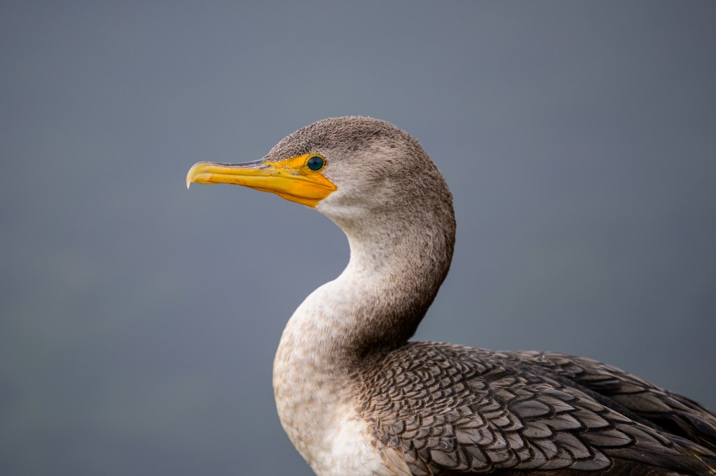
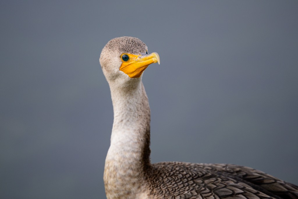
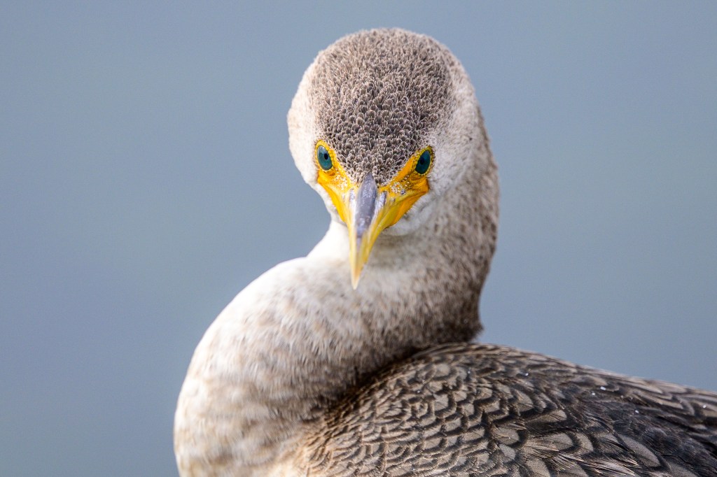
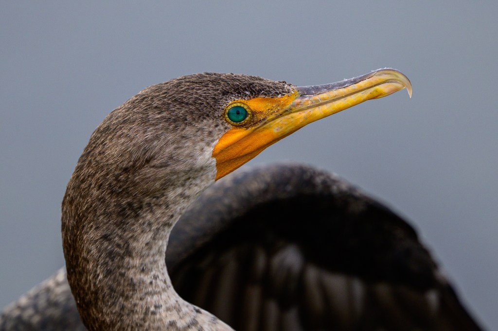
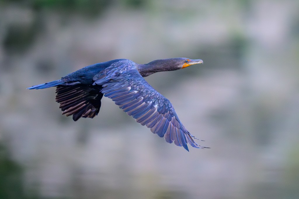
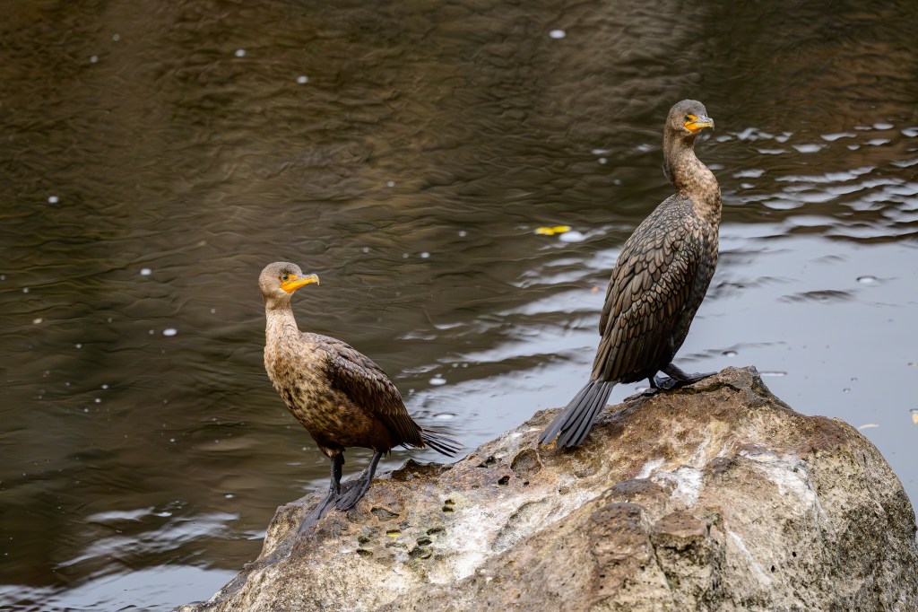
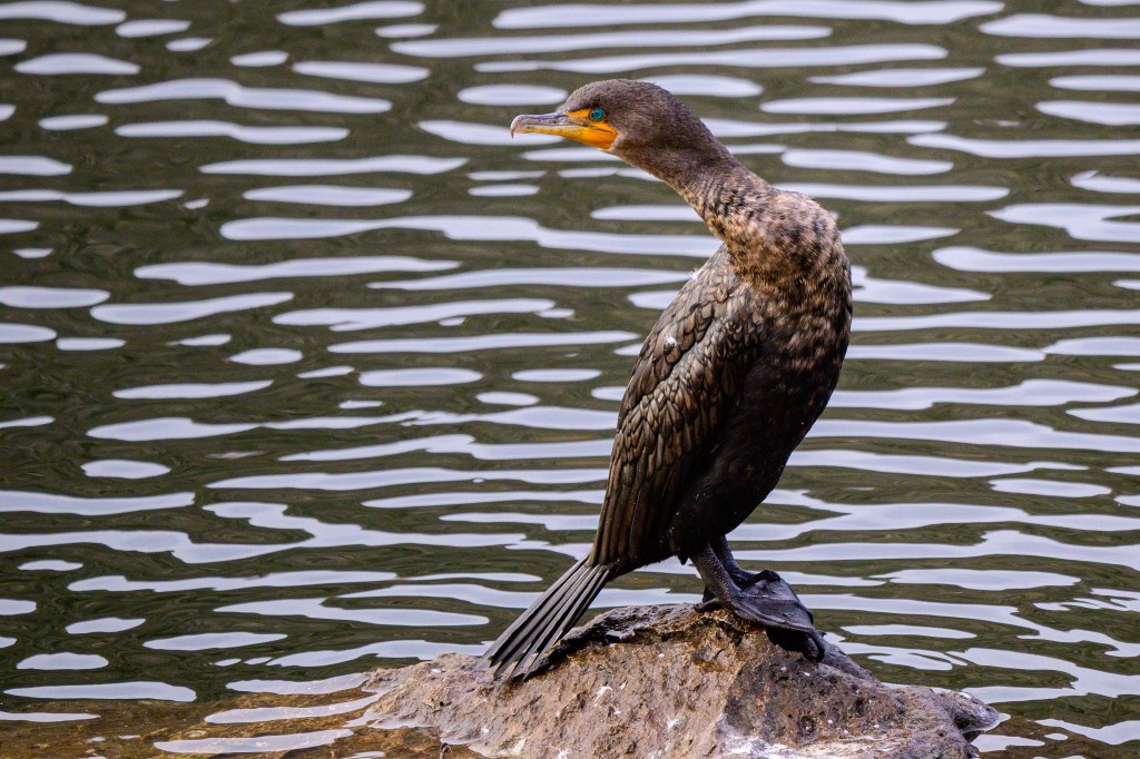
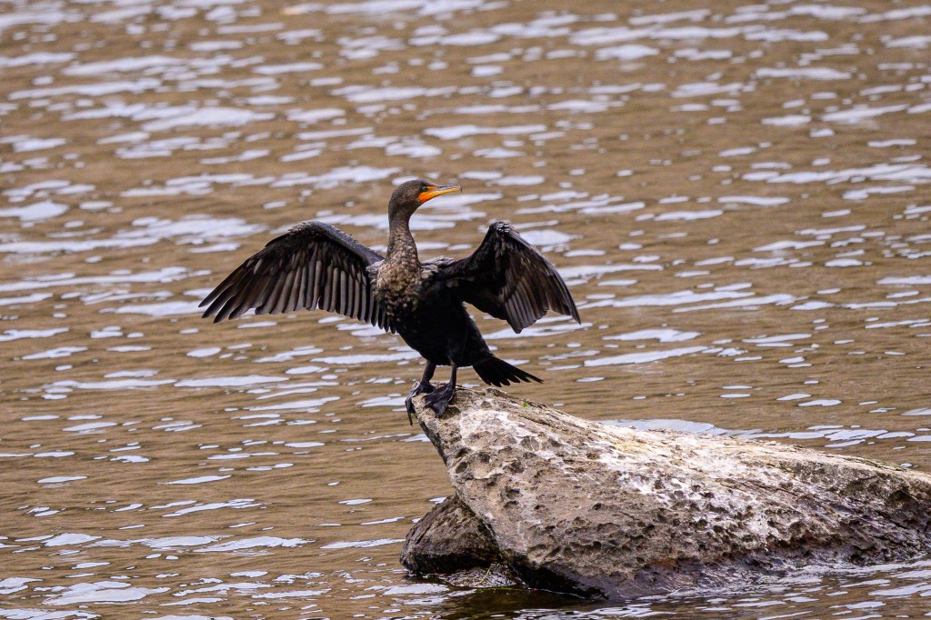
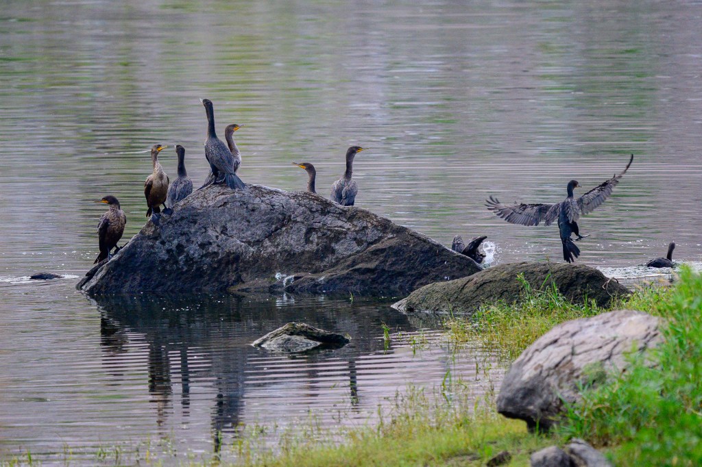
DOUBLE-CRESTED CORMORANT
This bird seems to be dancing with its reflection.
Take-off.
These birds often ride low in the water. The neck and head look like a periscope sticking up from a sub.
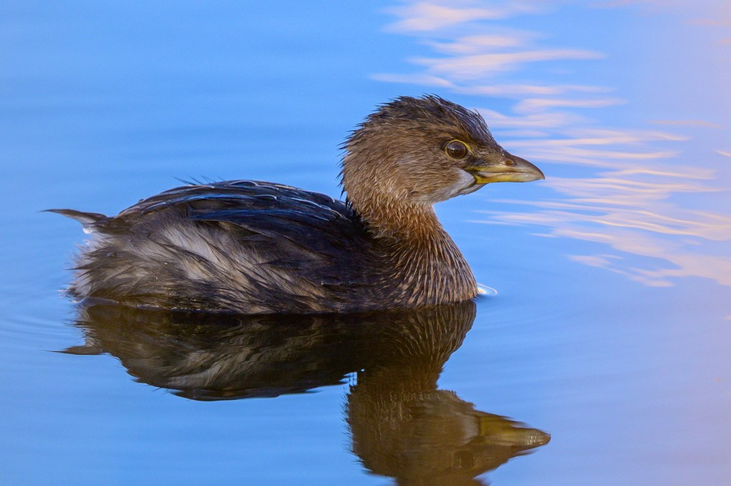
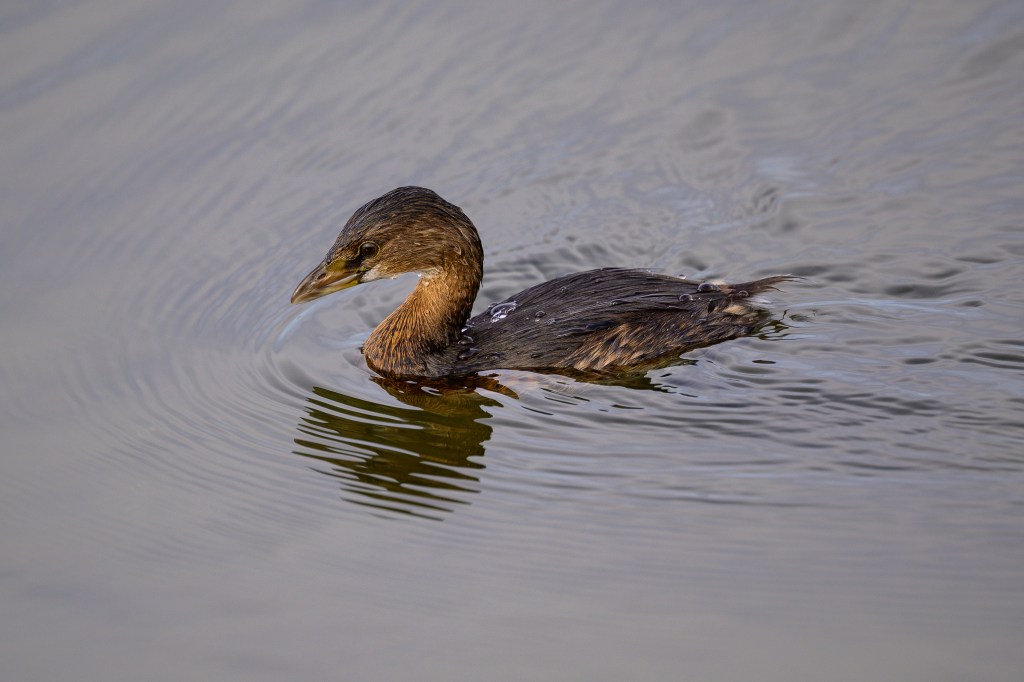
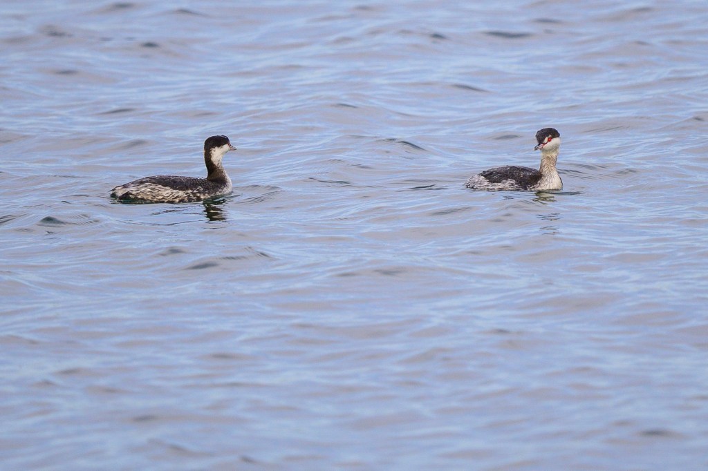
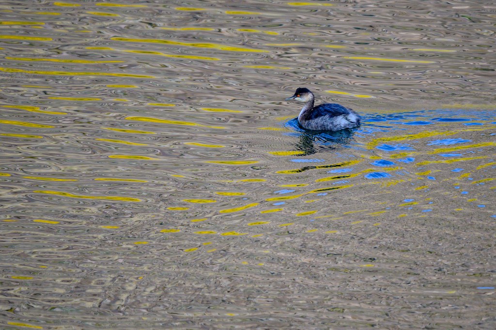
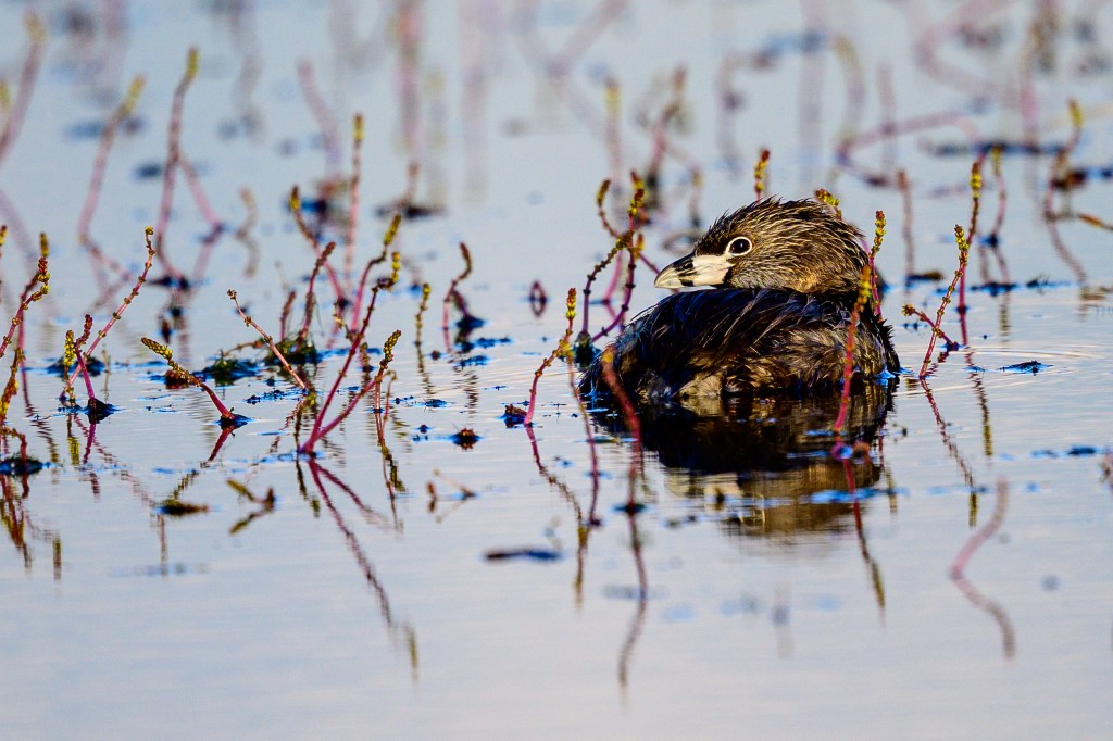
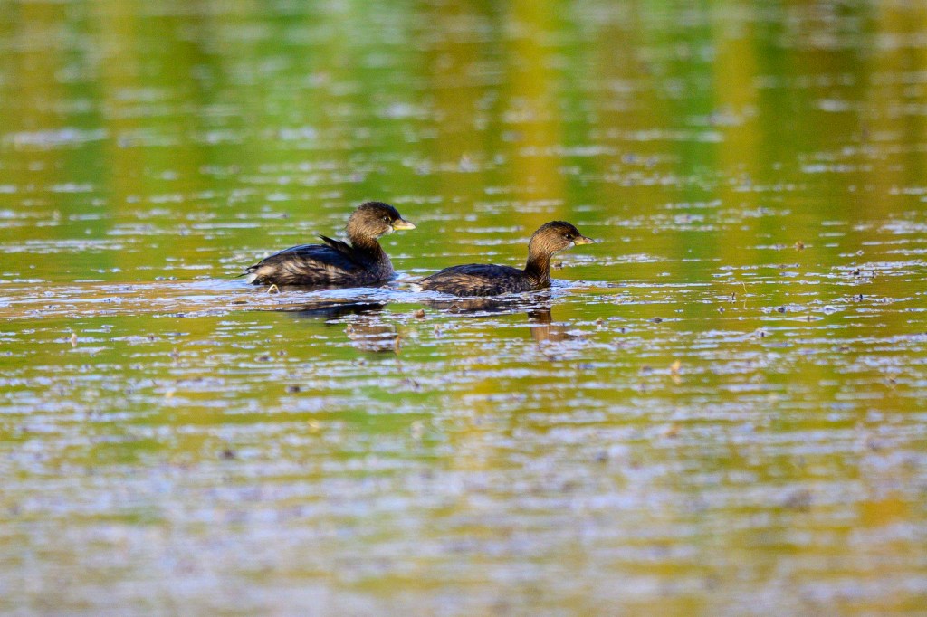
PIED-BILLED GREBE
These grebes are shy, but in February I managed to get a close-up at the Ponds.
At the Reservoir, a Pied-billed Grebe joins a Mallard family.
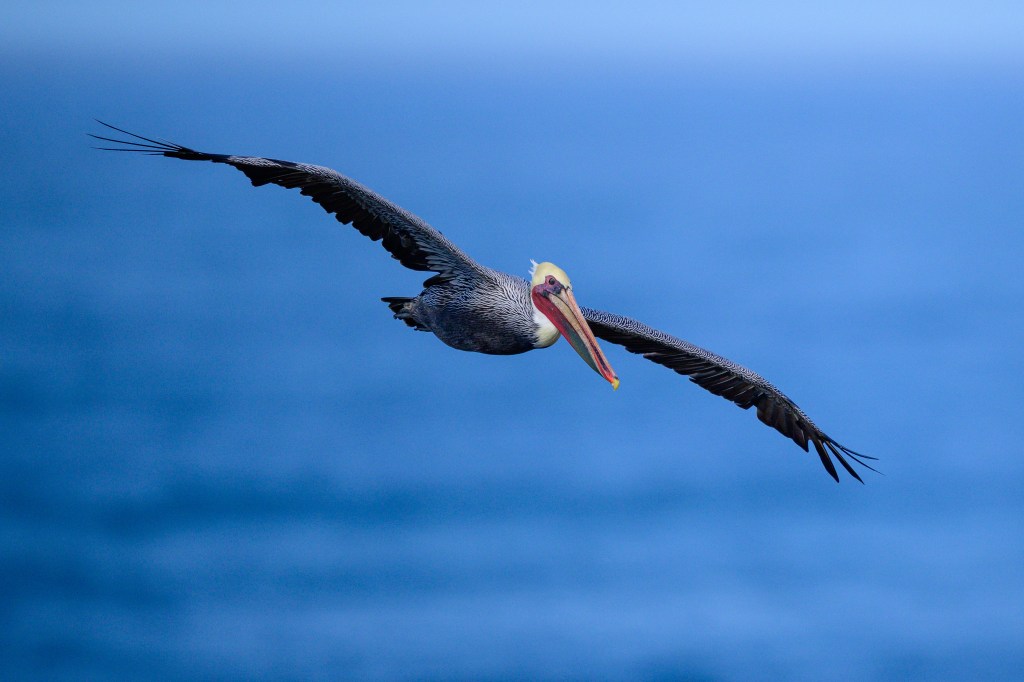
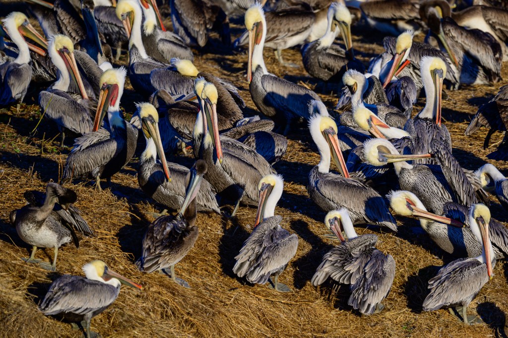
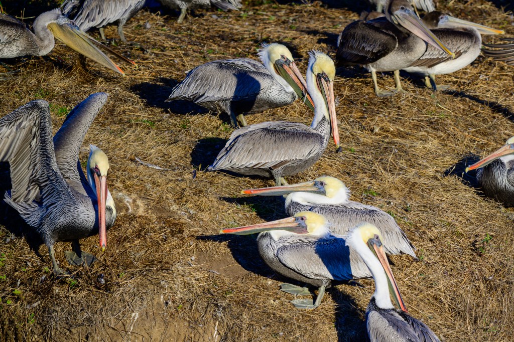
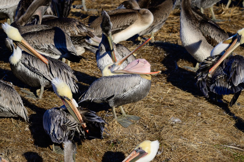
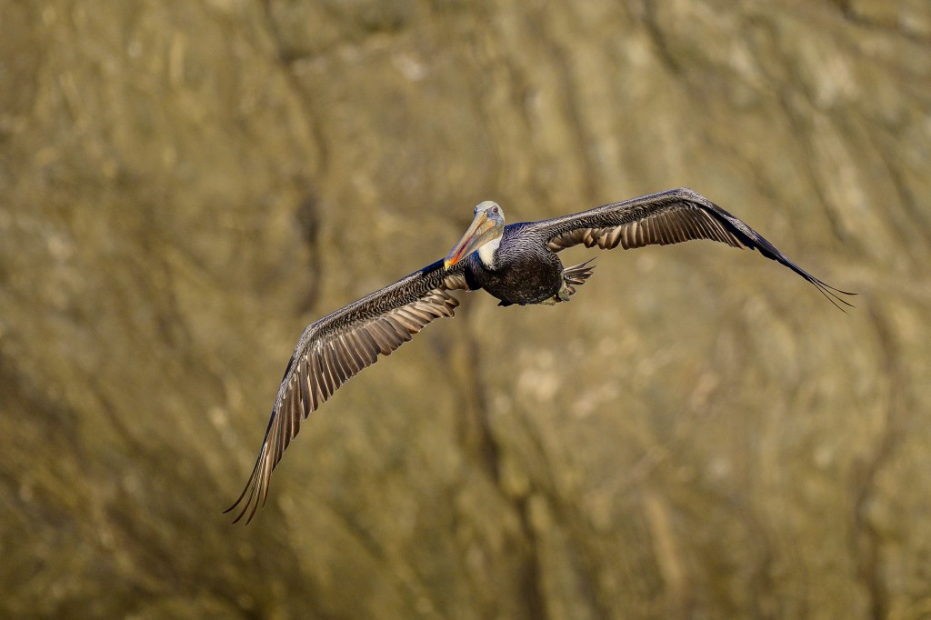
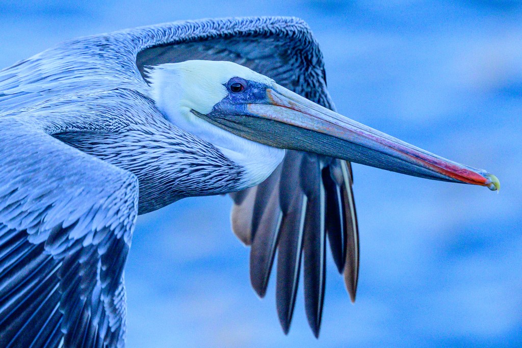
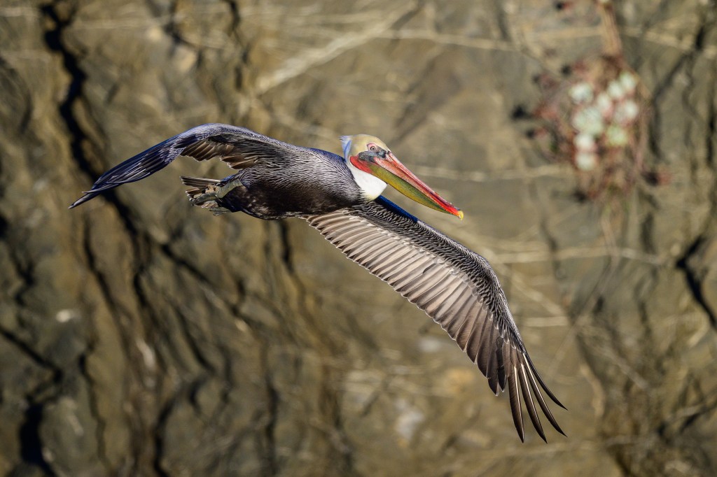
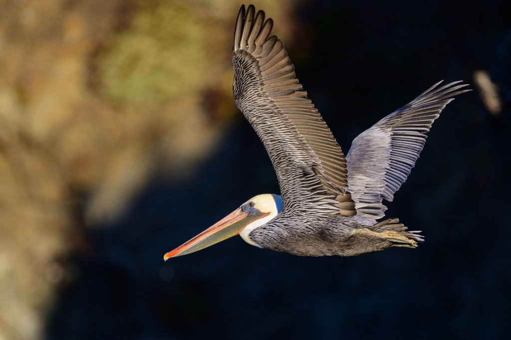
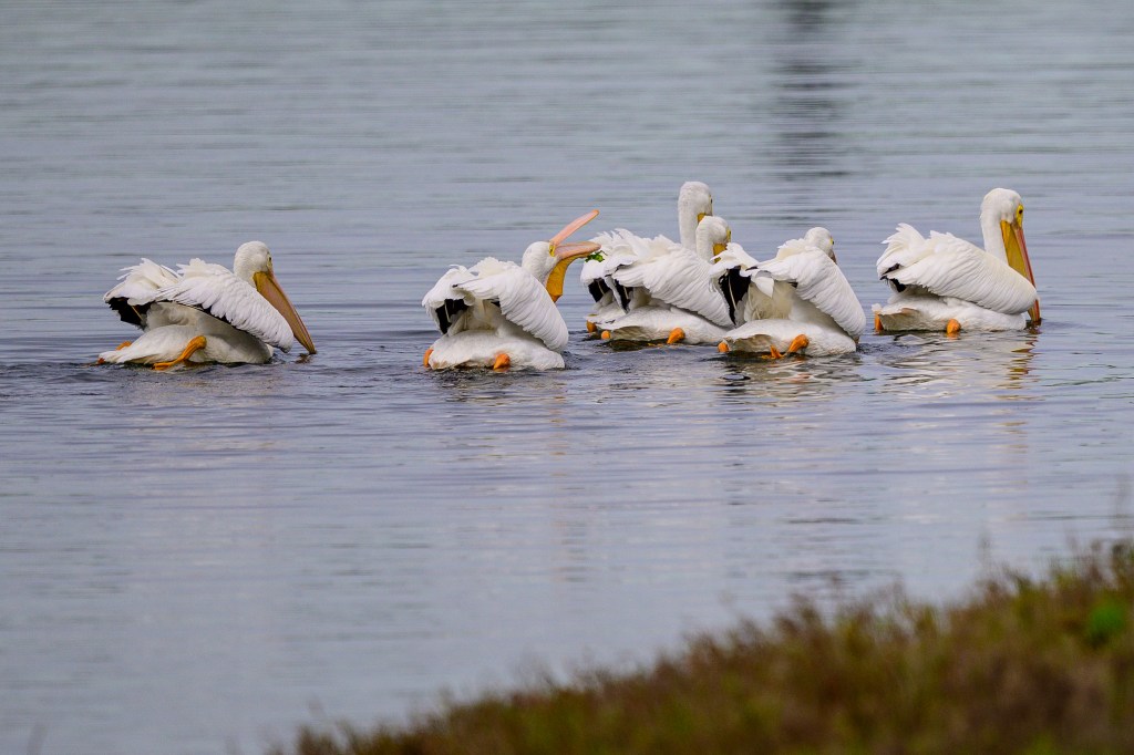
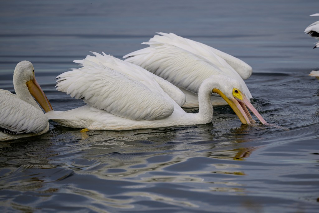
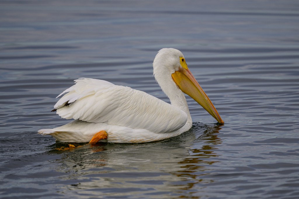
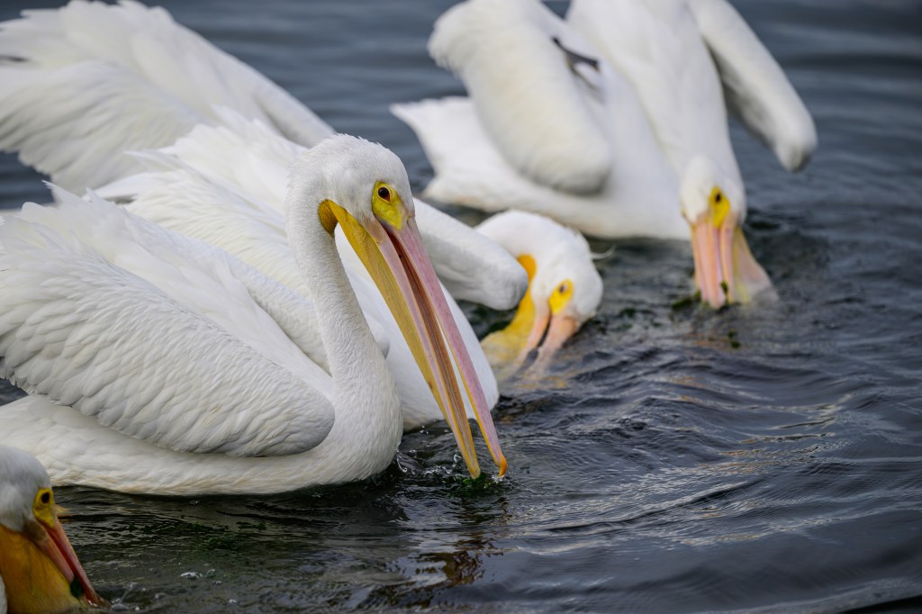
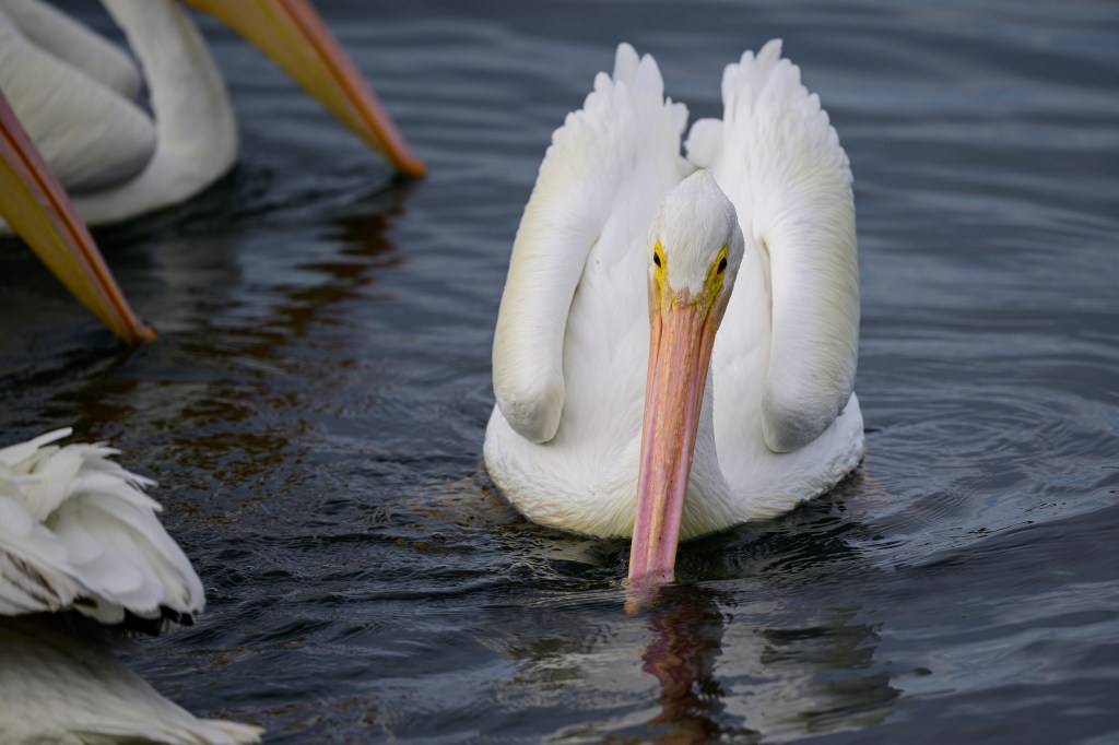
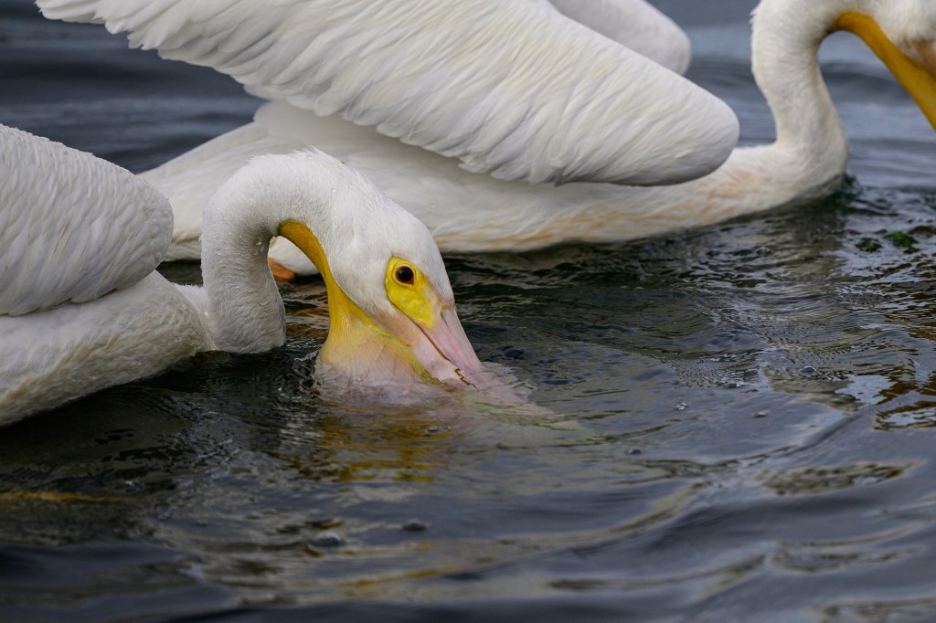
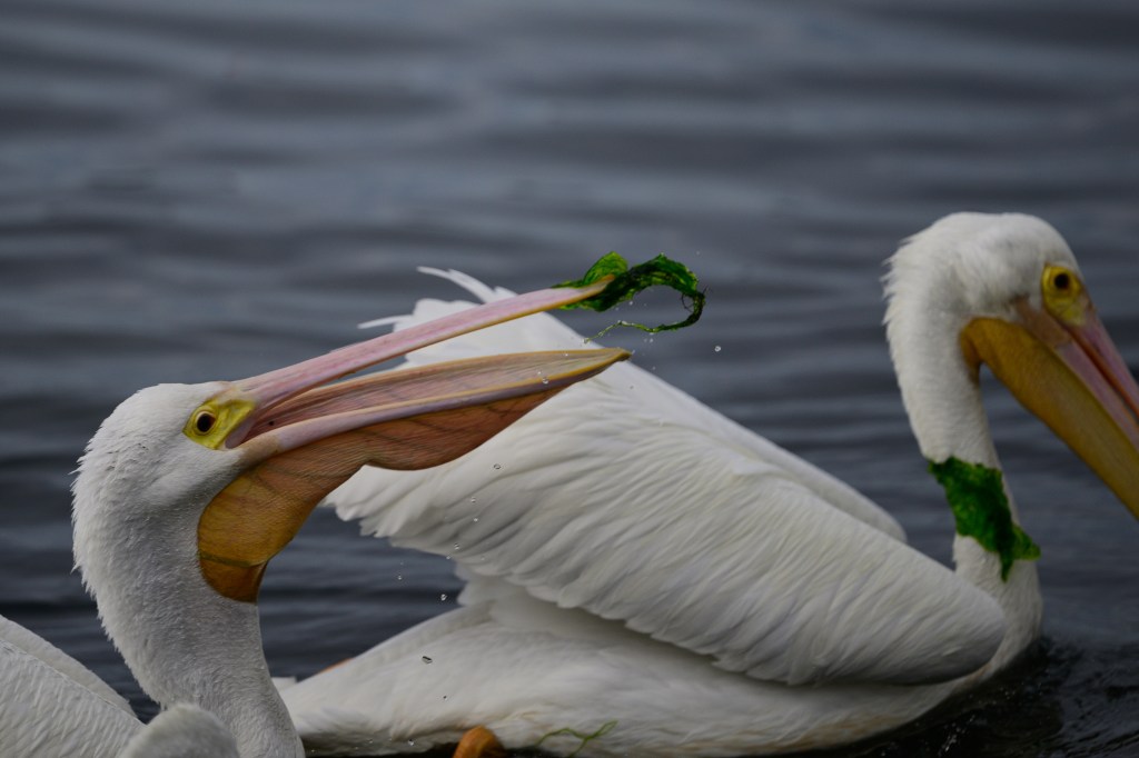
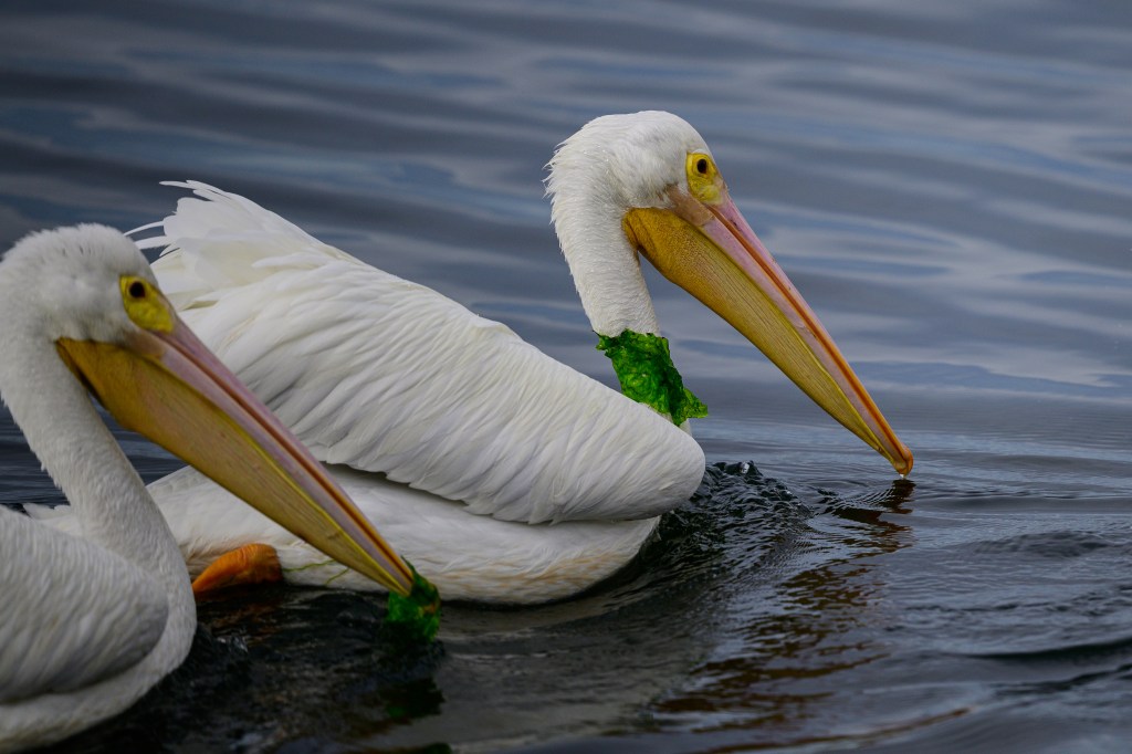
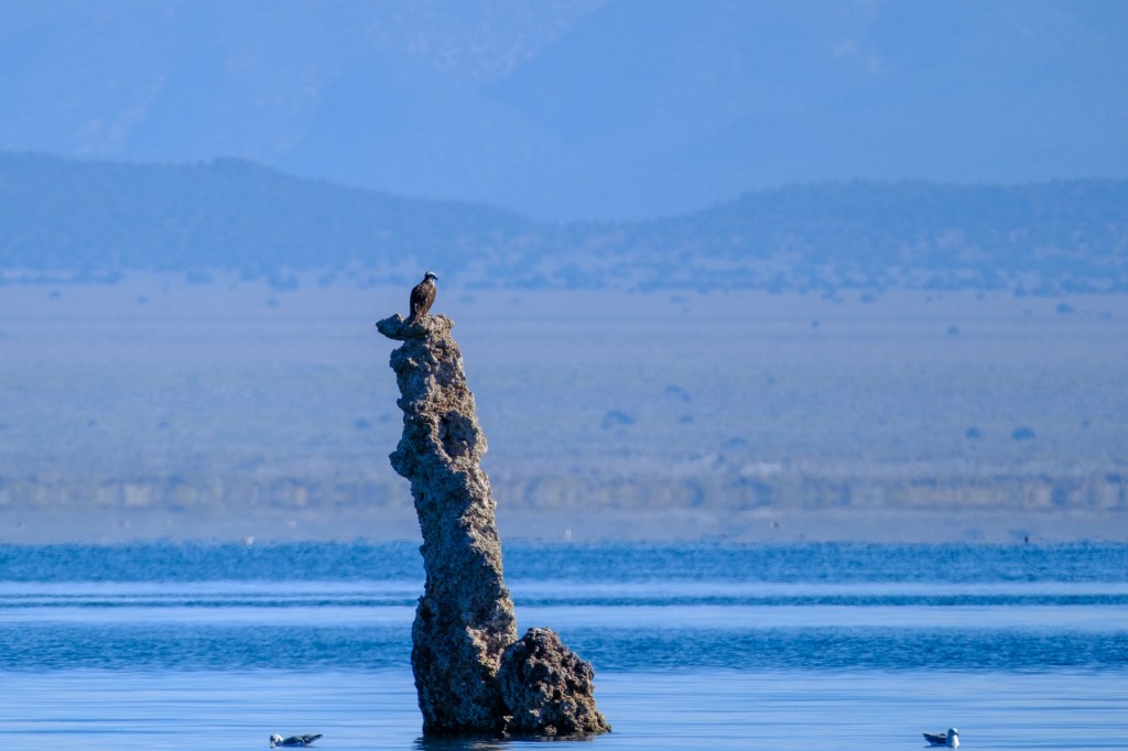
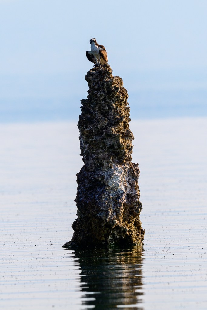
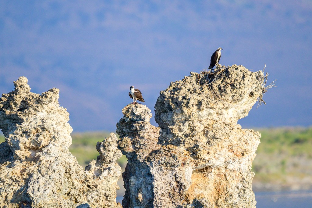
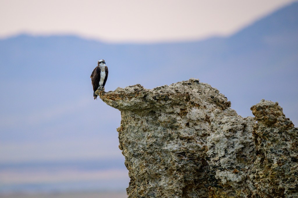
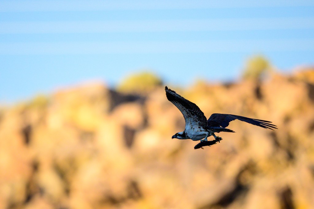
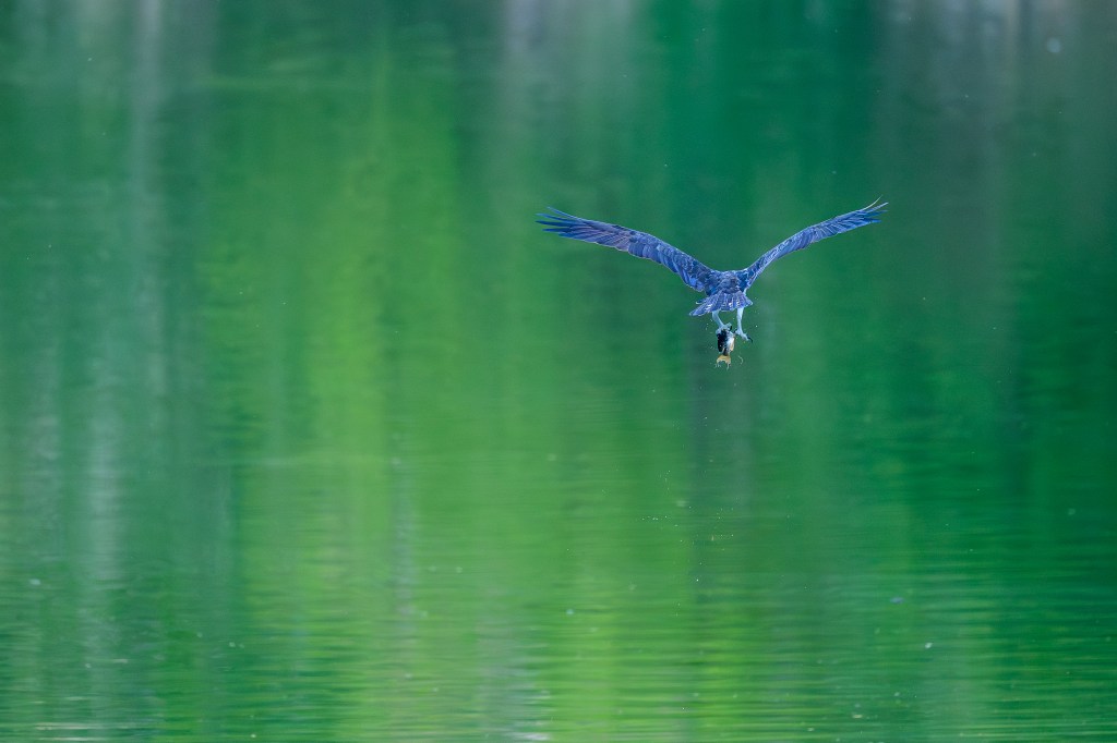
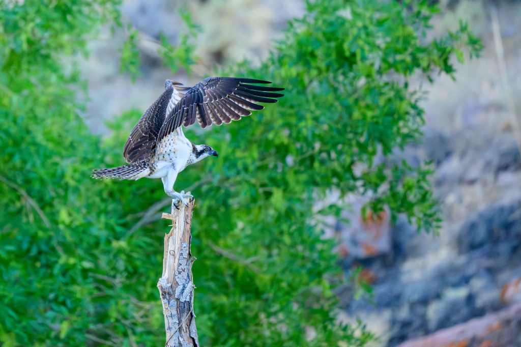
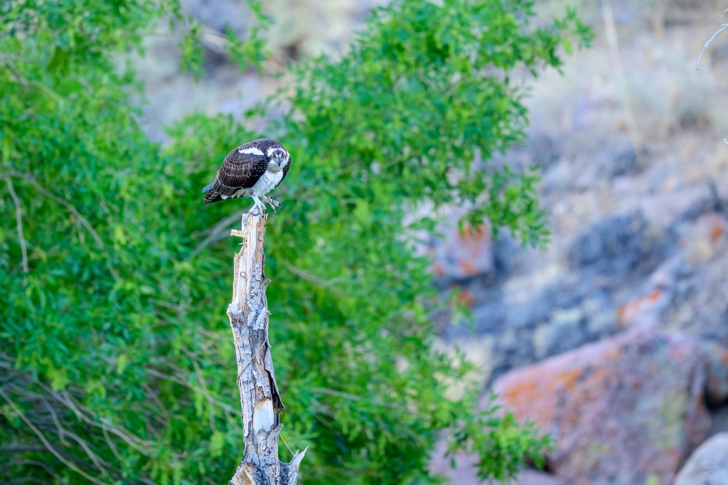
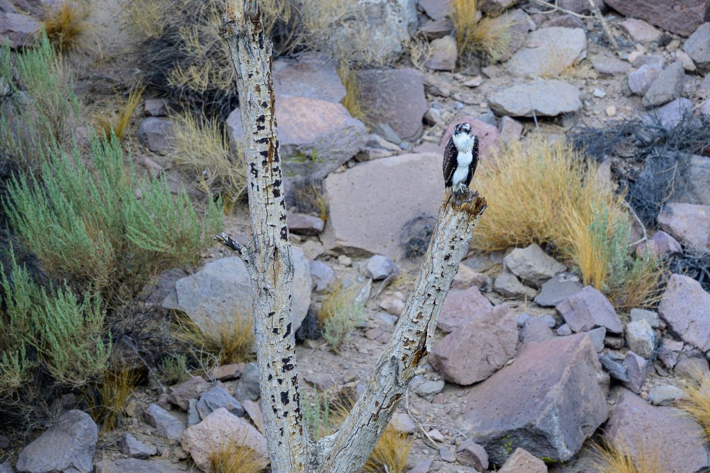
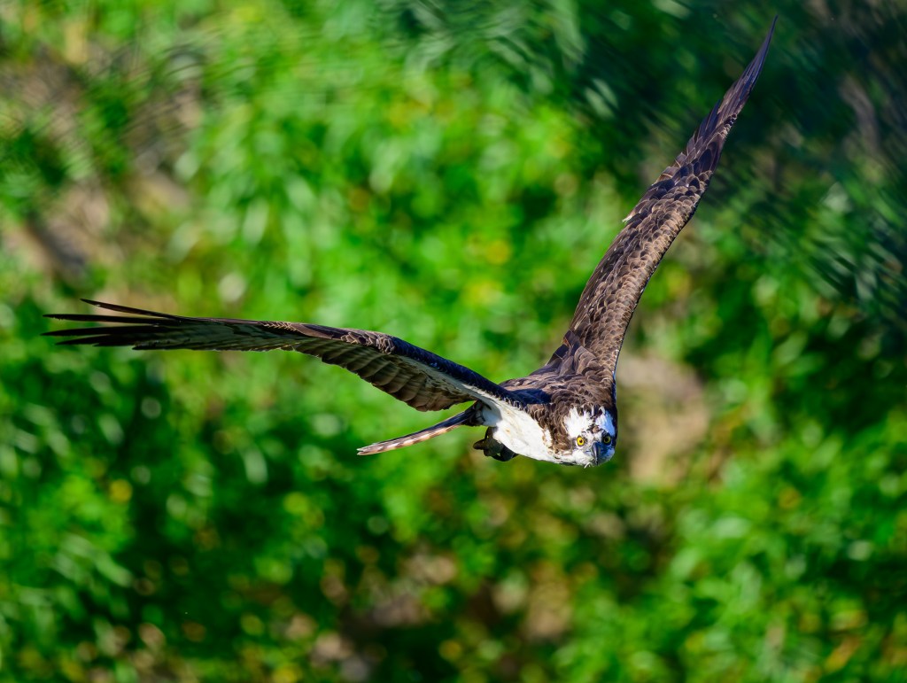
AMERICAN WHITE PELICAN
We were driving north on 395 when Roberta spotted 100 Pelicans right above us. We pulled over at the elk viewing area and watched the birds circle above; they were using thermal uplift to gain height.
Finally they headed north.
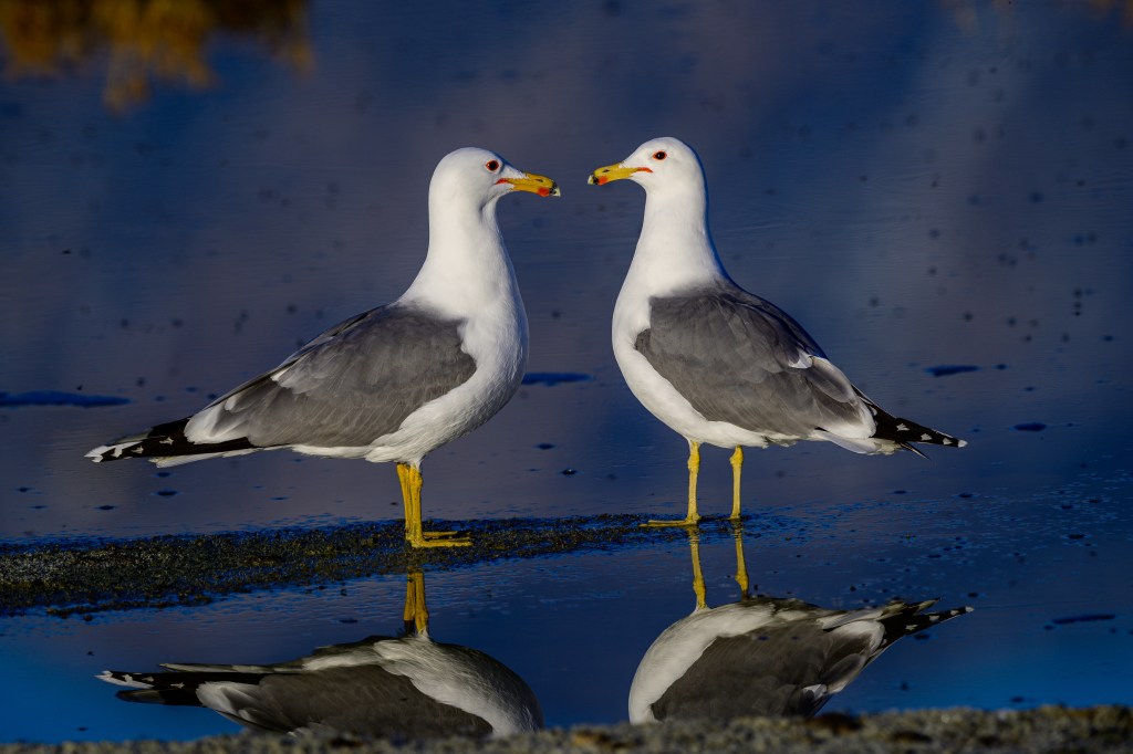
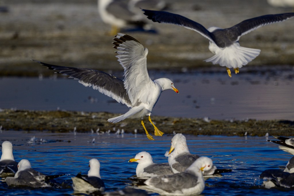
CALIFORNIA GULL
These Gulls were at Owens Lake.
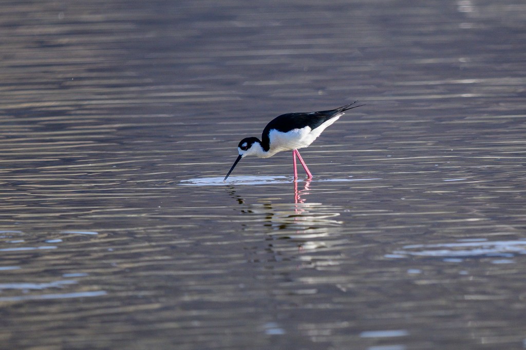
BLACK-NECKED STILT
Black, white, and pink at Owens Lake.
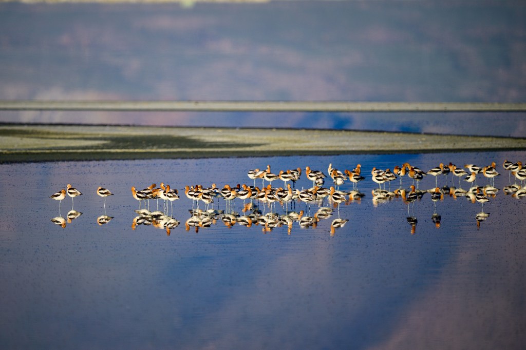
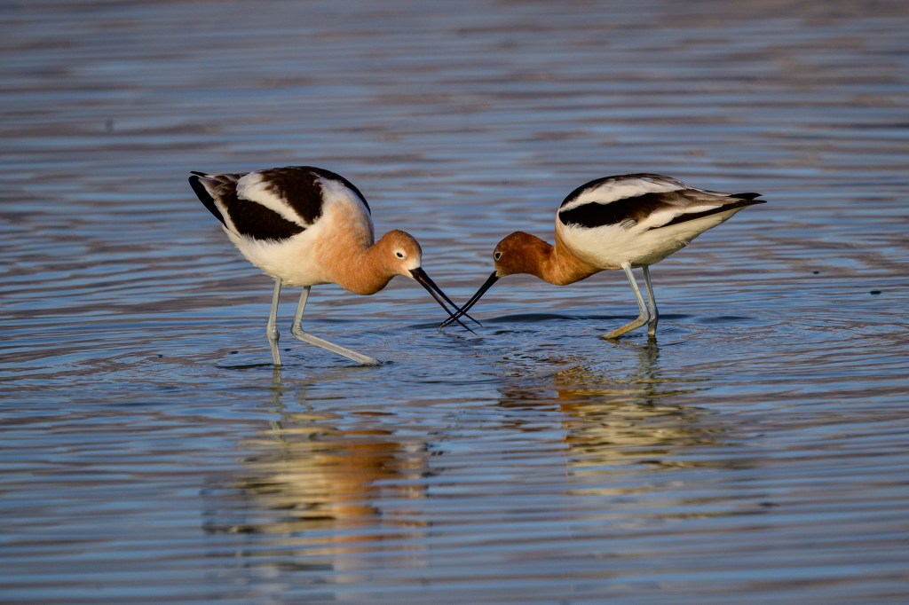
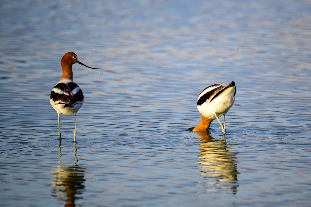
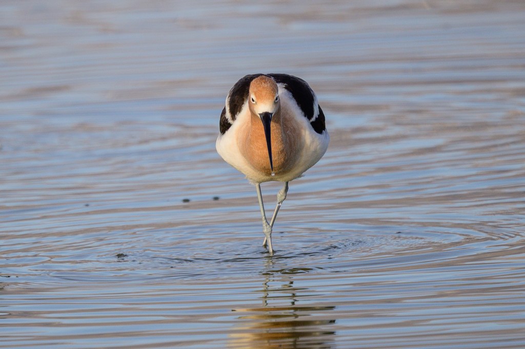
AMERICAN AVOCET
Avocets at Owens Lake.
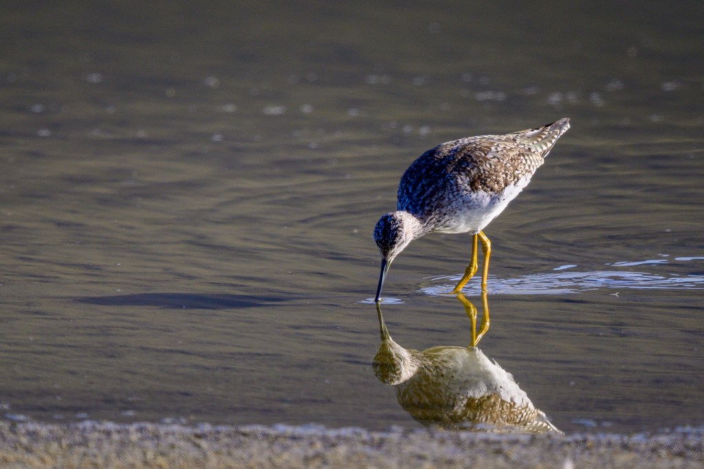
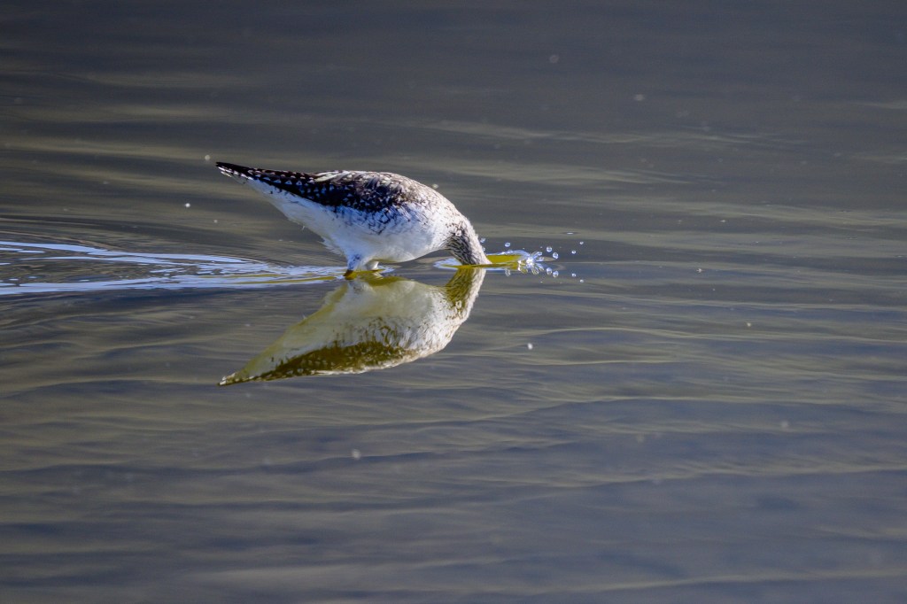
GREATER YELLOWLEGS
A narcissist kisses its reflection at Owens Lake.
Then it goes all in.
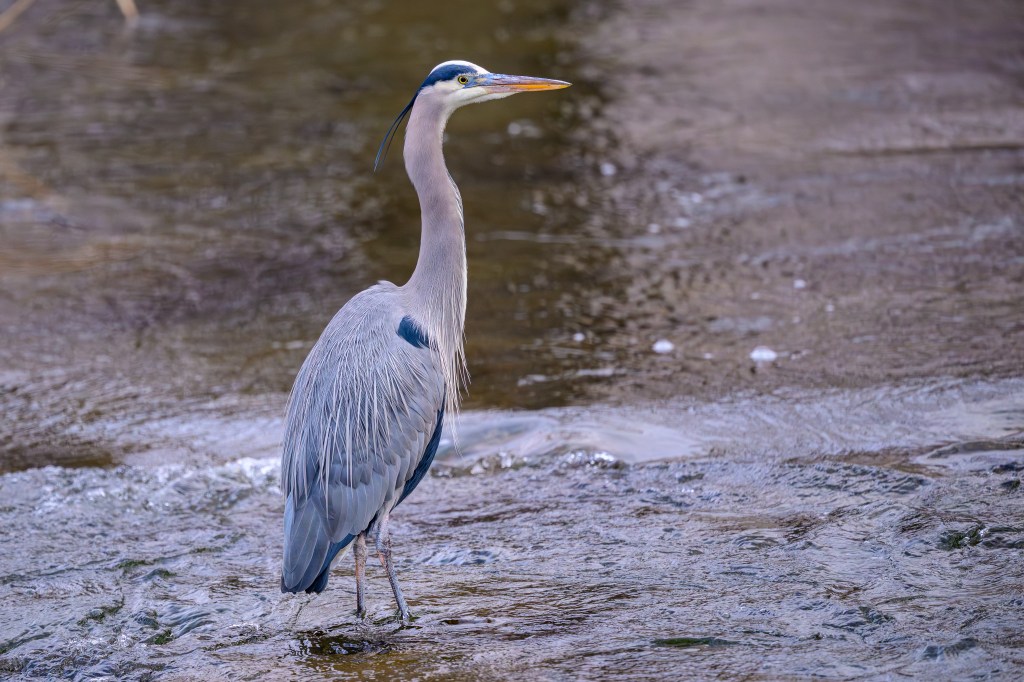
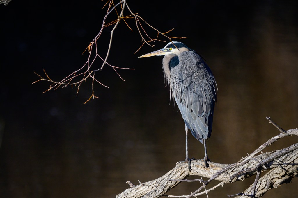
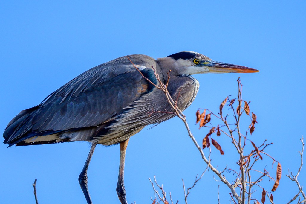
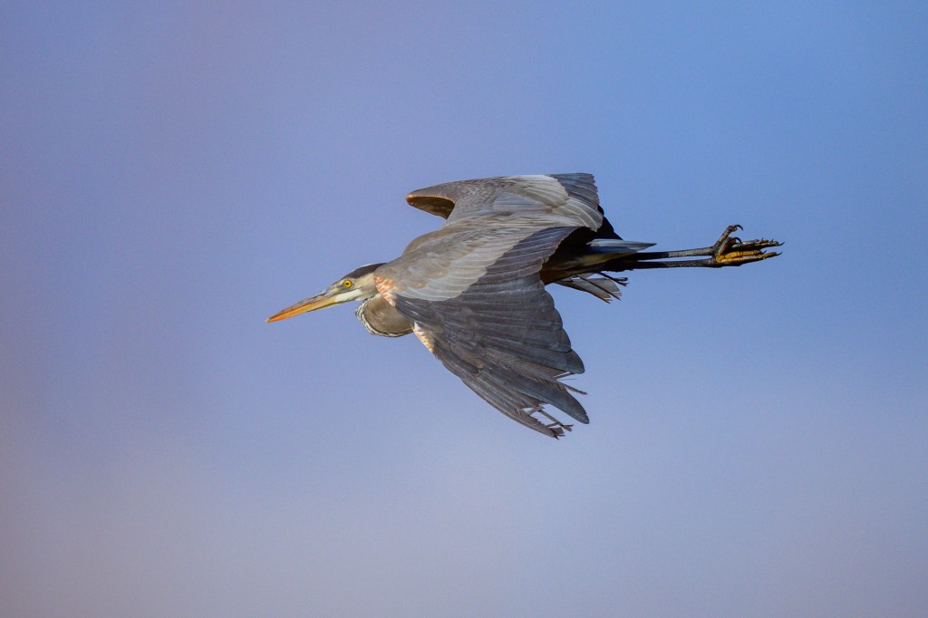
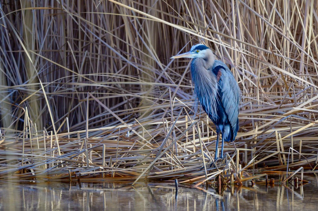
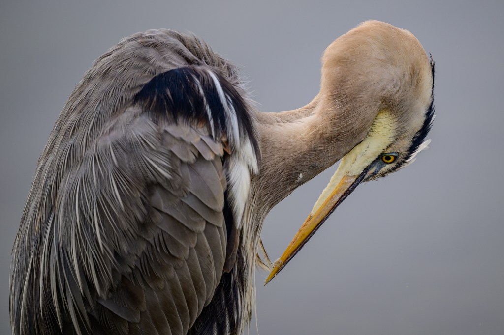
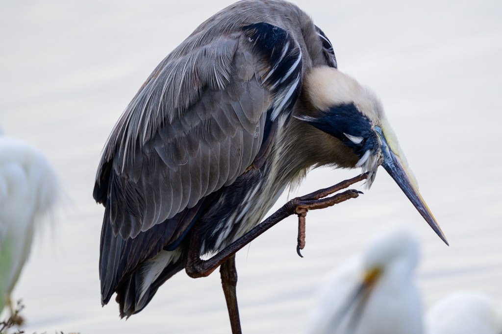
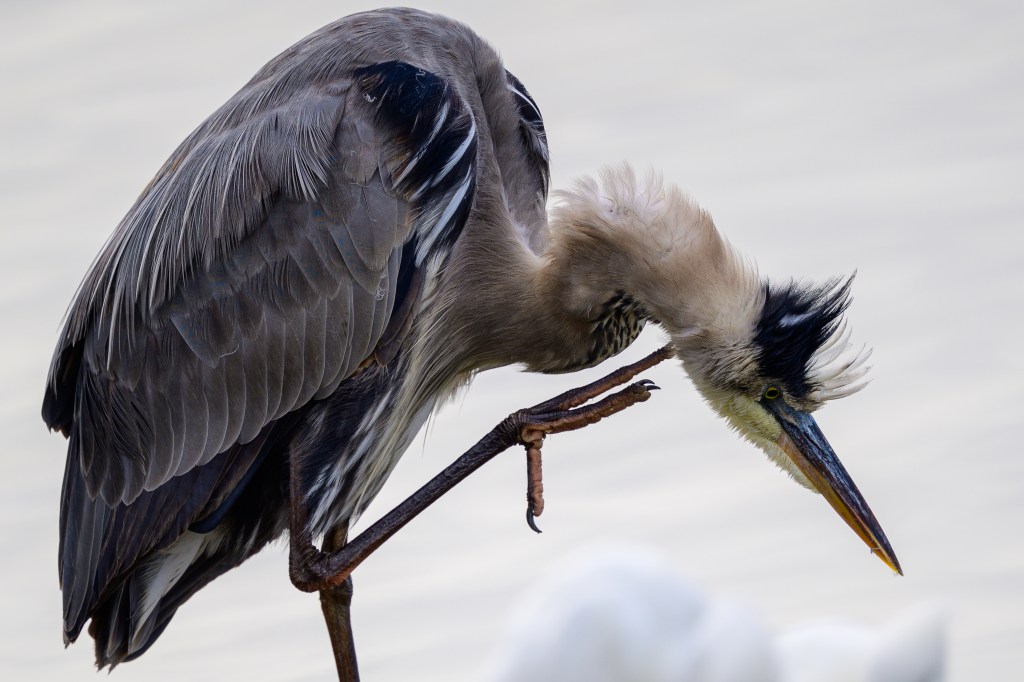
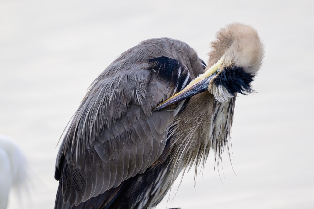
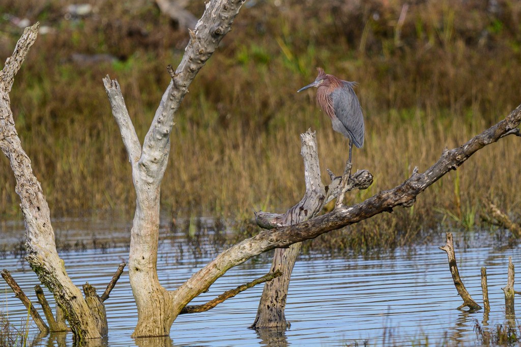
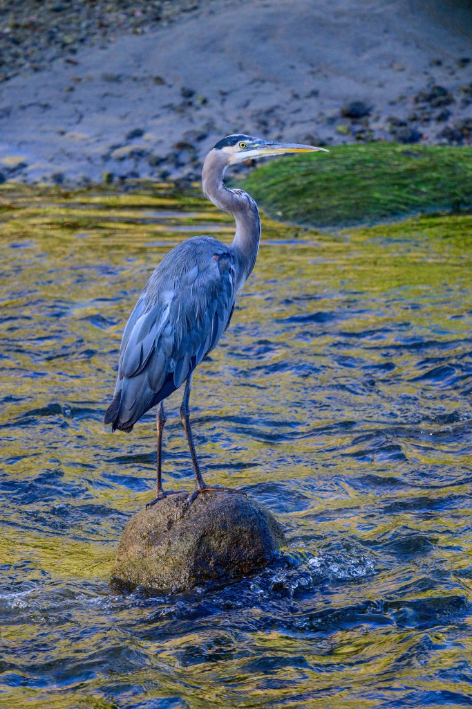
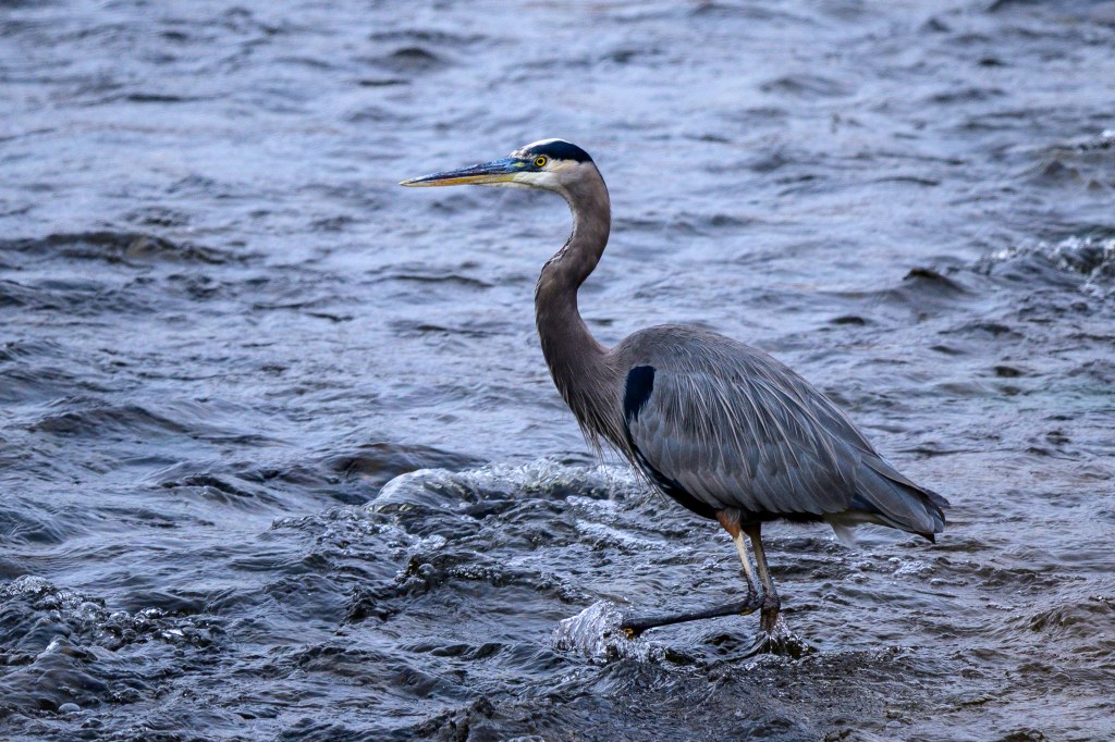
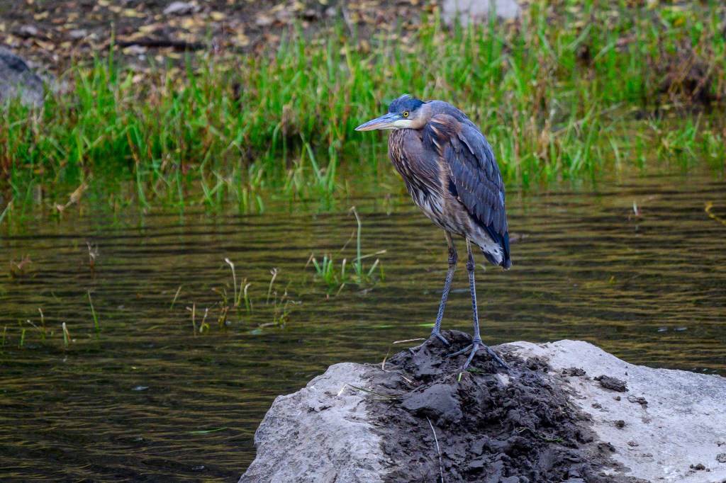
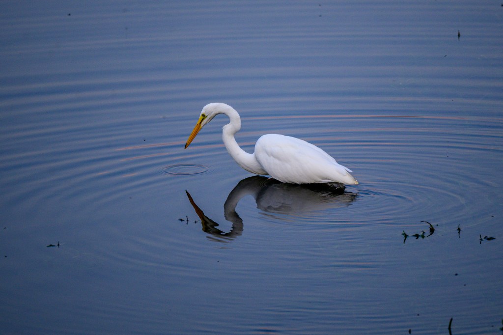
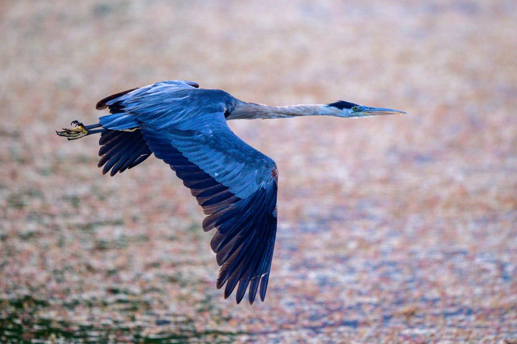
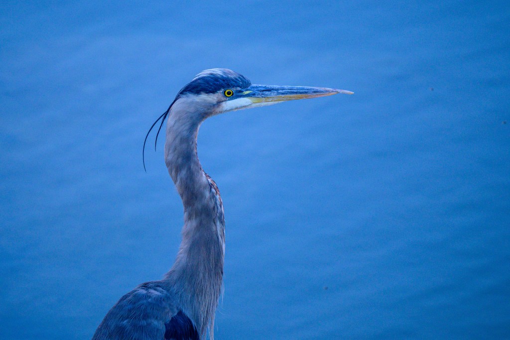
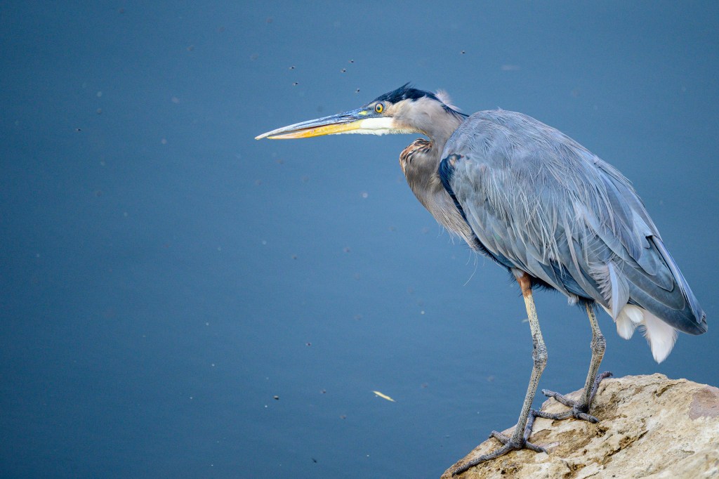
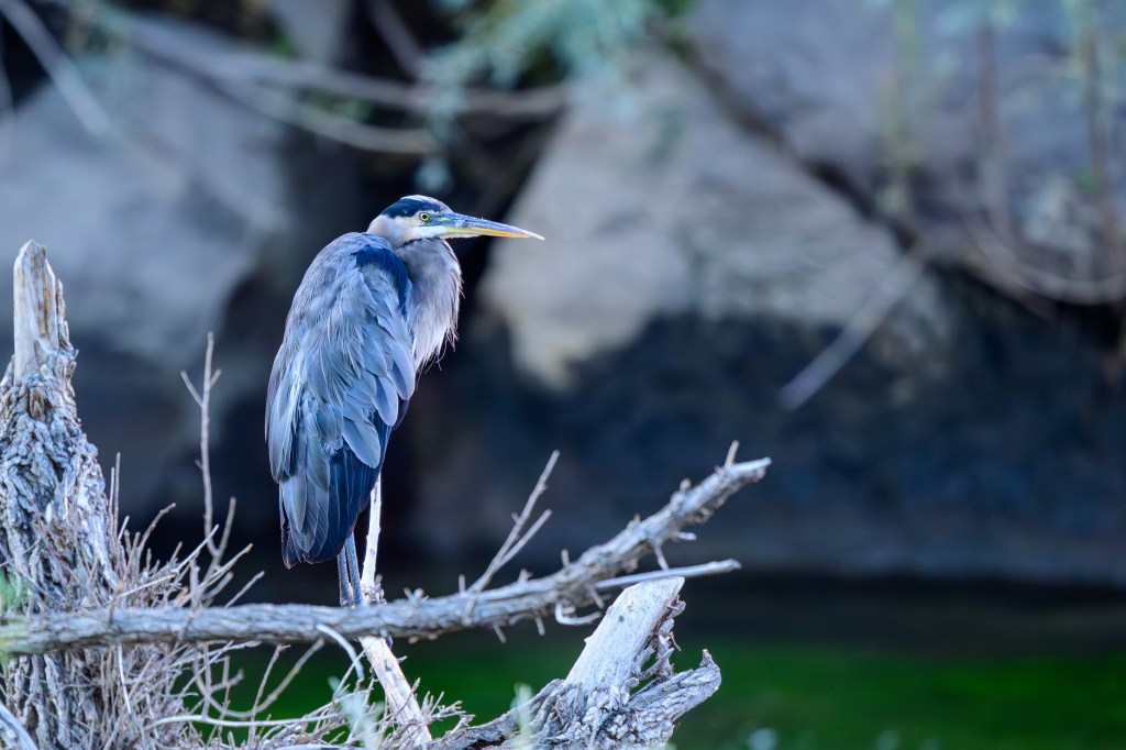
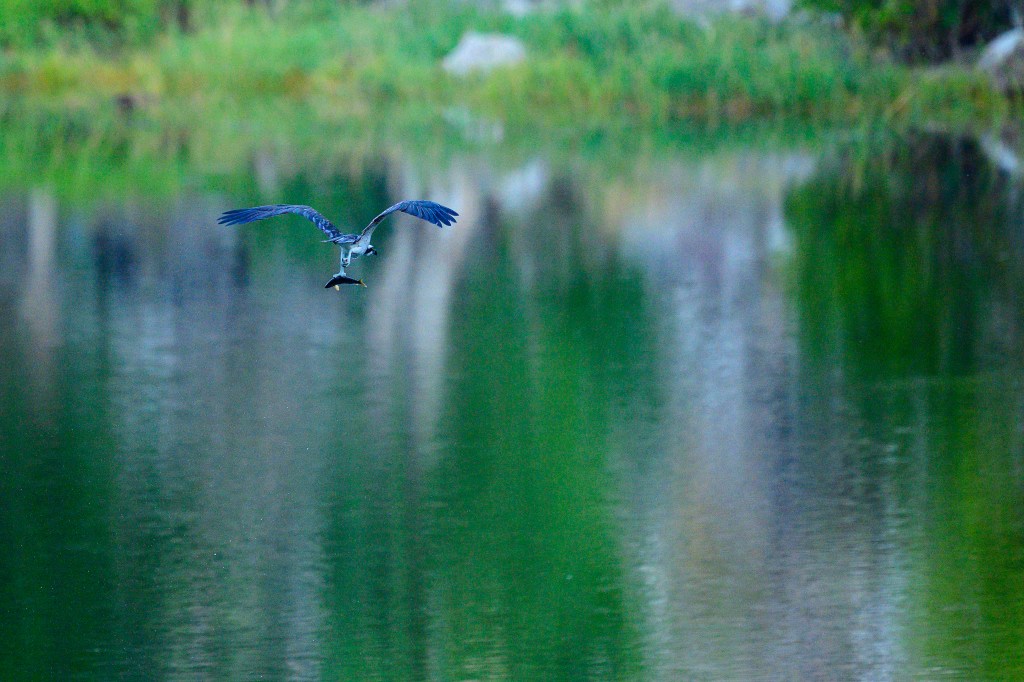
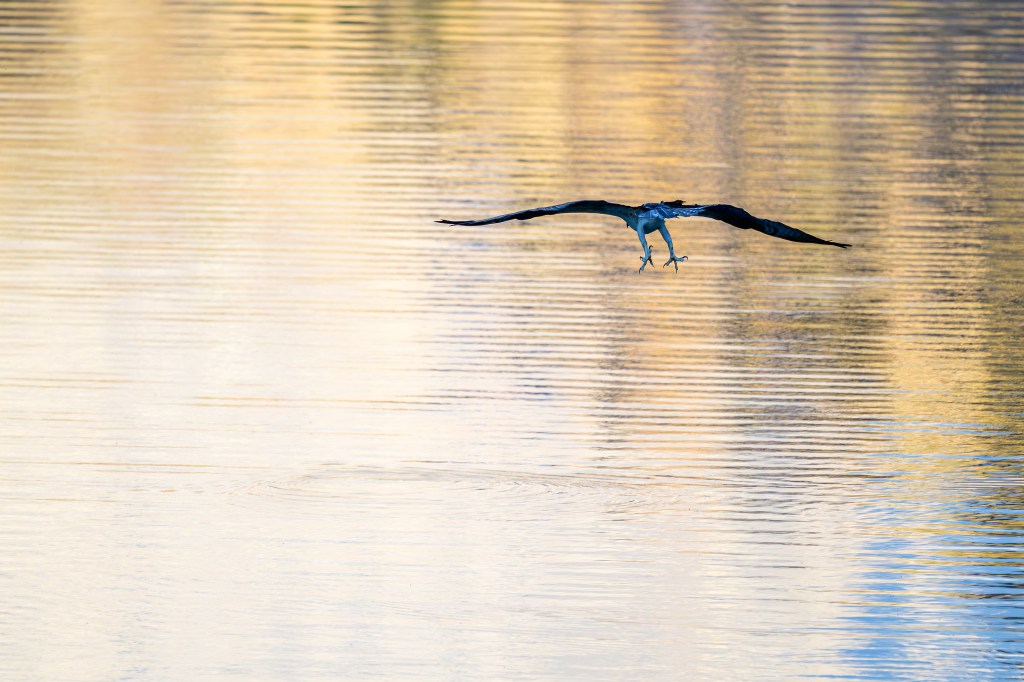
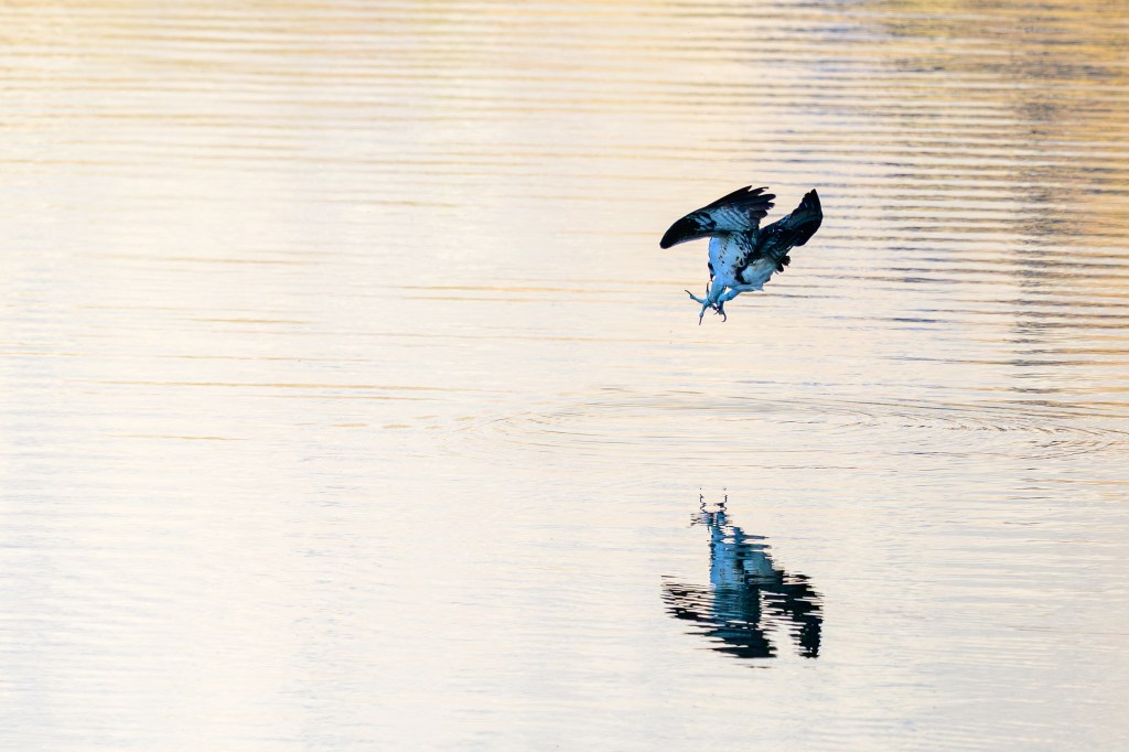
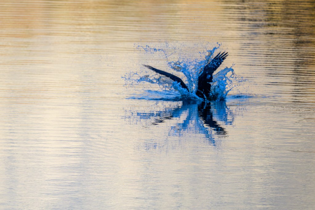
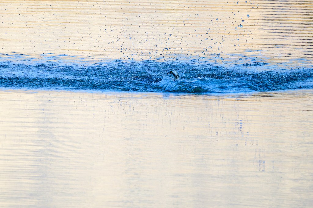
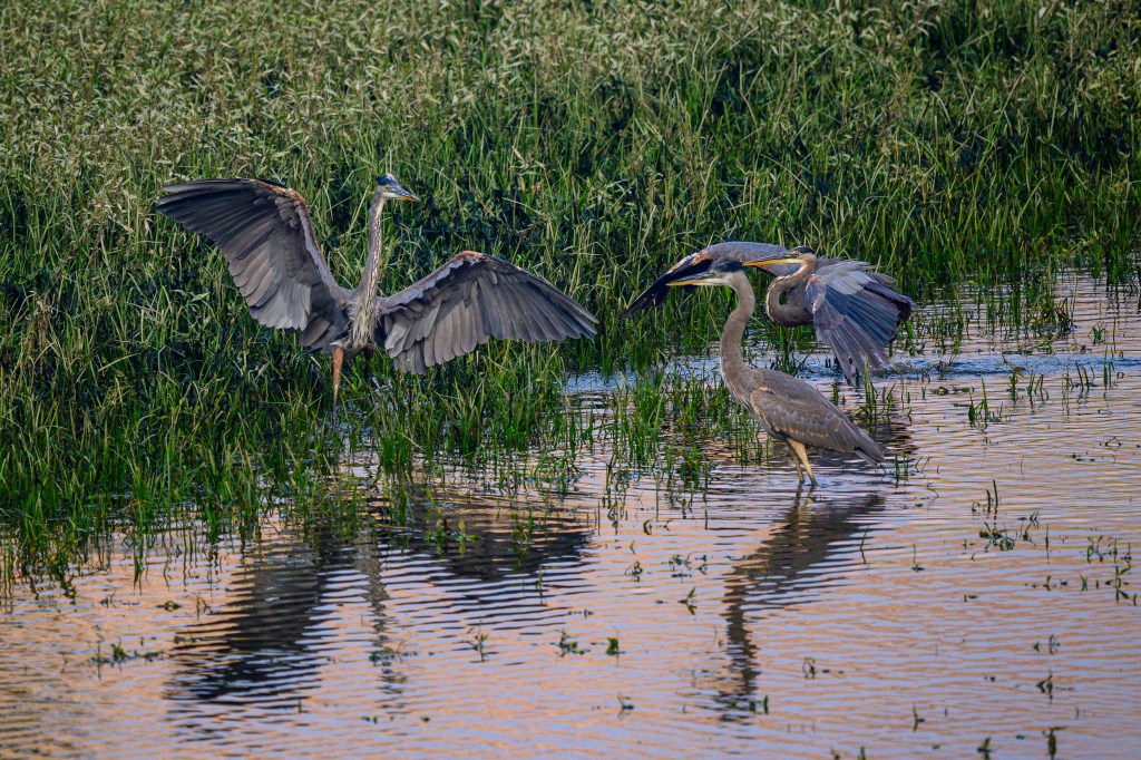
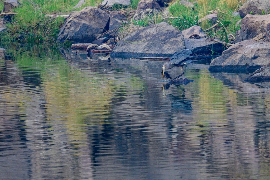
GREAT BLUE HERON
The first two photos were taken near the Pleasant Valley Reservoir.
Next two pictures were taken near the Bishop Creek Canal.
Last is a Heron at the Buckley Ponds.
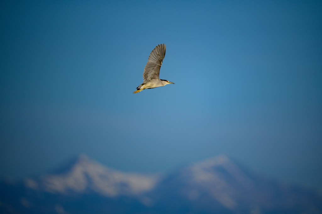
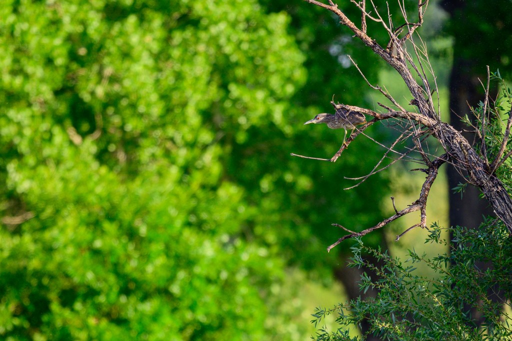
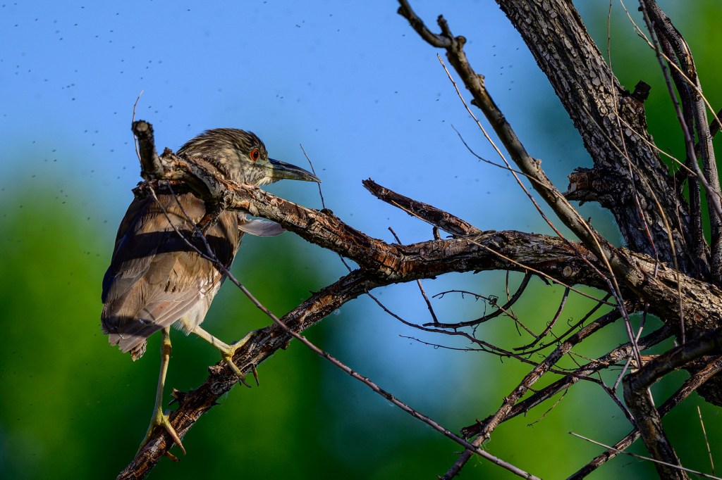
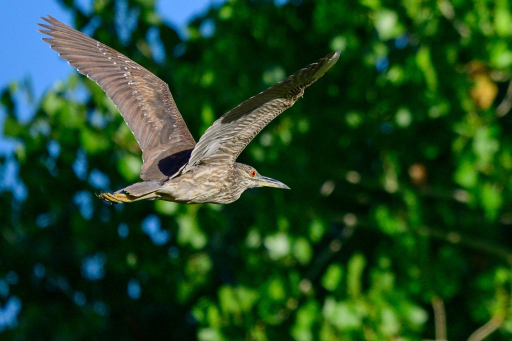
BLACK-CROWNED NIGHT HERON
This small heron was flying over Owens Lake.
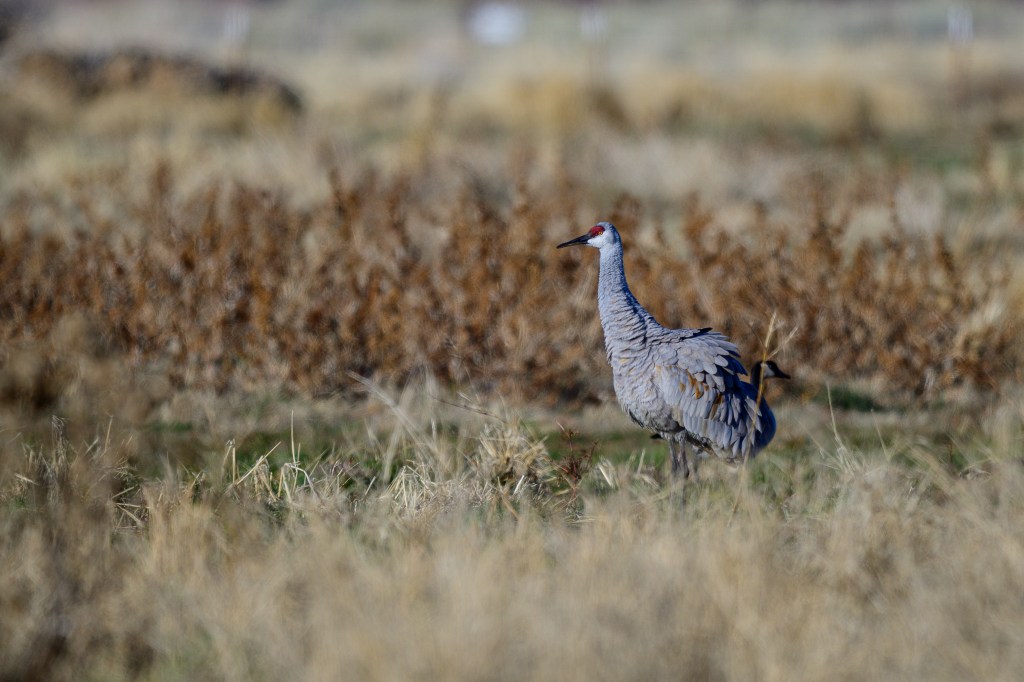
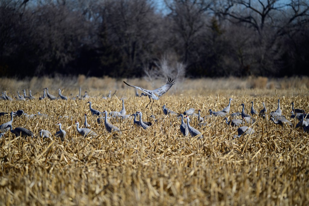
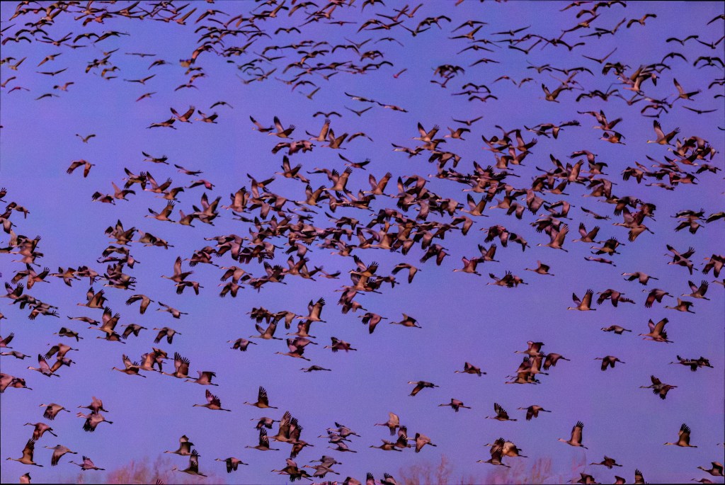
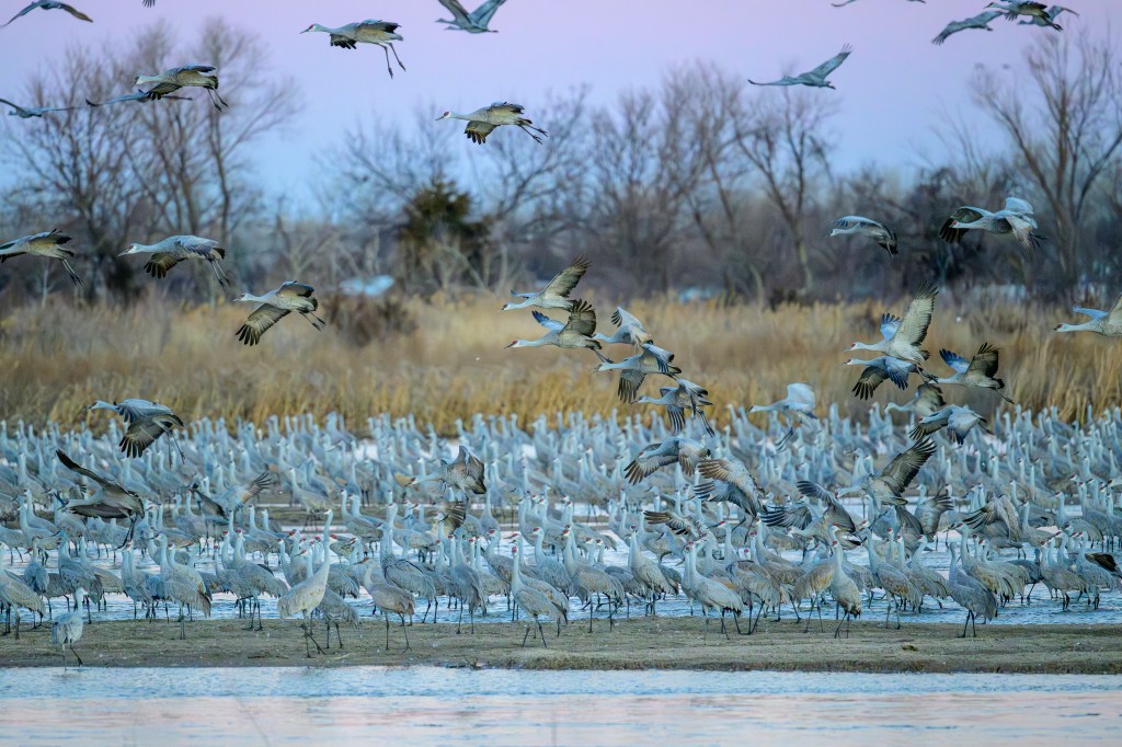
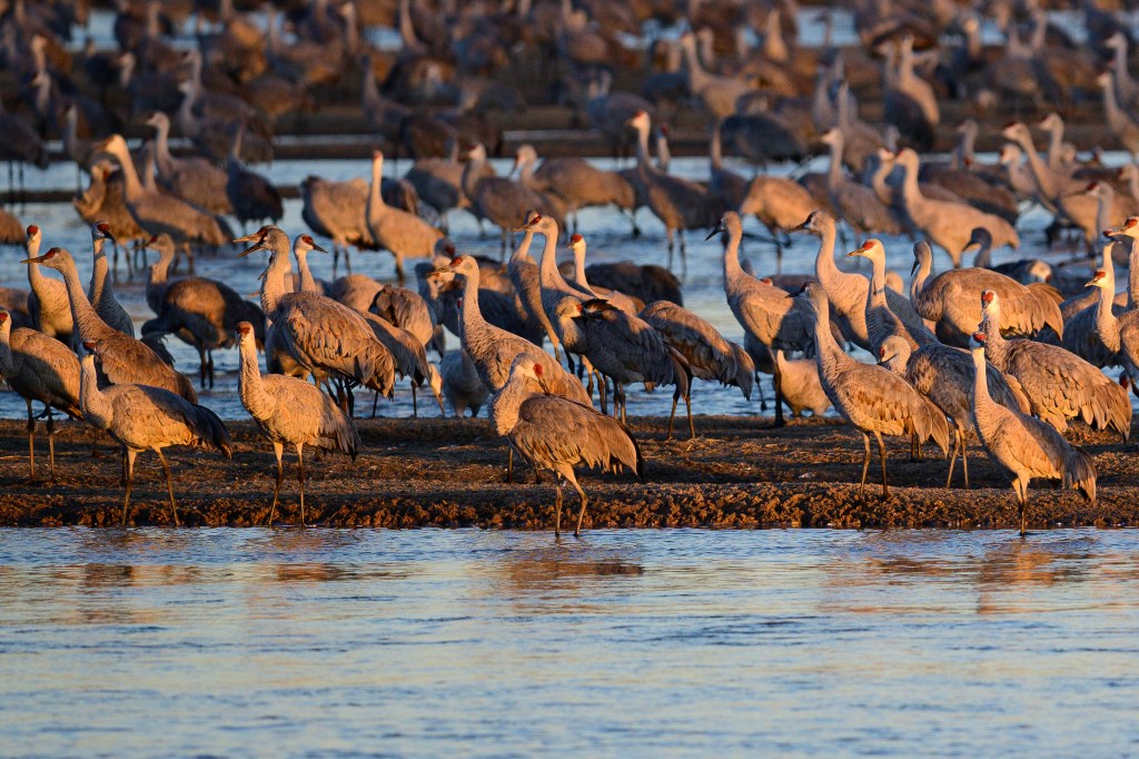
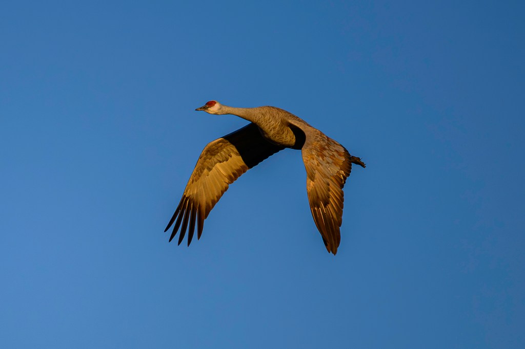
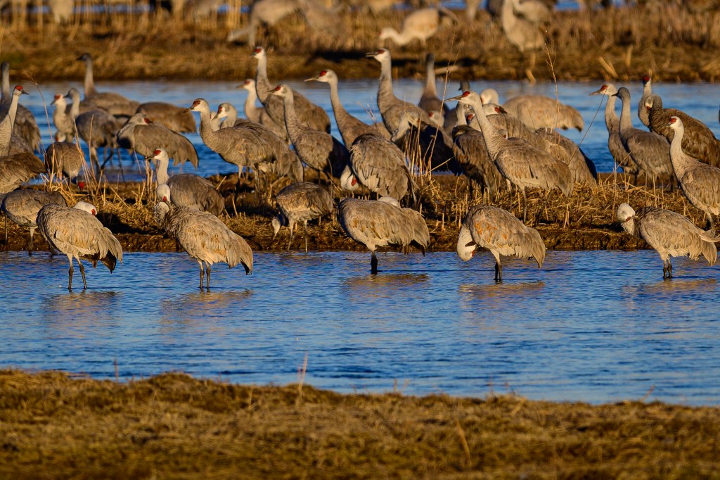
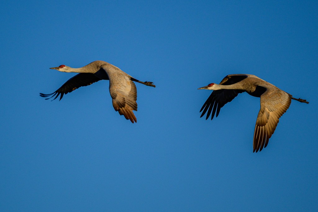
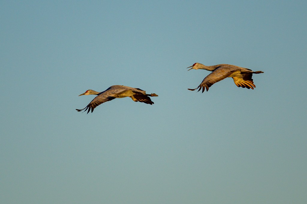
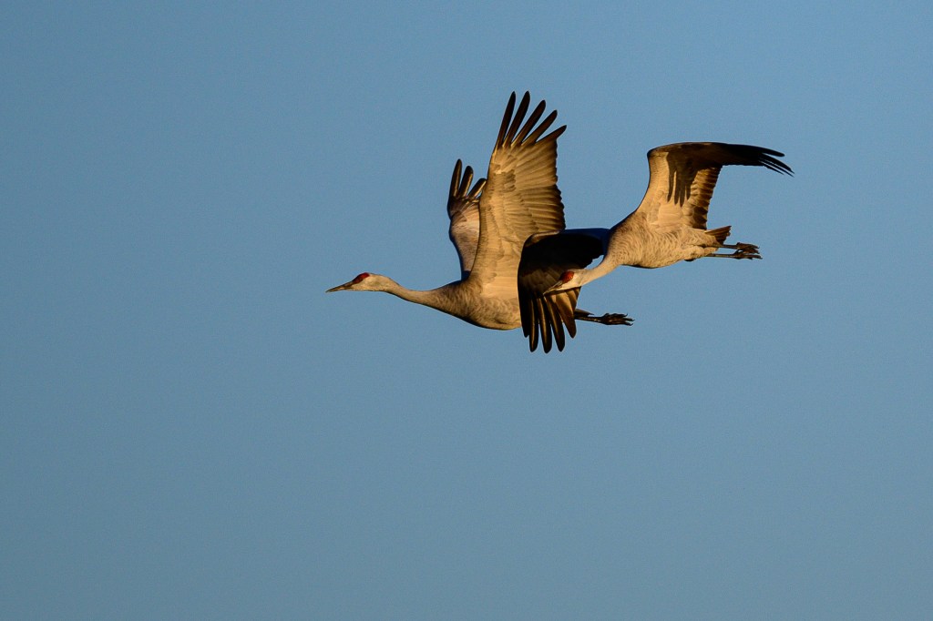
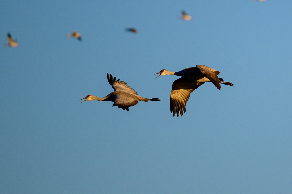
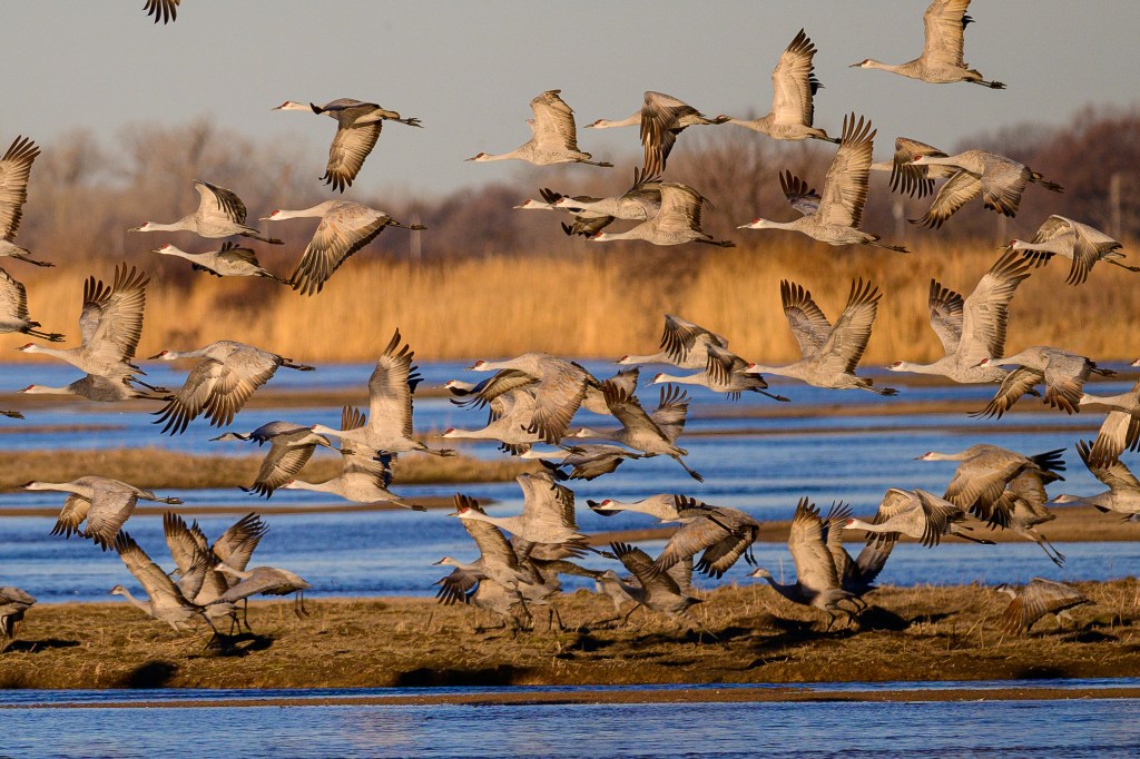
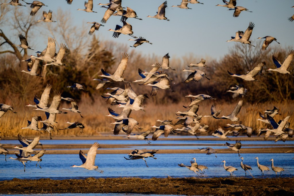
SANDHILL CRANE
A single Crane appeared near Airport Road in January.
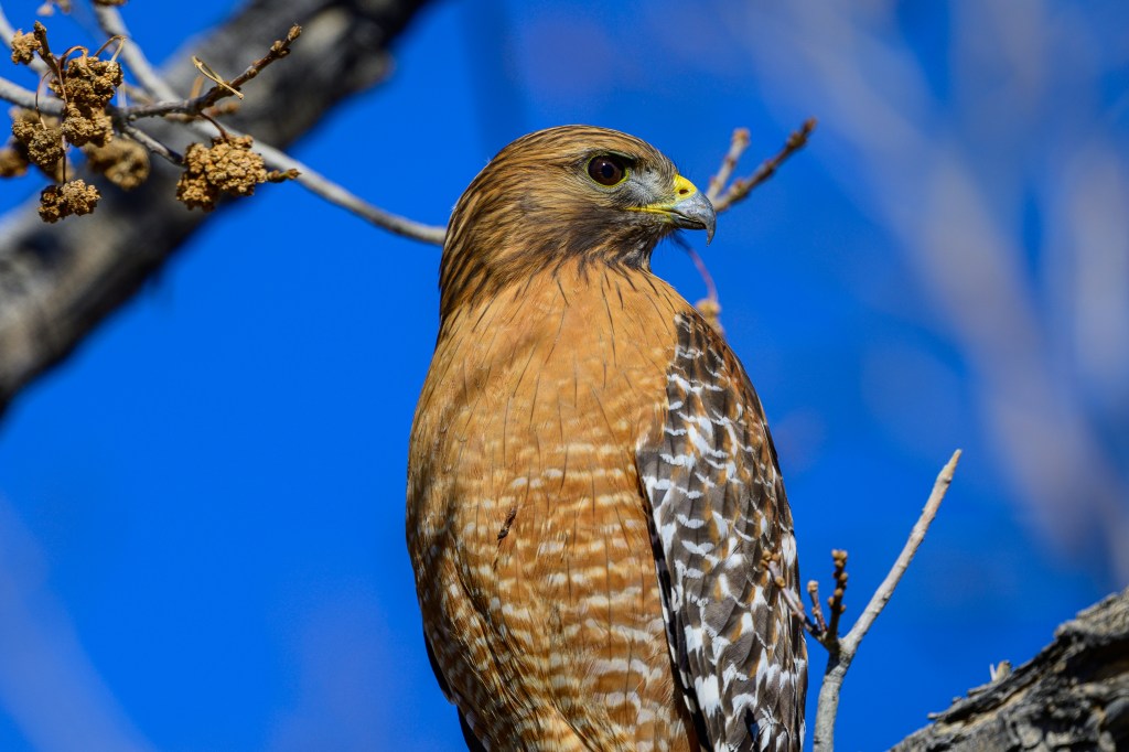
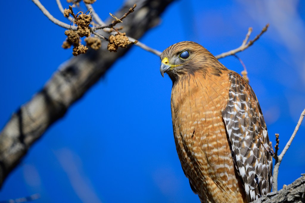
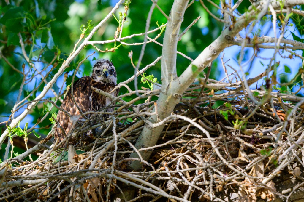
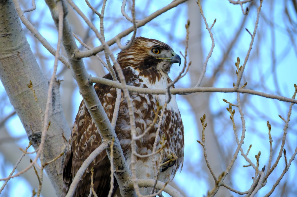
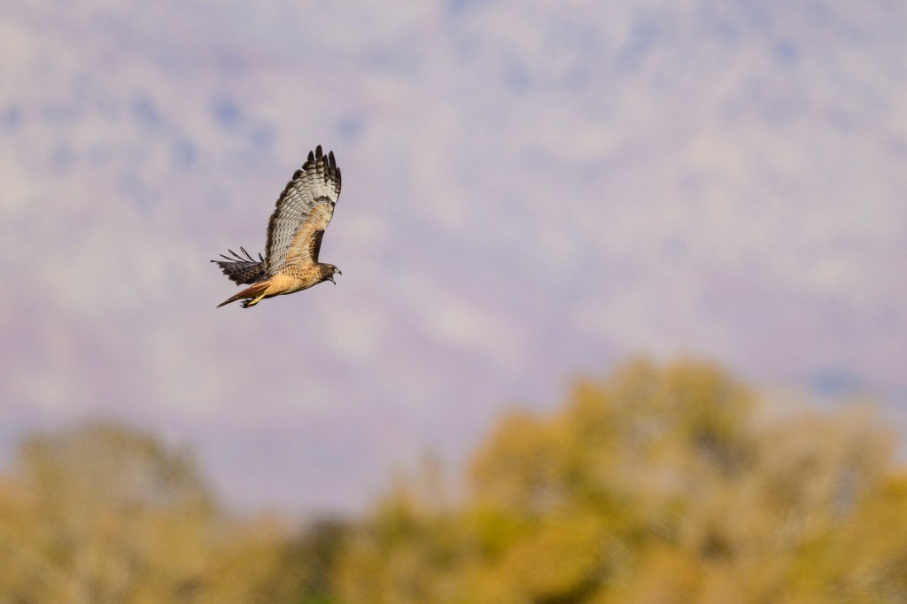
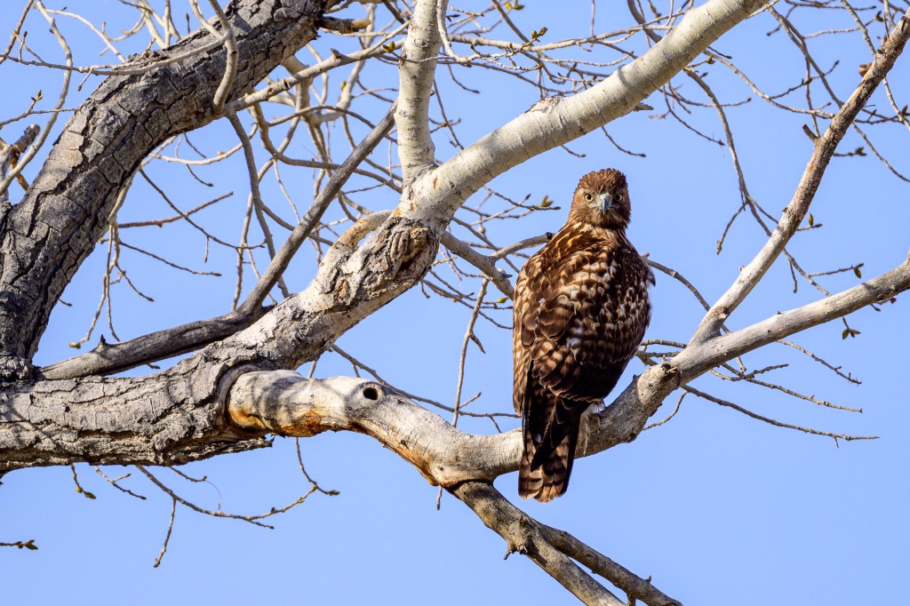
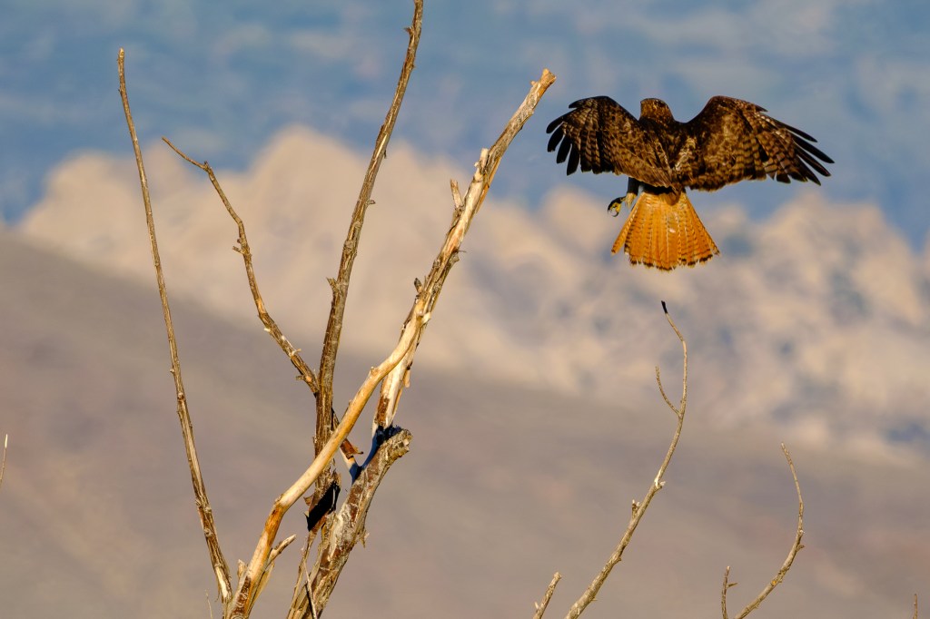
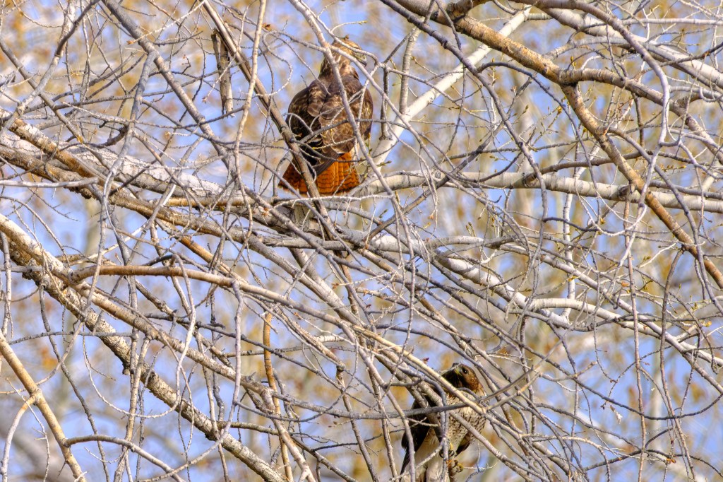
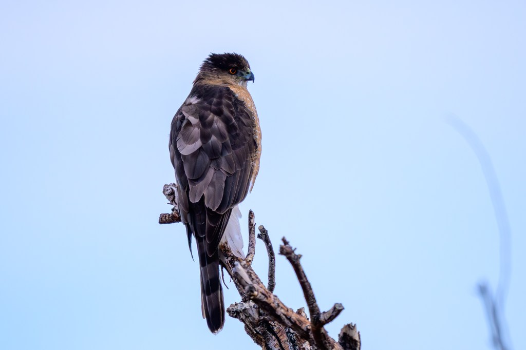
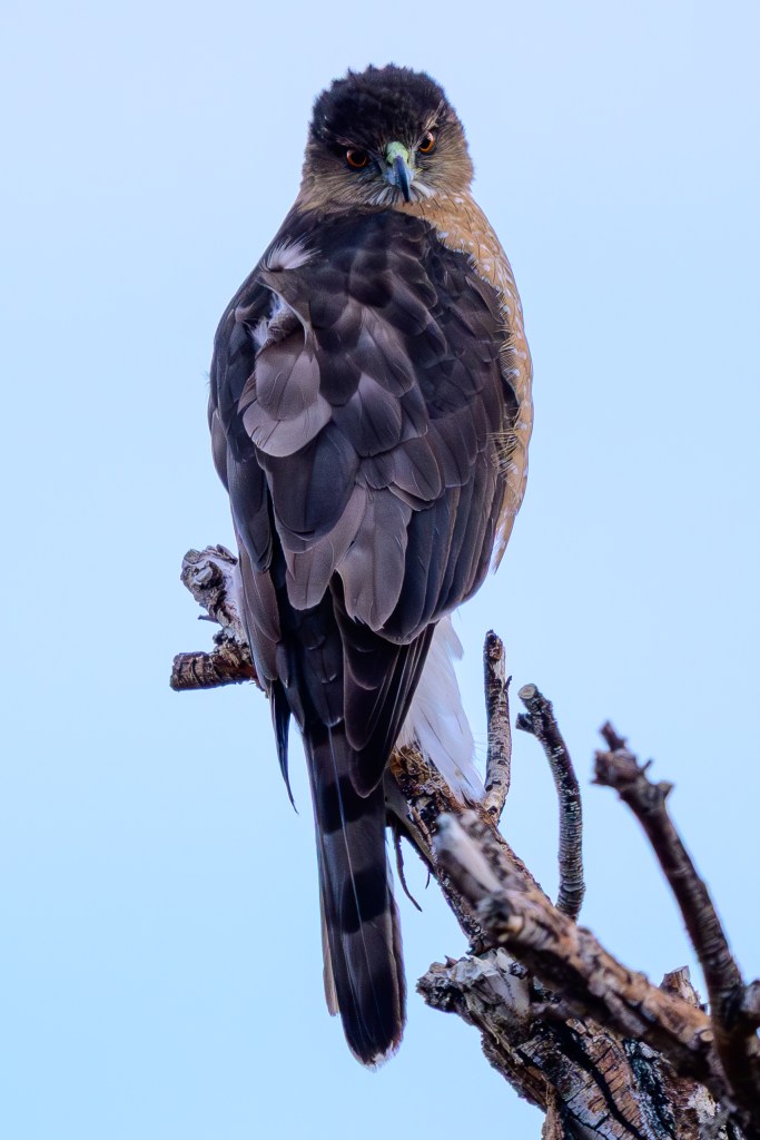
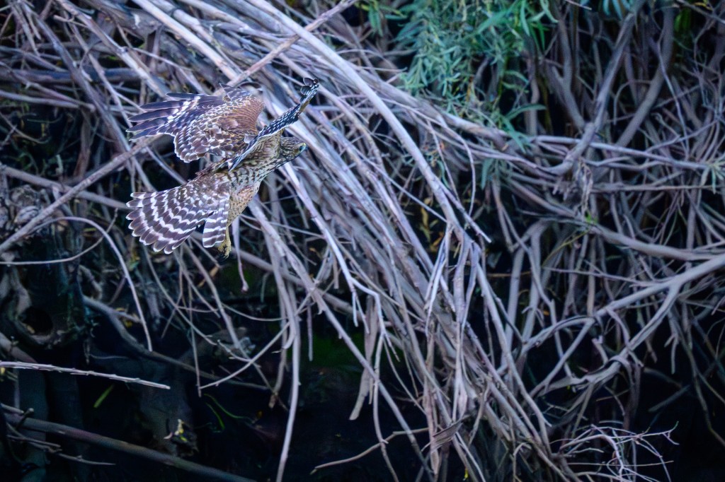
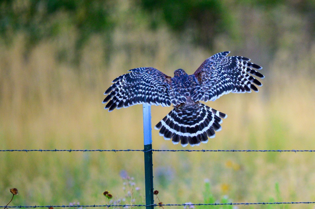
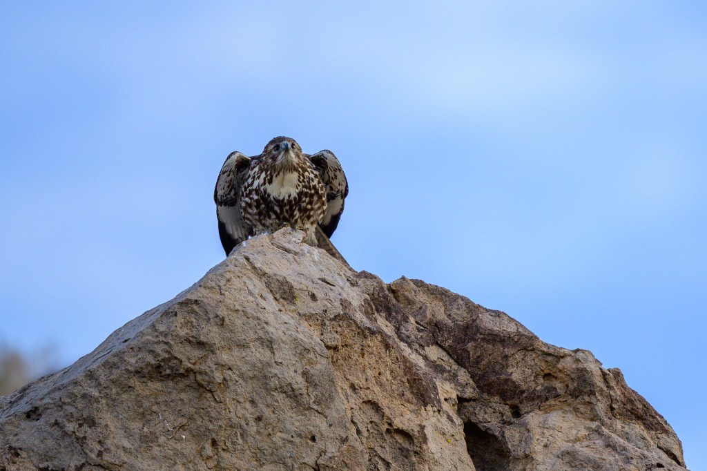
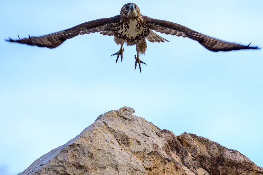
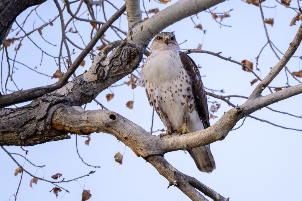
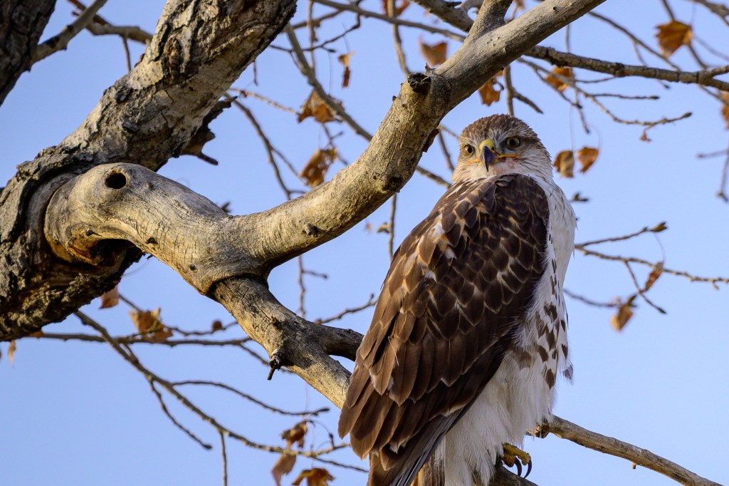
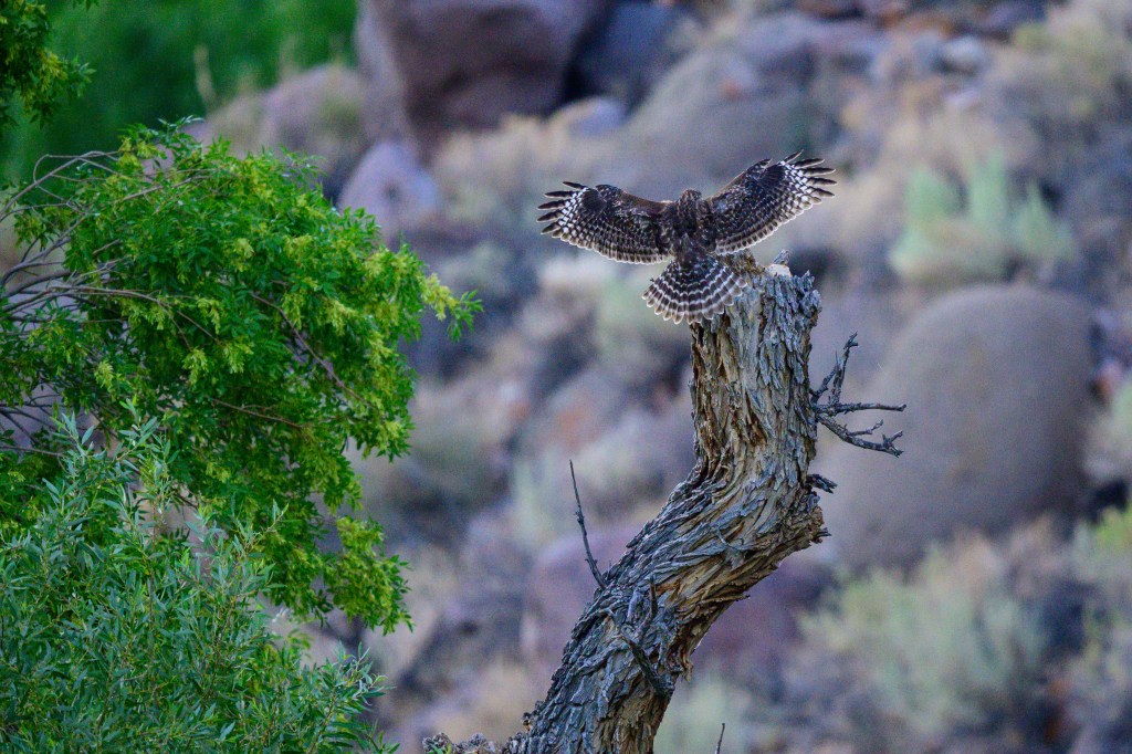
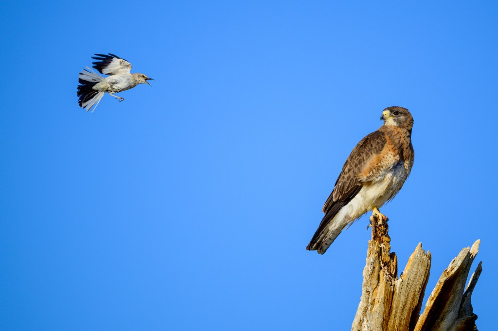
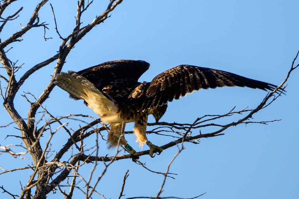
RED-SHOULDERED HAWK
This hawk was in a tree right near my home.
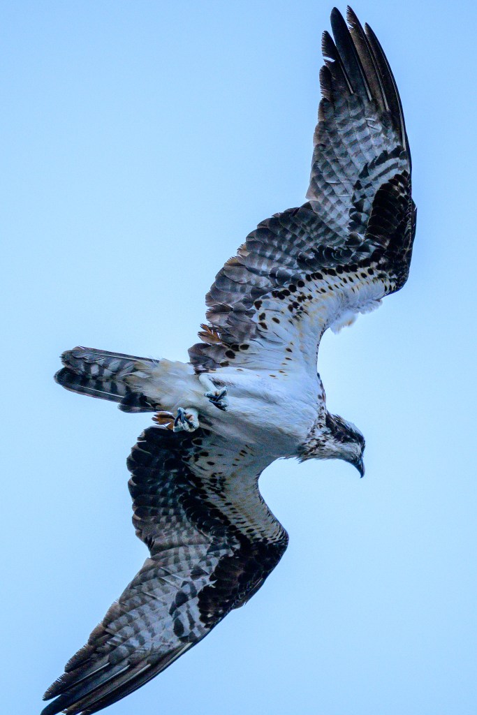
Birds have a nictitating membrane which can protect their eye. Think of this like a pair of googles. If you are flying at 30 mph and encounter bugs in the air, this protection is handy. The membrane creates a zombie-like appearance in some birds.
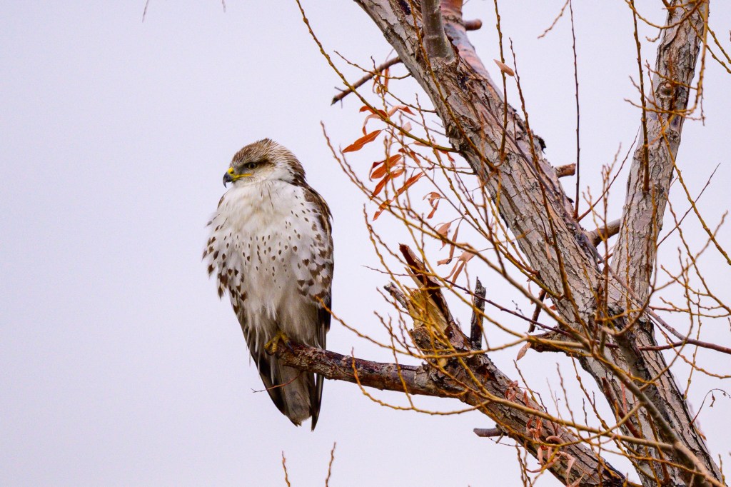
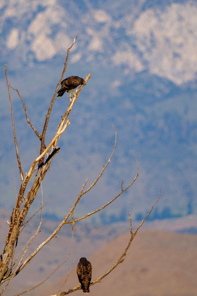
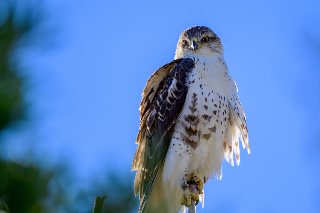
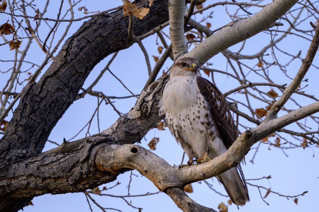
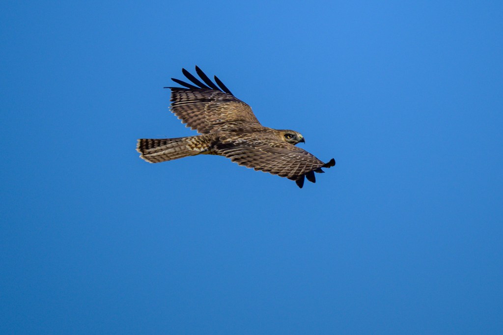
FERRUGINOUS HAWK
These white-chested hawks appear in winter.
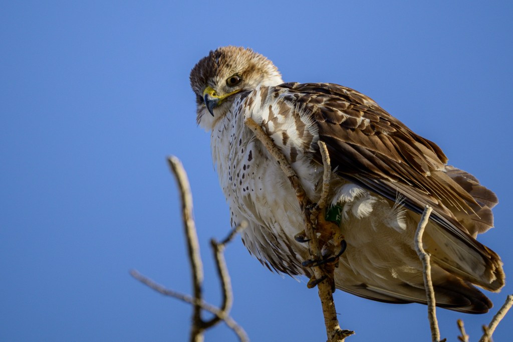
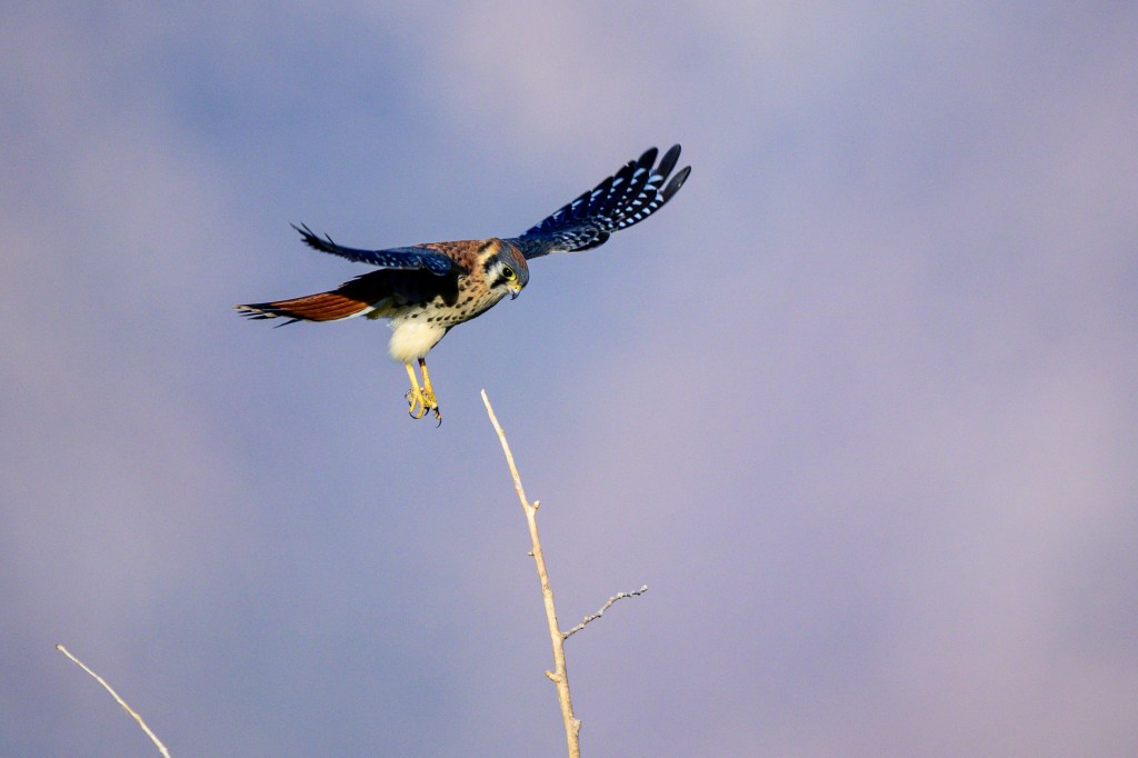
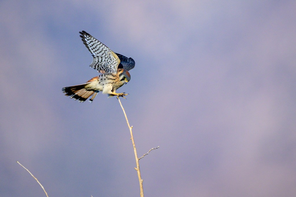
AMERICAN KESTREL
A female on Sunland Road.
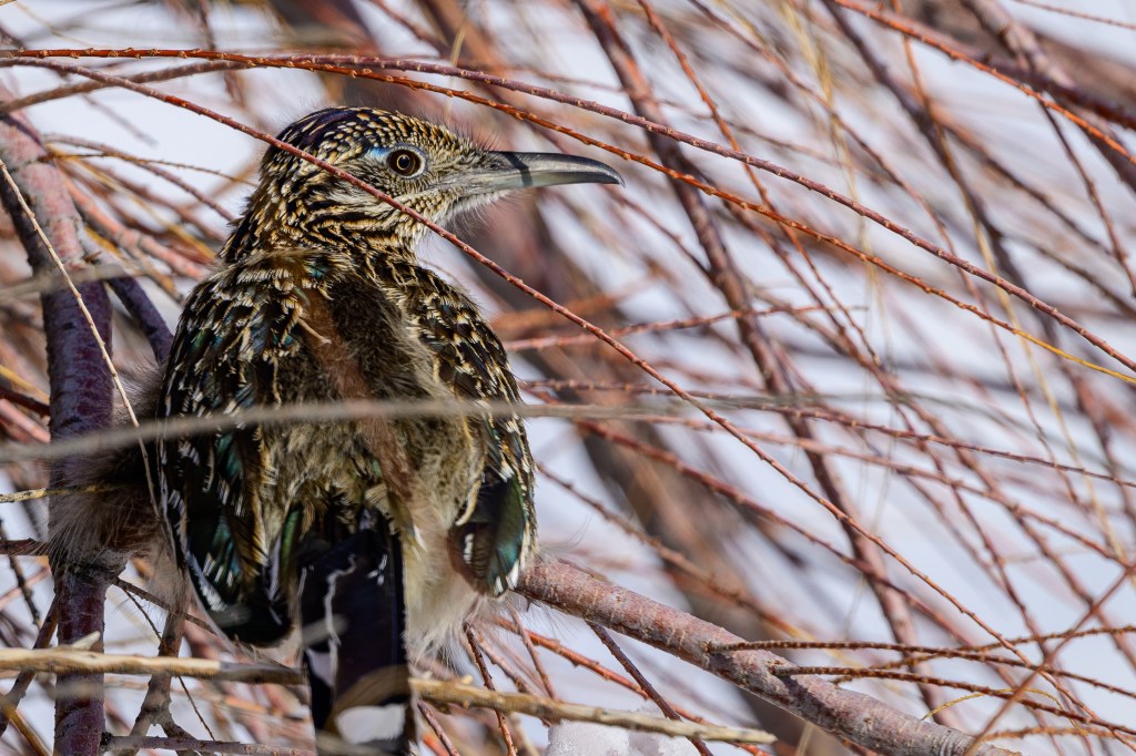
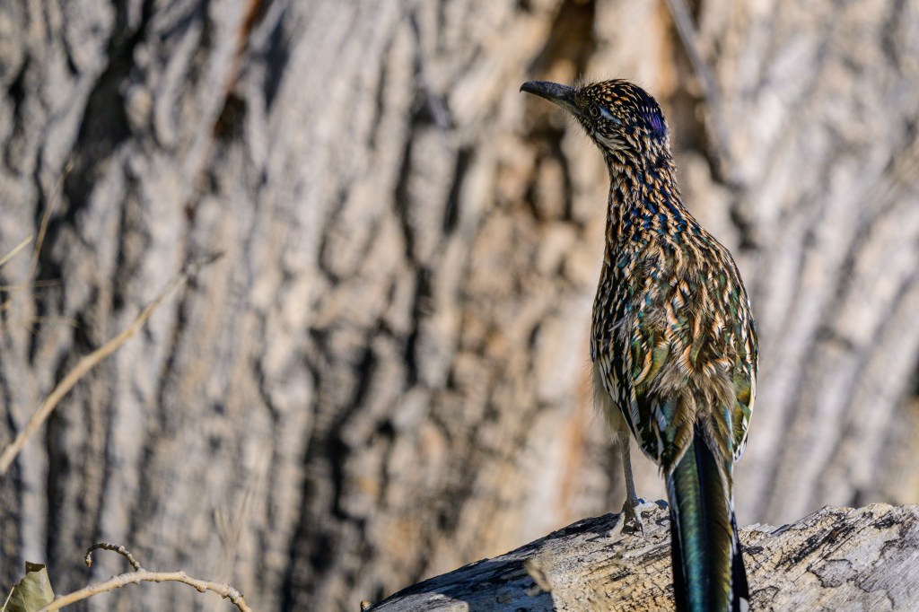
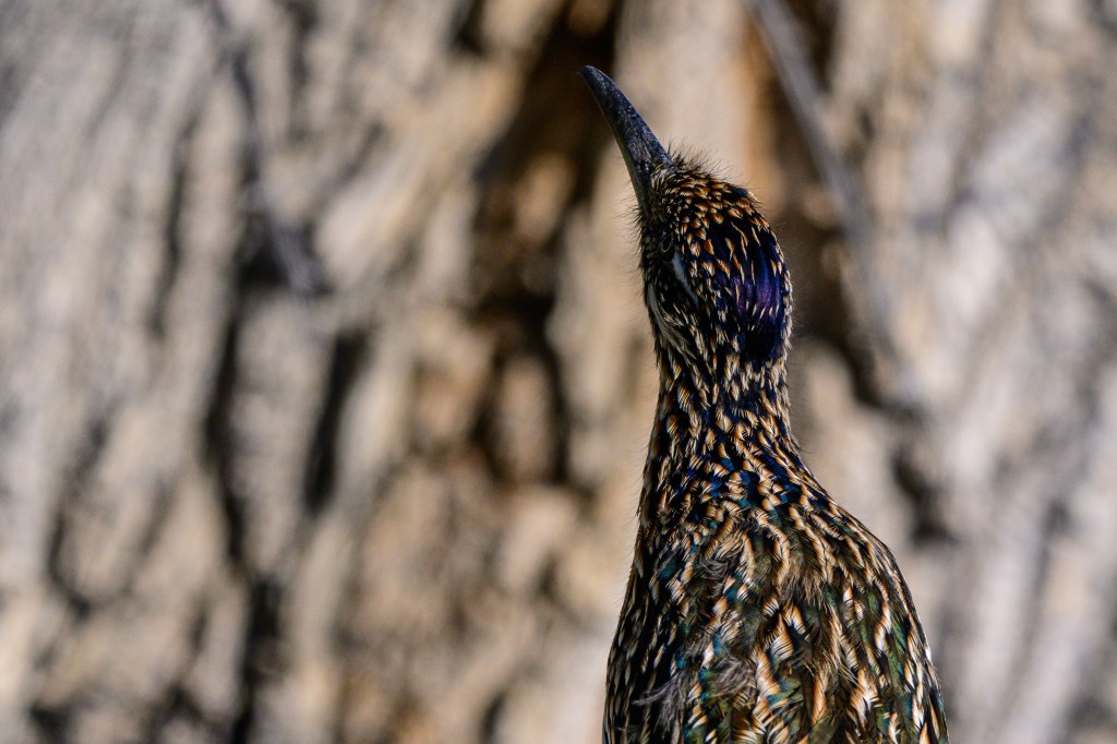
GREATER ROADRUNNER
I sometimes see a Roadrunner on Warm Springs Road. They look brown at a distance, but close-up they have some bright green feathers.
In the second photo, the bird raises the feathers on its head.
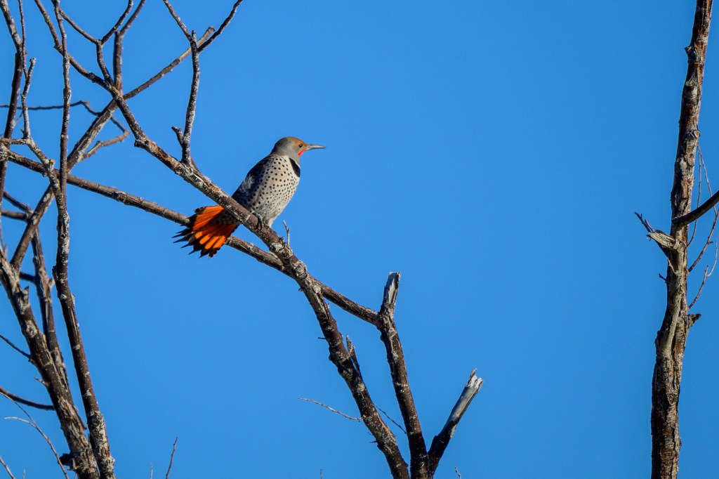
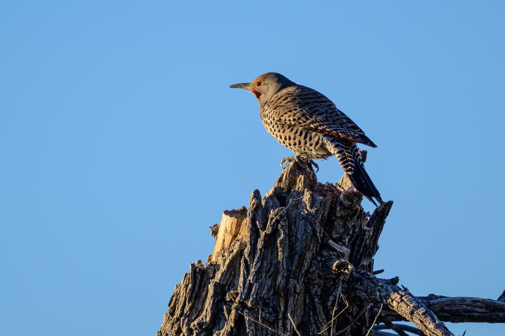
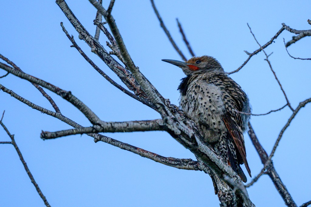
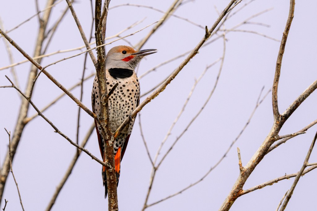
NORTHERN FLICKER
Our most common woodpecker. The first photo was taken at the Ponds, the second at the COSA.
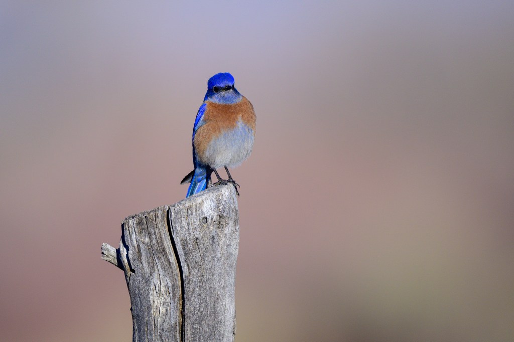
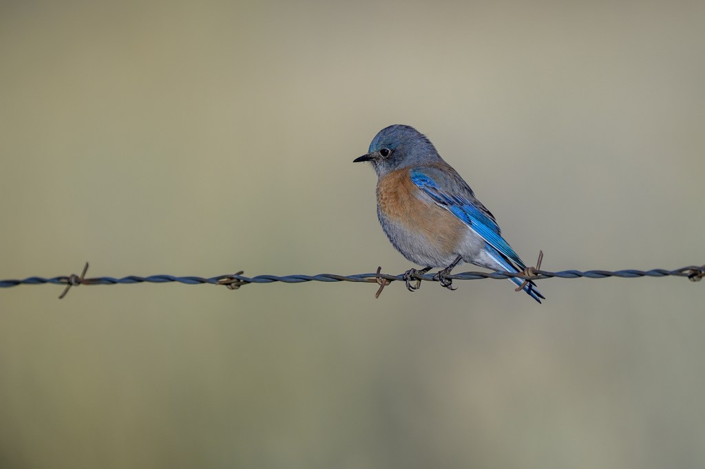
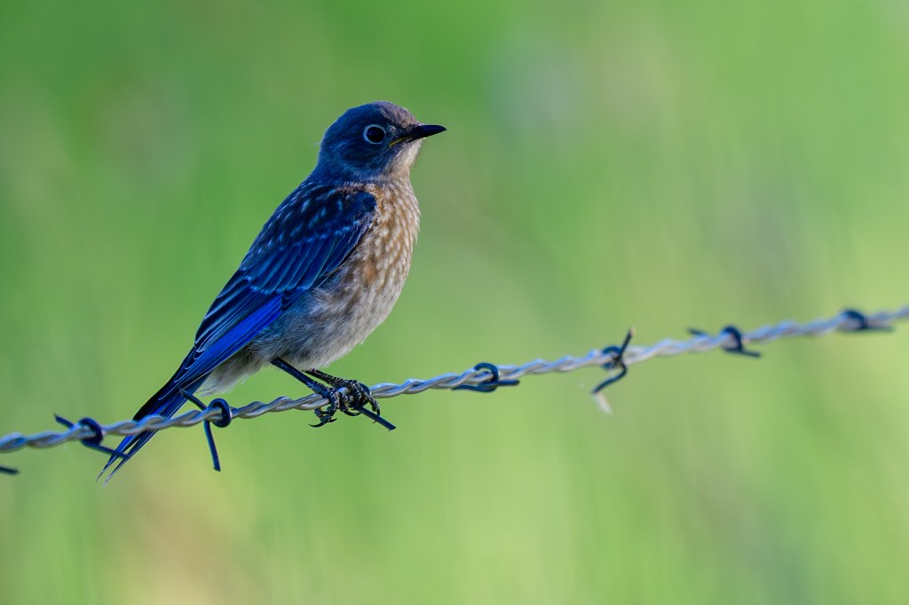
WESTERN BLUEBIRD
First photo shows a male, second a female. The colors are so dramatic that they make the photo look manipulated.
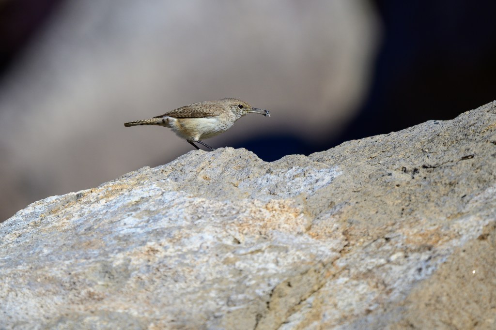
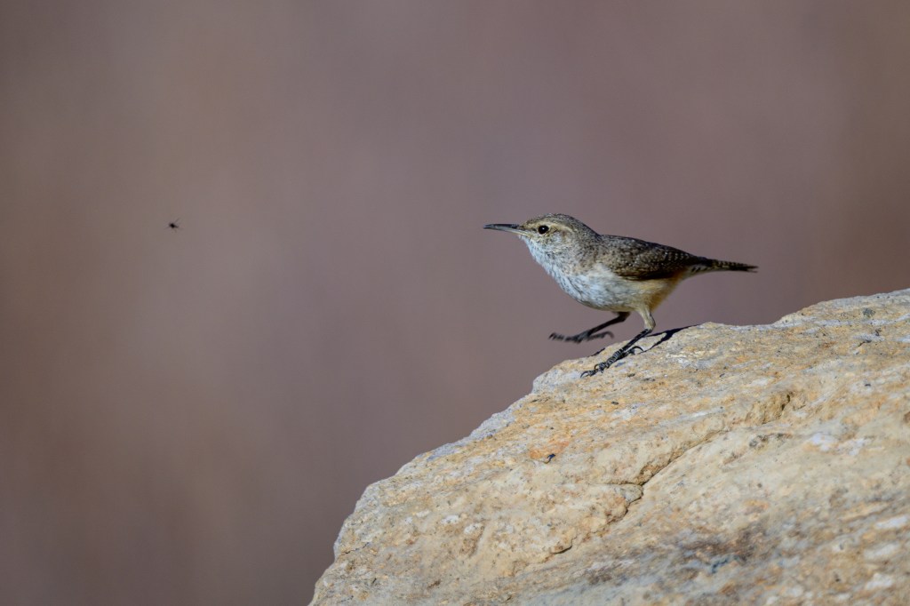
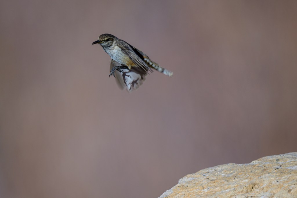
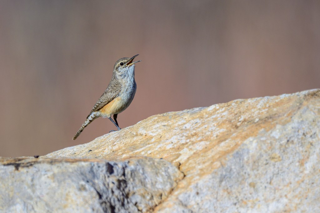
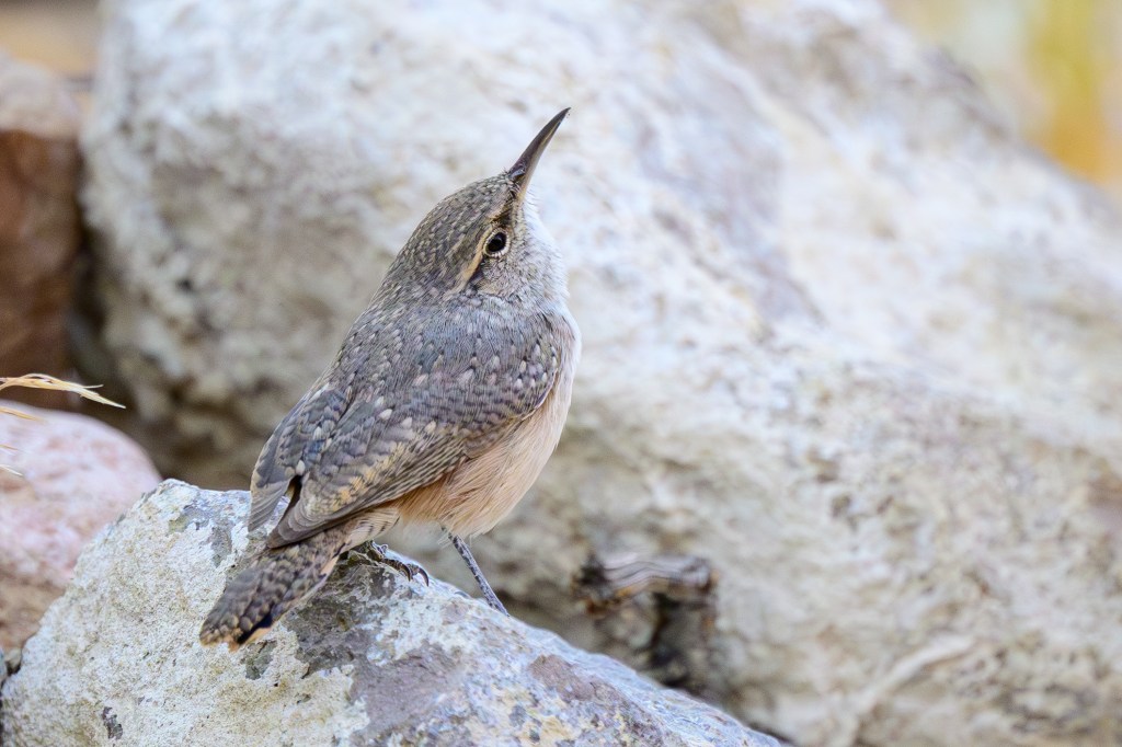
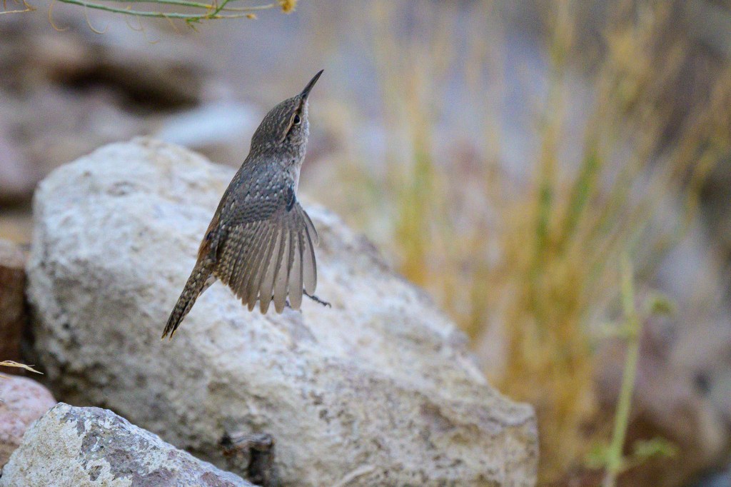
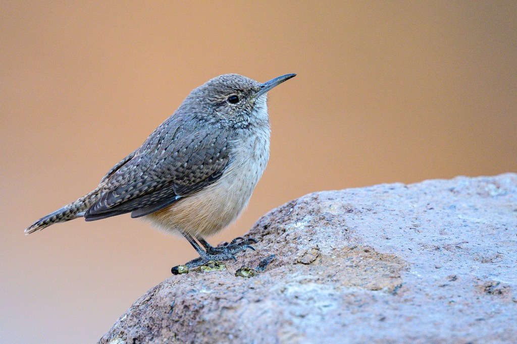
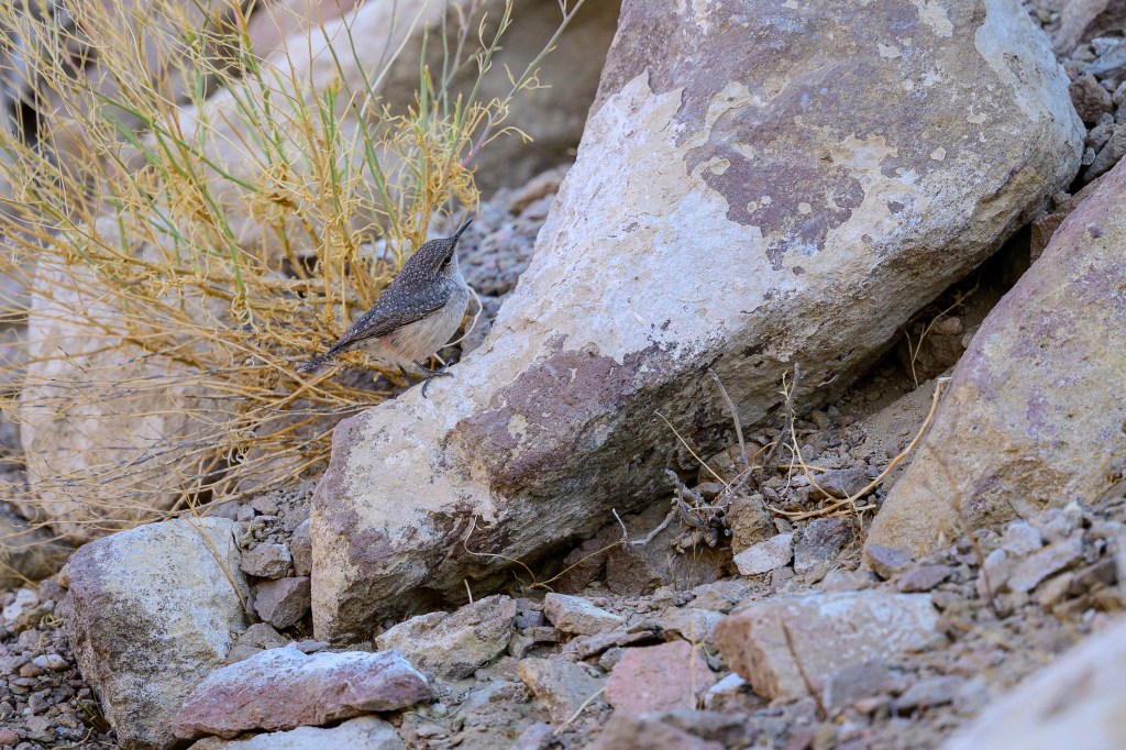
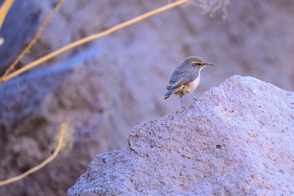
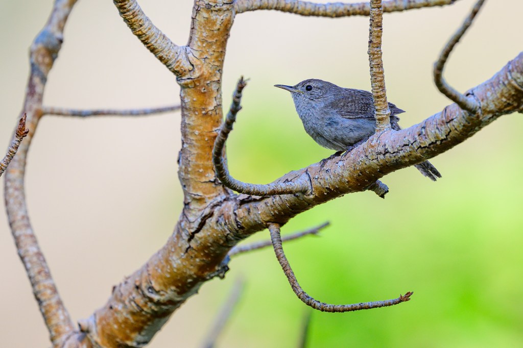
ROCK WRENS
These little birds let me get close. They often sing and sing. Or they hop about, looking for bugs. The road along the Reservoir winds past tons of basalt boulders. Rock Wrens seem to own these rocks.
This critter has a bug in its beak.
A Rock Wren eyes a breakfast bug.
The Wren jumps! Did it score a bug?
If it isn’t eating, it is singing.
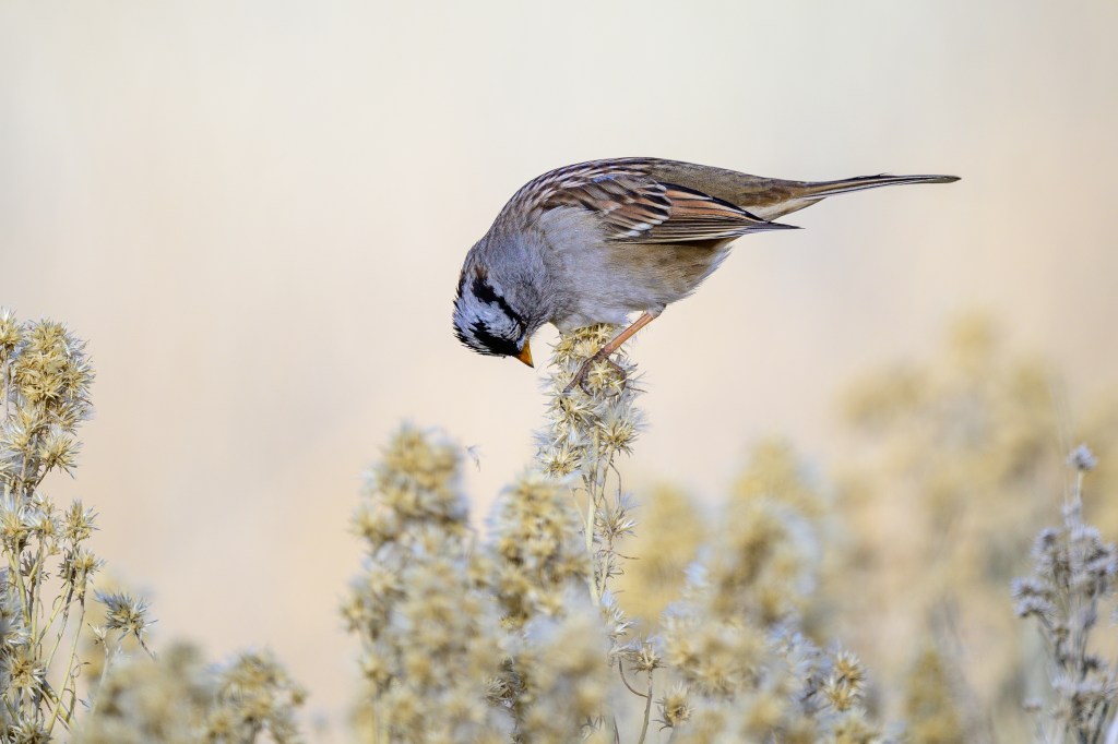
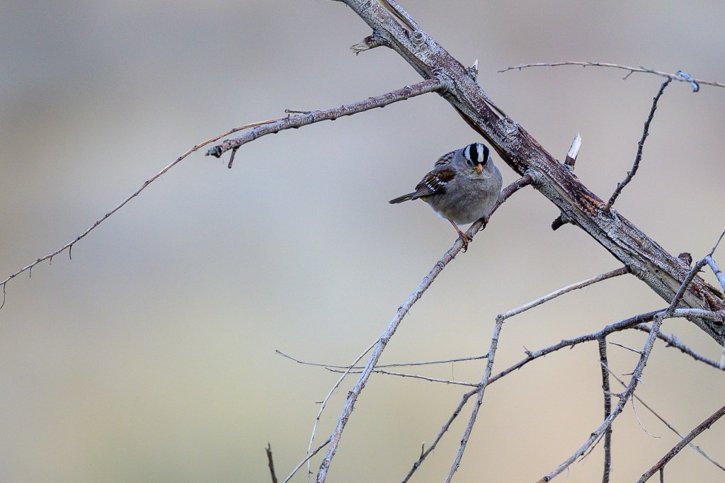
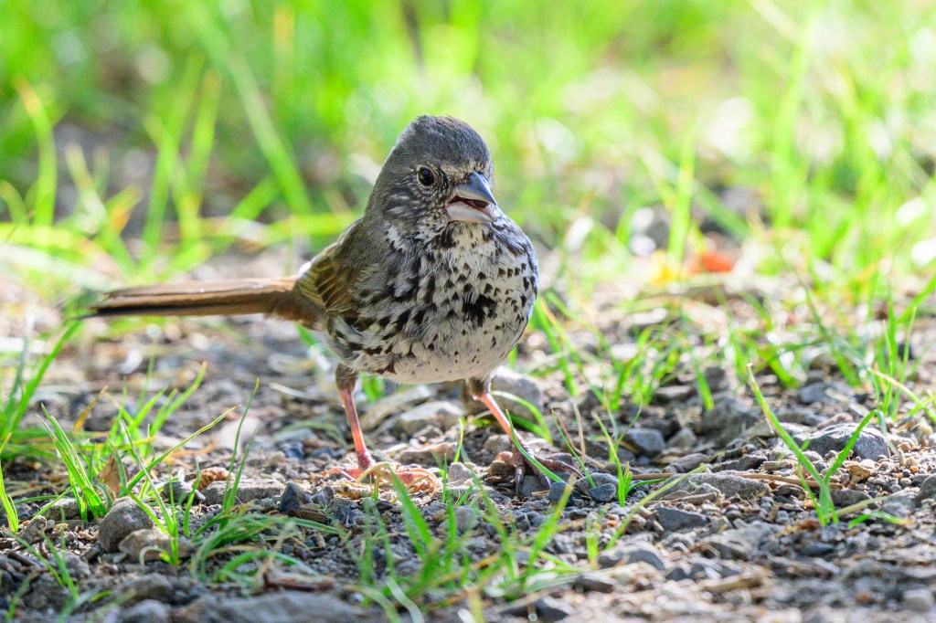
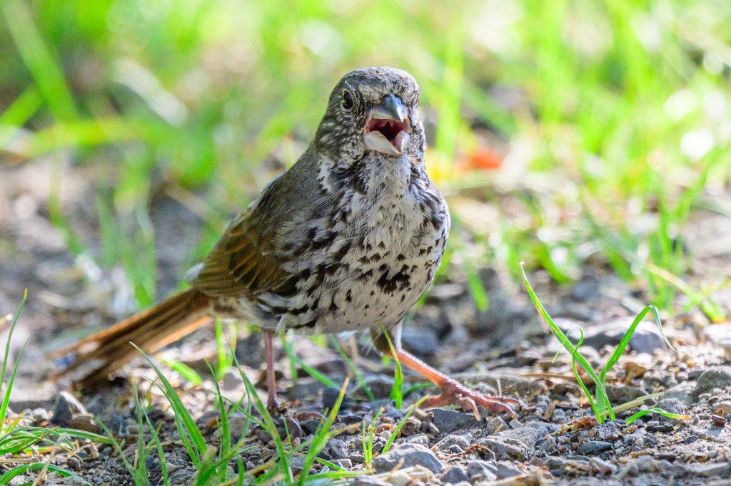
WHITE-CROWNED SPARROW
The most common Sparrow near Bishop
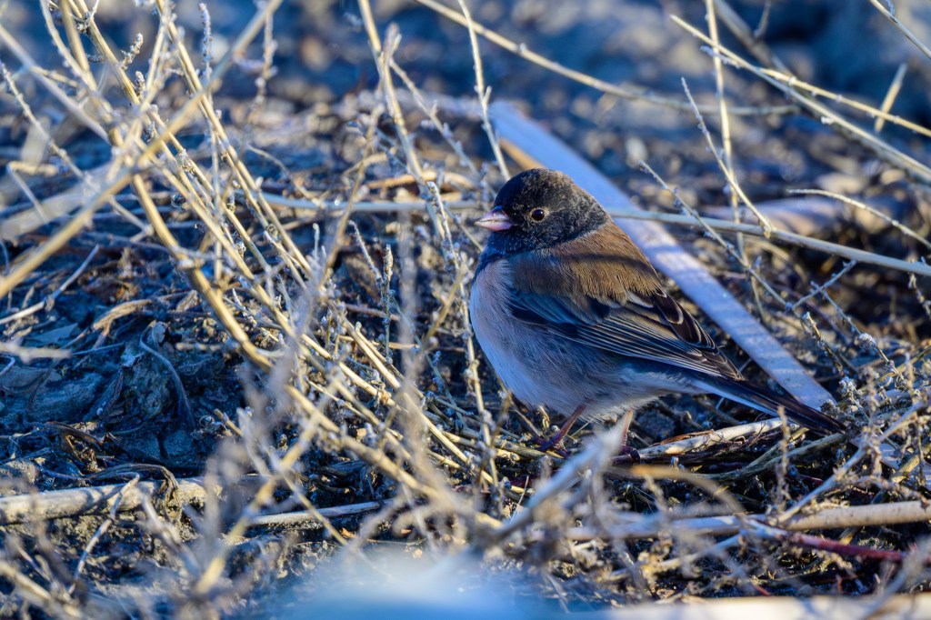
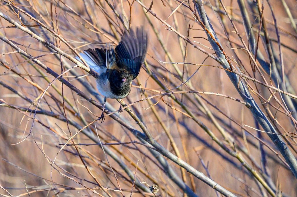
DARK-EYED JUNCO
Juncos at the Ponds in January.
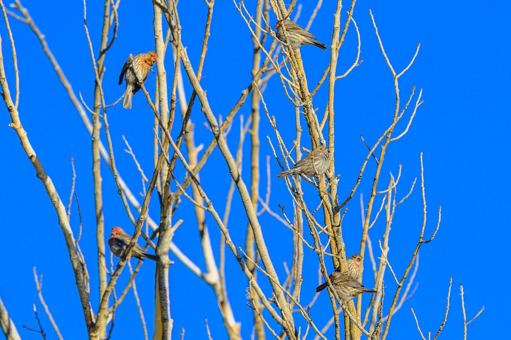
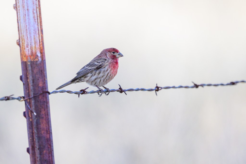
HOUSE FINCH
Six Finches at the Ponds
One male at Bishop Creek Canal.
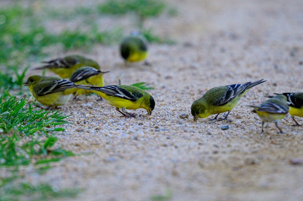
LESSER GOLDFINCH
Lessers dining at the COSA.
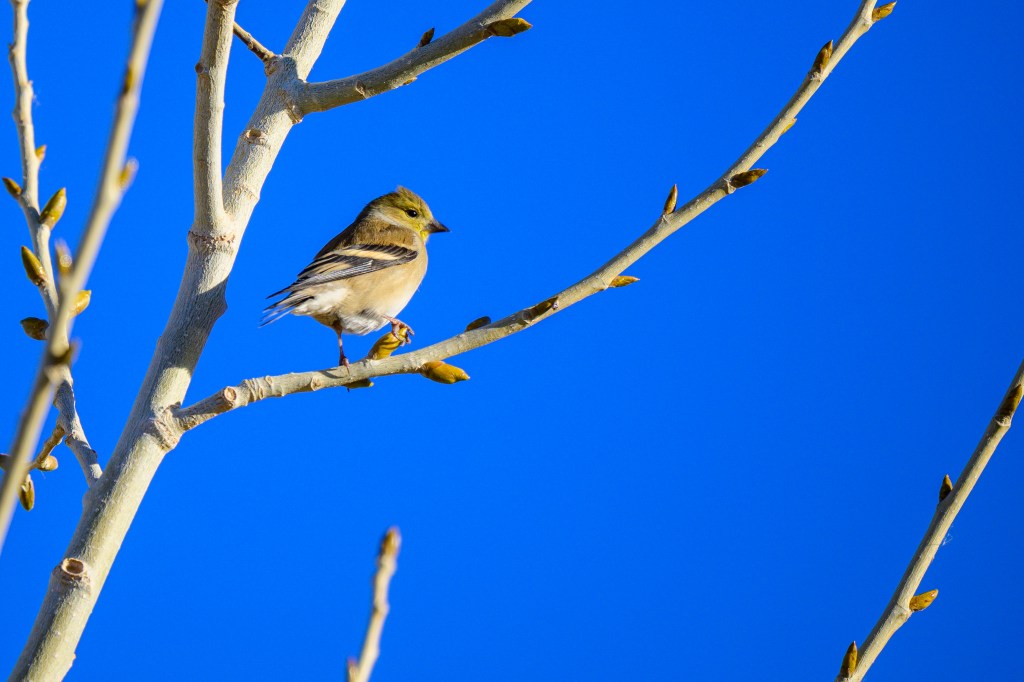
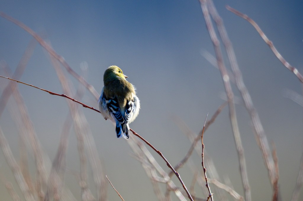
AMERICAN GOLDFINCH
American Goldfinches at the Ponds
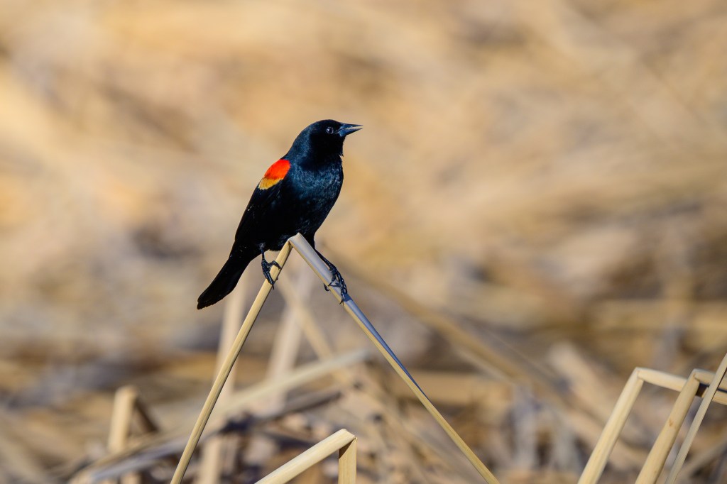
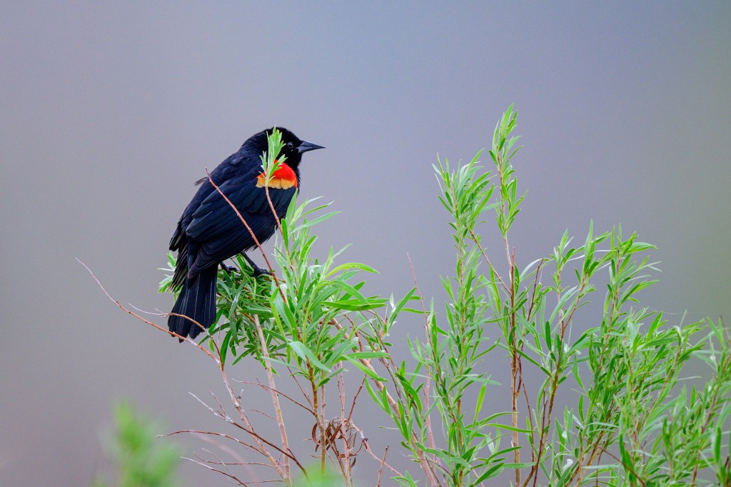
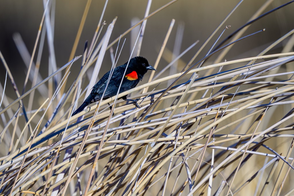
RED-WINGED BLACKBIRD
These birds show up in late February. And then they sing and sing and sing, for months on end. First two photos at Buckley Ponds, third at Owens Lake.
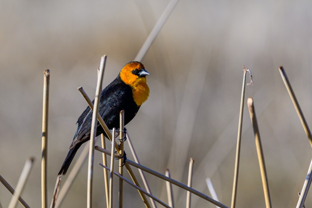
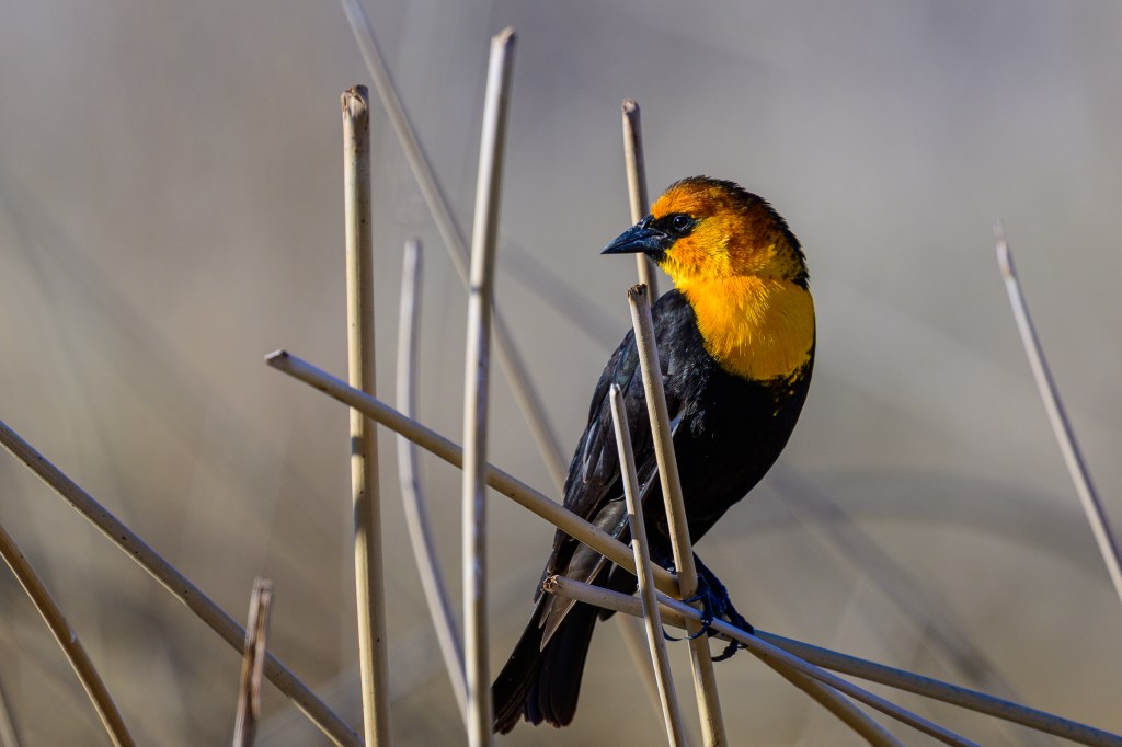
YELLOW-HEADED BLACKBIRD
Gorgeous bird with an awful song. Sounds as if it is being strangled. Photos at Owens Lake.
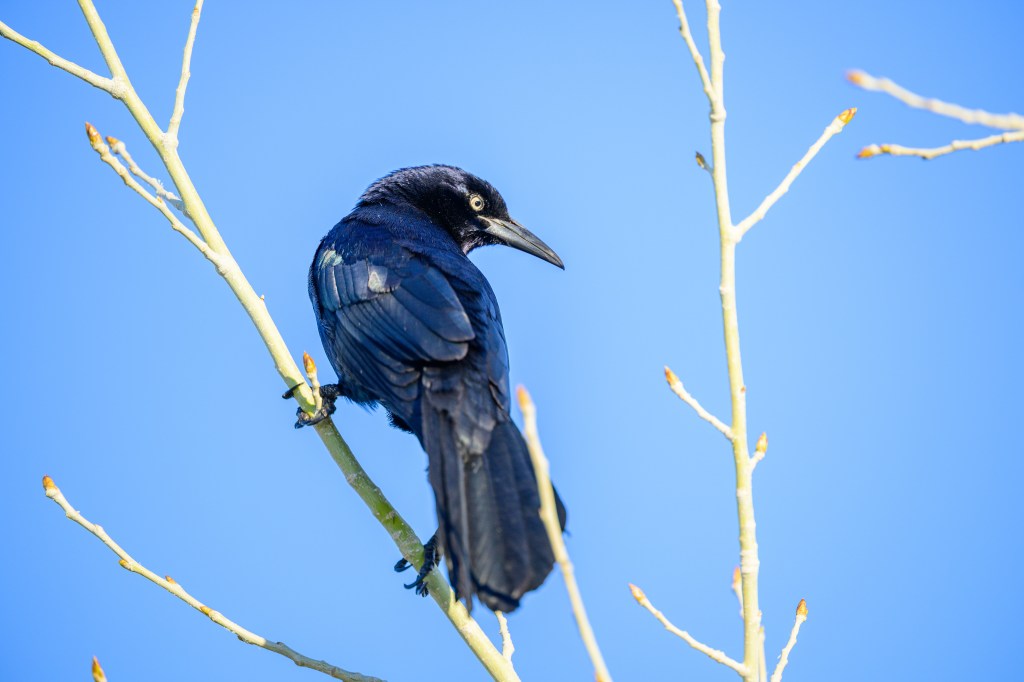
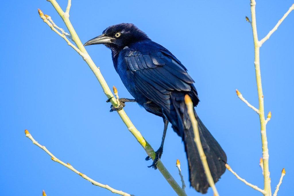
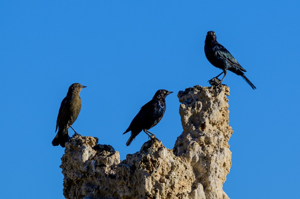
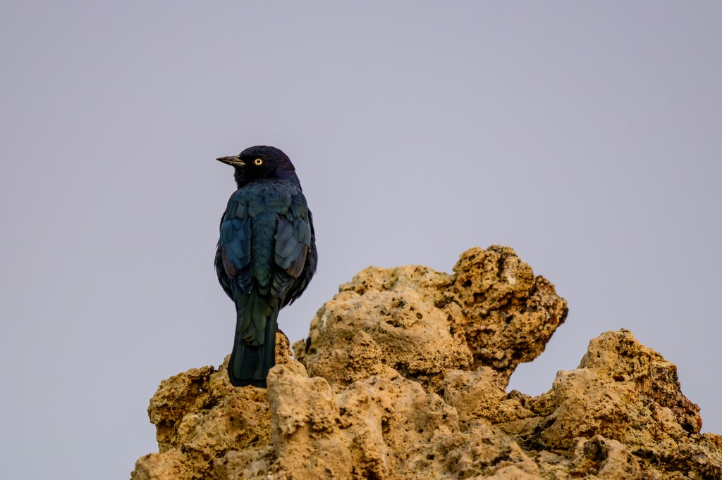
GREAT-TAILED GRACKLE
Looks like an elongated Brewer’s Blackbird.
NOT BIRDS
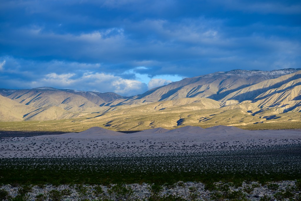
There are other things to see besides birds. First, the Panamint Dunes in shadow in Death Valley.
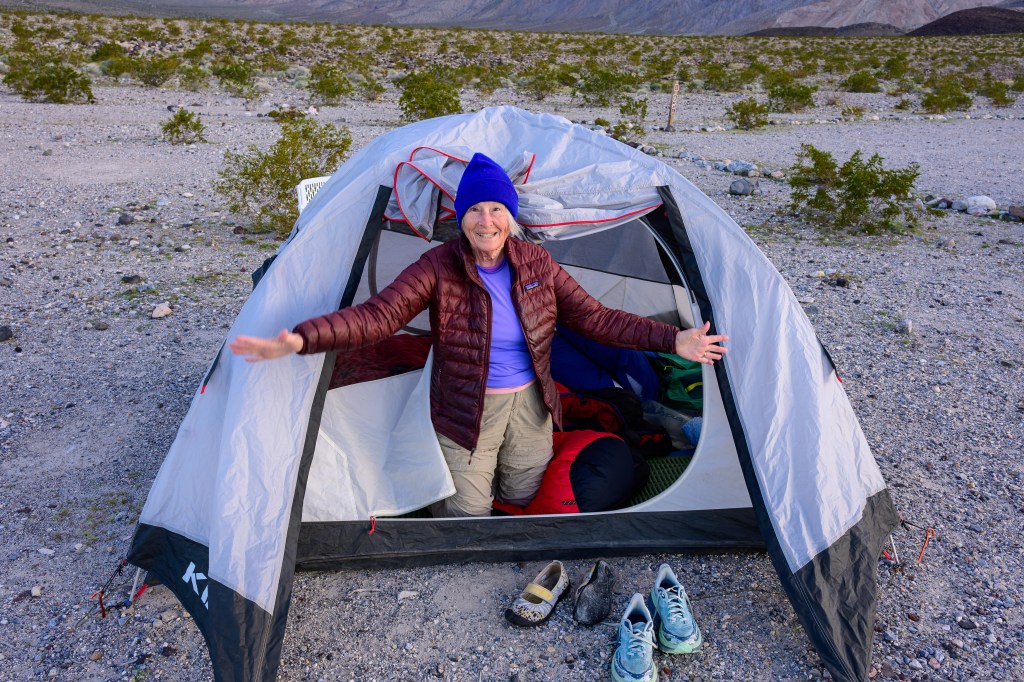
Camper below shows how to wake up and greet the day in Panamint Valley.
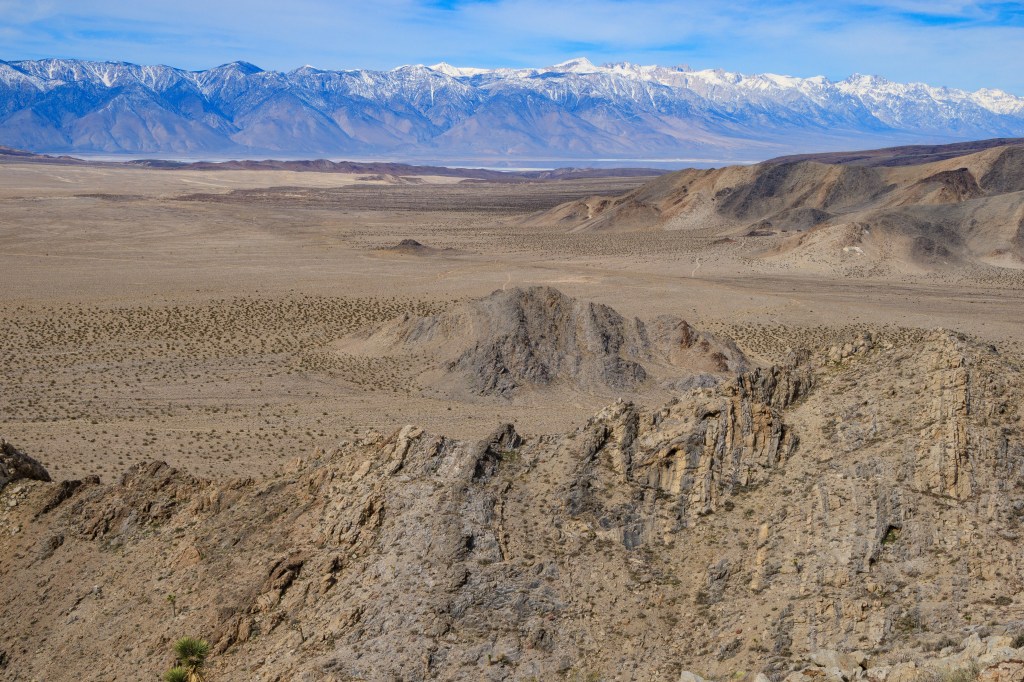
View of the Sierra from Talc Peak near Death Valley. Owens Lake visible in distance.
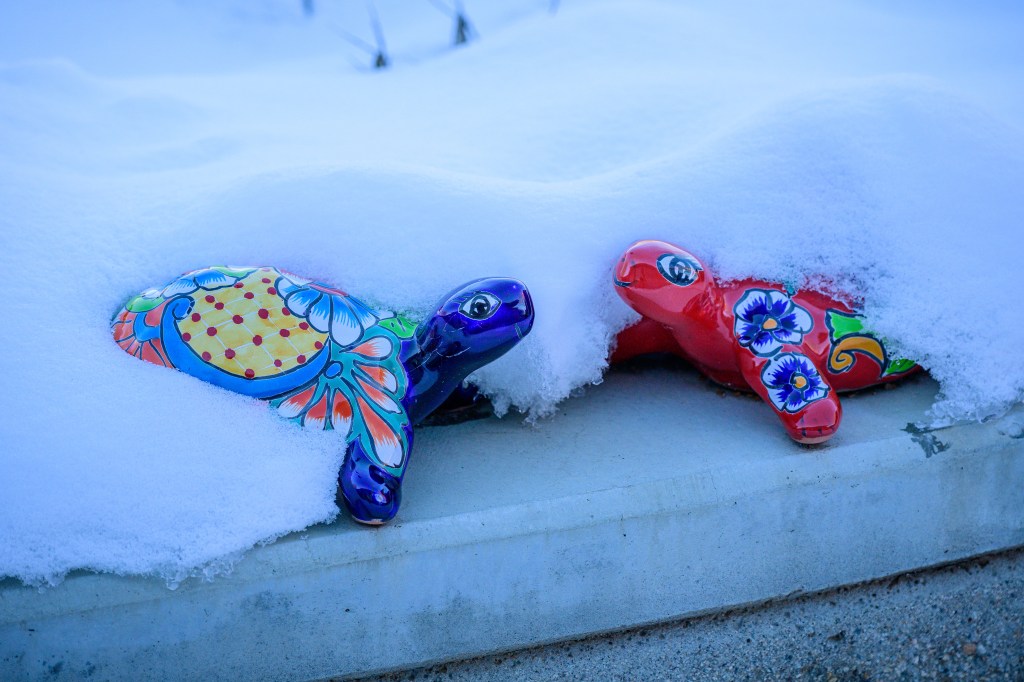
Backyard tortoises remain cheerful under fresh snow.
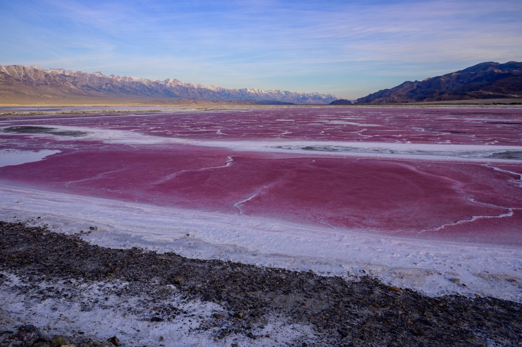
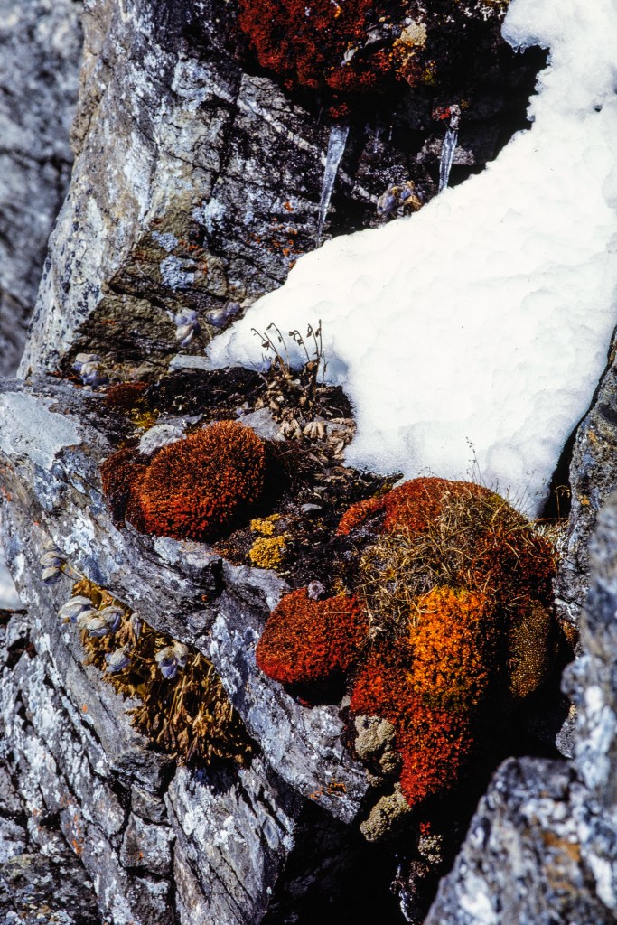
Much of Owens Lake consists of separate salt pans. This one has turned red, probably due to algae. Sierra in the distance.
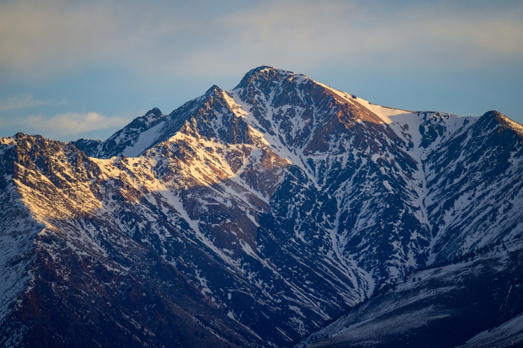
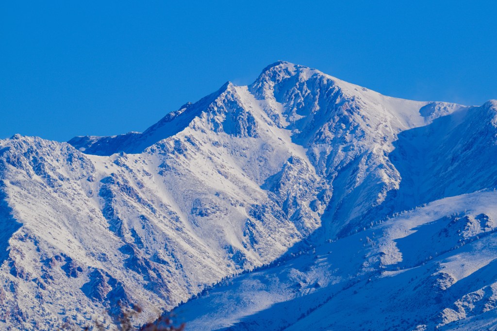
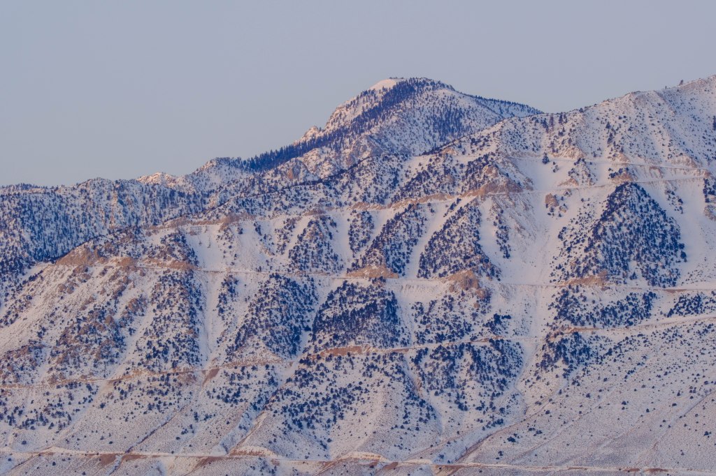
The White Mountains lie east of Bishop and the highest summit, White Mountain Peak (14,252), is easy to see from town. The peak had little snow in January, but more and after a storm in February. If you blow up these photos, you can make out a building on the summit. This is the Summit Hut, which belongs to the University of California White Mountain Research Center. The Center supports studies of plant and animal life at high altitude.
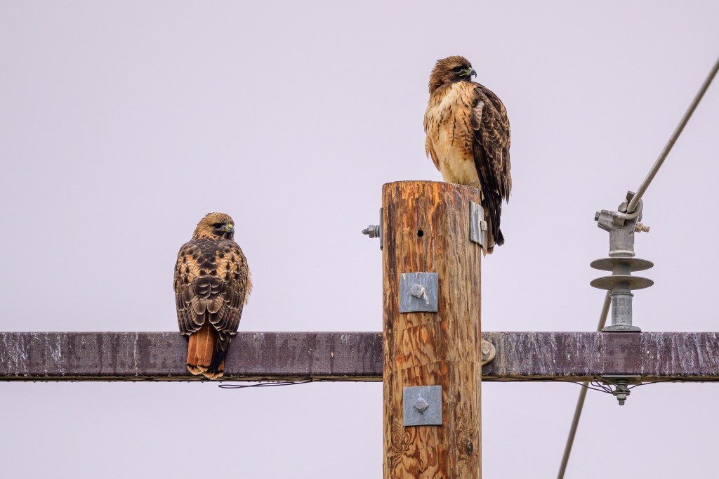
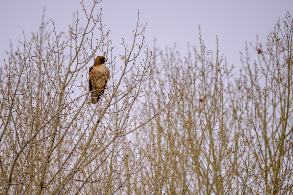
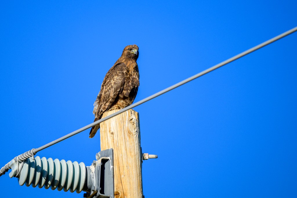
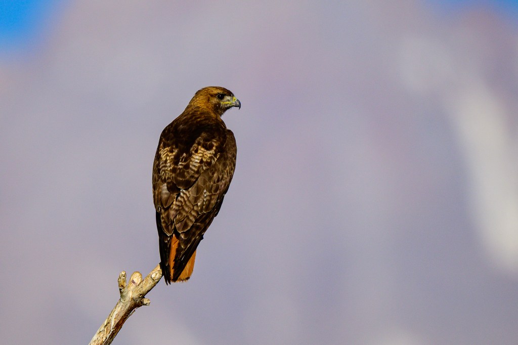
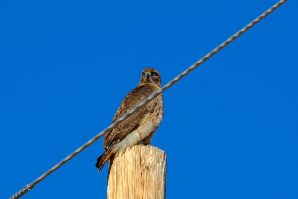
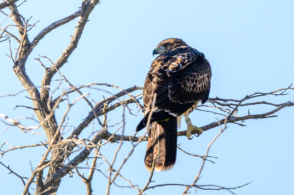
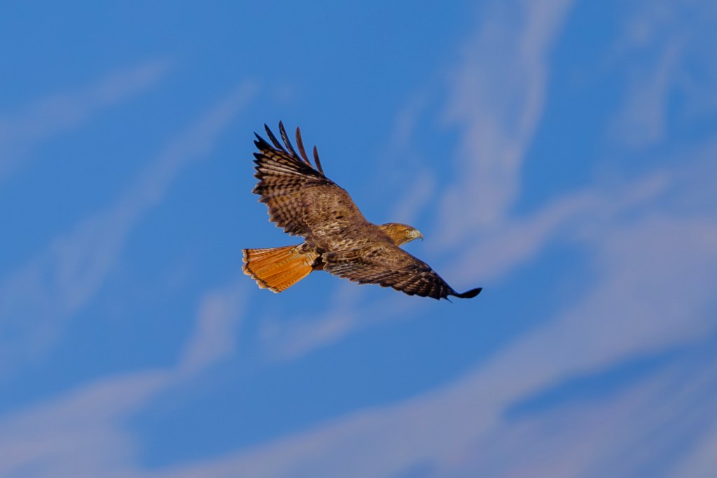
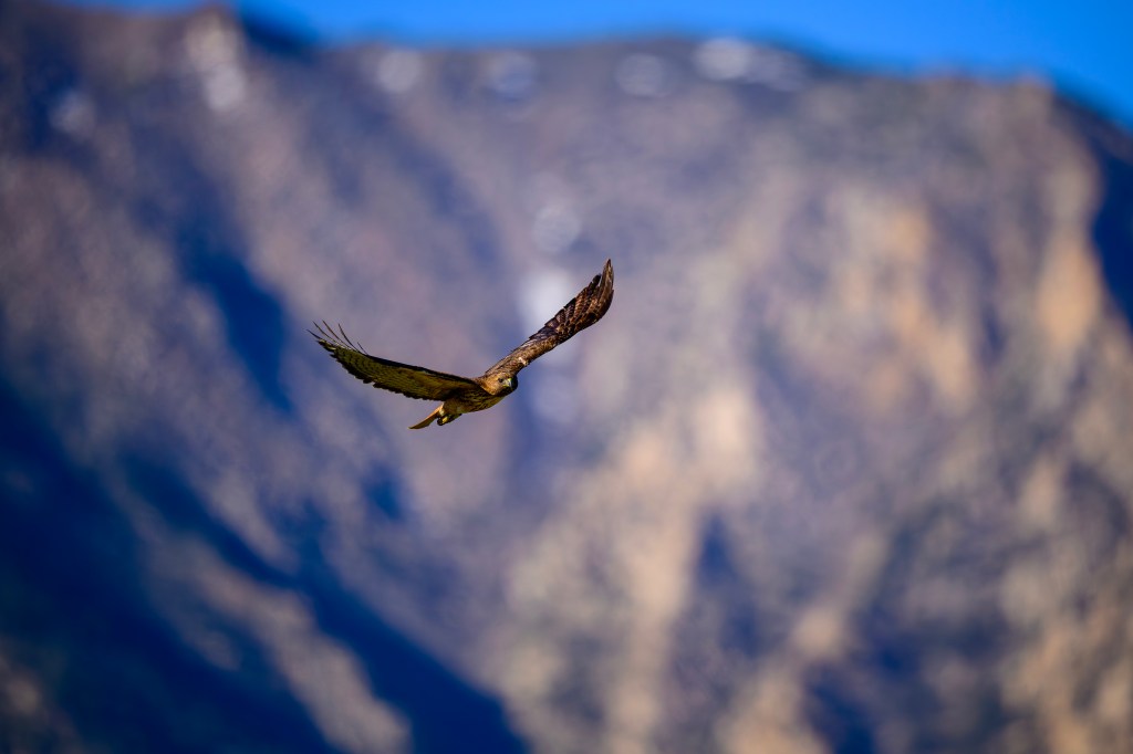
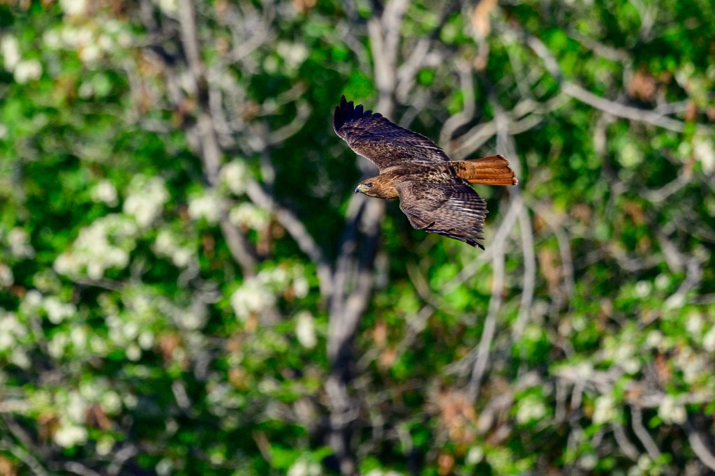
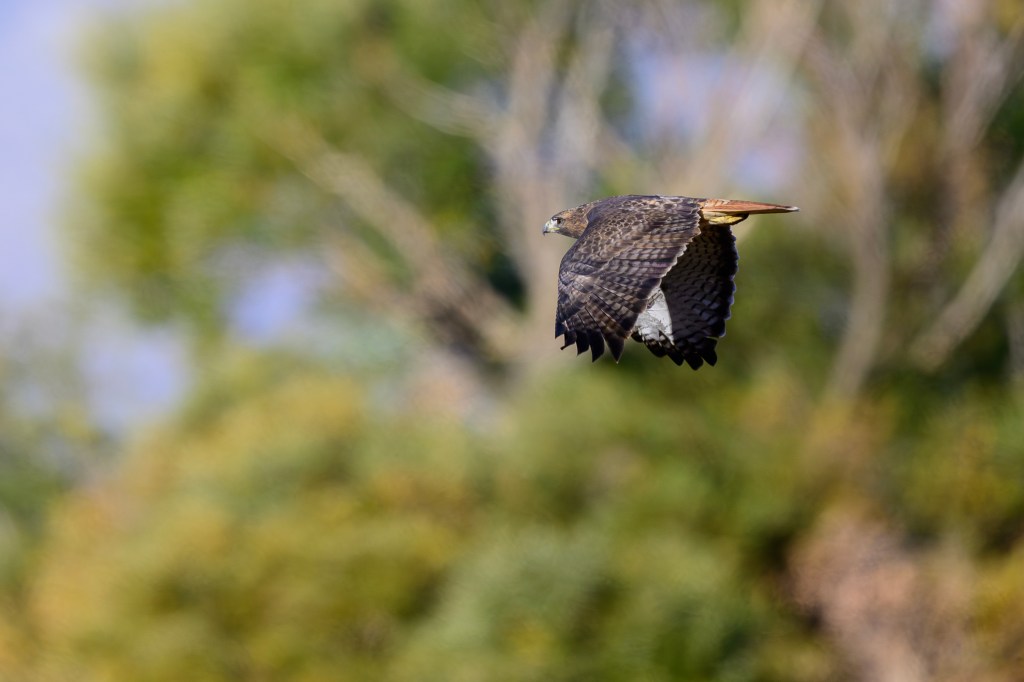
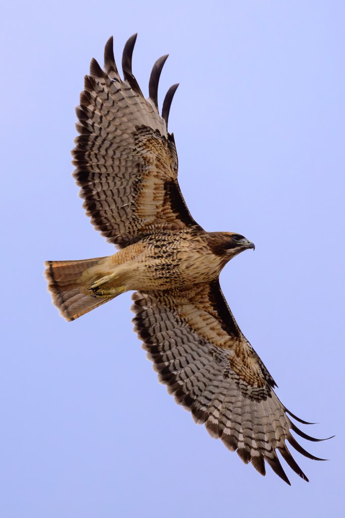
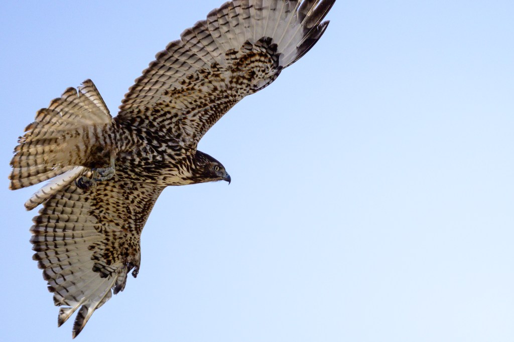
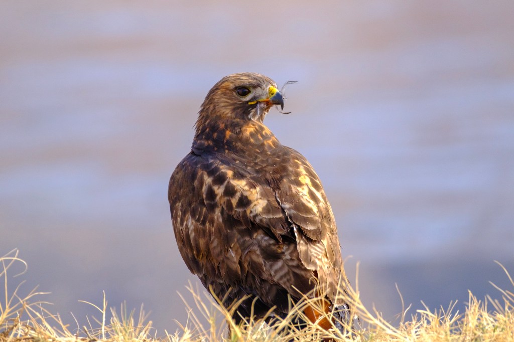
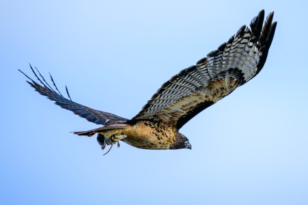
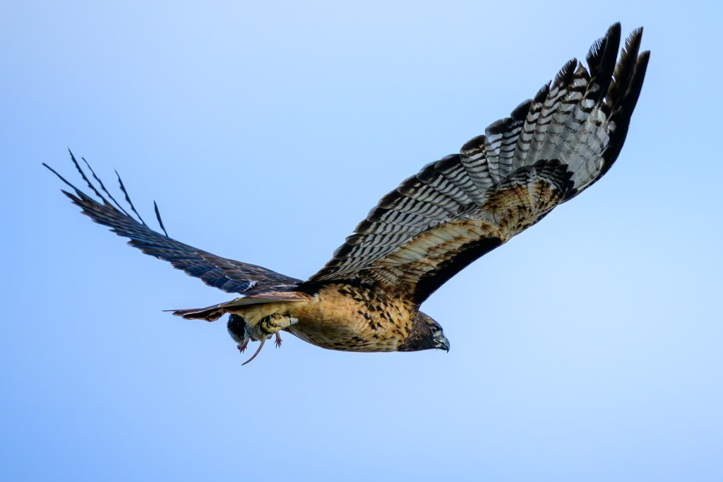
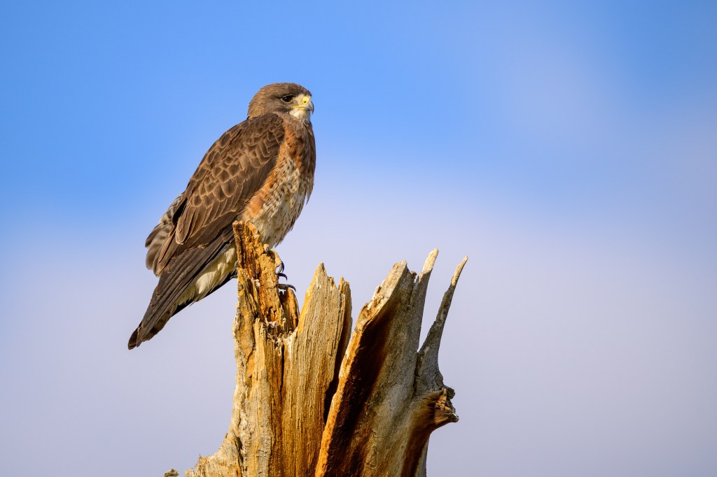
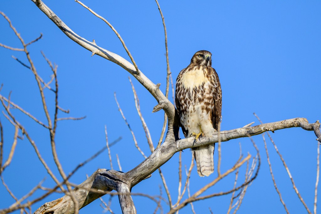
Red-tails are in every state. They perch on telephone poles, watching for hapless rodents. Or soar in lazy circles, often in pairs, using sharp vision to spot a moving meal. Hollywood uses the high-pitched scream of this bird to signify wilderness. Keith Hanson writes that this sound “bestows a ‘sense of the wild’ in macho truck ads.” This is our most common raptor; the one I learned to recognize before all others. Its line-backer body has broad shoulders and then tapers toward the tail. A brutish thug, 2.5 pounds of muscle with a 50” wingspan.
I see Red-tails everywhere near Bishop, but getting good photos is not easy. They spot me at a distance, then fly off if I approach. I can get closer in a car, but if I exit or even poke the lens out the window, they vanish. In the air, they often whip by before I can shoot. But because they are common, I have managed to get some images which I will share.
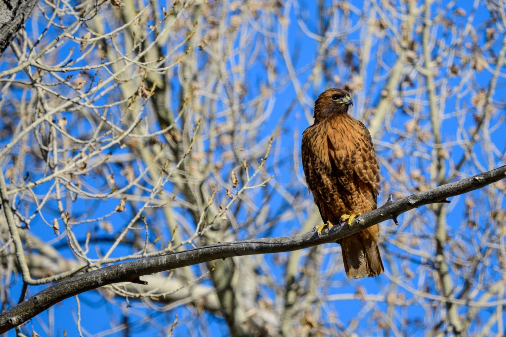
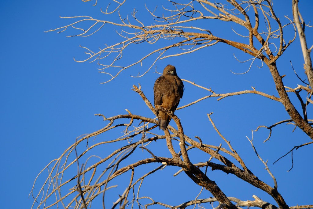
Red-tails all have the same basic shape, face, and beak, but they vary a lot in coloration. Birders group them as light morphs, rufous (or intermediate) morphs, and dark morphs. The word “morph” is just jargon for morphology, a word for the “form” or look of a living creature. Let’s examine these color variations:
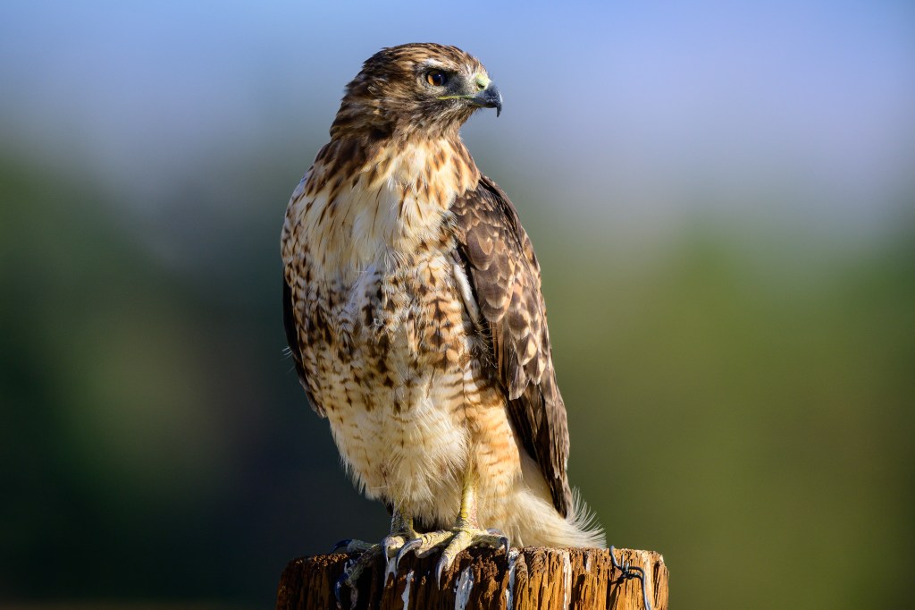
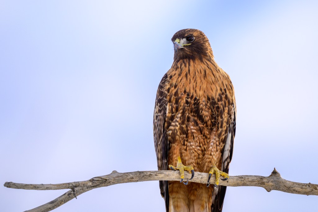
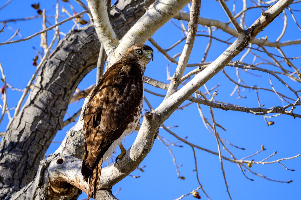
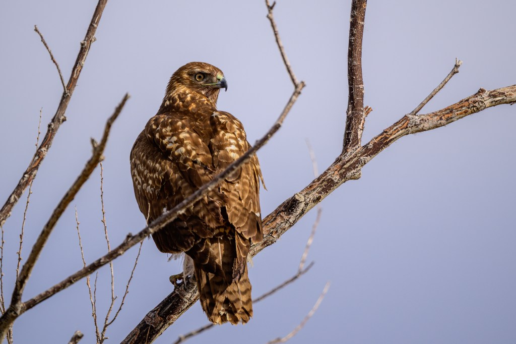
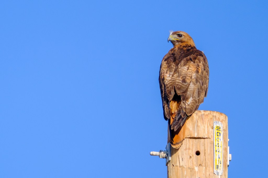
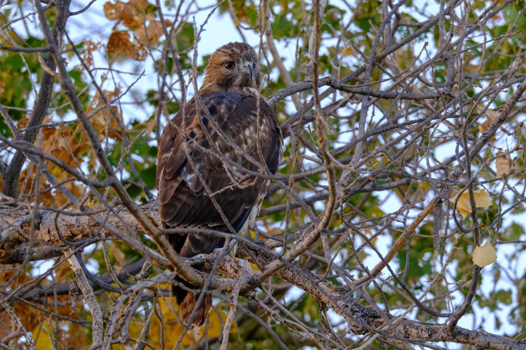
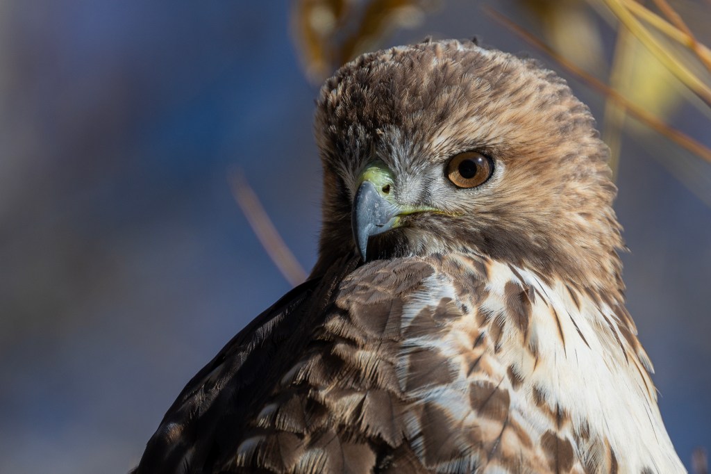
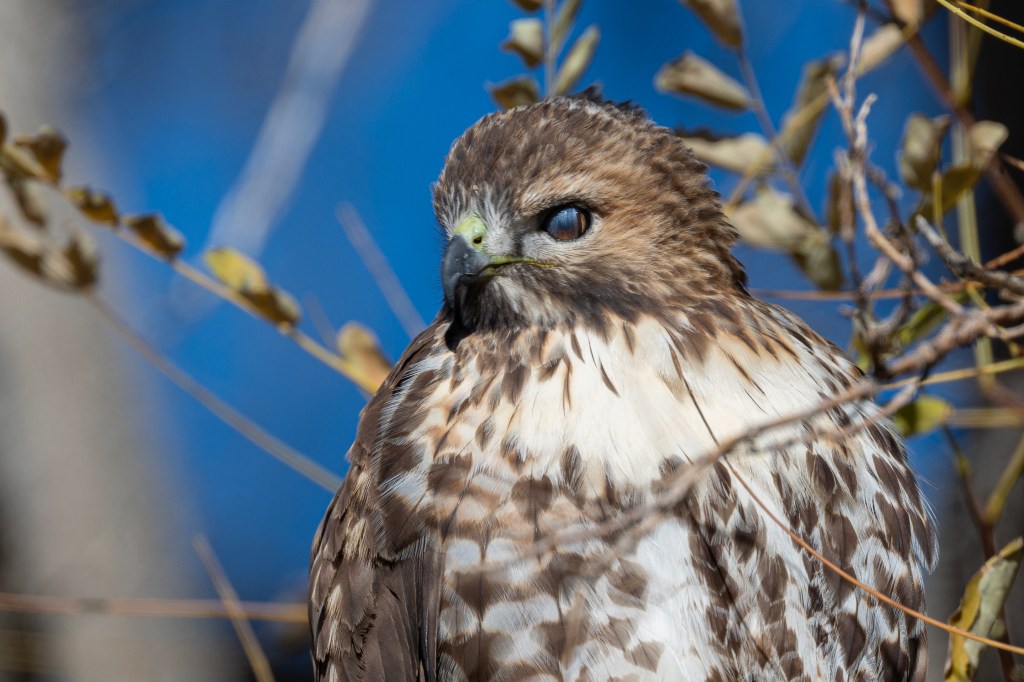
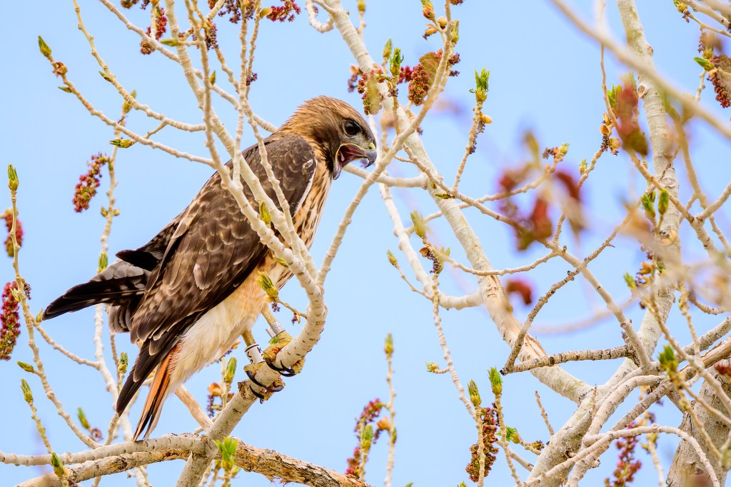
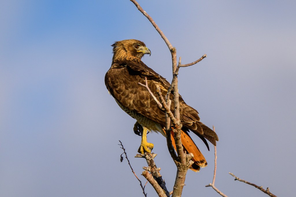
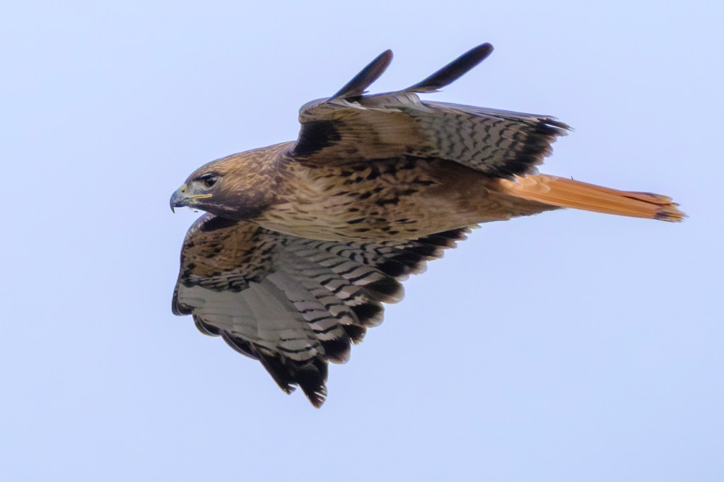
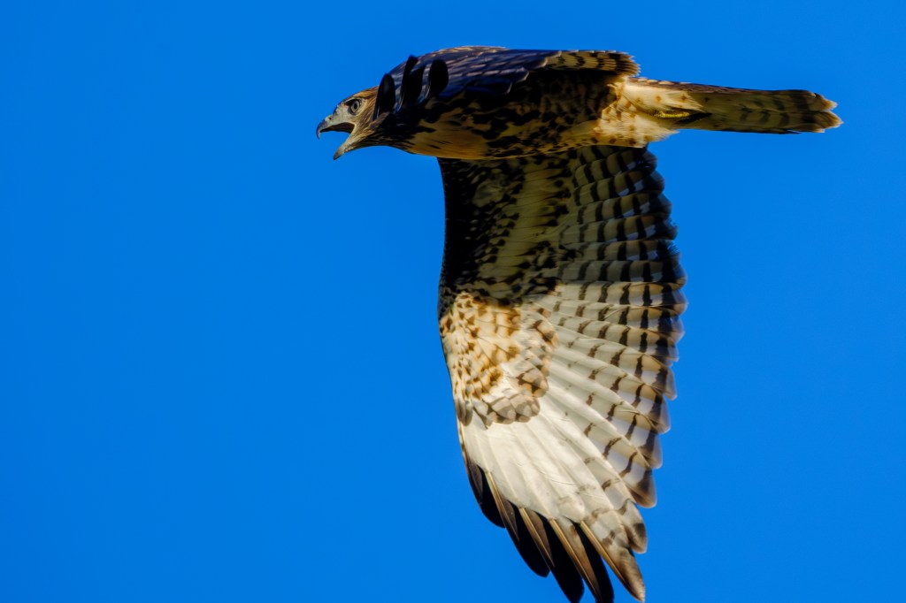
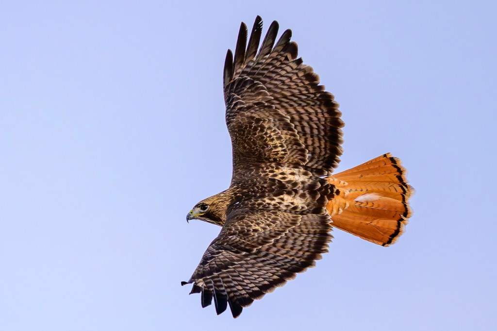
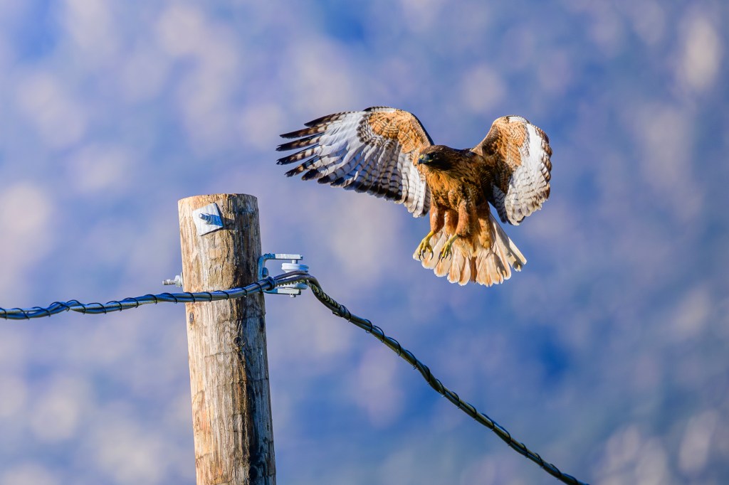
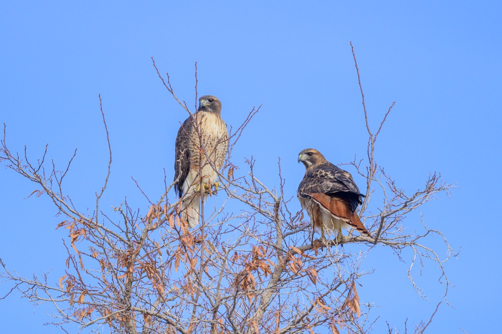
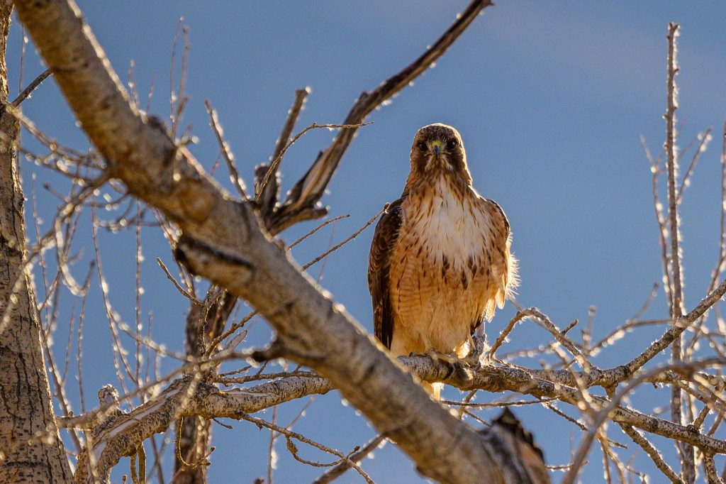
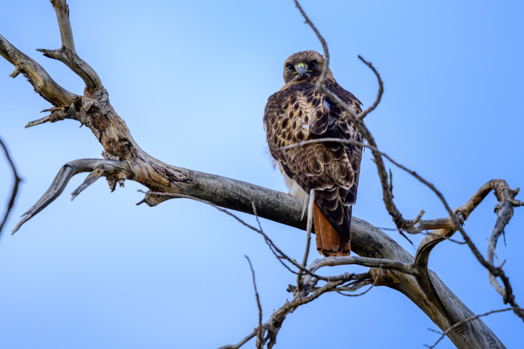
LIGHT MORPH
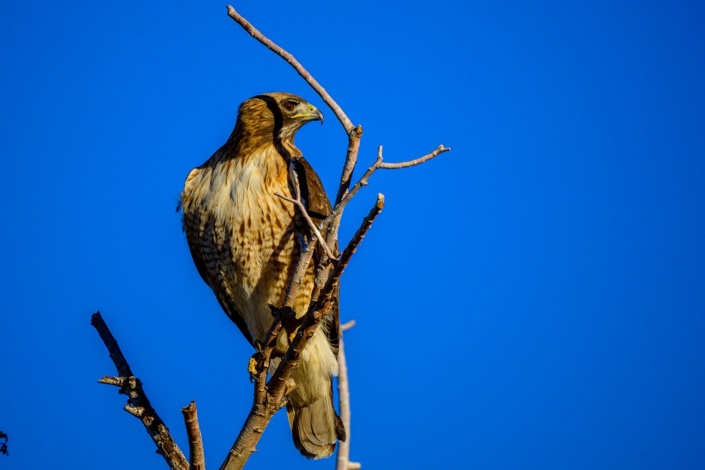
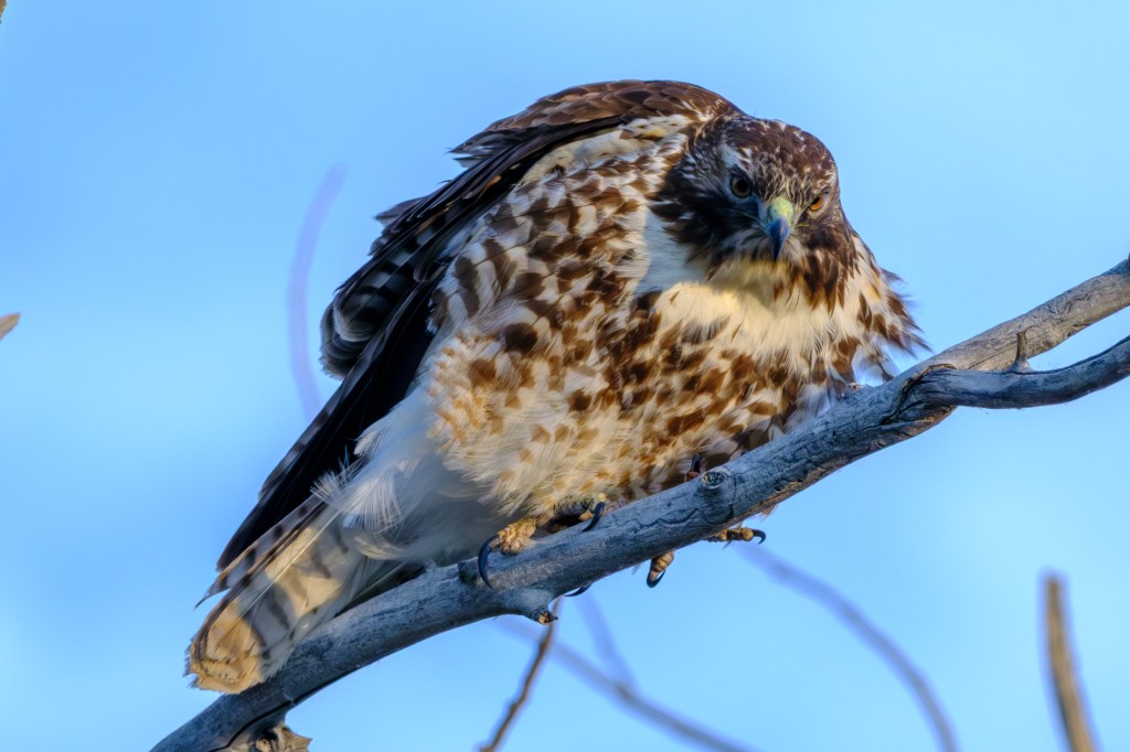
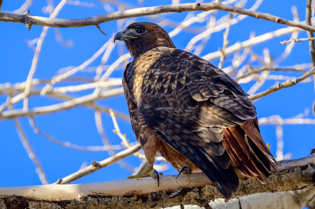
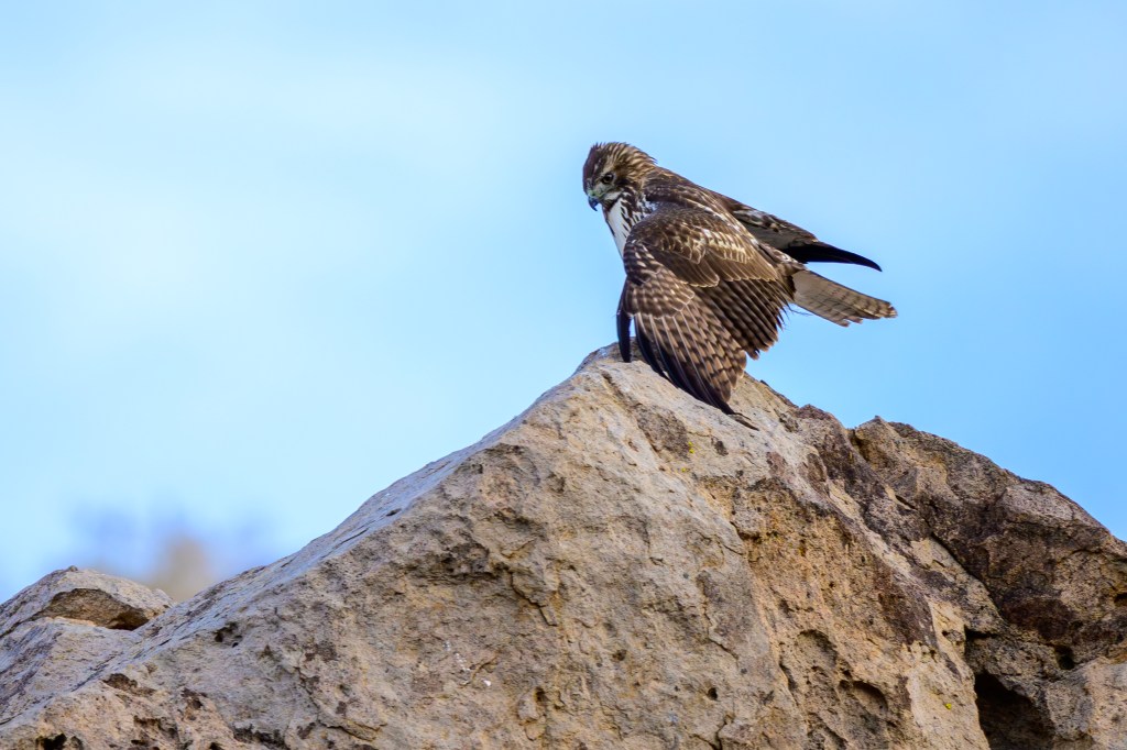
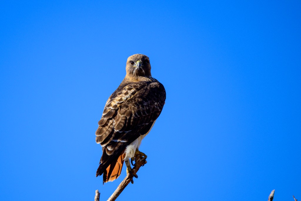
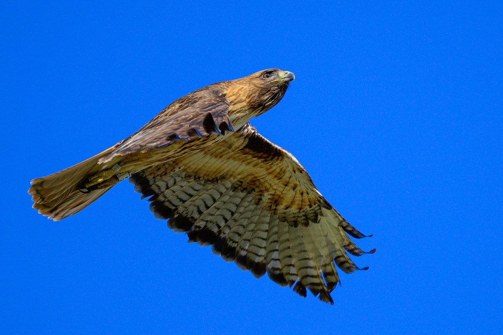
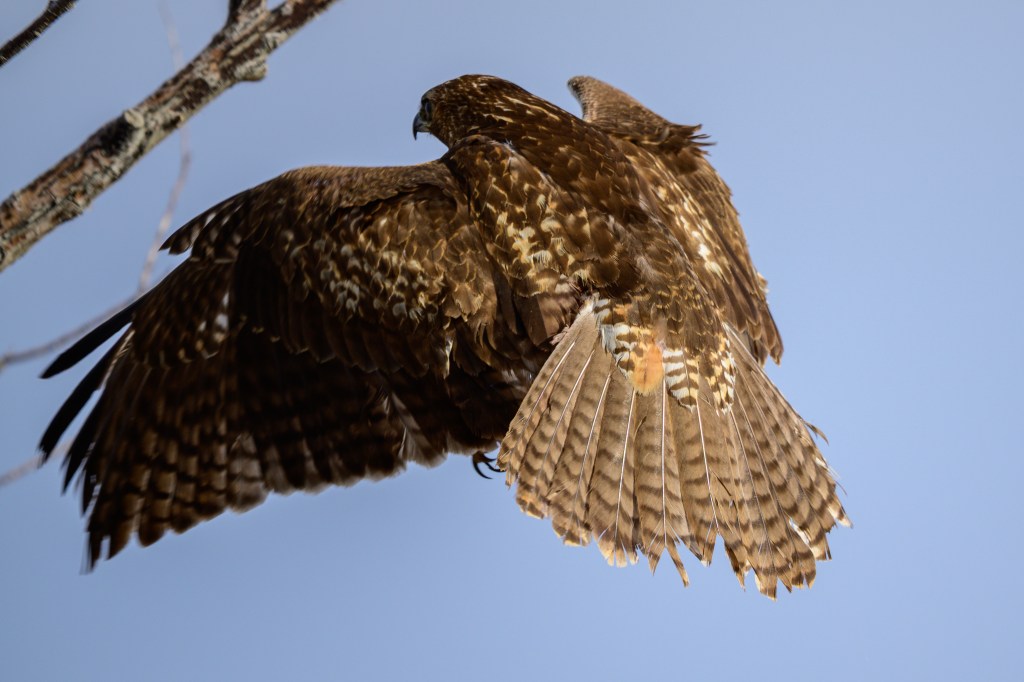
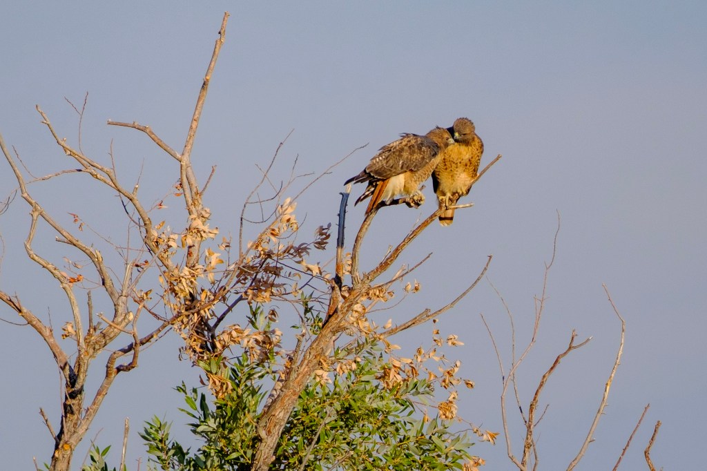
Light colored birds are the most common. They have a mainly white chest and belly. Check out the hawks in the first picture, below. The hawk on the right has a mostly white front with a band or cummerbund of darker feathers across the belly. The bird on the left displays the classic red tail, which all adult Hawks have. The beaks are not that long and have a nasty hook at the end. The bird on the left has white spotting on its back in a “V” shape. Both birds have a spiky haircut; not all red-tails have this, but I find this “hair”-do helps for identification. The perch, on top of a phone or power poll is classic. Both birds look bulky with wide shoulders. If you are a loan-shark and need to collect, these are the birds to hire.
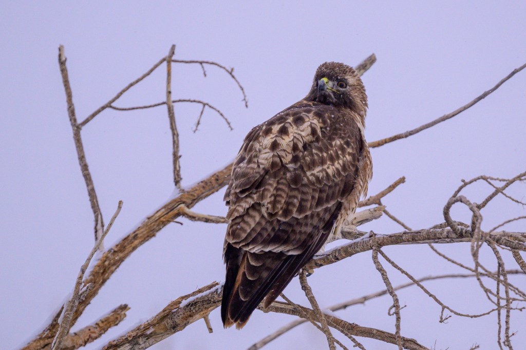
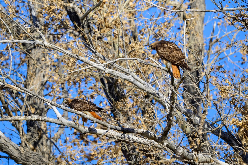
The next bird shows the cummerbund nicely. The eye is brown; juveniles have a pale or yellow eye. The talons are long and sharp.
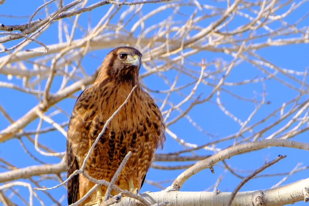
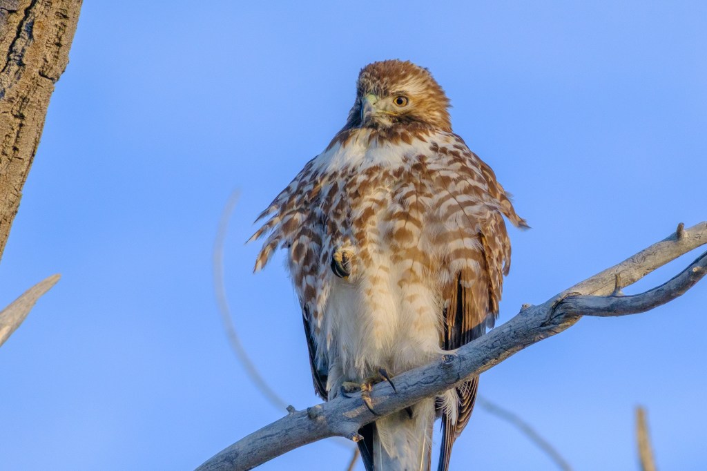
Below, a Hawk displays the belly-band of darker feathers, the spiky hair-do, and the short beak with a hook, plus broad chest and shoulders.
The next Hawk has smooth “hair” and the classic chest and beak. We cannot see the red color of the tail, because only the dorsal aspect of the tail is red.
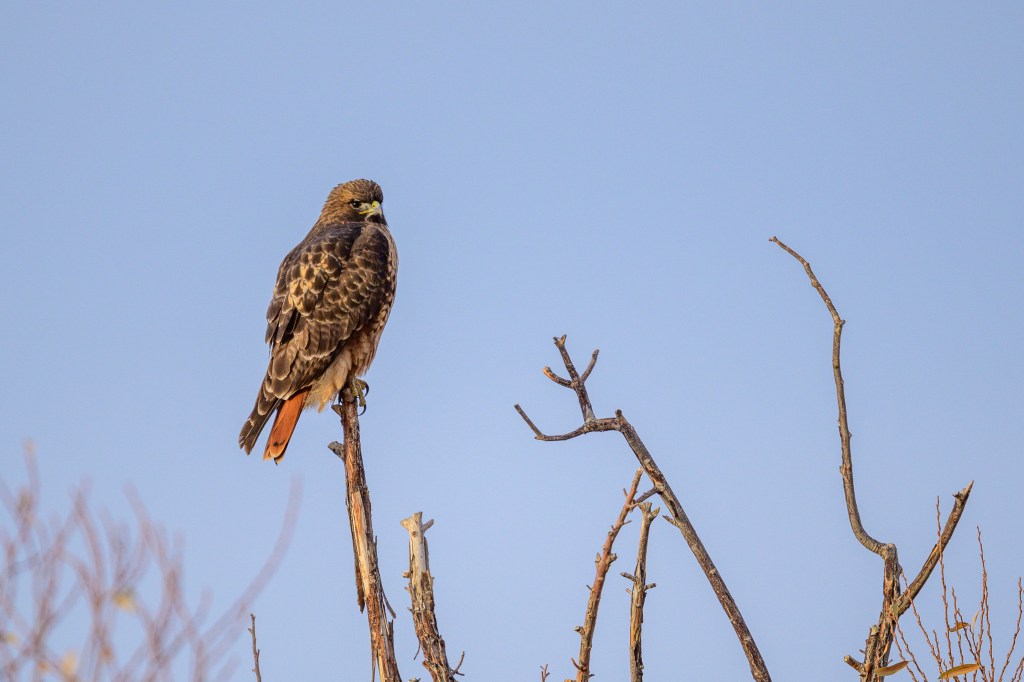
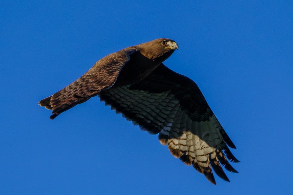
RUFOUS MORPH
Below are three Red-tails with red colored chests and bellies. All show the cummerbund and other common features of Red-tails. Check the awesome talons.
DARK MORPH
Dark Red-tails, nearly black, are the least common.
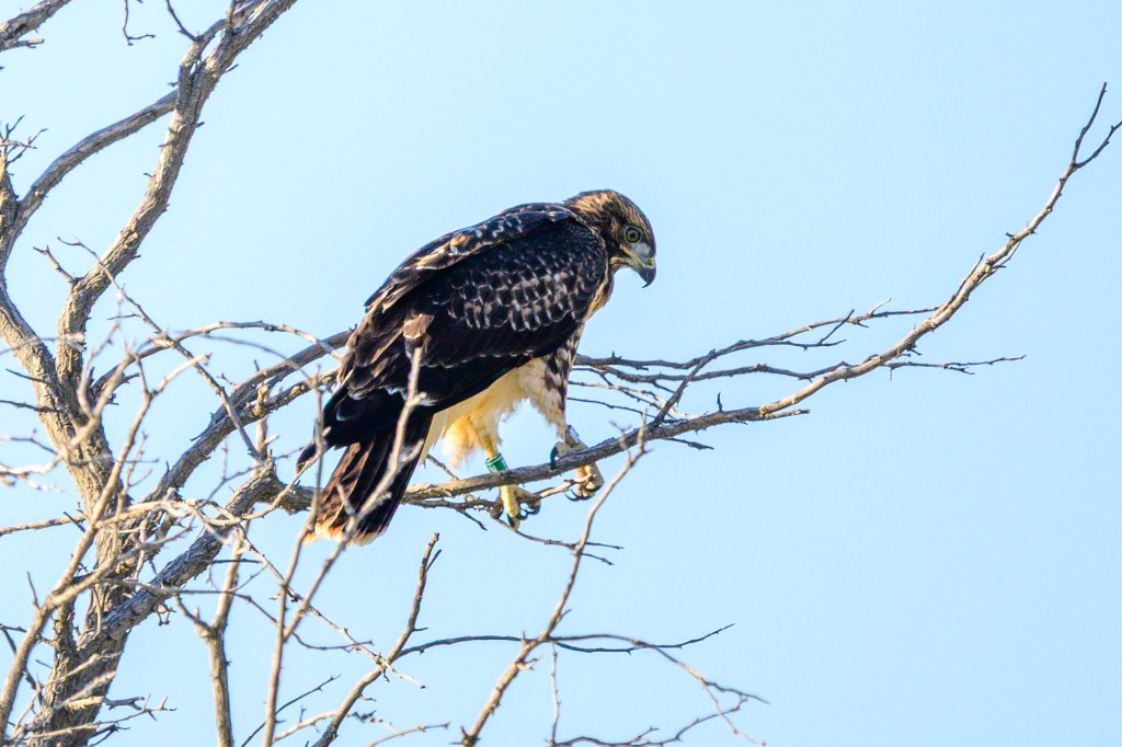
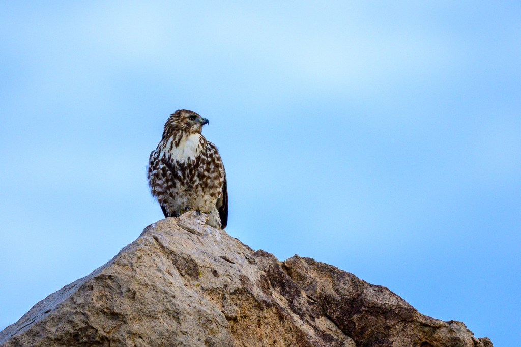
JUVENILES
Young Red-tails do not have red tails. The tail is brown/grey with narrow black stripes. Between ages 1 and 2, the juvenile tail feathers fall out and are replaced with brick-red feathers. At about that time the eyes turn from yellow to brown.
PORTRAITS
The next 23 pictures show a variety of perched Red-tails and I added a few comments.
Snow falls on the bird below.
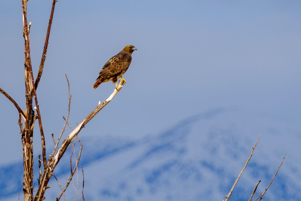
They love a high perch.
In the photo above, did you notice that the bird has one foot sticking out of the feathers on its belly? Lots of raptors do this, but it seems particularly common among Red-tails. They stand on one leg, bury the other leg in their feathers, and seem to have a foot growing out of their non-existent belly-button.
Bird below was changing its position on the limb. Look at the talons.
Bird below has one foot protruding from belly feathers. Looks as if it has two right feet.
Birds have a “nictitating membrane” which can cover the eye to protect it. The membrane of a Red-tail is thick and very blue. Gives the bird a creepy look, like a zombie-hawk.
Another shot of the nictitating membrane.
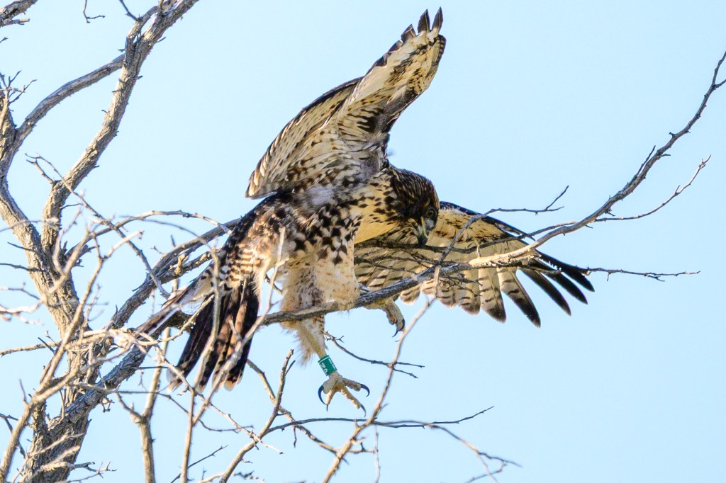
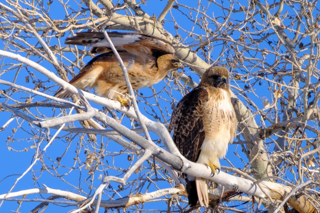
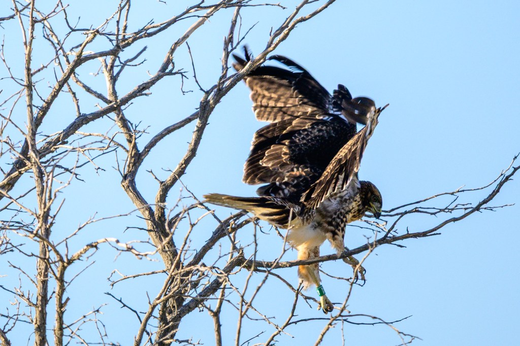
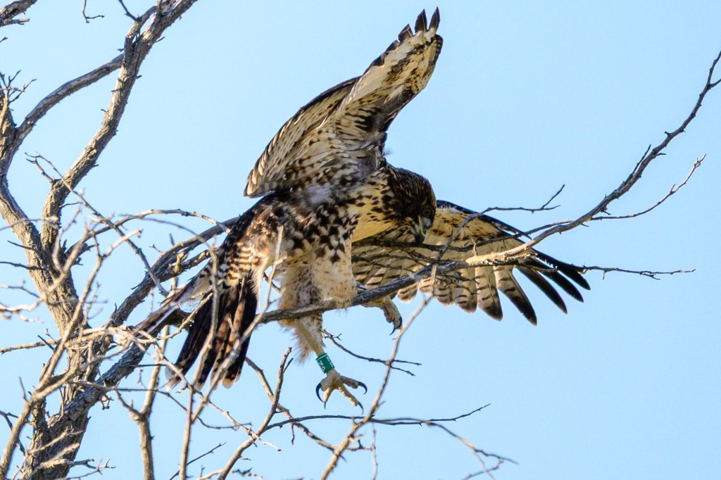
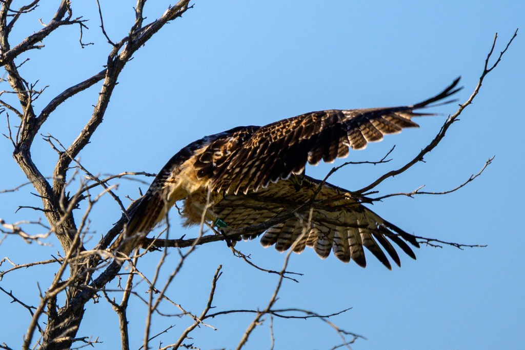
The next four photos show a young Hawk. The branch under the left foot broke and the bird fell off the tree. Two pictures show the struggle to get back to a perch. Then the bird looks around, thinking “I hope no one saw that.”
Bird below uses its wing to help with balance.
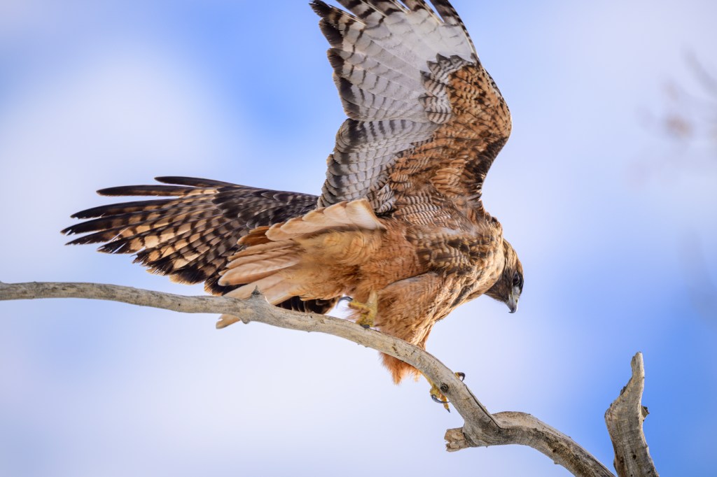
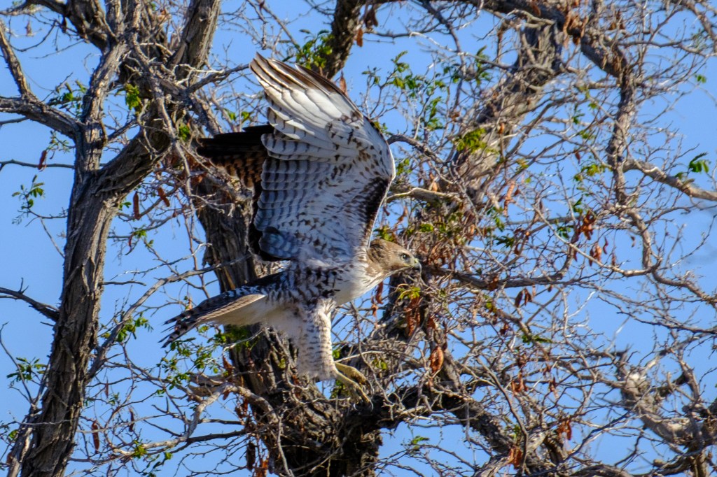
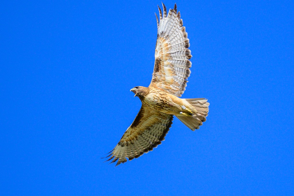
FLIGHT
Note the feathered leggings. The leading edge of the underside of the wing, from head to wrist (the bend in the wing), is black. This leading edge is called the patagium, so we can sound sophisticated by saying the Red-tail has a dark patagium or a dark patagial mark or patagial stripe. This feature is a great way to identify this bird from below. This is a young bird. You can tell because 1) the tail is gray with black bands, 2) the eye is yellow, and 3) the trailing (back) edge of the wing is not all black.
The next bird also demonstrates the feathered leggings. This is a mature bird. You can see the brown eye, the red tail, and the back edge of the wing is black.
The bird below is hovering while it searches for a meal. Red-tails don’t hover often, but they can do this with help from a headwind.
The next bird is very dark; probably a dark morph.
Below you can see the dark stripe on the trailing edge of the wing and the dark patagial area on the leading edge.
Below a juvenile bird has just launched into the air. The tail is not red and is very worn.
The next Hawk has a “V” of white blotches on its back and a spiky hairdo. It is a juvenile Red-tail with yellow eyes and striped tail.
But when this same bird took off, the patagial area lacks the uniform black that I expected. It is a mix of black and white. I think the dark area is not fully developed in this young Hawk.
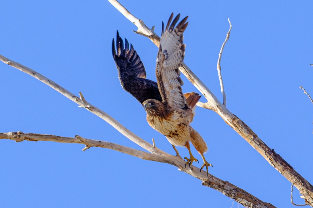
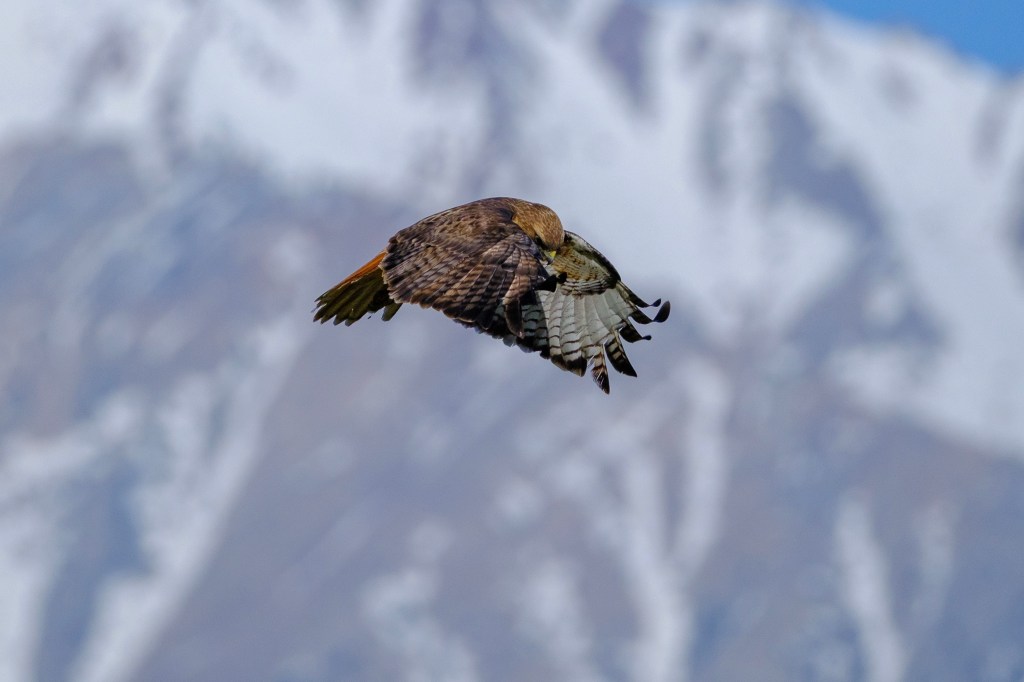
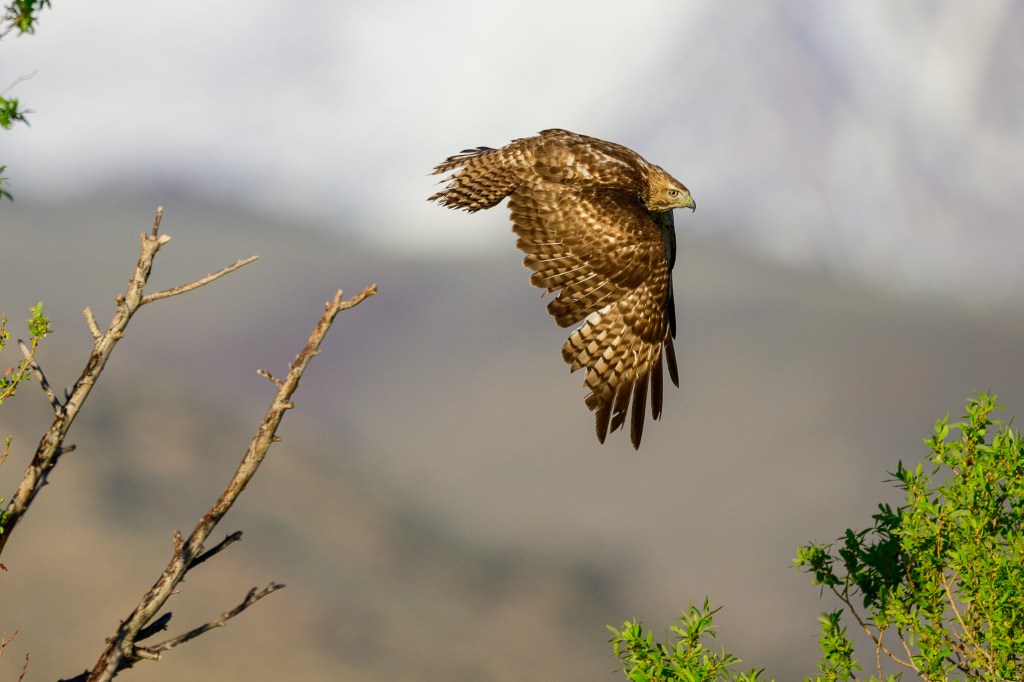
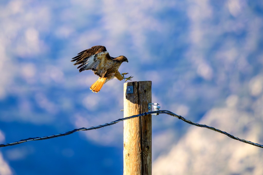
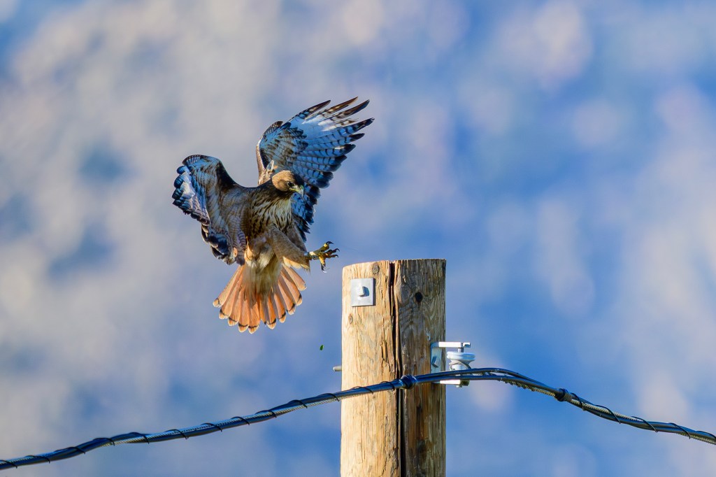
When a bird lands, it often flies a level or descending line to its perch. But Red-tails often fly at an altitude below the perch. At the last moment, they flair their wings and tail and use their speed to rise up to the perch. This looks dramatic and shows off their flying skill. In the last three pictures, the same bird makes 3 landings on the same pole.
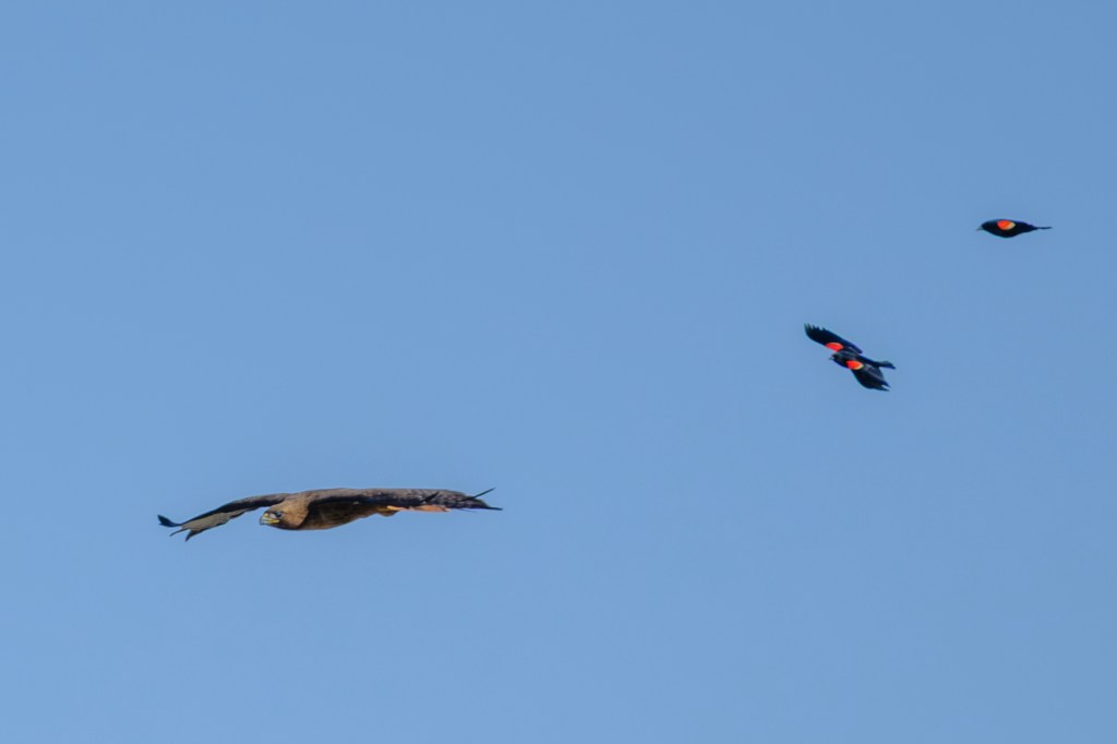
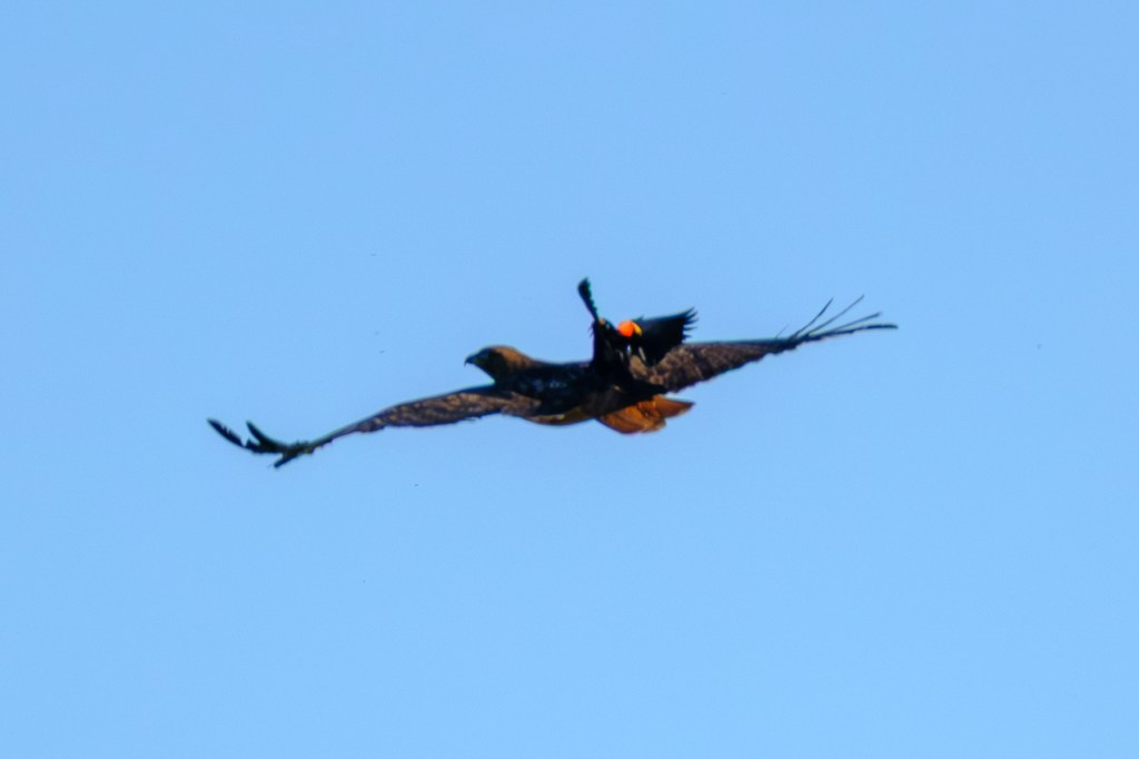
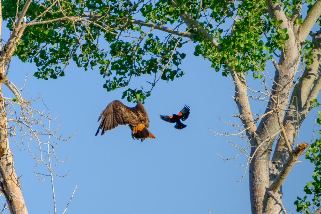
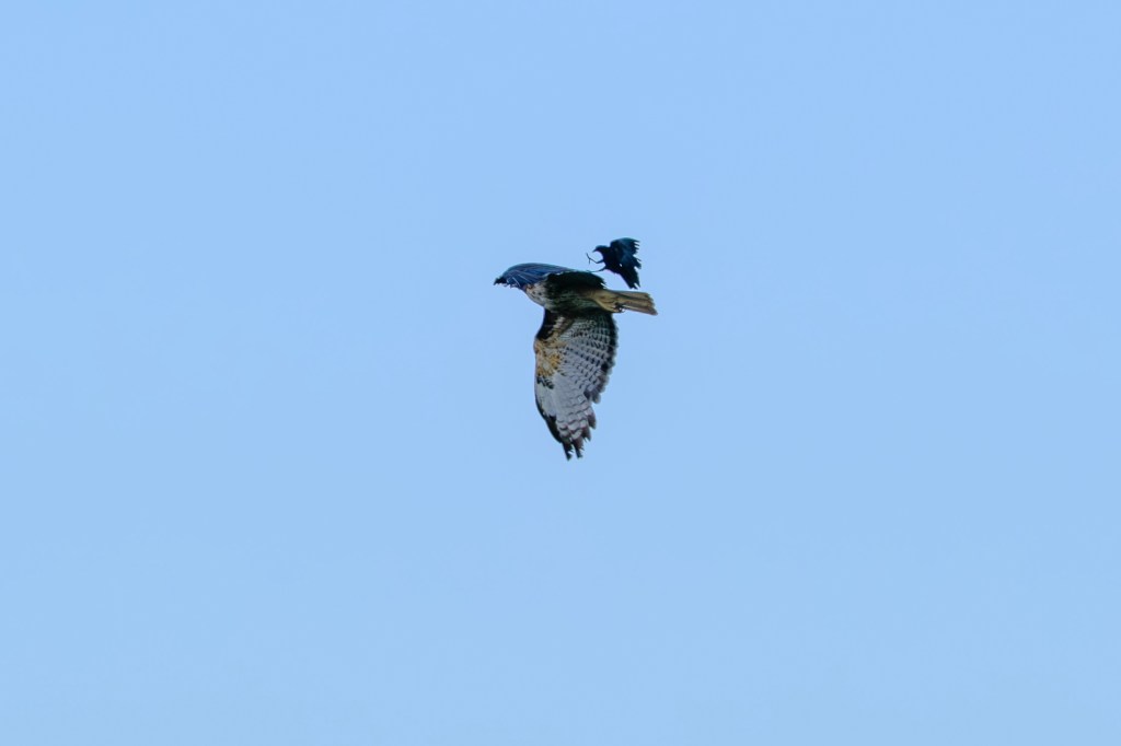
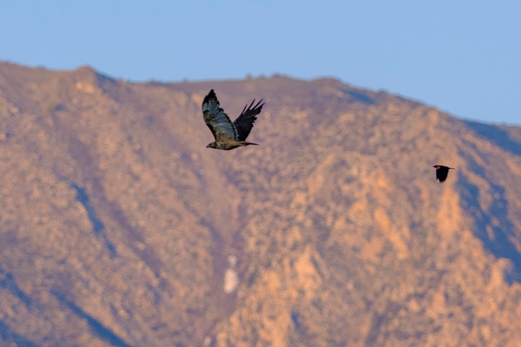
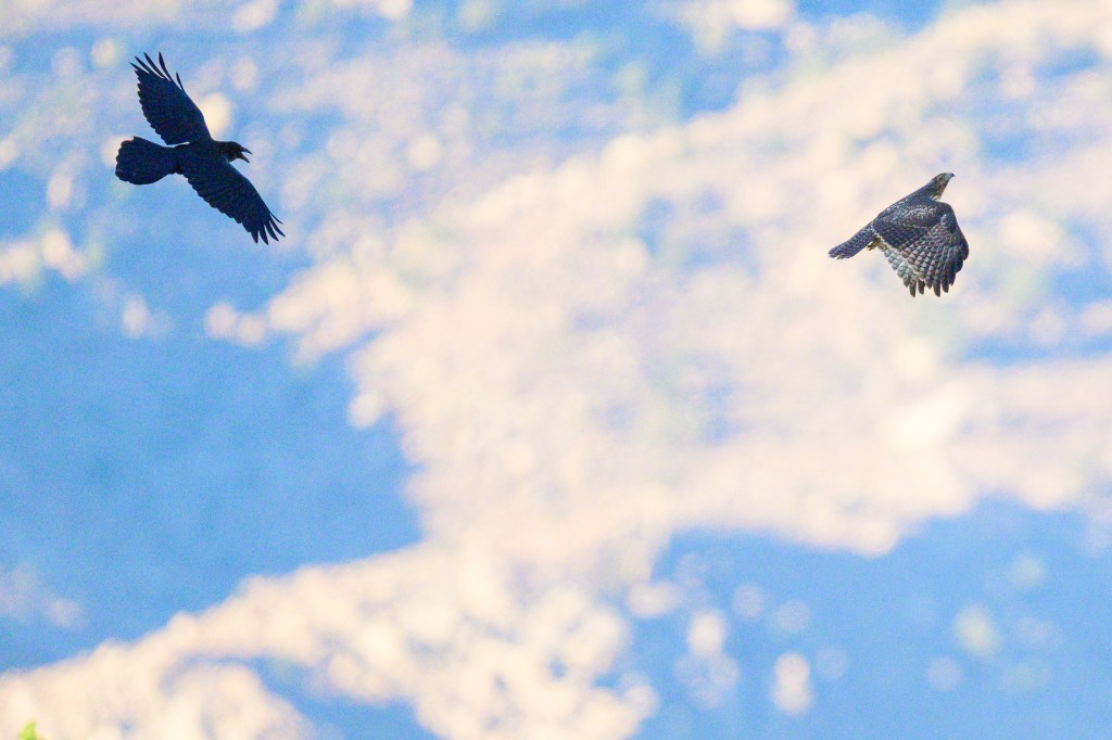
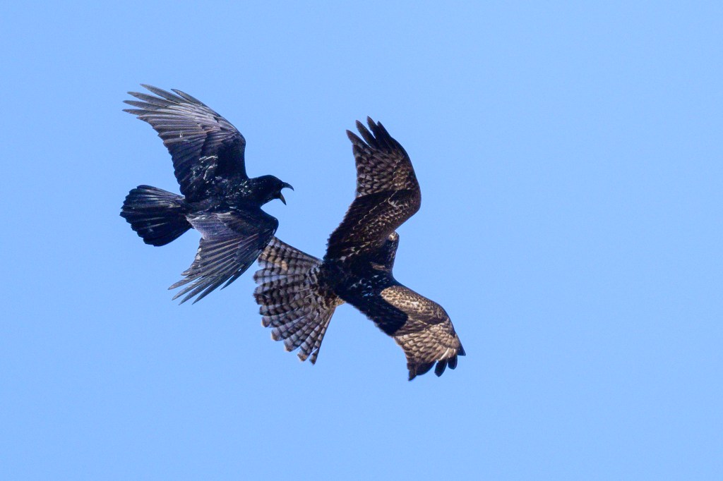
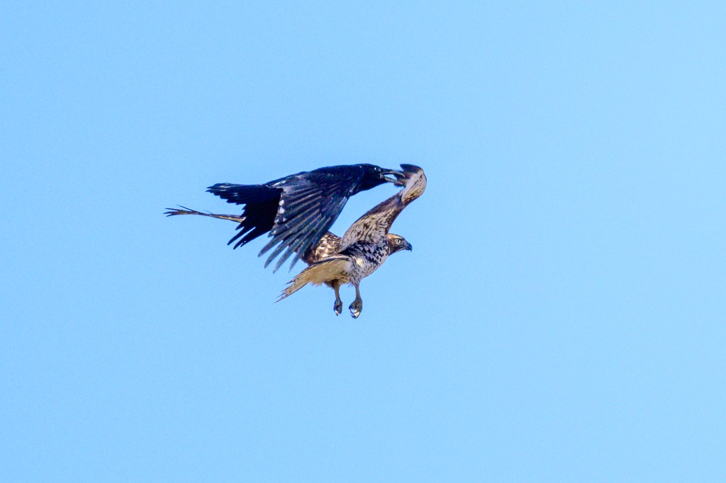
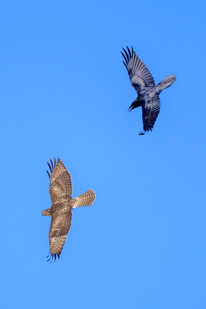
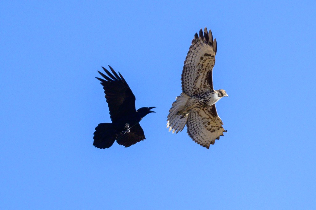
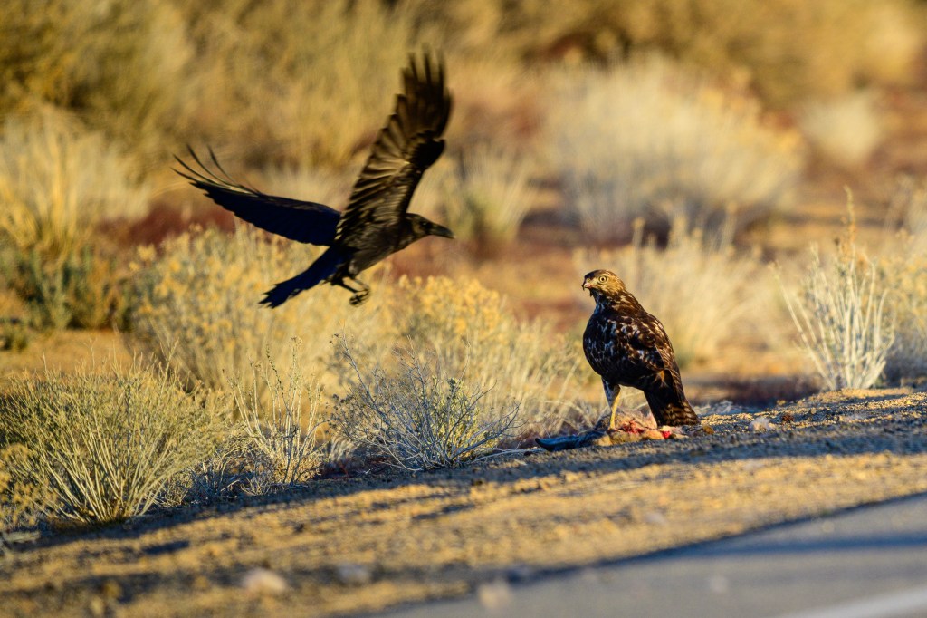
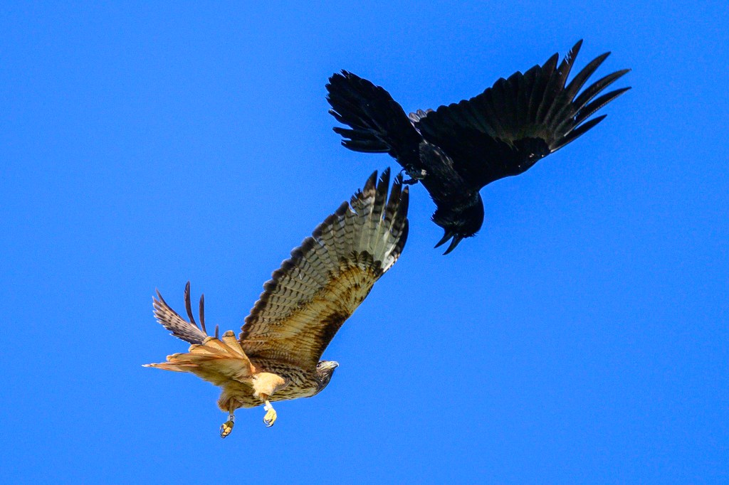
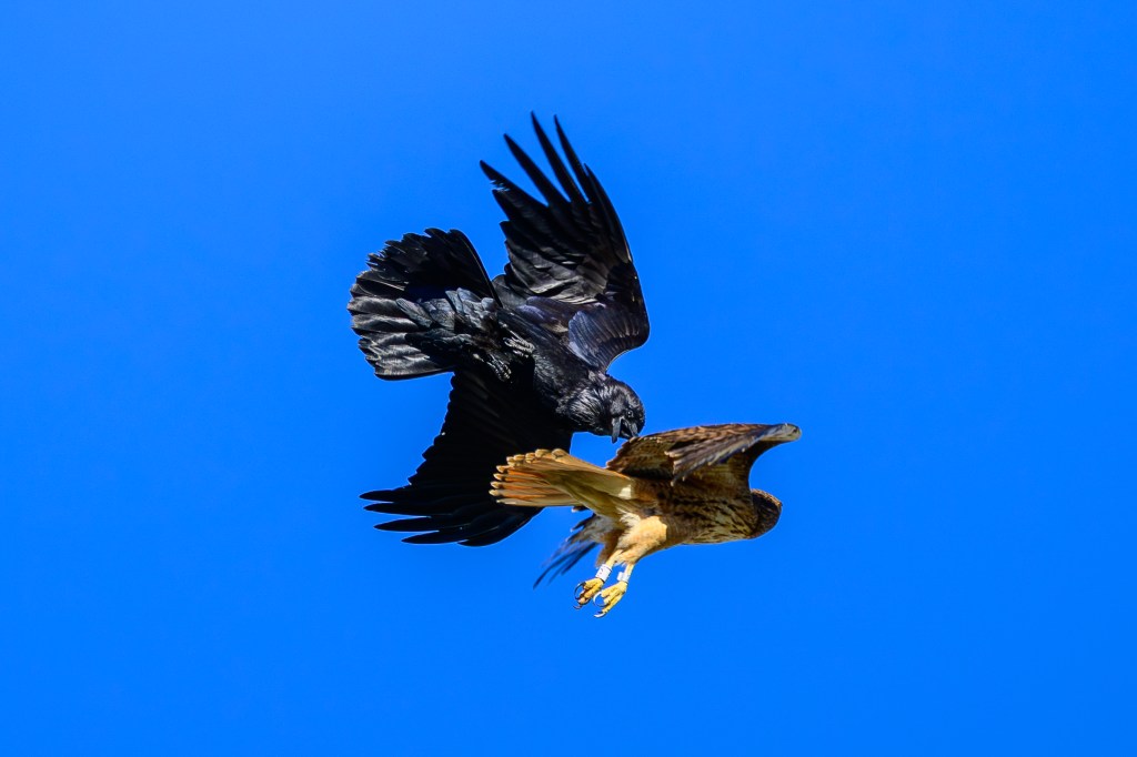
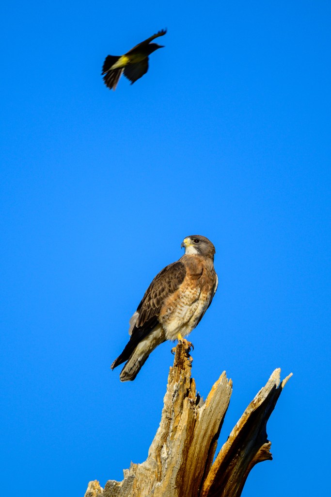
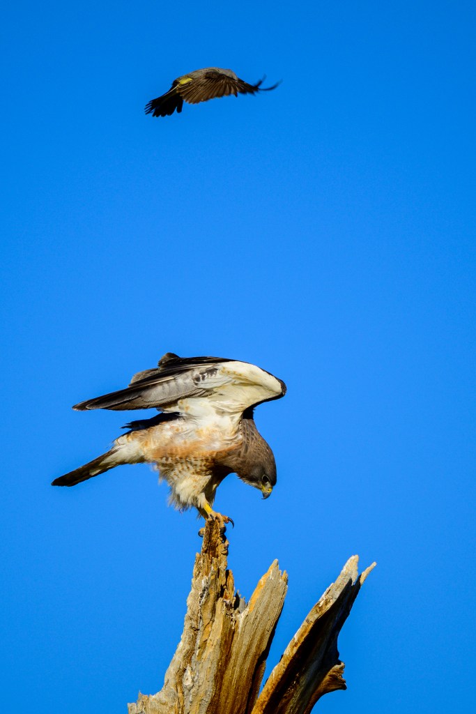
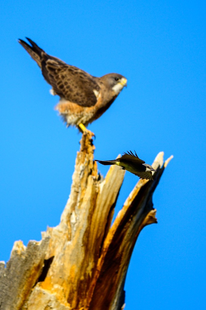
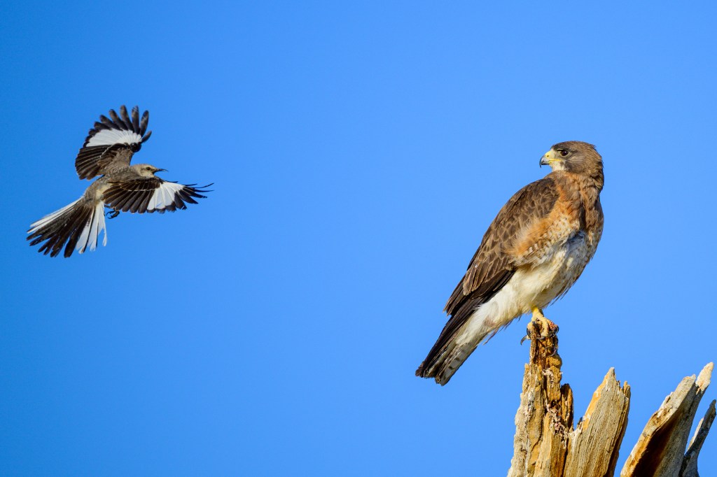
HARRASSMENT
I have described Red-tails as avian bullies. But what goes around, comes around. Blackbirds, crows, and ravens often harass and attack Red-tails. See the evidence below.
FEEDING
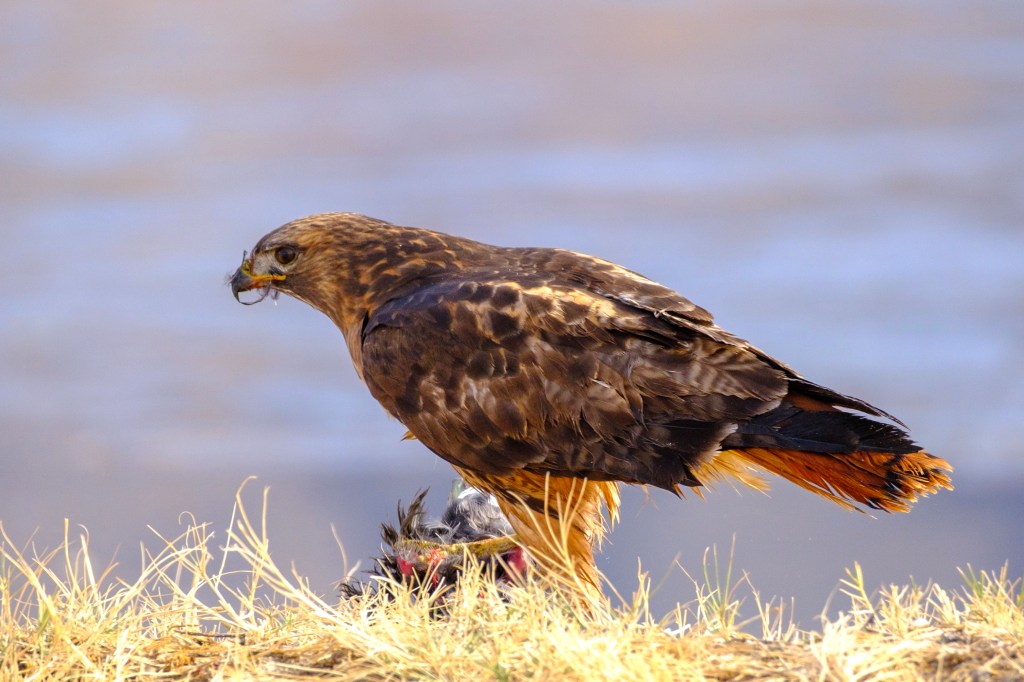
In December of 2021 I was walking around the Buckley Ponds. As I came around a bend, I surprised a Snow Goose. (And it surprised me.) It took off and circled behind me. An hour later I came near the same spot and discovered that a Bald Eagle had killed and eaten the Goose. The pond ice was covered in white feathers and blood. After the Eagle was sated, a Red-tail seized some of the Goose, which you can see in the bloody foot.
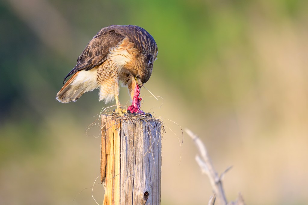
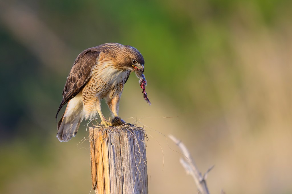
At the Conservation Open Space Area, a Red-tail snatched up a rodent and devoured it on a fence post. In the second photo the bird has a big chunk of mouse — it choked down that entire piece. Birds have no teeth and they can’t use utensils. Other birds may try to snatch away any food. So being able to gobble a meal is a useful tactic. This is eating to live, not living to eat.
The Red-tail below is clutching a critter.
A juvenile Red-tail below dined on a Desert Cottontail along Ed Powers Road.
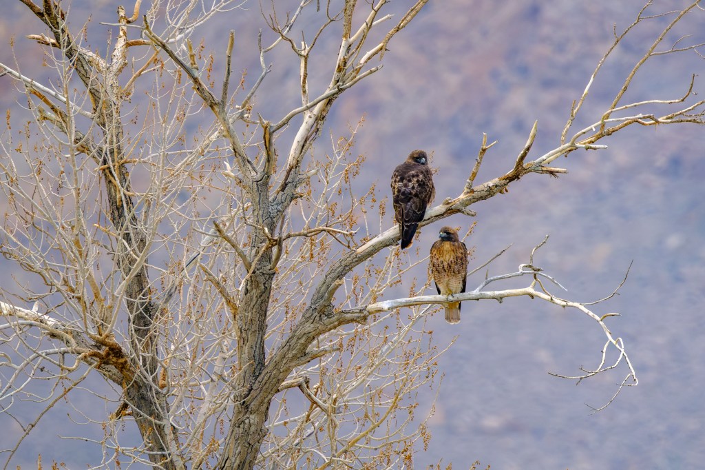
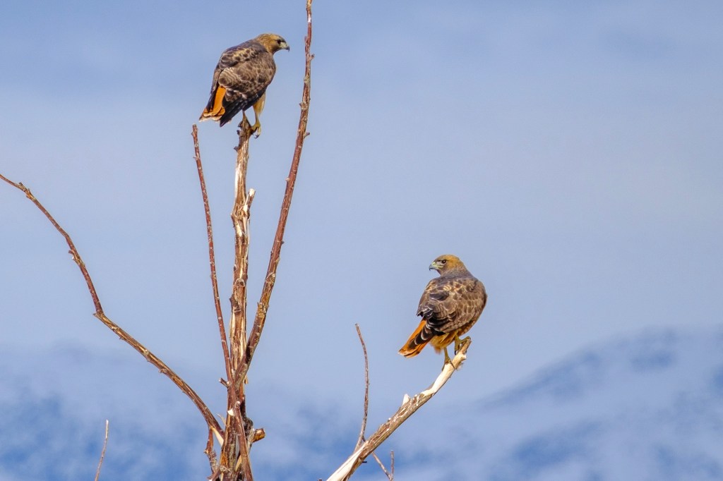
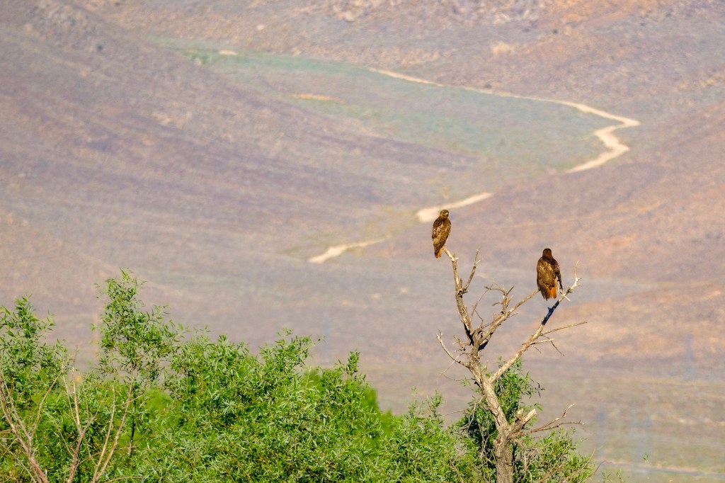
PAIRS
Red-tails often appear in pairs, both on perches and in flight. Mating pairs hang out, as well as siblings.
WHAT’S IN A NAME?
In my blogs, I’ve griped about some names applied to birds; for example, it annoys me that Bewick’s Wren is named for an Englishman who never saw this bird. In the case of the Red-tailed Hawk, the English name seems fitting. But the scientific name, Buteo jamaicensis, seems silly. Red-tails live from Canada to Mexico, Florida to Oregon. I love Bob Marley’s music, but calling this bird the Jamaican Hawk says nothing about this bird. The name arose because of how Europeans named birds two centuries ago. John Latham, an English physician and ornithologist, received a dead specimen of this raptor from a friend in Jamaica and published a description in 1781. In 1788, German naturalist Johann Friedrich Gmelin used Latham’s description in an edition of Carl Linnaeus’s book, and called the bird Falco jamaicensis. Later, the bird was reclassified from falcon to hawk.
INSULTS
In this post I called Red-tails bullies and thugs. I used disparaging words to add humor. But my insults are unfair to Red-tails. We should not describe birds as good or bad as if they were human. A century ago, hawks were called cruel and malevolent. They were slaughtered because they sometimes ate songbirds or chickens. States paid bounties for dead hawks. These attitudes and policies were misguided. Whether we believe God or evolution created Hawks, we should not criticize them for what they kill and eat. They cannot select tofu as their protein option. They are carnivorous birds that act to ensure the survival of their species.
FINAL COMMENT
To create this post, I reviewed over 1700 Red-tail photos in my computer. But getting a bird photo is like fishing; you remember the one that got away. One winter I was walking along Airport Road, lost in thought. I happened to look up and realized a Red-tail was in the air, just ten feet off the ground and 30 feet away. The bird was “kiting,” hanging motionless in the wind. By the time I came to my senses and raised the camera, this close encounter was gone.
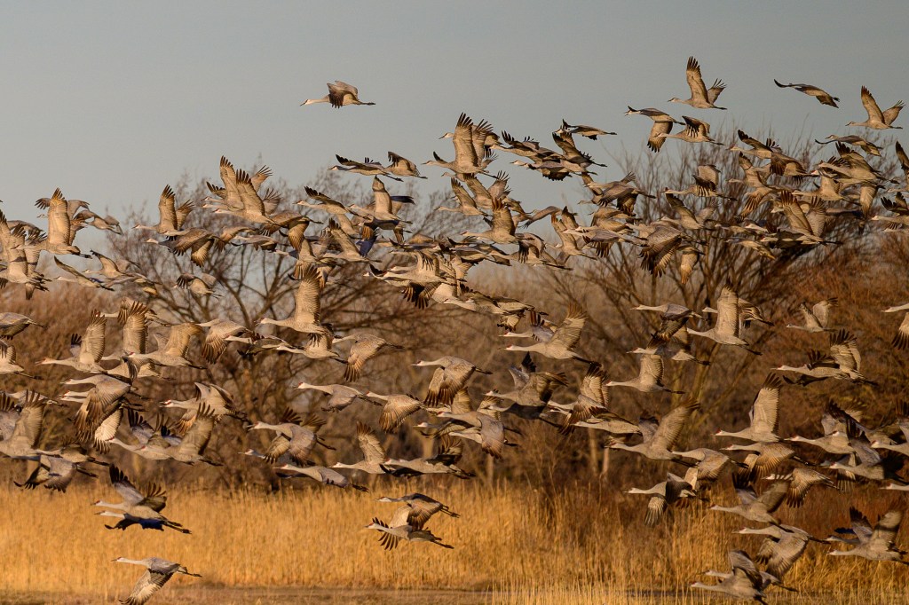
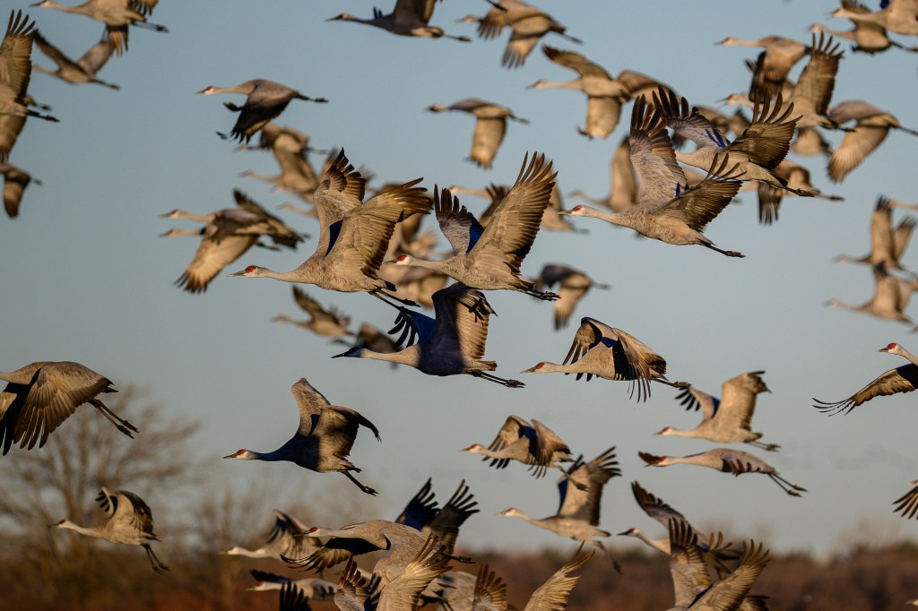
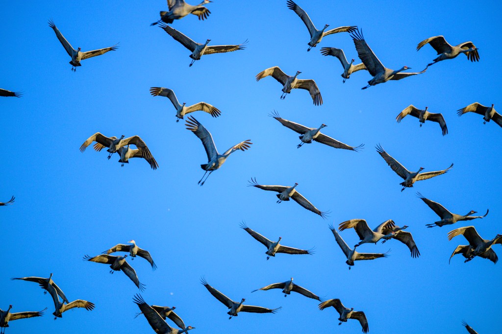
The answer is 5. East Africa has a famous migration of 1.5 million wildebeests and zebras. South Sudan hosts the Great Nile Migration of 6 million antelopes. Alaska is famous for the journeys of 200,000 caribou in the Porcupine Herd. And the Cornhusker State is on this list because half a million Sandhill Cranes use the Platte River as a stopover site for their migration in March.
Worldwide there are over a dozen species of crane. In the US we have two: the rare Whooping Crane and the Sandhill Crane. There are Sandhill Cranes in almost every state and they vary in their migratory habits. In Cuba, Florida, and Mississippi there are Sandhill Cranes that do not migrate. The Cranes in California’s Central Valley migrate to several areas in the Western States. There are other groupings: Eastern Flyway, Rocky Mountain, Lower Colorado, and Pacific Flyway.
The biggest Sandhill Crane group is the Mid-Continent population. This tribe spends the winter in Mexico, the Texas plains, the Gulf Coast, and at Bosque-del-Apache in New Mexico. In the early spring, these cranes fly north; by late spring they will reach the tundra of Canada, Alaska, and Siberia. In the far north they build nests, lay eggs, and raise their chicks. Then the parents and juveniles fly back south in the fall.
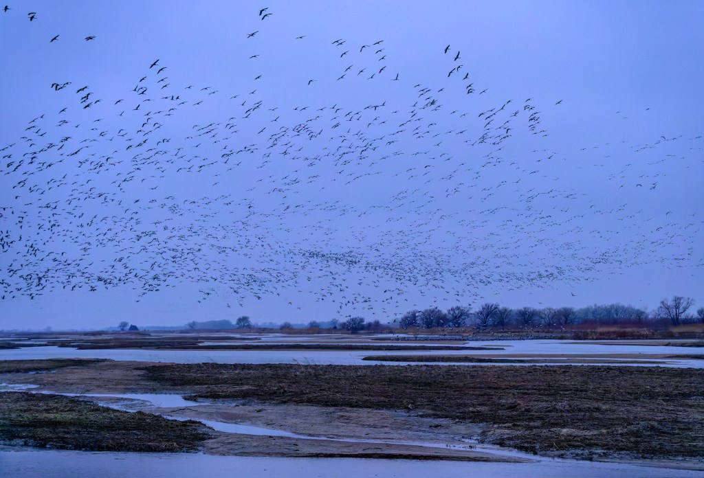
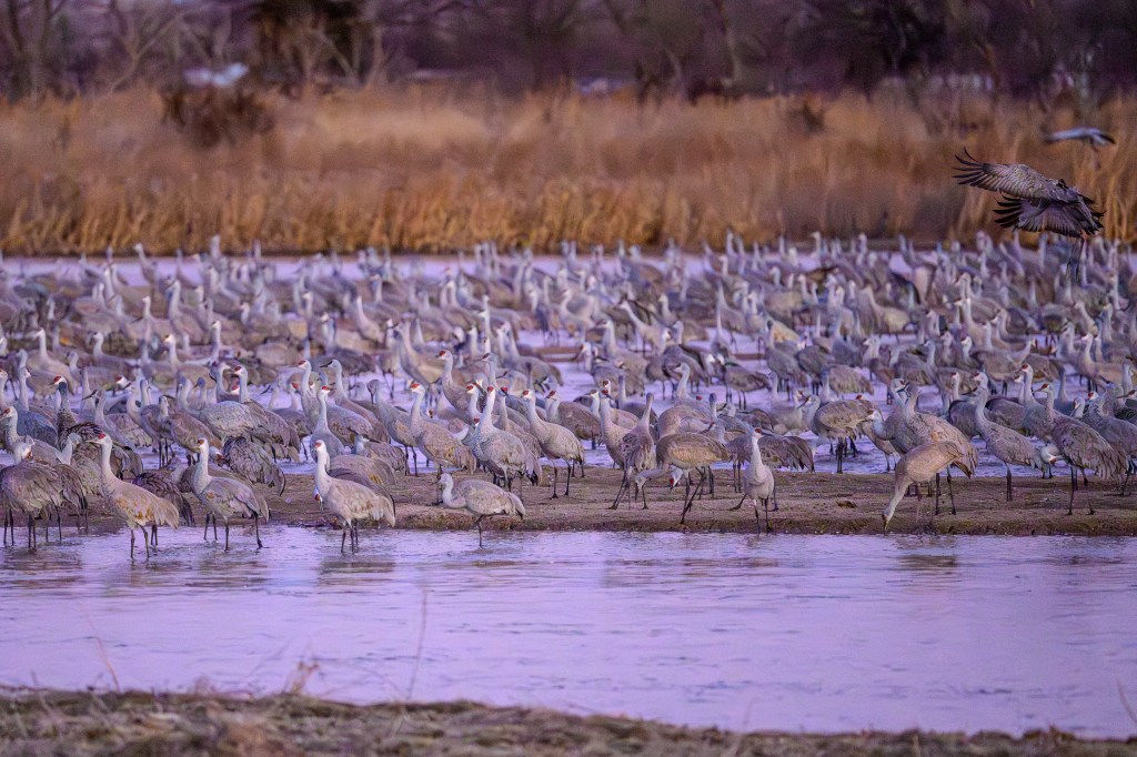
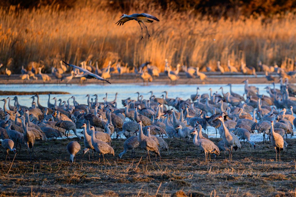
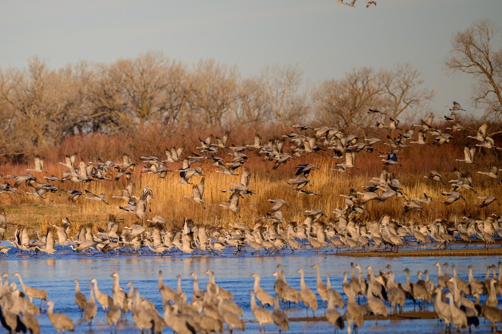
During the spring migration, birds roost for a month in March on a 70-mile stretch of the Platte River in central Nebraska. During this stopover, they add 15% to their body weight and then continue north. Most of central Nebraska is called the Sandhills — sand dunes stabilized by prairie grasses. The cranes are named for this area. The birds spend the nights on open sandbars in the Platte River, away from vegetation that could conceal a predator. During the day they feed in fields and wetlands. Sandhill Cranes have used this migration route and feeding area for thousands of years. During the last two centuries, European immigrants introduced modern agriculture and cranes adapted to eat in fields of alfalfa and unplowed corn stubble.
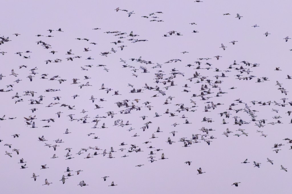
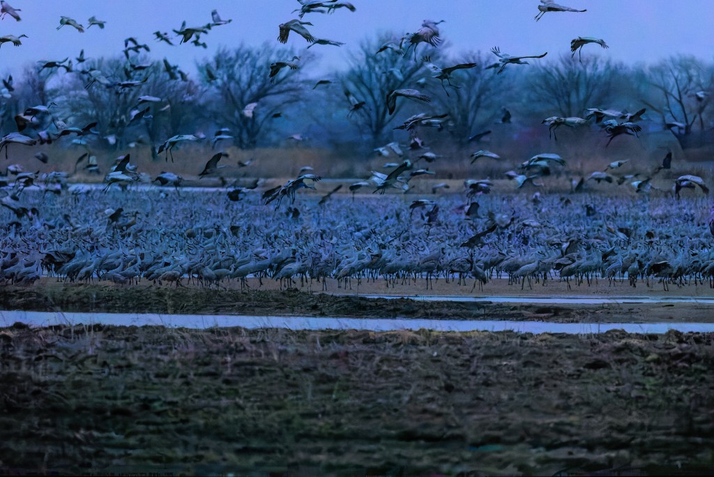
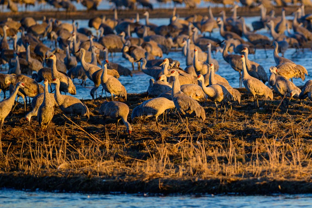
On a recent trip to see this migration, Roberta and I spent time at two crane sanctuaries near Kearney Nebraska. People told us that the number of migrating Cranes was half a million, or 700,000, or 1 million, or 1.5 million. According to Birds of the World, the Cornell Ornithology Lab website, the mid-Continent population was estimated as >=560,000 in a 1992 study and 356,742 in 2012. Whatever the true number, you can easily see thousands. We spent March 5 to 8 in Kearney and observed cranes from blinds in the morning and evening. I took over 16,000 photos (ridiculous, I admit) and have selected a few for this blog.
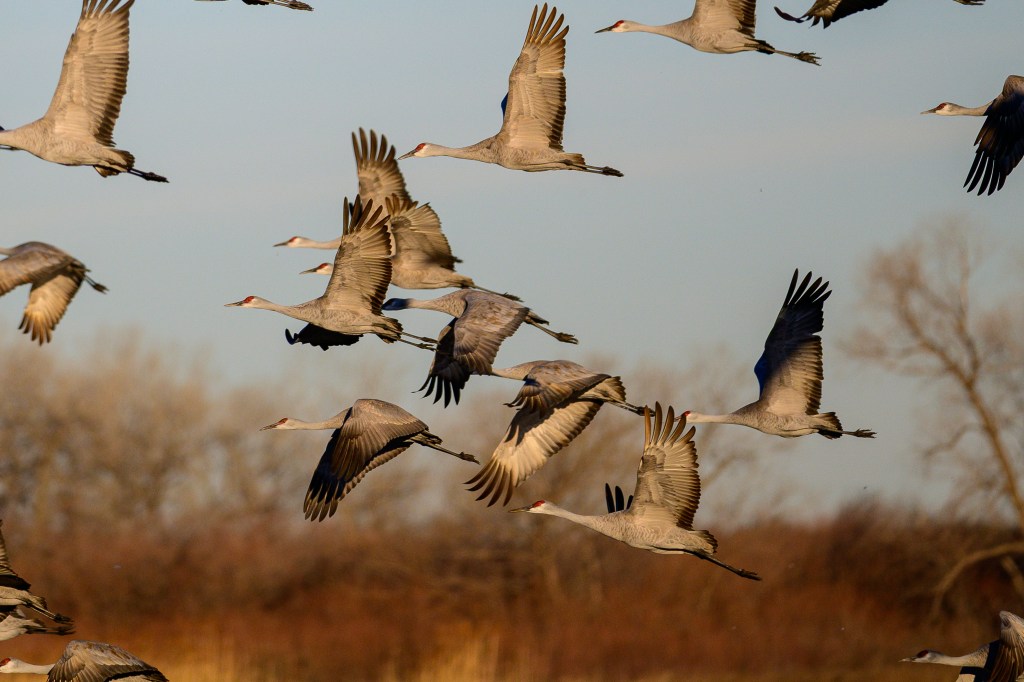
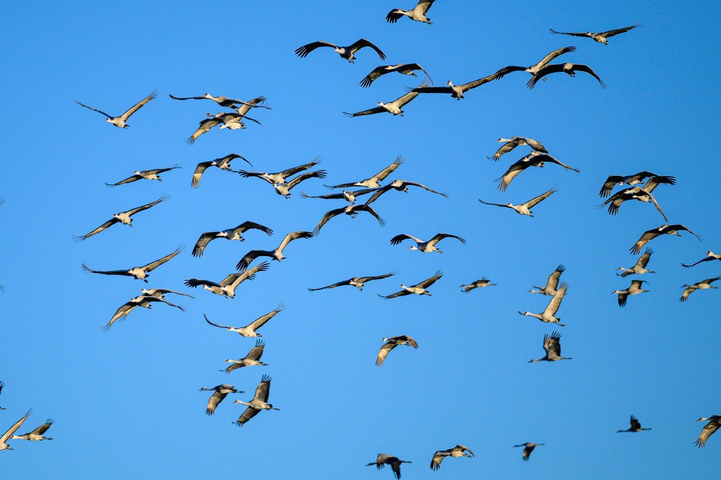
MARCH 6
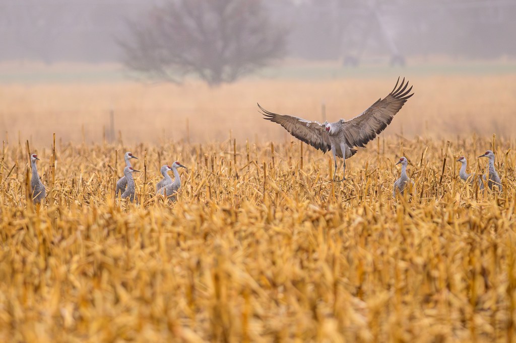
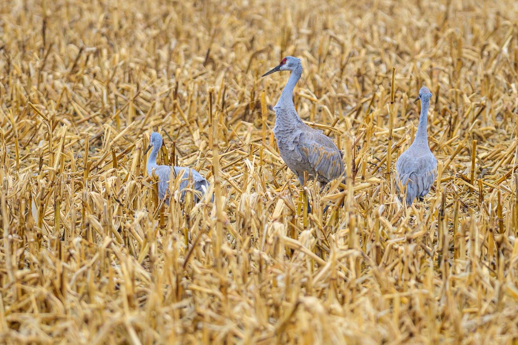
It was foggy that morning and I photographed Cranes in fields and corn stubble:
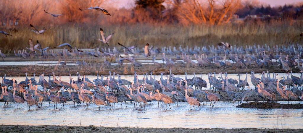
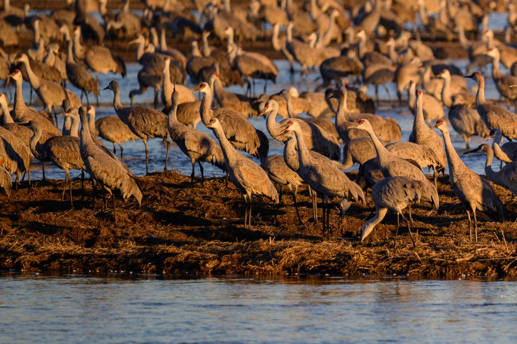
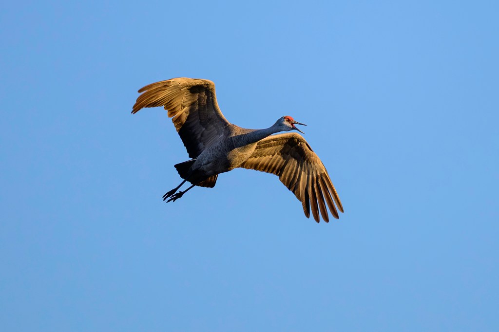
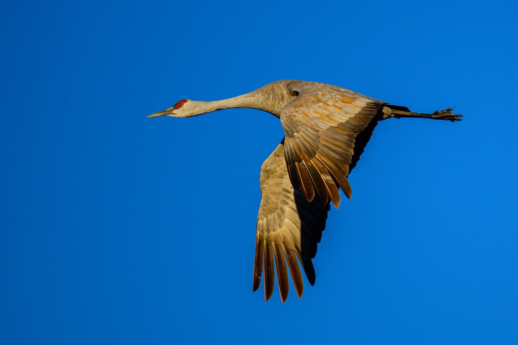
The photo below shows the plumage of a Sandhill. The red forehead is bare skin, eyes are yellow, the grey feathers of the “bustle” have brown stains.
Two centuries ago the Platte would flood each spring, ripping out trees and plants and creating ideal locations for the Cranes to congregate for the night. The name “Platte” is derived from French and German words that mean flat or plate-like. It used to be said that the river was a mile wide and an inch deep. Most of the river has now been diverted to irrigation and the floods are reduced; now sanctuaries use bulldozers to clear land for the Cranes.
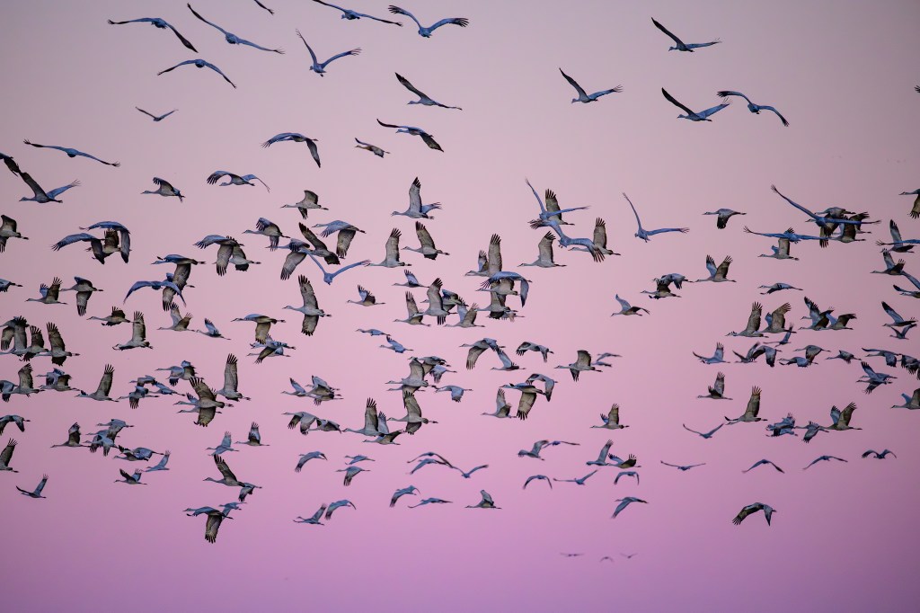
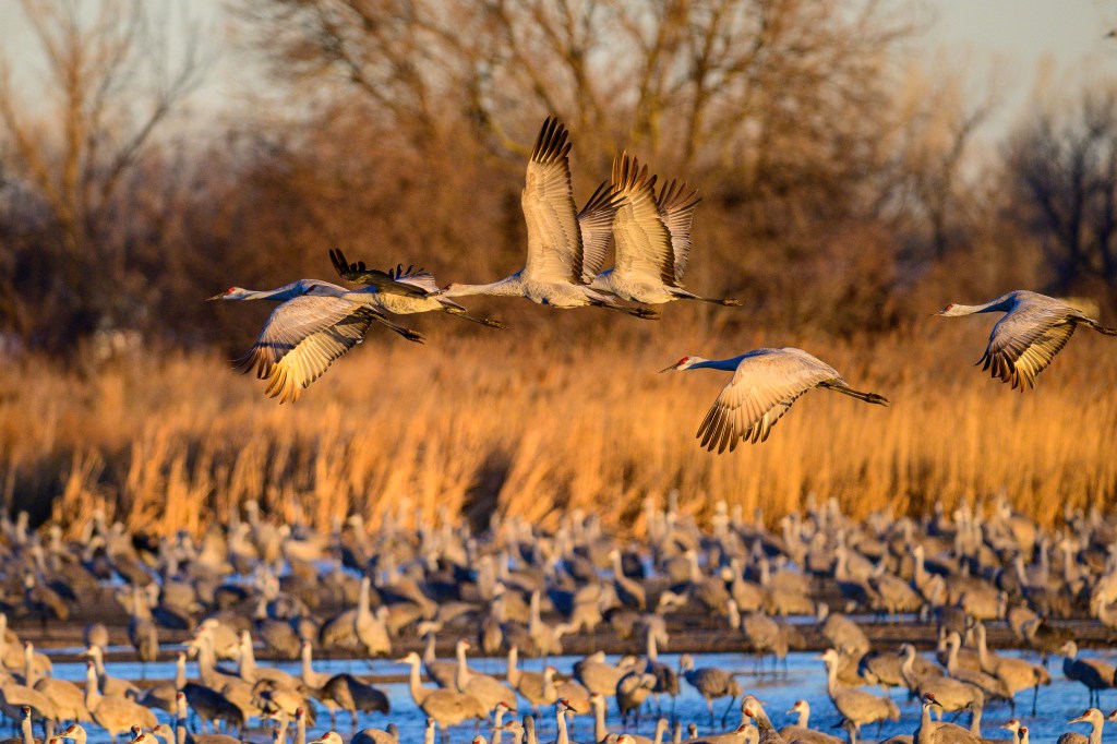
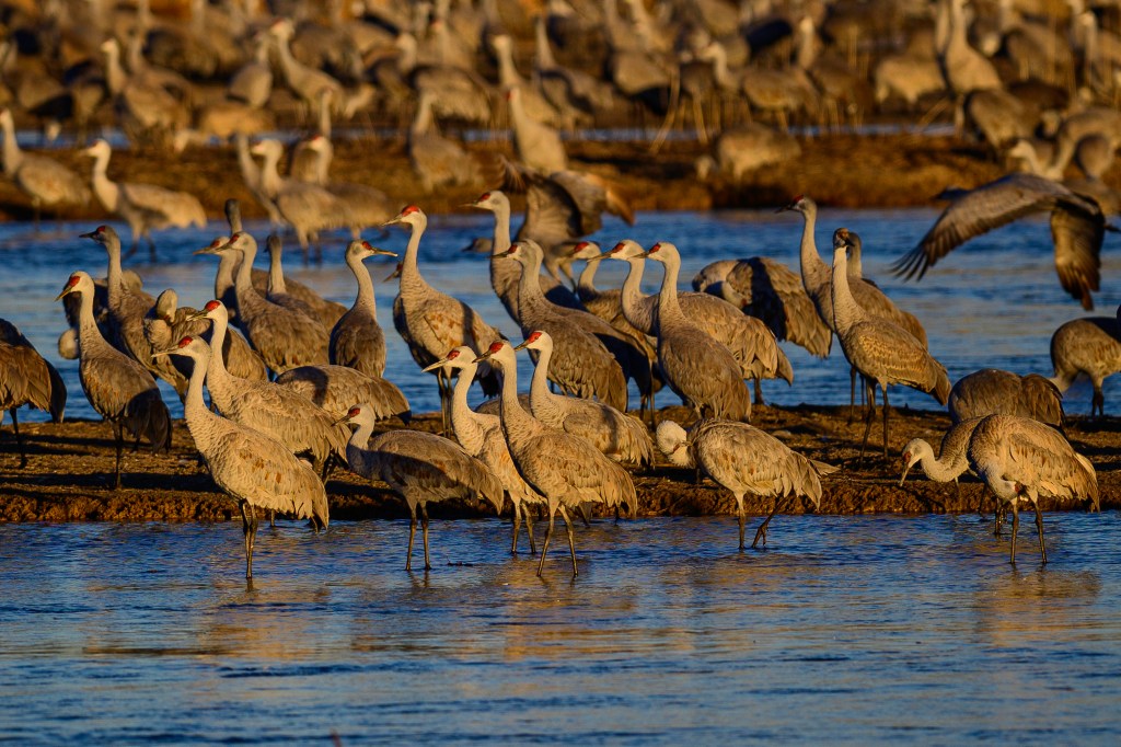
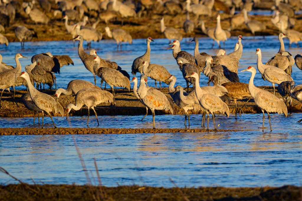
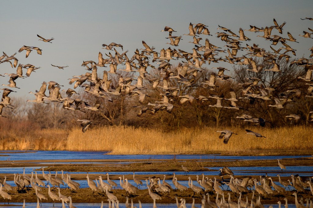
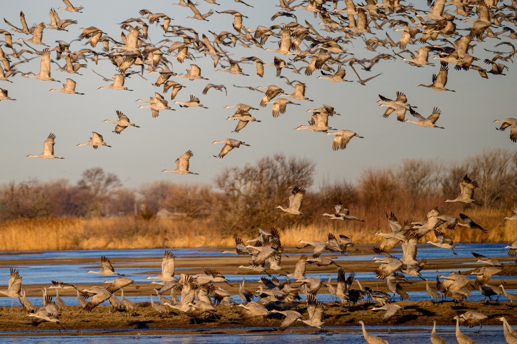
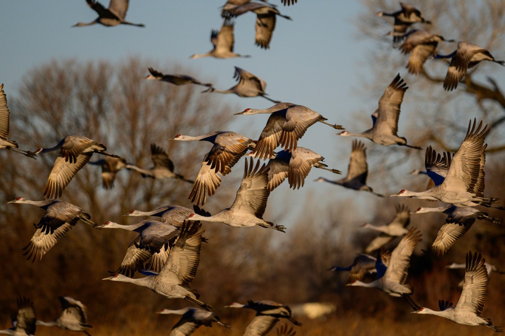
In the evening, we entered a blind at the Rowe Sanctuary. As the light faded, hundreds, then thousands of birds landed on sandbars in front of us.
MARCH 7
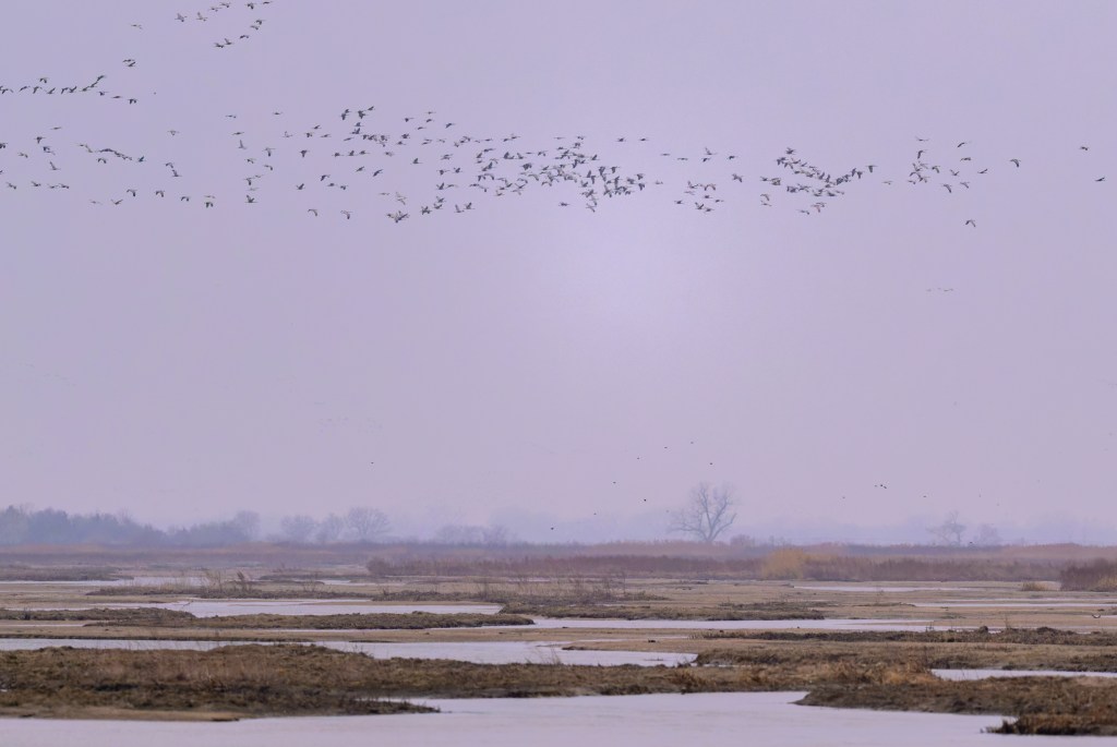
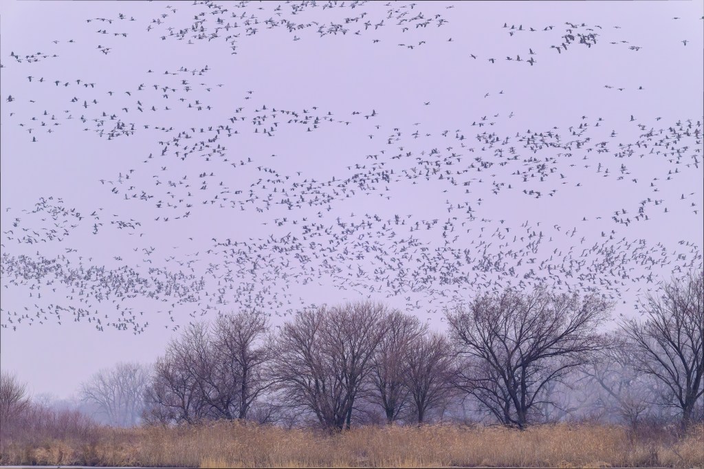
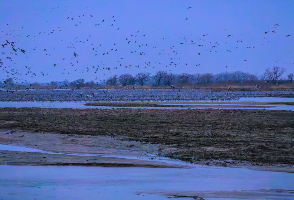
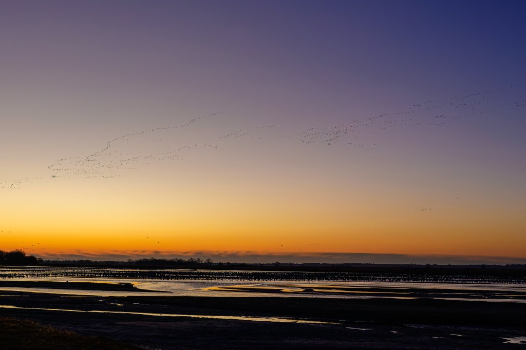
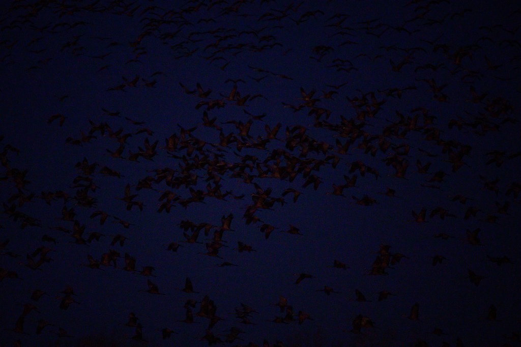
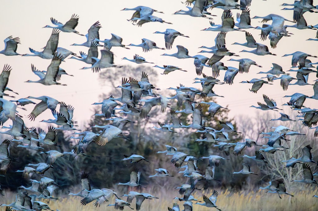
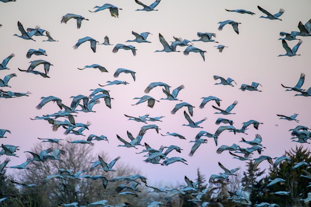
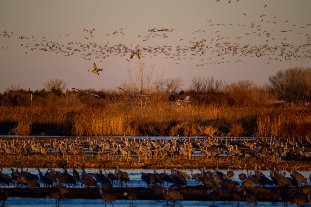
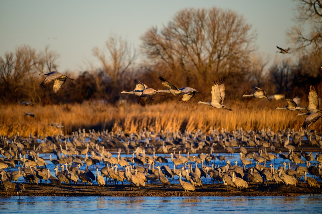
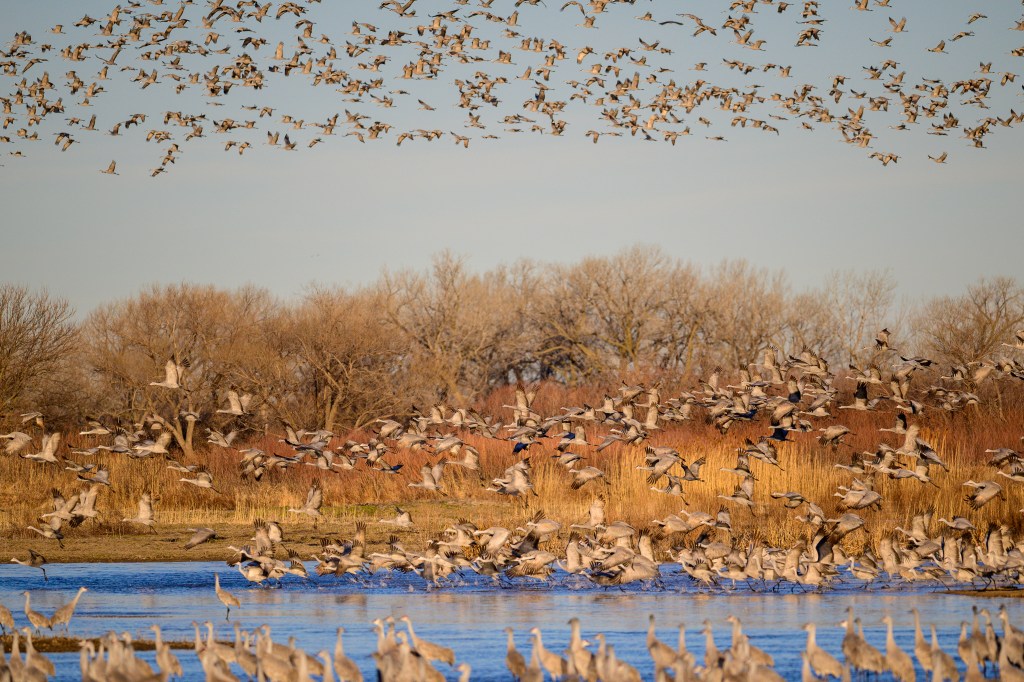
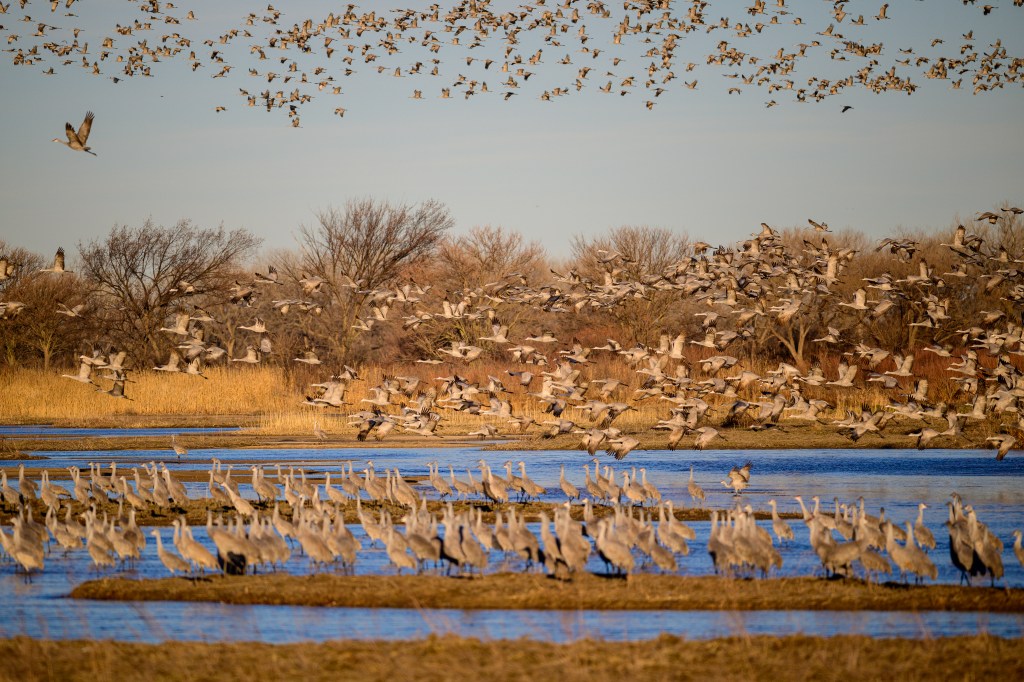
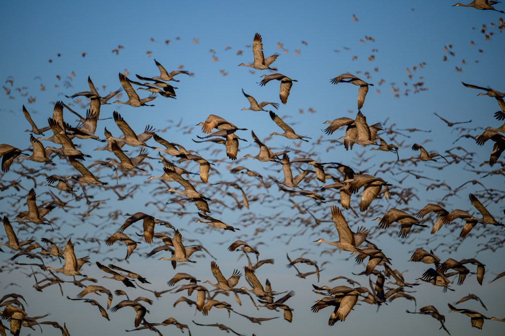
We got up at 3:30 am and drove to a blind at the Crane Trust. As the sun rose we could see hundreds (maybe thousands?) of Cranes on the river. The long lines of birds in the sky may be Cranes, but some could be Snow Geese, which also migrate through this area.
Cranes waking up. How many are in this photo? Look at the birds on the near sandbar and those near the far shore. A thousand?
Early light reached some Cranes in the air:
Later in the day we watched Cranes landing in corn fields:
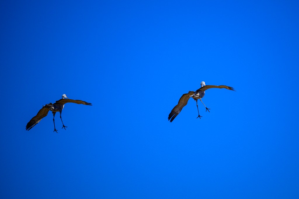
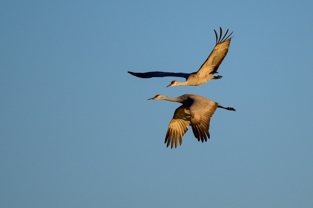
Two Cranes start their approach to land:
NOISE AND DENOISE
In Nebraska we used blinds to observe Cranes. The blinds are large buildings that can conceal 40 people from the birds. In the evening, we entered the blinds before the birds roosted, then watched them arrive. We left in the dark. In the morning, we entered well before sunrise, then shivered as it grew light. The dark-adapted eyes of a human can see much better than a camera set up to photograph birds. I took thousands of photos in an attempt to capture birds in the dark; most images were worthless. In this section, I’ll discuss “noise,” a problem for low-light photography. Feel free to skip ahead to the next photo if technical details about cameras are not your thing.
My Nikon Z8 has a full-frame sensor with 45.7 million pixels. Each pixel is a tiny, square-shaped electronic spot, or “photosite,” that can measure light intensity. Each pixel has a width and height of 4.34 micrometers. For comparison, a human hair has a width of 50 to 100 micrometers. Think of a pixel as a bucket that collects photons of light and turns them into a certain number of electrons. If I leave my lens cap on and take a picture, an ideal sensor would collect no photons and all the pixels would remain empty. If I take the lens cap off and take a picture, I want my camera to collect light photons so that there are some in every pixel, aside from those pointed at truly black (lightless) objects. But I don’t want any pixel buckets to be so full of photons that they cannot accept more; if a pixel is full to overflowing, then it contributes to a white area with no detail. Ideally, most pixels will be partly full and none overly full. This provides an image with lots of clear detail.
Two camera settings control how much light reaches each pixel. 1) Shutter speed. A slower shutter speed (meaning the shutter stays open longer) will let in more light. But a slow speed can blur the image due to camera movement or bird movement. For bird photography, I use a speed of 1/640 seconds for a perched bird or a bird on the ground. For a flying bird, I use 1/2000. Both these shutter speeds severely limit the light that reaches each pixel. 2) Aperture. The lens has an internal diaphragm which can open to let in more light or narrow to reduce the light. Because I use fast shutter speeds, I usually set the aperture to admit as much light as possible.
In a digital camera, there is another setting that can make an electronic image brighter. This is called “ISO.” ISO means “International Organization of Standardization.” This horrible acronym was invented in 1974 to merge two other horrible acronyms, ASA and DIN. If you search the web for information about ISO, you will often find two misleading myths:
Myth number 1: A website for Adobe says: “ISO controls the amount of light your camera lets in, and therefore how dark or light your photos will be.” Wrong. The number of photons that hits the sensor for a given camera and lens is determined by the shutter speed and the aperture. Changing only the ISO will not change how much light reaches the sensor.
Myth number 2: Google AI claims “ISO is a camera setting that determines the sensitivity of the sensor to light…” Wrong. The sensor’s sensitivity to light is determined by the sensor’s physical, chemical, and electronic characteristics. Those were determined in a factory and cannot be changed in your camera.
1. Modern sensors have a baseline ISO. The lower this number is, the better the sensor in terms of its ability to produce a detailed image in good lighting. My Nikon Z8 has a baseline of 64. Most good modern cameras have a setting of 100 or less. The actual size of this number is pretty meaningless, but in general, a sensor with a lower baseline is better.
2. If you change the ISO value of the camera, this boosts the image brightness. Imagine that I take a photo with shutter speed 1/1000, aperture f/4, and ISO 100. Now I take the same photo with the same shutter speed and aperture, but I change ISO to 200. The resulting second photo will look twice as bright compared with the first photo. The change of ISO from 100 to 200 has forced the camera to increase the brightness of the electronic image. Suppose a given pixel bucket collected light from 4 photons. By doubling the ISO value, you are telling the camera to make that pixel look as if it had collected light from 8 photons, doubling the brightness. If the original image was too dark, this forced brightening may be beneficial.
The ISO value of my camera can be adjusted up to 25,600. So the camera can multiply the brightness of a photo by 25600/64 = 400-fold! Great! I can now photograph in the dark, right? Nope; there is no free lunch here, because electronically boosting the brightness of an image will also boost the brightness of “noise.” Noise is the word used to describe tiny random specks of color in a digital image. Photos taken without sufficient lighting will often be ruined by noise.
A perfect camera sensor will record no photons in a completely dark room and the resulting image will be perfectly black. But sensors are not perfect. Pixel buckets are never completely empty of electrons. Due to physical properties of sensors, some pixels will have random electrons in their buckets, unrelated to any actual picture. Imagine that you have a sensor that collects a billion photons coming in from a scene. This imperfect sensor may already have random, artifactual electrons equivalent to 10 million photons in its pixel buckets; . Actual image photons (the signal) outnumber the noise photons by (1 billion)/(10 million) = 100 to 1. This large signal to noise ratio means that we won’t notice the effect of the random electrons in the image. But now imagine that we take the same photograph at night with the same shutter speed and aperture. The sensor now collects only 10 million photons, which is 1/100 th the previous number. We try to compensate for this by increasing the ISO by 100-fold; say from 100 to 10,000. This boosts the image brightness to be equal that of 100 x 10 million = 1 billion photons. But it also boosts the brightness of the random noise by 100-fold, so the signal to noise ratio is now (100 x 10 million)/(100 x 10 million) = 1. This means that random noise now contributes just as much information to the photo as the actual photons from the image. The result will look awful.
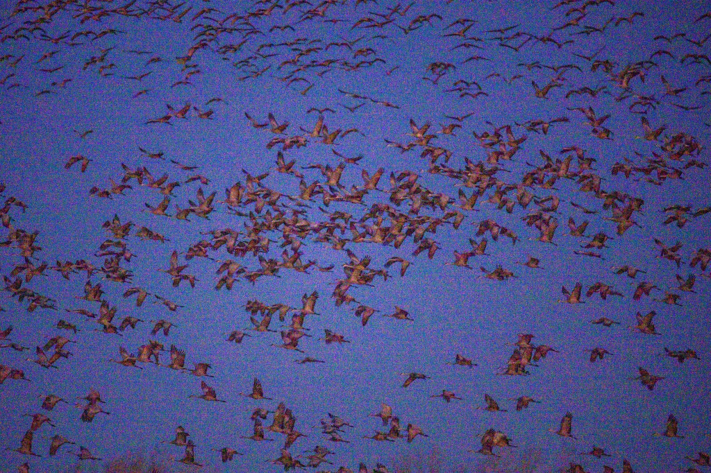
Below is a photo taken from a blind on March 8, well before sunrise. I was freezing and shivering, standing at an open window in 30 degree temperature in a building with no heat. My eyes were dark adapted, so I could see birds flying and standing about. I used a shutter speed of 1/1250 and the widest aperture opening of f/4.5. To get an image that was sufficiently bright, I allowed the camera to use an ISO value of 20,000. In the image below, you can vaguely make out blobs in the air.
On my computer, I used Lightroom software to further increase the image brightness from 0 to 2.75, which resulted in the picture you can see below. You can see little colored dots all over the sky and the birds. The image is a blurry mess of noise, which overwhelms the information provided by light photons from the actual scene. The signal to noise ratio is too low; very little signal from actual light, lots of noise created by random, unwanted electronics in the camera. So the high ISO value of 20,000, plus further brightness increases in my computer, produced a lousy picture.
I then tried to denoise the photo using software called DxO PureRaw 6. Seriously, “denoise” is a real word. The result is below. Not perfect, but much better.
The next 3 images were processed to denoise them. The image below had an ISO of 18,000 and I used the Denoise command in Lightroom software.
The next photo had an ISO of 7200 and looks pretty crisp after using Denoise.
The last shot in this series had an ISO of 5600. The detail in the feathers is impressive. Thanks to denoise in software, images that are degraded by noise can now be processed into useful photos.
Denoising an image is commonly called an AI (artificial intelligence) method. There is not much “intelligence” involved. The software does not “know” if the photo shows birds, cars, or coffee beans. It just uses algorithms to remove colored dots that were erroneously generated by the sensor. I suspect the software companies call this “AI” to sell more software. In fact the process is quite thoughtless, using computerized brute force algorithms. Compared with other photo editing commands, the process is slow; on my Mac Studio it takes about 15 seconds per photo.
AI can be used to alter or fabricate images. Photo contests understandably forbid photos that have been altered by “AI.” I agree that images should not be in contests if they were altered to make up things that were not in the original scene. But some contests forbid using denoise to process an image just because this is an “AI” method. That seems misguided to me. Denoise algorithms are intended to remove noise, an artifact that is introduced by the camera. The goal is to produce an image closer to the actual scene.
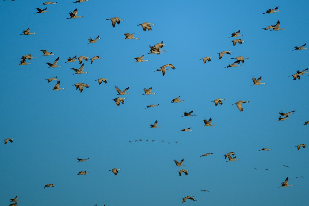
MARCH 8
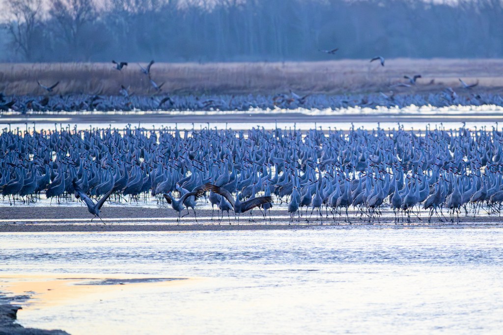
On March 8 I woke up at 4am (bird photography demands sacrifice) and drove to the Rowe Sanctuary. There was no fog and the birds were to the west, so the sun was coming up behind me, a favorable set-up for photography. I cut loose. I took three thousand pictures while it was still too dark, and then six thousand images with good lighting. There were thousands of Cranes in front of the blind, standing on sandbars in the shallow Platte River.
I was prepared to shiver on hard benches. I anticipated being bored for a while in the dark. I predicted hunger and the desire for hot coffee that was not there. I expected thousands of birds, which thankfully were there. But I was not prepared for the noise. Bird noise, not camera noise. I thought the Cranes would be quietly sleeping in the dark. Some were. But many were awake and emitting loud grunts, groans, gurgles, croaks, and clucks. A burbling cacophony. How could they sleep? If I was traveling with 500,000 friends, I would like my own private room, thank you. But I’m not a Crane. A Crane wants to survive the night and find food the next day. Other Cranes offer protection. The constant racket means that the sentries are awake and will call a warning if a bobcat approaches. The noise continues 24/7. Being a Sandhill means a social life with din that never stops.
TOP GUN
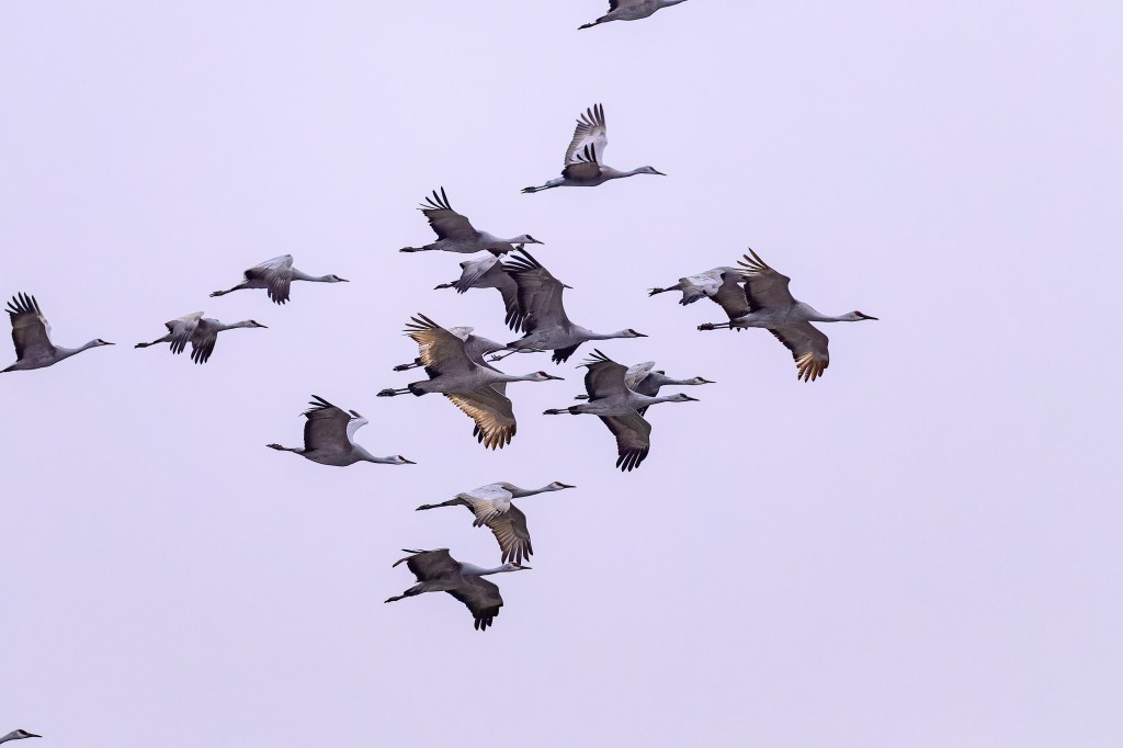
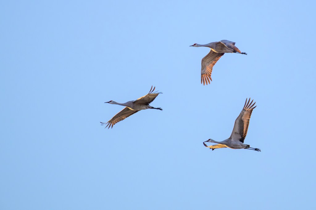
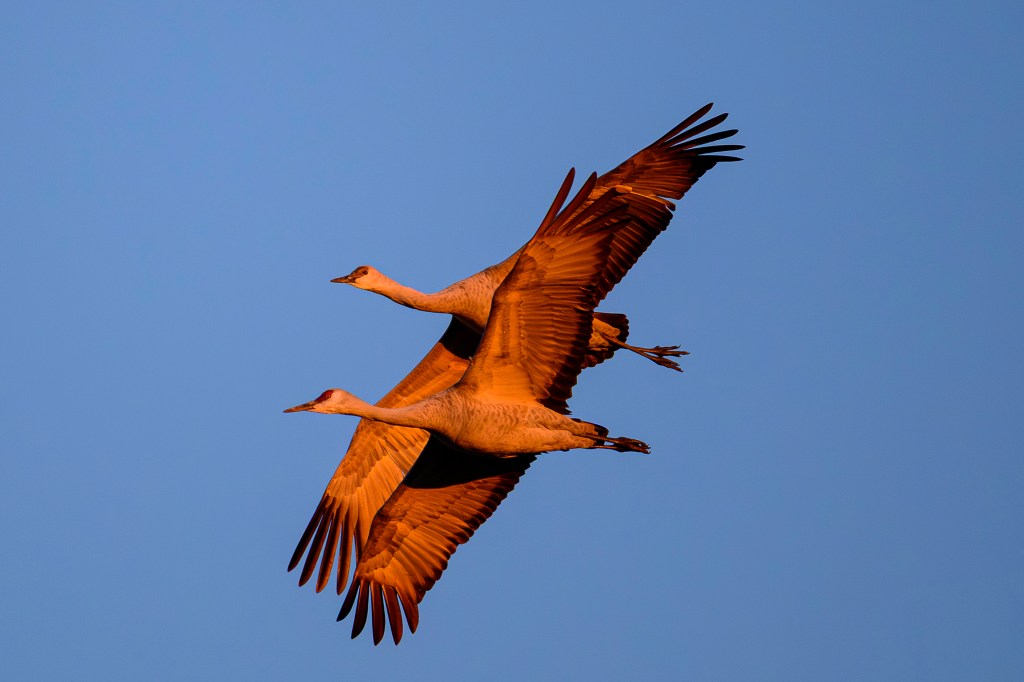
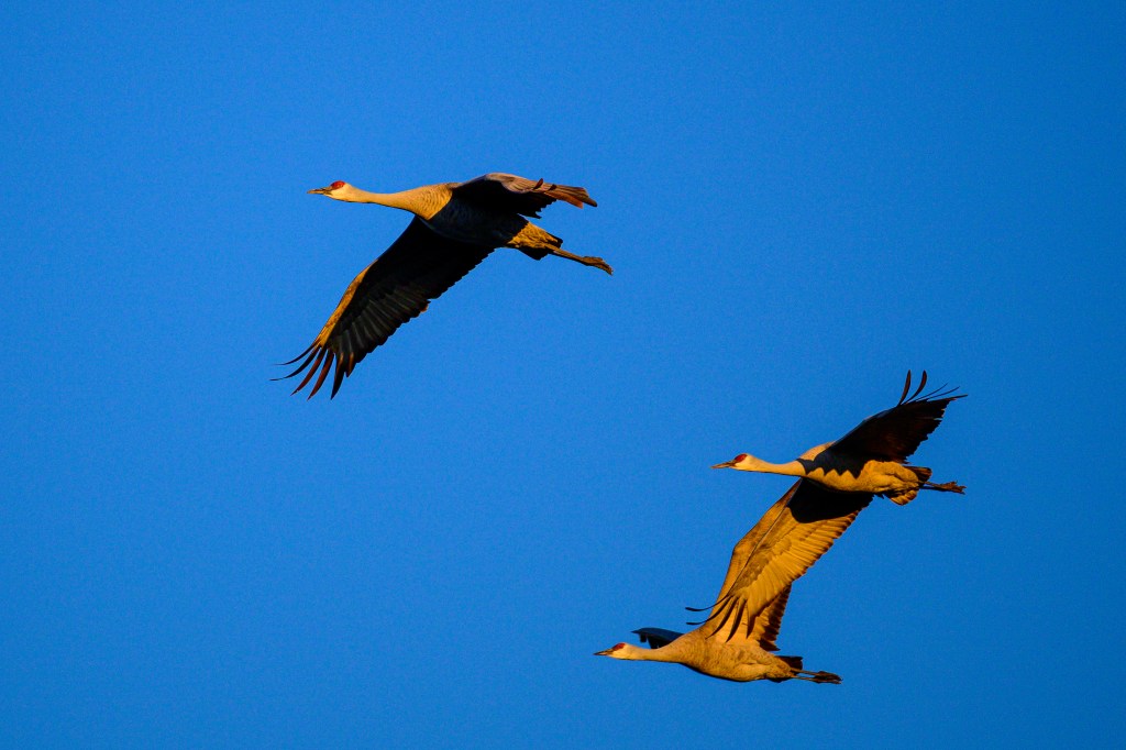
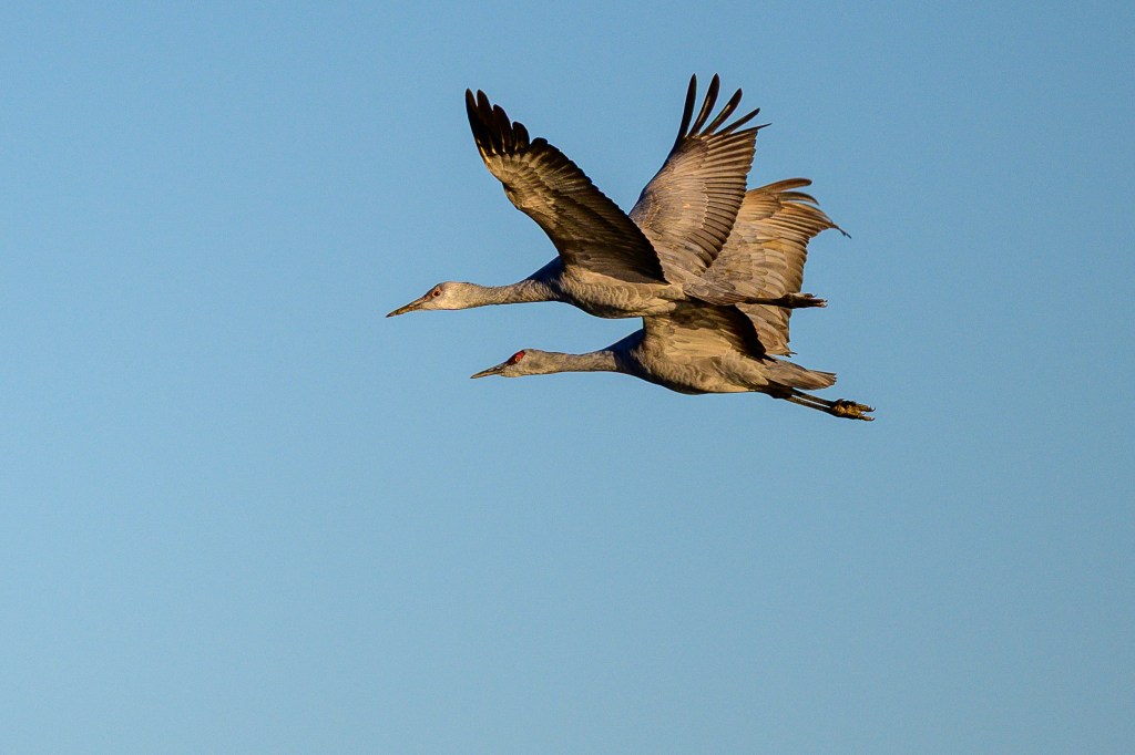
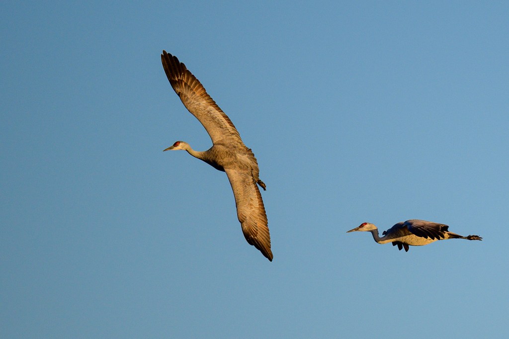
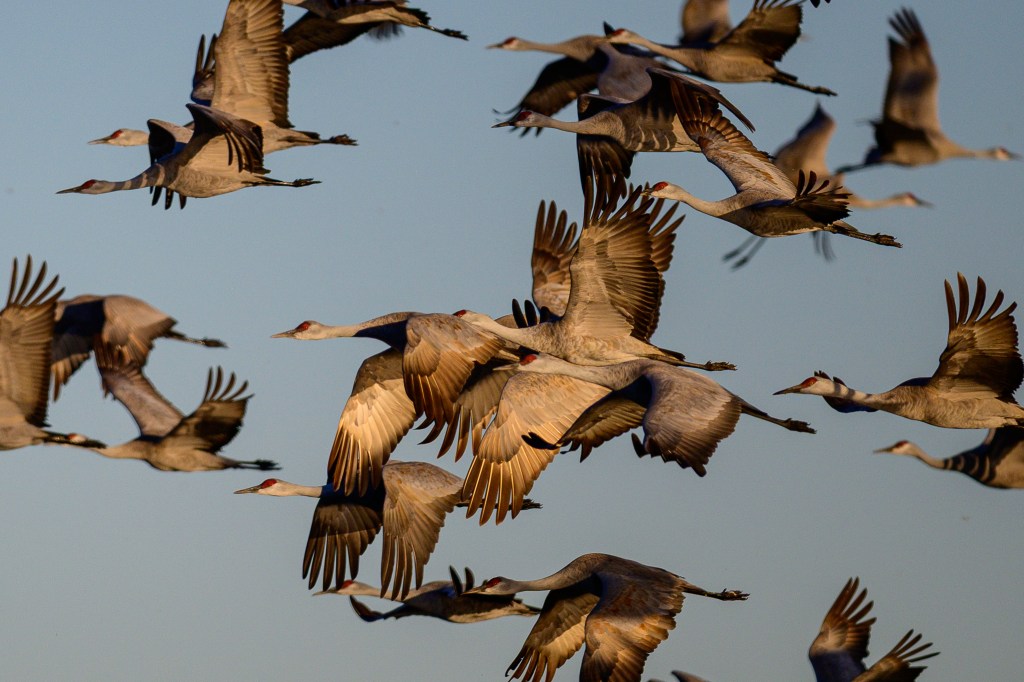
Thirty-one minutes into the 1986 movie Top Gun, Tom Cruise (aka Maverick) is in a training exercise. His F14A Tomcat is being hunted by instructor Lt. Commander Rick “Jester” Heatherly. As Jester is about to fire, Maverick jerks up the nose of his jet, slowing it and forcing Jester to pass him. Sandhills can do the same thing. In the first image, Sandhill A is leading and B is squawking a message, “Let me go first.”
Crane A flares its wings to slow down.
Crane A then drifts back at slower speed, while Crane B moves to the front.
Crane A then dives downward a bit, avoiding B and slowing further.
Finally, Crane A ends up behind Crane B. They both squawk “well done” and continue.
If you prefer, ignore my Top Gun analogy. What the photos show is what cyclists do when they change position in a paceline.
THE BIG LIFTOFF
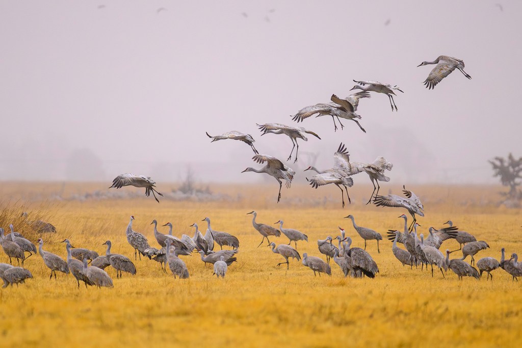
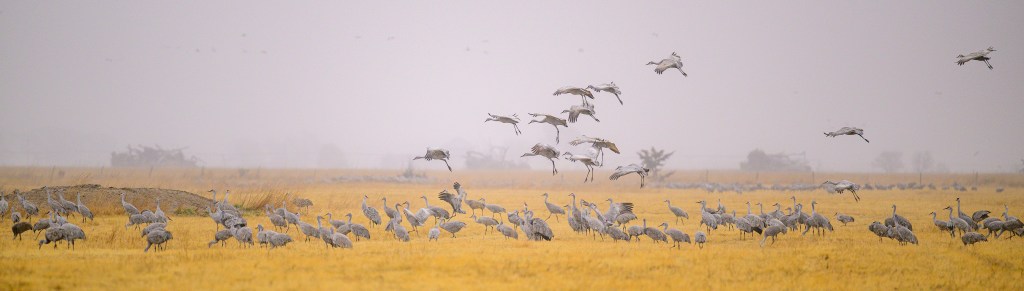
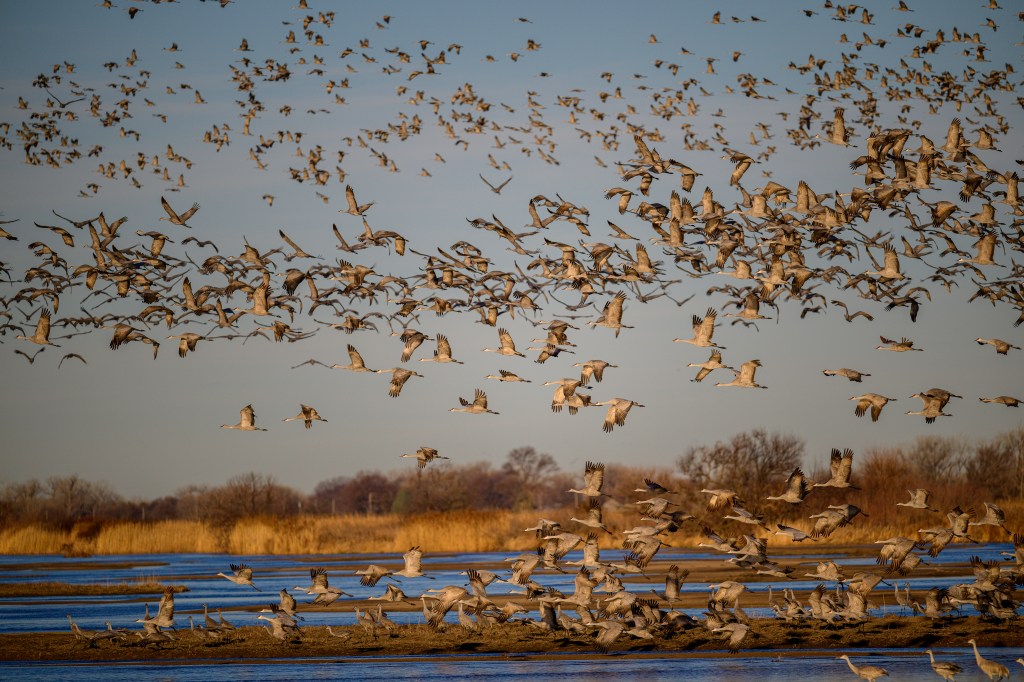
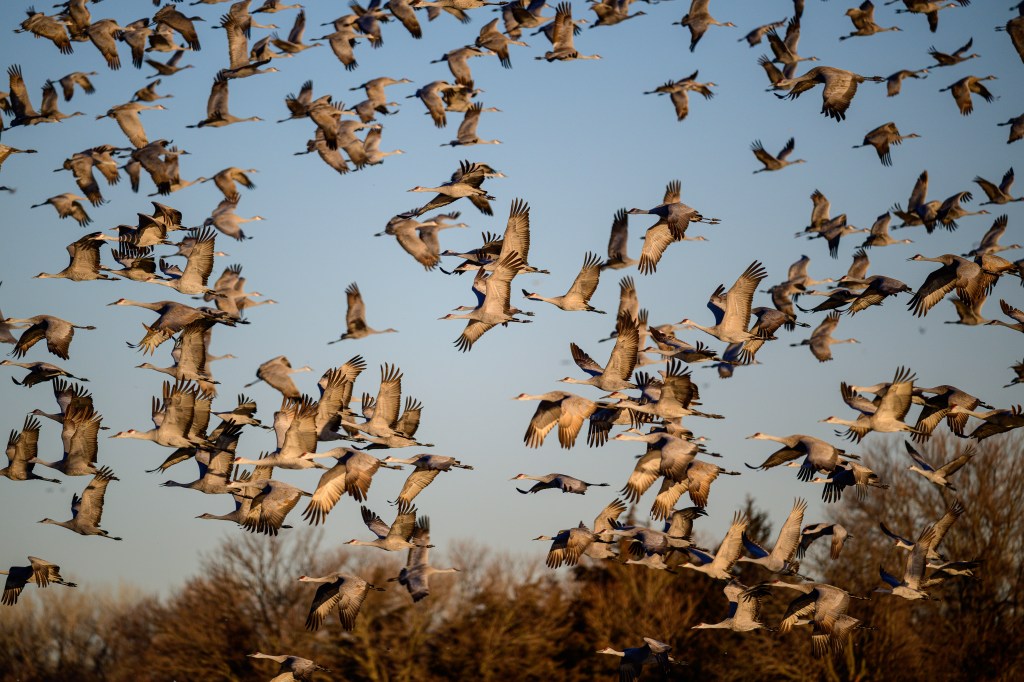
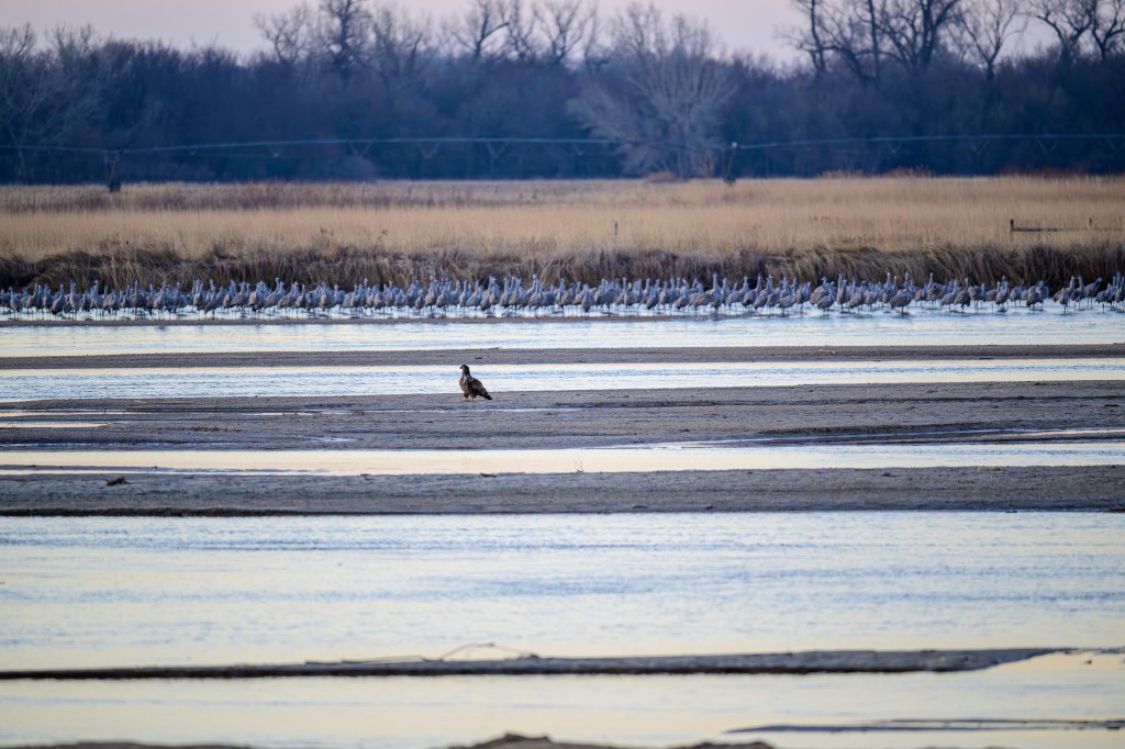
On March 8, at 8:44 am, half the cranes were airborne, looking for food or starting to migrate north. Suddenly, the remaining cranes took off; perhaps 2000 cranes over the space of a minute. The air filled with cranes. There was a slight breeze coming from our left, so the cranes ran in that direction, using the wind to help them lift off. The flapping of wings and cries of birds were deafening. Up to then we had been whispering to each other in the blind. Now we had to shout. In the first photo, you can see the cranes starting to run in the water; by the third picture they are in the air. Within a minute, there were cranes flying in all directions.
NOT CRANES
There are things in Nebraska aside from corn and Cranes. Below, a juvenile Bald Eagle stands by itself, probably causing anxiety for the Cranes.
Northern Pintails were common.
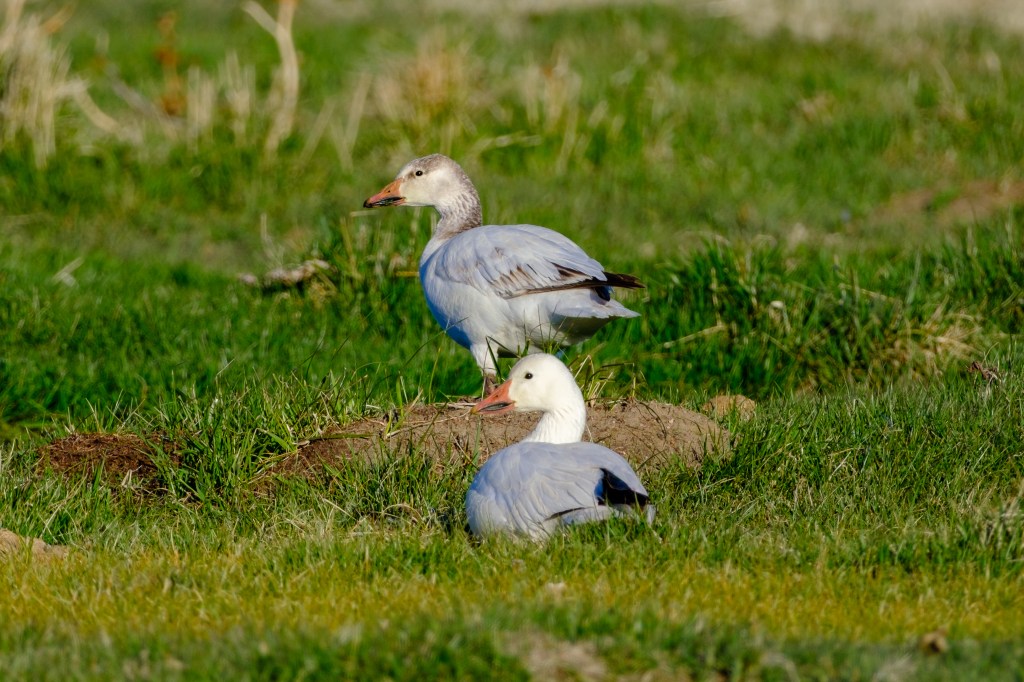
Below is a flock of Snow Geese.
More Snow Geese are in the photo below. Initially I thought the darker birds were Canada Geese or Greater White-fronted Geese, which often mingle with Snow Geese. But they are a dark morph of Snow Geese, called Blue Geese.
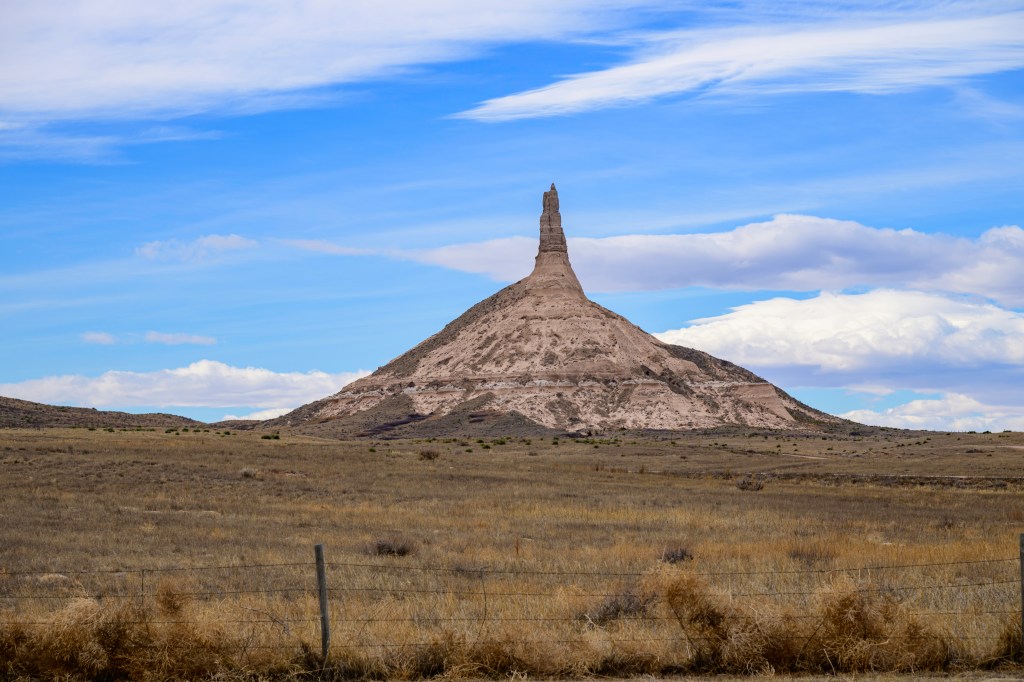
Chimney Rock, below, was a landmark on the Oregon Trail. It is now a national historic site.
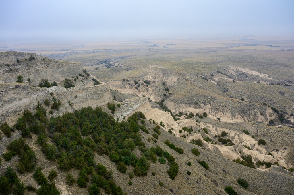
Below is a foggy view of badlands seen from Scotts Bluff in Scotts Bluff National Monument.
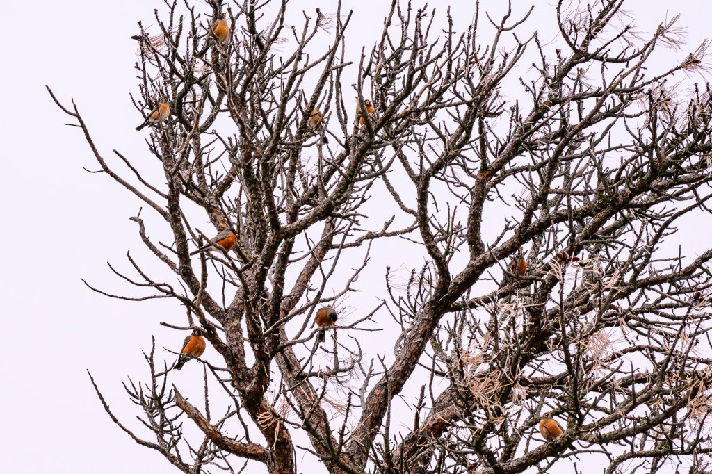
Nine American Robins are sitting in this tree on top of Scotts Bluff.
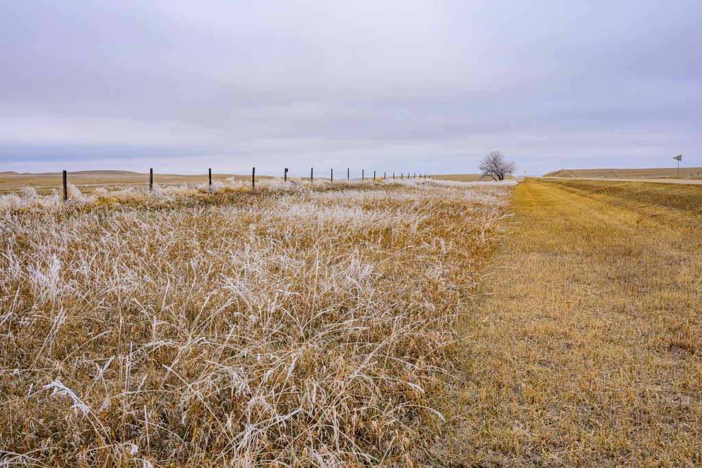
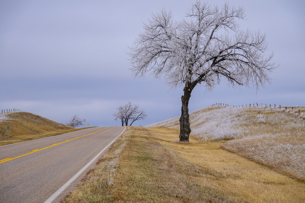
On Highway 29 we noticed white areas on both sides of the road and stopped to look. Freezing fog coated the longer grasses and trees. Areas that were mowed or grazed were mostly ice free. This all melted an hour later.
Four White-tailed Deer can be seen running across the valley of the Niobrara River, in Agate Fossil Beds National Monument. At 2pm we were visitors number 6 and 7 for the day. Come here to avoid crowds.
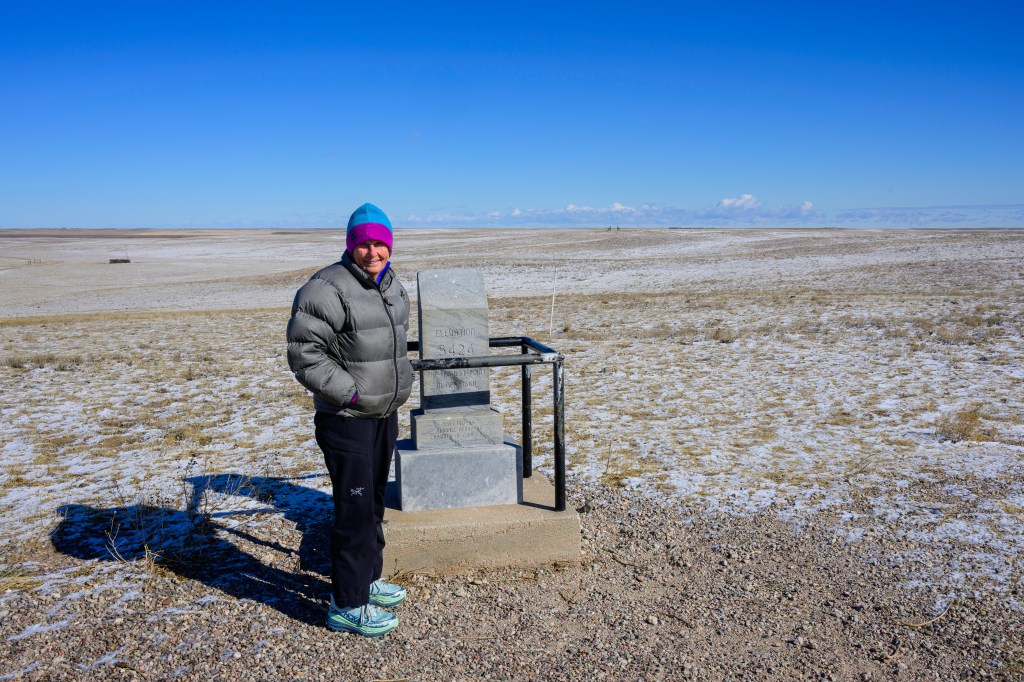
Below, a professional model posed at elevation marker 5424 feet, the high point of Nebraska. I have now been to the high point of 13 states. Roberta has been to eight. Please remember this, as this stuff is important. And yes, the white stuff is fresh snow.
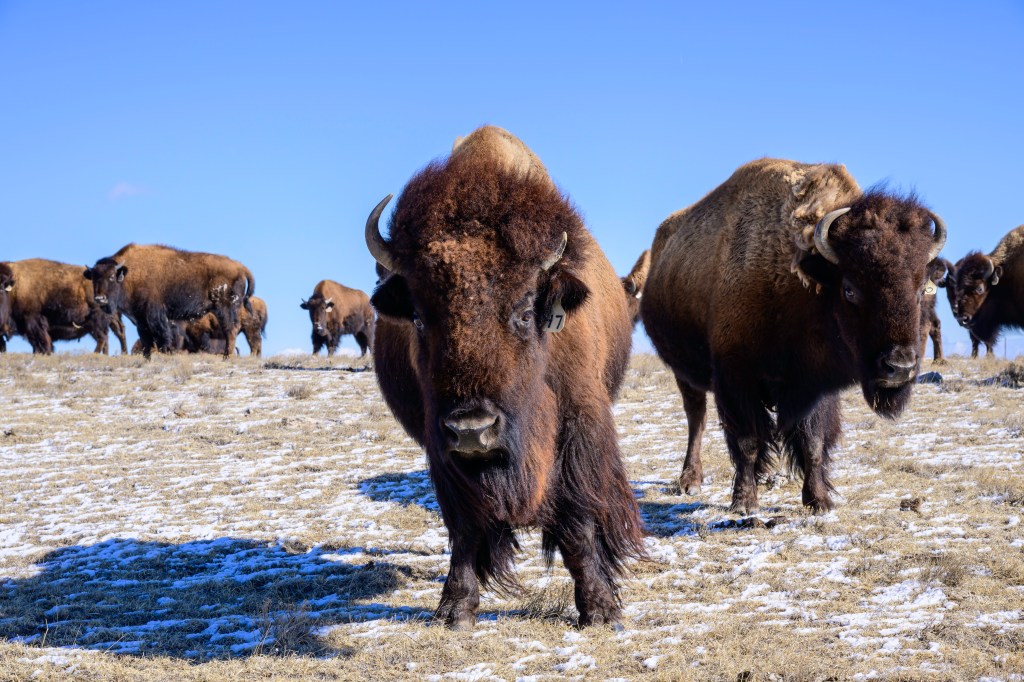
Nearby was a herd of domesticated Bison. Millions of these beasts used to prance across Nebraska; now they are raised to become burgers.
FINAL THOUGHTS
Earlier, I said that Sandhill Cranes spend the winter near the Gulf of Mexico and fly north to breed in the Artic during summer. My description implies Mexico, New Mexico, and Texas are their “home.” But this may have it backwards. Sandhill Cranes start life during the summer in the high artic. The tundra is a nesting area with a good food supply, few predators, and long summer days that allow parents to forage for their chicks. The artic is their home and the place they prefer above all others. In the fall, the approach of artic winter forces them to move south, a temporary displacement. In spring, they head back north to their preferred home, where millions of Cranes have been born and raised over thousands of years.
Seasonal migration is a strategy that allows birds to reuse a successful nesting location. This view of migration has been discussed by many authors. See Cavanagh P. How Birds Fly: The Science & Art of Avian Flight. Buffalo, NY: Firefly Books; 2024, p228, Winger BM, Auteri GG, Pegan TM, Weeks BC. A long winter for the Red Queen: rethinking the evolution of seasonal migration. Biological Reviews. 2019;94:737-752, and Sibley DA. The Sibley Guide to Bird Life and Behavior. New York: Knopf; 2001, p60.
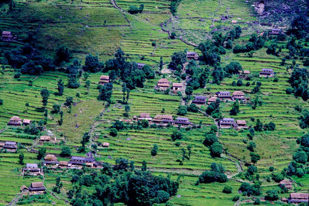
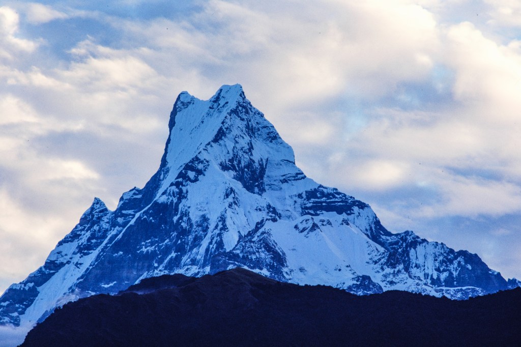
Nepal is shaped like a rectangle: 500 miles wide from west to east and 120 miles from north to south. The country covers the area where the Indian tectonic plate slides under the Eurasian plate. This collision pushes up the surface, forming the Himalayas. The northern third of Nepal borders Tibet and is covered by gigantic, glaciated peaks. The middle tier consists of ridges and valleys, with small villages and rice paddies, while the southern third meets lowlands and jungle in India. Only 14 peaks on Earth rise above 8000 meters (26,250 feet); 8 of these, including Everest, lie within Nepal or on its northern border with China.
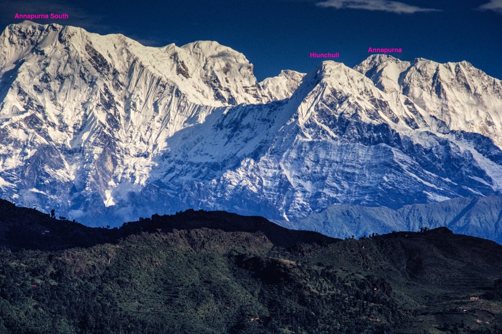
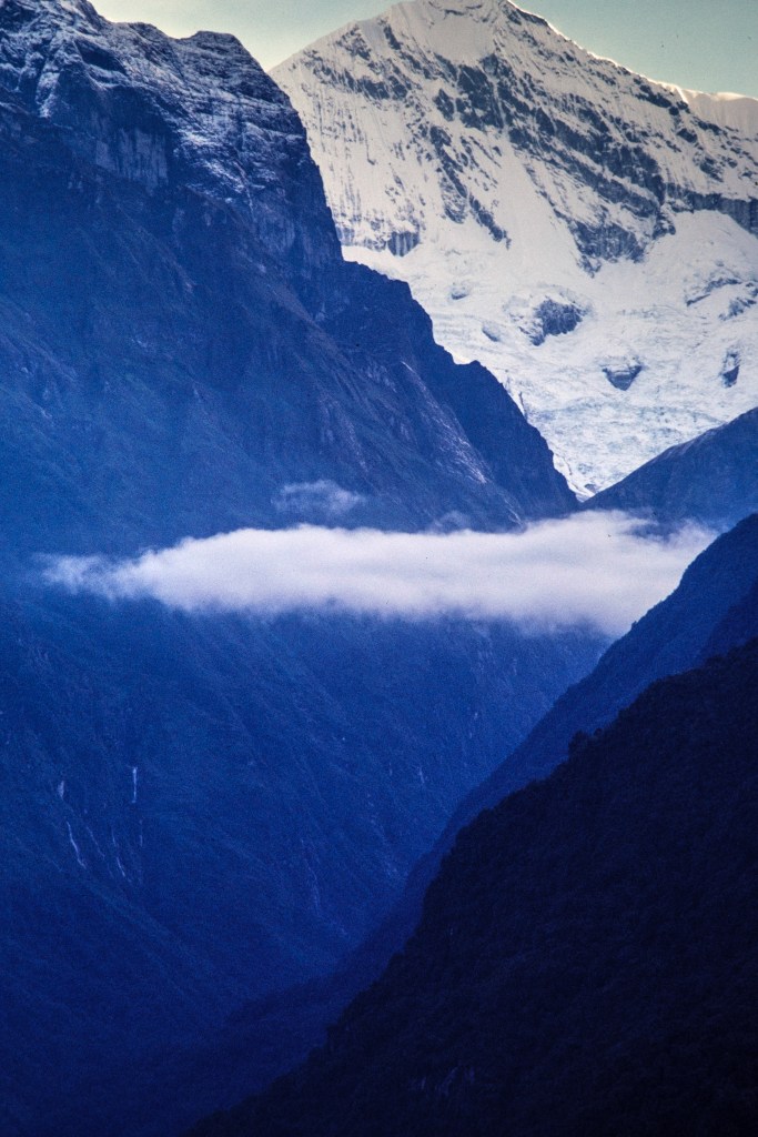
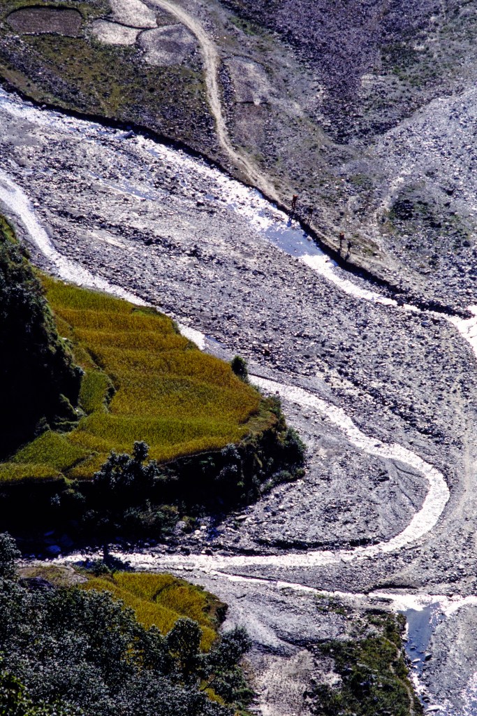
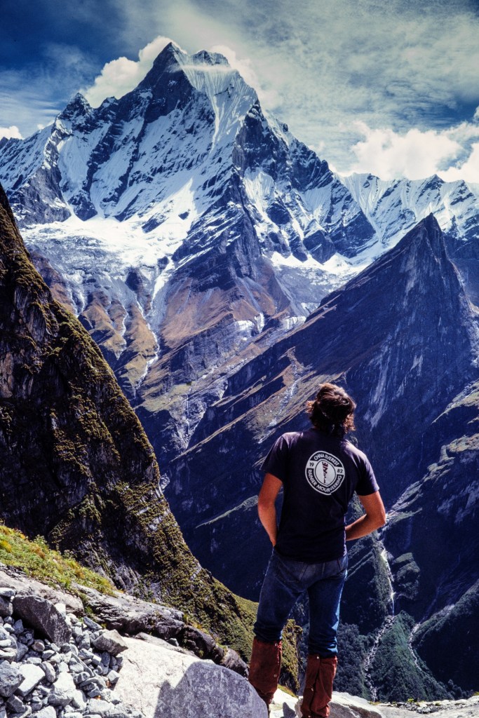
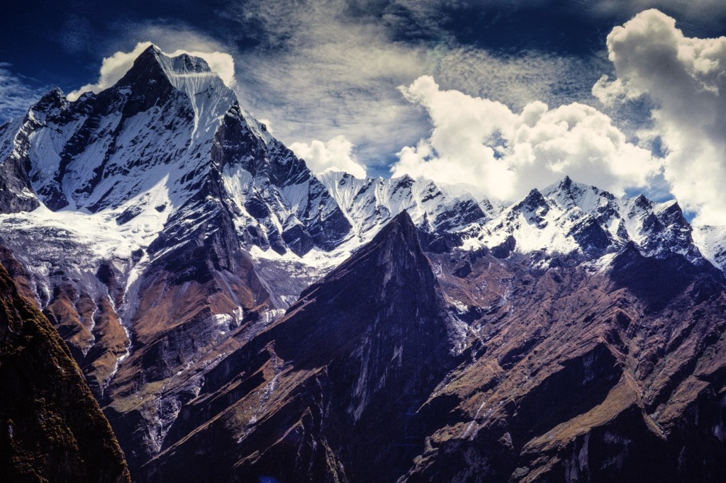
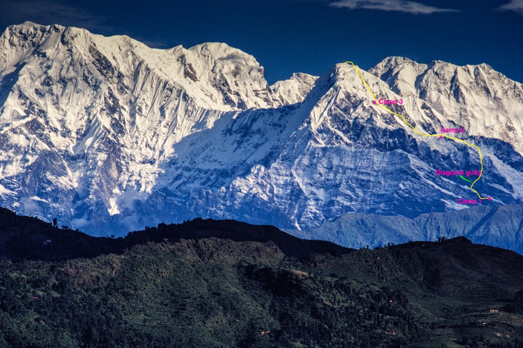
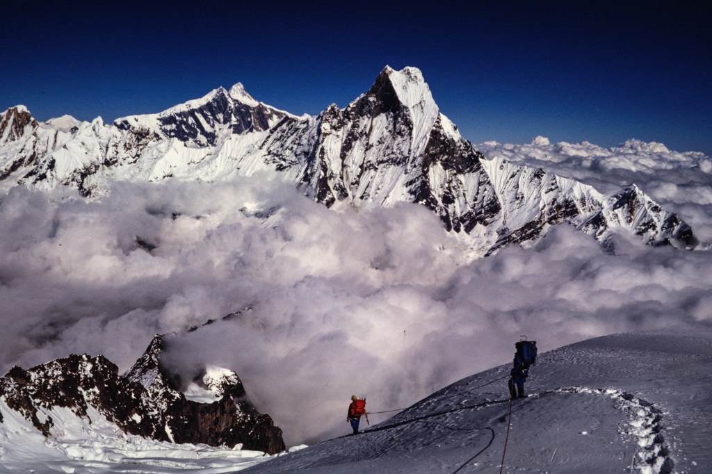
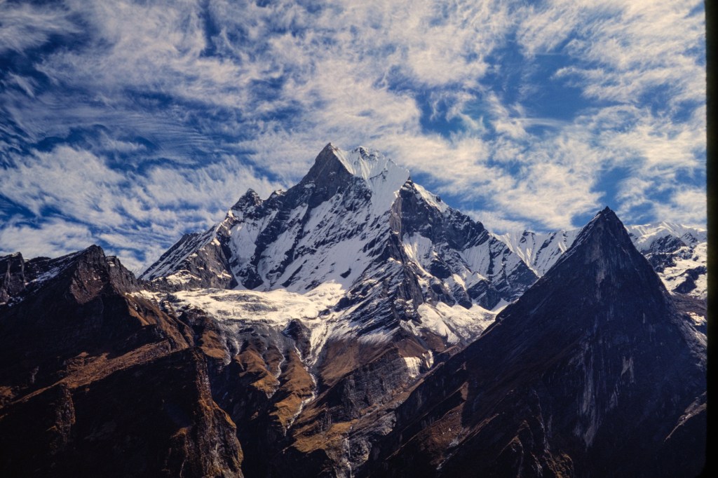
Annapurna, one of the 8000-meter peaks, rises near the center of Nepal. It is part of a bowl-shaped ring of mountains. The center of the bowl is the Annapurna Sanctuary; its floor is at 14,000 feet and the walls are above 20,000 feet. A river, the Modi Khola, drains this gigantic bowl by exiting to the south through a narrow slot, between Hiunchuli and Machapuchare. The peaks that form the walls of the bowl, clockwise, are Hiunchuli (21,132 ft), Annapurna South, Fang, Annapurna, Roc Noir, Glacier Dome, Gangapurna, Annapurna III, and Machapuchare (Fishtail Peak, 22,963 ft). The entrance to the sanctuary is a trail system in the deep gorge of the Modi Khola.
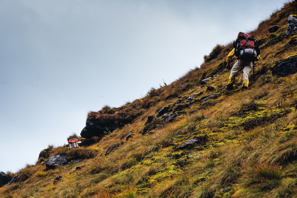
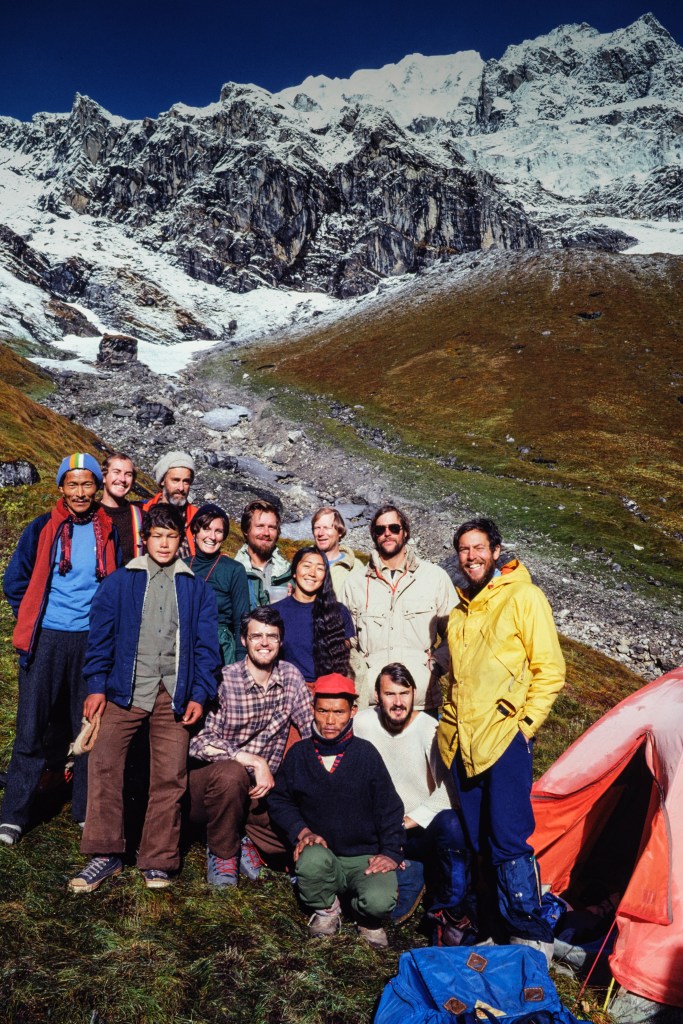
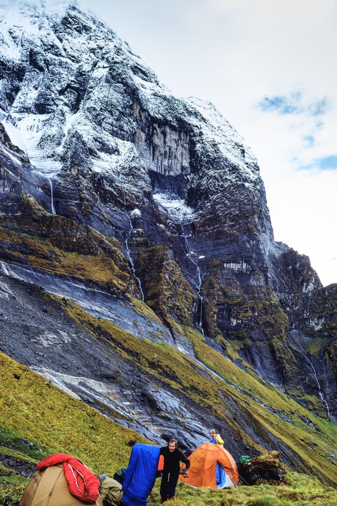
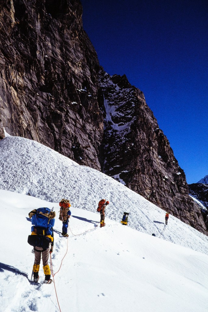
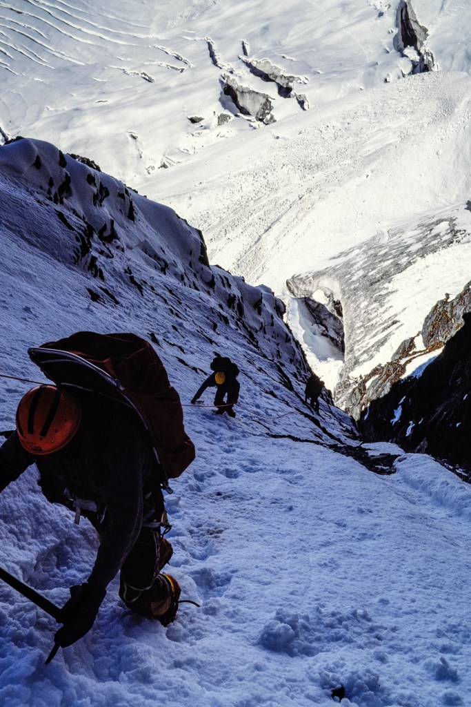
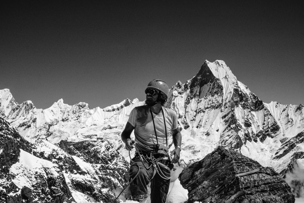
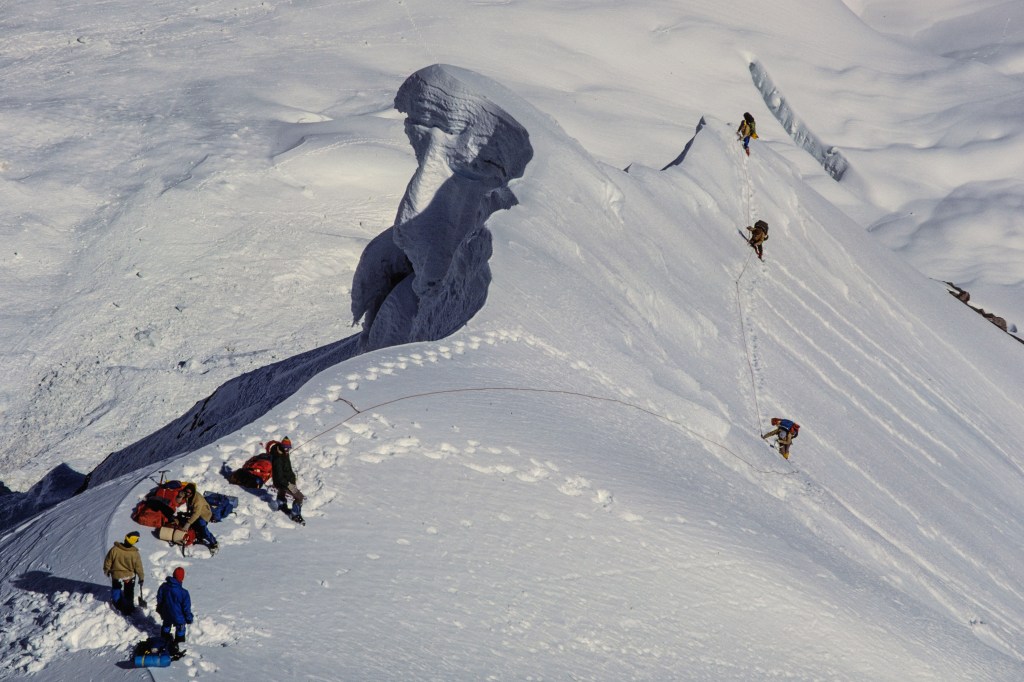
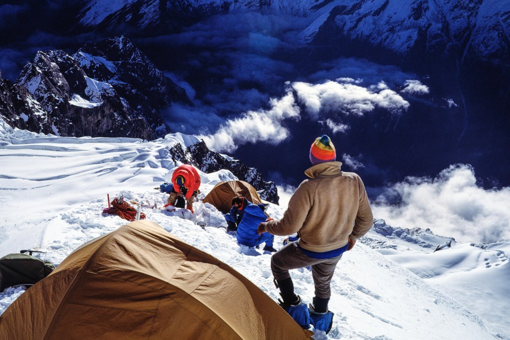
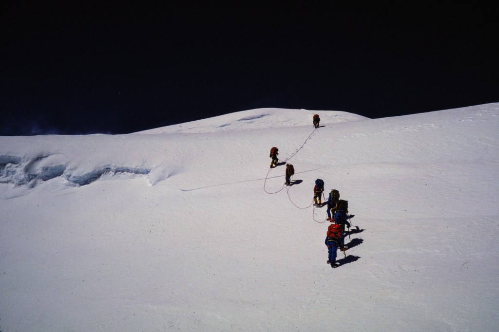
Hiunchuli was first climbed in 1971 by an American team led by a former Peace Corps volunteer. During the 70s there were six attempts to repeat this climb. A 1979 Japanese expedition ended when 3 climbers were killed by an avalanche near Basecamp. In 1981, I was invited to attempt the second ascent of this peak by Eric Simonson, a professional guide who I met during a 1979 attempt on Annapurna. Eric asked me and Bob Wilson to work as assistant guides; in return for our work, we paid only a minimal fee to cover costs.
THE APPROACH
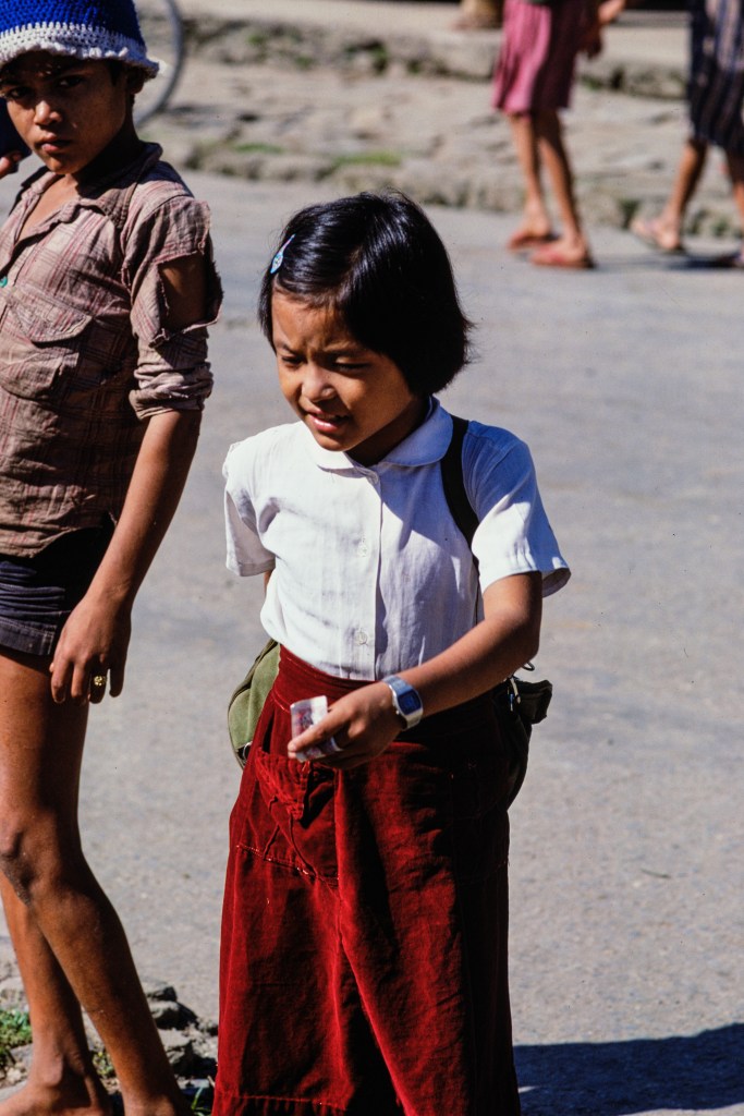
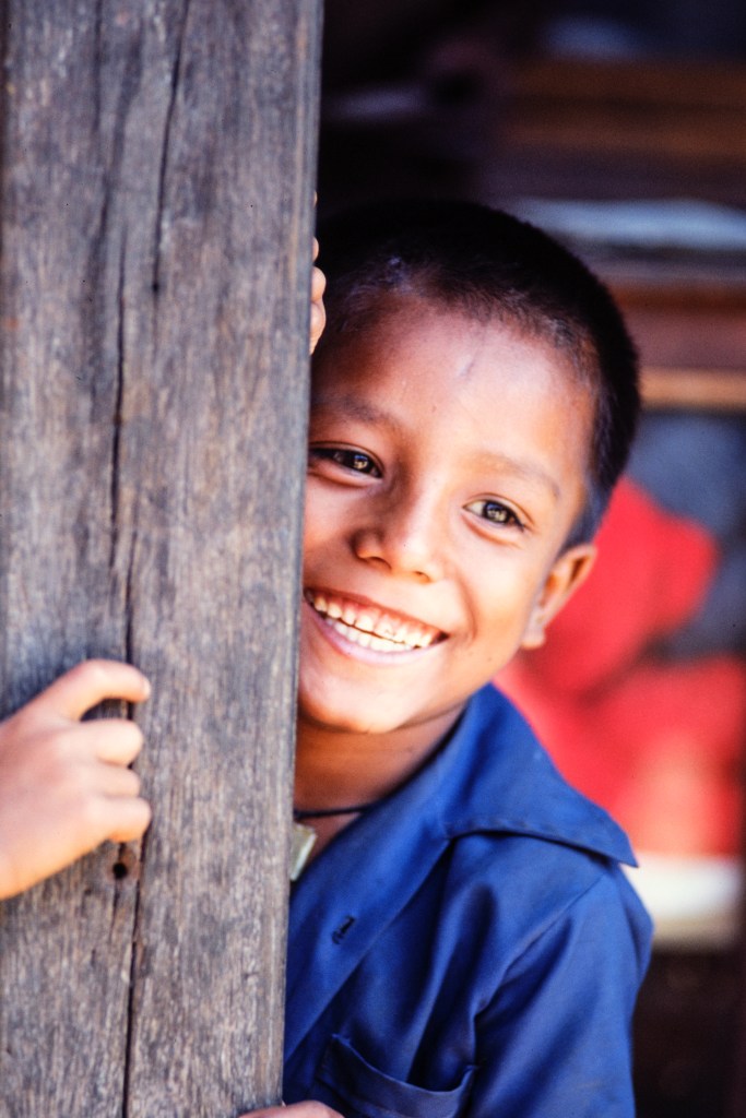
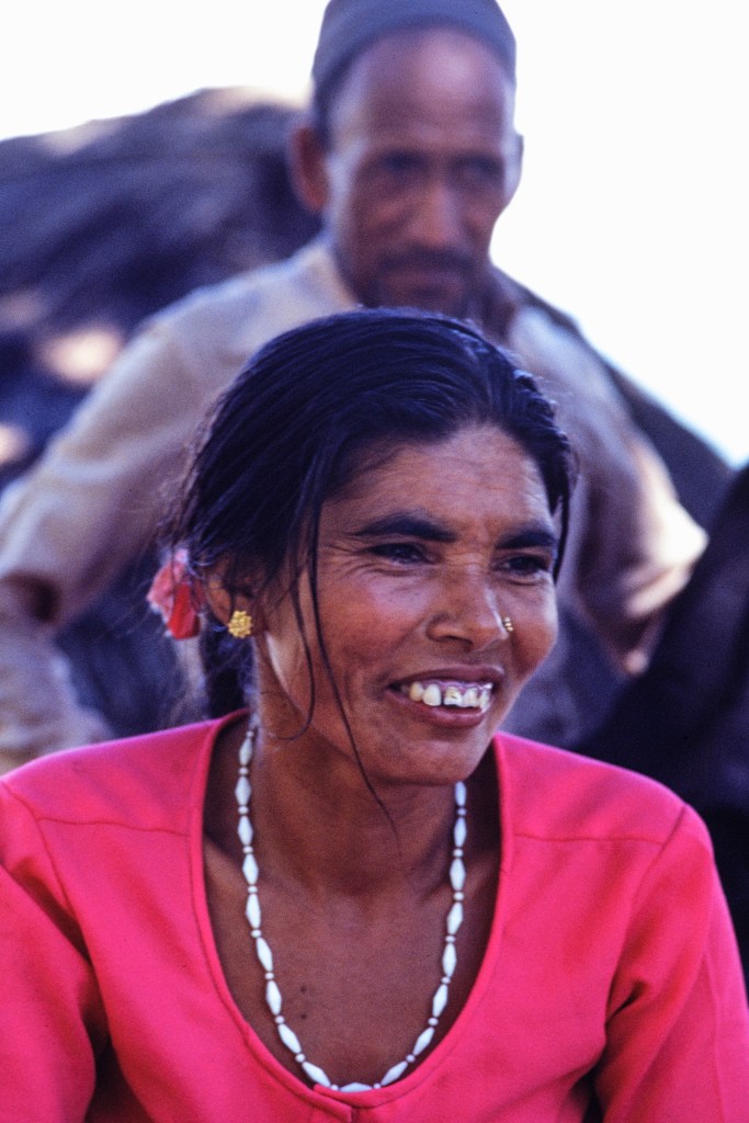
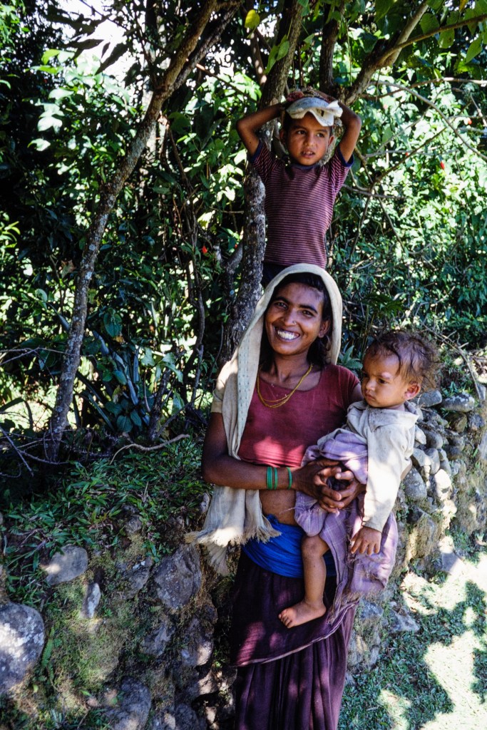
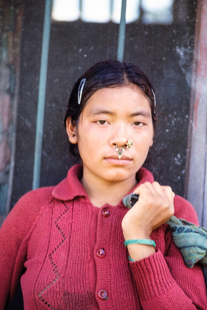
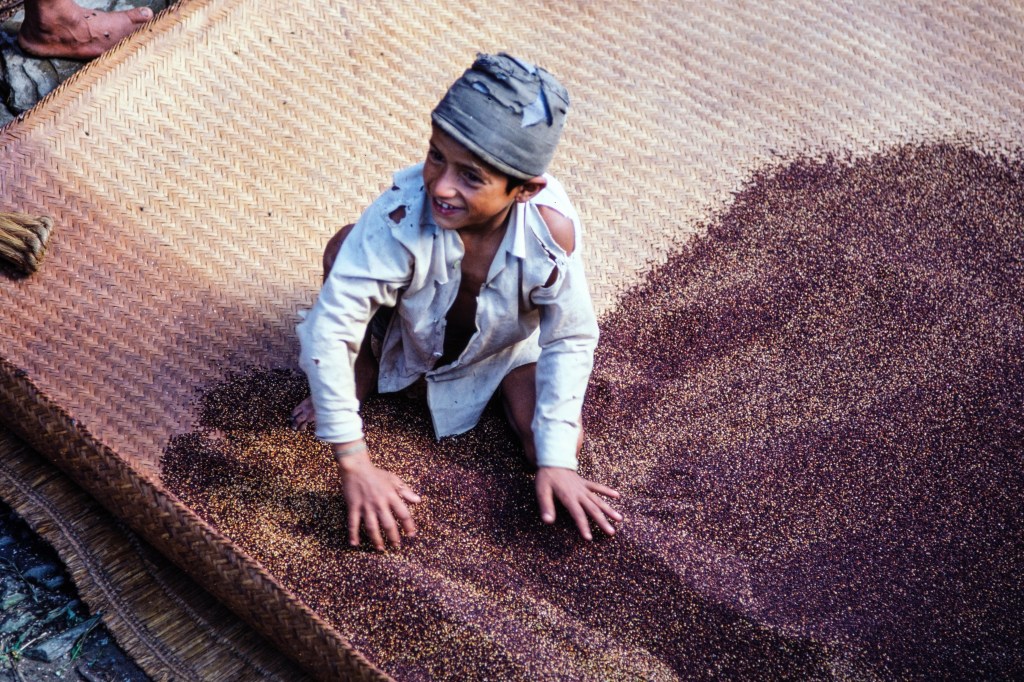
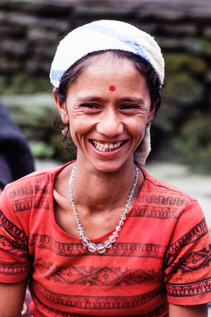
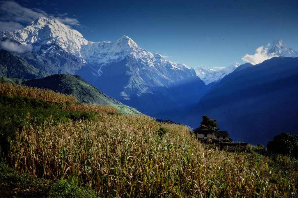
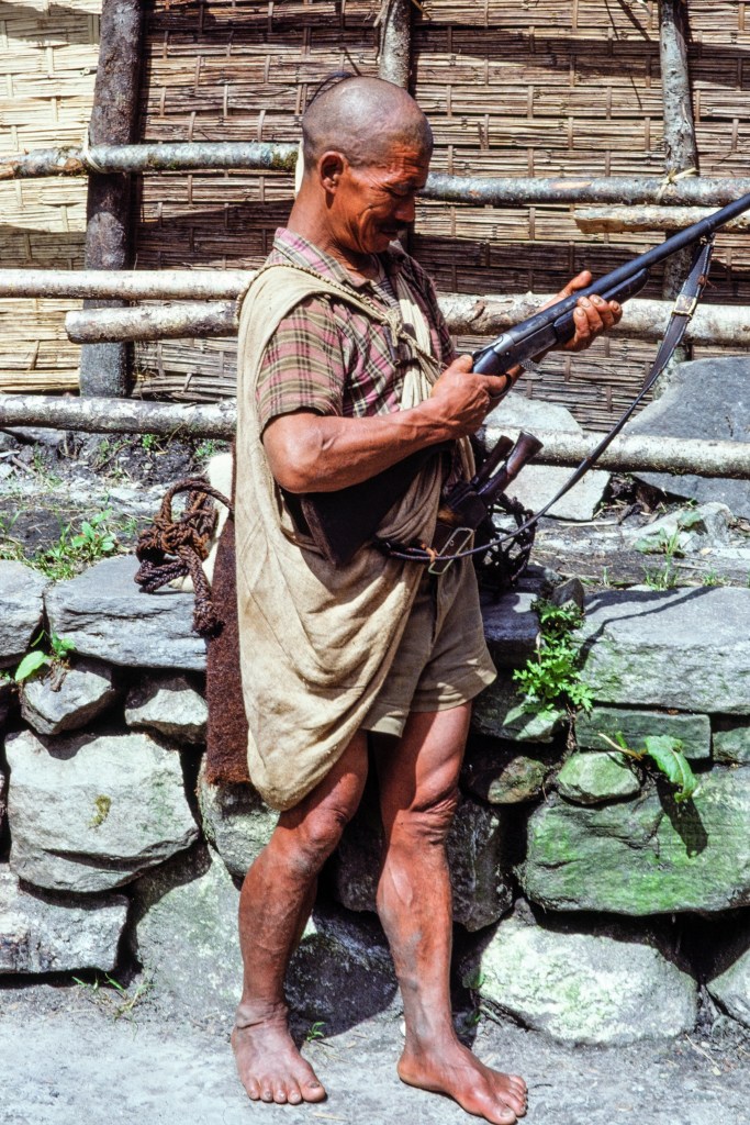
I arrived in Kathmandu on 9/15/81. We started our approach hike from near Pokhara on 9/19. Our path dropped down to the Modi Khola, then up the other side to a camp in forest on 9/22. My photos include portraits of the local people; a mix of religions (Hindu, Buddhist, other) and ethnic groups (Gurung, Tamang, etc.) (The famous Sherpa people live about 200 miles east near Everest.) Farming and tourism support the area we hiked through. Gurkha soldiers are recruited from this region. The Gurkha Kingdom fought the British East India company to a draw in 1816. The Gurkhas were tough and repelled a British assault by luring the attackers into a field of stinging nettles. The British recognized a good thing and recruited Gurkhas into special units of the British army in India and later elsewhere. Today Gurkha military units serve in the British, Nepali, and Indian armies, and as UN peacekeepers. The Royal Gurkha Rifles recently served in Helmand Province, Afghanistan. Central Nepal has many retired Gurkha troops who receive army pensions, while other families are supported by relatives still serving in the military.
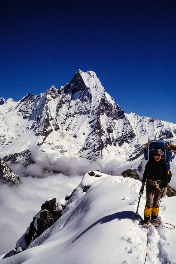
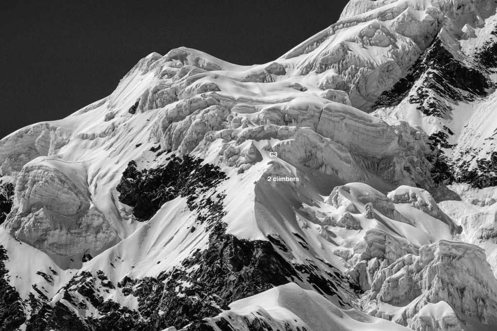
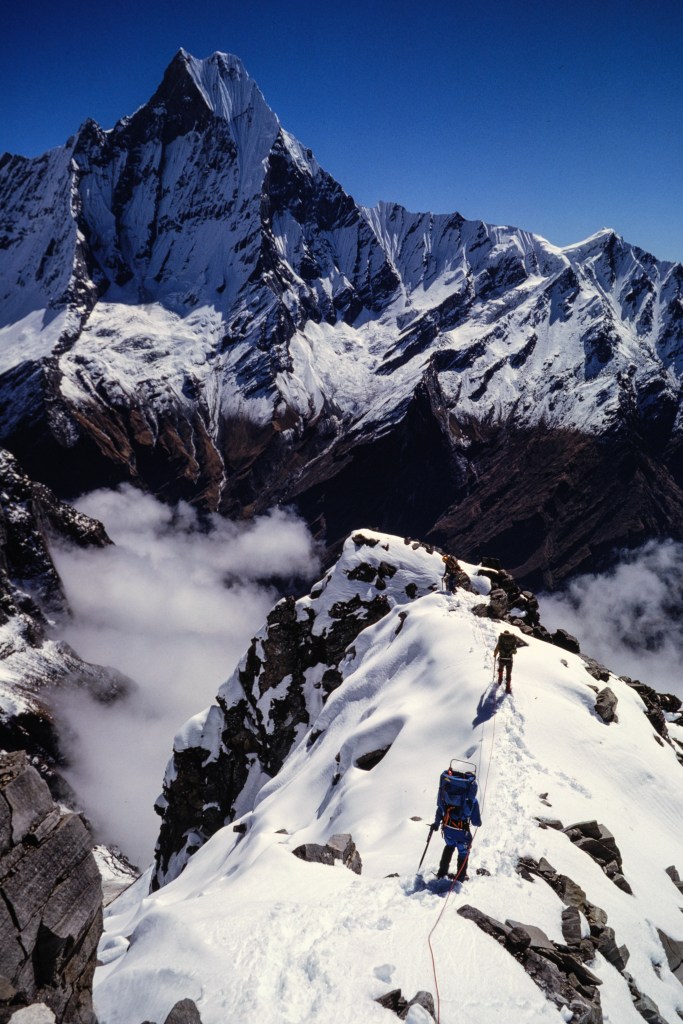
The photo below shows Hiunchuli (21,132 ft). To the left is Annapurna South (23,684 ft), and in the background is the summit of Annapurna (26,545 ft). The Modi Khola gorge is out of sight to the right.
Below is a telephoto view of Hiunchuli. The upper part of our route followed the skyline on the right.
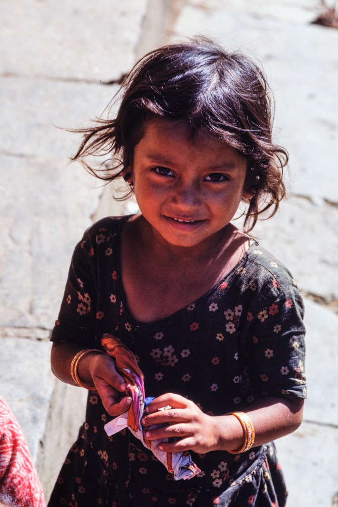
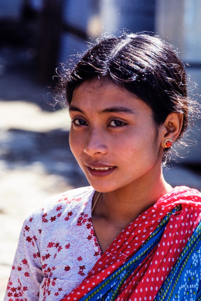
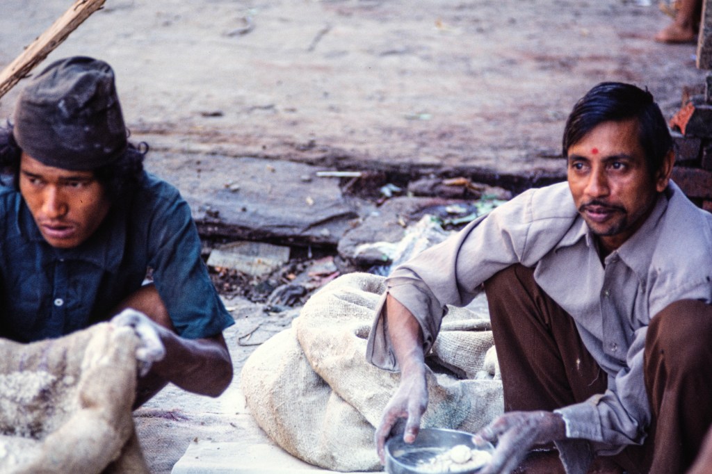
The next 11 photos are portraits of people that we met.
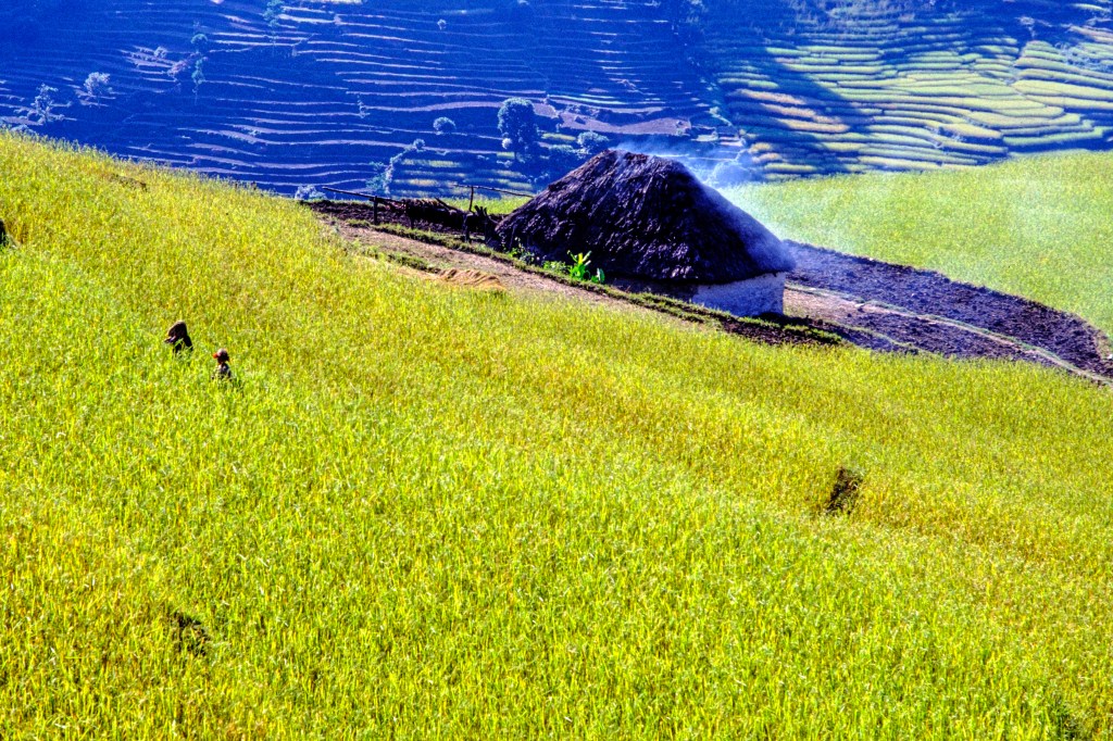
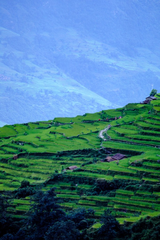
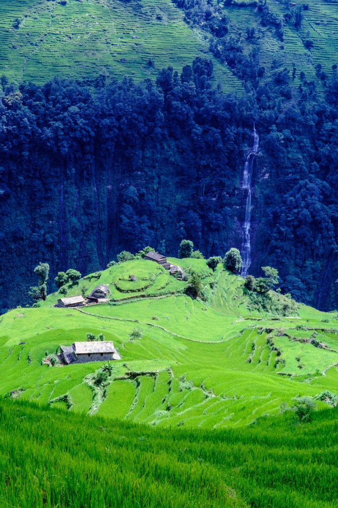
We passed through terraced fields with crops. In the photo below, smoke from cooking envelopes a home. There is no chimney, so the smoke just filters through the thatched roof. The inside is thick with smoke.
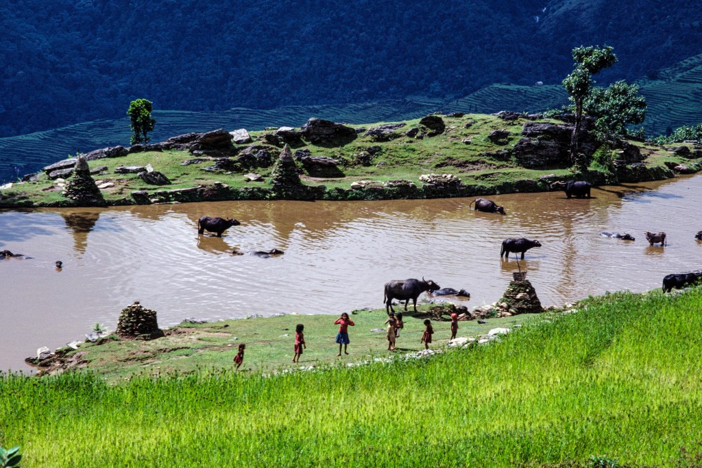
Children and water buffalo.
As you can see, below, this area looks fairly prosperous for a poor country.
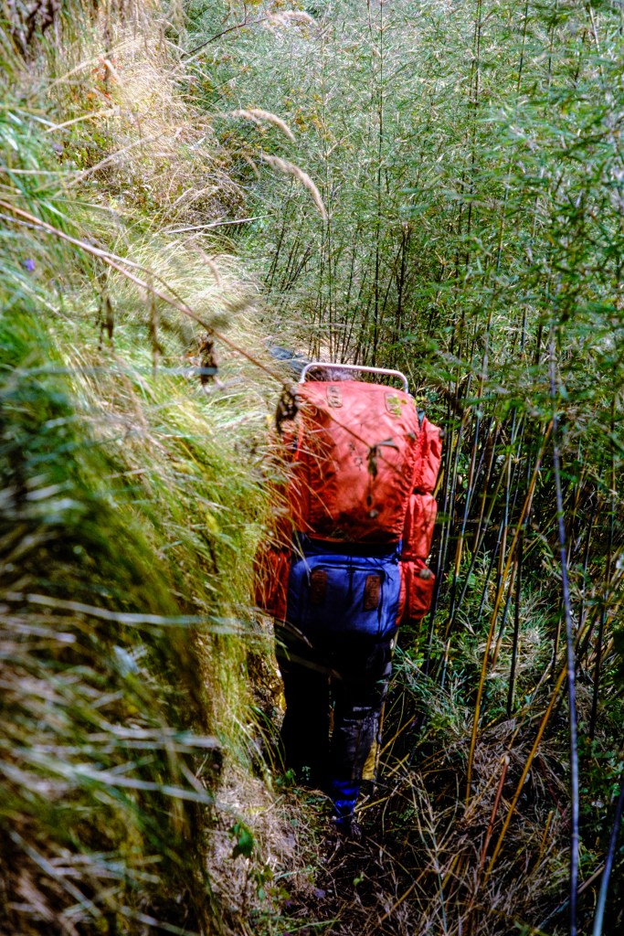
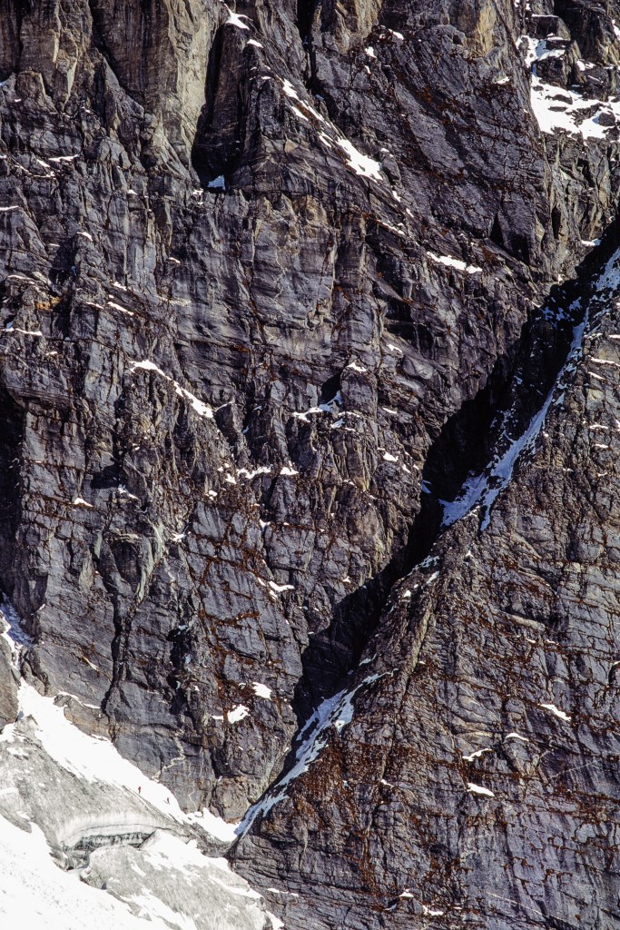
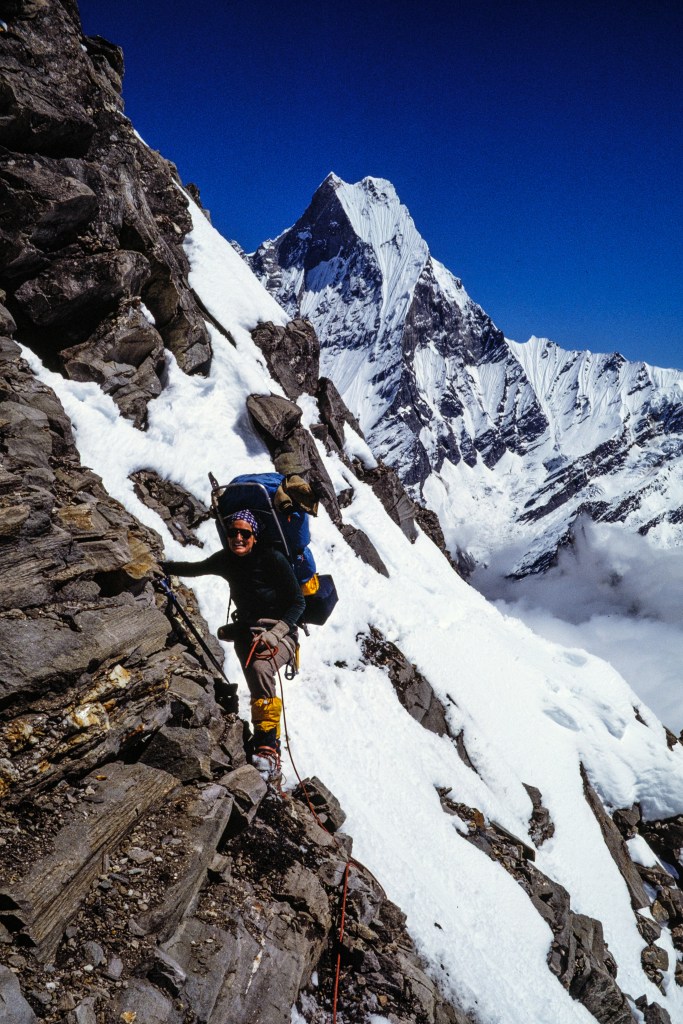
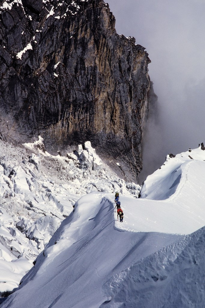
Below is a view into the narrow chasm of the Modi Khola. Our trail was on the left (west) side. The shadowed wall on the left is the lower part of Hiunchuli. Getting from the river valley up onto the peak is hard.
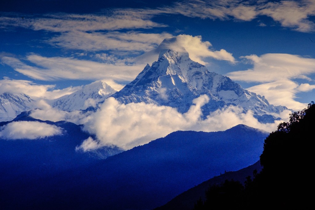
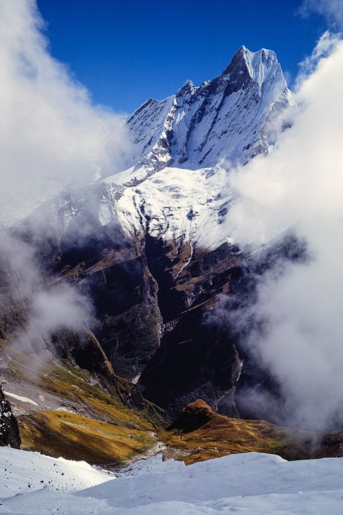
A view of Machapuchare.
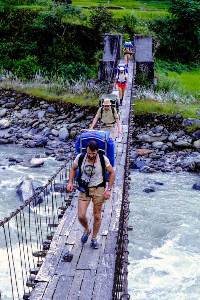
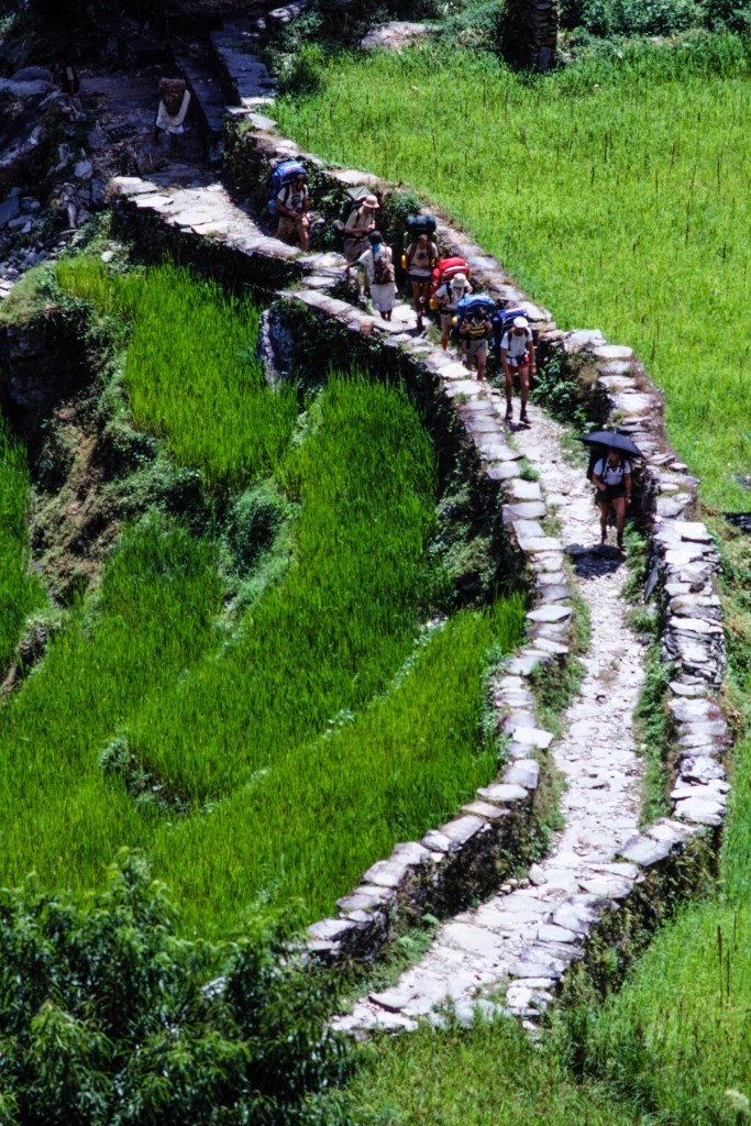
We used a sturdy suspension bridge and excellent paths.
A closer view of Machapuchare, below. This is called the Fish’s Peak or Fishtail Peak because of the shape of its summit.
And Hiunchuli.
The next view shows Annapurna South on the left, Hiunchuli a little left of center, then the shadowed slot of the Modi Khola, and Machapuchare on the far right.
Another view of Annapurna South and Hiunchuli.
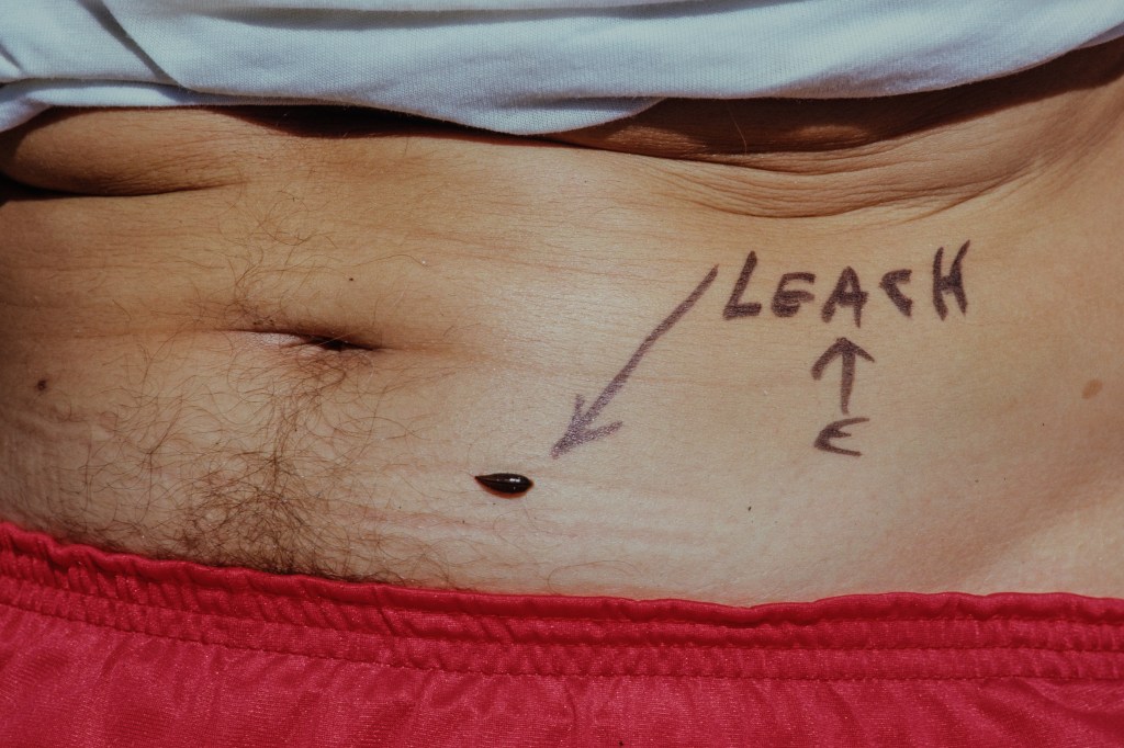
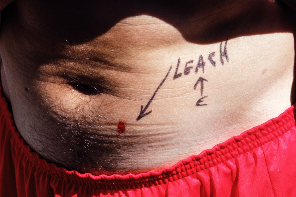
We arrived at the end of the monsoon season, so the forest was full of leeches. Photo below shows one that attached itself for a meal.
Leeches secrete an anticoagulant so that the host’s blood will flow easily. You can see this below. No one is going to bleed to death, but it takes a while for the wound to scab over.
The man below is a local hunter with a very old gun. His Gurkha knives, Kukris, stick out of his belt.
THE CLIMB
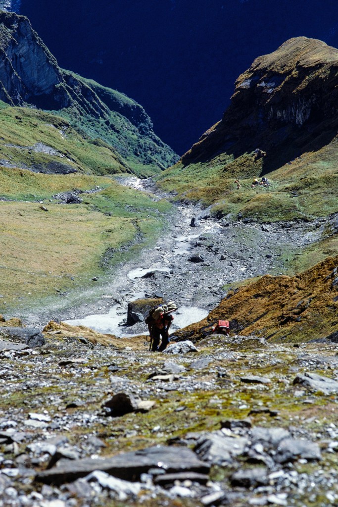
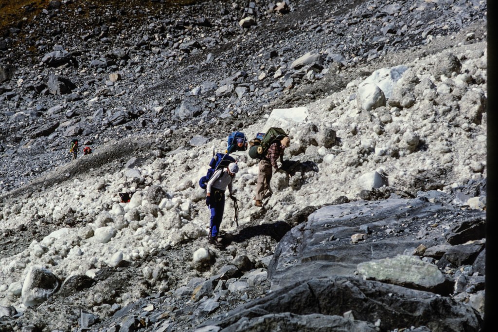
On 9/22 we camped near the trail at 9000 feet on the west side of the river. On 9/23 some of us explored above our camp to find a route through the jungle and get up onto the mountain. This involved a lot of thrashing in brush on steep terrain. The next day, we moved up to a temporary camp at 13,100 feet, and on 9/25 we moved to a better location at 13,200 feet. The route to Basecamp was so steep that two of our clients quit the expedition and hiked back to Kathmandu. A third client made the decision to not go above Basecamp.
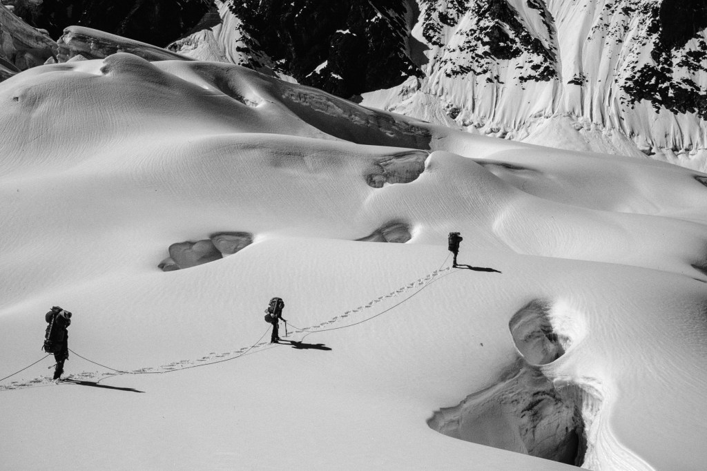
The picture below shows the dense vegetation.
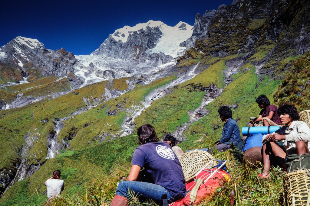
In the next photo, Simonson and porters look at the terrain we must cross to get to our Basecamp, which will be in the flat meadows at the far left of the photo.
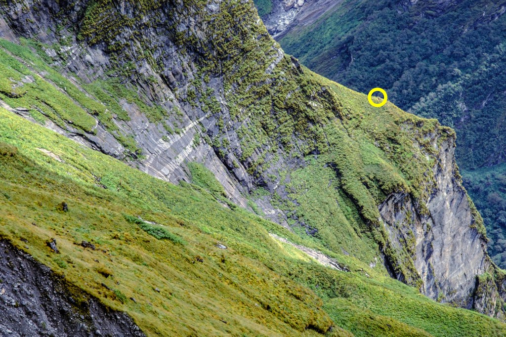
The view below looks back at our route. I added a yellow circle around a member of our team. From that spot, our “trail” went down through vegetation and up to where I was standing with my camera. Several previous expeditions failed because they were never able to get to Basecamp.
Image below shows two people walking the “trail” to Basecamp.
At Basecamp, the final climbing group now consisted of 3 guides and 6 clients. Simonson was just starting his guiding business. He selected this peak because the approach was not too long, the permit was cheap, and he wanted to make the second ascent. His clients were mostly people he had previously guided on Mt. Rainier and Denali. Most were fit, but had little climbing skill or experience. It is not surprising that three people quit after reaching Basecamp. The climb was more threatening than they expected.
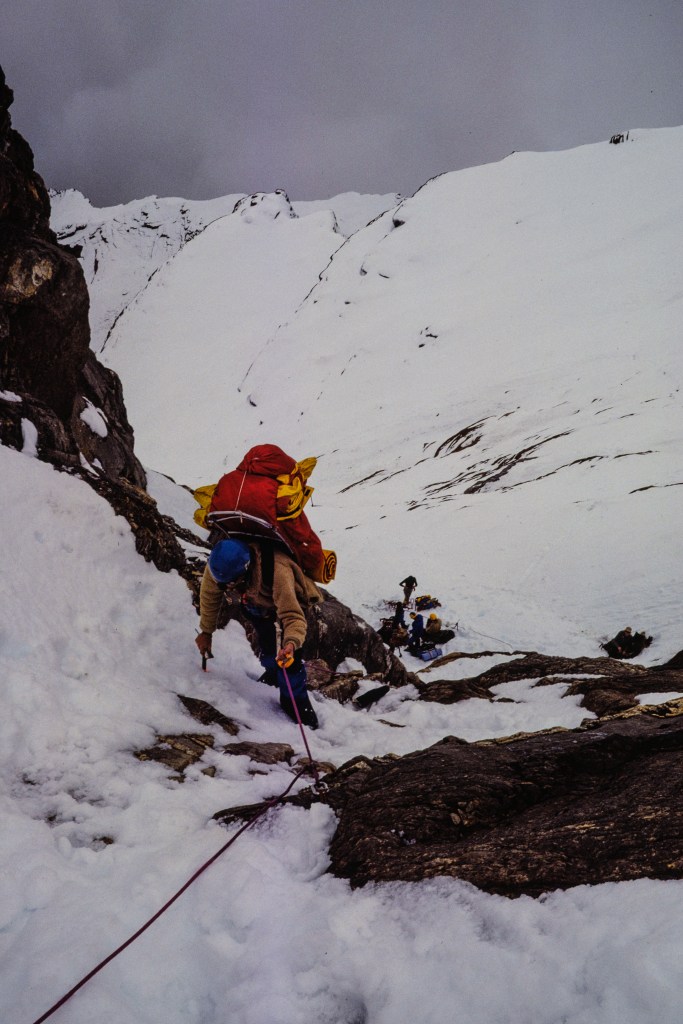
As you approach Basecamp, you cross a wide gully of dirt and rocks torn out of the grassy slope. An avalanche swept across this gash in 1979, killing three Japanese climbers. We hurried when crossing this area; I got my crossing time down to 4 minutes.
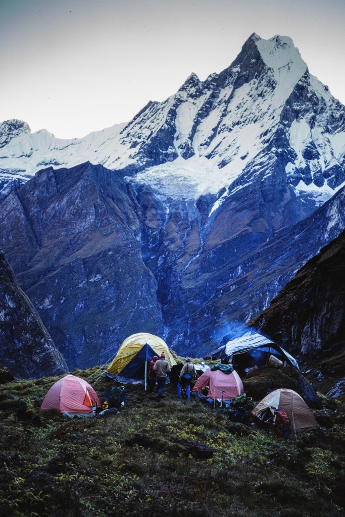
The next three pictures show views of Machapuchare from Basecamp.
The next photo shows our climbing team, plus Nepali support staff who would remain at Basecamp. I am the guy in the yellow jacket with the black hair and white teeth.
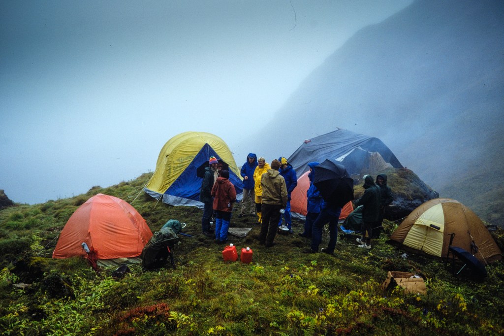
The monsoon rains were not finished yet. For three days it poured buckets, soaking our gear. Two clients had so much water in their tent that they cut a hole in the floor. Bad idea — more water came in the hole. Next photo shows our soggy home.
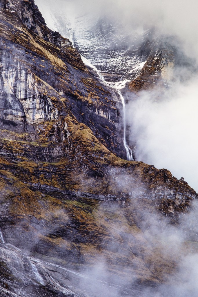
Water poured off the cliffs
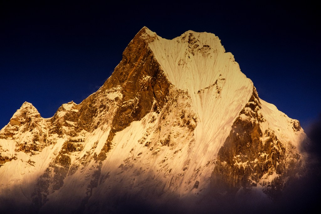
Machapuchare looked lovely when the clouds cleared.
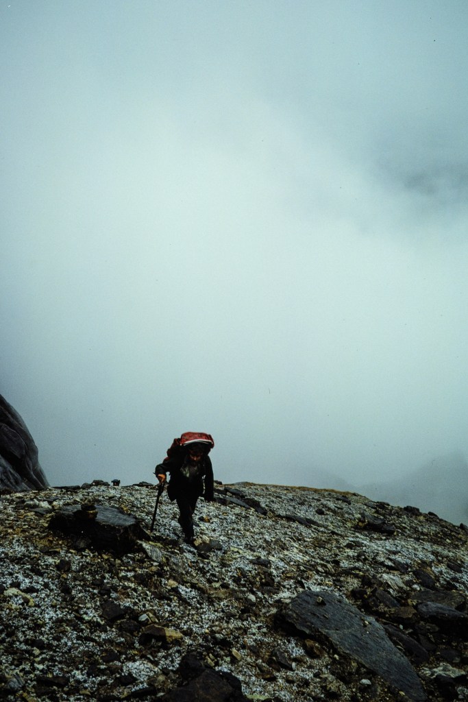
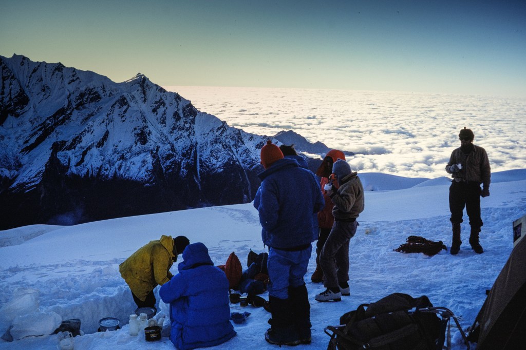
The bad weather did us a favor; it gave everyone three days to rest and acclimatize. When the clouds cleared, we dried our gear.
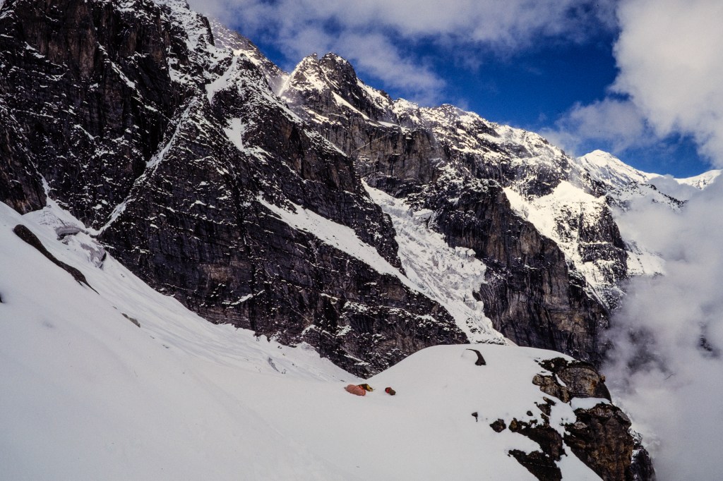
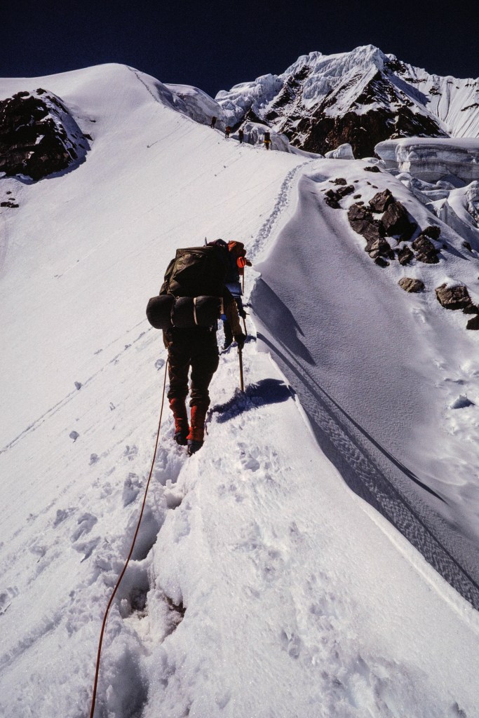
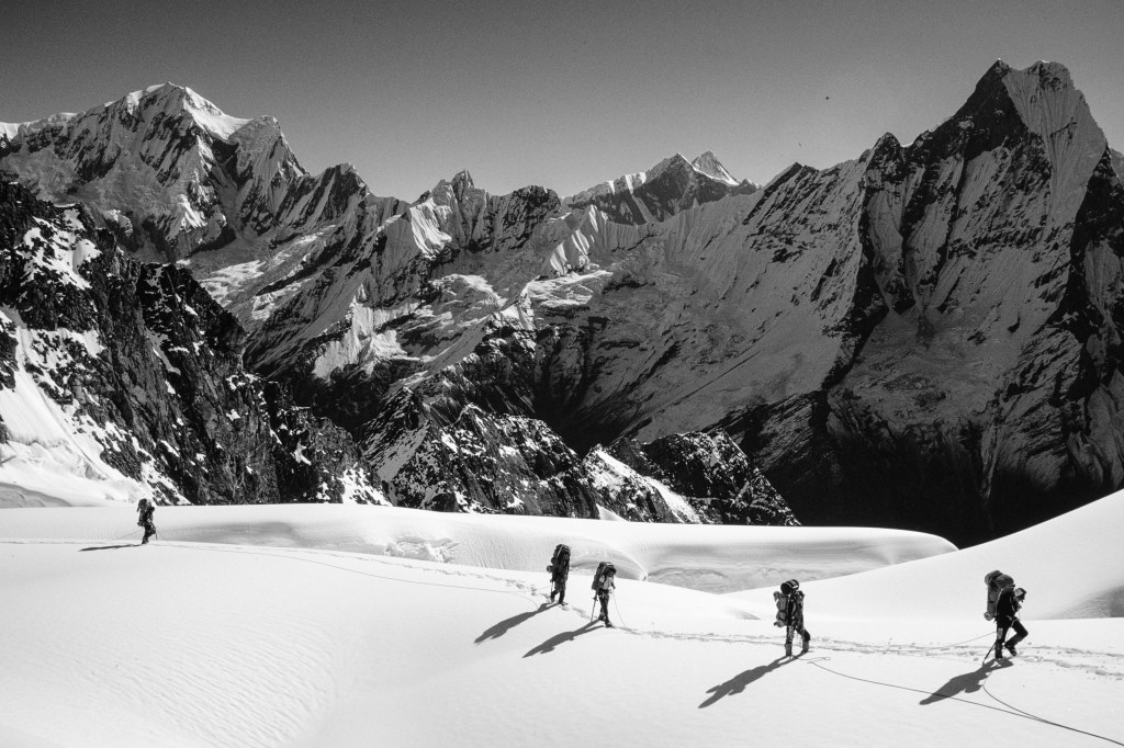
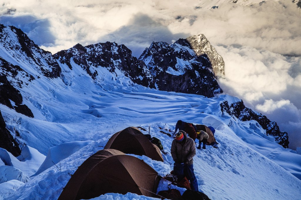
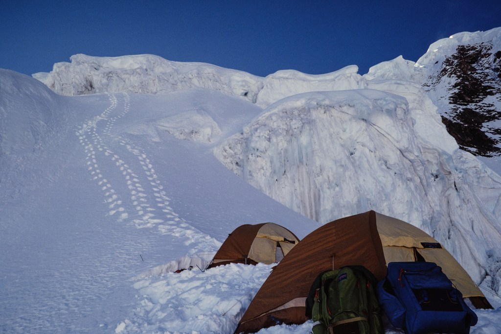
On Oct 1 we moved up to Camp 1, at 15,700 ft. Lovely to walk in the sun. Note Basecamp tents in two of the pictures below.
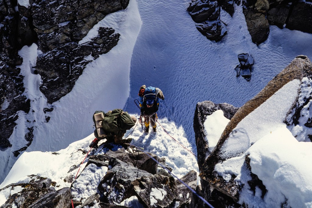
The photo below shows a climber who is pulling up on a rope that is anchored to the rock. Simonson, Wilson, and I carried up hundreds of feet of rope and attached this to steep parts of the route. We anchored this “fixed line” to rock or snow using ice screws, snow pickets, pitons, nuts, and slings. Climbers use a clamp, called an ascender or jumar, that grips the fixed line and is attached to the climber. This makes for safer travel when shuttling loads on steep terrain. It means the clients do not always have to be attached to the guides – instead, they are attached to the fixed line.
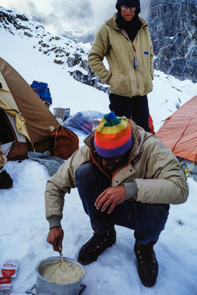
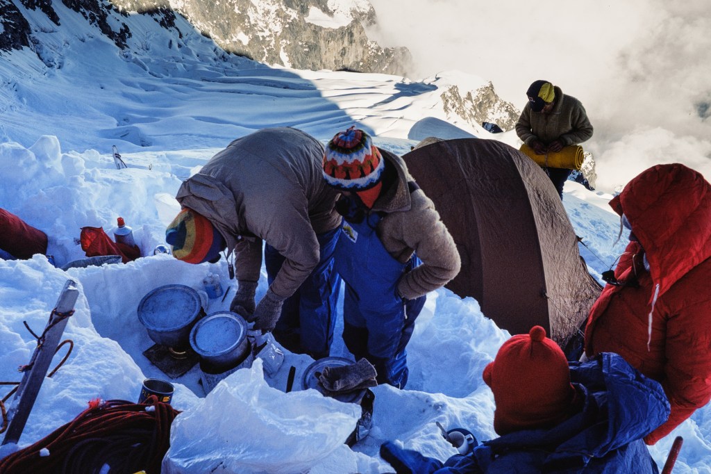
At Camp 1, Simonson stirs a pot of “food.” Looks yummy!
Our first evening meal at Camp 1.
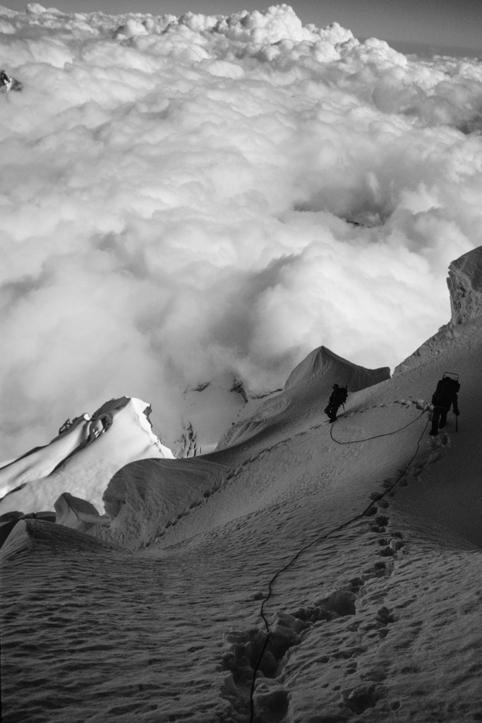
In addition to installing fixed line, guides provide two additional services. First, guides find the route. Guides lead up the steep sections. We find a path through the fields of crevasses. Route finding is a physical and mental drain; the person leading must constantly decide where to go. Those that follow just have to put their feet where the guide stepped. Second, we kick the steps. Walking in deep snow is work. At altitude, this is a penance. Experienced leaders learn to set a steady pace; step and breath, pause, step and breath, pause… Endless. One hundred steps, one hundred more. Over and over. The work that the first person performs is enormous. A good leader sets a pace that everyone can follow, without needing a rest, for an hour or so.
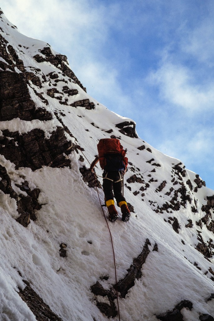
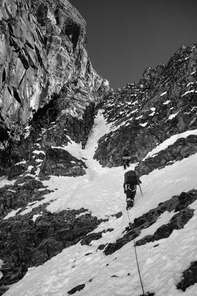
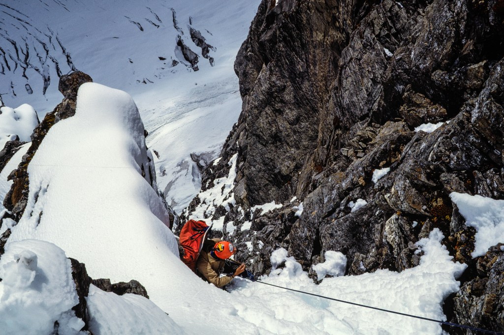
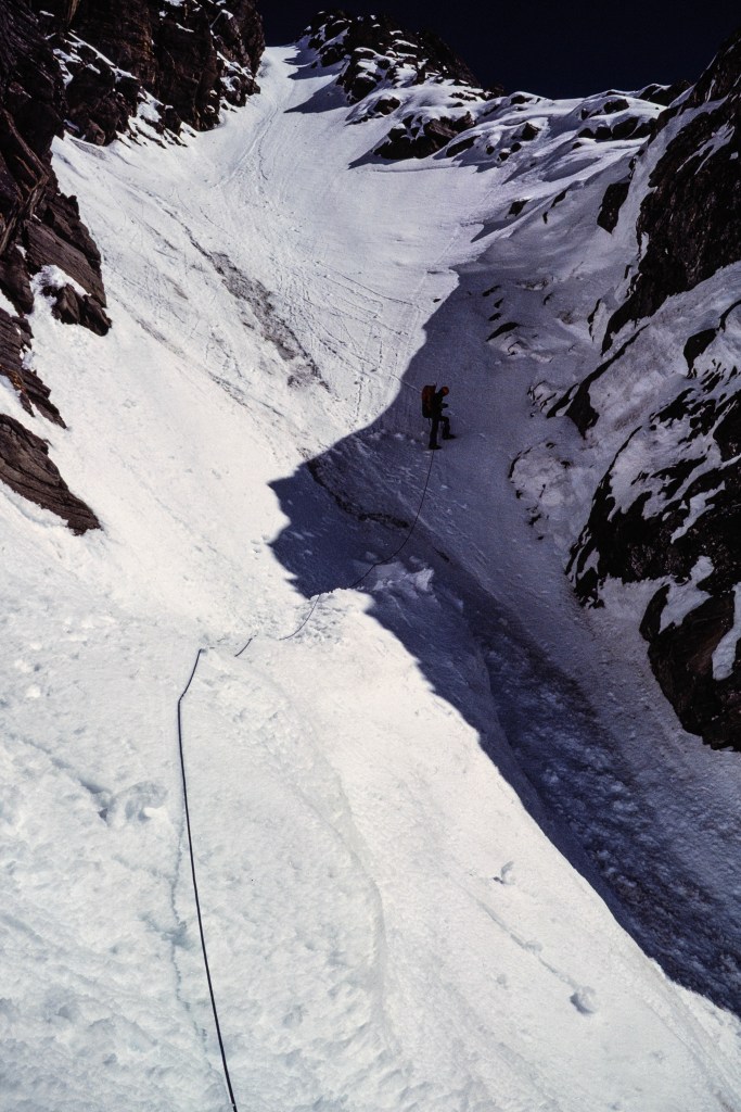
Parts of the climb were steep with lots of air below. The Nepalese government classifies Hiunchuli as a “trekking peak,” but it is harder than most peaks in this category and involves serious risk. A fatal fall is possible and other hazards included falling rock (note the helmets in some photos), snow and rock avalanches, and crevasse falls. Even though the guides try to protect the clients, this is not a safe endeavor.
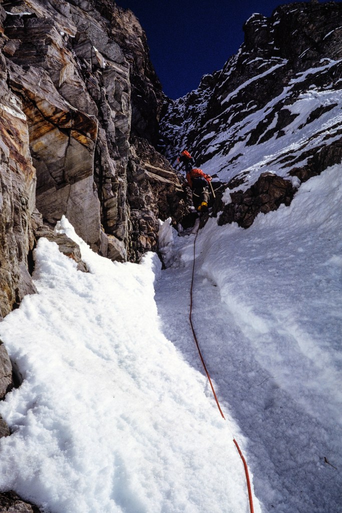
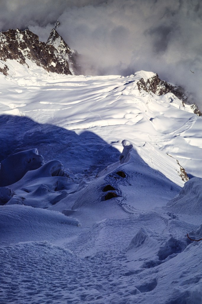
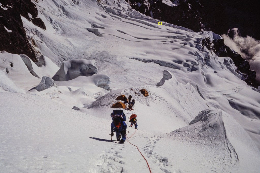
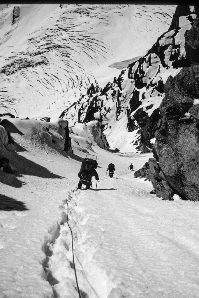
On Oct 2, Simonson, Wilson, and I placed fixed line in a steep, diagonal gully. The next photo shows the location of our 3 camps and the route, including the diagonal gully.
The diagonal gully is on left side of the next picture, our Camp 1 can be seen near the middle.
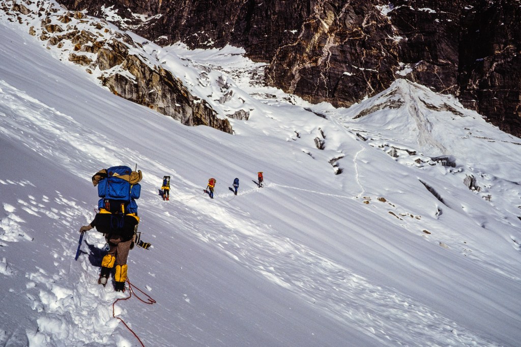
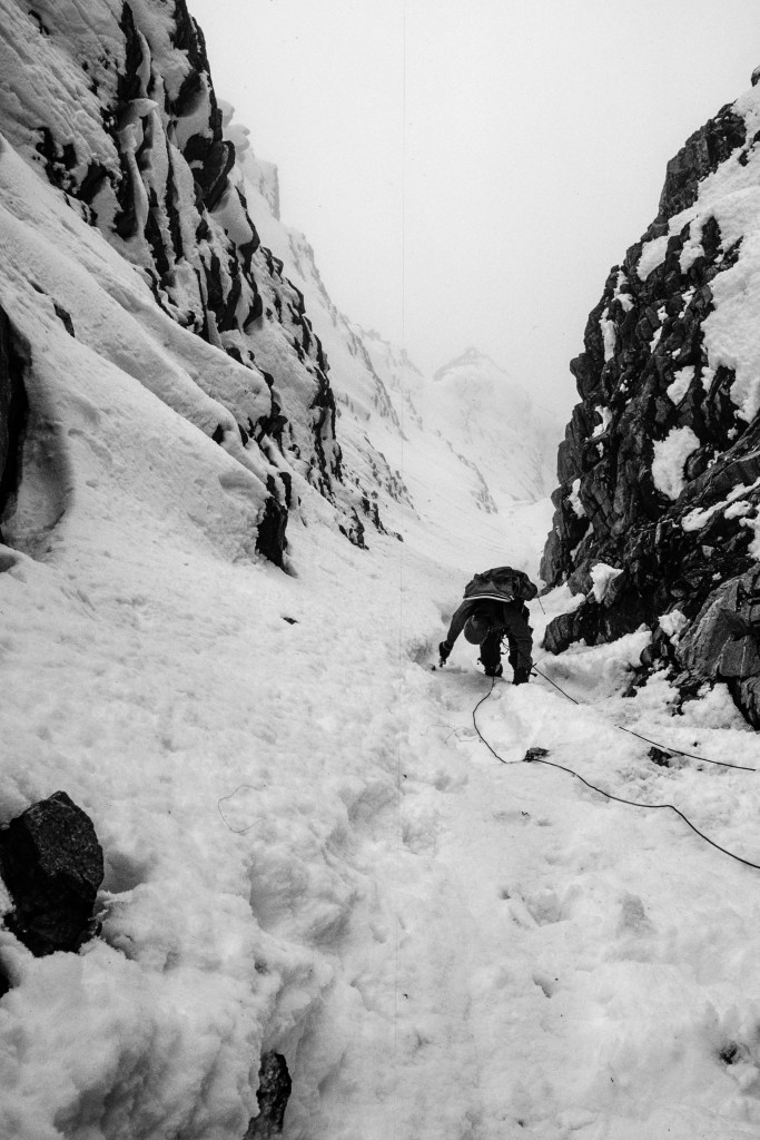
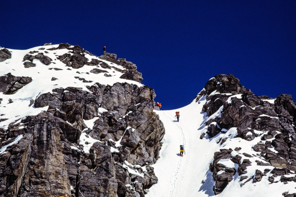
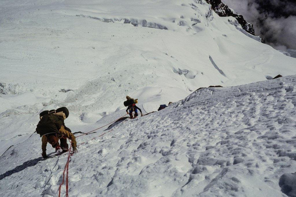
The next several pictures show climbers approaching the gully, crossing an avalanche area, entering the gully, and climbing up to a ridge.
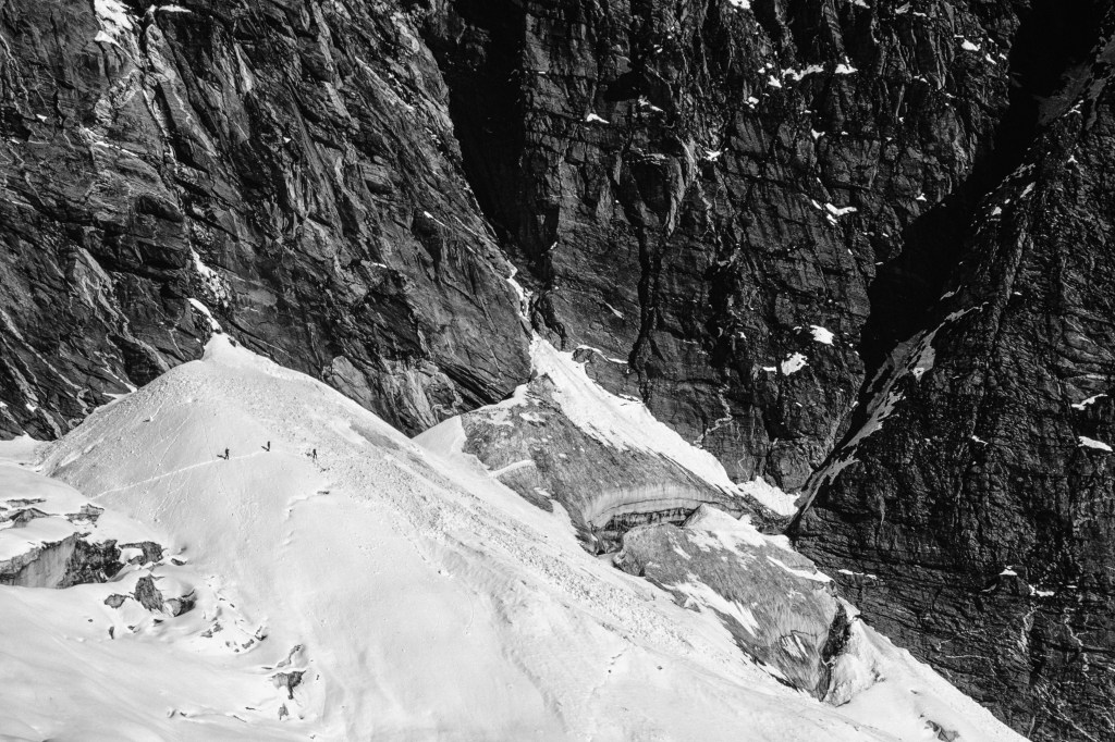
In the photo below, 3 climbers on the left have stopped just before they have to cross debris from an avalanche. The diagonal gully is on the right.
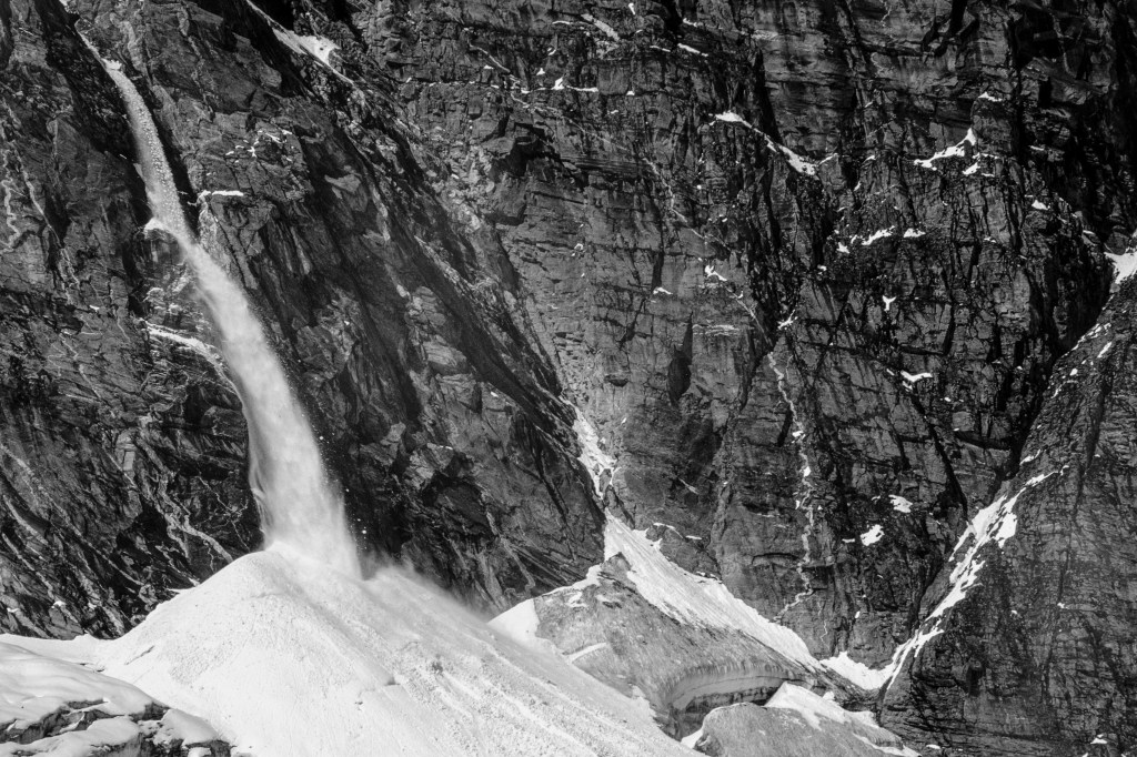
In the photo below, an avalanche comes down near where the climbers were in the previous photo.
In picture below, the avalanche debris is right in front of the climbers. The gully is further away in shadow.
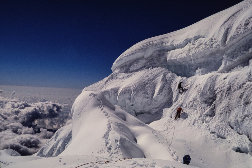
Below, you can see three climbers about to enter the diagonal gully.
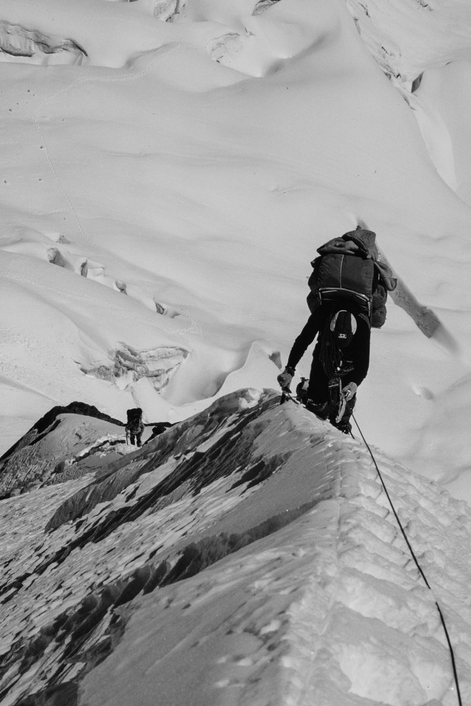
Finally we emerged on a ridge of snow and rock.
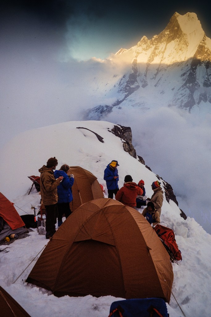
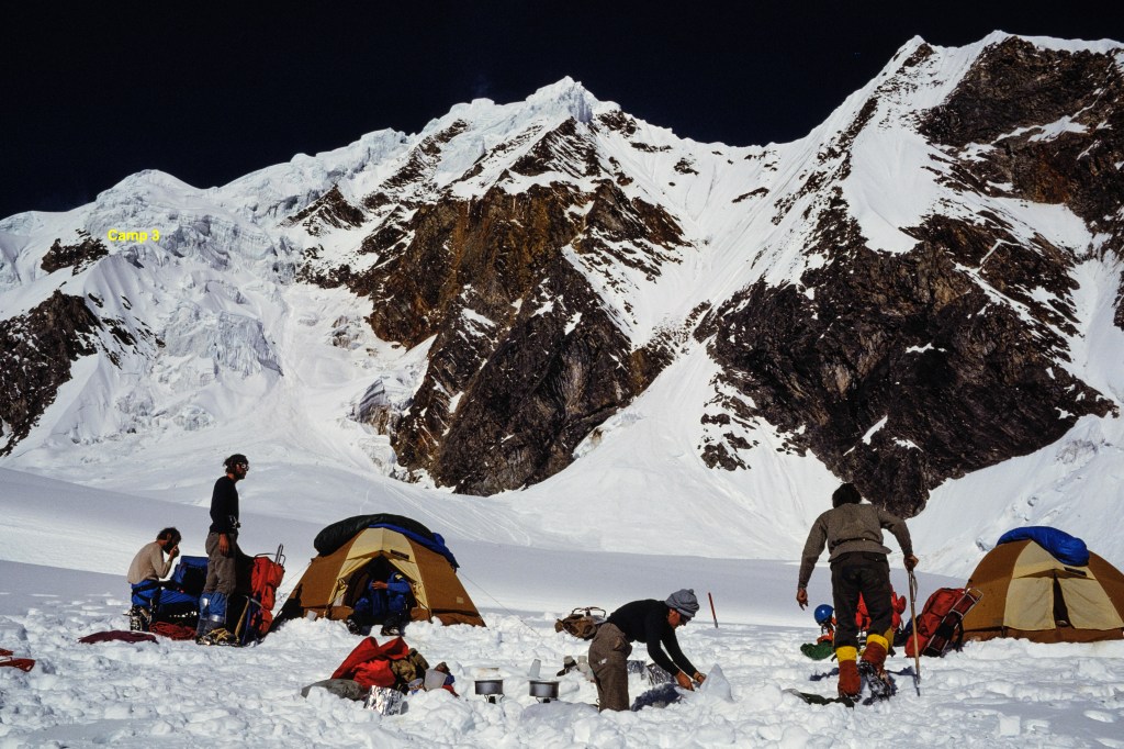
On Oct 3 we moved into Camp 2 at 17,300 feet.
The photo below shows Camp 2, with the location of our future Camp 3 marked in upper left.
The photo below shows Simonson and Wilson putting in fixed line on the route to Camp 3.
The next set of photos shows our move up to Camp 3, 18,700 feet, on Oct 7.
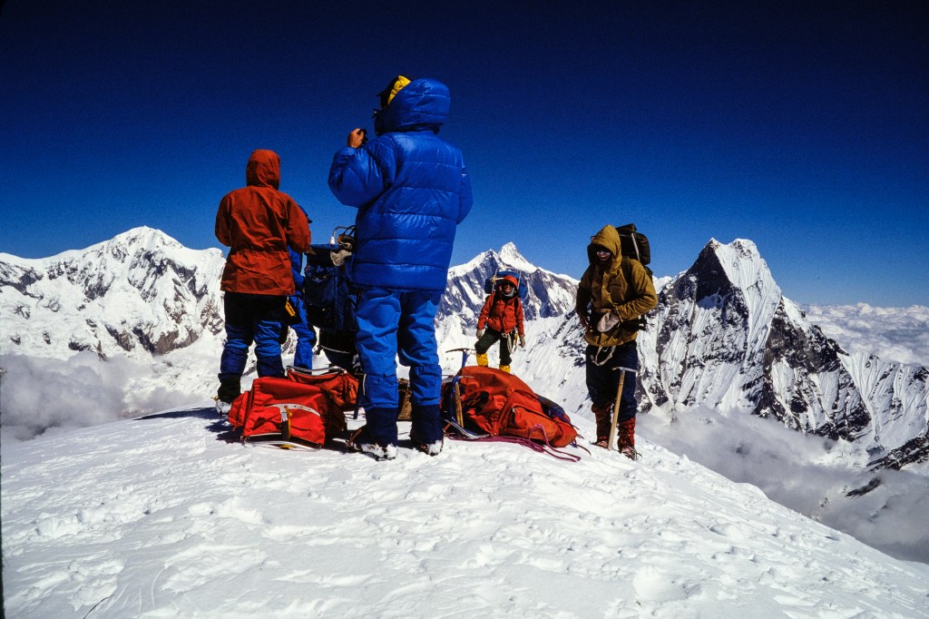
On Oct 8 we set out for the summit: 21,132 feet.
Next photo shows us on top.
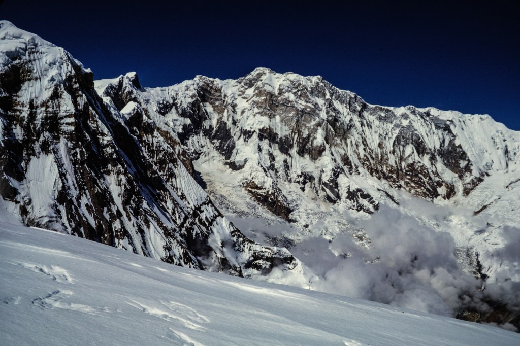
A view of Annapurna’s great south face.
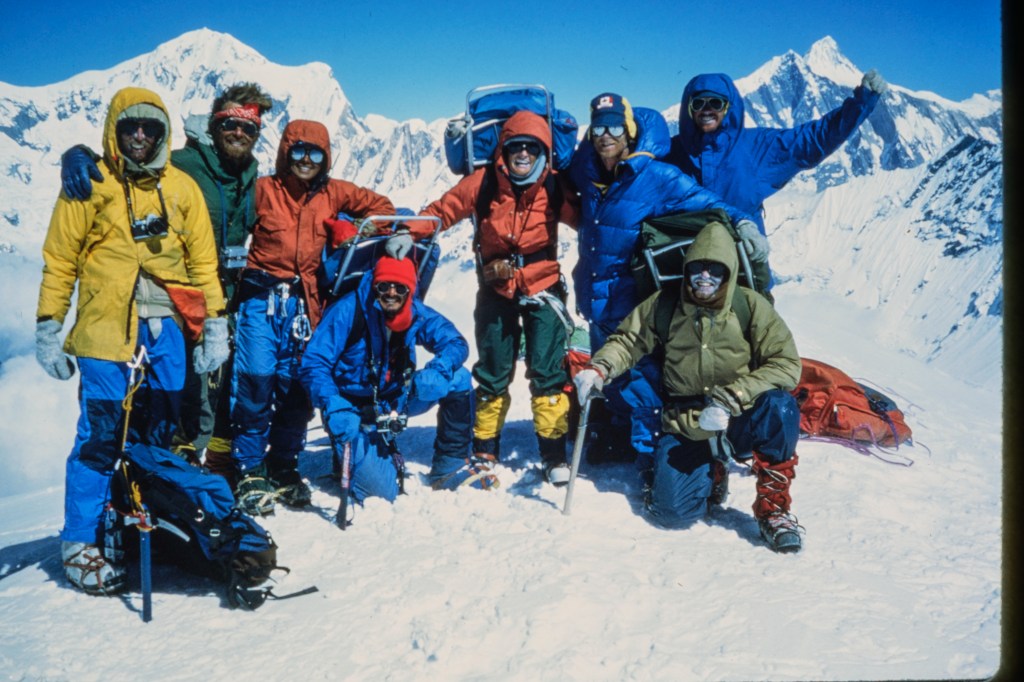
Group picture on top. I am in the yellow parka with the camera hanging around my neck.
THE DESCENT
The next photo shows the area where an avalanche killed three climbers in 1979. We always tried to cross this quickly. Note the fresh blocks of snow and ice that fell while we were up on the mountain.
Two final views.
A FEW FINAL COMMENTS
By Oct 12 we were back to the Modi Khola, safely off the mountain. I detoured upstream to the Annapurna Sanctuary for a night, then back downstream to rejoin the group. I contracted giardia on this detour and had a tough hike back to Kathmandu. You don’t need the details. I was back in the USA by Oct 20. This was a fun climb for me and I think most of the clients enjoyed it as well. I feel bad for the three clients who turned around; this must have been very disappointing for them.
Simonson was an excellent leader; strong, relaxed, confident. The food was not great, but sufficient. Up high we cooked ramen noodles for supper, throwing in cans of tuna or chicken. This was filling, easy, and quick to make, and provided necessary liquid. The cooking and clean-up chores were rotated across the group, a style I liked. The clients were generally strong. Aside from one client, most had little climbing skill. But they all pulled their weight. Considering how scary this must have been for some of them, they did well. I’ve searched on the internet and cannot find any evidence that anyone has successfully summited Hiunchuli after our climb. Is that true?
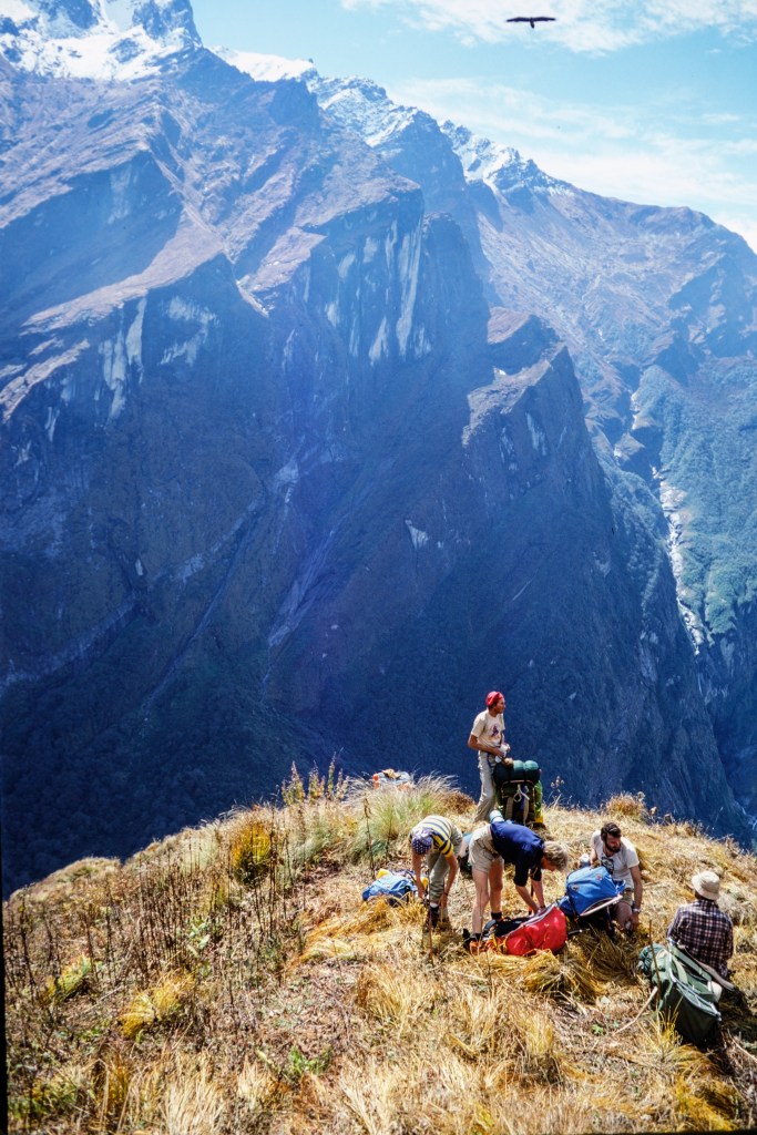
In 1998 I returned to this area with Roberta and some friends; Mike Jauregui, Susan Olson, their 10 year-old son, Kevin, and Mike’s older boys, Phillip and John. We all hiked up through the Modi Khola gorge to camp in the Annapurna Sanctuary, a spectacular location.
COMMENTS ABOUT THE PICTURES
The original photographs for this show were my Kodachrome slides, taken on the climb in 1981. I later photographed those slides with a digital camera and processed the electronic images in Lightroom. I edited some pictures into black & white for variety. You may notice marks left by dust in some pictures; I try to remove dust before photographing the slides, but it is hard to get all of it.
You may have noticed that a lot of the pictures in this show used a vertical or “portrait” mode format. That format was more popular before computer screens encouraged a wide or “landscape” framing.
In February 2025 I posted a blog about coastal birds near Fort Bragg, on California’s north coast. This new blog shows birds from a recent (Oct, 2025) Fort Bragg trip, plus a trip this winter (Jan, 2026) to the Bolsa Chica Ecological Reserve in Huntington Beach, south of Los Angeles.
Mendocino
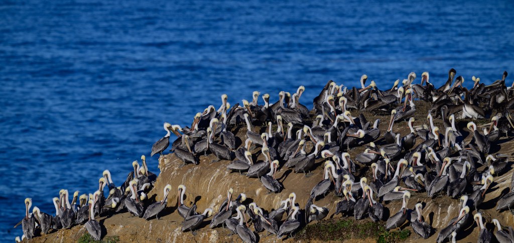
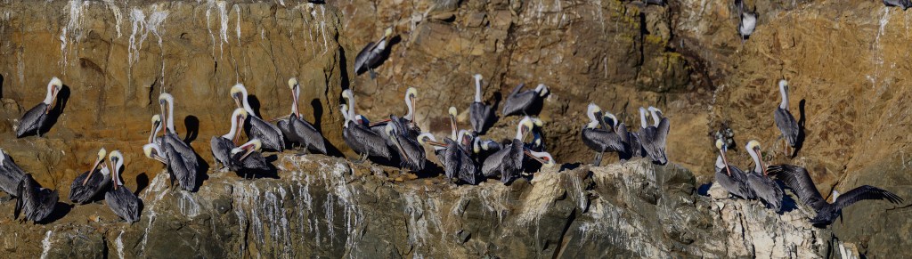
Brown Pelicans
Mendocino is a small town a few miles south of Fort Bragg. In October 2025 Roberta and I parked at the Mendocino Headlands State Park. Walking paths on the bluffs are 100 feet above the ocean. Tall rock towers are a short distance offshore. A thousand Brown Pelicans were roosting on these towers. I set my camera on a tripod and took over 2000 pictures.
Brown Pelicans hatch their young on secluded islands off of southern California (Anacapa and Santa Barbara) and Baja. In early summer they move north to feed on fish. After October they head back south. These birds stick to the coast; there are only three records of a Brown Pelican in Inyo County.
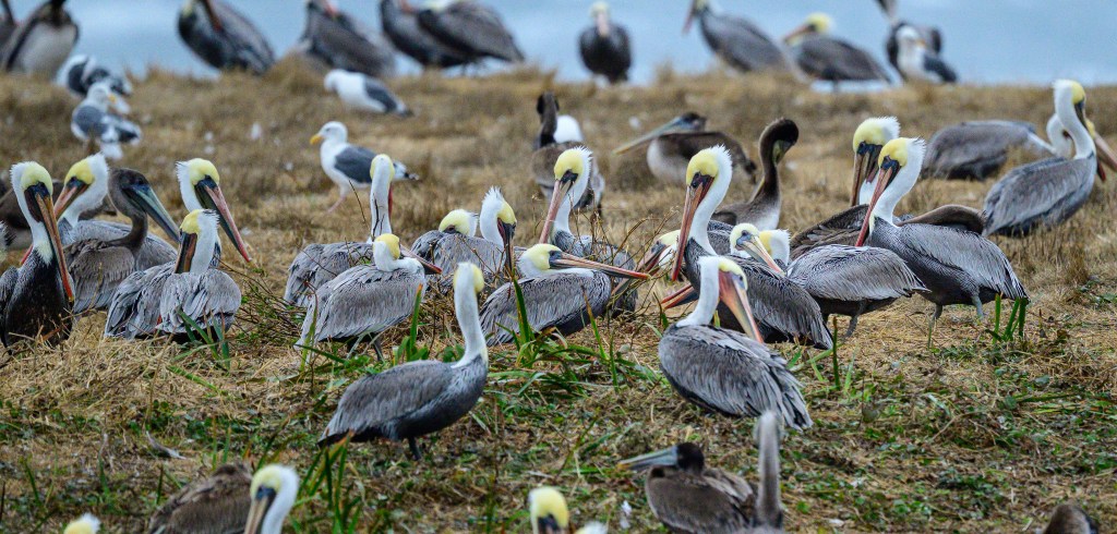
A Brown Pelican weighs 8 pounds and has a wingspan of 6.5 feet. Young birds are, well… brown. By age 3 years they have white heads, a yellow forehead, the bodies are a mix of grey and white, and the bills are partly red. They are lovely in the air, flying in lines of 5 to 25 birds, often skimming just above the waves.
Below is a Brown Pelican; this all-brown bird is a juvenile, about one year old.
The next photo shows an adult, with a white/yellow head, partly red bill, and body of grey and white streaks. A few birds, including this one, had a lot of red color in their bill pouch, which is part of their breeding outfit. They will soon move south to nest.
On land, the Pelicans preen their feathers frequently, to get them into shape for flying and swimming. As the morning went on, the birds took off in small groups to find fish.
In the next photo, a bird near the center has turned its lower bill pouch inside-out. Bad table manners.
The remaining images all show Pelicans in flight. They are easy to photograph in the air, as they are big and they fly in straight, predictable fashion.
Bolsa Chica
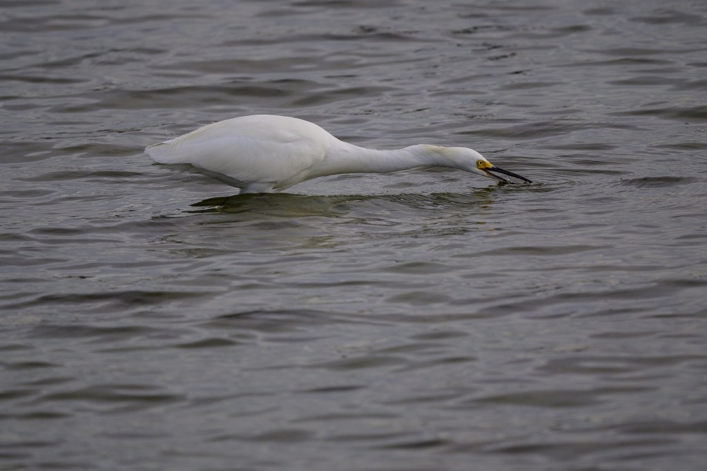
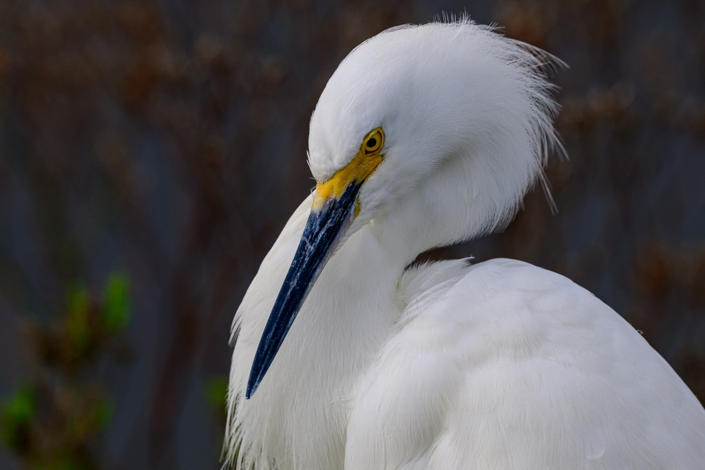
In January, 2026, we visited the Bolsa Chica preserve south of LA. This wetland hosts many species of coastal birds. There are a couple of miles of dirt road on embankments, so it is easy to walk about and find birds. The birds are protected and many of them know this; they allowed me to get surprisingly close. I sometimes had to back up to get the birds in focus with my telephoto lens. Snowy Egrets were so numerous and tame that I had to kick them out of the way. (Ok, full disclosure: I did not actually kick any birds.)
Pelicans
The American White Pelican is an enormous bird: 16 pounds, wingspan 9 feet. They are mostly an inland bird, fairly common near Bishop. There was a group of 7 birds feeding at Bolsa Chica and they did not seem to mind as people walked past.
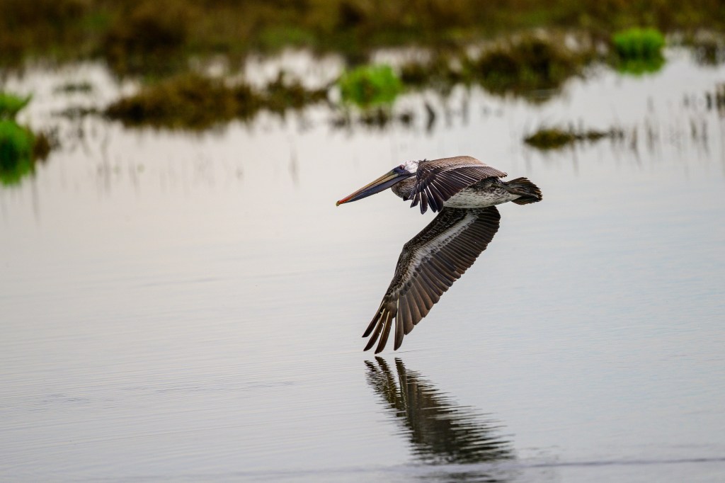
One Brown Pelican cruised past.
Ducks
There were several duck species, including a Bufflehead:
Ruddy Ducks, which I always describe as a bowl of noodles with chopsticks sticking out:
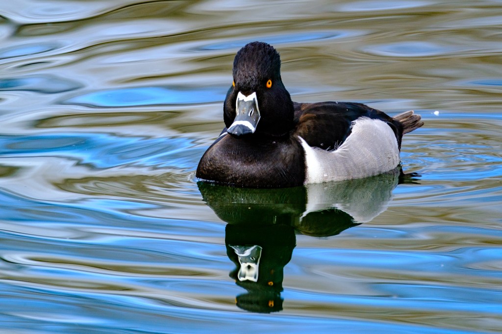
A few Lesser Scaups:
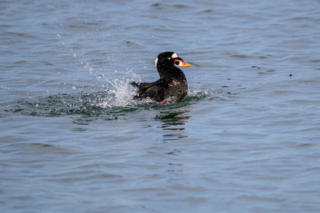
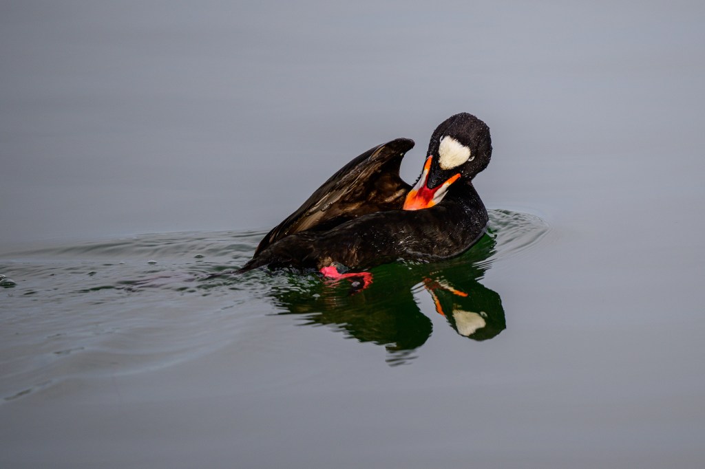
Surf Scoters were cruising about. Males have a bill colored black, white, orange, red, and yellow. The female has a black bill.
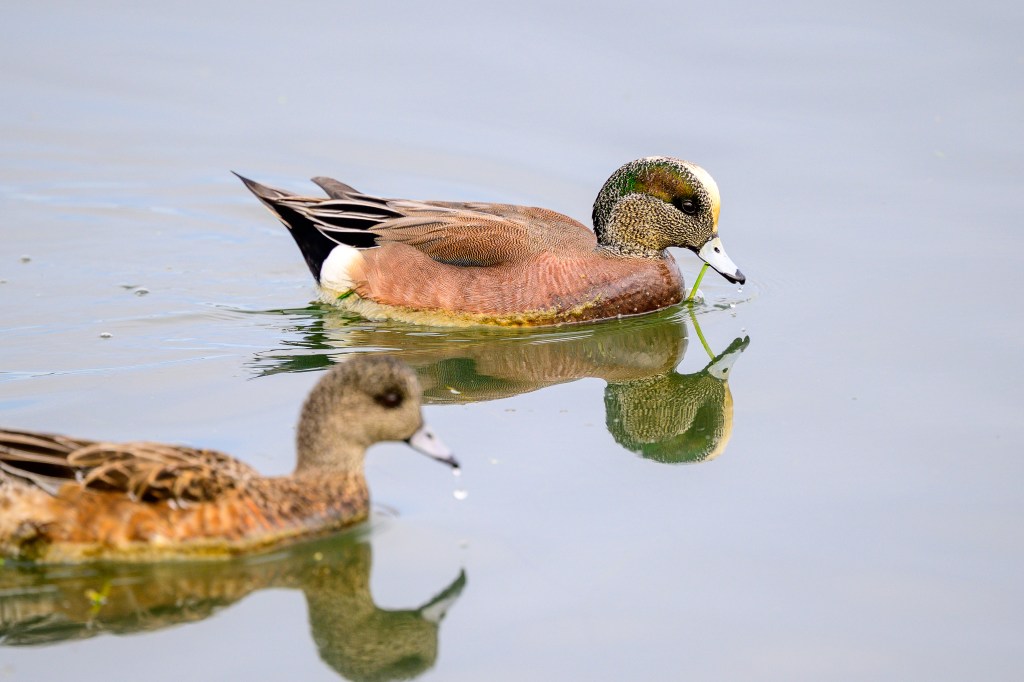
Several American Wigeons appeared:
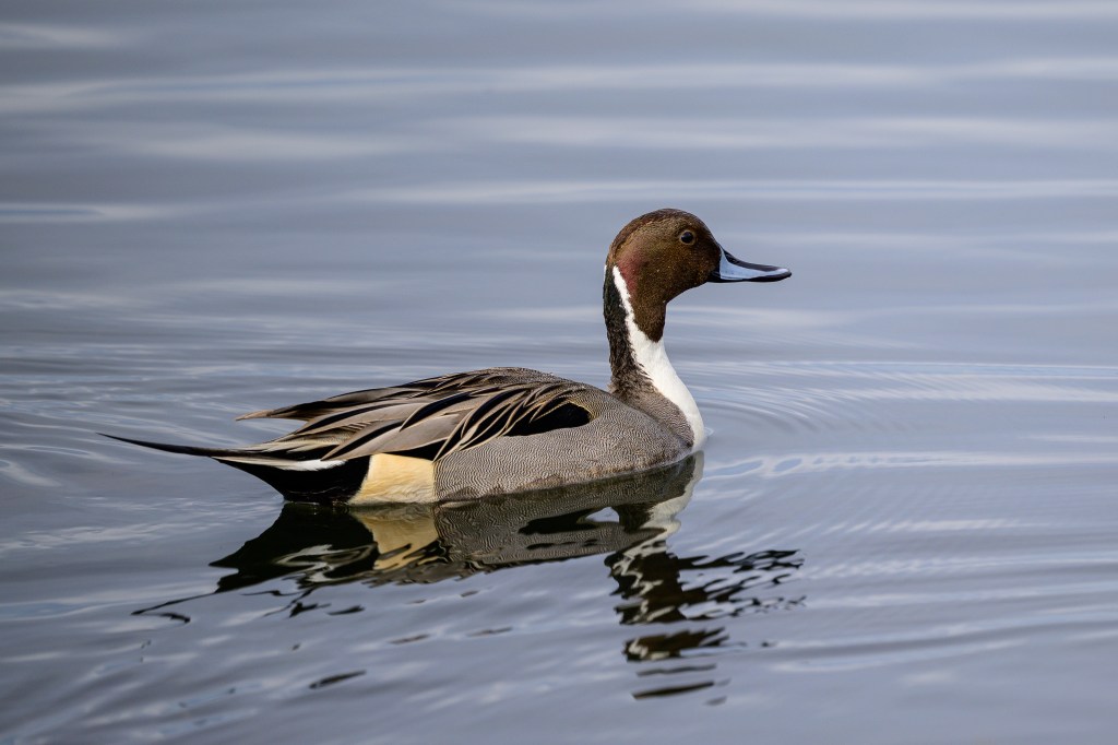
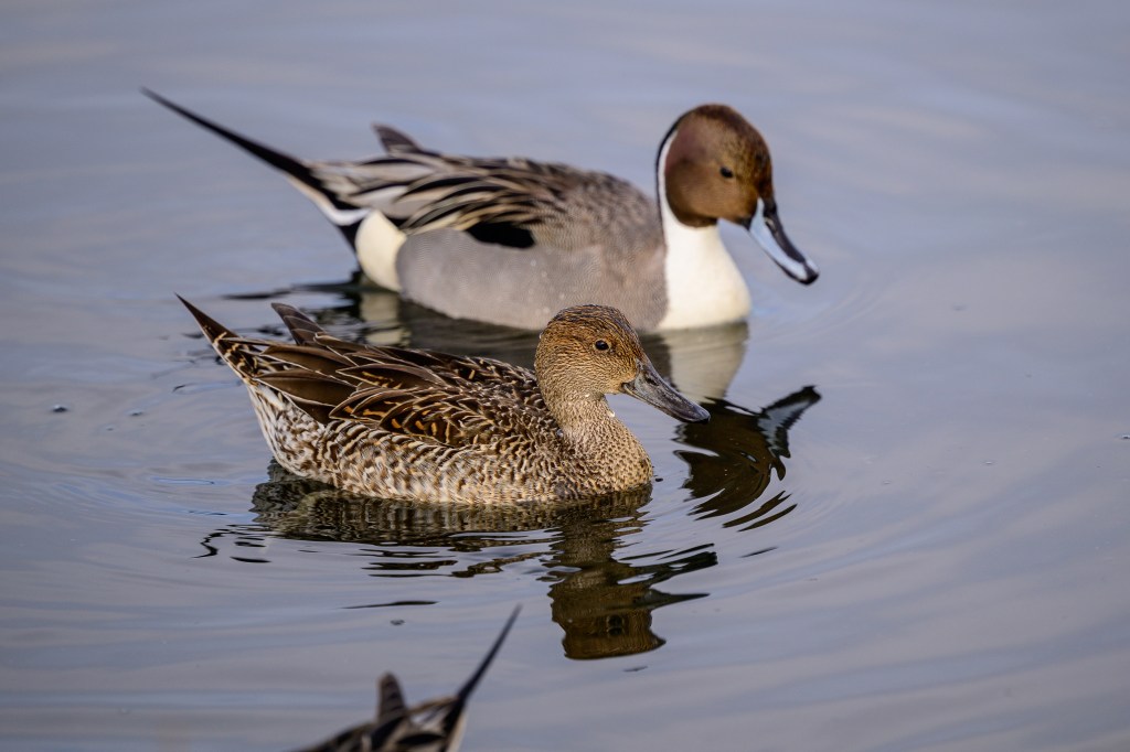
Northern Pintails are common migrants in Inyo County, but I have had poor luck finding them. Some birders have reported as many as 800 of these ducks at Owens Lake. At Bolsa Chica, I had the opportunity to collect images of this elegant duck; the males have striking colors. The reason for the name is obvious.
Grebes
Several species of Grebe were present. A Pied-billed Grebe was very close:
Horned Grebes were further away:
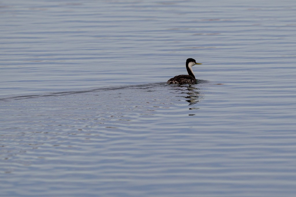
A Western Grebe was far off:
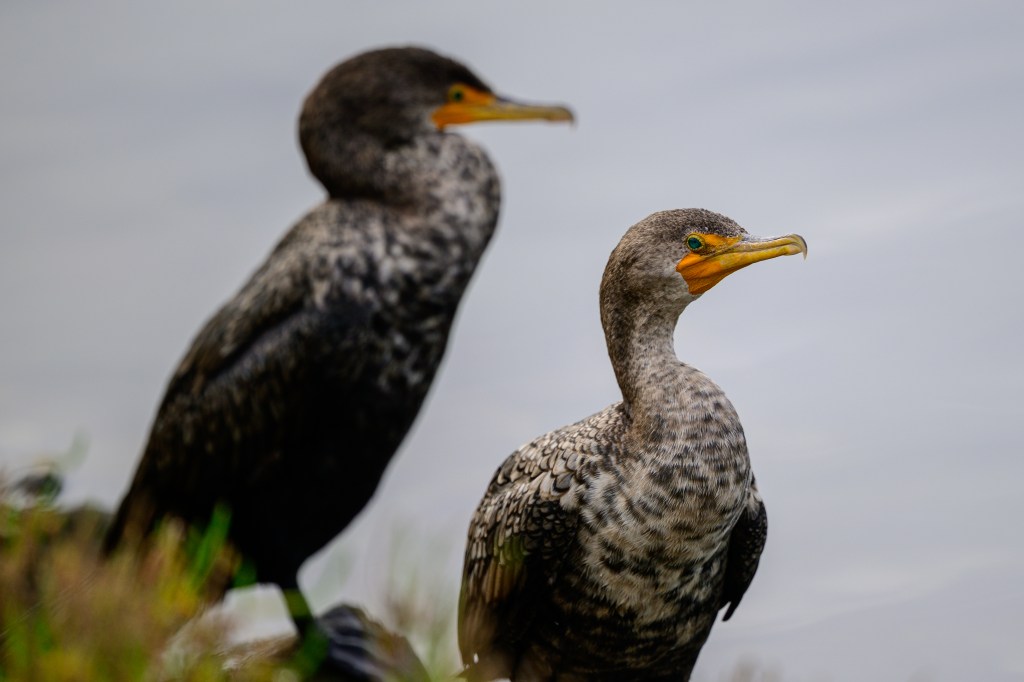
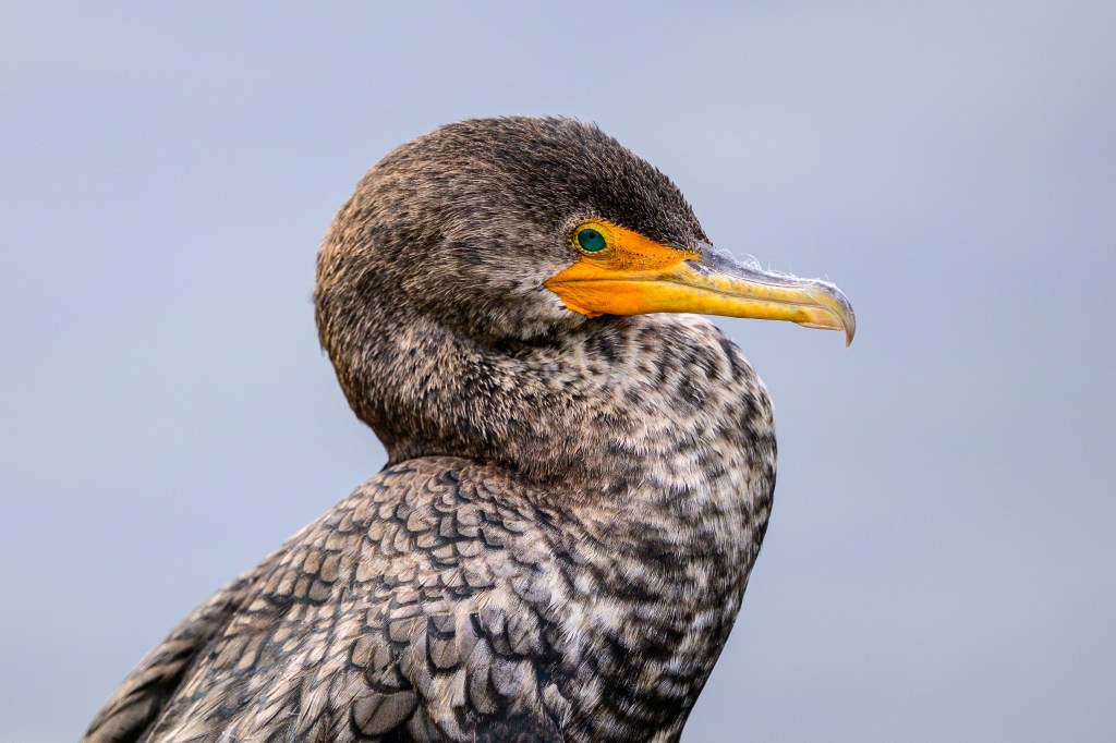
Double-crested Cormorants
These birds are common at the Pleasant Valley Reservoir near Bishop. They also show up at the Buckley Ponds. At Bolsa Chica, they were remarkably tame, allowing me to get detailed close-ups.
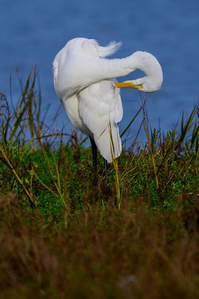
Great Blue Heron
The photos below show preening behaviors.
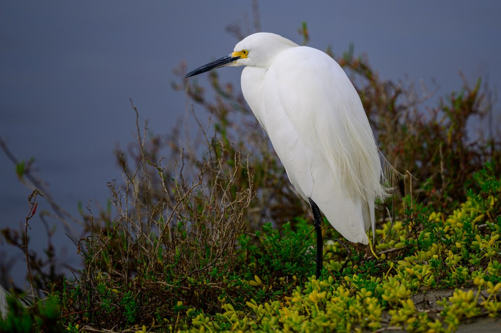
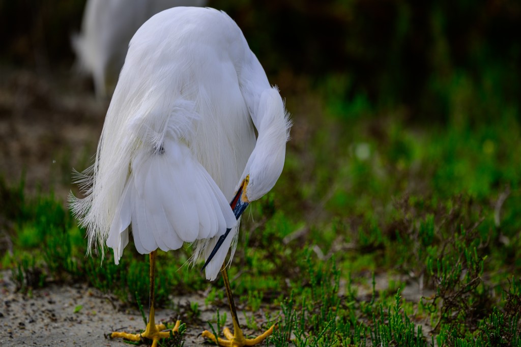
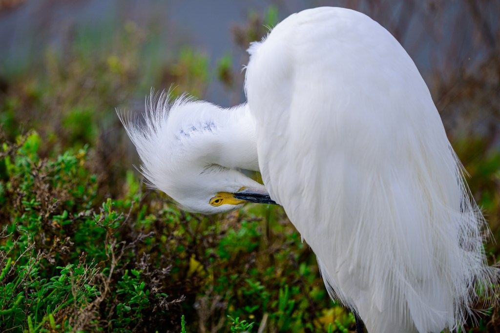
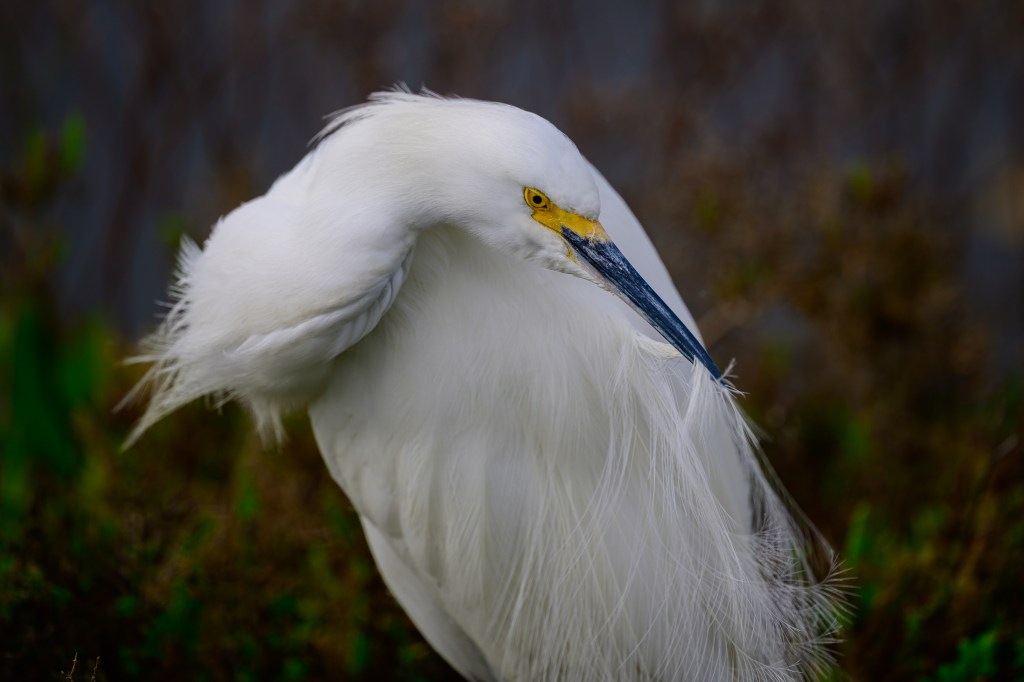
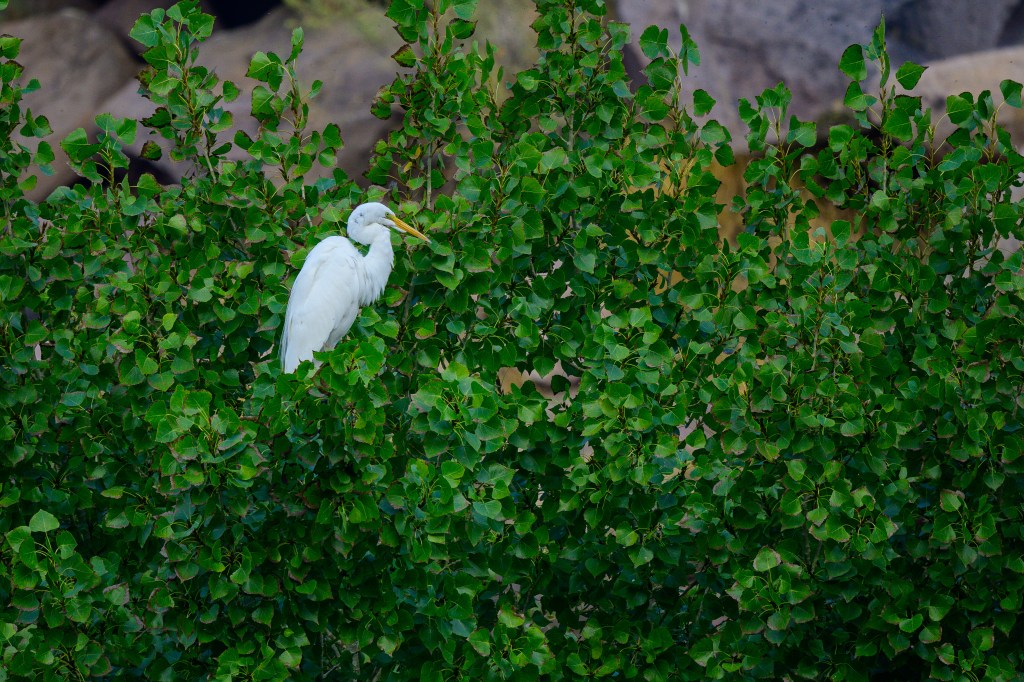
Egrets
There were a few Great Egrets, such as the one below:
One birder pointed out a single Reddish Egret. This was a new bird for me. This Egret has only been reported once in Inyo County. Sibley’s guide says there are only 5000 of these birds in North America. A lucky find.
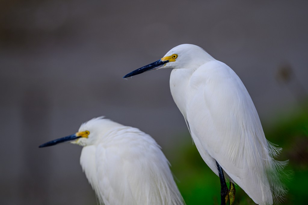
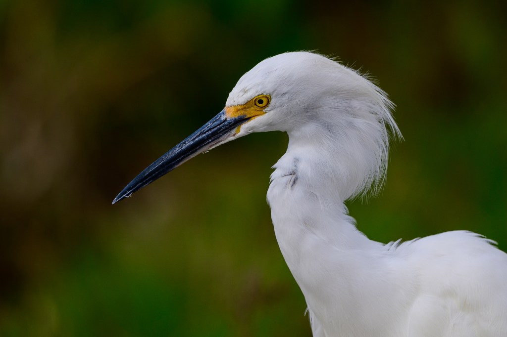
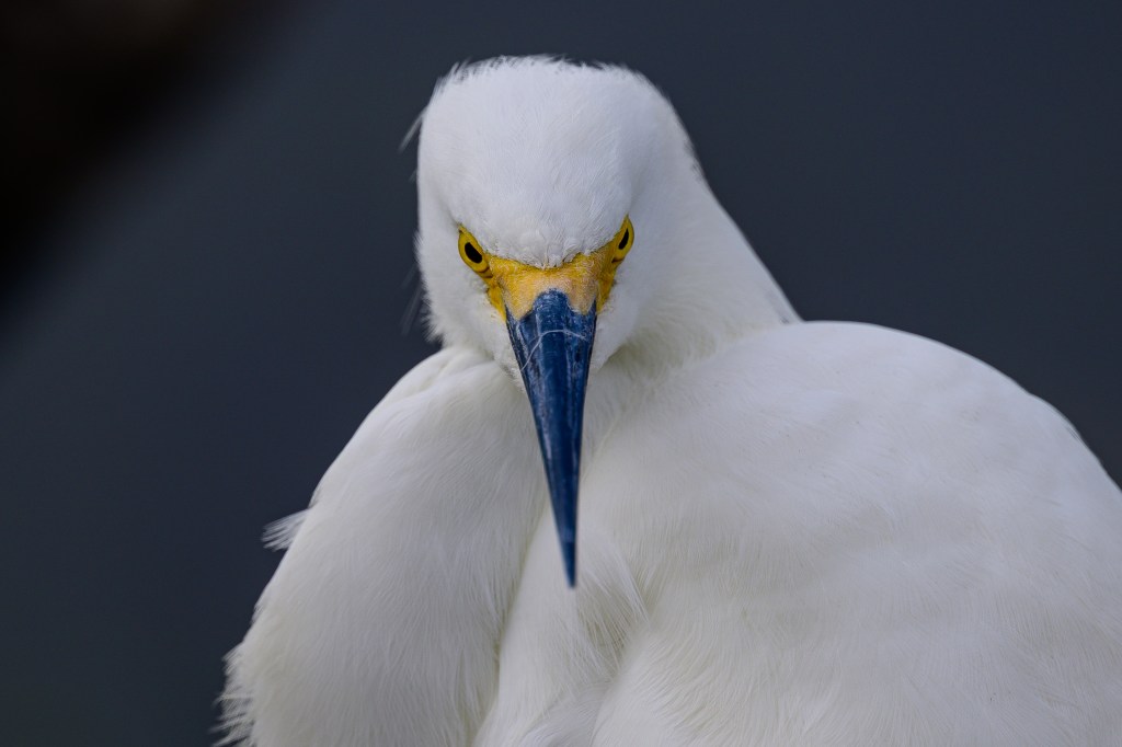
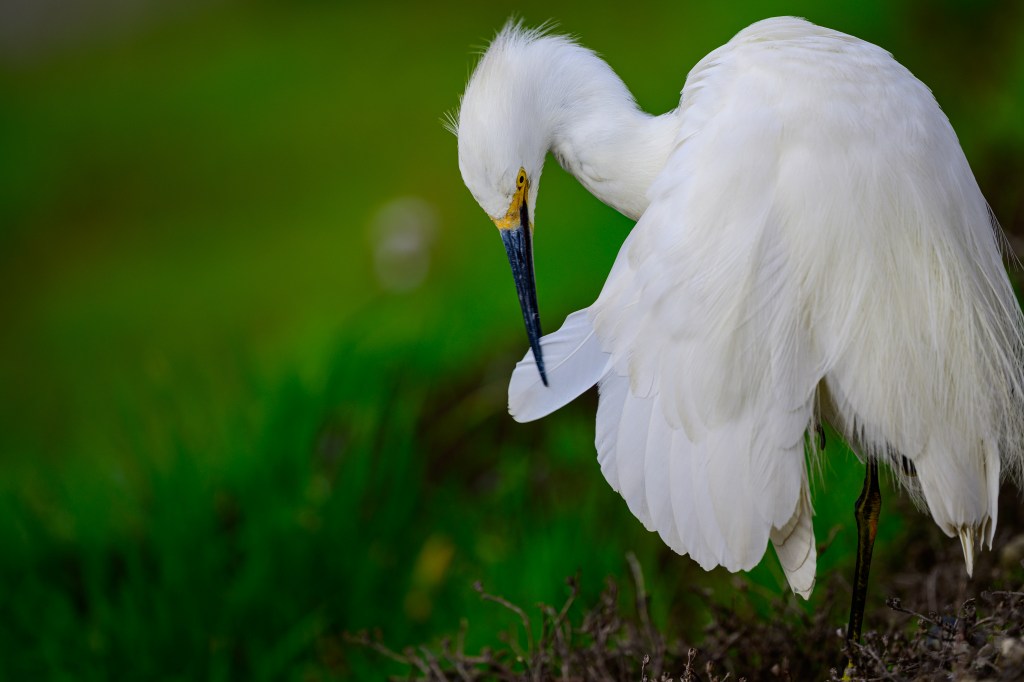
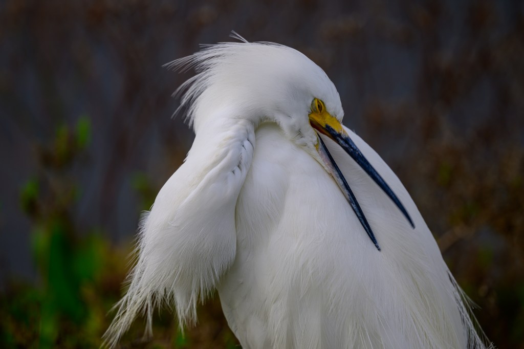
The next 13 images show Snowy Egrets. I have photographed these birds near Bishop, but they are not terribly common. At Bolsa Chica there were a hundred along part of the walk. I selected a few images that show a lot of detail and interesting preening behavior.
I particularly liked the details of the eyelids in the next three pictures.
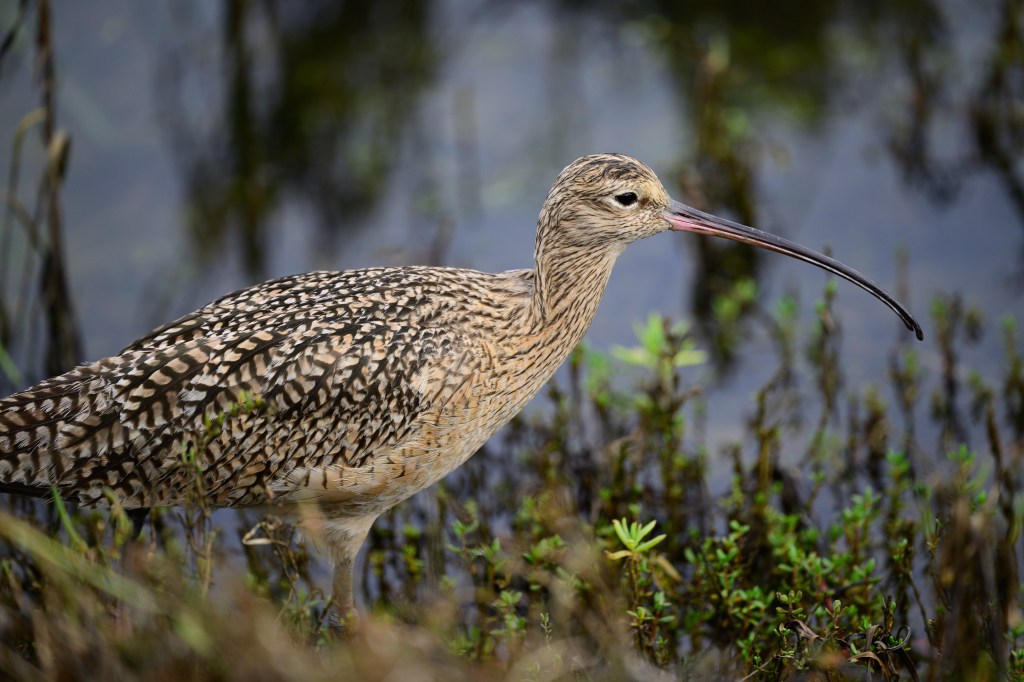
Curlew
Here is a Long-billed Curlew. The absurd bill seems like a joke.
A final comment:
A place like Bolsa Chica is special: 1) you can see many birds of several species in a short time and 2) you can get closer to the birds than in most other places. It functions as an open-air aviary. It might be nice if every region had a place like this where people could enjoy birds so easily in an outdoor setting. But doing this is expensive. It would be costly to provide the habitat and protection that the birds need; fencing, gates, water supply, nesting areas, vegetation, and so on. When we were at the Bolsa Chica, two young rangers were patrolling the walks, greeting visitors and making sure that people followed the rules. It would be costly to provide that level of security in many places. Many wildlife refuges do provide habitat for birds and are patrolled by rangers. But they are usually set up so that people can shoot birds; a different experience.
I bought a full-frame Nikon Z8 camera in the fall of 2024. In March of 2025 I sold my firstborn and bought a Nikkor Z 600mm f4 lens that has a built-in 1.4x teleconverter. Using this expensive gear I collected 5000 bird images by the end of 2025. I delete 90% of the pictures I take, so this means I took 50,000 bird photos in 9 months. That is equivalent to 1390 36-shot roles of 35mm film. Back in 1990, a roll of Fujifilm Velvia cost about $10, so the cost of 50,000 film pictures would have been $13,900. Developing the film would double that amount. Accounting for inflation from 1990 to 2025 adjusts the cost to $70,000 in today’s dollars. Digital images are obviously much cheaper than film photographs. Digital gear allows me to take photos in a profligate manner that would have been financially ruinous in the film era.
This blog is a collection of 72 wildlife photos taken near Bishop CA in the last 3 months of 2025. I took thousands of photos during that time, so at least some of these should be good.
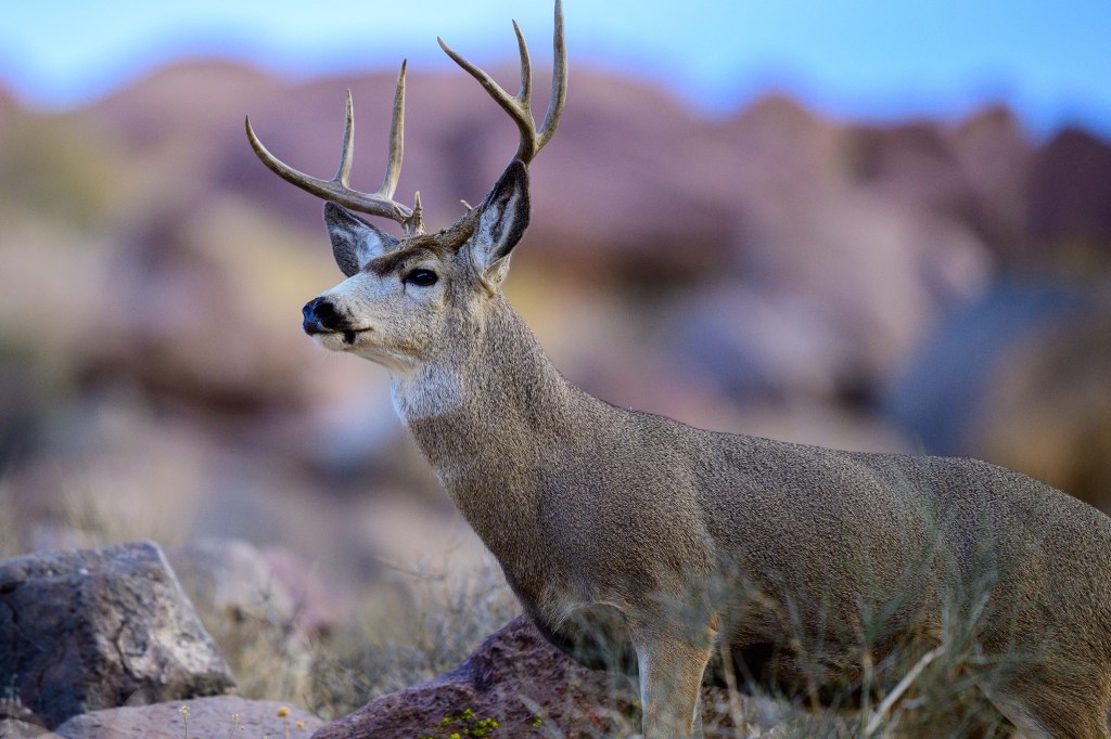
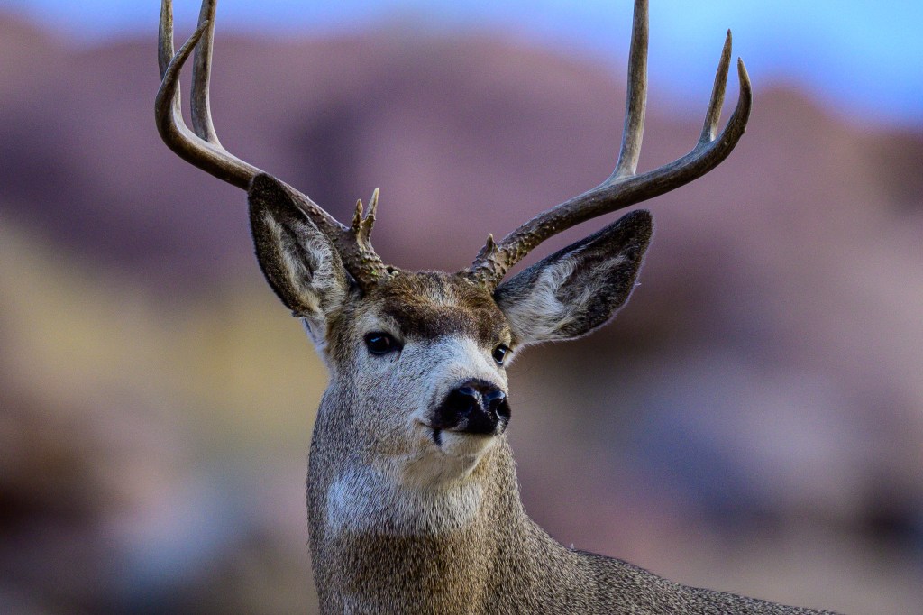
Mule Deer
Hundreds of Mule Deer live within 50 miles of Bishop. In summer, deer are high up in the Sierra, but in winter they roam the floor of the Owens Valley. This buck was getting a drink at the Pleasant Valley Reservoir. Roberta spotted him as he crossed the road and ambled up the hill above us. They are named for their large, mule-like ears. Deer often have scrapes and scars on their fur, but this one looks as if he was groomed for a show.
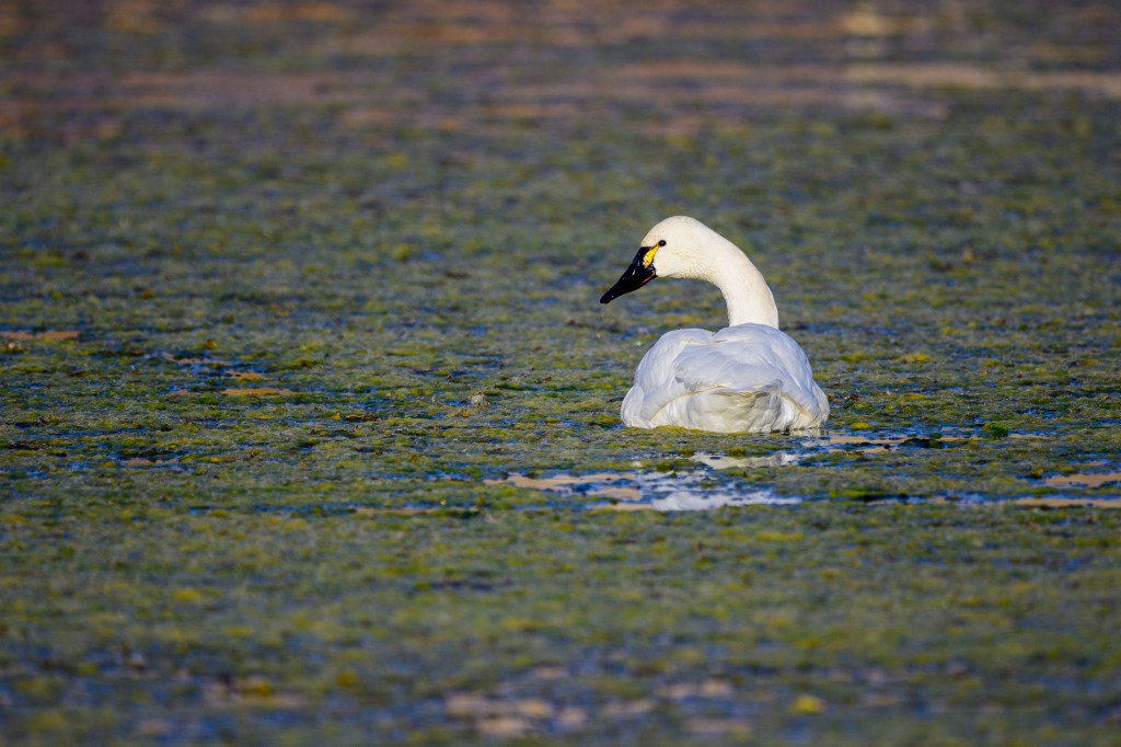
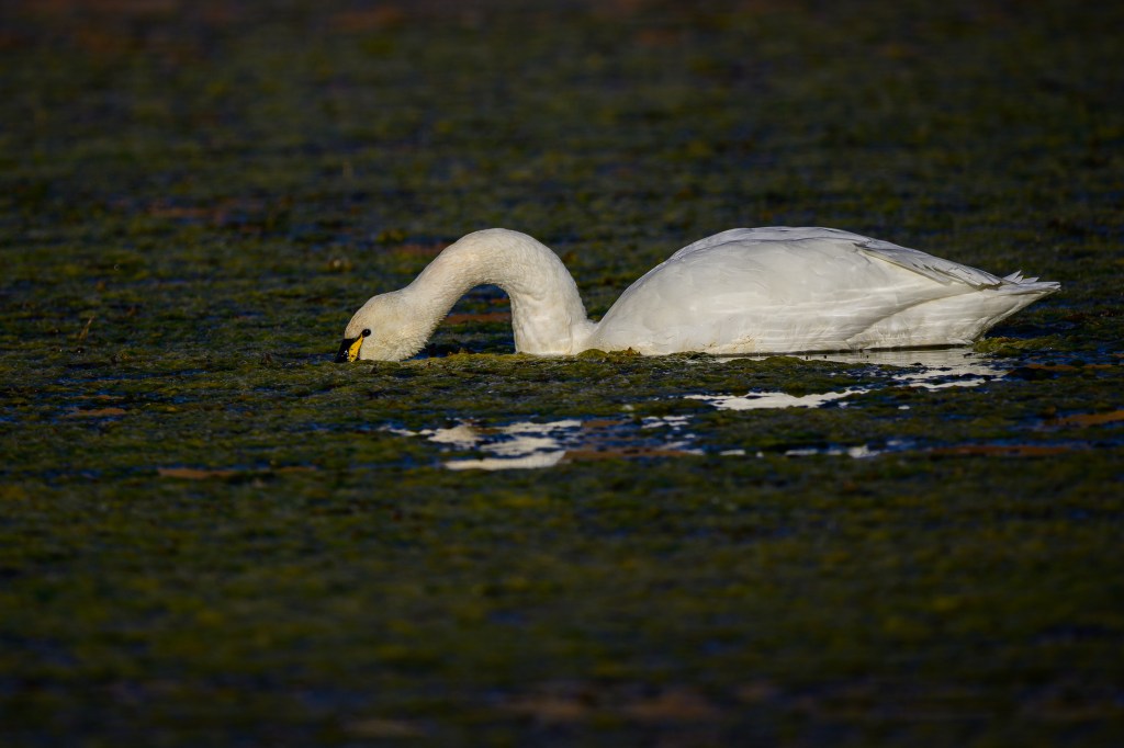
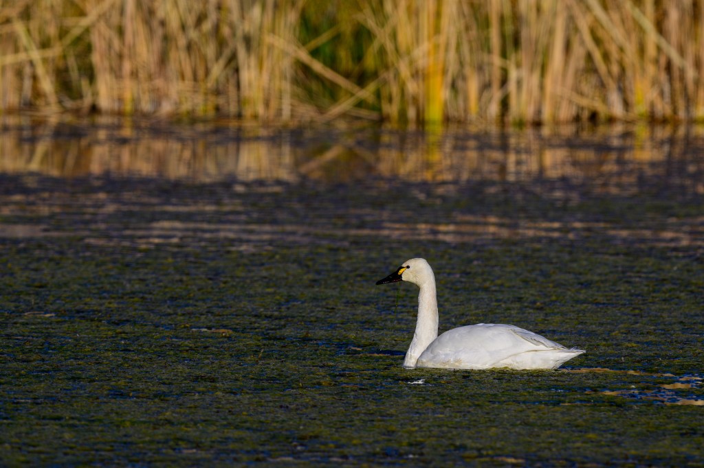
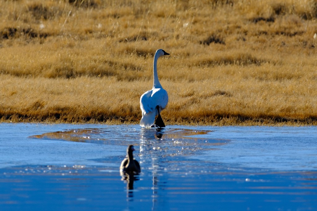
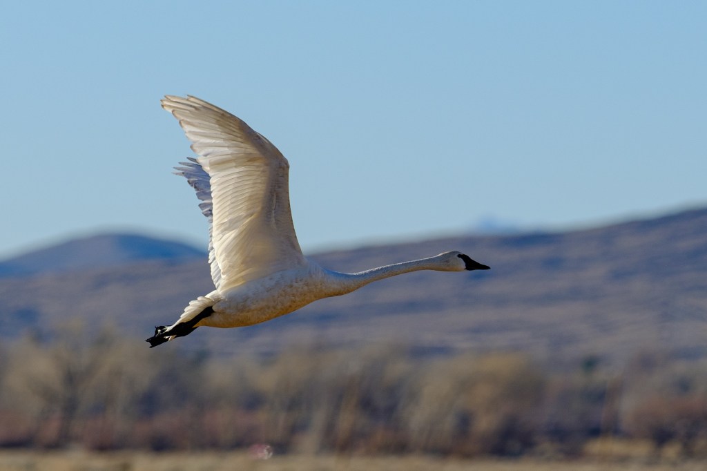
Tundra Swan
A lone, migrating swan was at the Buckley Ponds for a few days.
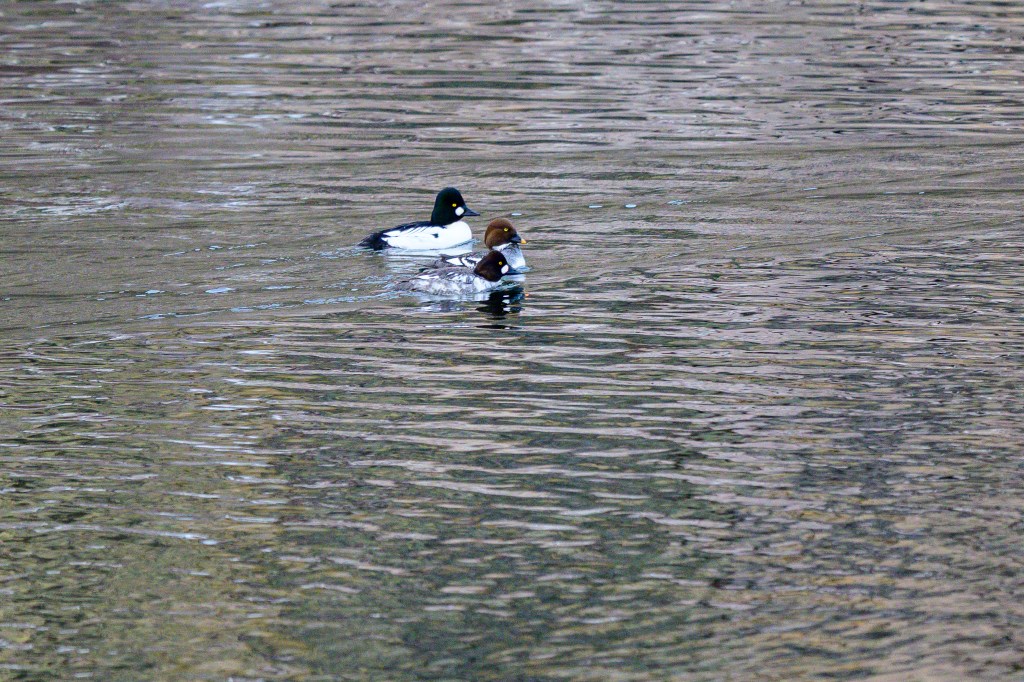
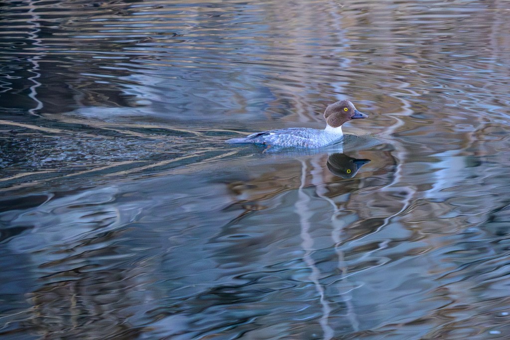
Common Goldeneye
Goldeneye’s migrate through in winter. A few were hanging out at the Reservoir.
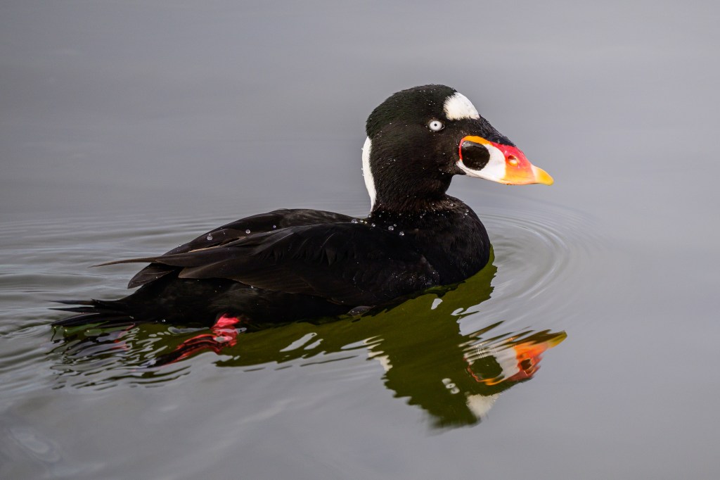
Surf Scoter
Below is a female Surf Scoter, which I photographed on Nov 12, 2025. This bird brought me 15 minutes of fame. I’ll explain below.
Some birders engage in a competition to count the greatest number of species in their area during each year. In the digital era, they report their findings to eBird, a website run by the Cornell Lab of Ornithology. During 2025, for example, Nancy Overholtz was the leader for Inyo County, with 301 different species that she saw in our county. Rosie Howard was close behind with 297, and Chris Howard was third at 284. These people are superb birders; in a year, they see more species than I’ve seen in my lifetime. (They also happen to be nice people who are happy to share their bird knowledge with others.)
On Nov 12, I spotted the Surf Scoter at the Reservoir and snapped a few images. I realized this was a female Surf Scoter, a bird that I have photographed on the coast. It sports a strange, bulging bill that seems ill-fitted to its face. This bird does not belong here, over 100 miles inland; they are rarely show up here. By luck, I was the first person to spot this bird species in Inyo County during 2025; or at least the report it. I posted my find to eBird and sent email messages to Nancy, Rosie, and Chris; before the sun set, they traipsed to the Reservoir and saw this bird. So I was briefly famous to a few people. OK, not actually famous, but at least notable?
Full disclosure: I was Inyo birder number 640 with just 12 species seen during 2025. In my defense, I don’t report the birds I see, I only made the report for Nov 12. If I were to report faithfully, I suspect I could break into the top 100 for Inyo County!
Double-crested Cormorant
California has only one inland cormorant species, the Double-crested. They are at Pleasant Valley Reservoir year-round. I try to get sharp images of their lovely feather patterns and colors. Their blue eyes look like buttons sewn to their faces. Look at the third photo below. Doesn’t it look as if there are yellow stitches around the eye?
Grebes
Below is an Eared Grebe. The “ears” are feathers that appear only during breeding season; so there are no “ears” in this photo
Pied-billed Grebes are smaller. The ones below have been at the Buckley Ponds for months, but these Grebes also appear at the Reservoir and in other locations. “Pied” means multi-colored, white and brown, or white and black; an old-fashioned word that people usually apply to horses.
Great Blue Heron
Three photos from the Reservoir and the Owens River.
Great Egret
Four images of Great Egrets at the Pleasant Valley Reservoir in late September. The first shows an Egret high up in a tree. It is common to see Egrets and Herons up in trees. I suppose they perch there for a location where they can take a break and be safe. But they always seem out-of-place to me.
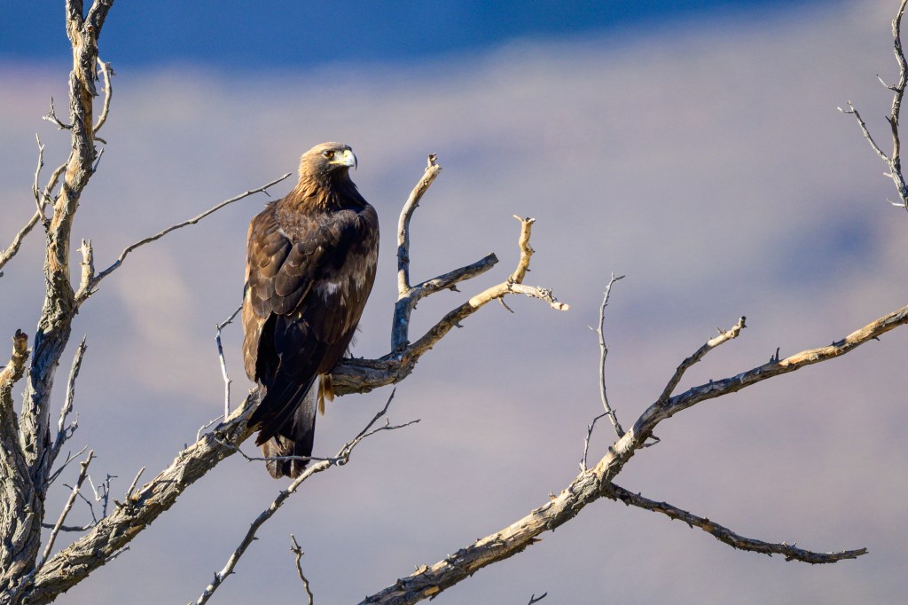
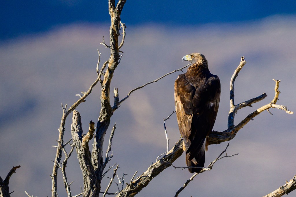
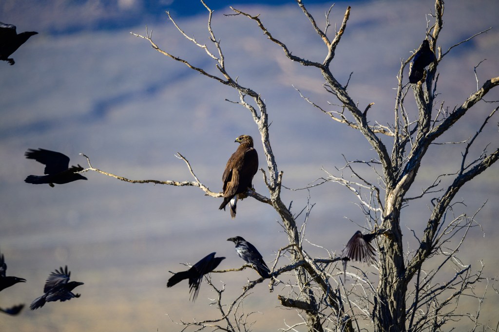
Golden Eagle
Below is a Golden Eagle near Warms Springs Road in November. Sometimes we see what we expect, rather than what is there. I’ve seen Bald Eagles at this location and initially that is what I thought I had photographed. But on reviewing the pictures, I realized that the golden feathers on the neck and the long bill were not those of a Bald Eagle. In the third photo, a flock of Ravens (or Crows) tries to intimidate this Eagle.
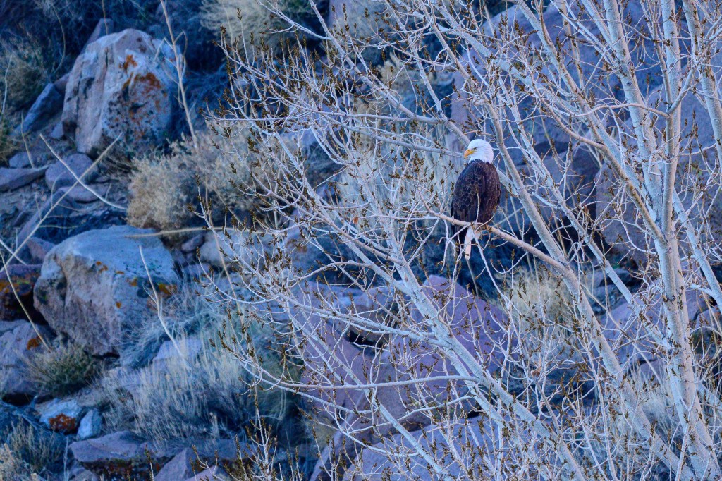
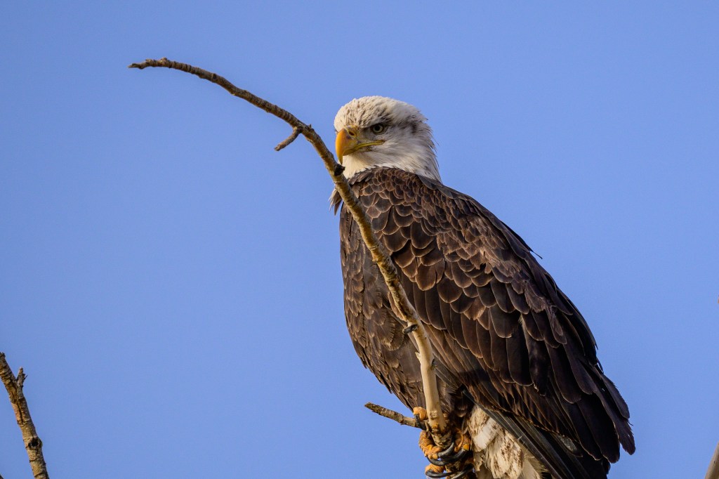
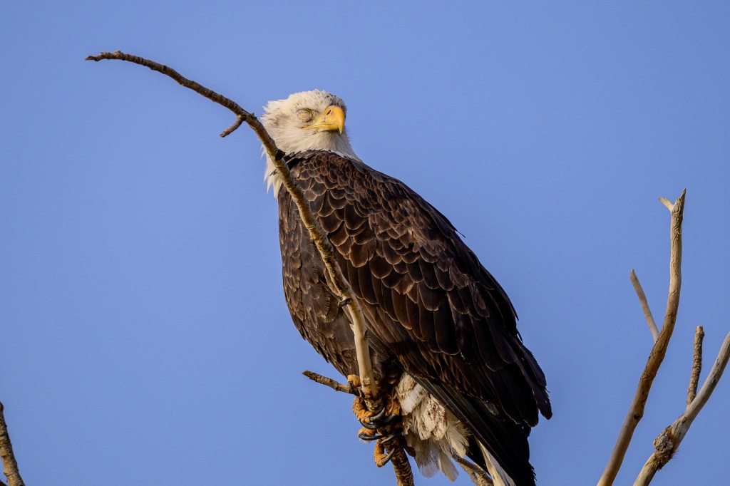
Bald Eagle
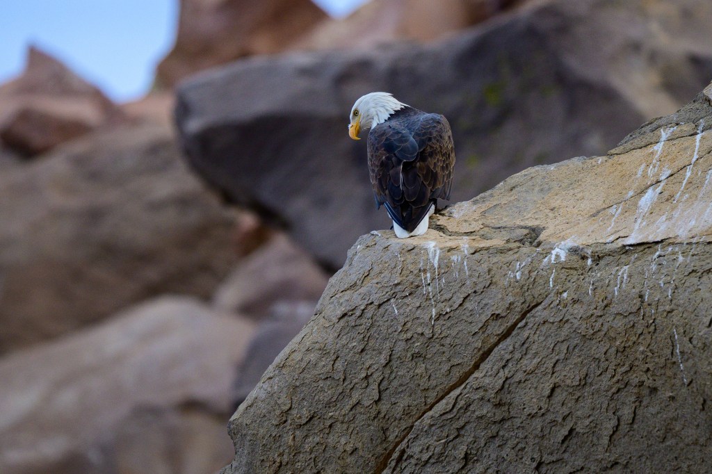
The first photo shows a Bald Eagle on the basalt boulders above the Reservoir.
Another Eagle at the Reservoir.
The next two photos show a Bald Eagle on Gus Cashbaugh Lane near Bishop.
Birds have three eyelids; upper and lower lids, similar to those of humans, and a nictitating membrane, a translucent membrane that is under the eyelids. The nictitating membrane protects the eye in flight or from dust, but the bird can see through the membrane; sort of like a pair of goggles. It is common for me to photograph this membrane. Less common is to see the outer opaque eyelids, but you can see the eyelid over the bird’s right eye in the next picture.
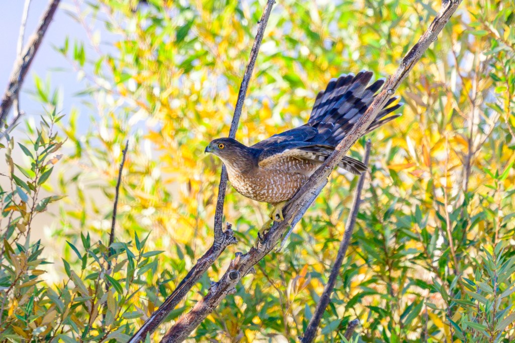
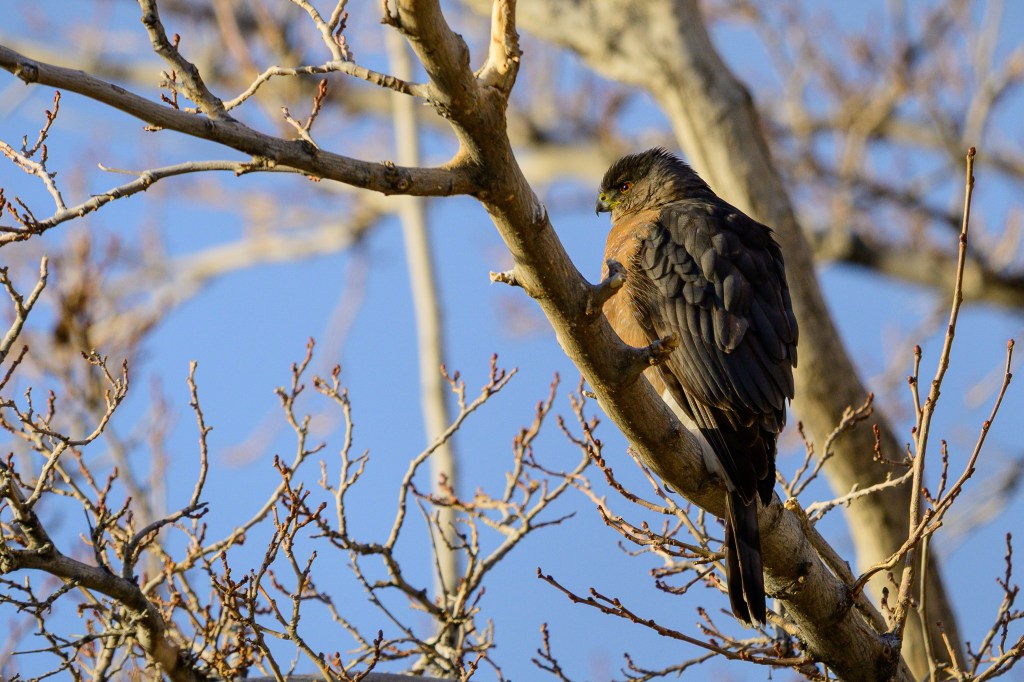
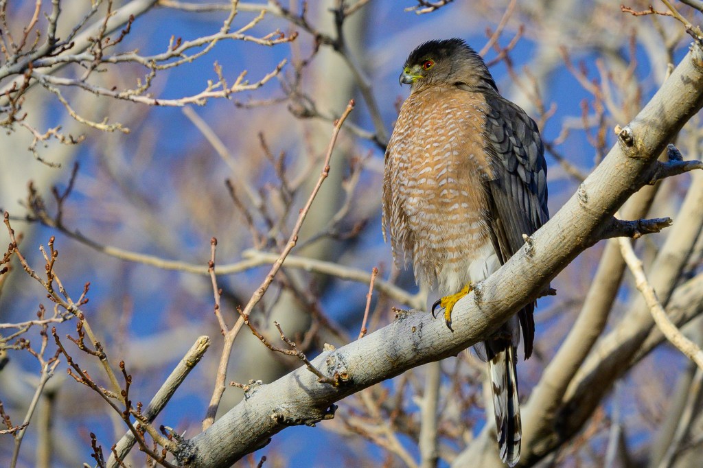
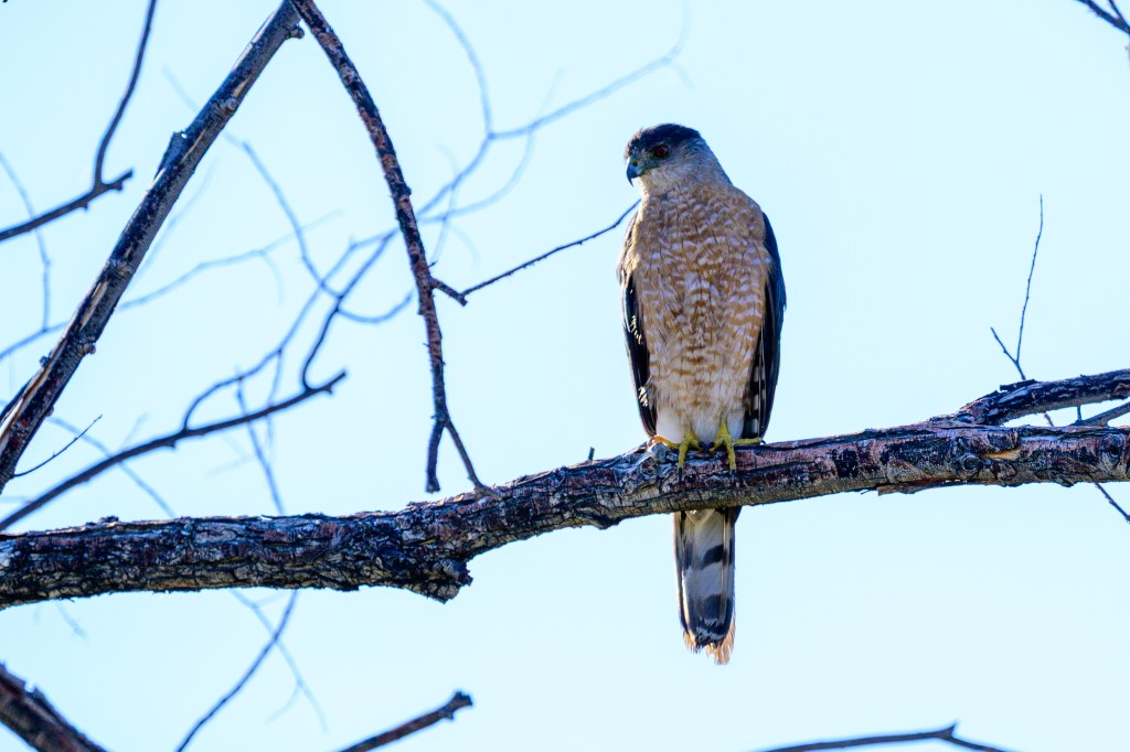
Cooper’s Hawk
Their long tails and colorful eyes make these hawks stand out. The first four photos were taken at the Buckley Ponds. In the first two photos, the iris is more yellow than red, indicating that this is a young bird.
The next two pictures show a Cooper’s Hawk that was 100 feet south of my home. Sometimes these birds are in my backyard. To get these pictures, I just walked out my door and strolled down the street until I had a clear view.
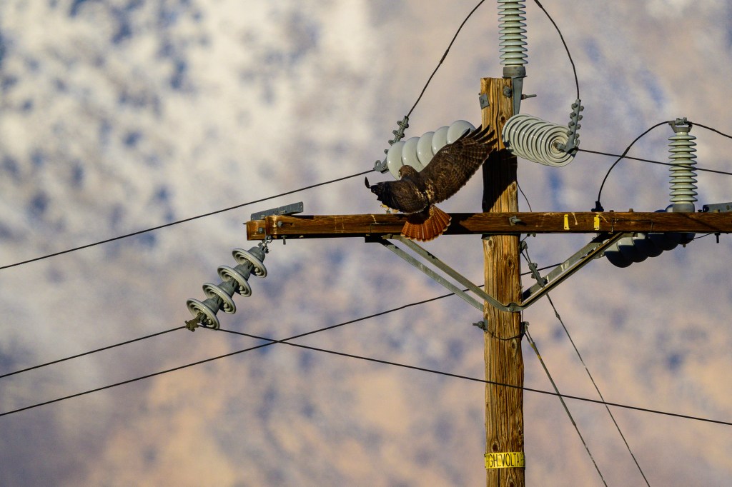
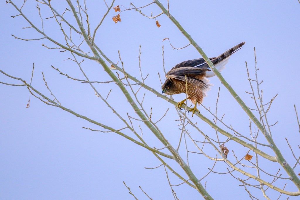
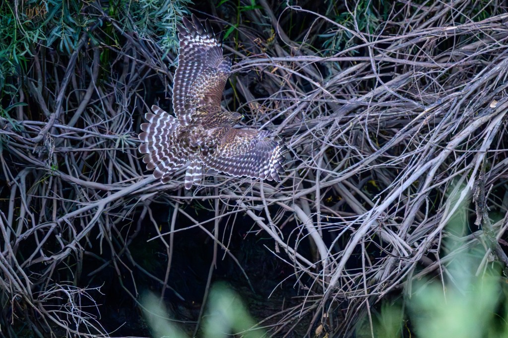
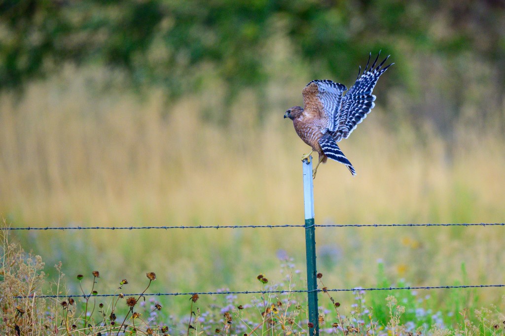
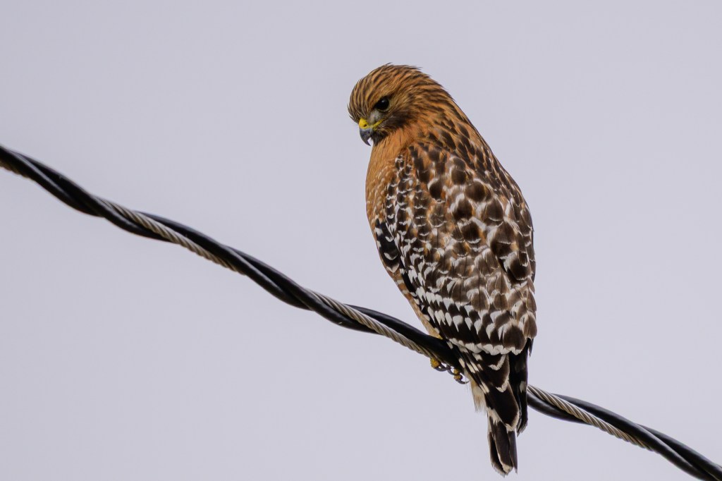
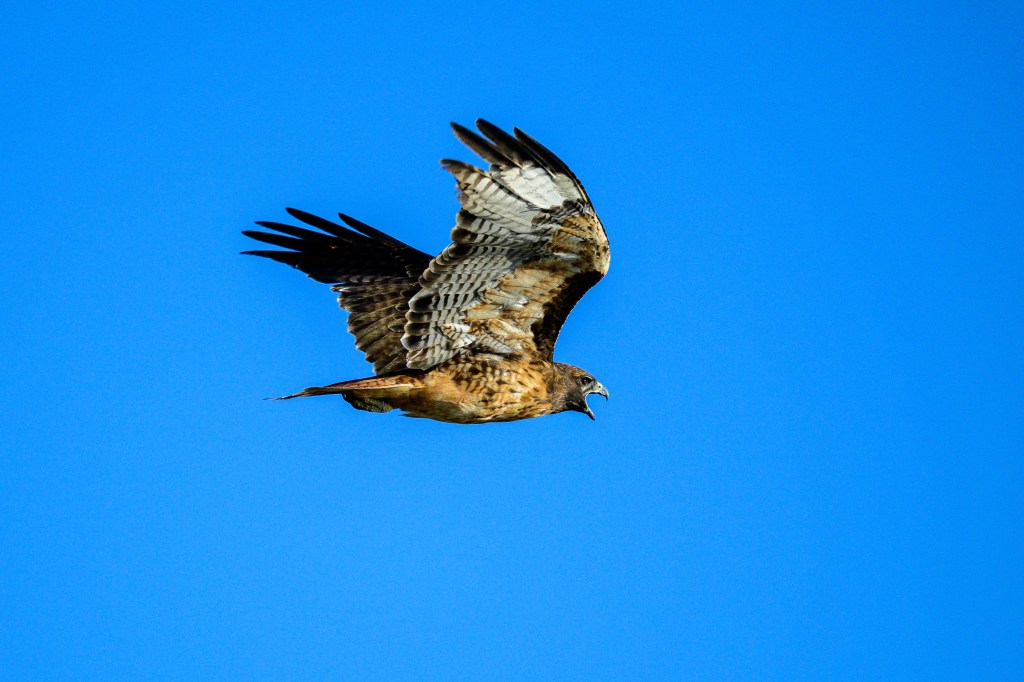
Red-shouldered Hawk
We walk to the Pleasant Valley Reservoir on a paved road that was built when the Reservoir was constructed on the Owens River. The road is about 20 feet above the water. This lets me look down on some birds, an unusual view. In the first photo, a Red-shouldered Hawk flies below me along the Owens River.
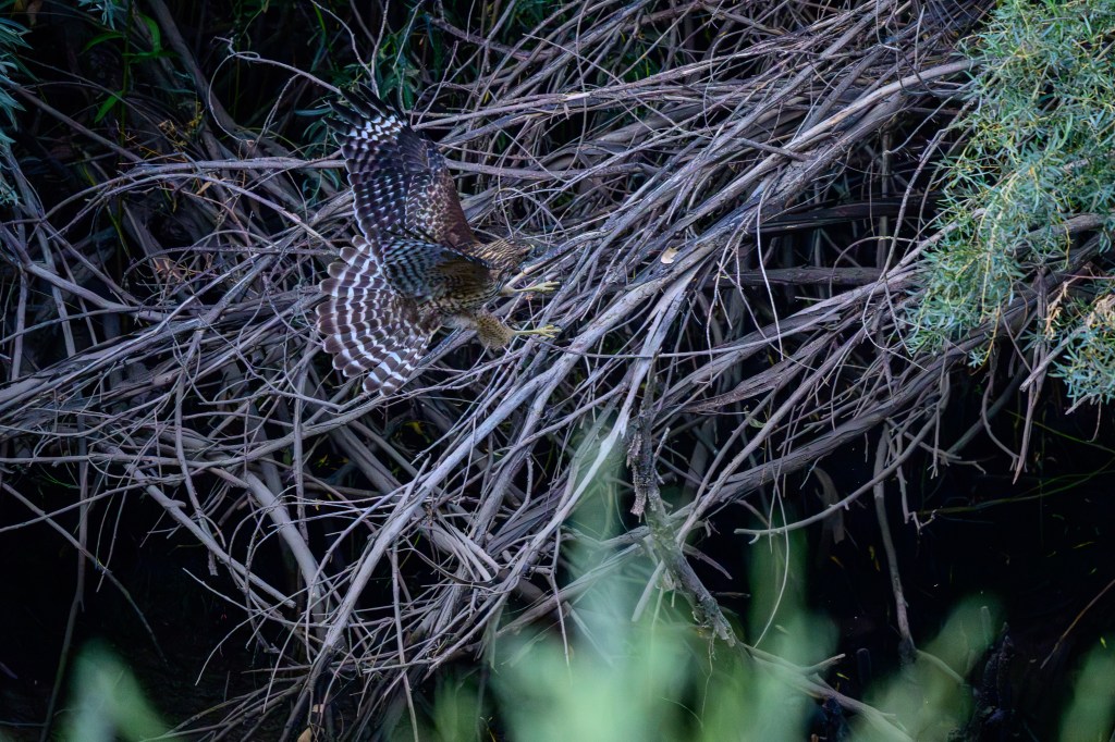
As the bird lands, it flairs its wings and tail to slow down. The bird even lifts feathers on its back to reduce lift and speed. Note the white bands (called “windows”) near the end of each wing. You can see a badly damaged feather in the tail. All birds molt, replacing old feathers with new ones. Some birds molt all at once. Ducks will find a pond or secluded marsh where they can feed and renew all their feathers; for about a month they cannot fly. Hawks would starve without flight, so they shed and regrow just a few feather at a time.
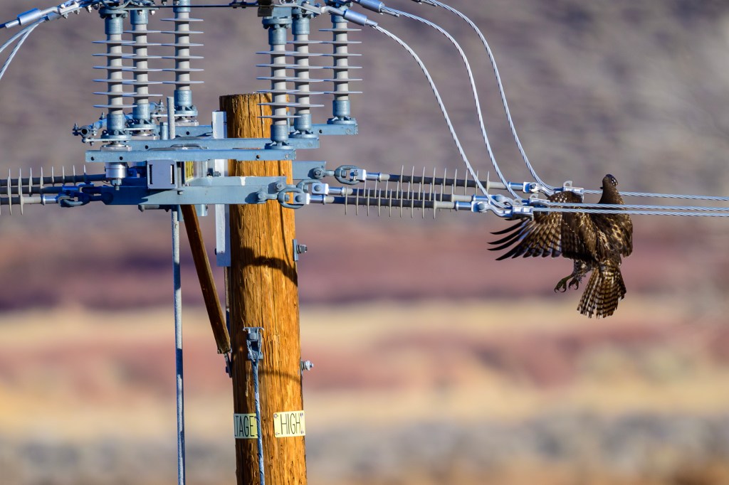
At the last moment the bird throws out its feet for landing.
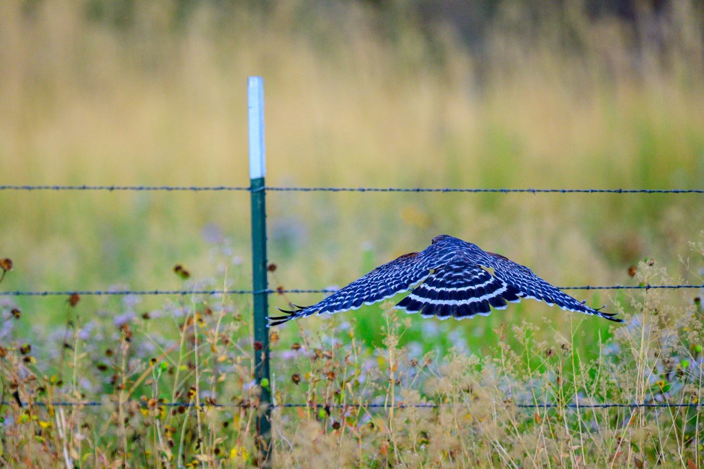
At the Conservation Open Space Area, a sequence of three photos shows a Red-shouldered Hawk making the same landing maneuvers:
Below, a Red-shouldered Hawk perches on a power line in my backyard. These birds hang out in my Bishop neighborhood. I often hear them calling while I edit bird pictures at my desk.
Red-tailed Hawk
Bald Eagles usually appear at the Buckley Ponds by December. But they did not do that in 2025. Instead, Red-tailed Hawks have been using the trees that are usually occupied by their bigger rivals.
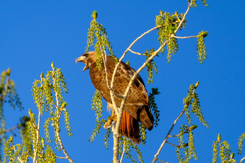
The Red-tail below is crying out as it takes off.
When I got home and reviewed my photos, I found that the Hawk below was carrying breakfast; a rodent of some kind. The Hawk has a band on its leg.
Two more Red-tails in December
Below, a Red-tail takes off from a basalt boulder above the Pleasant Valley Reservoir. Red-tails vary a lot in color; this bird is quite dark.
Ferruginous Hawk
Ferruginous Hawks appear in winter. The first photo shows one on Warm Springs Road. This species has a stunning white chest. Feathers on the head look as if they have been combed back and kept in place with hair gel. The yellow lips extend far back under the eye, past the center of the pupil. The yellow corner of the mouth is called the “gape.” A large gape makes it easier for this bird to quickly swallow an entire rodent. If you scroll back to my pictures of Cooper’s, Red-shouldered, and Red-tailed Hawks, the corner of the mouth ends in front of the pupil.
The next three photos show a Ferruginous Hawk on Gus Cashbaugh Lane near town. There is red color on this birds nose, face, and feet. That ain’t lipstick.
Below is a list the average weight, in pounds, for the raptors I have shown. This gives you an idea of how varied they are:
Golden Eagle 10
Bald Eagle 9.5
Cooper’s Hawk 1
Red-shouldered Hawk 1.4
Red-tailed Hawk 2.4
Ferruginous Hawk 3.5
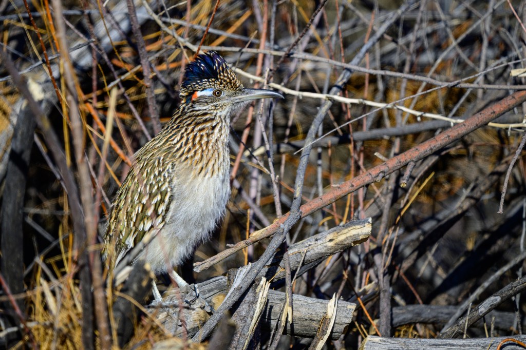
Greater Roadrunner
I see this bird twice a year, usually as it runs across a road ahead of me. Some books say they are uncommon in our area, but the sagebrush habitat seems ideal for them. I suspect they are just good at staying hidden. One of my photography goals is to get better images of this bird. The photos below show the iridescent colors of a Roadrunner near Warm Springs Road.
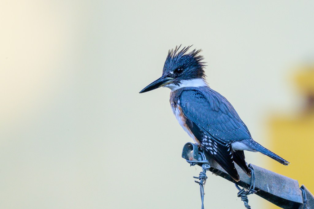
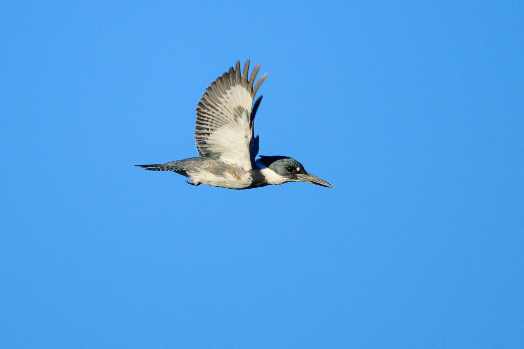
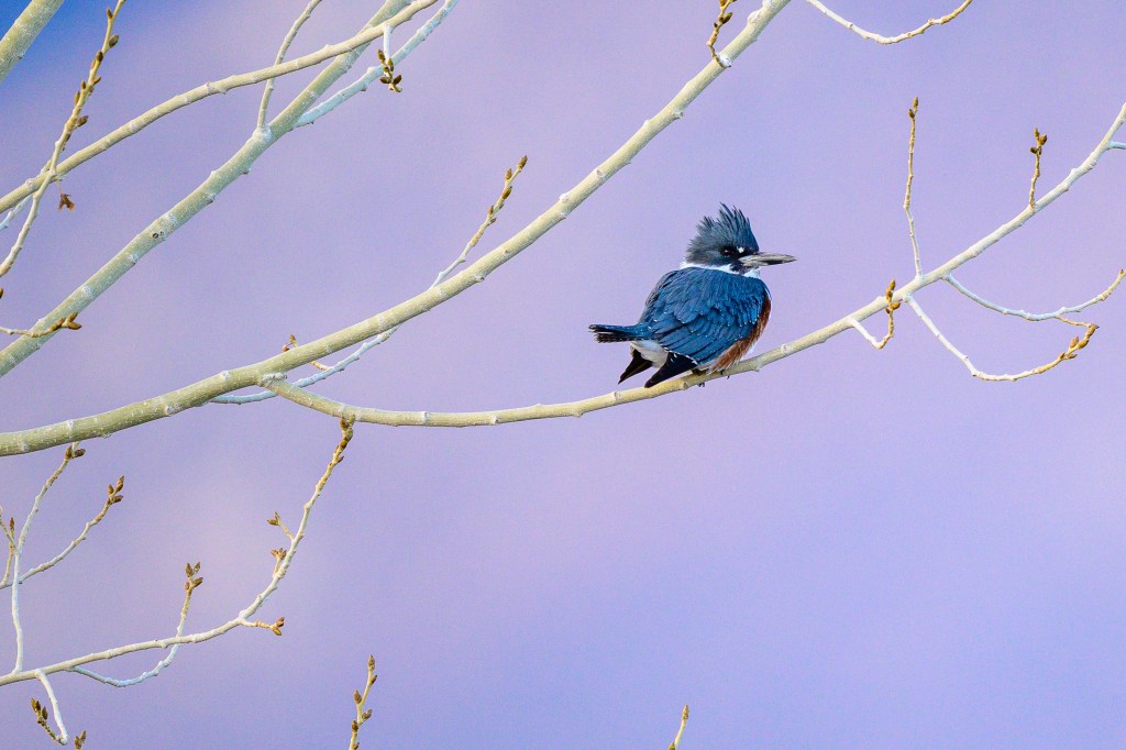
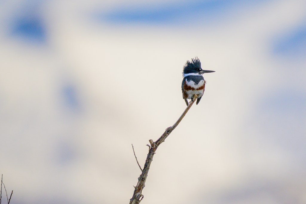
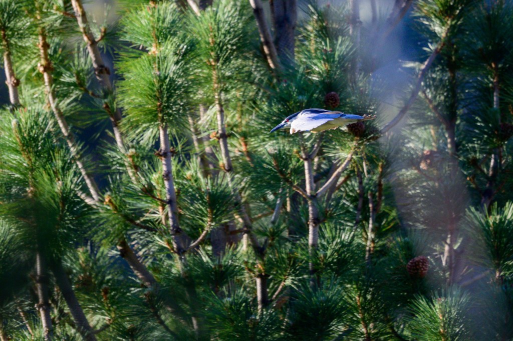
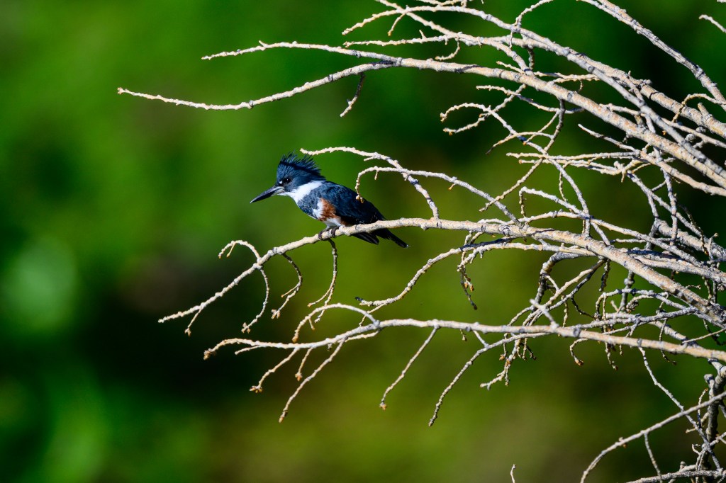
Belted Kingfisher
The first photo was taken at the Control Gorge Power plant on the Owens River, the next three at the Buckley Ponds. Lovely bird with a bad haircut.
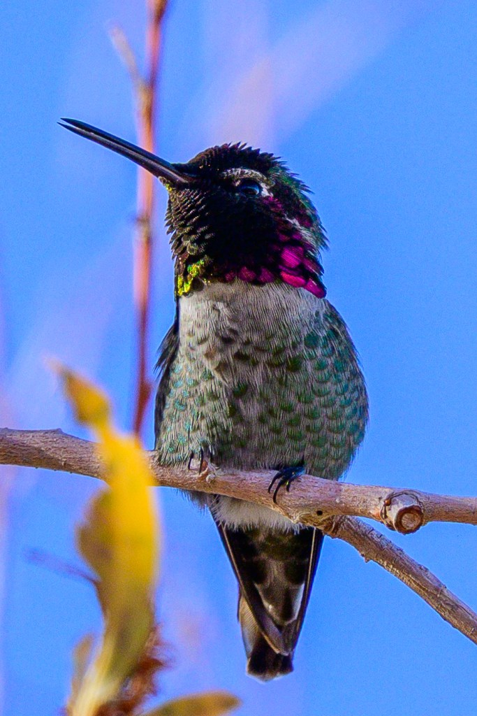
Anna’s Hummingbird
In mid-December I joined two expert birders at the Conservation Open Space Area for the Christmas count. They heard, saw, and identified this bird before I knew it was there. I was finally able to see it and started taking pictures as it moved from perch to perch. It was gone in a minute.
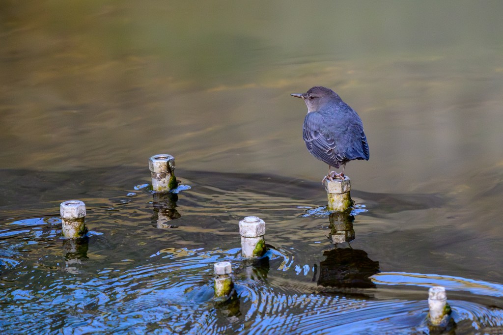
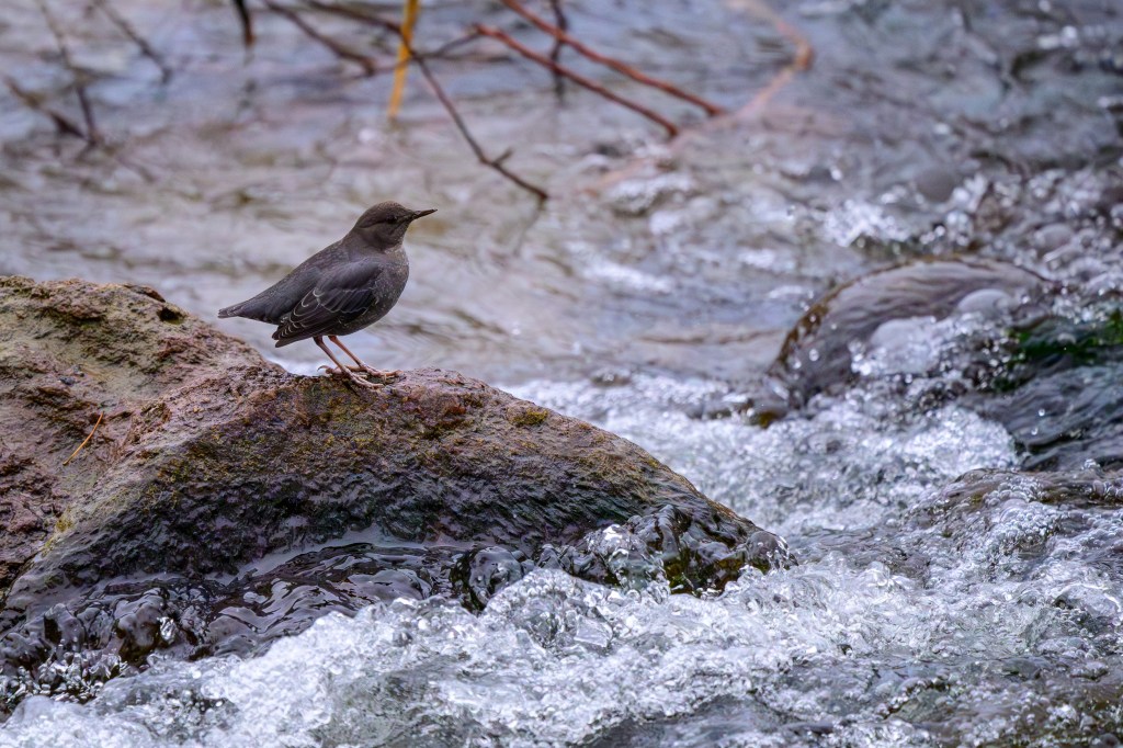
American Dipper
The Dipper dives into streams and walks around under the water looking for stuff to eat. I took these photos along the Owens River near the Control Gorge Power Plant. The bolts in the first picture are part of the power plant’s structure.
Rock Wren
These tiny things hop about on the basalt boulders above the Reservoir. In the second photo, the bird is jumping up to grab an insect out of the air. These birds are small and are colored to match their rocky surroundings. They give themselves away by jumping and flitting about, and singing a loud song.
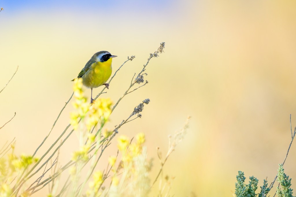
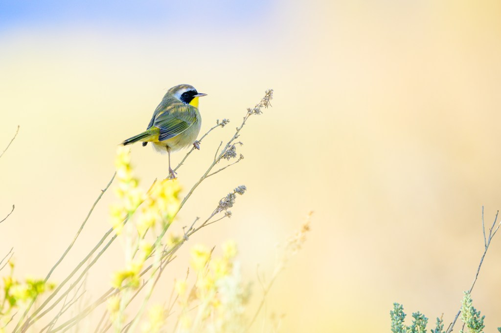
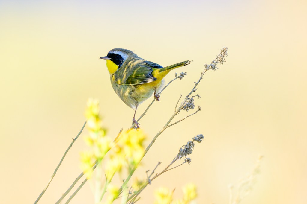
Common Yellowthroat
A Yellowthroat appeared at the Buckley Ponds in late September. I had less than a minute to take pictures. Fortunately, the bird perched in a well-lit spot.
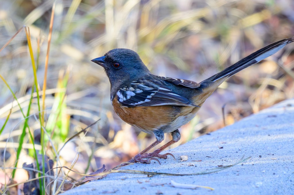
Spotted Towhee
The spots are on the wings. Lovely color scheme and striking red eye. This bird was near the nursing home on Line Street.
Here is a collection of 90 wildlife photos taken during June-September, 2025. I picked images that appealed to me for a variety of reasons. We have a lot of wild creatures here.
Rabbits
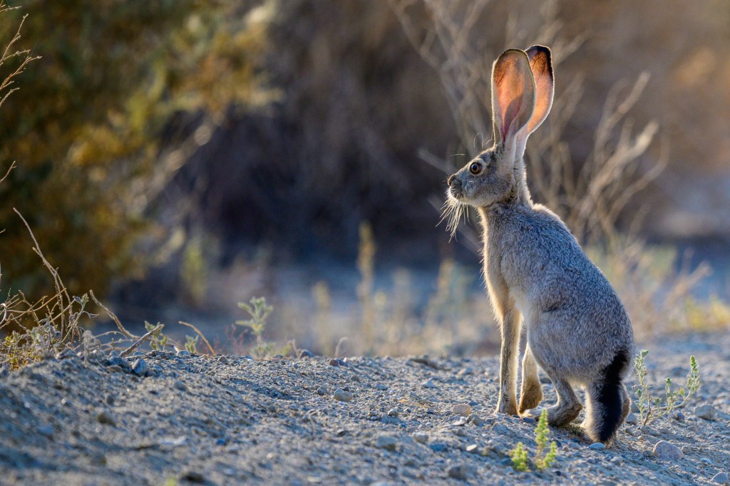
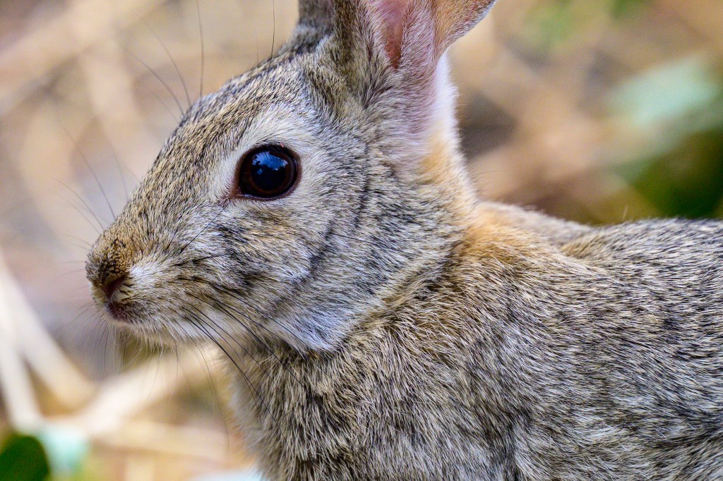
Long legs, bodies, and ears characterize the Black-tailed Jackrabbit. Even the black tail is long. They are fast; I often see just a glimpse of movement as they disappear into the sagebrush.
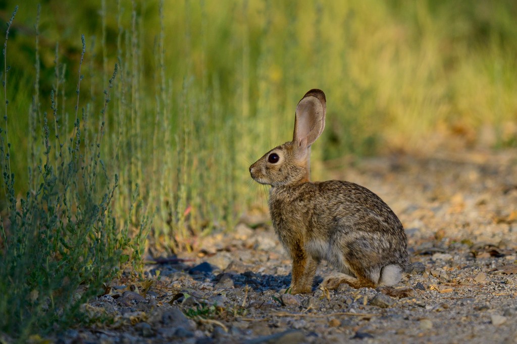
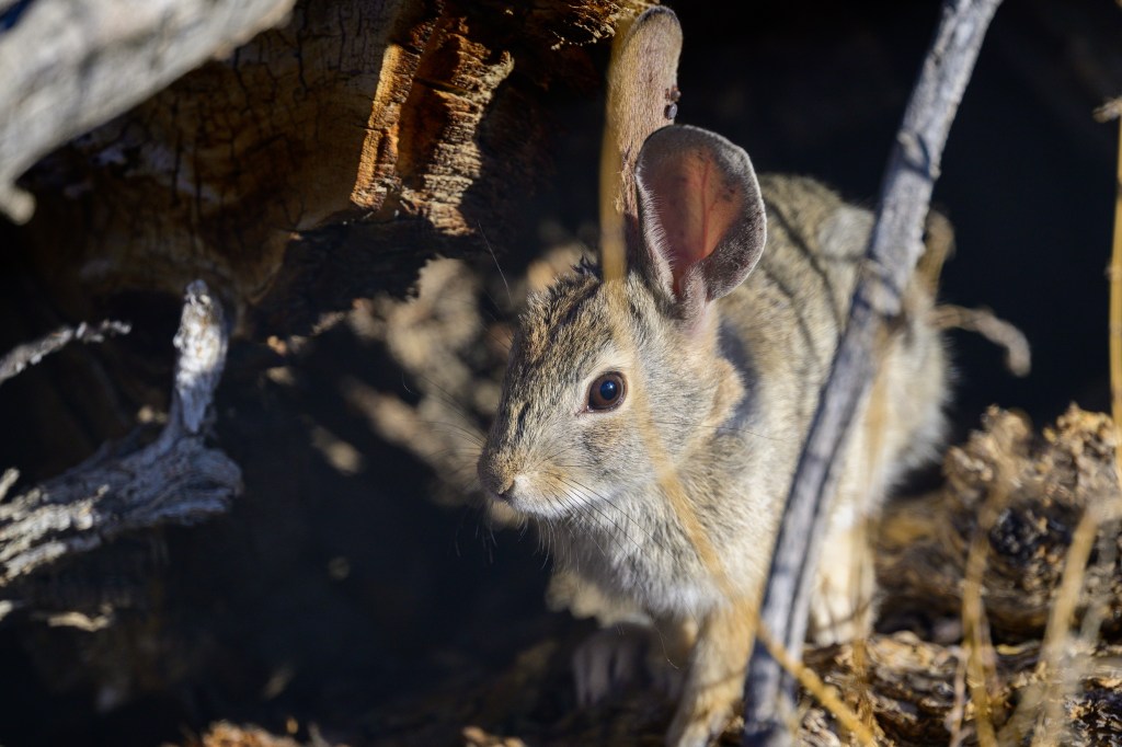
The Desert Cottontail is more compact and has eyes that seem too big for its head. Here is one at the Conservation Open Space Area.
Cottontail below was at Mono Lake. Looks very young.
Cottontails below were at Airport Road.
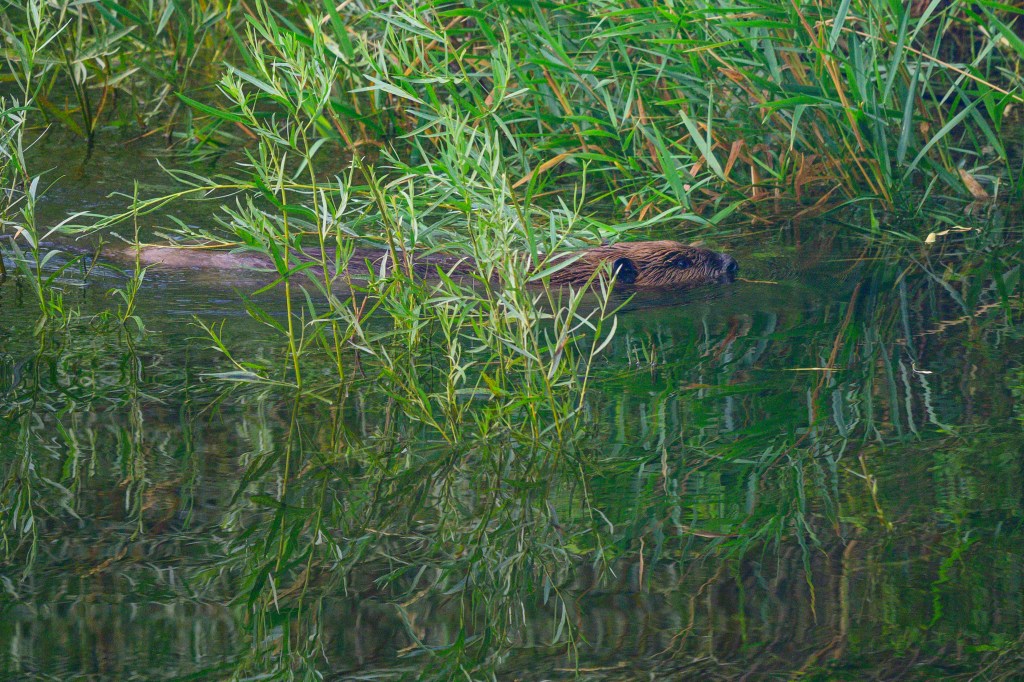
American Beaver
The beaver drags its tail, leaving wavy marks on the dirt roads that we walk. For 20 years I mistakenly thought these were rare creatures, found only on some mountain streams. I was wrong. They are common, but elusive. On our local walks I see a beaver once a year. The beaver below was swimming in the Owens River, upstream from the Pleasant Valley Reservoir.
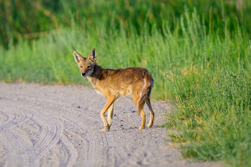
Coyote
They always look skinny. If you live by chasing rabbits, being fit and thin is advantageous.
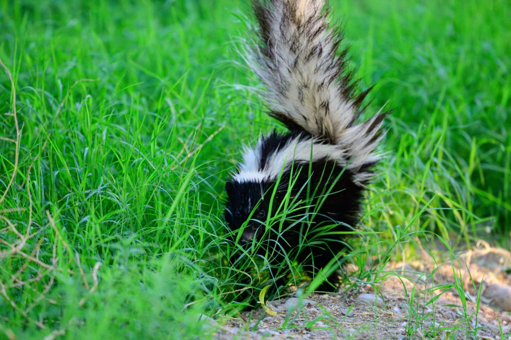
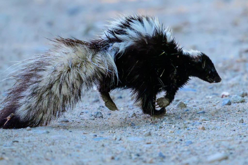
Stripped Skunk
Usually presents as a crushed and pungent mess at the edge of a road. Fun to watch when seen alive.
Are pieces of grass stuck to its body? Or could they be porcupine spines? I cannot tell.
Chipmunk
These two animals were chasing each other in Lee Vining Canyon. I think they are Lodgepole Chipmunks. They would periodically stop for one second of sex, then run on.
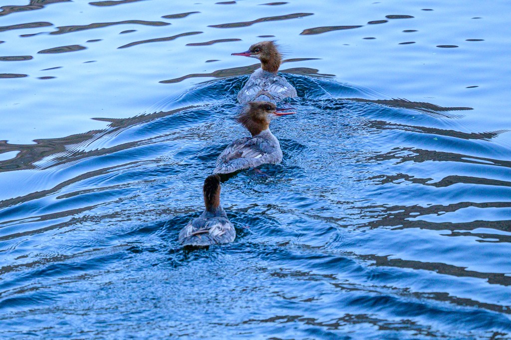
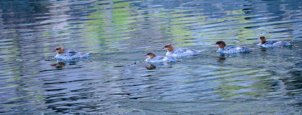
Common Merganser
Mergansers are often found at the Pleasant Valley Reservoir. I think the birds in the photos below are all juveniles, born this Spring.
American White Pelican
A nine foot wingspan. This Pelican was at Pleasant Valley Reservoir.
California Gull
This bird was at Mono Lake, where thousands of gulls gather to mate and raise their young on islands.
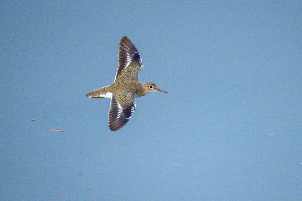
Spotted Sandpiper
A young Spotted Sandpiper cruises over Pleasant Valley Reservoir.
Great Blue Heron
I have more photographs of this bird species than any other. They are colorful, common, and easy to photograph.
Herons near Airport Road.
A Heron shows its balancing talent along Warm Springs Road.
When Herons fly, they usually curl their neck. But the bird below, at Buckley Ponds, is like a runner straining to get part of their head over the finish line first.
Heron 3
The next 3 photos are all from Pleasant Valley Reservoir, where subdued light made the feather patterns stand out.
Note the mosquitos in the next photo.
Black-crowned Night Heron
About once a year I see a Black-crowned Night Heron. The bird below, on Bishop Creek Canal, is too young to have the black head color.
Note mosquitos
An adult bird with a black crown flew past in Lee Vining Canyon.
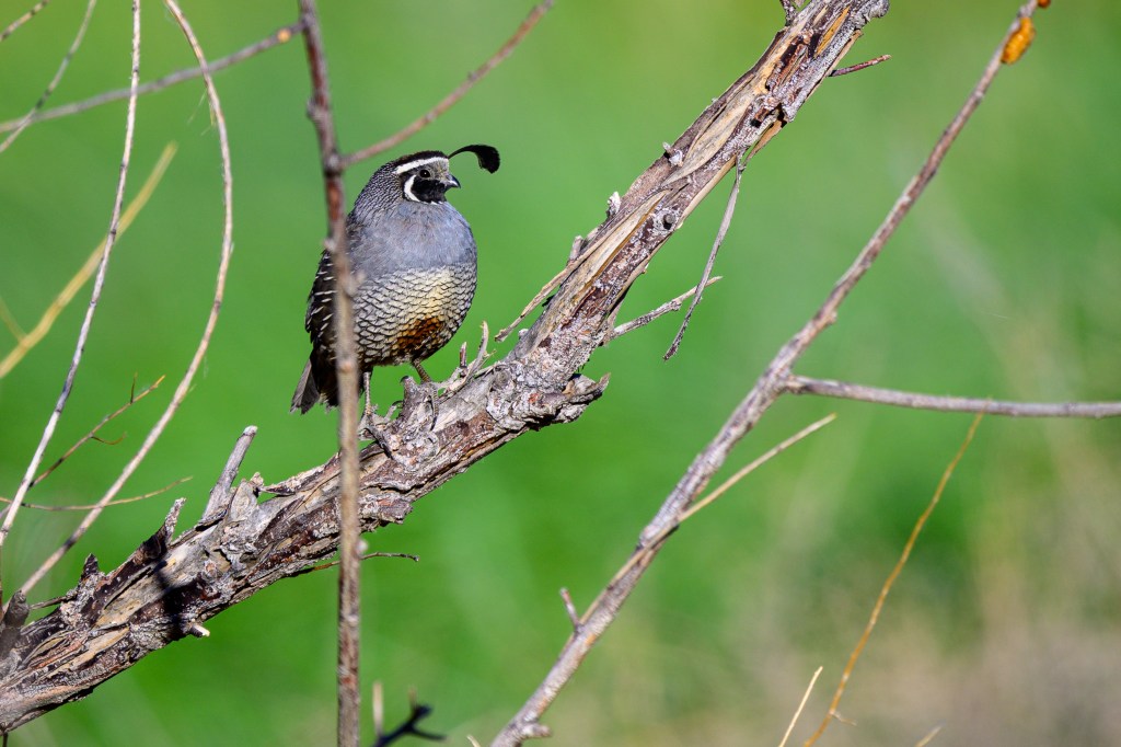
California Quail
A male posed north of Bishop.
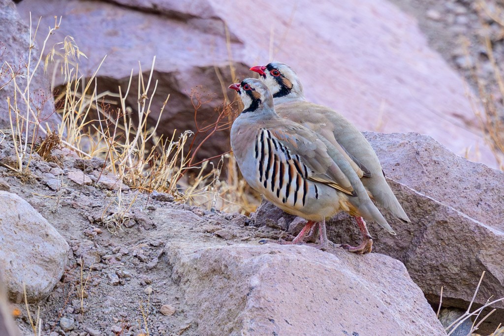
Chukar
These are game birds introduced from Asia. This pair was at Pleasant Valley Reservoir.
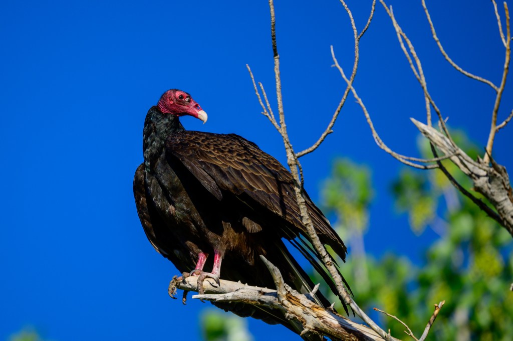
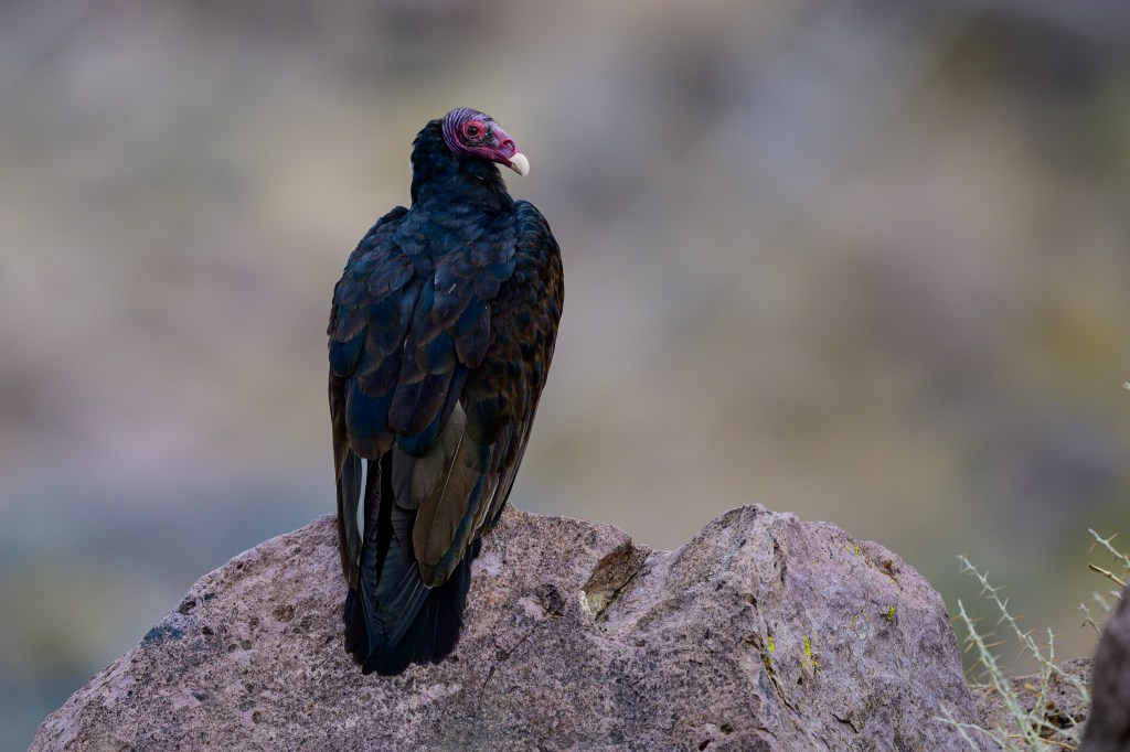
Turkey Vulture
This bird locates food by detecting ethyl mercaptan, a gas released by decaying flesh. It can follow a gas plume back to a rotting carcass that is miles away. Using smell, the vulture can locate carrion that is hidden by snow or dense foliage.
A Vulture on Airport Road.
A TV at the Reservoir.
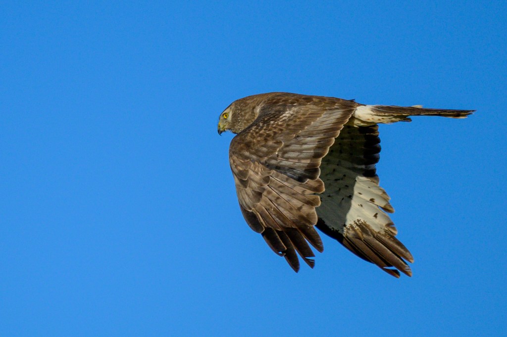
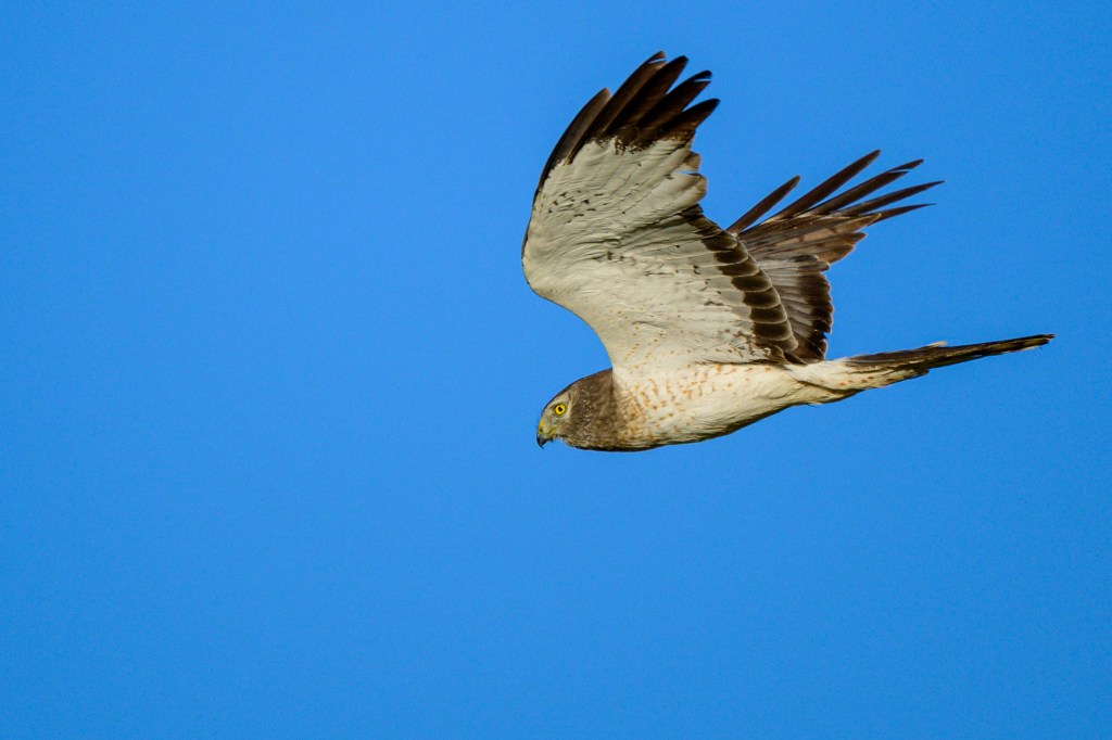
Northern Harrier
A female Harrier cruises past me on Airport Road.
Sharp-shinned Hawk
This raptor was at the Conservation Open Space Area near downtown Bishop.
Red-shouldered Hawk
This medium-sized hawk was at the Reservoir.
When this bird lands, it slows down by flaring its wings. Near the end of each wing, the primary feathers are partly white so that it looks as if the wings have a clear “window.” You have to use your imagination to think of these white areas as windows; they look like white bands to me. The next 3 photos all show these white “windows.” The first photo was taken at the Pleasant Valley Reservoir.
Next two photos from the Conservation Open Space Area.
Swainson’s Hawk
The Swainson’s below is probably a juvenile in its second year. It appeared in June and used a perch on Warm Springs Road for several weeks.
On June 19, a Western Kingbird harassed the Hawk. In the first photo the Hawk turns, in the second the Hawk ducks and almost flies away, in the third the Hawk settles down as the Kingbird flies past.
A month later, on July 19, a Northern Mockingbird harasses the same Hawk.
Finally, a peaceful moment.
Red-tailed Hawk
Red-tails are the most common hawk that I see near Bishop. They are big, which makes them easy to spot. If you see one or two birds circling high up on thermals, they are probably Red-tails. Young Red-tails don’t have red tails, as shown below in a photo from Warm Springs Road. This bird has bands on both legs; green plastic on the left leg, silver metal on the right. The left foot rests on a fragile branch and the right foot is balanced on one toe. This young bird is being a bit careless.
Then the bird literally fell off its perch. In the first photo, the fragile branch under the left foot gave way. The Hawk used its wings to stay up and both legs are on the stronger branch.
In the next 4 pictures, the bird struggles to get both feet onto the sturdy branch. It then looks around, probably thinking: “Wow, that was embarrassing. I hope no one saw me do that.”
On Sunland Drive a mature bird posed. Note the pattern of darker feathers across the middle of the bird; an avian cummerbund.
The next Red-tail on Warm Springs Rd has different coloration, but a similar cummerbund.
The Red-tail below, a juvenile, has almost no red in the tail.
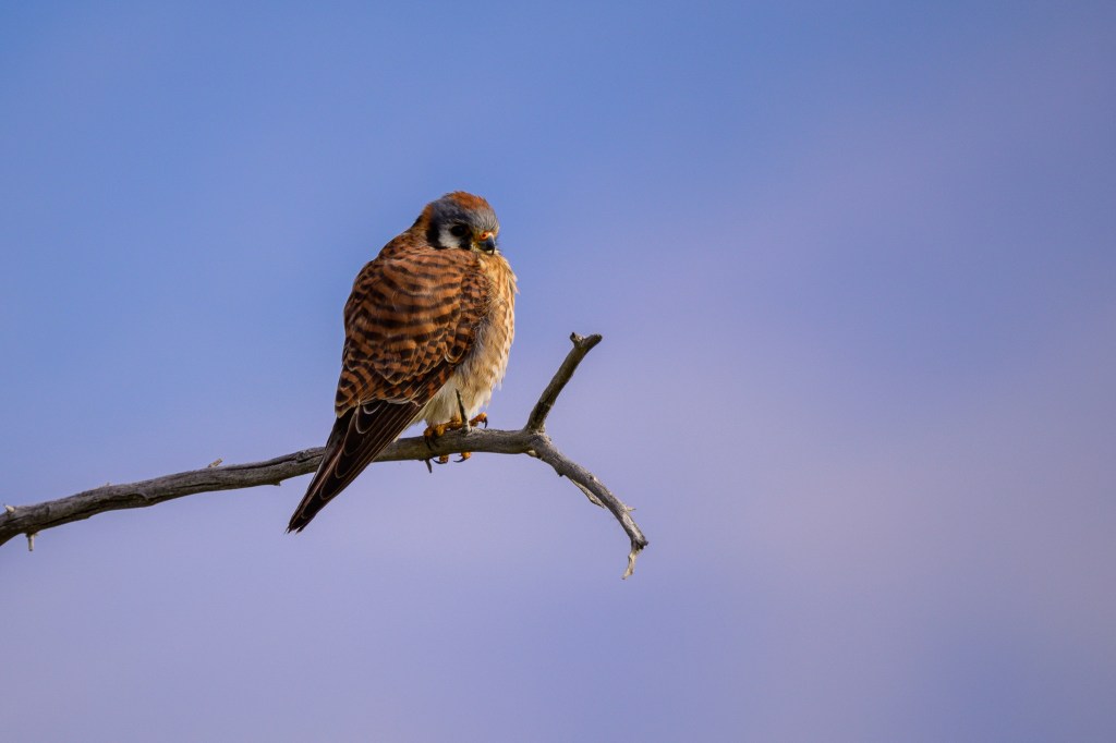
American Kestrel
This small raptor is common in the Bishop area. After the Red-tail, I think this is our most common raptor. They are small birds, but if you look for their compact shape on top of small trees, they are there to be found. The first three photos show a male landing on a bare tree at the Buckley Ponds.
The shape and posture below are typical for this bird. A round ball. The tail sticks out and down, as if this is a capitol letter Q. With an added lump formed by the head.
In the next photo, a Kestrel takes off at Pleasant Valley Reservoir. The tail is out of sight, so he looks as if he forgot his pants.
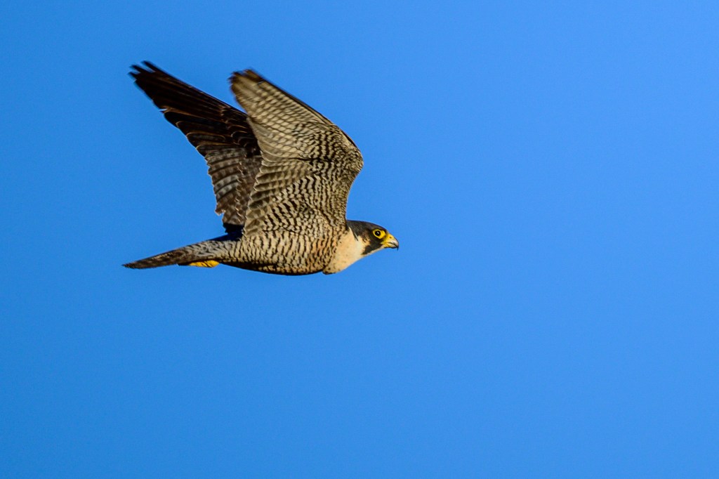
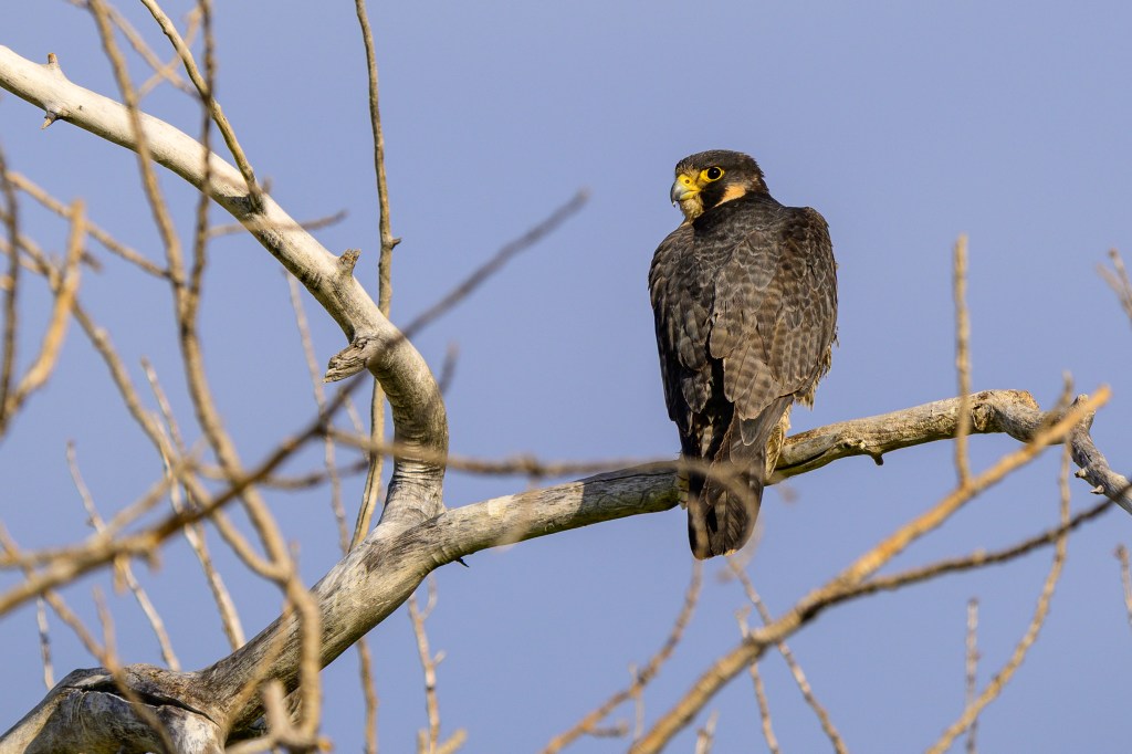
Peregrine Falcon
Not common, but impressive when it appears. I show two photos taken five days apart in June. The first shows a Peregrine in flight at Bishop Creek Canal.
Below, a Peregrine displays its “executioner’s hood” on Warm Springs road. These photos may show the same bird.
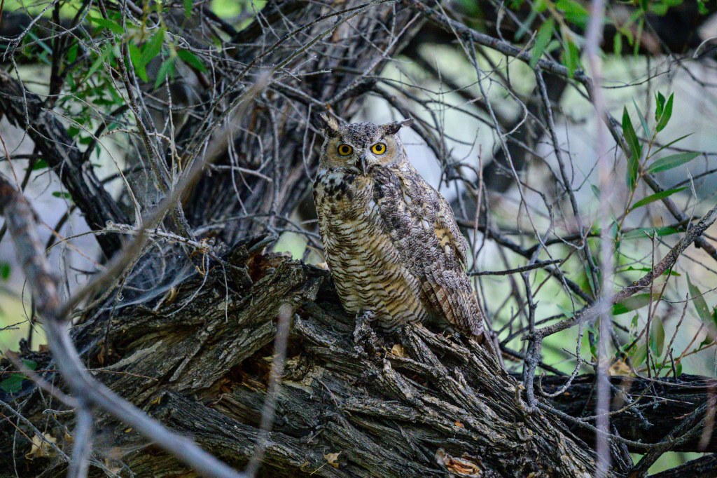
Great Horned Owl
Two of these owls were on a dirt road north of Dixon Lane.
The next photo shows an unusual pose. This owl may be looking for its partner.
Doves
The Mourning Dove was first recorded in Inyo County in 1890. It was the dove for a century. But in the last two decades, counts have plunged. The photo below shows the blue eye ring and black spots on the feathers.
The Eurasian Collared Dove appeared in Inyo in 2002, the same year I arrived. It is now the most common Dove in Inyo. Photo below shows the collar on the back of the neck.
Northern Flicker
This woodpecker is common, colorful, and noisy. In the first photo the female is above. A male, with his red mustache, is taking off near Dixon Lane.
The next image shows a male at the Conservation Open Space Area.
The last photo shows a male in my neighbor’s yard.
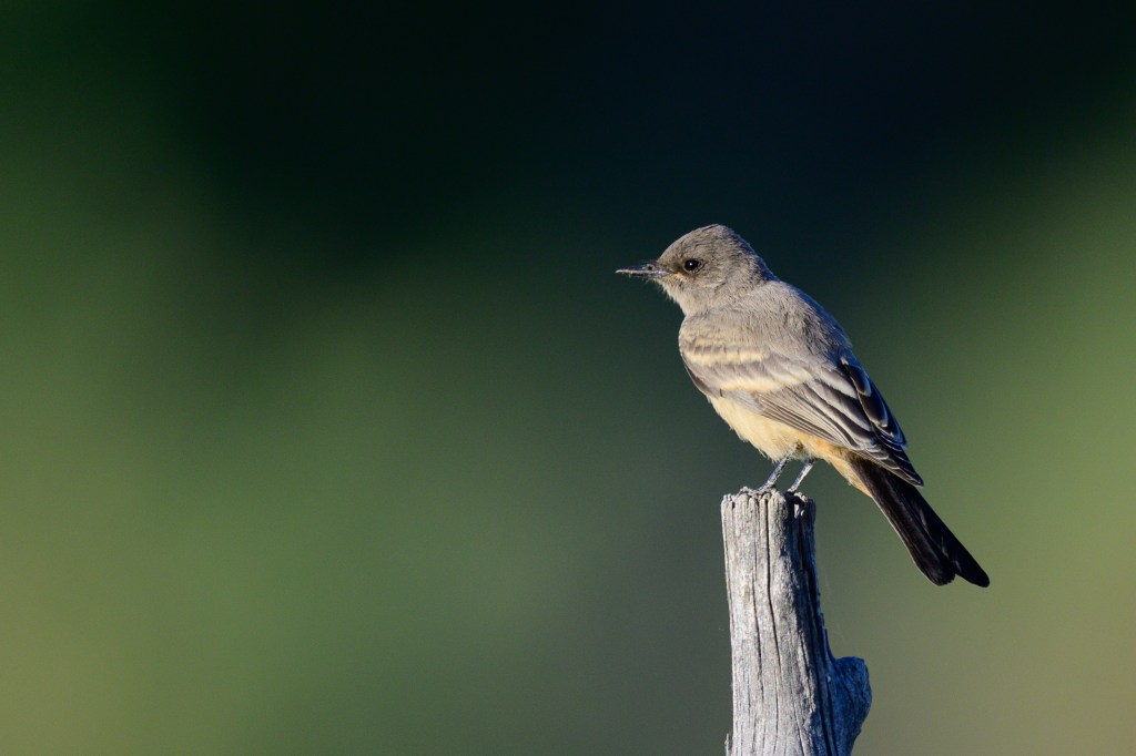
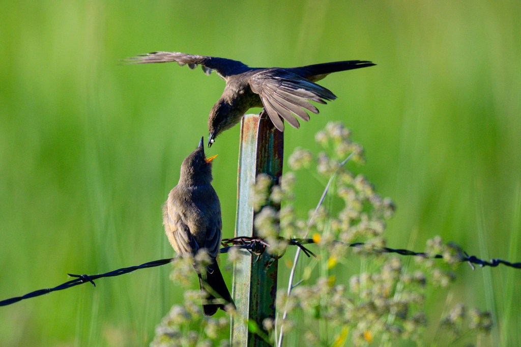
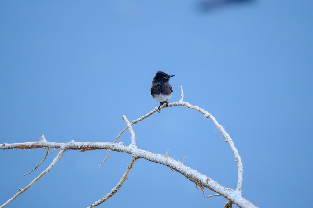
Phoebe
The Say’s Phoebe has subtle colors. Bird below was at Mono Lake.
Next Phoebe is at Bishop Creek Canal.
Below, a mother feeds her child. The youngster looks big enough to find his own meal. But what mother would miss the chance to feed her child; “Come on darling, finish your peas.”
The Black Phoebe strikes a formal look in a tuxedo. Both shots at the Reservoir.
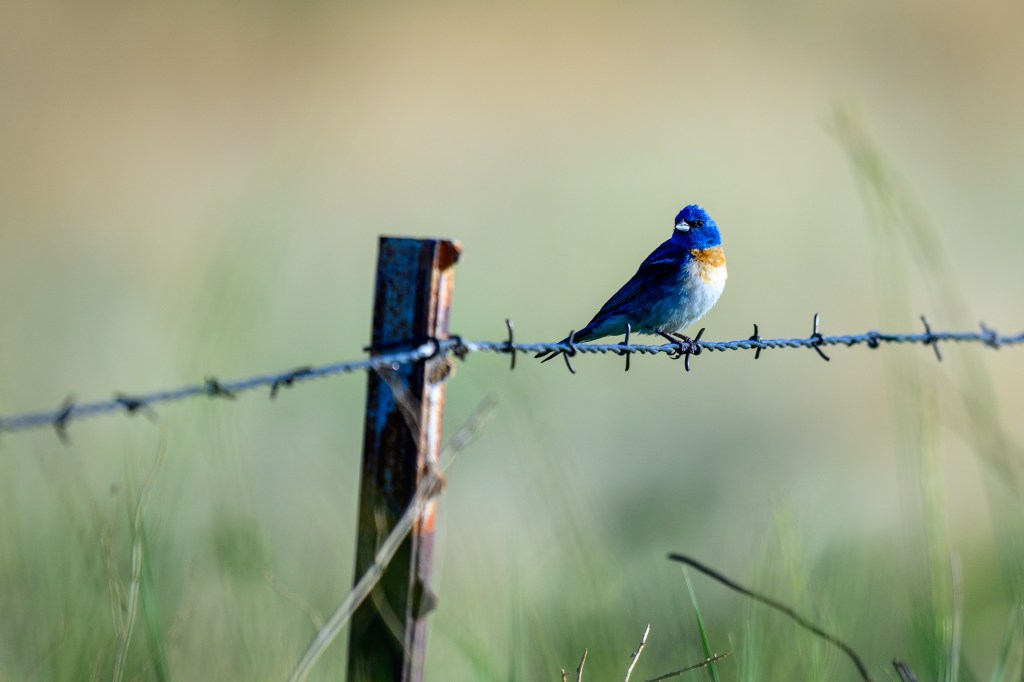
Western Bluebird
The colors of the adult male look unreal. Photo from Airport Road.
At the Conservation Open Space Area, a juvenile Western Bluebird displays softer colors and many spots on chest. Wing edges are flashy.
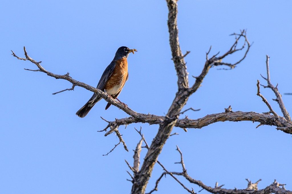
American Robin
Eating a caterpillar at Bishop Creek Canal.
House Wren
This Wren was at Convict Lake.
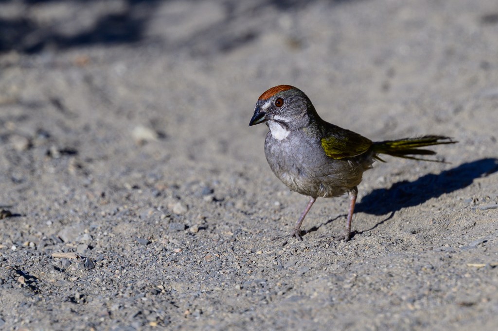
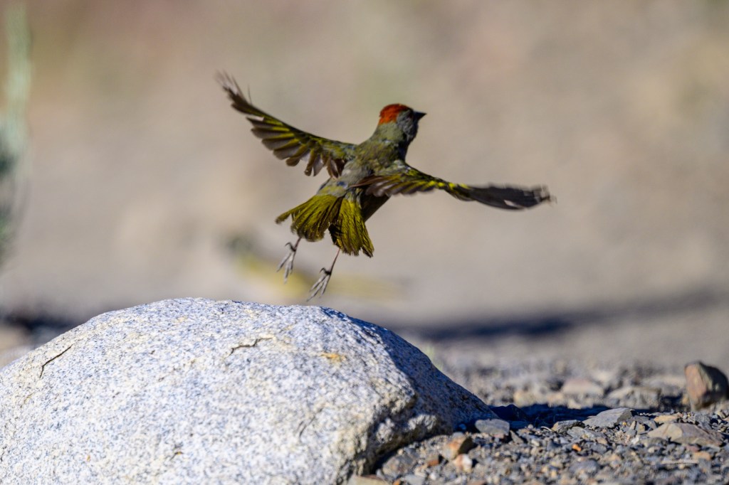
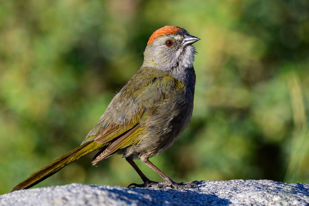
Green-tailed Towhee
Convict Lake is home to Green-tailed Towhees. In next six photos, a mature Towhee hops and swaggers.
At far end of the lake, a juvenile Towhee shows streaks, no red crown, brown-green feathers.
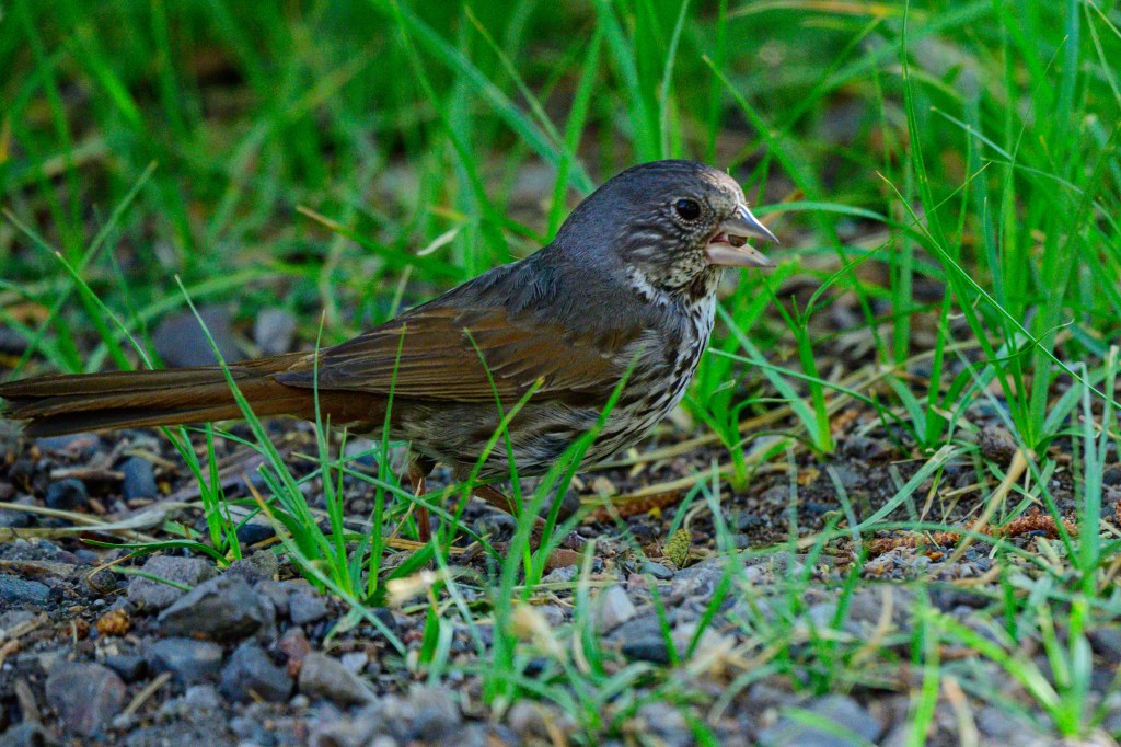
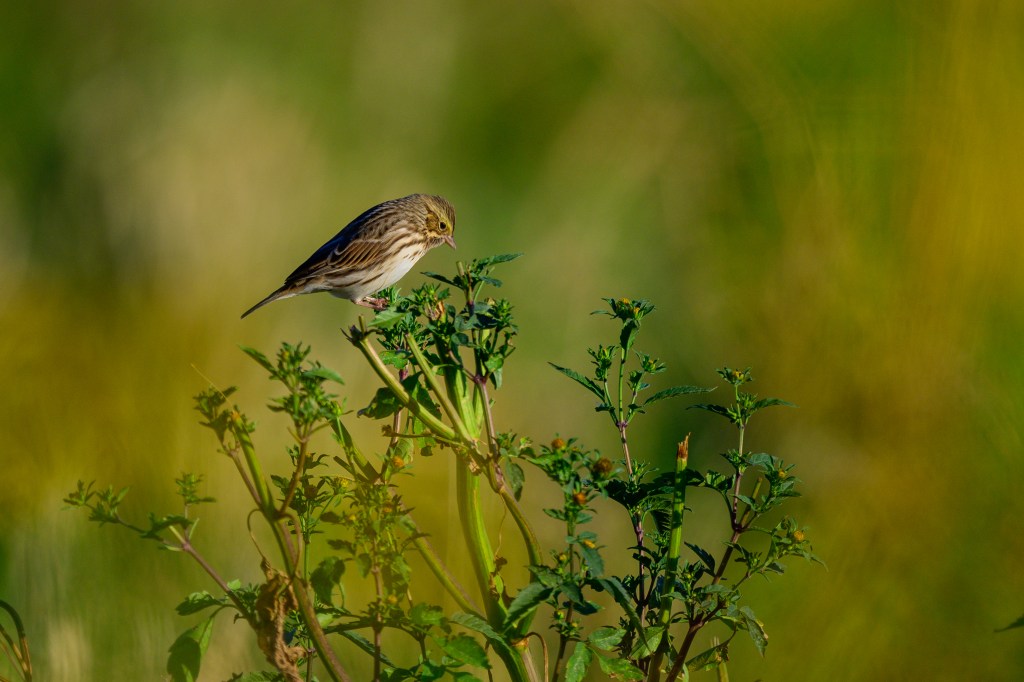
Savannah Sparrow
Savannah feeds at Airport Road. Note yellow eyebrow streak.
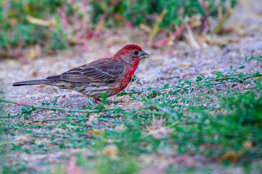
House Finch
This bird was feeding at the Conservation Open Space Area. Bird looks like it fell into a paint bucket.
Brewer’s Blackbird
The females are muted, the yellow-eyed males are garish. These pictures are from Mono Lake. To see these birds up close, sit at the tables in front of Schat’s Bakery. Stay alert or they will grab your pastry.
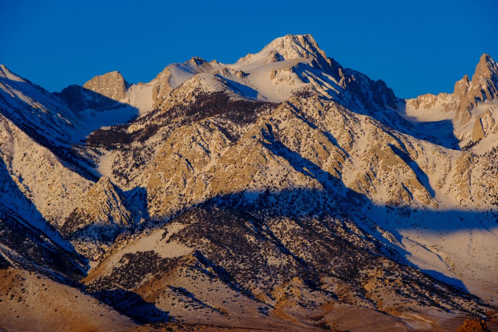
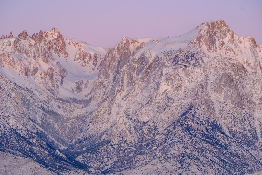
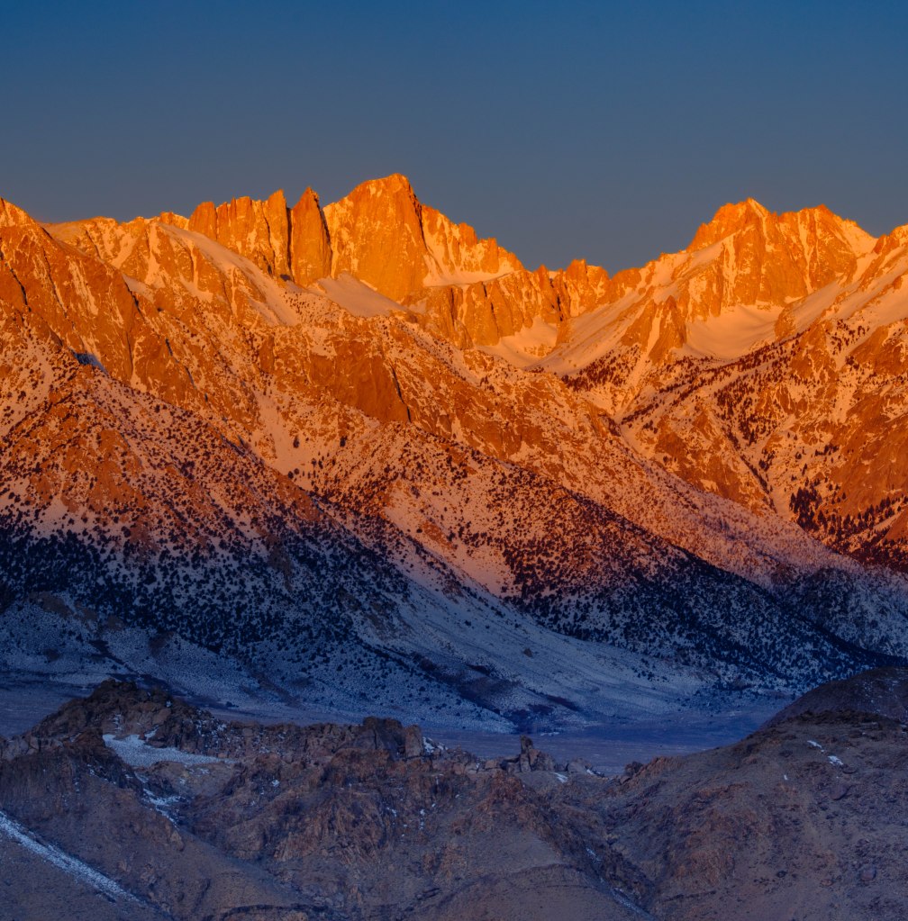
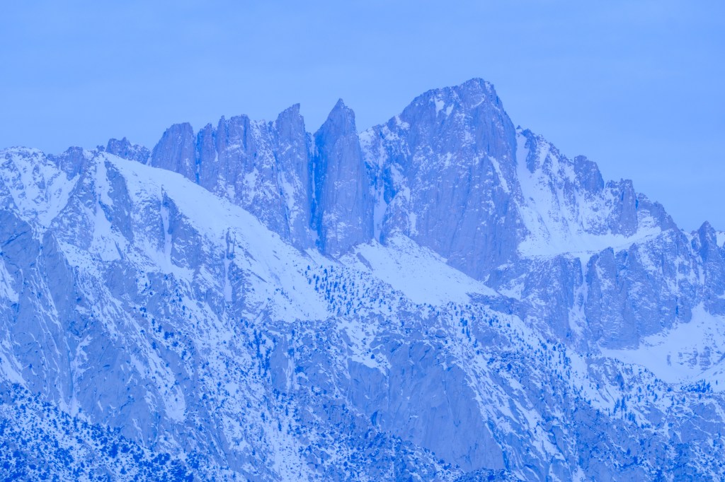
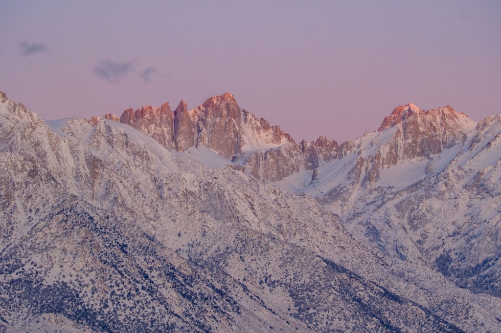
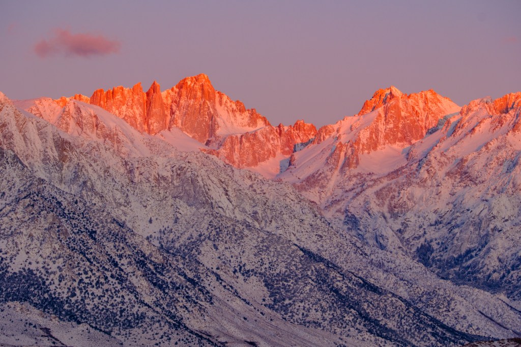
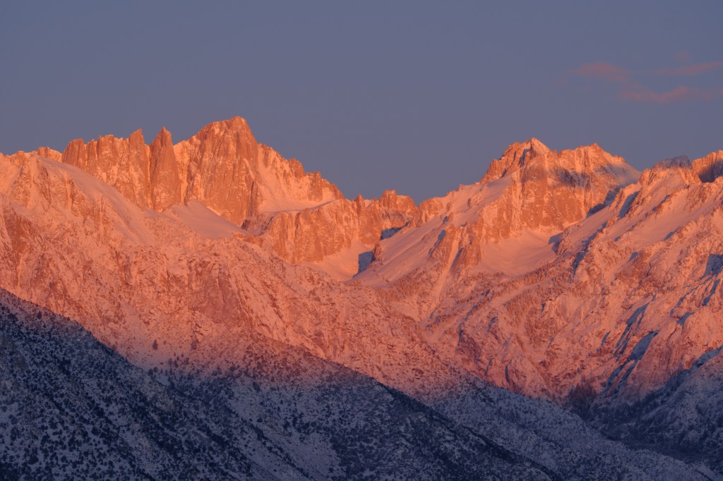
This blog shows photos of sunrise on the peaks near Mt Whitney (14,505 feet), the tallest US summit outside of Alaska. Some tourist spots offer “light shows” using electric lights on natural features. The eastern Sierra has a free light show every morning.
The Sierra Nevada extends north-south for 400 miles. It separates California’s Great Central Valley from the Great Basin. No road crosses the range from Sherman Pass Road in the south to Yosemite’s Highway 120 in the north; the Pacific Crest Trail between these roads is 240 miles long. Near my home, the Sierra crest is generally higher than 13,000 feet, a steep wall over 150 miles long.
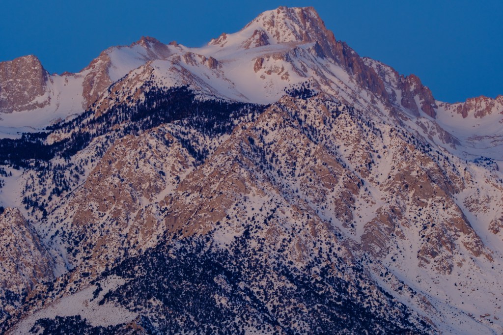
Roberta and I sometimes photograph the sunrise on the Sierra. I pick locations on the east side of the Owens Valley, 8 to 15 miles from the nearest Sierra summits. We get up at 4 am, eat, fill a thermos with coffee, and head out. We arrive in the dark and sit in the car, letting our eyes adjust and getting caffeinated. Then I get out, bundled in warm cloths, and use a headlamp to set up two cameras on tripods in the sagebrush. I get back into the car to warm up.
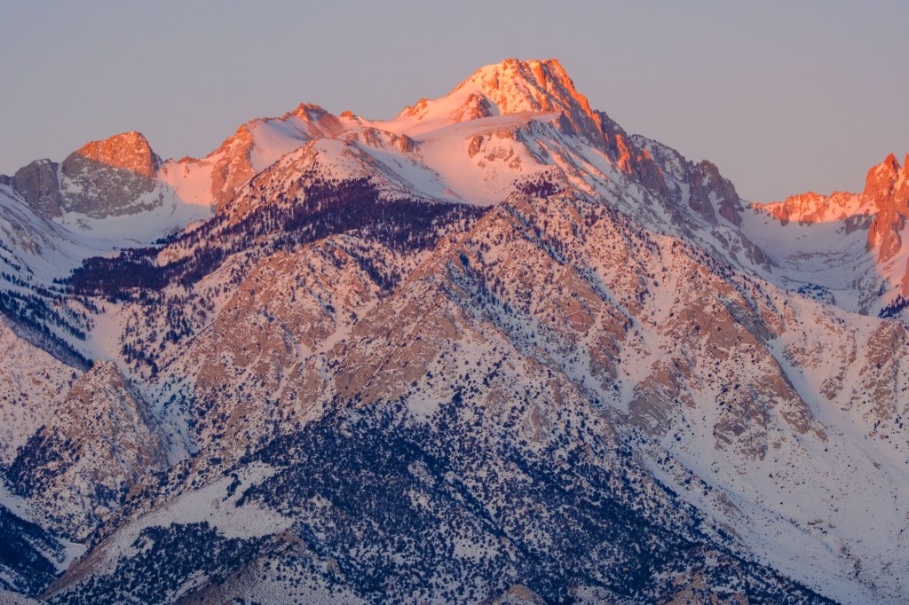
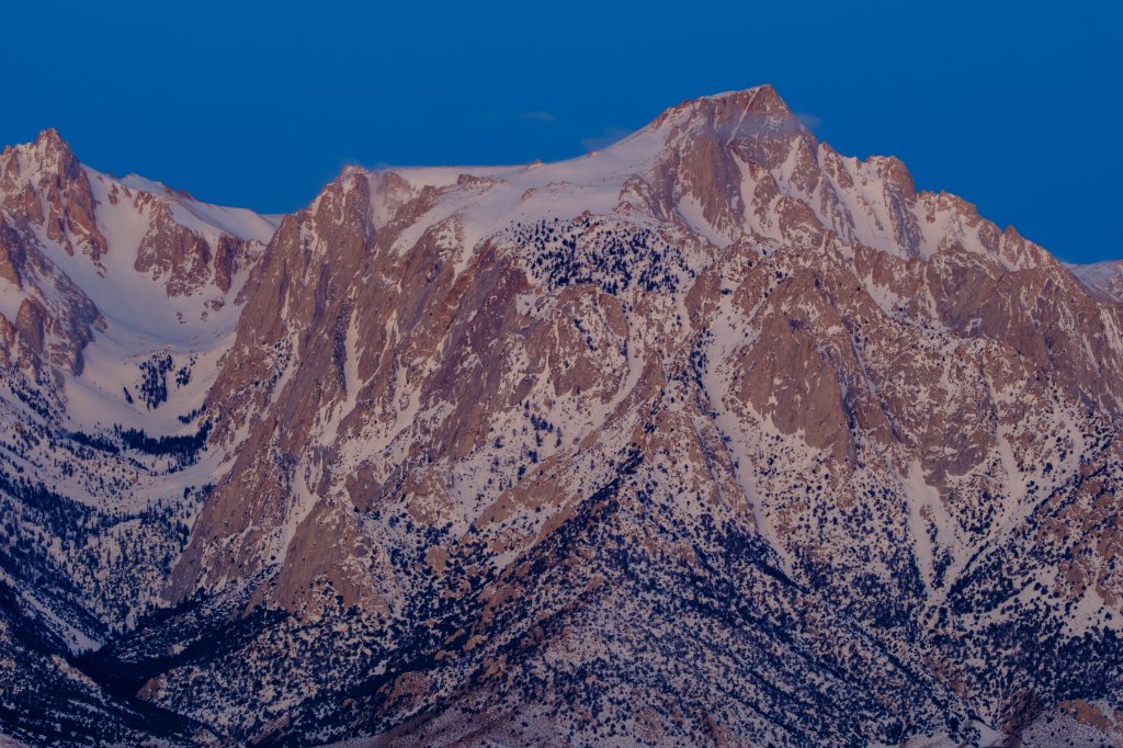
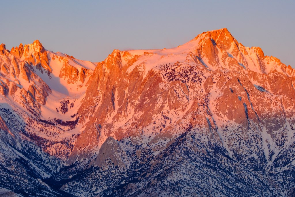
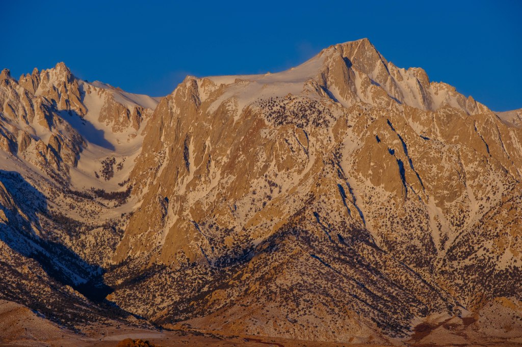
In morning twilight the peaks become brighter for half an hour. The range has a subdued look as I start taking pictures. Then sunlight reaches the summits around 6:30 AM and for half an hour the light moves down the slopes to the Valley floor. This early light is often tinged with red. By 8 AM the best colors are gone. We pack up the cameras and head home.
The air is usually calm and clear in early morning, so photographs have a lot of detail despite distances up to 15 miles. I used telephoto lenses equivalent to full-frame (35mm) focal lengths of 75 to 600mm. Consequently the images are “magnified” about 2 to 12 times, compared with the view without a camera. Cropping on the computer doubles the magnification of some pictures. Camera exposure times range from 3 seconds during twilight to 1/1000 second when the sun is fully up.
All photos in this post were taken from a spot on highway 136, south-east of the town of Lone Pine, at elevation 3600 ft. They were taken on March 1, 2023, February 24, 2024, and April 1, 2024. I’ve sorted them into groups from south to north, then ordered them by date and then by time, so you see images from twilight to full sun for each group of peaks on each day.
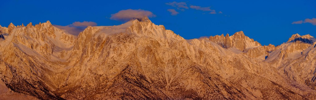
Panoramic Photographs
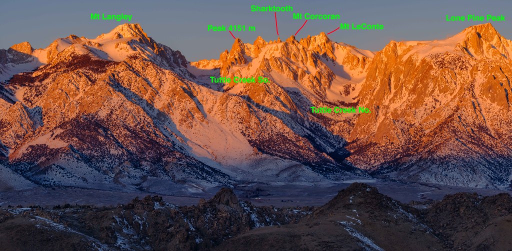
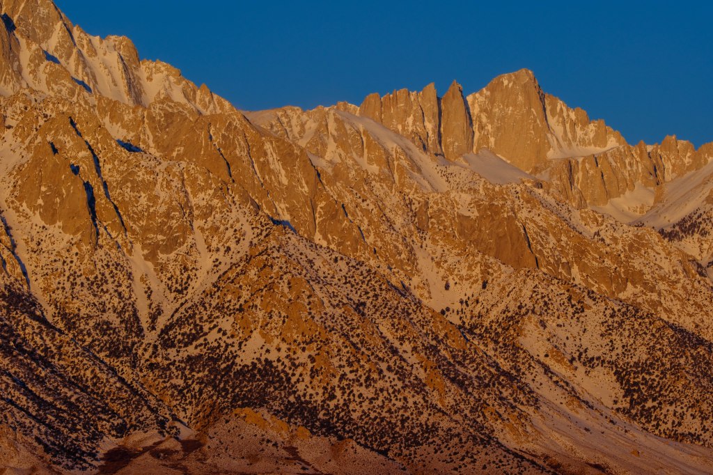
In the days of film, it was a big deal to take photos that could be stitched together into a wide panorama. This is easy with digital photos. You can move your camera from left to right and take multiple pictures that are joined into a single, wide shot, with lots of detail. This can be done within the camera or by taking several photos and combining them in software. To orient you to the peaks near Mt Whitney, below is a panoramic image that extends from Mt Langley (14,042 feet) on the left to Lone Pine Peak (12,944 feet) on the right. The smaller rocky summits in the foreground, still in shadow, are the Alabama Hills.
3/7/23. 6:18 AM.
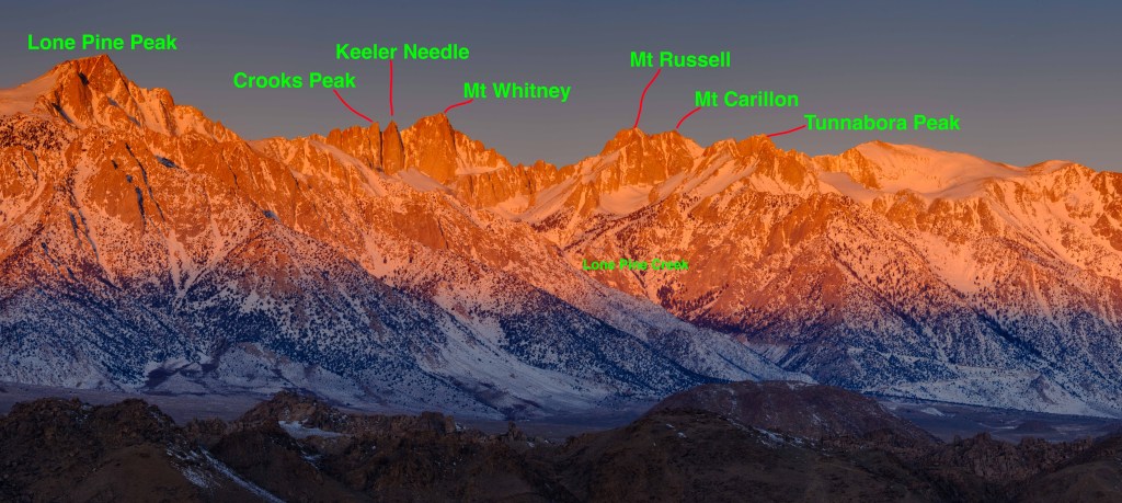
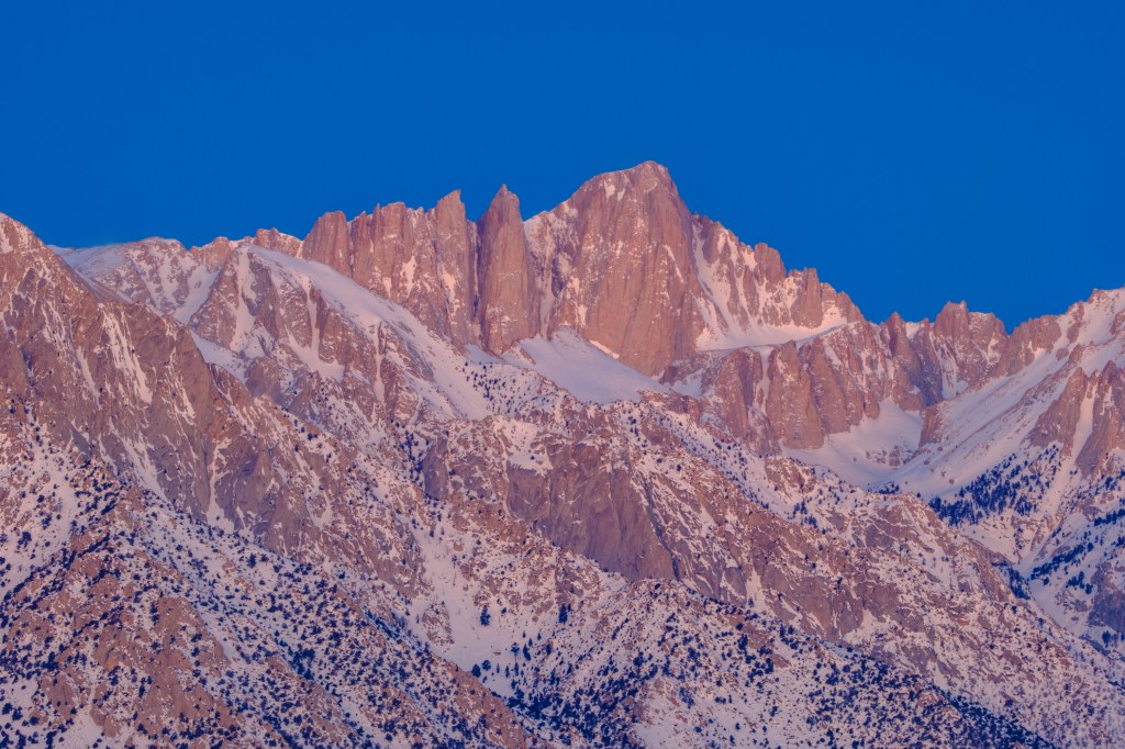
Next you can see summits from Lone Pine Peak to Tunnabora. Whitney is labeled; its enormous east face is in sunlight.
3/7/23. 6:17 AM.
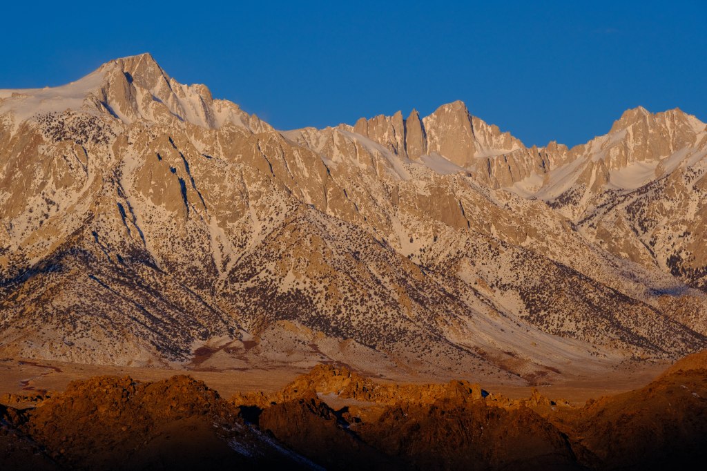
Next I show all these peaks, from the Corcoran group to Carillon.
4/1/24. 6:48 AM
Mt Langley
I’ll start at the southern end of this group. To the south of the peaks I’ve already shown, is the road to Cottonwood Lakes. It switchbacks up from 3500 feet to over 10,000 feet. After big rain storms, parts this road may be covered in rocks and sand; sometimes sections of the road are washed away.
3/7/23. 6:09 AM
Next is Mt Langley (14,042 ft).
3/7/23. 6:04 AM
3/7/23. 6:12 AM
3/7/23. 6:32 AM
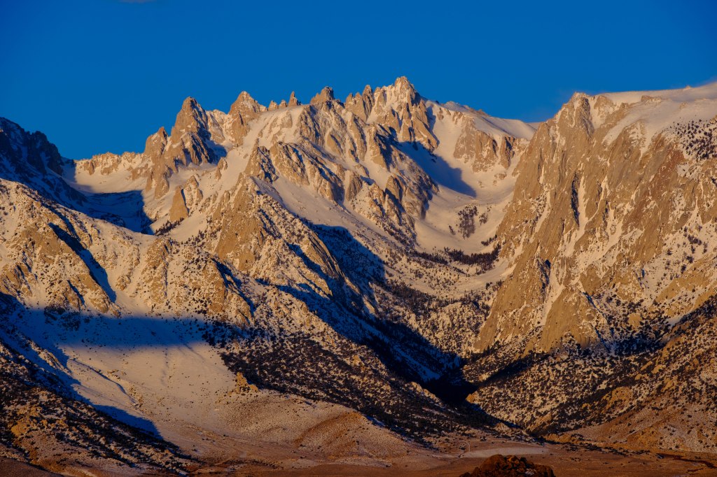
Looking a bit further north, the next photo shows Langley and the summits near Corcoran.
3/7/23. 6:32 AM
Mt Corcoran and Nearby Peaks
Mt Corcoran is a long ridge with several summits. The branches of Tuttle Creek bracket this collection of peaks.
3/7/23. 5:51 AM
3/7/23. 6:04 AM
3/7/23. 6:12 AM
3/7/23. 6:14 AM
3/7/23. 6:24 AM
A closer look at Peak 4151 meters.
3/7/23. 6:25 AM
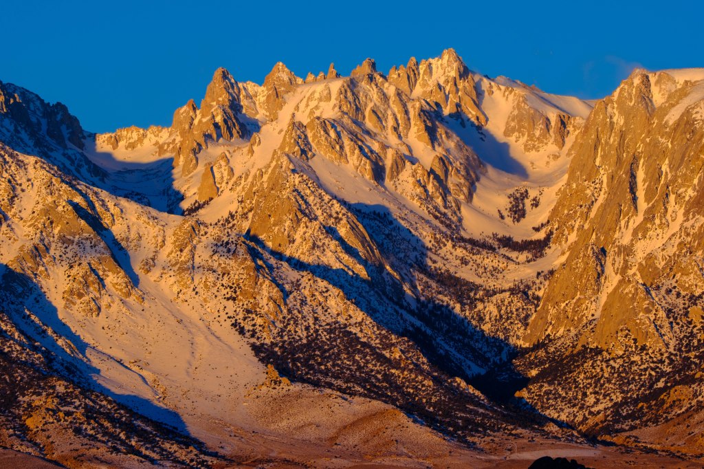
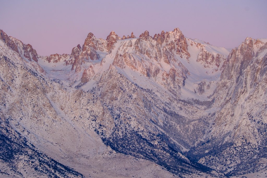
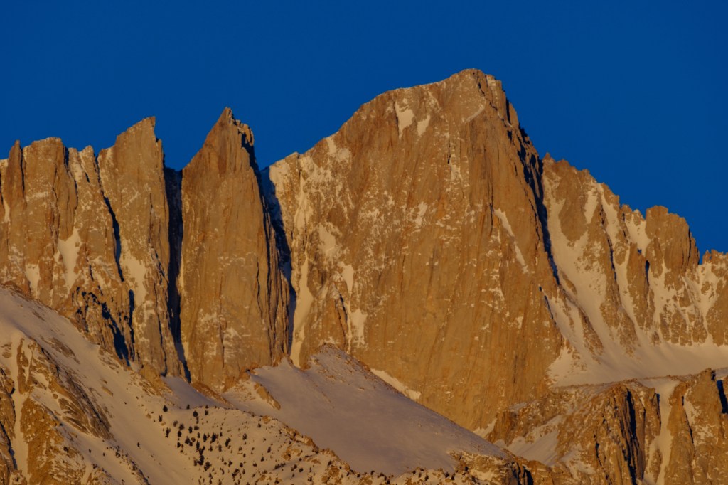
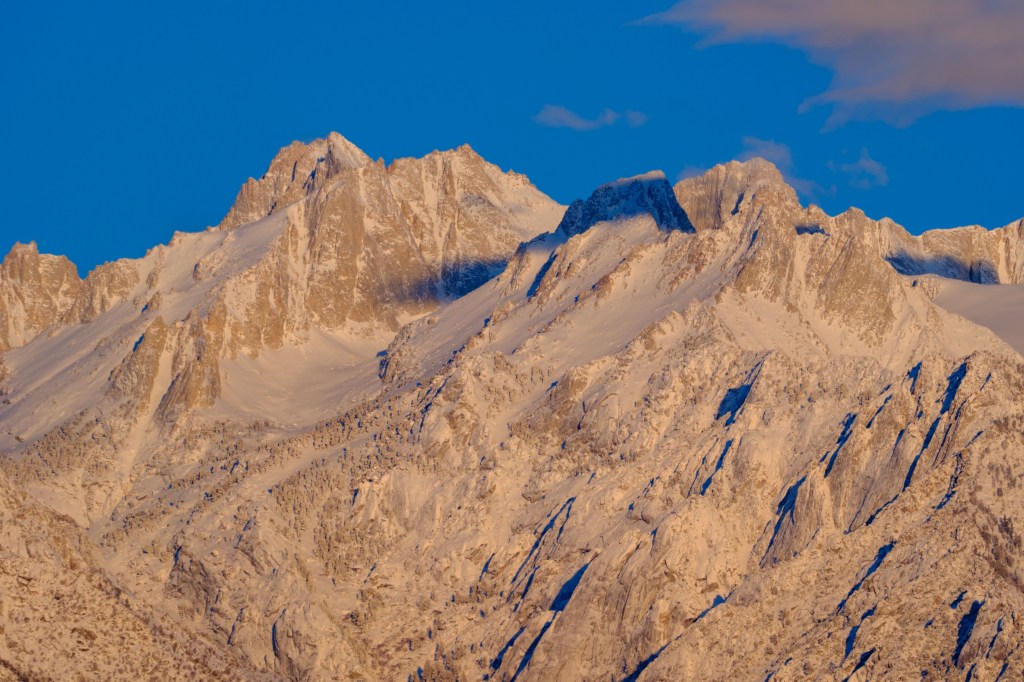
Details of Sharktooth, Corcoran, and LeConte (13,960 feet)
3/7/23. 6:28 AM
3/7/23. 6:32 AM
In the next photo, Langley and the Corcoran group have subdued colors due to clouds.
2/24/24. 6:46 AM
Next we see sunrise on April 1, 2024. The colors change quickly as the sun comes up.
4/1/24. 6:34 AM
4/1/24. 6:39 AM.
4/1/24. 6:47 AM.
4/1/24. 6:55 AM.
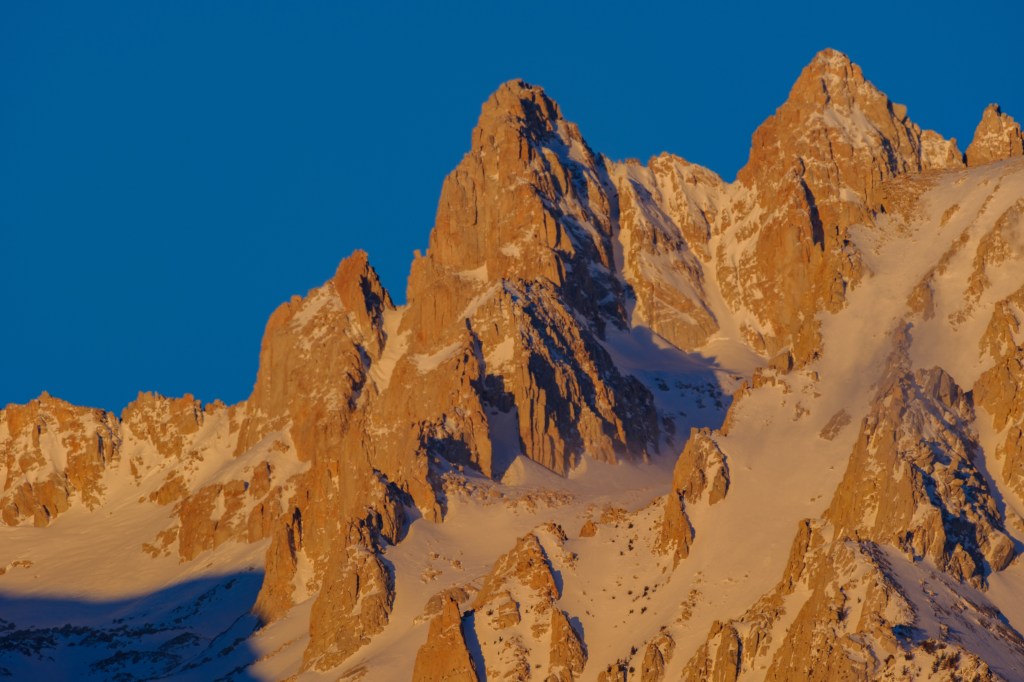
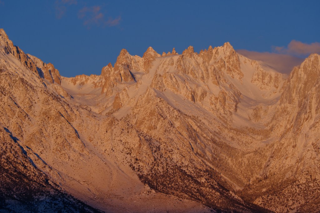
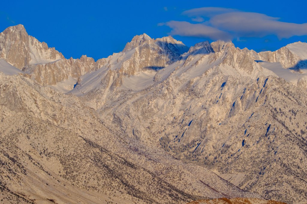
A close-up of Sharktooth, Corcoran, and LeConte.
4/1/24. 7:04 AM.
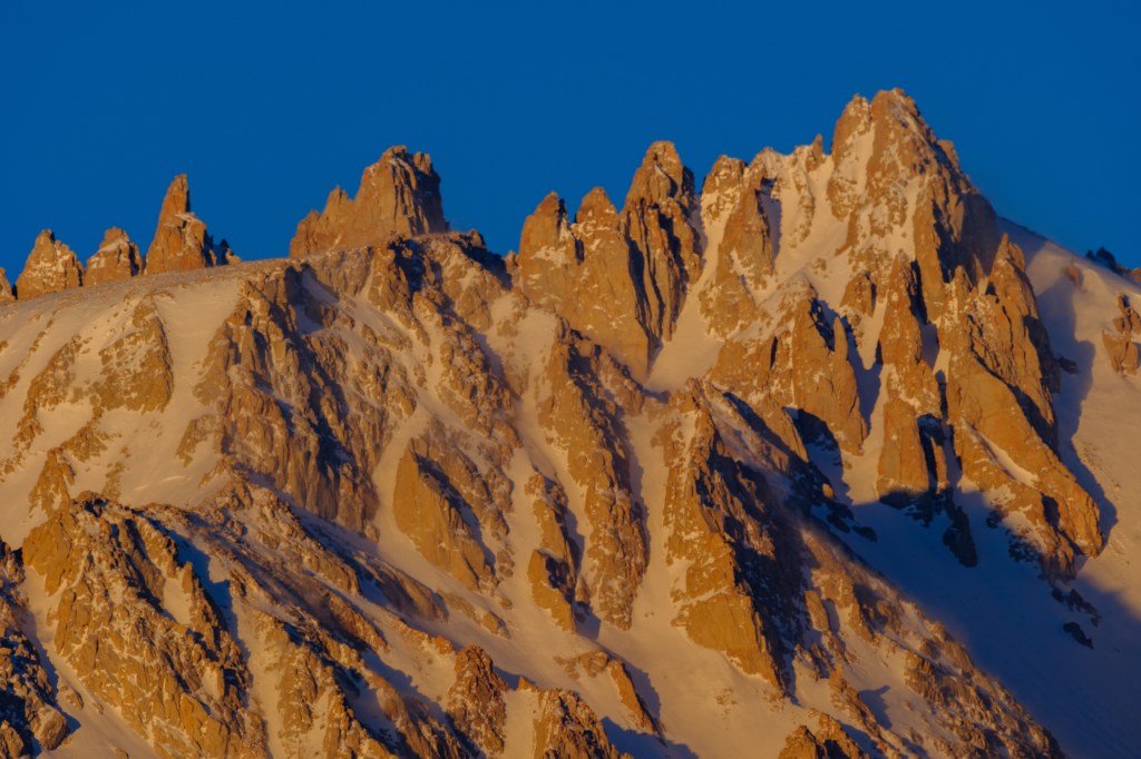
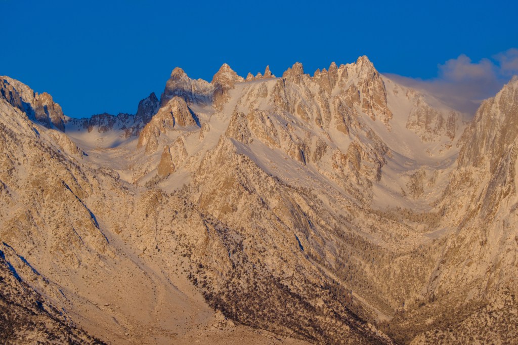
Peak 4151 meters (left) and Sharktooth (right)
4/1/24. 7:04 AM.
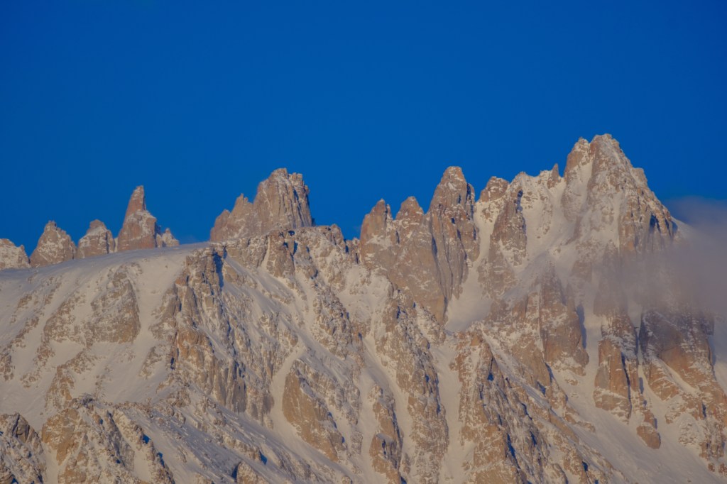
4/1/24. 7:05 AM.
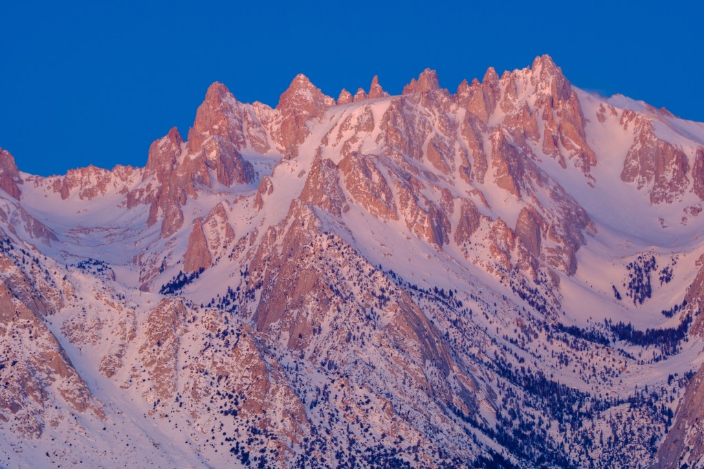
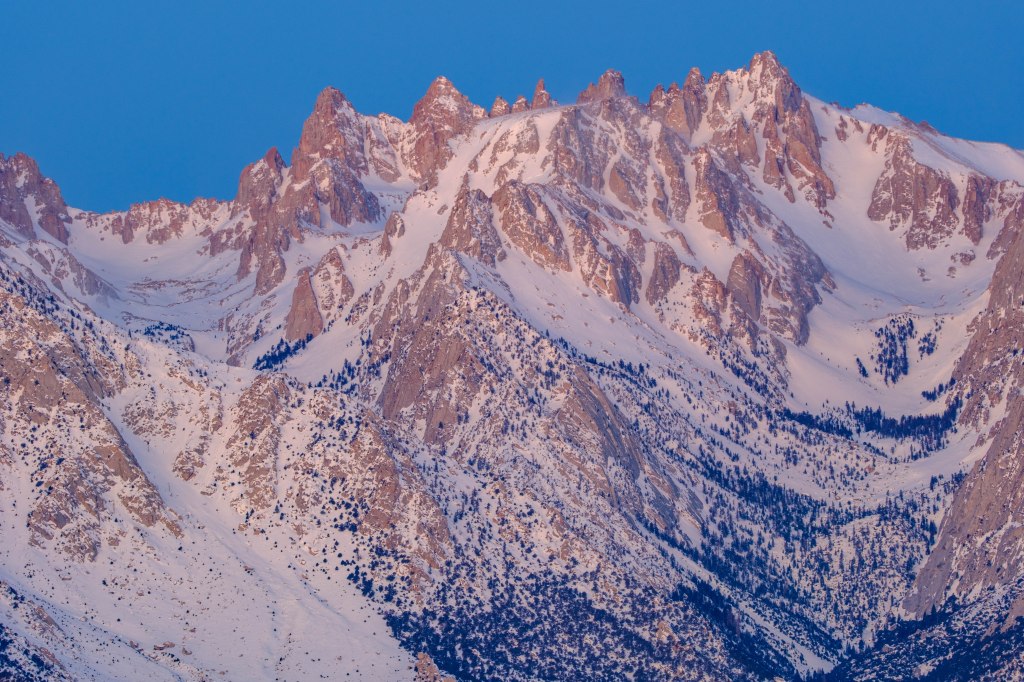
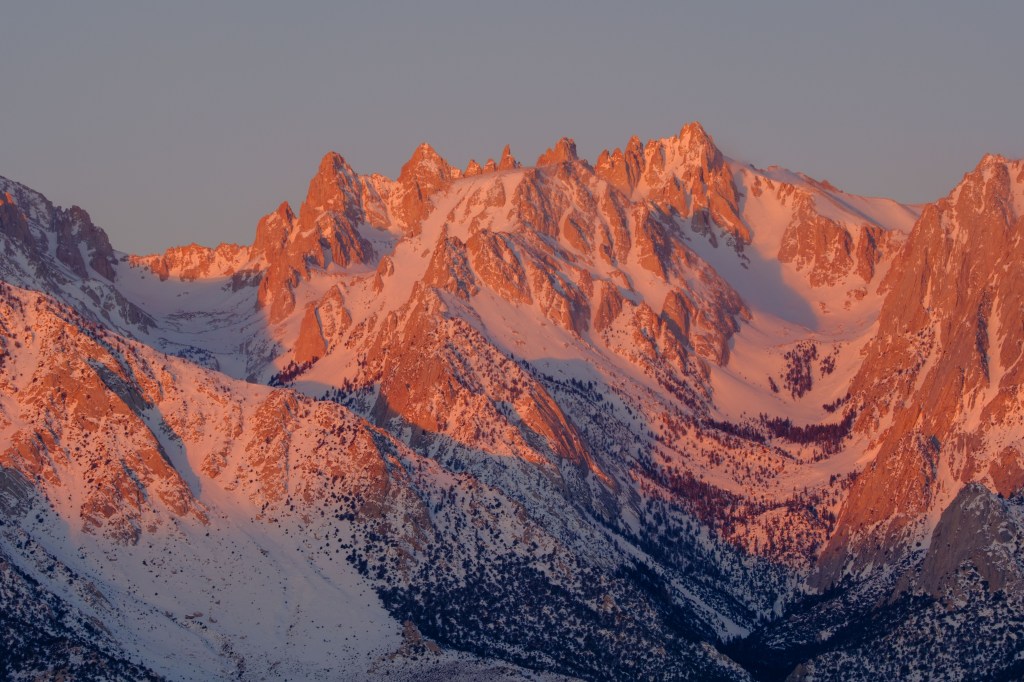
Lone Pine Peak
Because Lone Pine Peak is so much closer to the town of Lone Pine, it looks bigger than Whitney. It is slightly lower than 13,000 feet, lower than the other summits in this blog. Additional, higher summits (Mt Mallory and Mt Irvine) are blocked from view behind this peak.
3/7/23. 6:03 AM.
3/7/23. 6:15 AM.
3/7/23. 6:24 AM.
A closer view of the south face of Lone Pine Peak: a 3,000 foot wall with many climbing routes.
3/7/23. 6:29 AM.
3/7/23. 6:32 AM.
Another sunrise on 4/1/24.
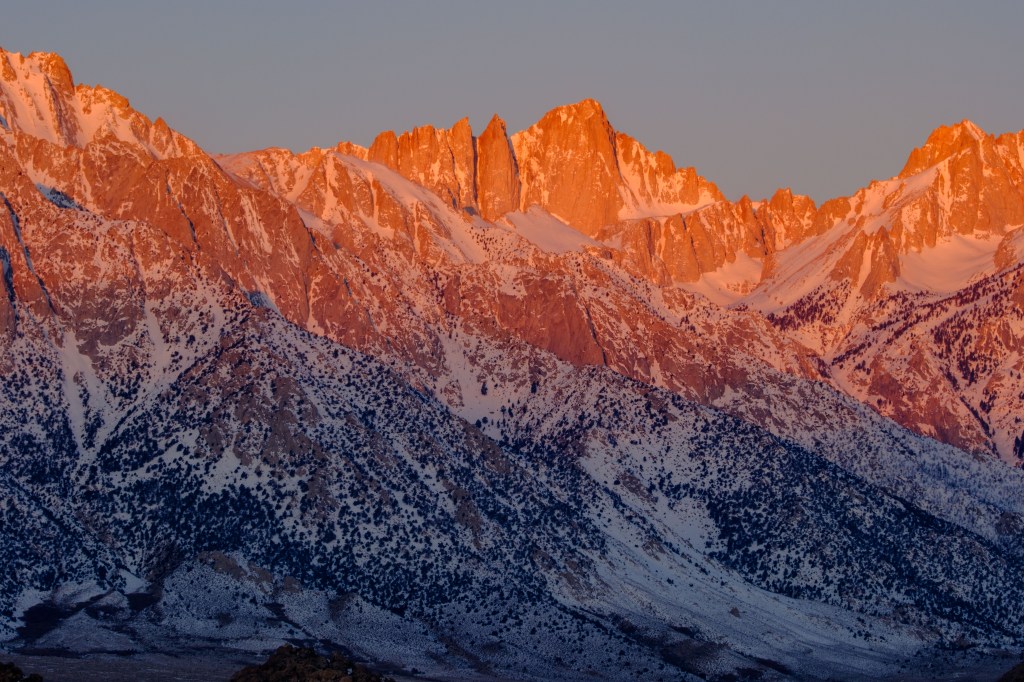
4/1/24. 6:34 AM.
4/1/24. 6:46 AM.
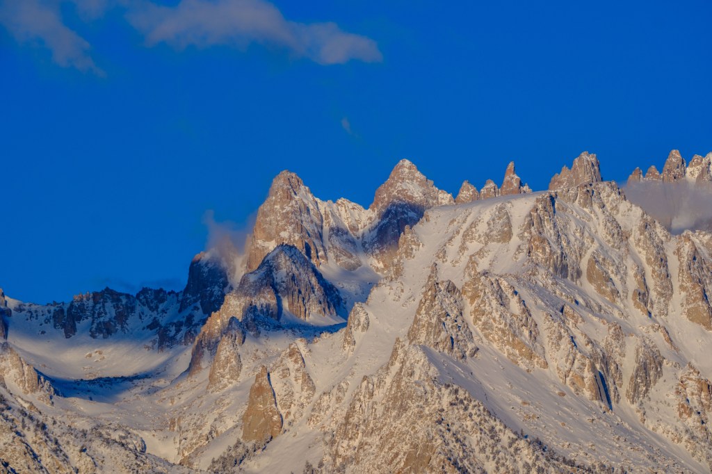
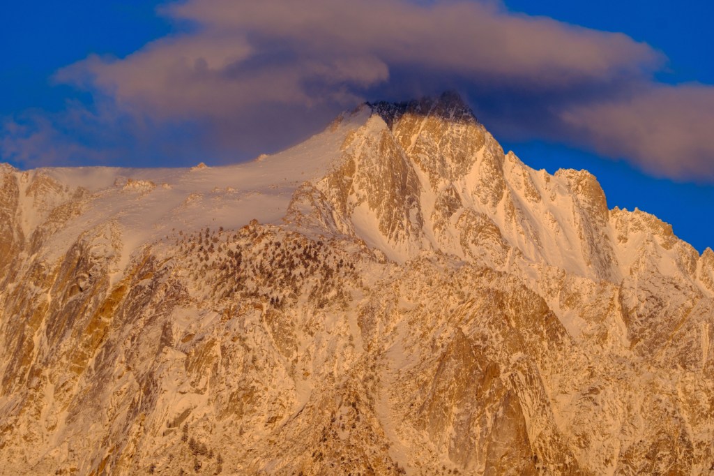
4/1/24. 6:45 AM.
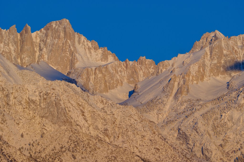
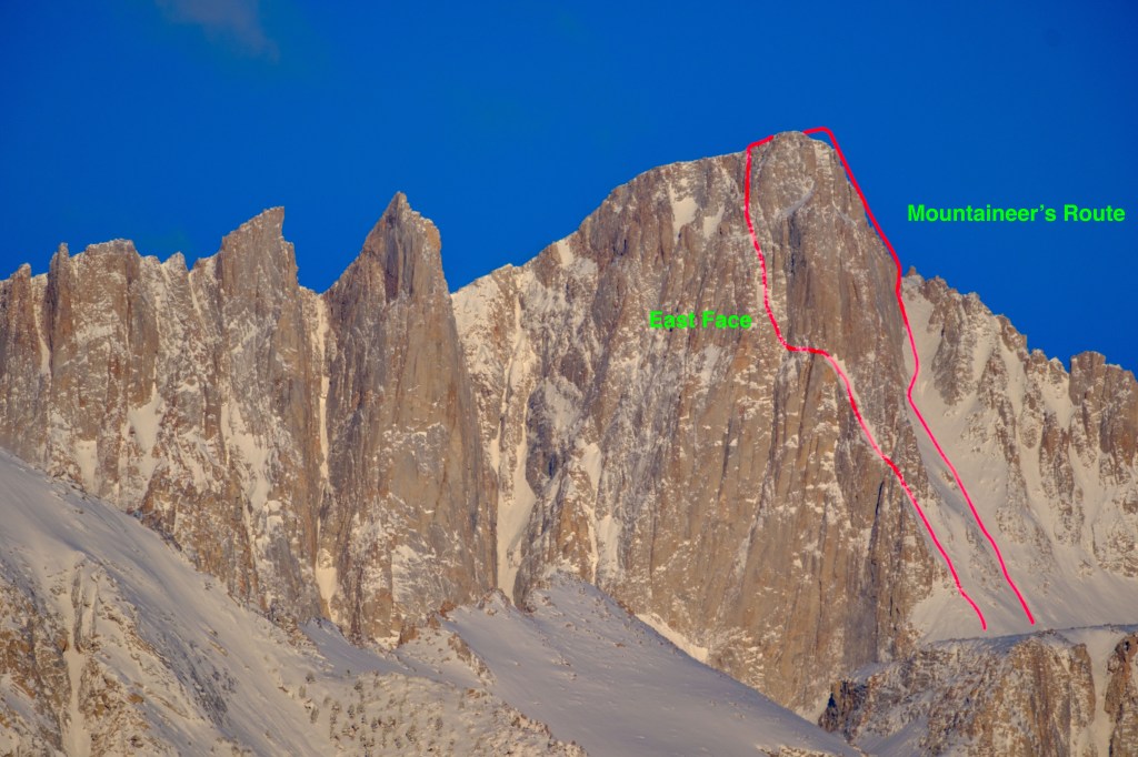
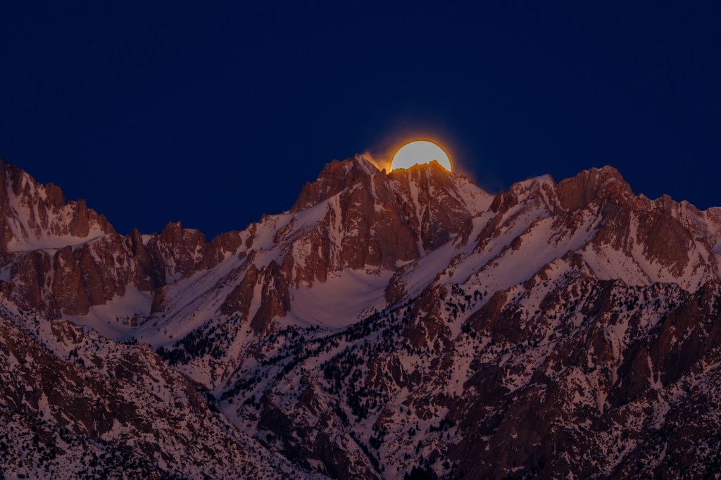
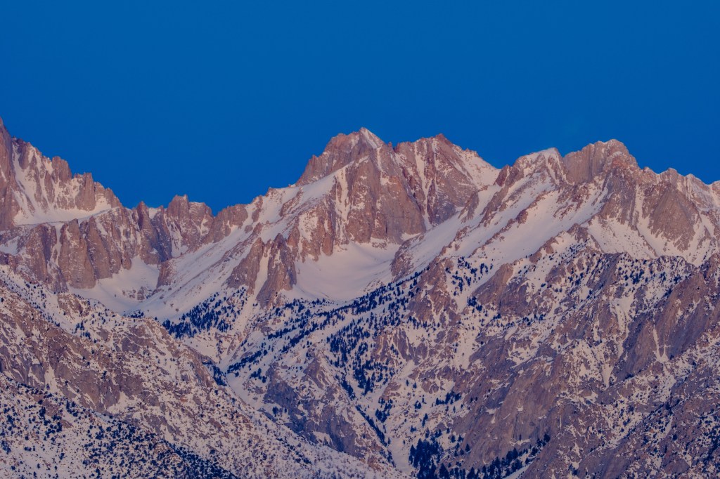
Mount Whitney
My first climb of Whitney was in 1971. I drove to Lone Pine and picked up a permit for the Mountaineer’s Route in May. My climbing partner and I saw no one on our climb and met only four people on the summit. But that ship has sailed. Because this is the tallest US summit aside from peaks in Alaska, the demand for permits has surged in the last 25 years. Most people use the trail to the top; 11 miles with 6000 feet of uphill. For hiking permits during the period May 1 to November 1, people must now enter a lottery in February. There are 100 permit spots each day for people who want to try to reach the summit without camping, 60 spots for people willing to camp overnight along the trail. In 2023 there were 26,219 permit applications for about 115,000 people; 27% of the applications were granted, so about 31,000 individuals had permit spots to go up Whitney. Some of these people never went and many others failed to reach the top; it is estimated that about 10,000 people reach the summit each year.
You cannot see the trail to the summit in photos from the valley. The trail is hidden behind Lone Pine Peak and behind Whitney’s long south ridge.
3/7/23. 5:56 AM.
3/7/23. 6:15 AM.
3/7/23. 6:18 AM.
3/7/23. 6:24 AM.
Whitney’s east face has routes popular with climbers. To the left of the summit you can see Keeler Needle (14,240 feet). Crooks Peak (14,080 feet) is further left.
3/7/23. 6:29 AM.
In the photo below, Crooks Peak, Keeler Needle, Mt Whitney, and Mt Russell are all taller than 14,000 feet. Lone Pine Peak on the left looks taller, because it is closer, but it is actually shorter than 13,000 feet.
3/7/23. 6:33 AM.
2/24/24. 6:26 AM.
2/24/24. 6:46 AM.
Below, see how much the light changes in 1 minute, from 6:35 to 6:36 AM.
4/1/24. 6:35 AM.
4/1/24. 6:36 AM.
4/1/24. 6:39 AM.
4/1/24. 6:46 AM.
4/1/24. 6:54 AM.
The photo below shows Crooks Peak, Keeler Needle, and Whitney’s east face. I have marked two climbing routes on the photo. In May of 1971 I climbed Whitney via the Mountaineer’s Route. That route goes up a long snow gully, then turns left and out of sight to climb icy rocks to the top. In June of ’81, I climbed the East Face Route.
4/1/24. 7:03 AM.
Peaks North of Whitney
Below, the moon sets behind Mt Carillon (13,552 feet), with Mt Russell left of the moon.
3/7/23. 5:54 AM.
3/7/23. 6:02 AM.
Below you can see Russell, Carillon, and Tunnabora.
Another moonset.
2/24/24. 6:05 AM.
In the lower part of the photo below you can see fir trees covered in ice.
4/1/24. 6:54 AM.
The deep canyon that slopes from lower right to upper left, in the next picture, contains Lone Pine Creek. It also contains the road to Whitney Portal, the trailhead used for the hike to the summit. You can see part of the road in the lower right of the photo.
4/1/24. 7:02 AM
Farther north is Mt Williamson (14,375), California’s second highest peak.
4/1/24. 7:01 AM
My Climbs on Whitney
I first climbed Whitney in May of 1971, using the Mountaineer’s Route. John Muir made the first ascent of this route in 1873.
I climbed Whitney again in June of 1981, using the East Face Route. Before the climb I was lounging near my tent at Iceberg Lake, reading Wilderness and the American Mind by Roderick Nash. Another climber strolled up to me and I felt miffed that my reading was interrupted. That stranger was Bart O’Brien and soon we were discussing Nash’s book and other areas of interest that we shared. We went on to become close friends. We’ve done more than 160 climbs together on 4 continents.
In 1982, Roberta decided to climb Whitney. We did a 6-day hike, first up the trail to Consultation Lake, then over Arc Pass to Rock Creek. We used the PCT to reach Guitar Lake on Whitney’s west side. On September 12 we reached the summit before anyone else, then we descended the usual trail.
In January 1988, Leni Reeves and I climbed Whitney. Due to snow, we had to park at 6500 feet on the approach road. We took 2 days to walk and snowshoe to a camp above Consultation Lake. After a rest day, we climbed up a gully north of the switchbacks, then followed the trail to the top. A line of black clouds approached as we raced back to camp. High winds damaged our tent that night. After 4am we had to sit up and use our backs to brace the tent wall against the storm winds. At first light we packed up and hiked down to the car. We met no one else on this climb.
Bishop lies at 4000 feet in the sagebrush ocean. The landscape hosts Giant Sagebrush, Rabbitbrush, Sulfur Buckwheat, and other drought-tolerant plants. Precipitation averages 5 inches a year. Despite being a desert town, the nearby Sierra Nevada collects snow and rain, which fills local creeks and canals. We have ponds in the City Park and the Conservation Open Space Area. Within a ten-mile radius is the Pleasant Valley Reservoir, the Buckley Ponds, and Klondike Lake. Because of this water, we have waterfowl; Swans, geese, and ducks. Most birds that migrate via the Pacific Flyway pass west of the Sierra, over California’s great Central Valley. But a sliver of this migration passes on the east side of the Sierra, over the Owens Valley. This blog post contains pictures of twenty waterfowl species that I photographed within ten miles of Bishop in the last 5 years.
What are waterfowl? This is a North American term applied to swans, geese, and ducks. They have webbed feet and a spatula-like bill. In Britain, this group is generally called wildfowl. Another characteristic is that people think of these birds as food. They are hunted and eaten. Their down feathers are used in pillows.
I’ve sorted these birds into a few tribes. Within each tribe, I ordered them from heaviest to lightest and provide average weight information from Richard Crossley’s guide: Crossley R, Baicich P, Barry J. The Crossley ID Guide: Waterfowl. West Cape May, New Jersey: Crossley Books; 2017. I also give the seasons during which each bird is most likely to be seen, using data from Heindel TS, Heindel JA. Birds of Inyo County, California, Including Death Valley National Park. Camarillo, CA: Western Field Ornithologists; 2023.
Swans
1. Tundra Swan – 15 lb. Winter.
These big birds breed on the tundra of northern Canada. A few winter near Bishop. The photo below was taken at a small pond near Klondike Lake. The Swan’s foot looks like a scuba diver’s flipper. The blurry bird in the foreground is a Greater White-fronted Goose; it looks tiny compared with the Swan.
In the air, you can see that the belly feathers are stained by the muddy water.
The Swan below was on the Buckley Ponds in December. Note the yellow spot at the base on the bill, in front of the eye. This marking is diagnostic.
Geese
2. Canada Goose – 10 lb. Fall/Winter.
Honking flocks of geese announce the arrival of fall. One of my favorite sounds. The photos below were all taken from Airport Road south of Line Street. These birds are found almost everywhere in Canada and the US.
In December, a flock passes in front of the Wheeler Crest.
The remaining photos were taken in March.
This is a heavy bird; see below.
Goose honks at a Red-winged Blackbird.
3. Snow Goose – 6 lb. Fall/Winter.
Snow Geese often mingle in the air or on the ground with both Canada Geese and Greater White-fronted Geese. The pictures below were taken in winter along Airport Road.
A mixed flock of Greater White-fronted (dark) and Snow Geese (white).
Feeding near Airport Road.
Perching Ducks
This tribe consists of Wood Ducks and Muscovy Ducks; only the former visit Bishop. They are surface-feeding, woodland birds with sharp claws on their toes. They perch and nest in tree cavities.
5. Wood Duck – 1.3 lb. All year.
Seeing a duck in a tree seems like a prank. The first three photos were taken on Gus Cashbaugh Lane.
The next two pictures were taken at the Conservation Space Open Area (COSA). The plumage of the male Wood-Duck is garish or gorgeous, depending on your taste.
Dabbling Ducks (Puddle ducks)
Dabblers feed on or near the surface. They often tip themselves up so their butts are in the air while their heads are submerged. Their feet are located in a mid-position under their bodies, so they can walk about on land. Powerful wings let them explode almost vertically from the water into the air. To lift off, the first wing-beat of a Mallard usually pushes on the surface of the water. I find it hard to photograph dabbler take-offs because they are so fast. The outspread wings are decorated with a rectangular patch of colored feathers, called the speculum. This area of color is often bordered by a white band.
6. Mallard – 2.6 lb. All year.
The Mallard is the “Make Way for Ducklings” duck. To see this bird, visit the Bishop City Park. Or almost any place with water. They sometimes stroll across highway 395, our Main Street. A friend had to wait in traffic when a Mallard-pair copulated on the highway. Mallards are so common that I have more pictures of this bird than all other ducks combined. I picked over a dozen Mallard photos for this blog.
Two females and a male in the air in October. Note the blue speculum, bordered front and back by a white band.
Mallards waking up at Pleasant Valley Reservoir, November.
Mallards on ice, Conservation Open Space Area, December.
Dinner on Christmas day, Reservoir.
This bird may seem ordinary, because we are so familiar with them. But are striking creatures. COSA in January.
Flying past the Sierra, February.
Nap in City Park, March.
Strolling at the COSA, March.
Preening at City Park, April.
Make way for you-know-what at Buckley Ponds, May. Awww, mira que cute.
Mom and child, Reservoir. May.
Mother and teenagers, July. Reservoir.
Airborn at Reservoir. Males are in their “eclipse” (non-breeding) plumage, so males and females look similar. August.
Flying over the Reservoir, August.
7. Northern Pintail 2.1 lb. Spring & Fall.
I have only one photo of this bird, standing on ice at Buckley Ponds.
8. Gadwall – 2 lb. All year.
Not colorful, but delicate feather patterns. First two photos taken on Airport Road.
Shovelers crack me up. They look like they are wearing a fake nose.
In the air they look strikingly colorful. Next 4 photos all from the Reservoir.
When landing on water, the tails touch first, then the feet. The birds ski on this 3-point platform for a while, then settle on the water.
11. Cinnamon Teal – 0.9 lb. Spring & Fall.
Three different Teal species visit Bishop. Cinnamon Teals are the most common. In flight their colors seem to change with their position and the angle of the sun.
In the water or on land, the plumage is striking.
12. Blue-winged Teal – 0.9 lb. Spring & Fall.
This bird has a large blue area on the wing, plus a green speculum, and a wedge of white. If you compare this with the wings of Northern Shovelers, shown earlier, you can see the same pattern.
Teals are all small ducks, weighing less than a pound. The photo below shows a diminutive Green-winged Teal with a massive female Mallard.
Below, a small Green-winged Teal swims with male Mallards at the Reservoir.
The next 3 photos all show Green-winged Teals at the Reservoir in winter.
Diving Ducks (Bay Ducks)
This group of ducks can dive to 20 feet for food. Their powerful legs are positioned to the rear, so they swim well underwater, but have trouble walking. It is hard for them to take wing, as their bodies are heavy compared with the surface areas of their wings. To get into the air, they run on the surface, pushing on the water with their feet. Take-off requires a long runway and a lot of splashing. These birds have no speculum on the wings.
14. Merganser – 3.2 lb. Fall/Winter.
Mergansers have a long bill with a hook at the end. I find it hard to think of them as ducks, as they lack the spatula-shaped bill. In flight, they look long and narrow. Below, a fleet of Mergansers cruises on the Buckley Ponds. Males have sleek dark heads, females have messy red “hair.”
At City Park, a heavy Merganser bullies a Mallard. Both birds wear similar socks and shoes. Later the Merganser poses alone.
Male Mergansers patrol the Ponds. Adult females look similar to juveniles of both sexes.
Scenes at the Reservoir.
15. Canvasback – 2.7 lb. Fall/Winter.
A big duck. Below are 4 views at the Ponds, all in winter.
16. Redhead – 2.3 lb. Spring/Summer/Fall.
Color pattern similar to a Canvasback. Three photos from the Ponds in March.
17. Lesser Scaup – 1.7 lb. Fall/Winter/Spring.
Iridescent head, delicate feather pattern on back. Visits the Reservoir in winter.
This bird has the wrong name. The ring on the bill is obvious. The ring on the neck is obscure. This should be called the ring-billed duck.
A male at the City Park looks fierce when seen head on.
A female at the Park. She looks placid as she demonstrates that water rolls off a duck’s back.
At the Reservoir, a group of Ring-necked Ducks thrashes about as they try to take off.
Three images taken at the COSA. In the last photo you can see the ring on the neck.
19. Ruddy – 1.3 lb. All year.
These are called stiff-tailed ducks, as their tail feathers stick up. On a cold morning they sleep in, heads tucked away, tails pointed up. I think they look like a bowl of noodles with chop sticks inserted. Or a basket of yarn with knitting needles. The three photos below were taken in winter. First at the Reservoir, last two at the Ponds. Note the blue bill.
20. Bufflehead – 0.9 lb. Fall/Winter/Spring.
Small diving duck. Head iridescent in sunlight, black and white in shade. First 4 photos taken at the Reservoir.
Below you can see how a diving duck uses its feet to take off.
Last photo shows what a diving duck does to eat; it dives.
The Osprey is ubiquitous. They aren’t particularly common, but they are found on 6 continents. There are Ospreys in every state. If there is a pond, ocean, lake, stream, or river, an Osprey may be nearby.
An Osprey Family
Let’s meet a typical Osprey family in their rural home, a nest on a tufa tower in Mono Lake. The nest is a large pile of wood, about 6 feet across, constructed over many years. In the first photo, Dad is on the left; his chest is white, his eye yellow, and his feathers are brown. Mom is on the right. She wears a necklace of brown feathers on her chest and she is a bit bigger than Dad. Junior, about three months old, has black feathers outlined with white, giving him a scaly look. His eye is red/orange. All three birds have a chest and belly that is mostly bright white and a band of dark feathers that runs across the eye and down the neck to the back. Adults weigh 3.5 lb. Their 63” wingspan approaches the 80” of a Bald Eagle, but the Eagle weighs 3 times as much; a thuggish brute compared with the slender Osprey.
This cooperative family posed for more images. The next shot shows the size of the nest.
Mom flies off, leaving Dad and Junior to bond.
But after a minute, Dad departs with his lunch. Junior is left alone, a latchkey bird.
What Does “Osprey” Mean?
Most birds have a species label made from two or three words: Great Blue Heron, Say’s Phoebe, Yellow-headed Blackbird. A select few have a single moniker: Mallard, Killdeer, Merlin. The Osprey is one of these, but the name is a mystery. One theory is that the Latin “avis praedae” (bird of prey) became the French “ospreit” which evolved into the English “osprei” in 1460 — maybe, but why was this the “bird of prey” any more than some other Eagle, Hawk or Falcon? A second theory notes that the Lammergeier, an old world vulture, was called the “ossifragus” in Latin, which means bone-breaker. “Os” means bone (ossify, etc.) and fragus means break (or fragment). This bird likes to eat bones and breaks its preferred food items by dropping them from a height. Somehow “ossifragus” migrated to a different bird of prey, the Osprey, although Ospreys are not bone-eaters. Neither theory seems terribly satisfying.
What do Ospreys Eat?
There are reports of Ospreys eating mice, rabbits, ducks, even a baby alligator. These are exceptions. This bird prefers fish for breakfast, lunch, and dinner. Each meal has a fish appetizer, a main course with gills, fins, and tail, and a desert fish. If you ask an Osprey to eat out, they will suggest a Sushi bar or Legal Sea Food. Ospreys generally avoid carrion, even dead fish. They always ask, “Is the fish fresh?”
Ospreys at Mono Lake
Mono Lake is three times saltier than the ocean; consequently, it has no fish. So why are Ospreys nesting on the tufa towers that rise up above the water? The answer is safety. Tufa is calcium carbonate, or limestone. Tufa towers form below the lake surface, where freshwater springs emerge and mix their load of calcium with carbonate in the water. When Los Angeles Department of Water and Power diverted water from the Mono Basin, the lake level fell, exposing these offshore tufa platforms. After World War II, the towers rose above the falling lake waters and Ospreys built their nests on these protected spots. To get fish, the Ospreys commute to nearby Rush Creek or a bit further to Grant Lake.
In August of 2025, Roberta and I visited Mono’s South Tufa area. We counted 10 Ospreys, adults and juveniles. Here are photos of these birds:
Below an Osprey lands on a nest. Note the bands on both legs. In the third photo, the wings bend at the wrist, a common sight with these birds.
Below is the mother with one of the fledglings we saw in the first photo of this blog. This picture was taken July 14, while the first photo was taken Aug 6.
The next few photos show these birds on nests. They often make a racket — high-pitched cries of “PIERP! PIERP!”
The next photo shows a juvenile having a meal.
Canada Geese sometimes use Osprey nests:
A Taxi for Fish
After catching a fish, Ospreys usually point the fish head-first and zoom off to find a safe dining location. The fish has a final aerial ride, but gets little joy. It isn’t easy to hold a cold, wet, slippery, wriggling trout. To hang on, Ospreys can rotate one toe so that two talons are on one side of the fish, two on the other side. The talons are strong and have tiny barbs that help grip the fish. The pads of the toes and feet have sharp spikes. Below are photos showing this transport. The first picture shows an Osprey landing at a Mono Lake nest with a fish.
The following pictures are from the Pleasant Valley Reservoir in 2025. In the first and last photo, the Osprey uses only 1 foot to hold on. Rarely an Osprey will catch two fish at once, one with each foot.
The Catch
Ospreys cruise 20 to 100 feet over the Pleasant Valley Reservoir, looking for fish within four feet of the surface. When the dive starts, they use a head-first position, but in the last tenth of a second, the feet come forward with talons open for the catch. The splash is impressively noisy. The bird may submerge entirely. Then powerful wingbeats lift it, with a squirming burden, back up into the air. Observers have reported that 20 to 80% of dives are successful. Success depends on type of fish, water conditions, lighting, and so on.
The next three pictures show a dive that failed. The bird came up empty.
The next series of pictures shows a successful dive. First the bird spots a target.
Then the dive starts.
Head first now
Feet drop down and talons open.
Feet thrust forward in last split-second
Wham. Impact speeds up to 40 mph have been reported. The bird vanished right after the impact.
Head appears
Wings appear
The struggle to get into the air, using powerful wing muscles.
Success!
One footed hold
In the next shot, the bird throws its tail to the left, to shake out water. More about this shaking later.
The bird continues to use just one foot to hold the fish
On September 21, 2025, I filmed another dive. The first photo shows the start, with the bird well lit by the sun.
The next photo shows the bird lower down, wings in a “W” formation. This dive came to an end before the bird hit the water; evidently the fish moved.
Shake it Baby!
After diving for a fish, the osprey will often be soaked. Its feathers are oily and dense, to resist getting totally soggy. But the bird still needs to shed water to save weight, to allow the feathers to work properly, and to avoid losing heat. Getting dry makes flight faster and easier. Wet feathers waste energy and make the bird vulnerable. In one earlier photo, I commented that the bird was shaking its tail to get rid of water. Next I’ll show two sequences of this shaking behavior, both taken at the Pleasant Valley Reservoir.
Series A. A juvenile bird failed to get a fish. Three photos show water dripping behind and below the flying bird.
In the next picture the bird starts to swivel its head to shake it
Then the bird acts as if it is in the Exorcist. Fierce shaking throws off a cloud of water
Shaking stops, but feathers are disheveled
Just three seconds later, the bird looks smooth and orderly, as if it dried off with a little towel.
Series B. The bird below plunged into the water a little behind me. I heard the splash and started taking pictures as it rose up without a fish. Water drips from the feathers and the belly looks like a wet rag.
First the head starts shaking, followed by spasms of the body, tail, and even wings. A cloud of water flies off the bird. By the last photo the bird is so bedraggled that it is actually falling out of the air. This was all over in one second.
This shaking behavior of Ospreys is well-described in books. I’ve photographed other birds that shake themselves dry in the air: Belted Kingfisher, Double-crested Cormorant, Green-winged Teal.
Portraits
The next photos are Osprey portraits from several Bishop locations. First an Osprey takes off along Bishop Creek Canal.
Then two pictures from the Buckley Ponds. Ospreys in the air often bend their wings at the wrist, so they form a W (or M) shape.
Osprey at the Conservation Open Space Area (COSA)
The remaining portraits are from the Pleasant Valley Reservoir.
The Competition
Humans fish at the Pleasant Valley Reservoir. When we walk there, it is common to meet a half-dozen fishermen with gear that may include small rafts and up to five rods per person. Osprey are competing for fish with these humans. They are also competing with other birds, including the ones below, all photographed at the Reservoir:
Bald Eagles have been known to attack Ospreys in the air and steal their fish.
Double-crested Cormorants. Some cormorants are reported to be the most efficient fish-catchers of all birds; more ounces of fish per calorie of effort.
Common Loon
Common Merganser
Great Egret in the process of catching a small fish
Belted Kingfisher
Great Blue Herons, a group of three
Great Blue Heron with a large fish. These birds do not spear fish; they catch them between their mandibles. The heron had a lot of trouble choking down this fish.