Hiunchuli

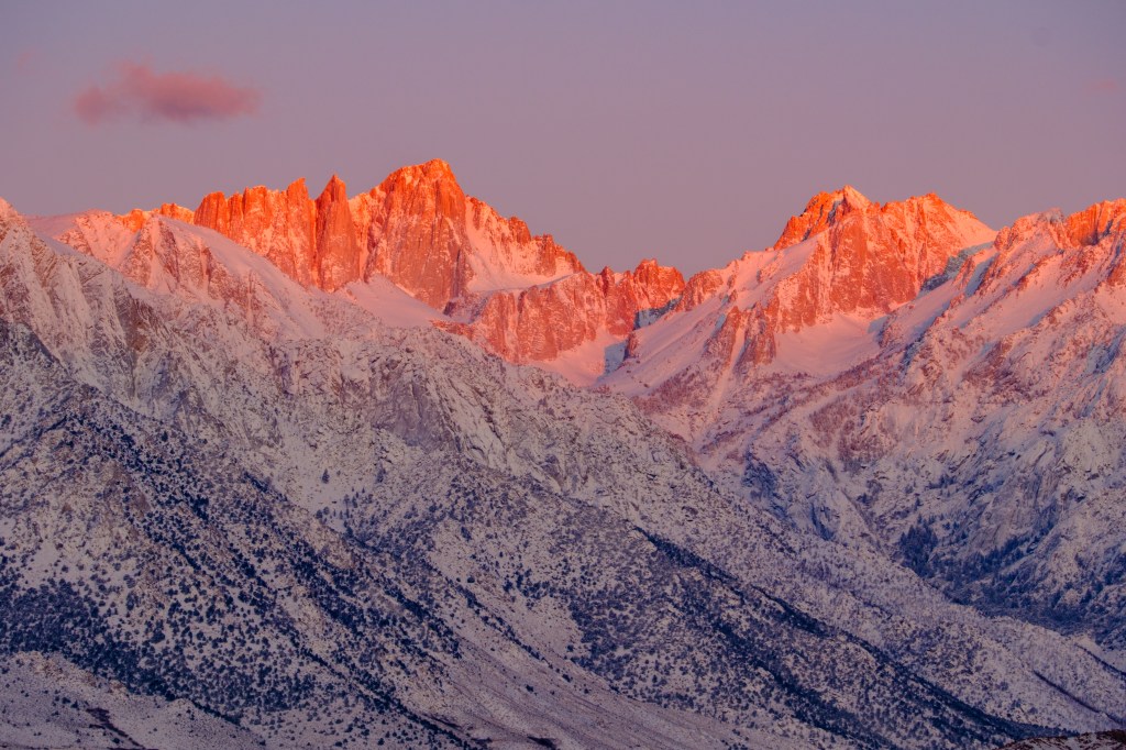
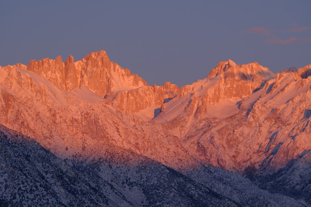
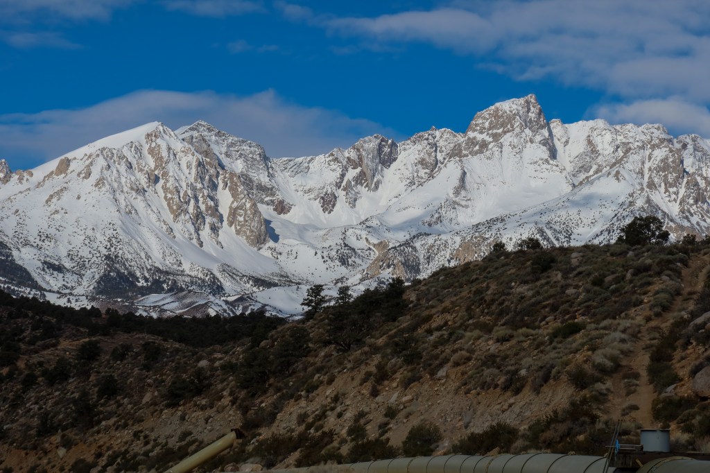
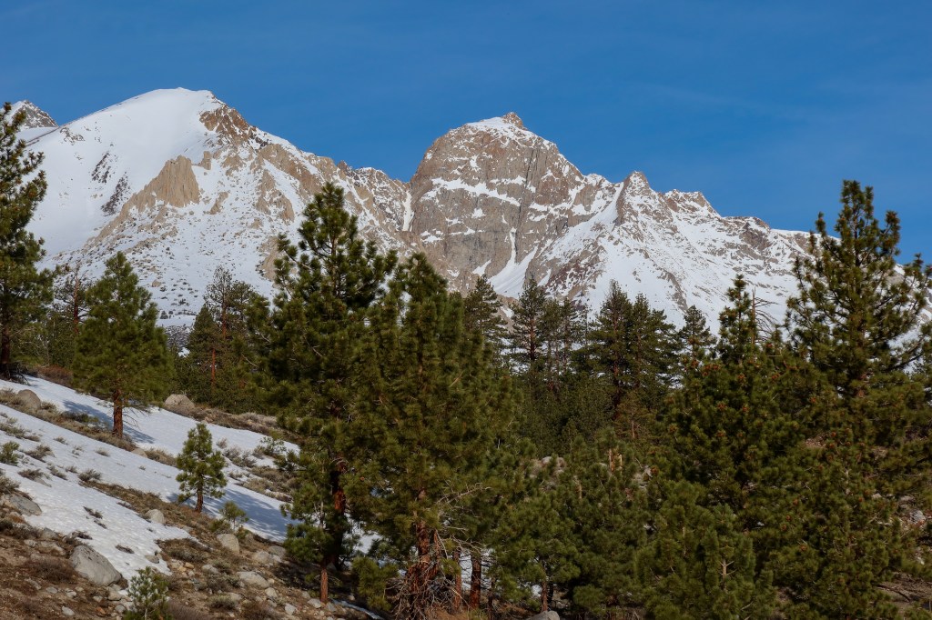
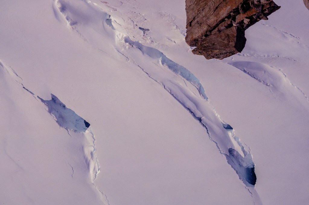
Nepal is shaped like a rectangle: 500 miles wide from west to east and 120 miles from north to south. The country covers the area where the Indian tectonic plate slides under the Eurasian plate. This collision pushes up the surface, forming the Himalayas. The northern third of Nepal borders Tibet and is covered by gigantic, glaciated peaks. The middle tier consists of ridges and valleys, with small villages and rice paddies, while the southern third meets lowlands and jungle in India. Only 14 peaks on Earth rise above 8000 meters (26,250 feet); 8 of these, including Everest, lie within Nepal or on its northern border with China.

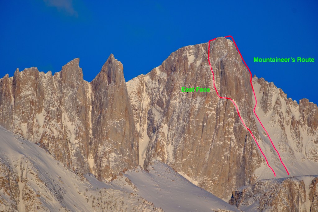
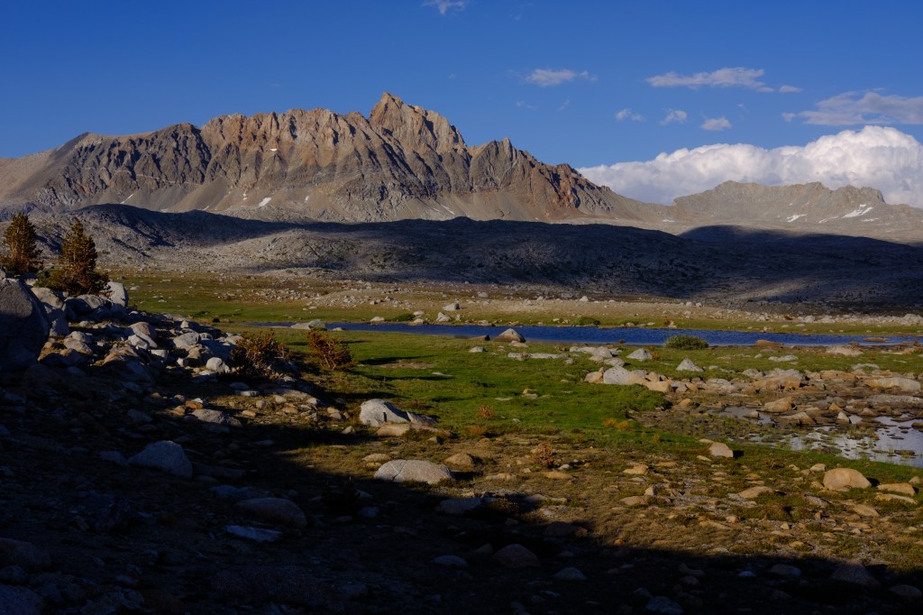
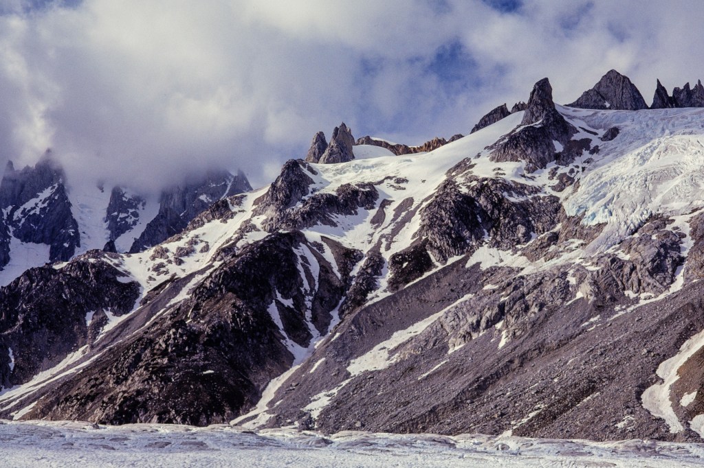
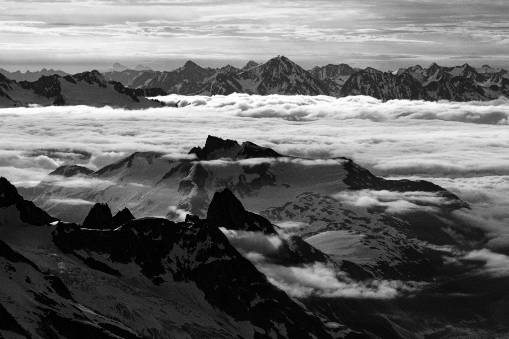
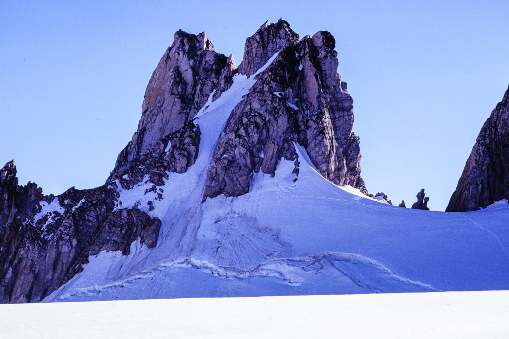
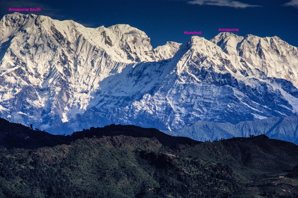
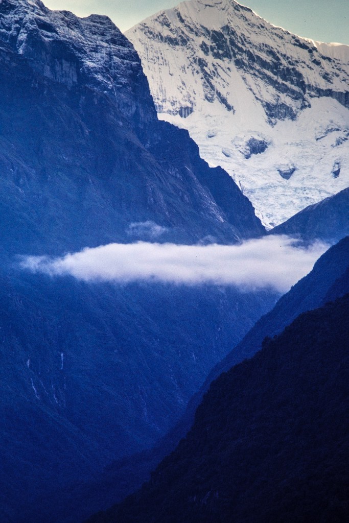
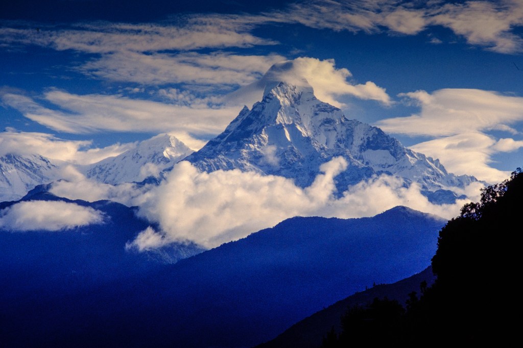
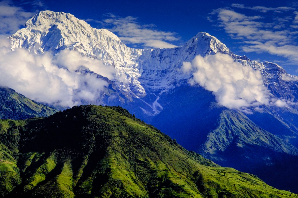
Annapurna, one of the 8000-meter peaks, rises near the center of Nepal. It is part of a bowl-shaped ring of mountains. The center of the bowl is the Annapurna Sanctuary; its floor is at 14,000 feet and the walls are above 20,000 feet. A river, the Modi Khola, drains this gigantic bowl by exiting to the south through a narrow slot, between Hiunchuli and Machapuchare. The peaks that form the walls of the bowl, clockwise, are Hiunchuli (21,132 ft), Annapurna South, Fang, Annapurna, Roc Noir, Glacier Dome, Gangapurna, Annapurna III, and Machapuchare (Fishtail Peak, 22,963 ft). The entrance to the sanctuary is a trail system in the deep gorge of the Modi Khola. 

Hiunchuli was first climbed in 1971 by an American team led by a former Peace Corps volunteer. During the 70s there were six attempts to repeat this climb. A 1979 Japanese expedition ended when 3 climbers were killed by an avalanche near Basecamp. In 1981, I was invited to attempt the second ascent of this peak by Eric Simonson, a professional guide who I met during a 1979 attempt on Annapurna. Eric asked me and Bob Wilson to work as assistant guides; in return for our work, we paid only a minimal fee to cover costs.

THE APPROACH

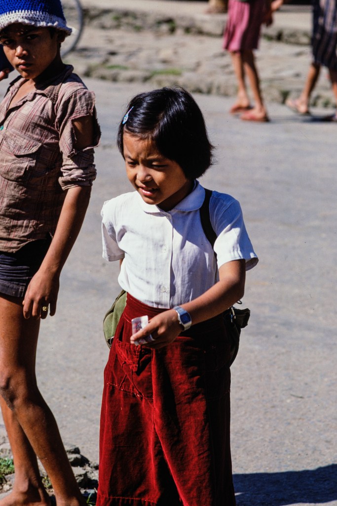
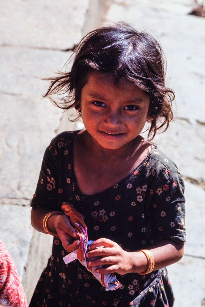
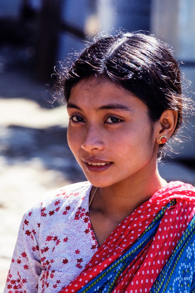
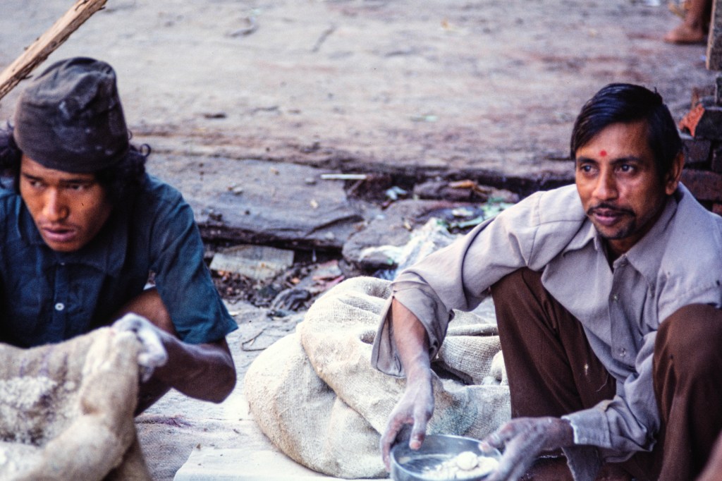
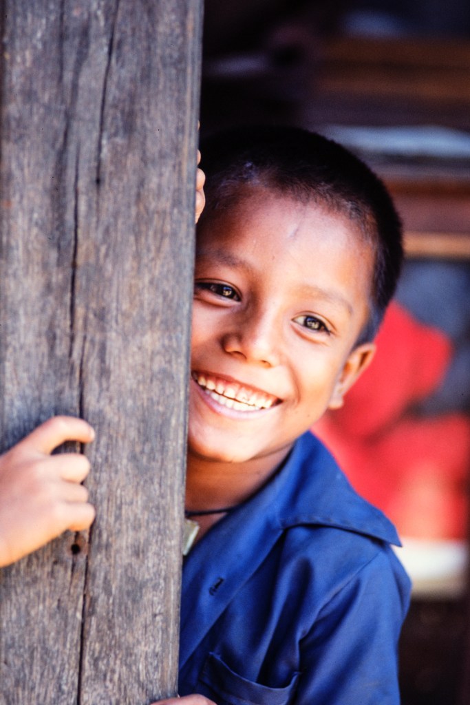
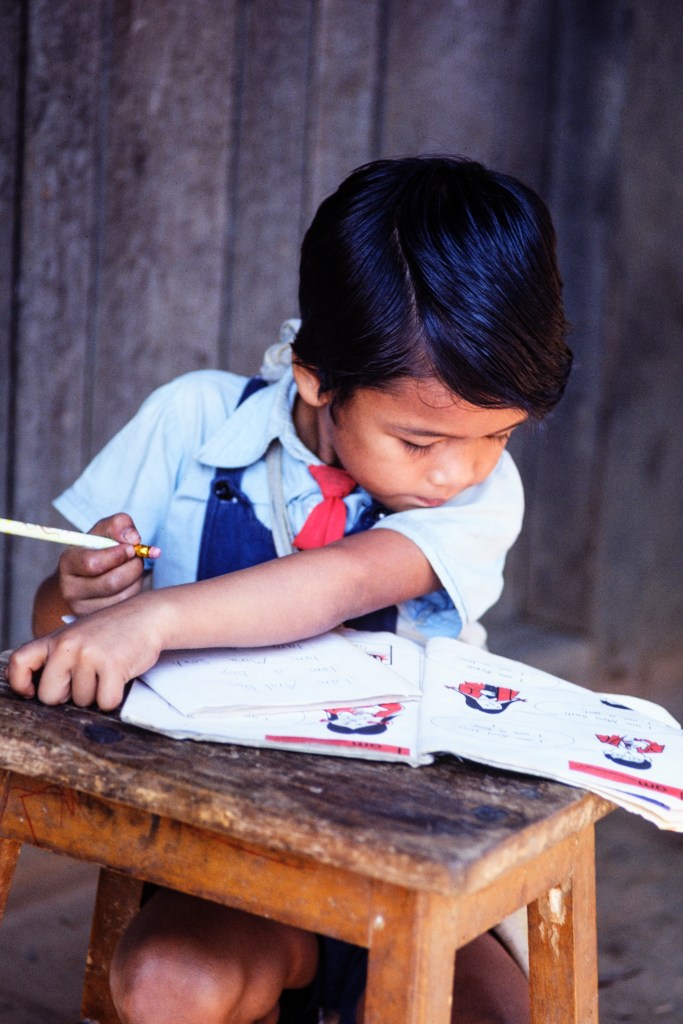
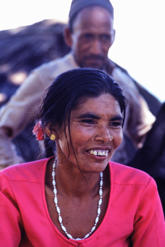
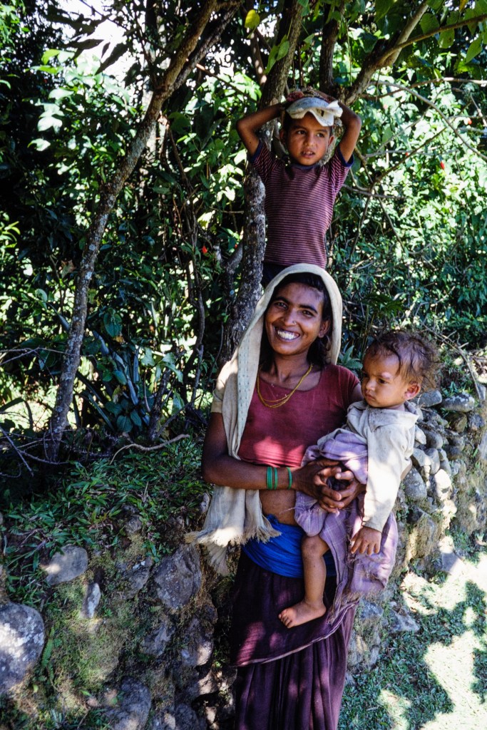
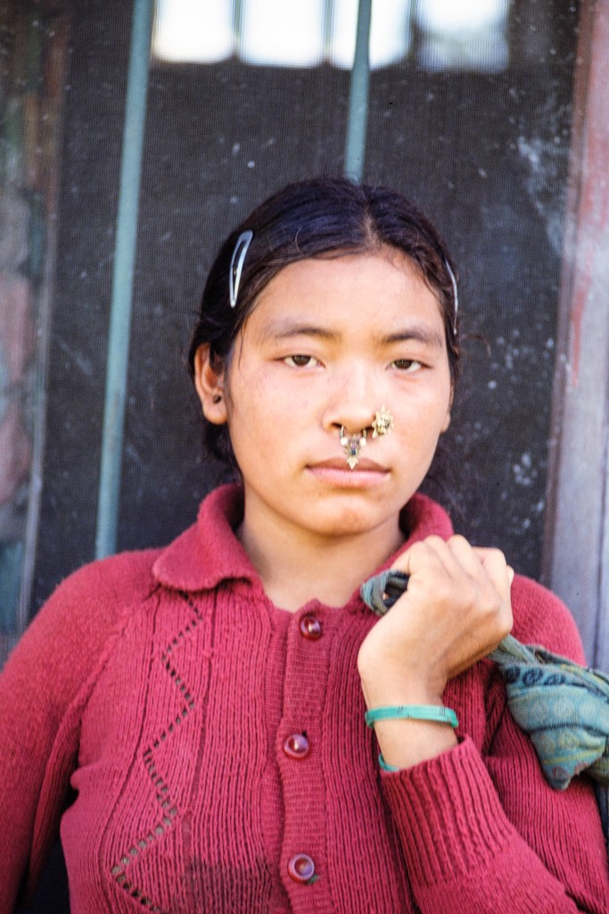
I arrived in Kathmandu on 9/15/81. We started our approach hike from near Pokhara on 9/19. Our path dropped down to the Modi Khola, then up the other side to a camp in forest on 9/22. My photos include portraits of the local people; a mix of religions (Hindu, Buddhist, other) and ethnic groups (Gurung, Tamang, etc.) (The famous Sherpa people live about 200 miles east near Everest.) Farming and tourism support the area we hiked through. Gurkha soldiers are recruited from this region. The Gurkha Kingdom fought the British East India company to a draw in 1816. The Gurkhas were tough and repelled a British assault by luring the attackers into a field of stinging nettles. The British recognized a good thing and recruited Gurkhas into special units of the British army in India and later elsewhere. Today Gurkha military units serve in the British, Nepali, and Indian armies, and as UN peacekeepers. The Royal Gurkha Rifles recently served in Helmand Province, Afghanistan. Central Nepal has many retired Gurkha troops who receive army pensions, while other families are supported by relatives still serving in the military.

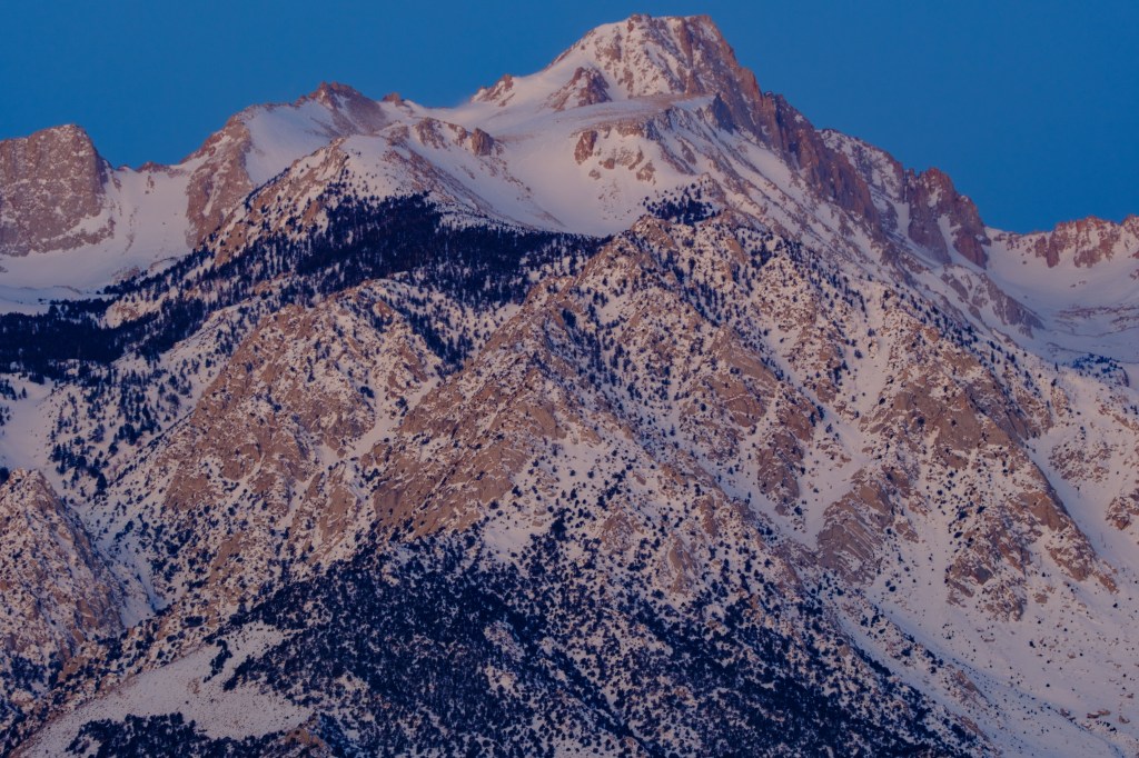
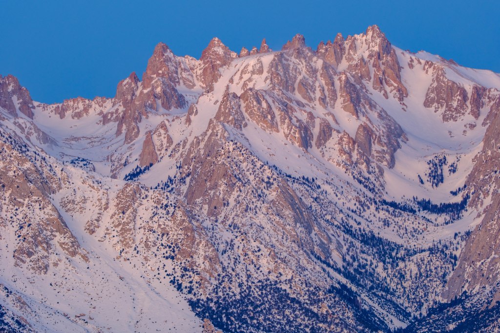
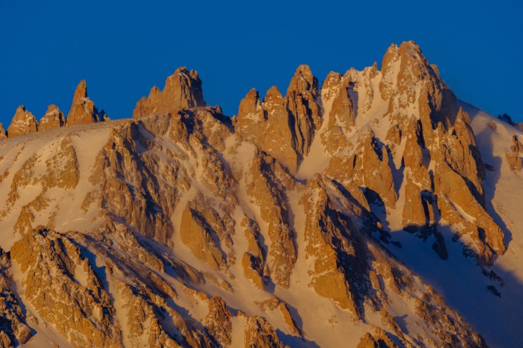
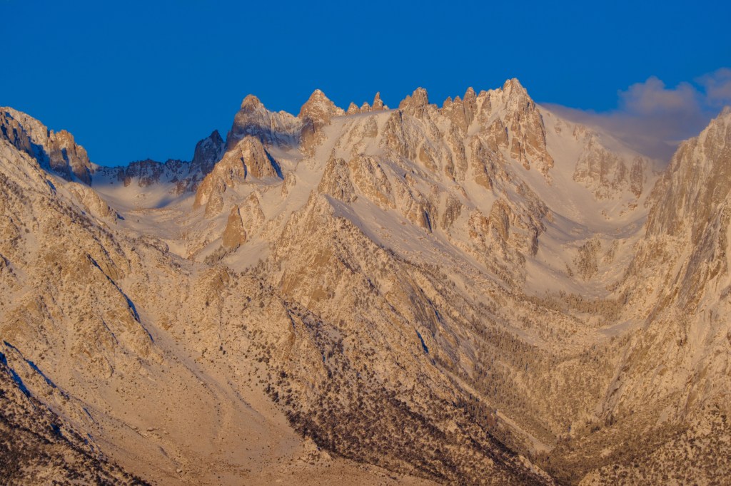
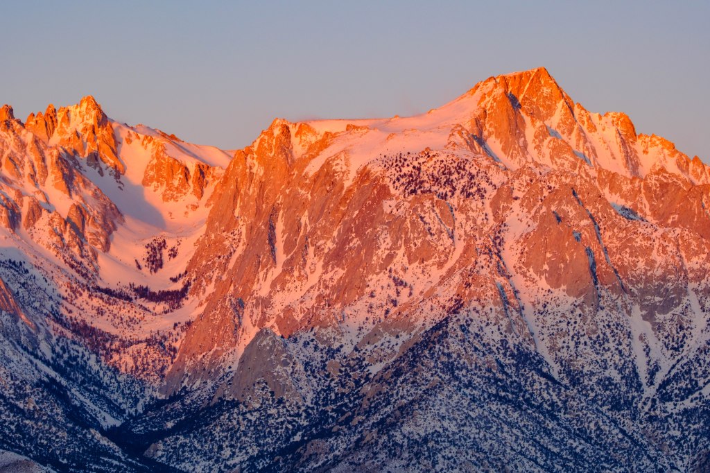
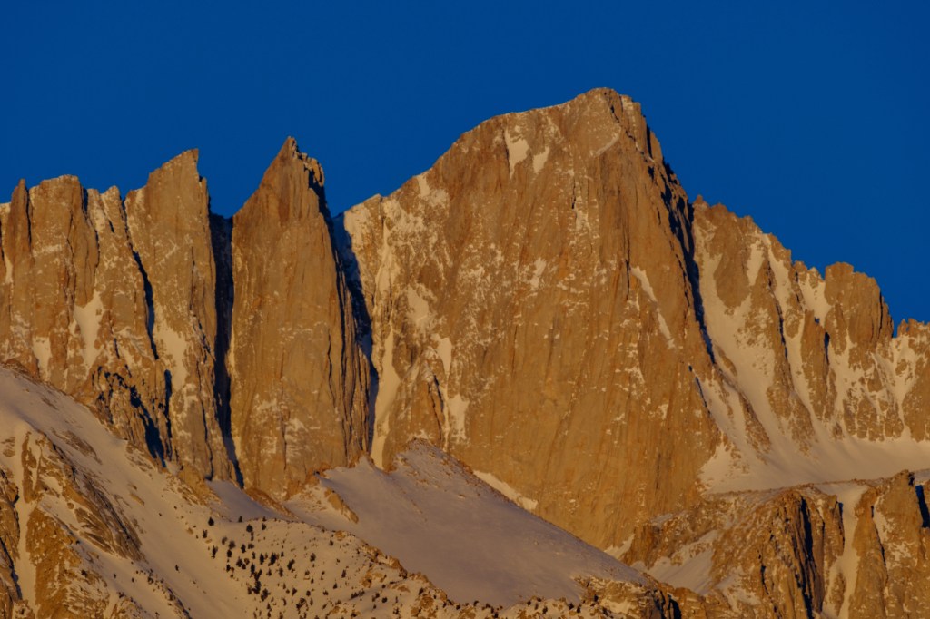
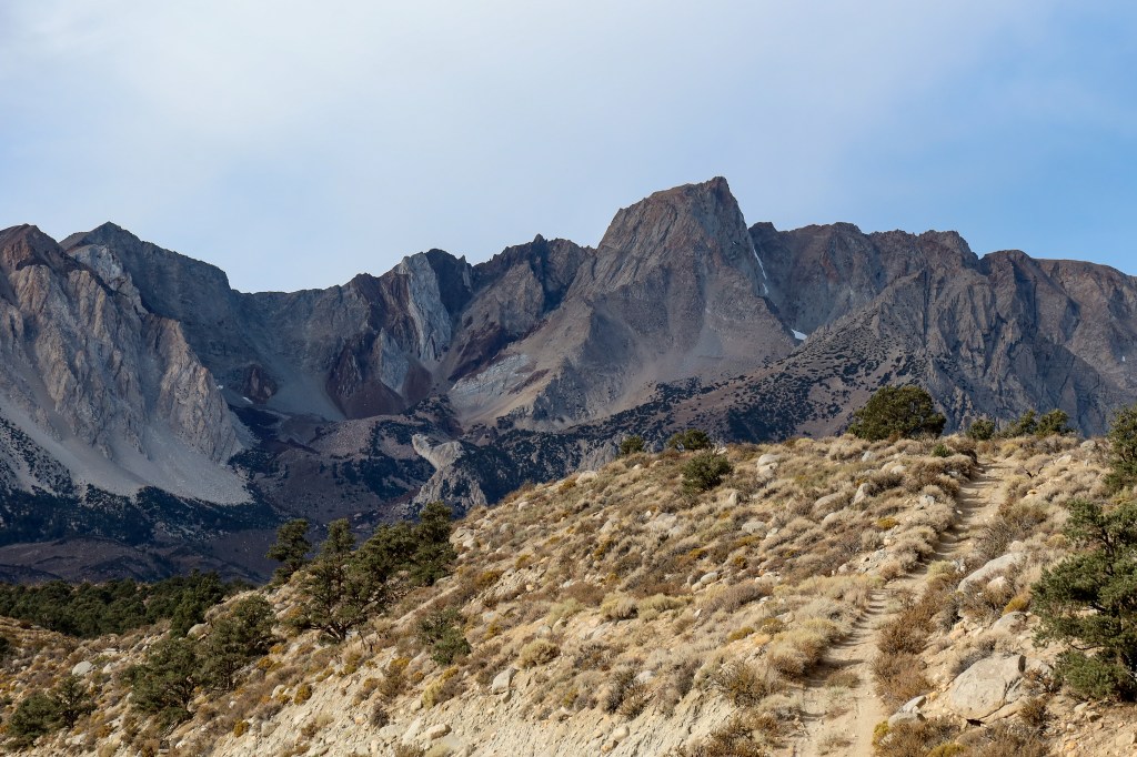
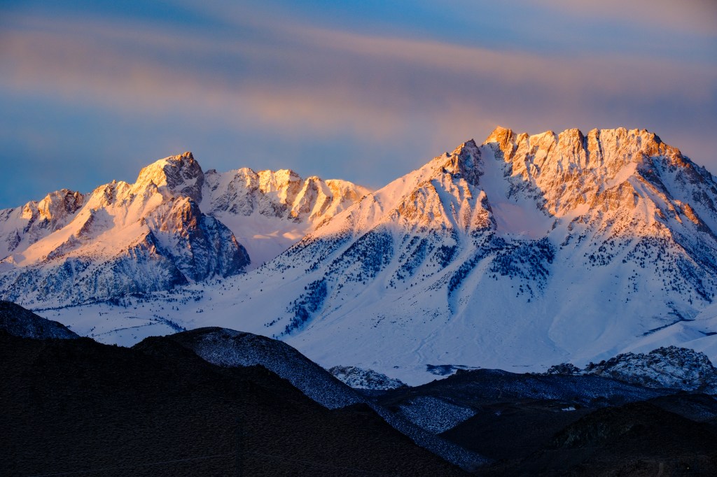
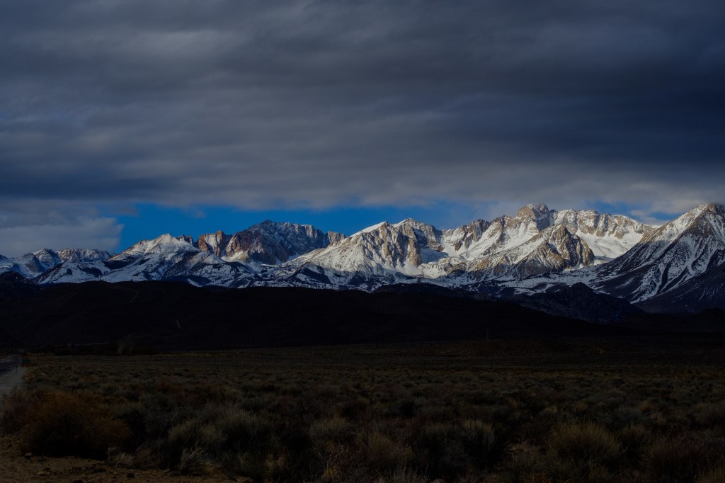
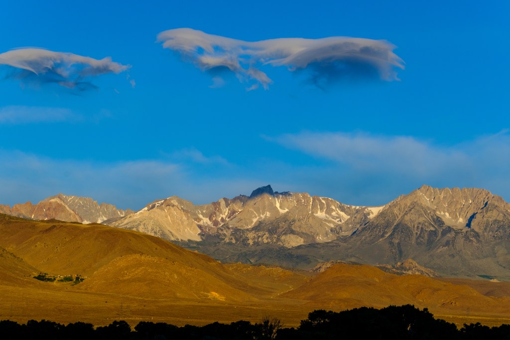
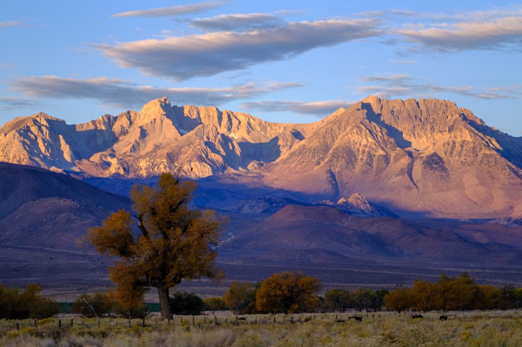
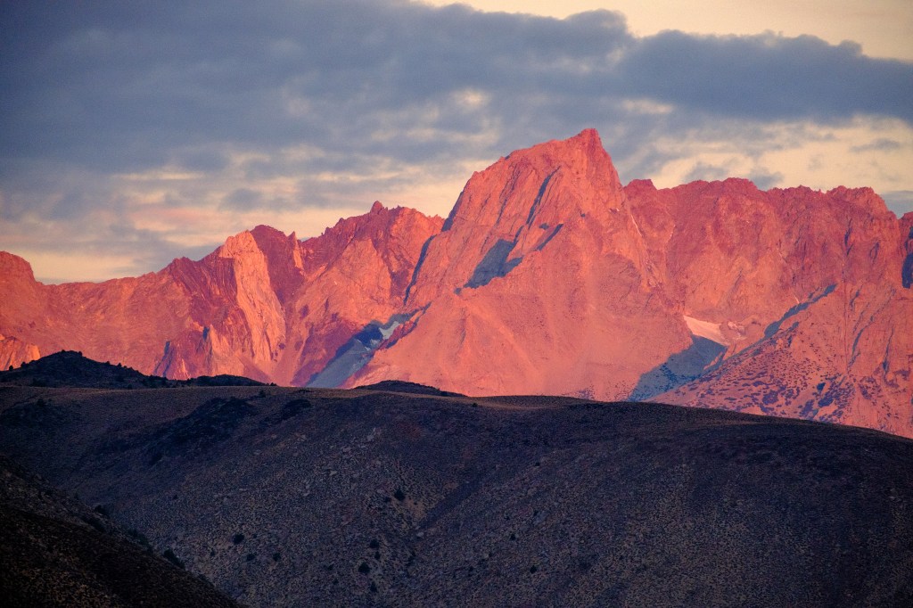
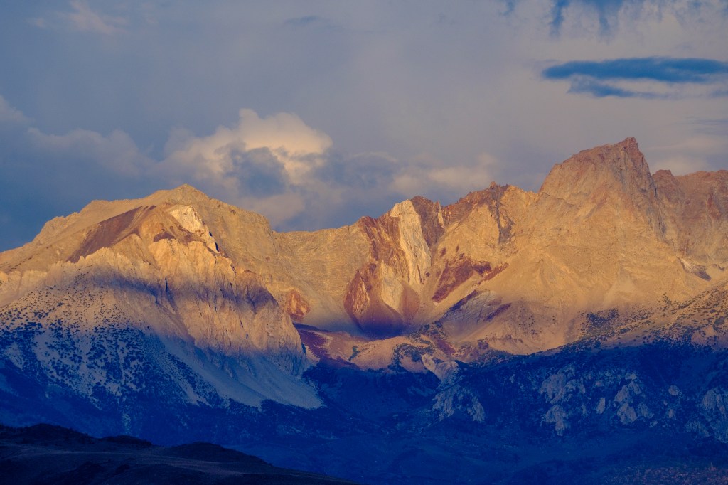
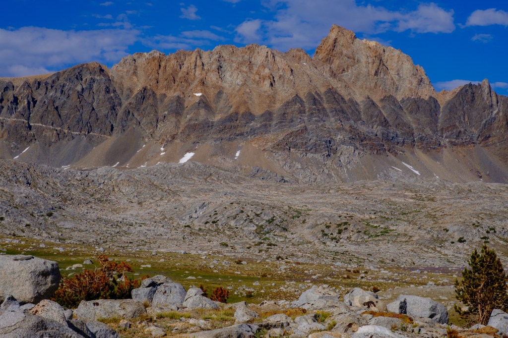
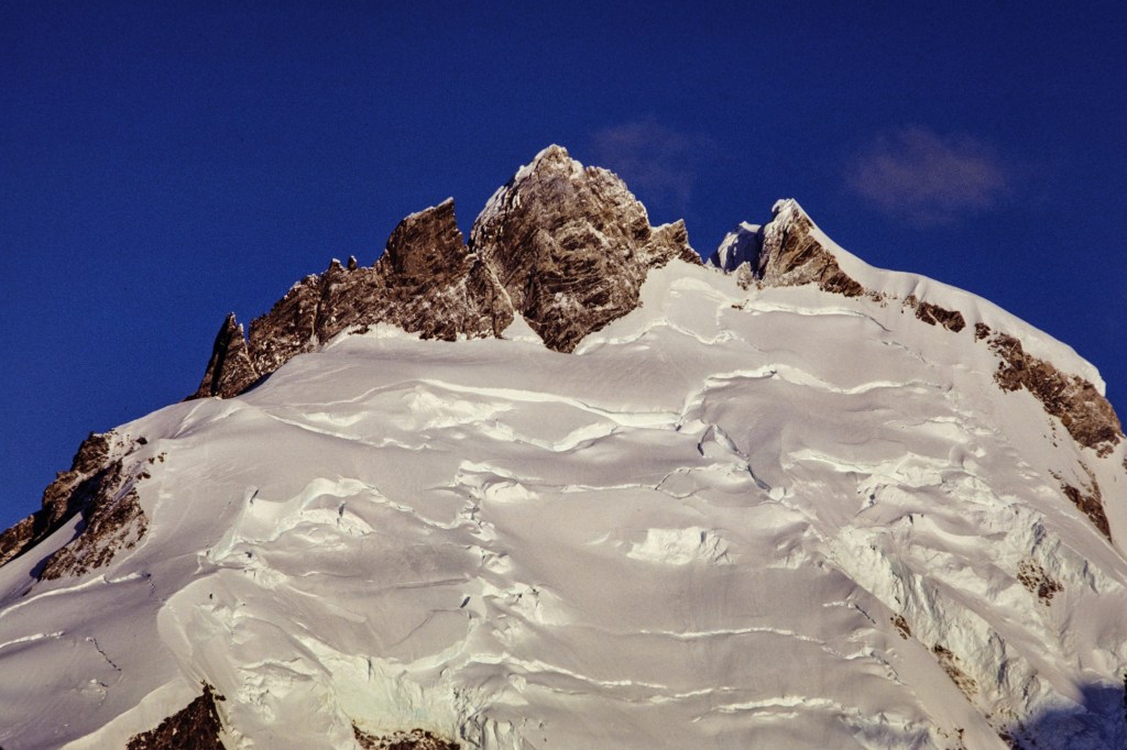
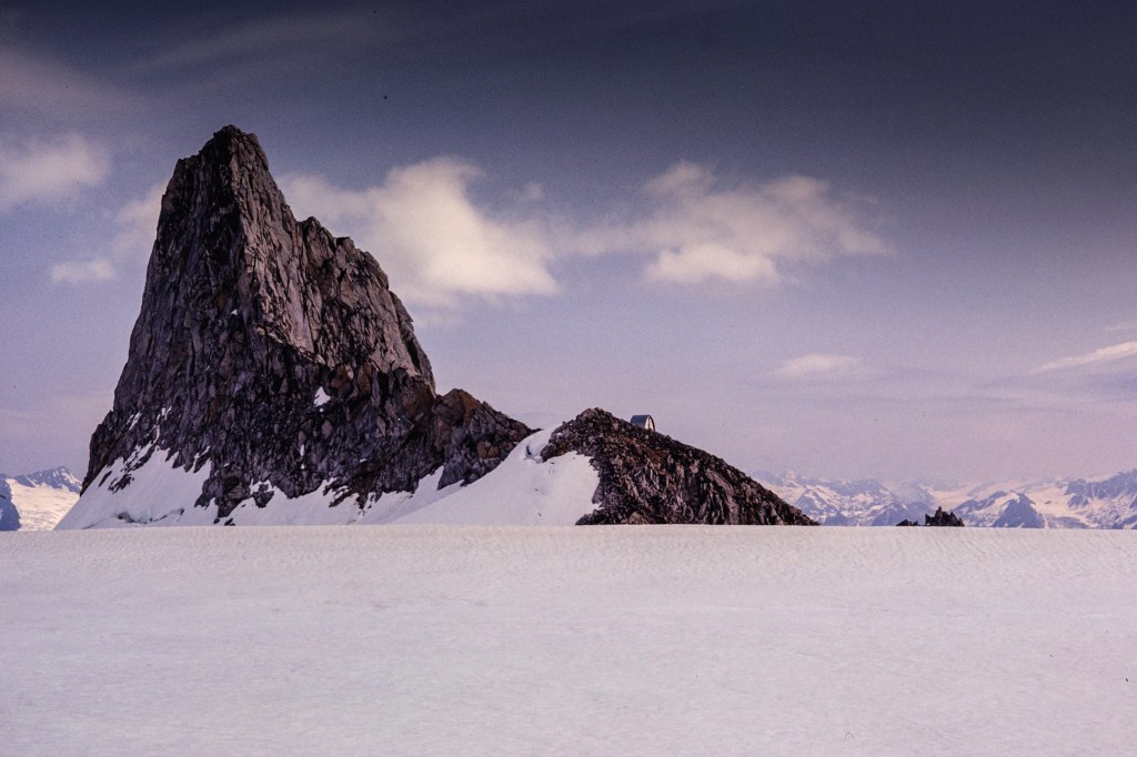
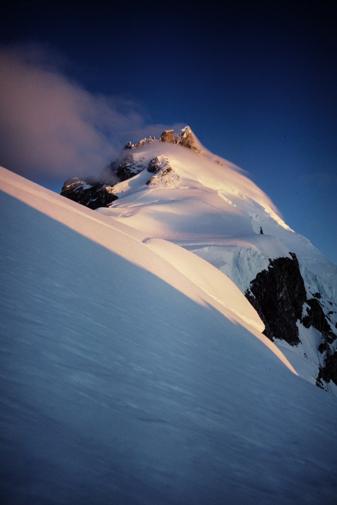
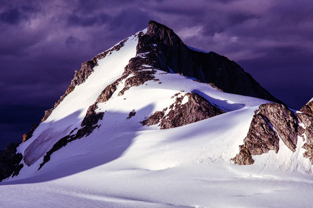
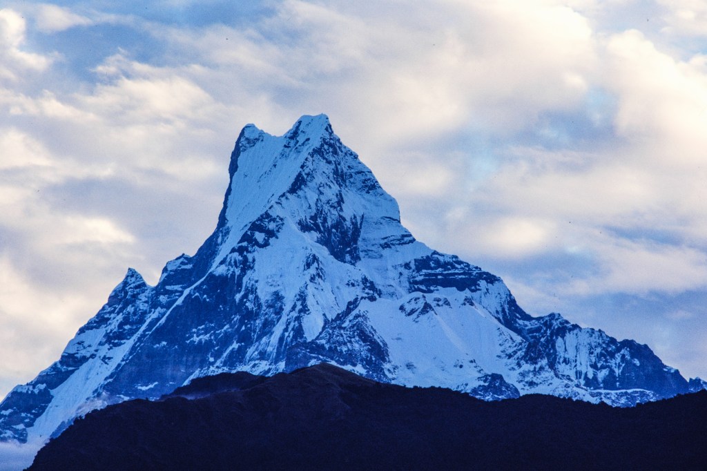
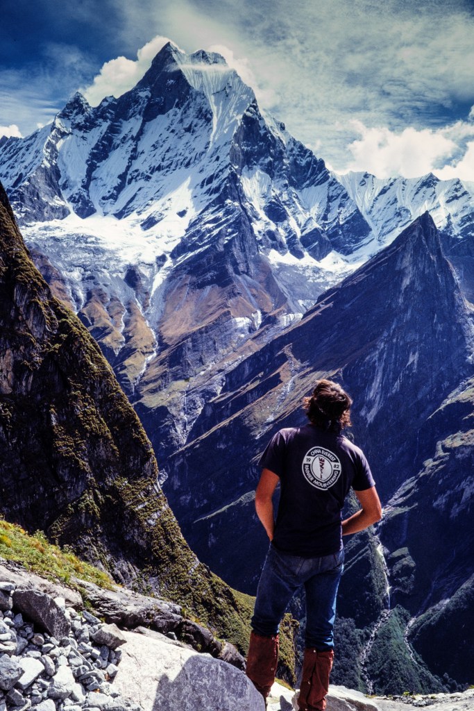
The photo below shows Hiunchuli (21,132 ft). To the left is Annapurna South (23,684 ft), and in the background is the summit of Annapurna (26,545 ft). The Modi Khola gorge is out of sight to the right. 

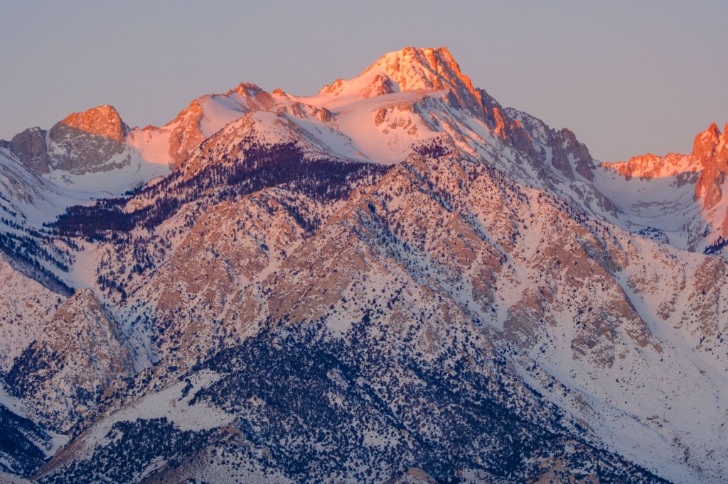
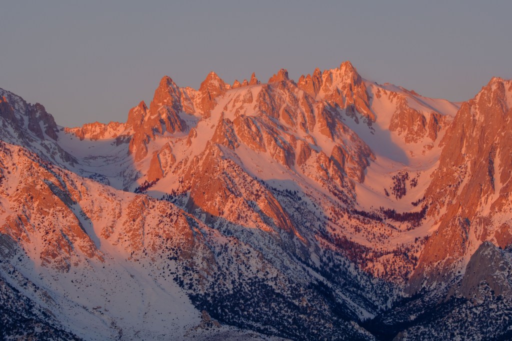
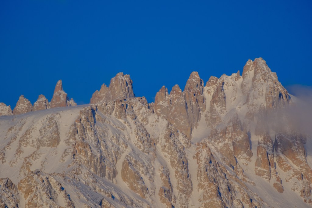
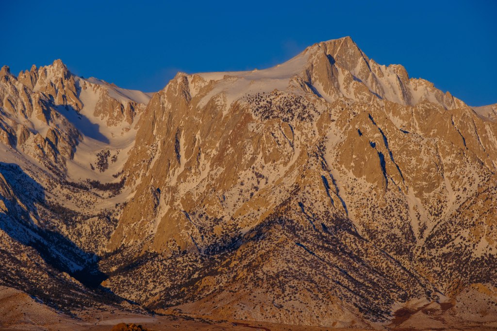
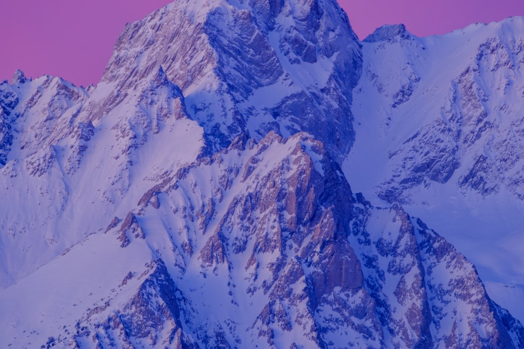
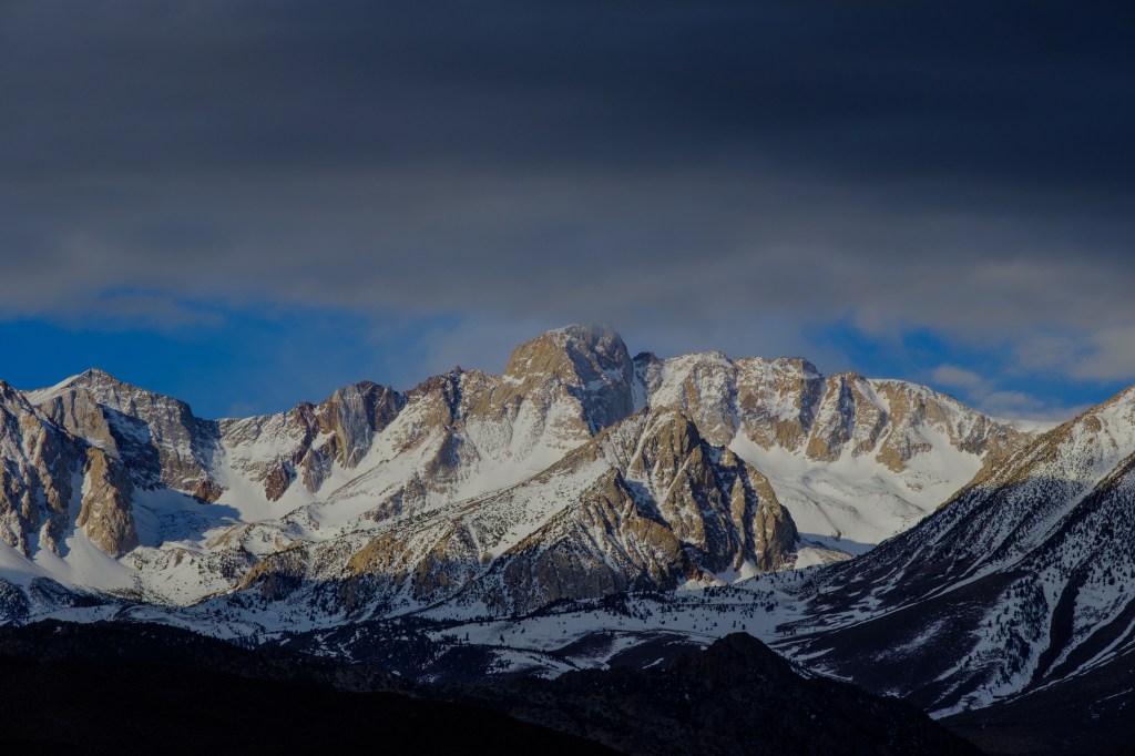
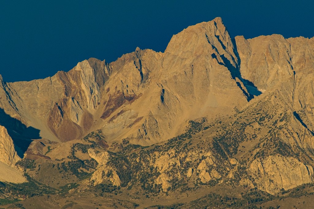
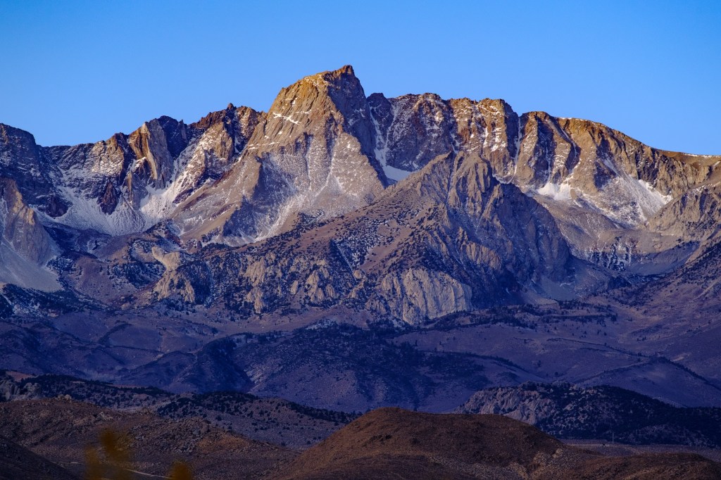
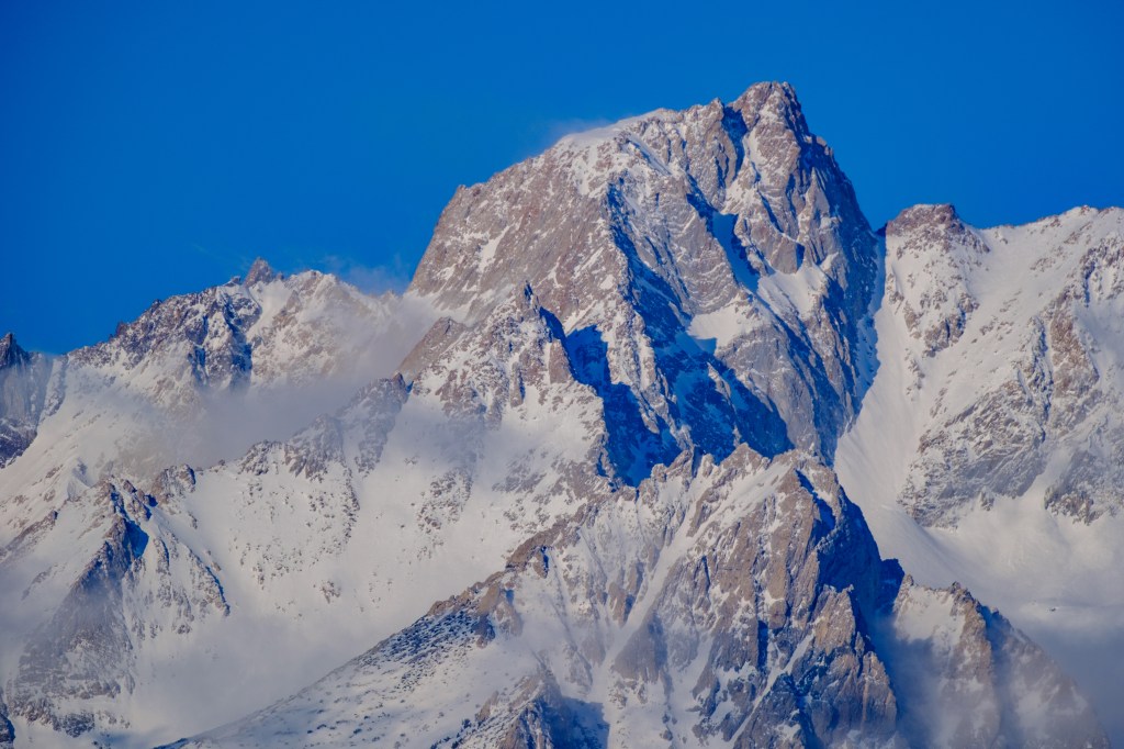
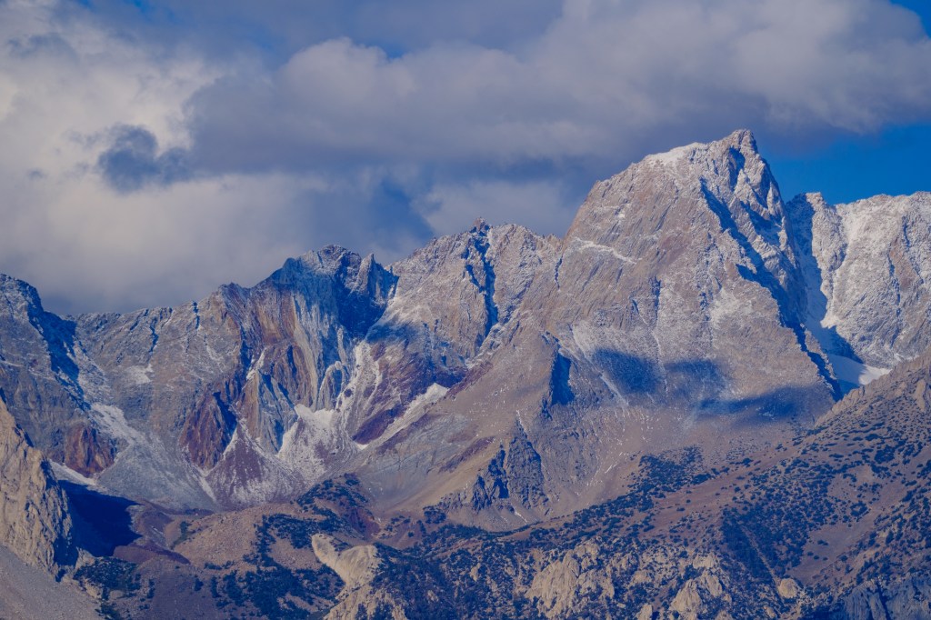
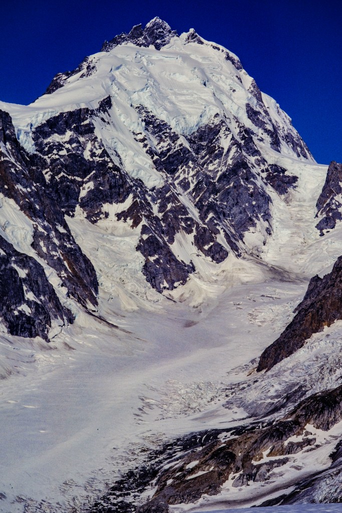
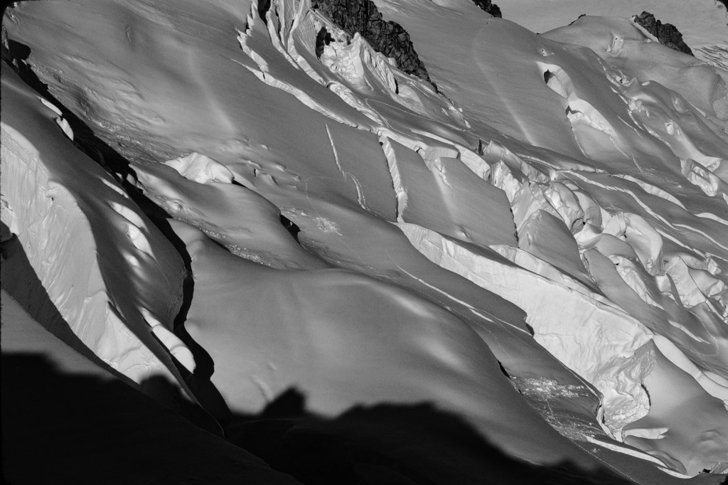
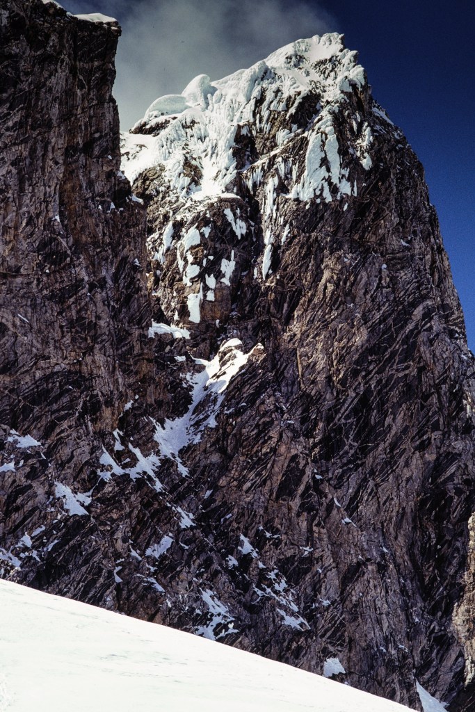
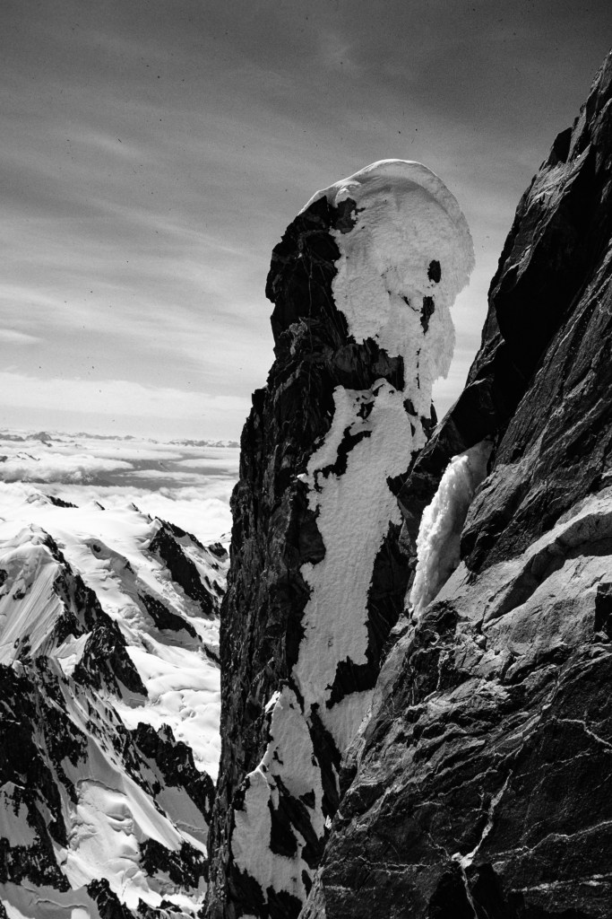
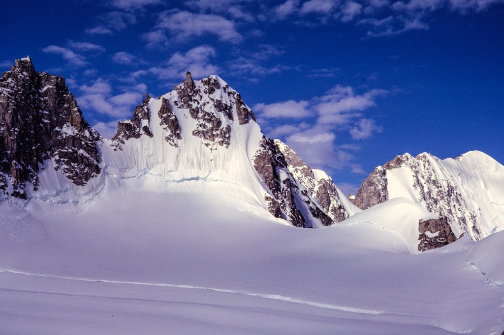
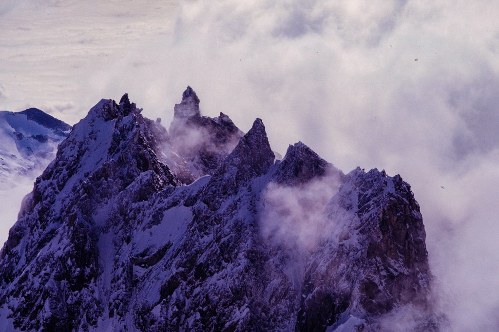
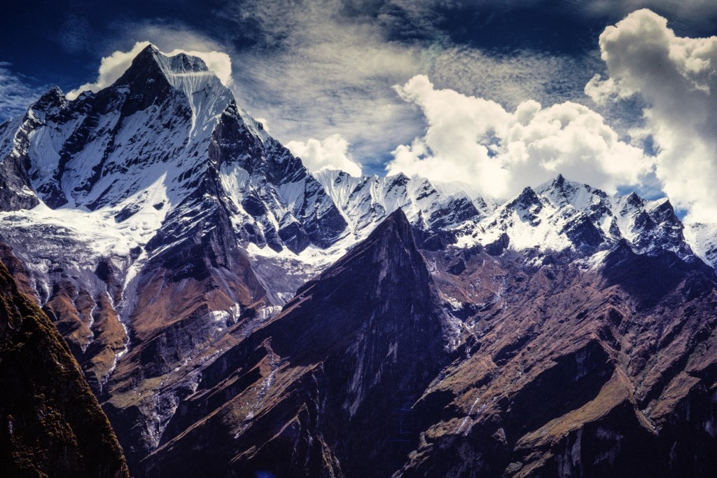
Below is a telephoto view of Hiunchuli. The upper part of our route followed the skyline on the right.

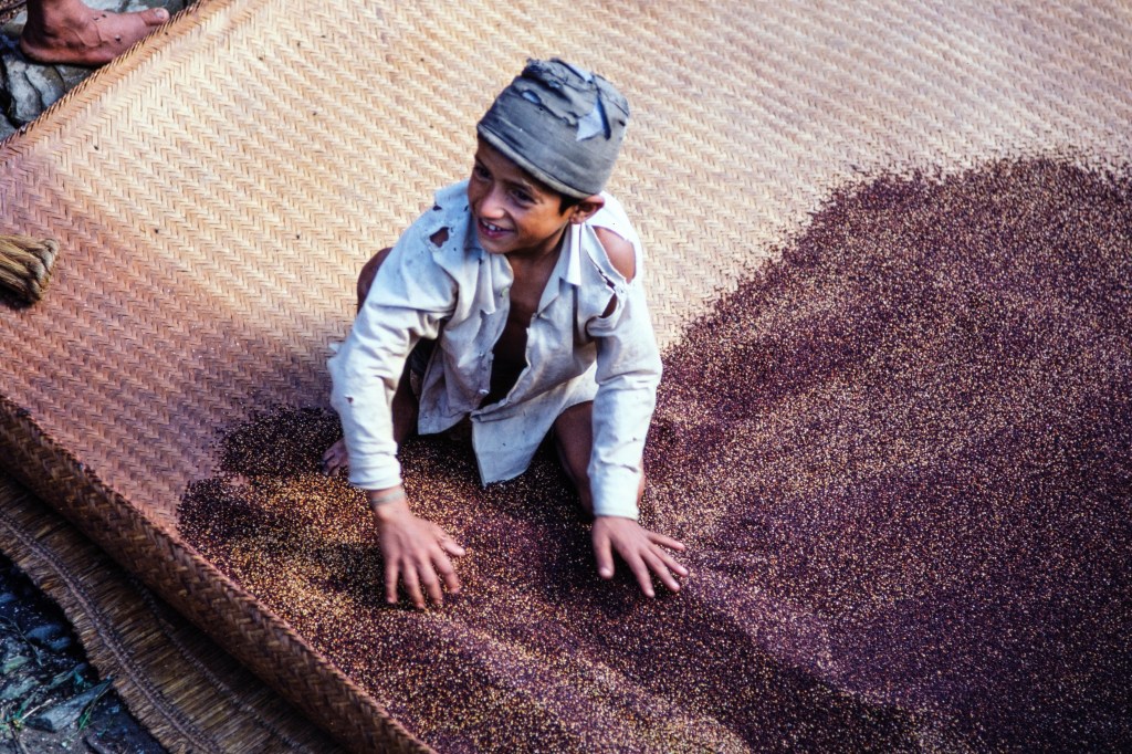
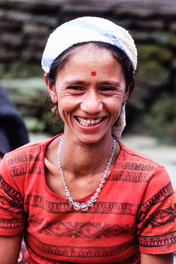
The next 11 photos are portraits of people that we met.

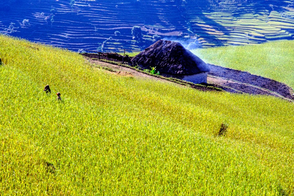
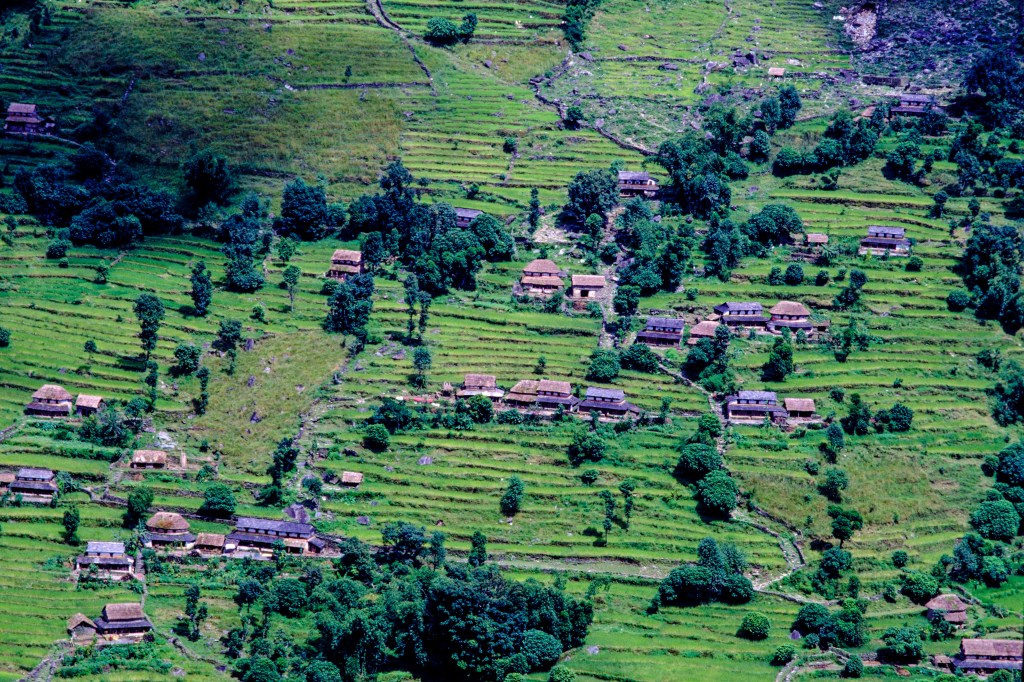
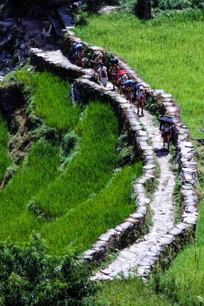
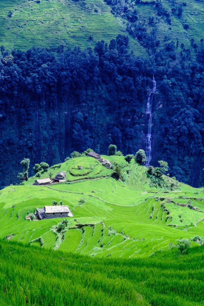
We passed through terraced fields with crops. In the photo below, smoke from cooking envelopes a home. There is no chimney, so the smoke just filters through the thatched roof. The inside is thick with smoke.

Children and water buffalo.

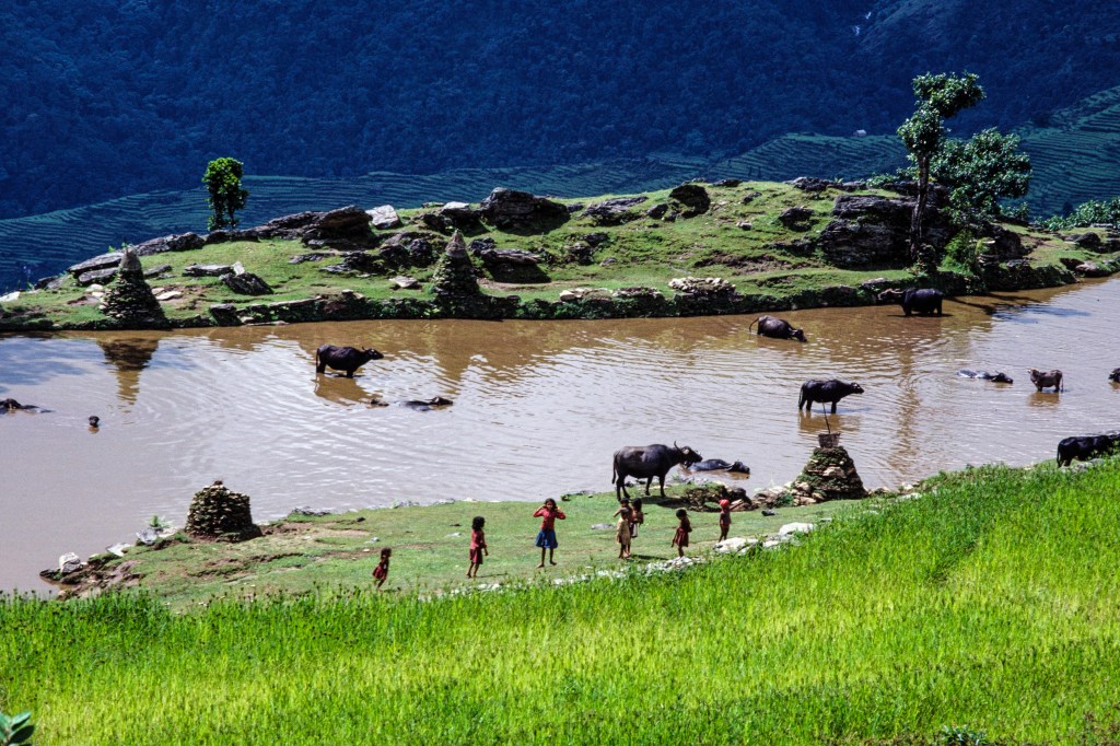
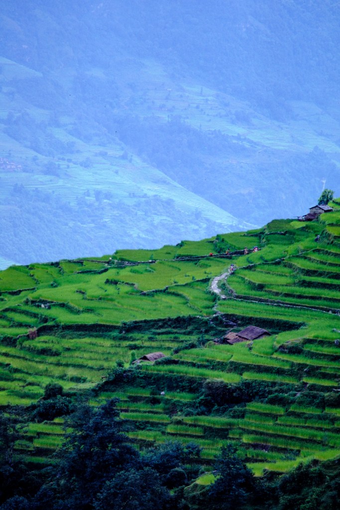
As you can see, below, this area looks fairly prosperous for a poor country.

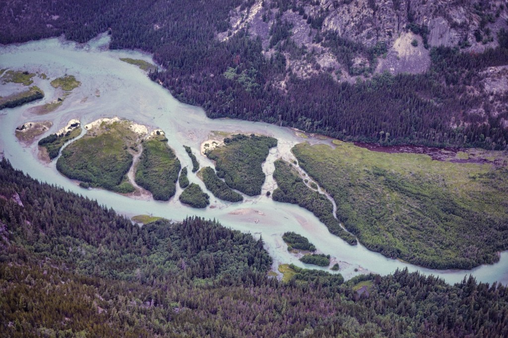
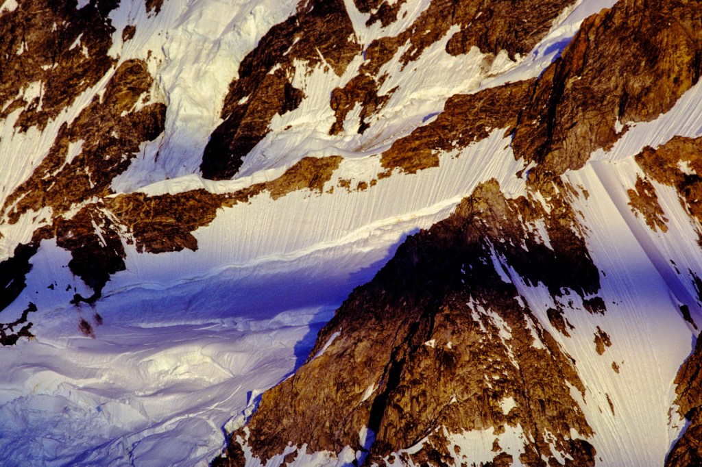
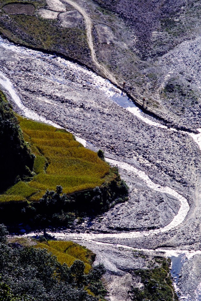
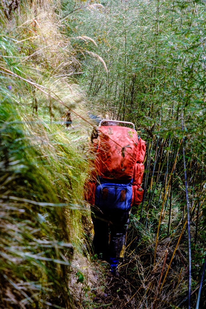
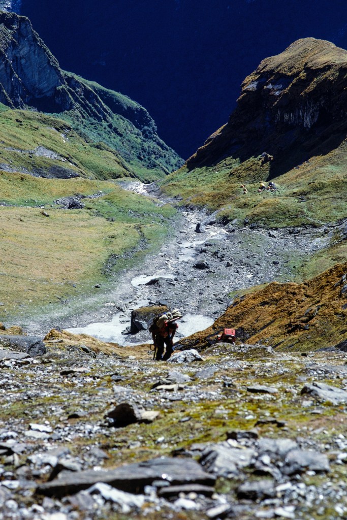
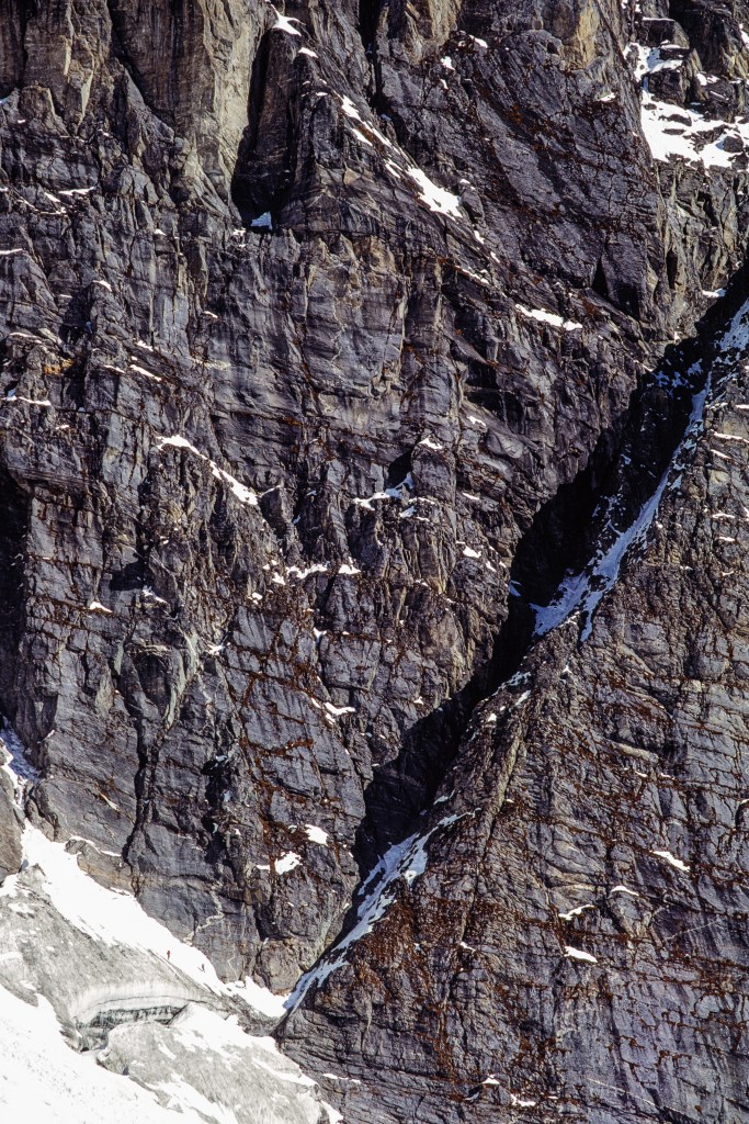
Below is a view into the narrow chasm of the Modi Khola. Our trail was on the left (west) side. The shadowed wall on the left is the lower part of Hiunchuli. Getting from the river valley up onto the peak is hard.

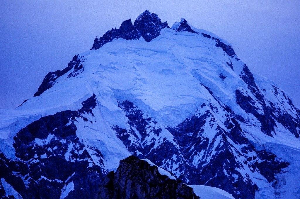
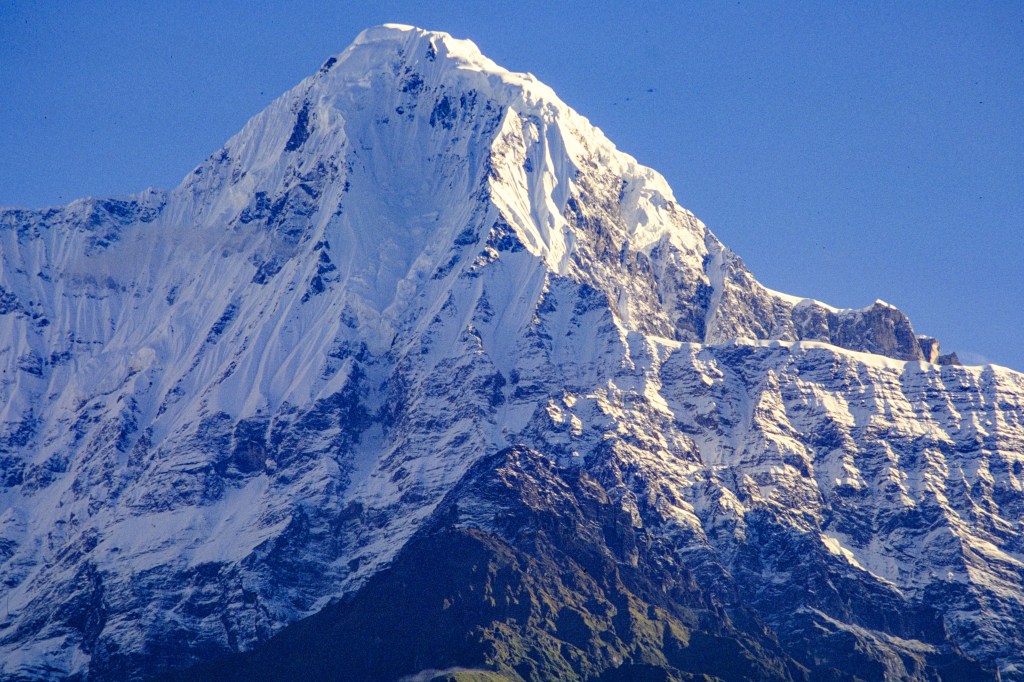
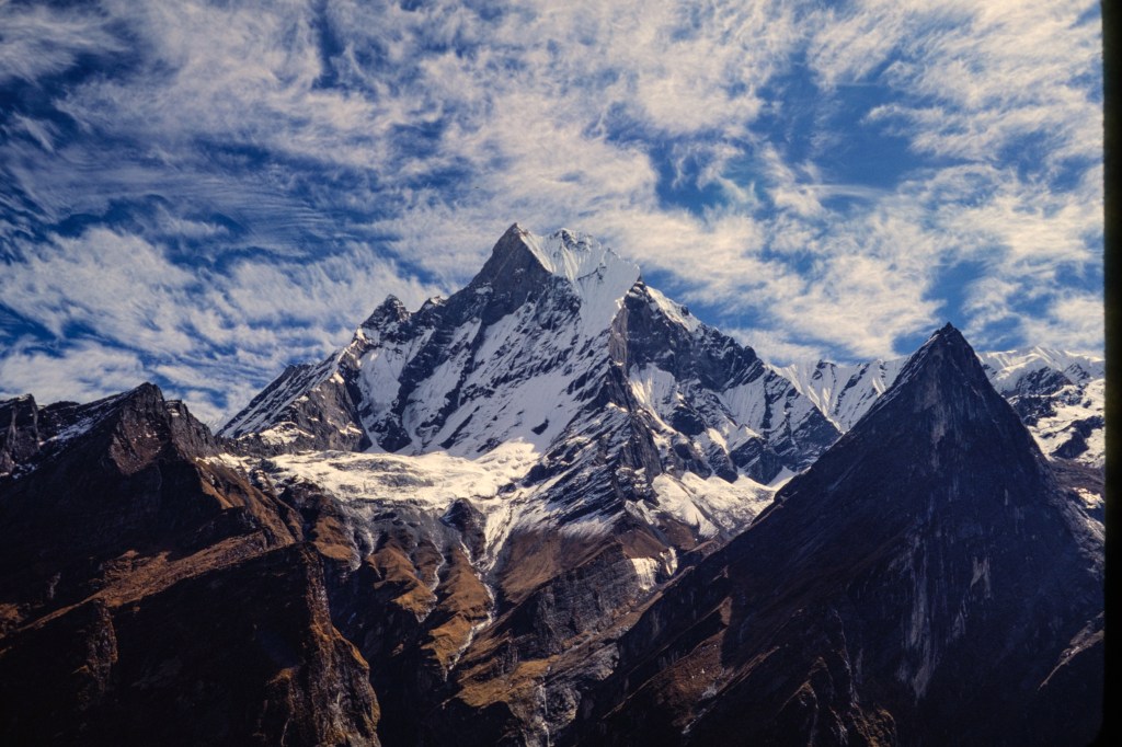
A view of Machapuchare.

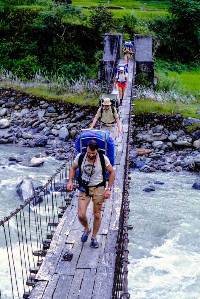
We used a sturdy suspension bridge and excellent paths.

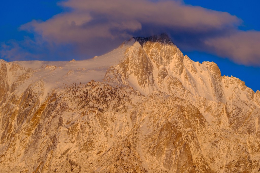
A closer view of Machapuchare, below. This is called the Fish’s Peak or Fishtail Peak because of the shape of its summit.

And Hiunchuli.

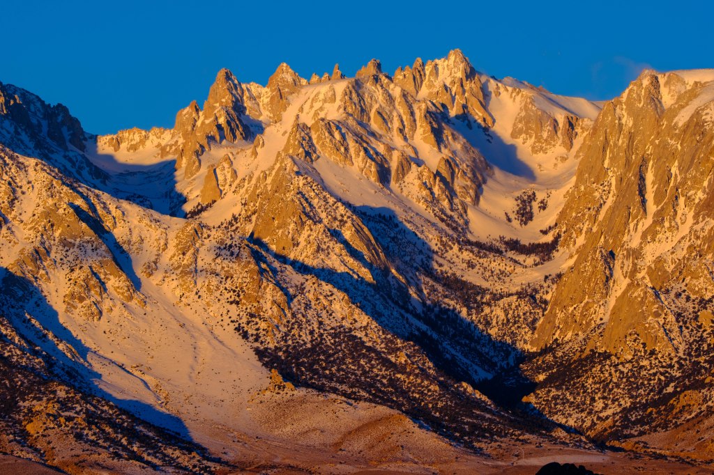
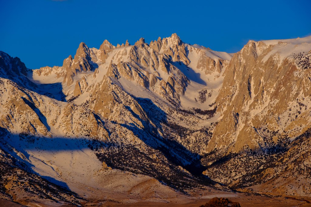
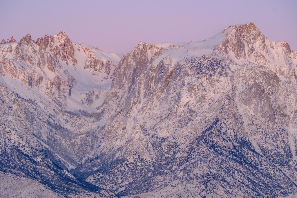
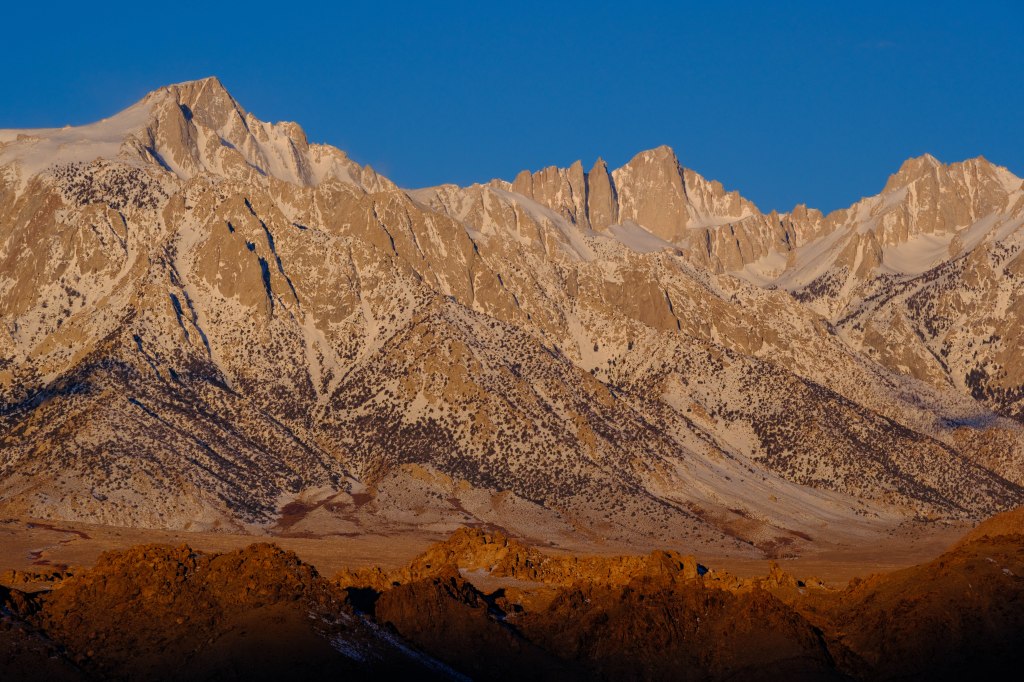
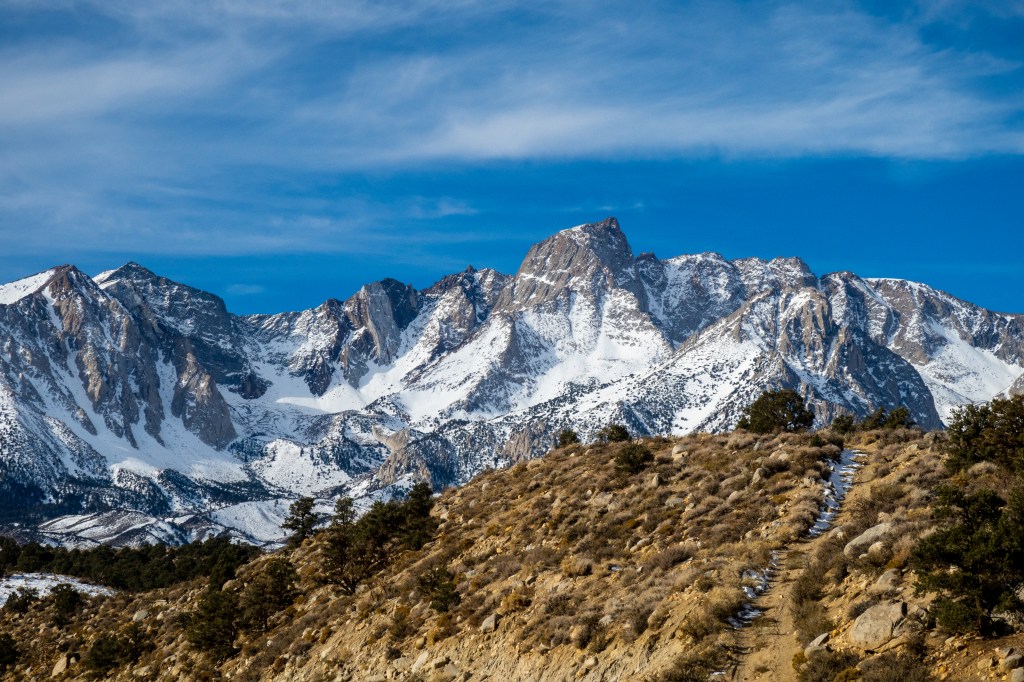
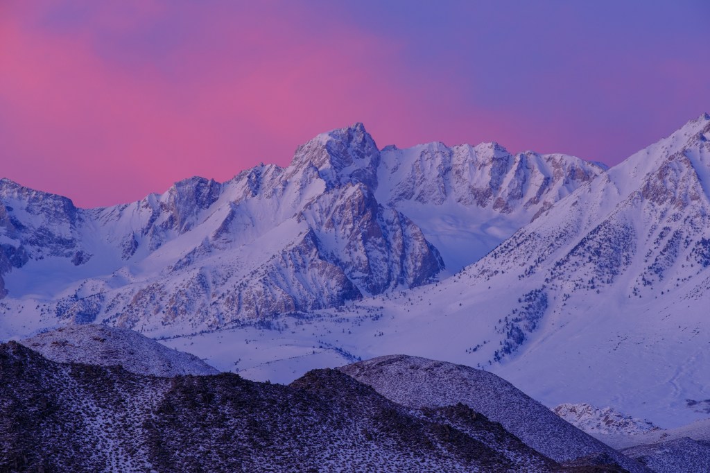
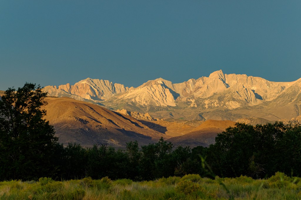
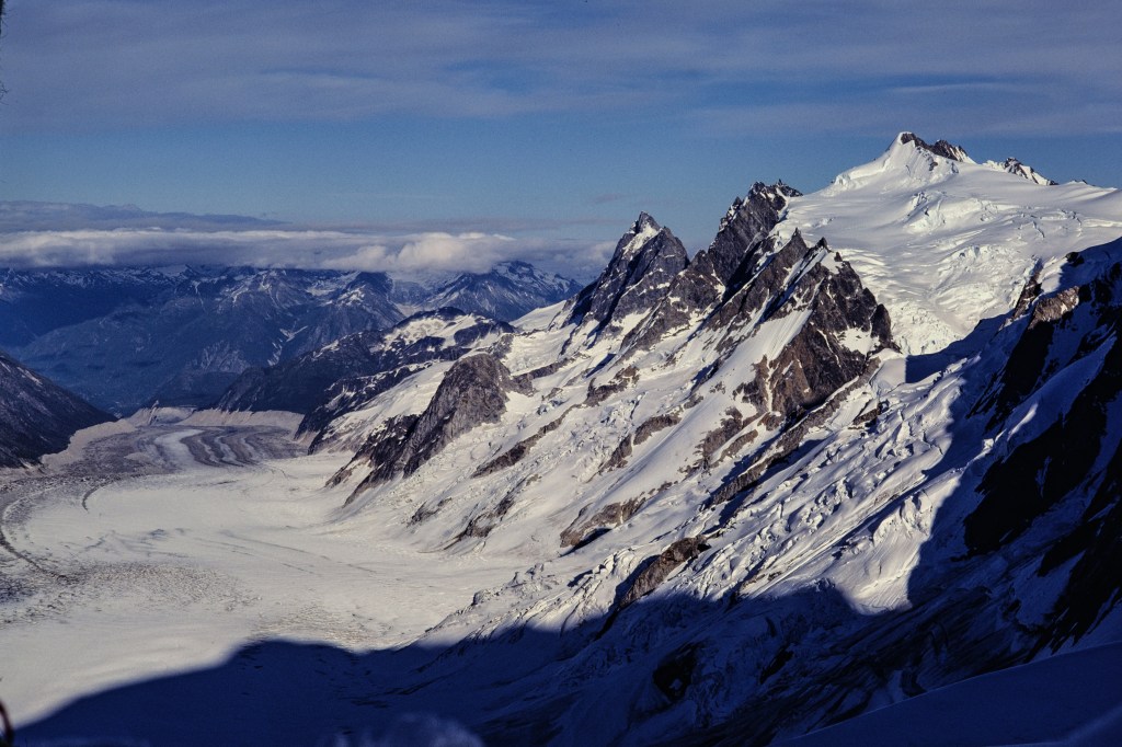
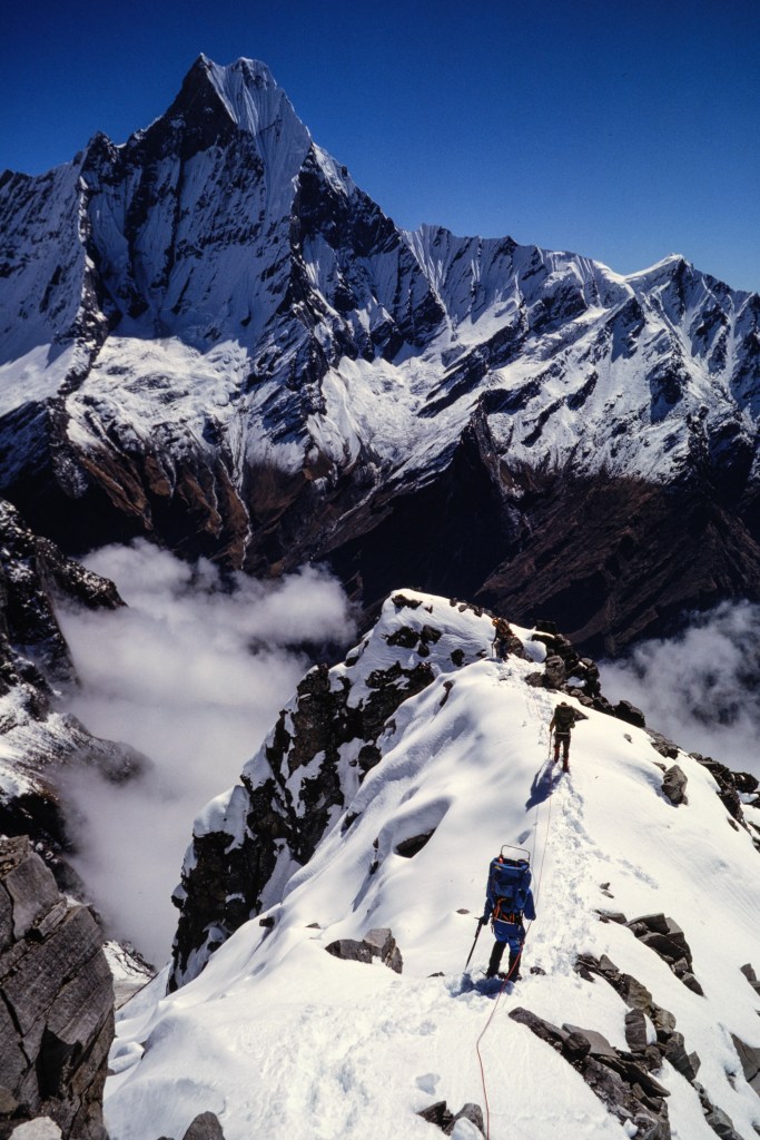
The next view shows Annapurna South on the left, Hiunchuli a little left of center, then the shadowed slot of the Modi Khola, and Machapuchare on the far right.

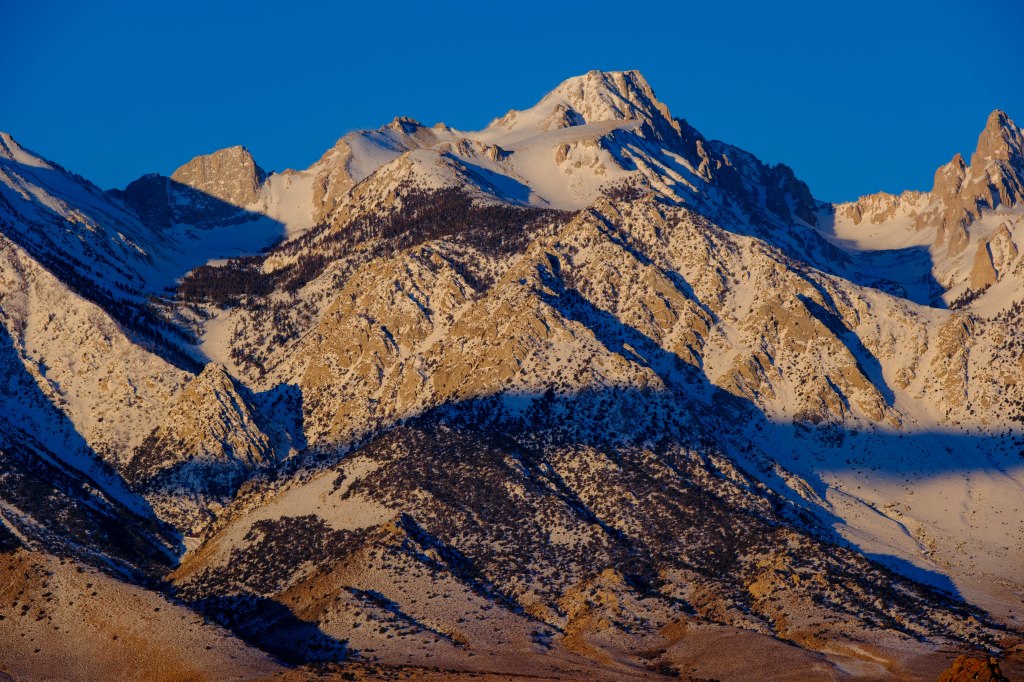
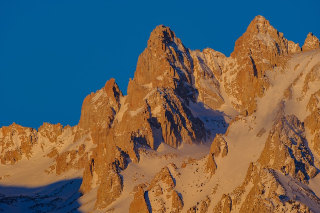
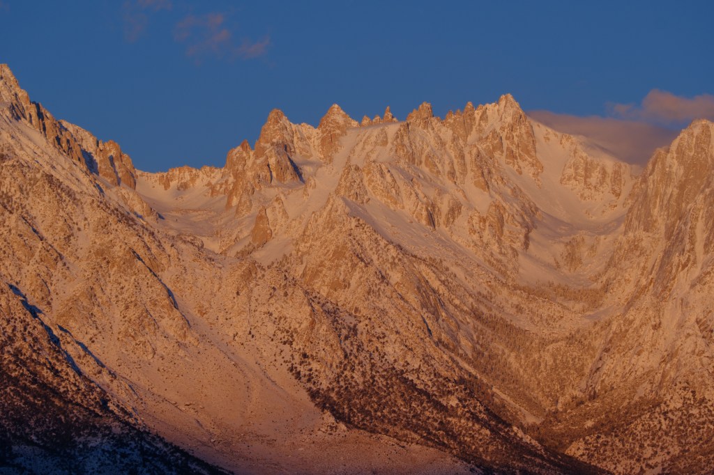
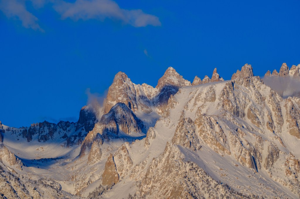
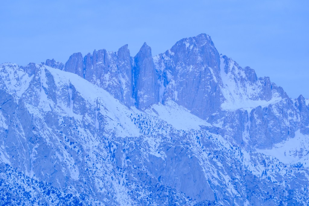
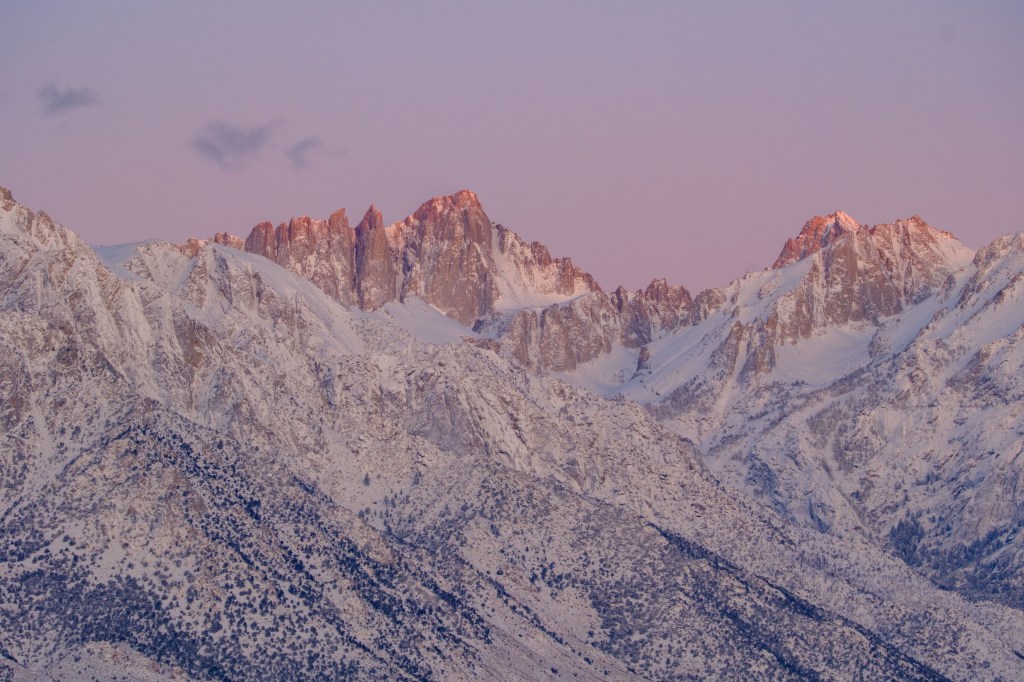
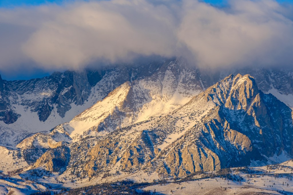
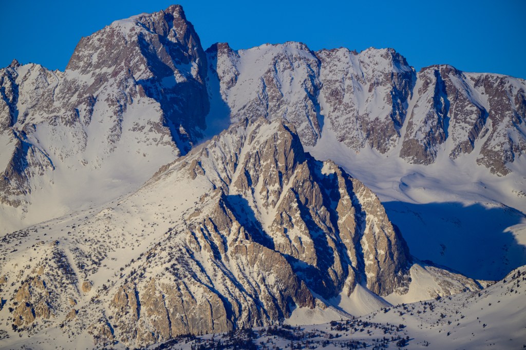
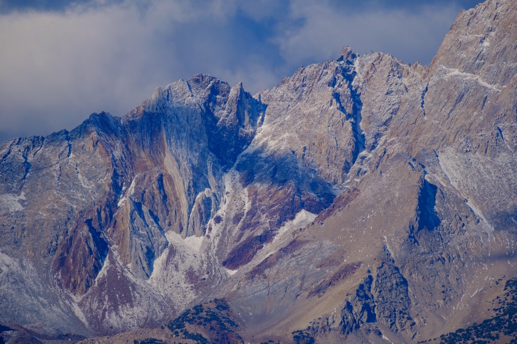
Another view of Annapurna South and Hiunchuli.

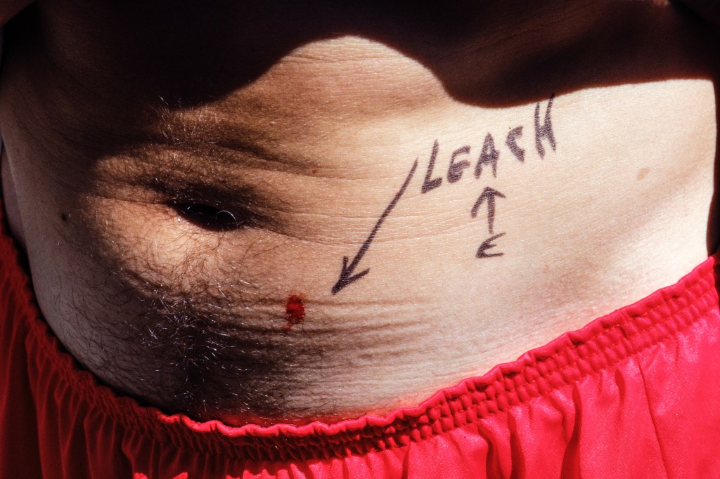
We arrived at the end of the monsoon season, so the forest was full of leeches. Photo below shows one that attached itself for a meal.

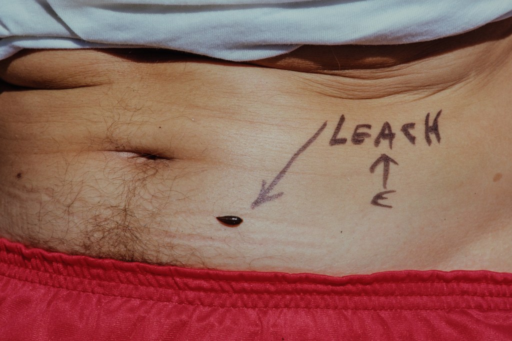
Leeches secrete an anticoagulant so that the host’s blood will flow easily. You can see this below. No one is going to bleed to death, but it takes a while for the wound to scab over.

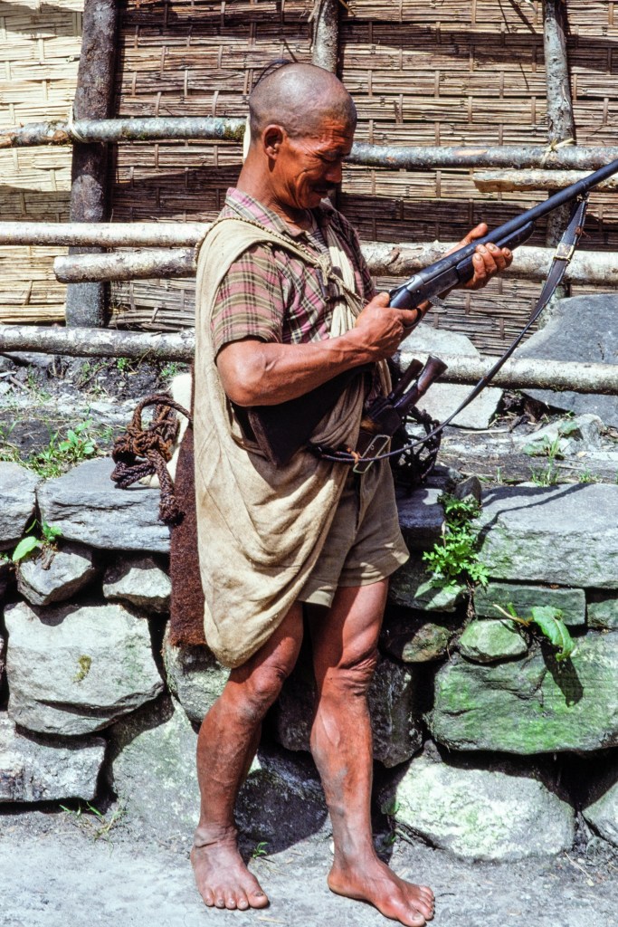
The man below is a local hunter with a very old gun. His Gurkha knives, Kukris, stick out of his belt.

THE CLIMB

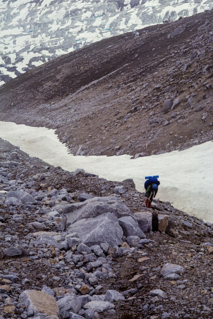
On 9/22 we camped near the trail at 9000 feet on the west side of the river. On 9/23 some of us explored above our camp to find a route through the jungle and get up onto the mountain. This involved a lot of thrashing in brush on steep terrain. The next day, we moved up to a temporary camp at 13,100 feet, and on 9/25 we moved to a better location at 13,200 feet. The route to Basecamp was so steep that two of our clients quit the expedition and hiked back to Kathmandu. A third client made the decision to not go above Basecamp.

The picture below shows the dense vegetation.

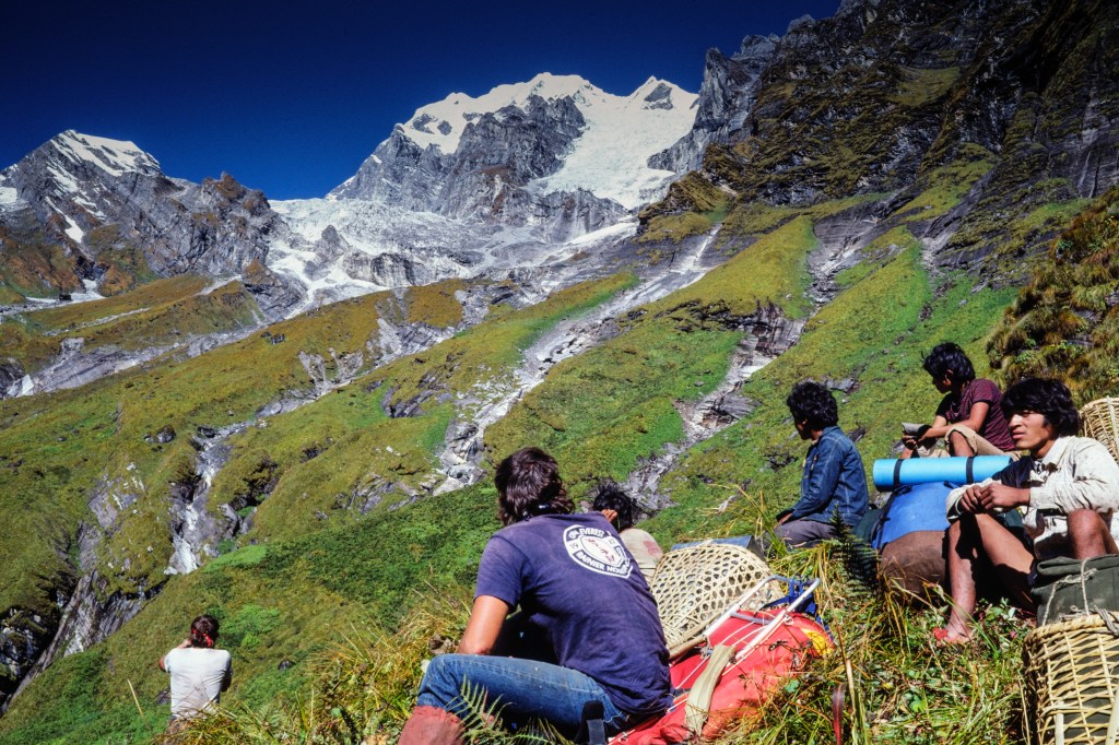
In the next photo, Simonson and porters look at the terrain we must cross to get to our Basecamp, which will be in the flat meadows at the far left of the photo.

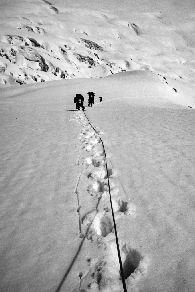
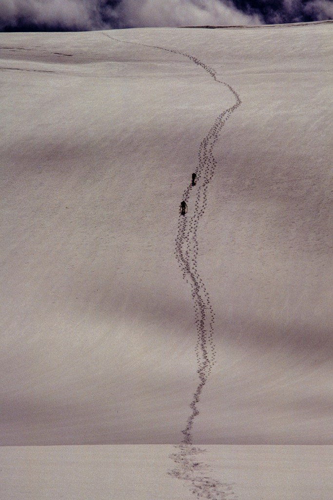
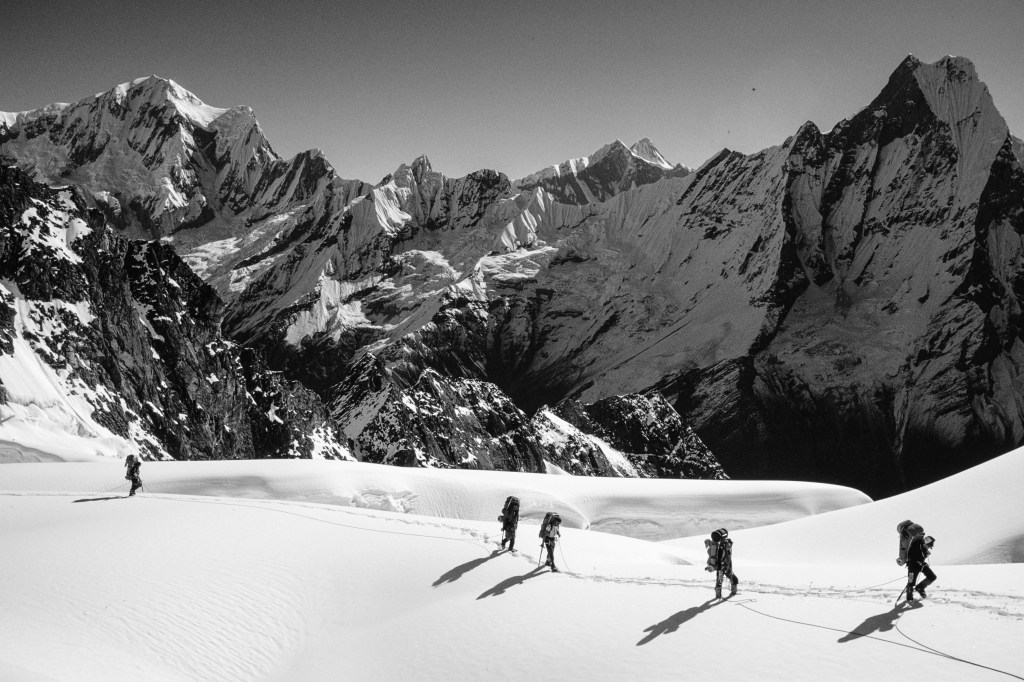
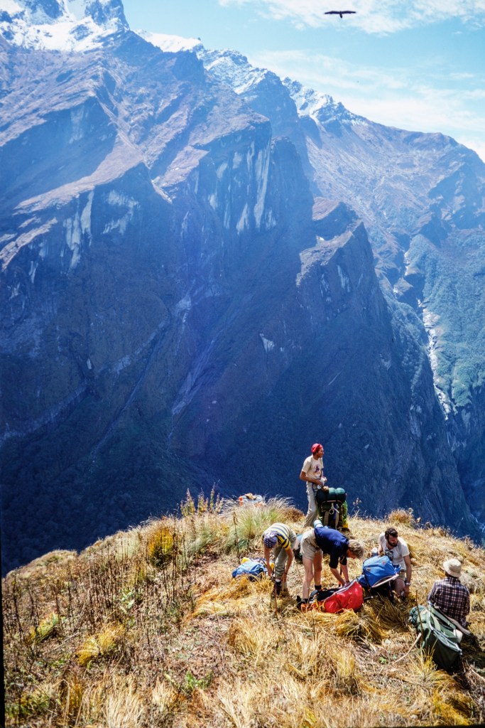
The view below looks back at our route. I added a yellow circle around a member of our team. From that spot, our “trail” went down through vegetation and up to where I was standing with my camera. Several previous expeditions failed because they were never able to get to Basecamp.

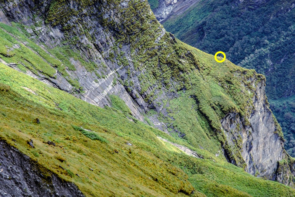
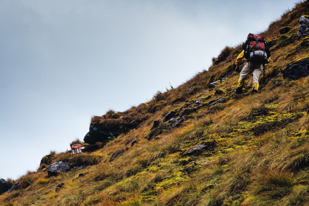
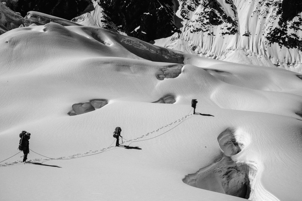
Image below shows two people walking the “trail” to Basecamp.

At Basecamp, the final climbing group now consisted of 3 guides and 6 clients. Simonson was just starting his guiding business. He selected this peak because the approach was not too long, the permit was cheap, and he wanted to make the second ascent. His clients were mostly people he had previously guided on Mt. Rainier and Denali. Most were fit, but had little climbing skill or experience. It is not surprising that three people quit after reaching Basecamp. The climb was more threatening than they expected.

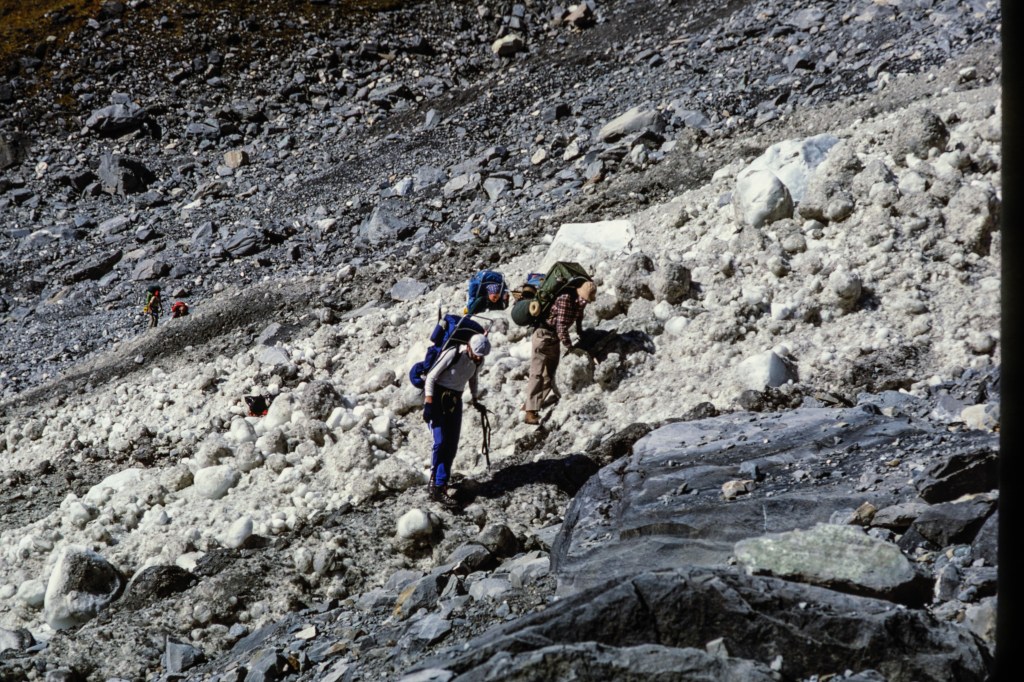
As you approach Basecamp, you cross a wide gully of dirt and rocks torn out of the grassy slope. An avalanche swept across this gash in 1979, killing three Japanese climbers. We hurried when crossing this area; I got my crossing time down to 4 minutes.

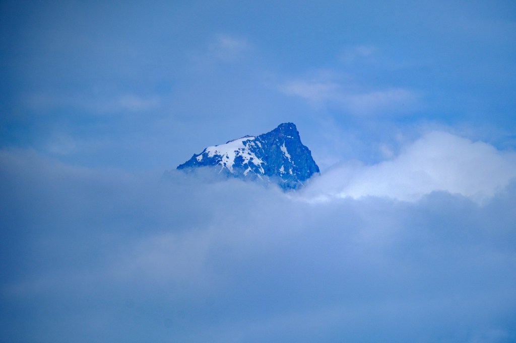
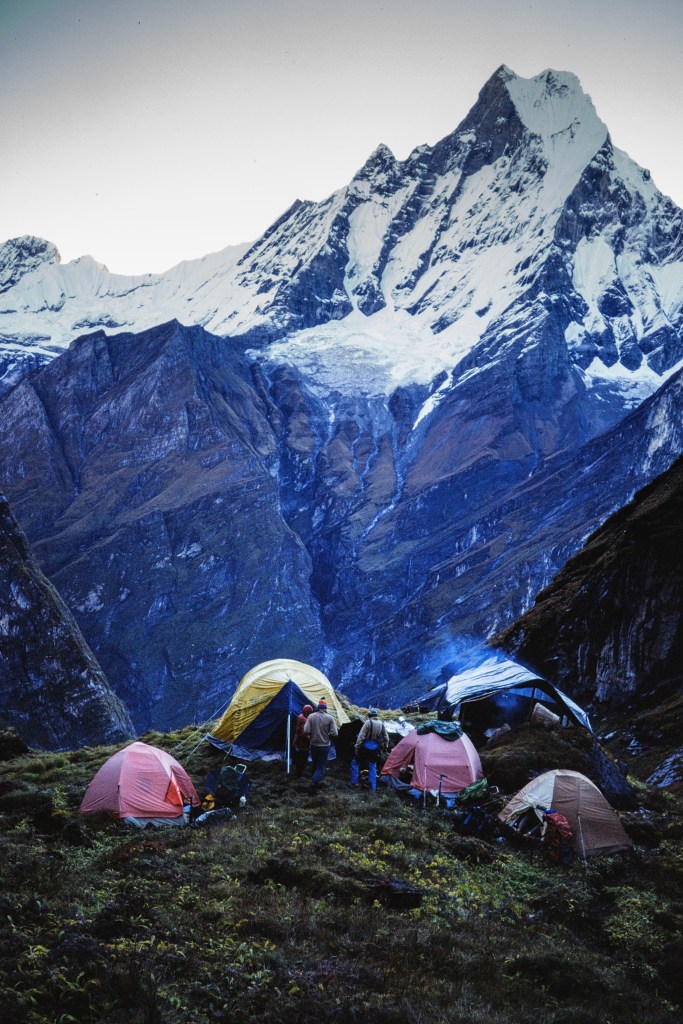
The next three pictures show views of Machapuchare from Basecamp.

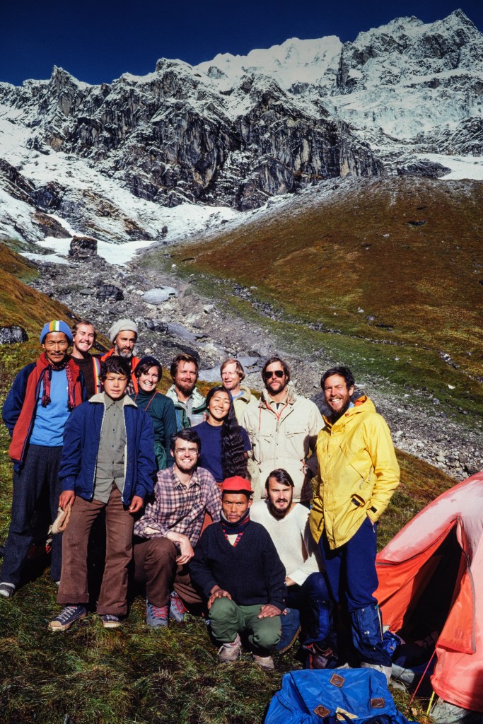
The next photo shows our climbing team, plus Nepali support staff who would remain at Basecamp. I am the guy in the yellow jacket with the black hair and white teeth.

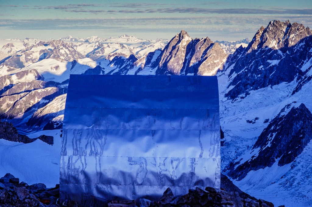
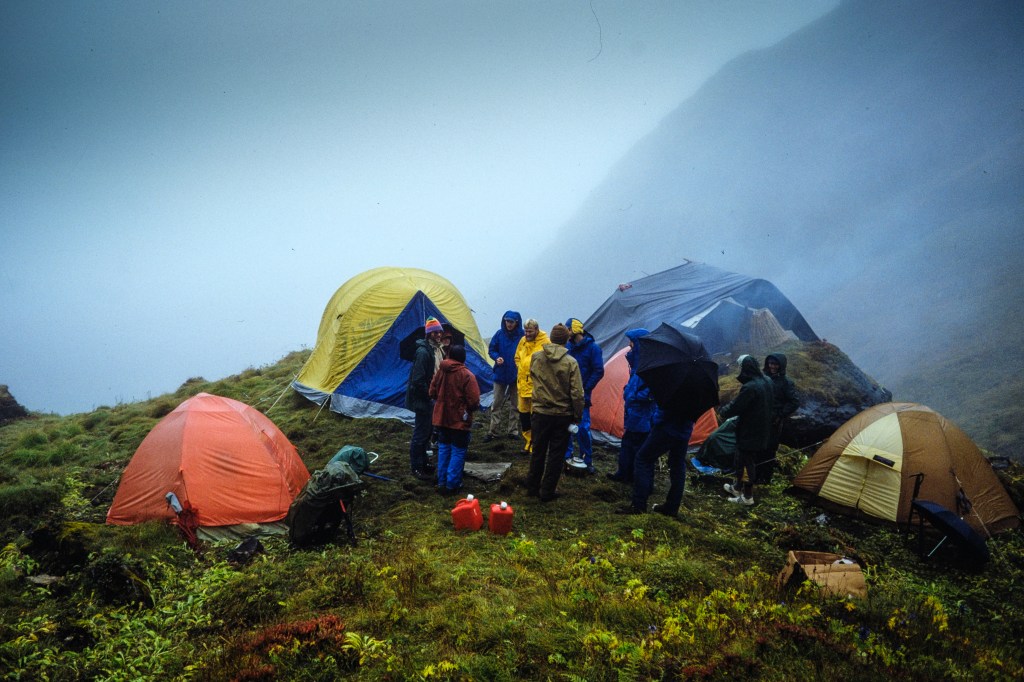
The monsoon rains were not finished yet. For three days it poured buckets, soaking our gear. Two clients had so much water in their tent that they cut a hole in the floor. Bad idea — more water came in the hole. Next photo shows our soggy home.

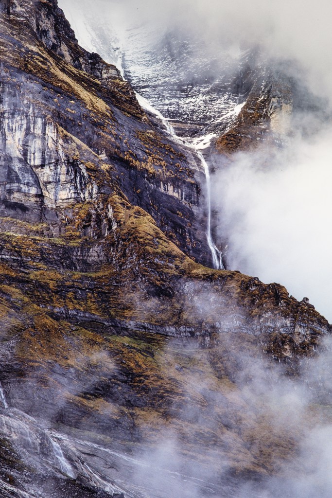
Water poured off the cliffs

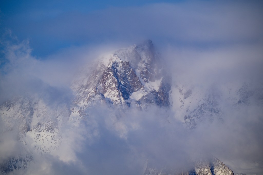
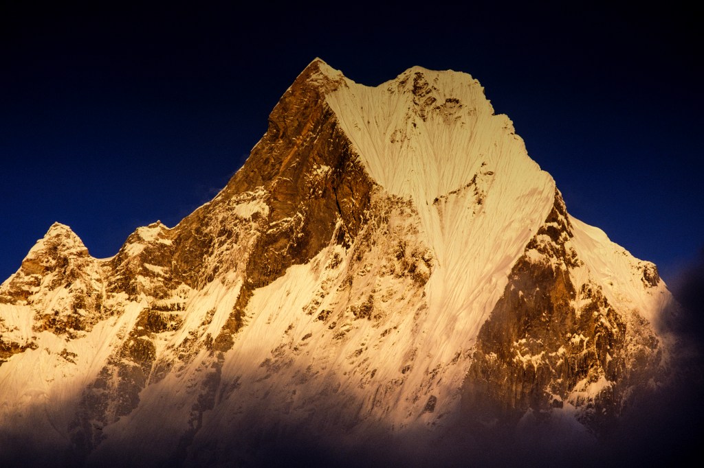
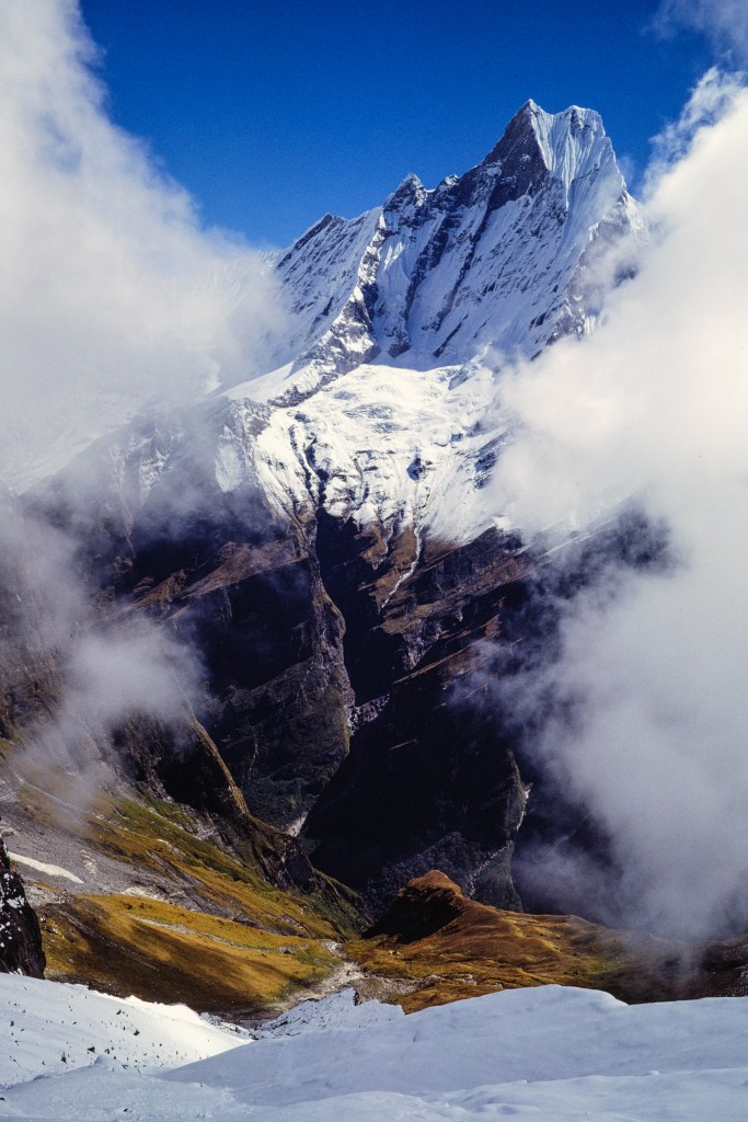
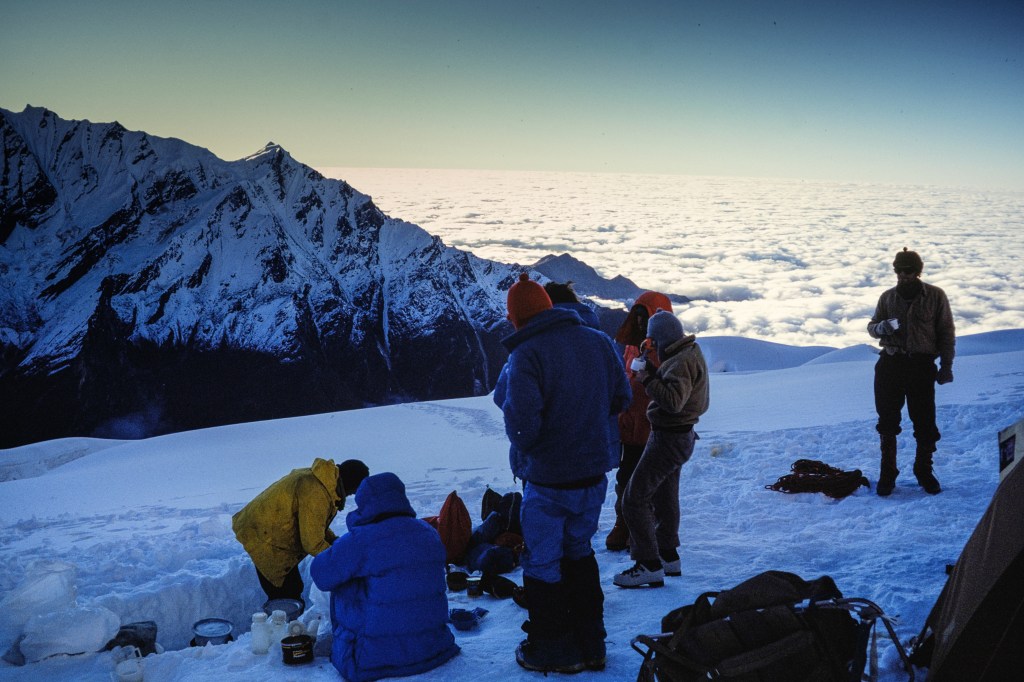
Machapuchare looked lovely when the clouds cleared.

The bad weather did us a favor; it gave everyone three days to rest and acclimatize. When the clouds cleared, we dried our gear.

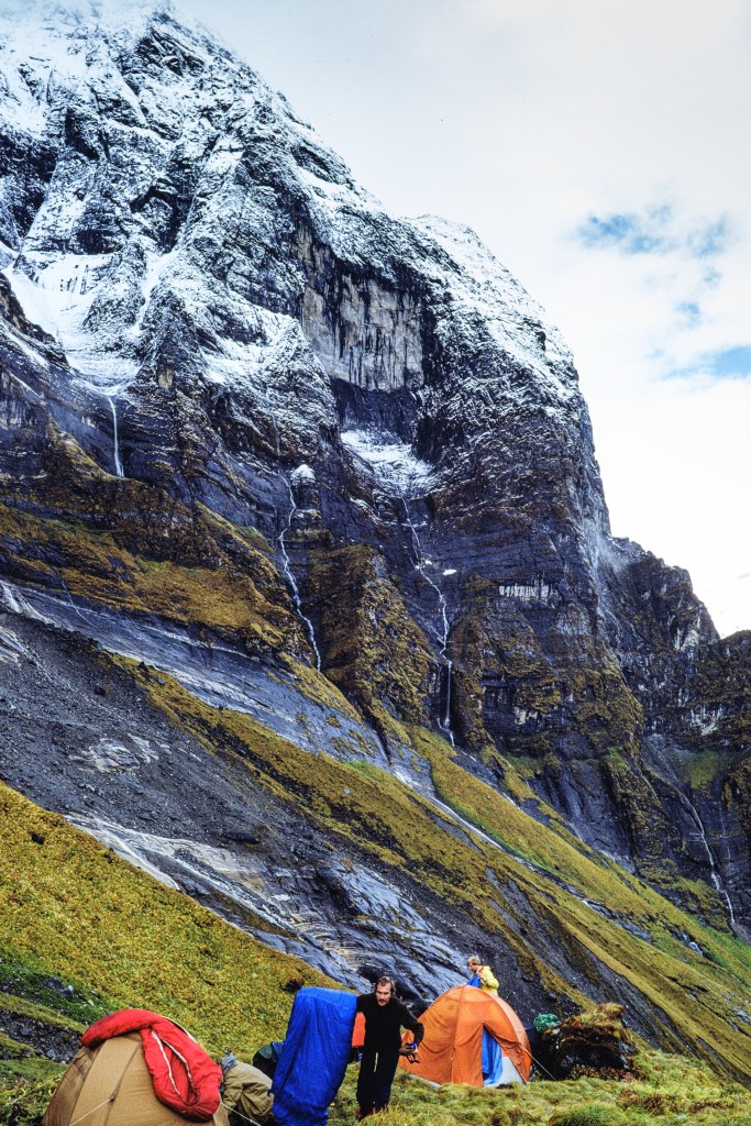
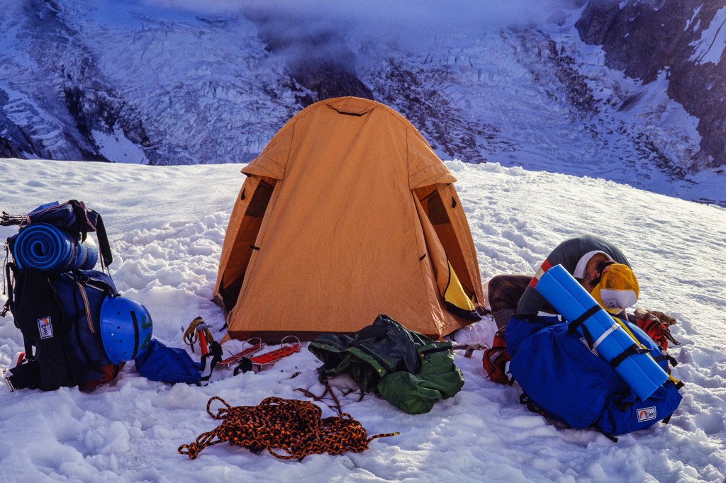
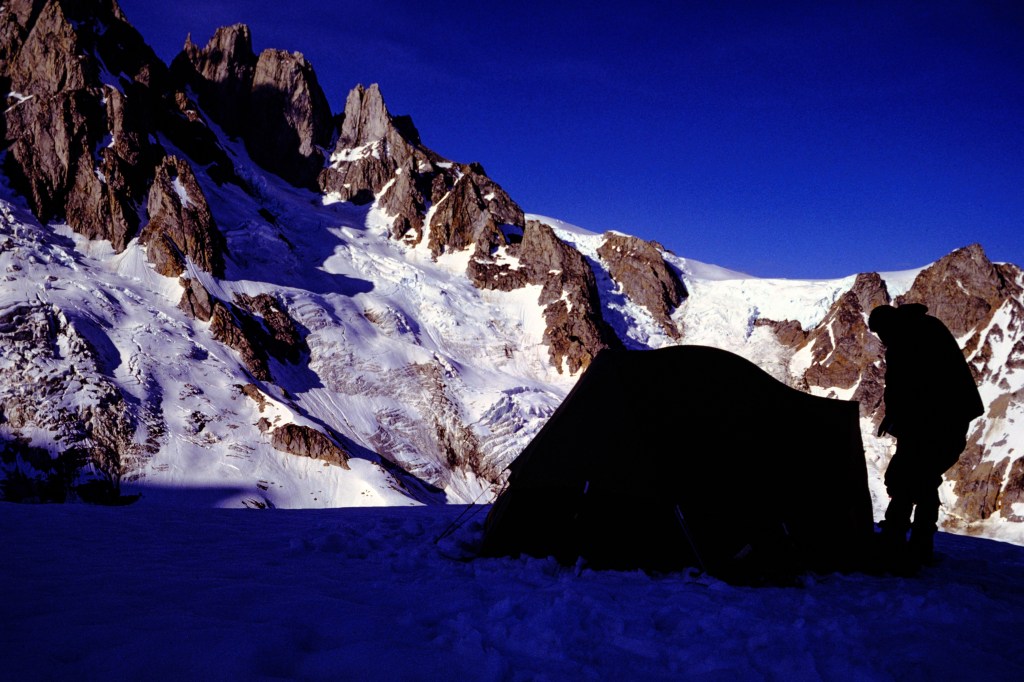
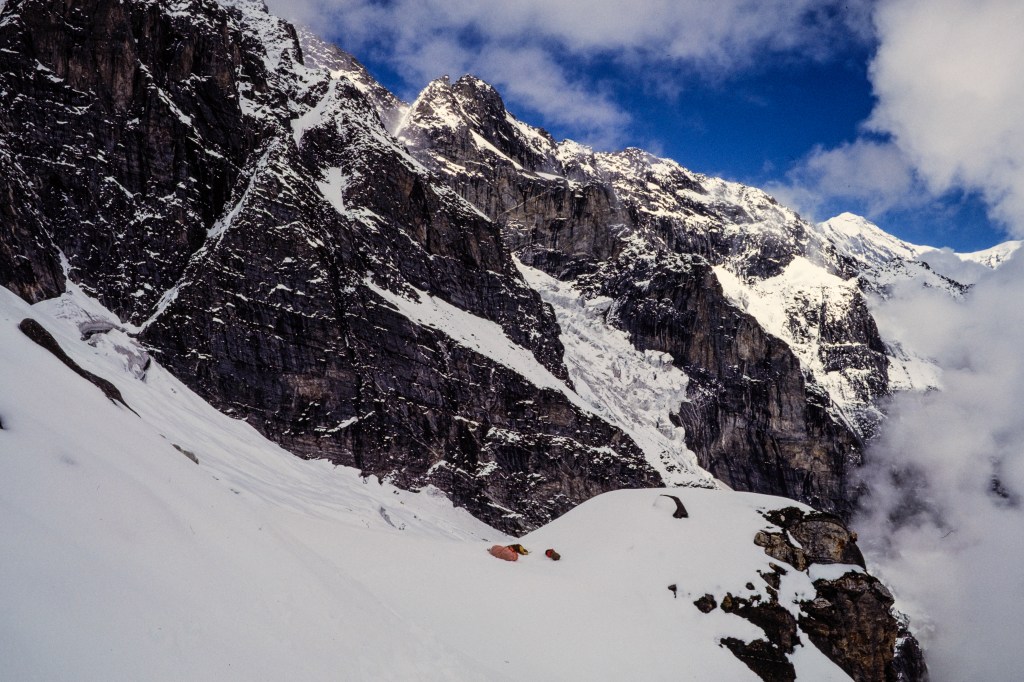
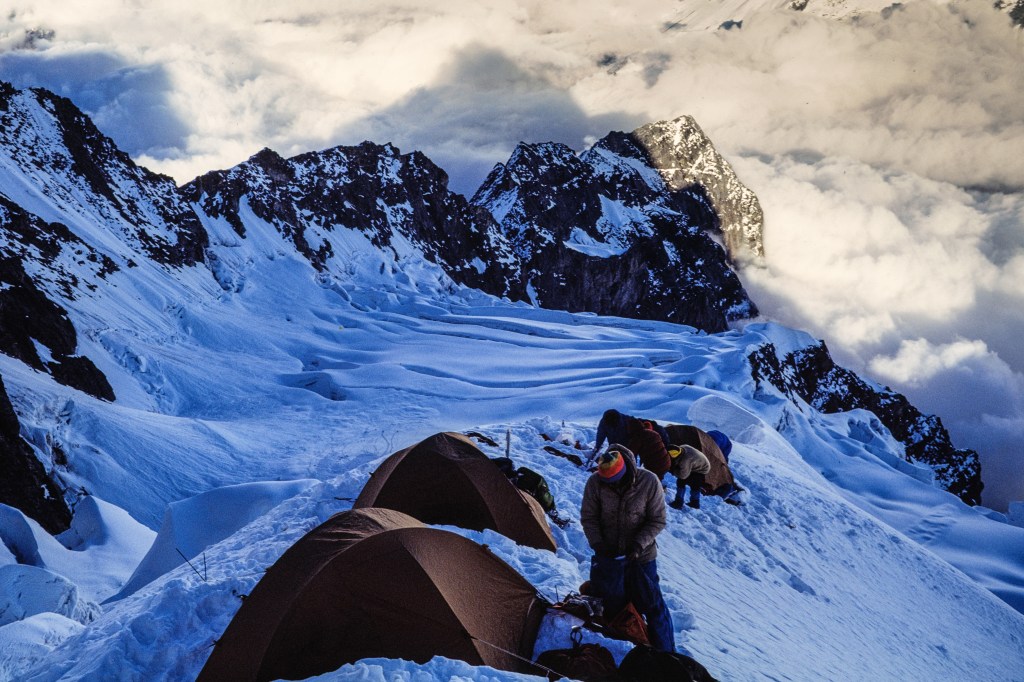
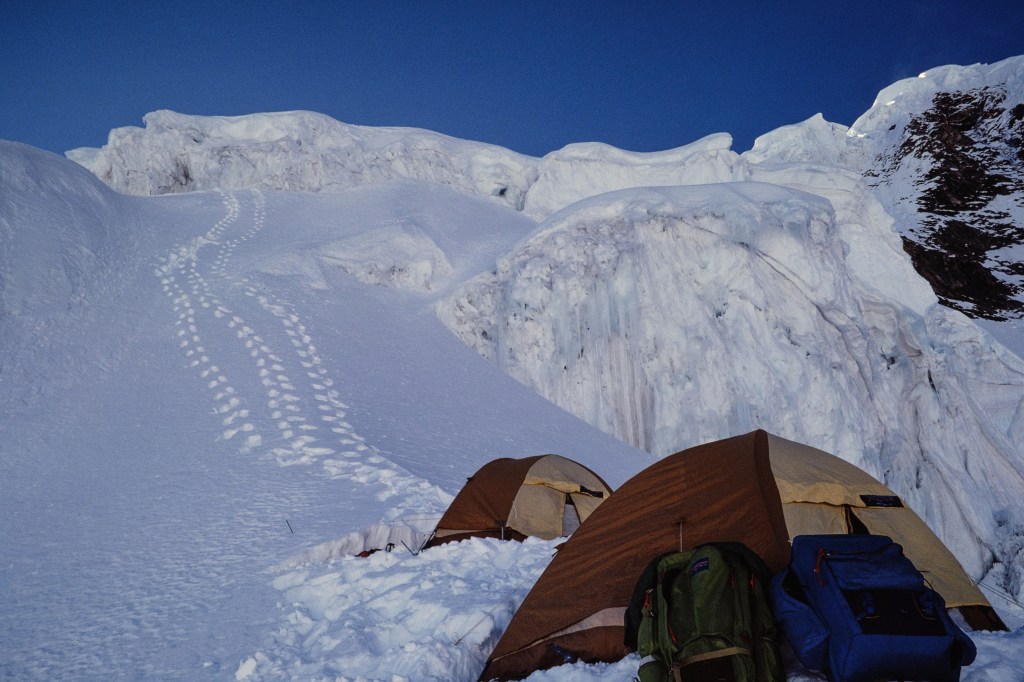
On Oct 1 we moved up to Camp 1, at 15,700 ft. Lovely to walk in the sun. Note Basecamp tents in two of the pictures below.

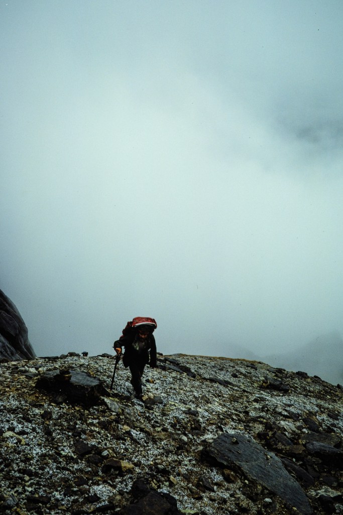
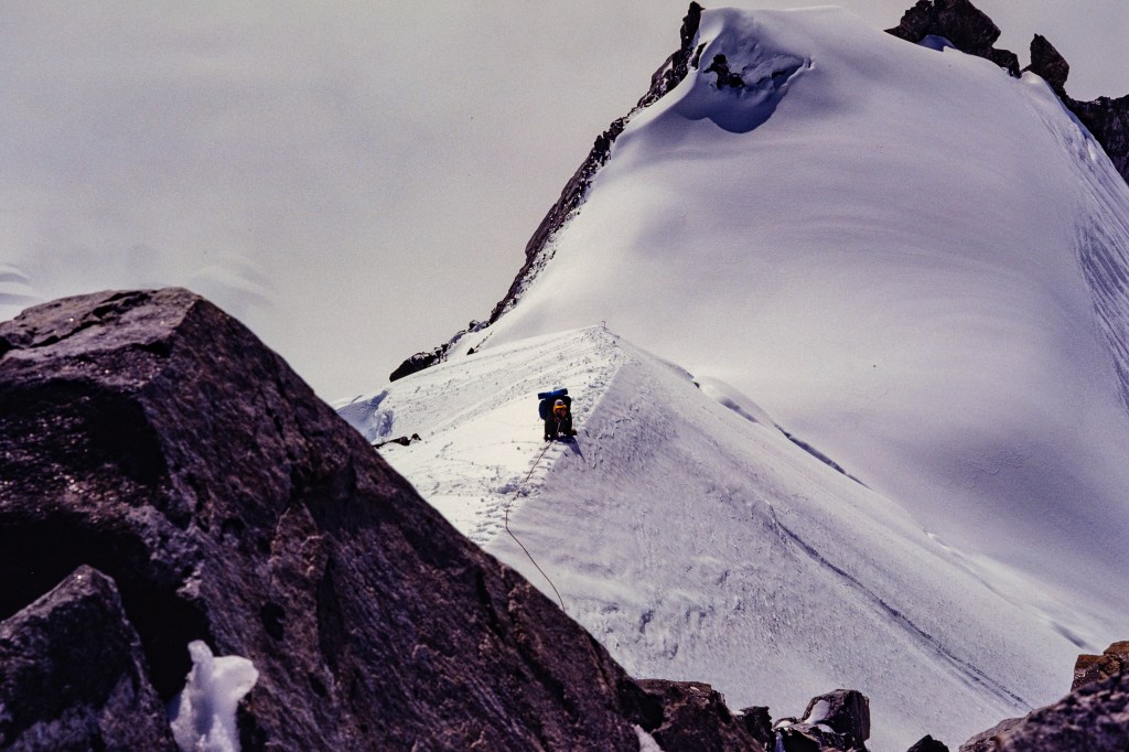
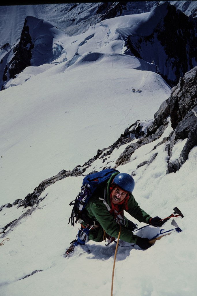
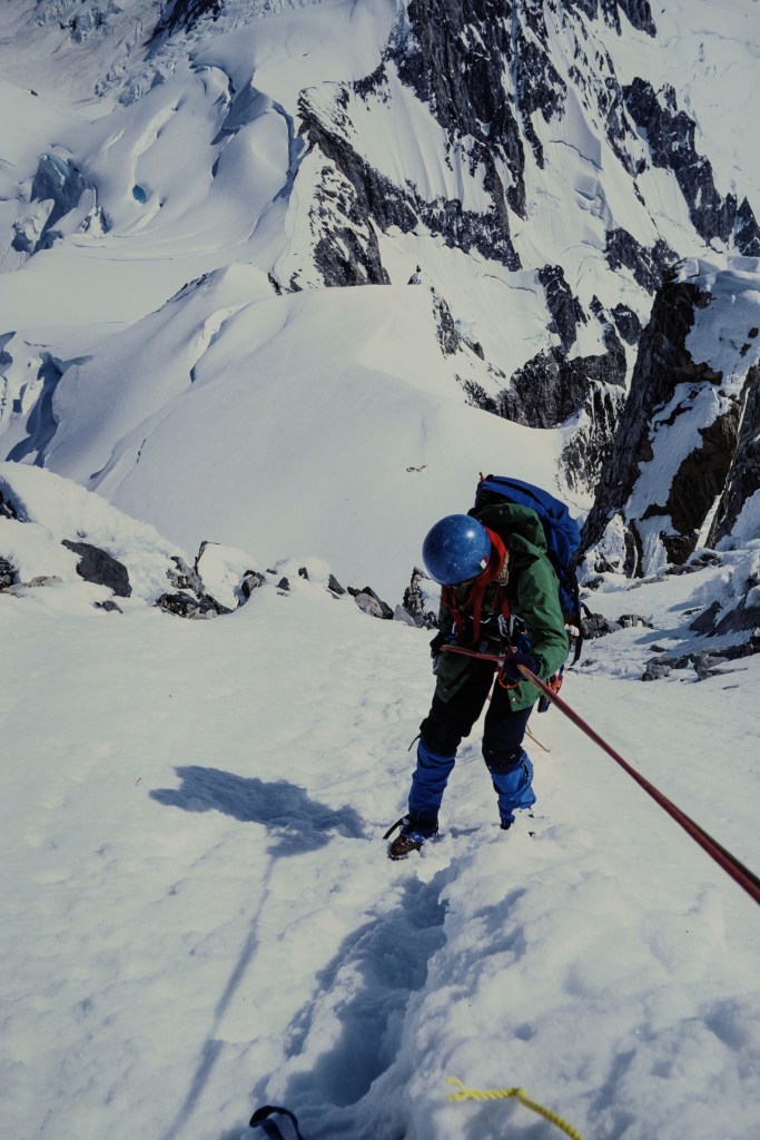
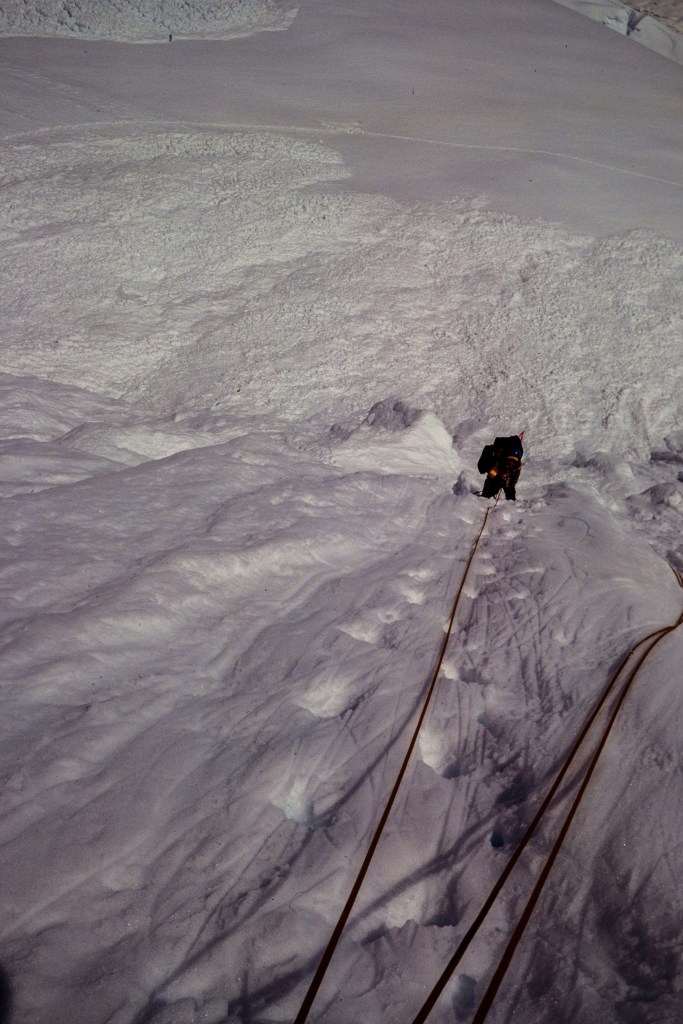
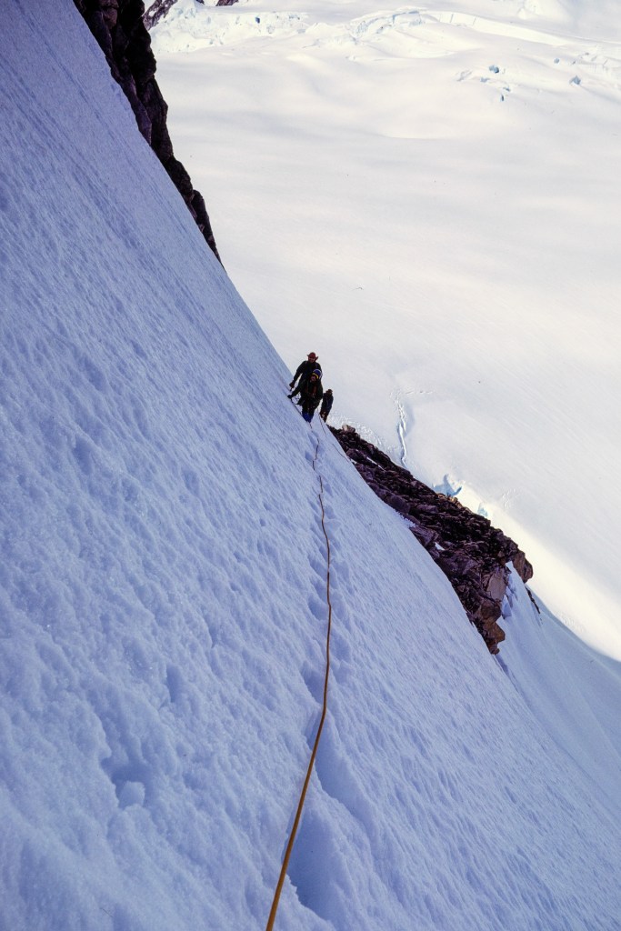
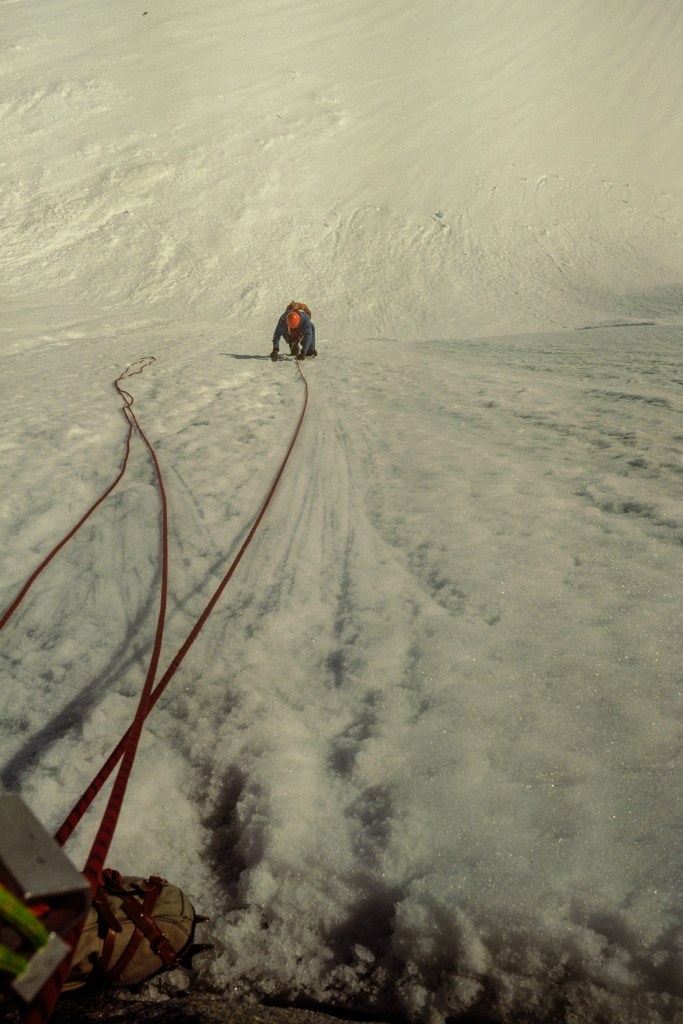
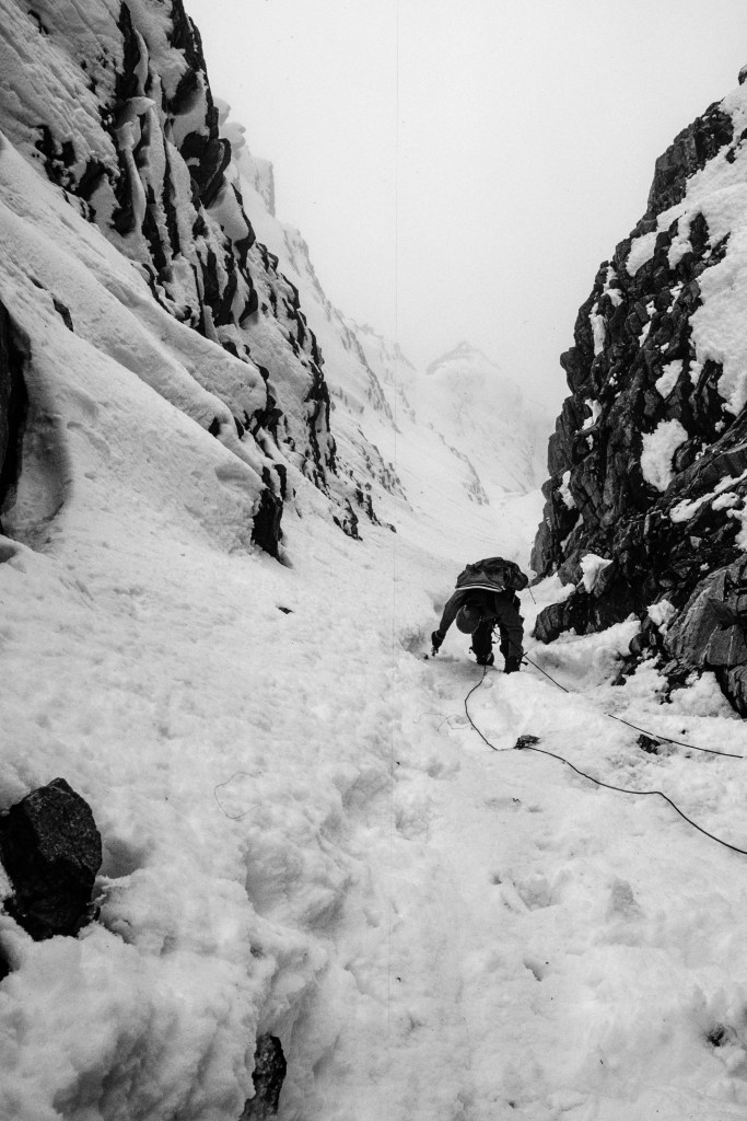
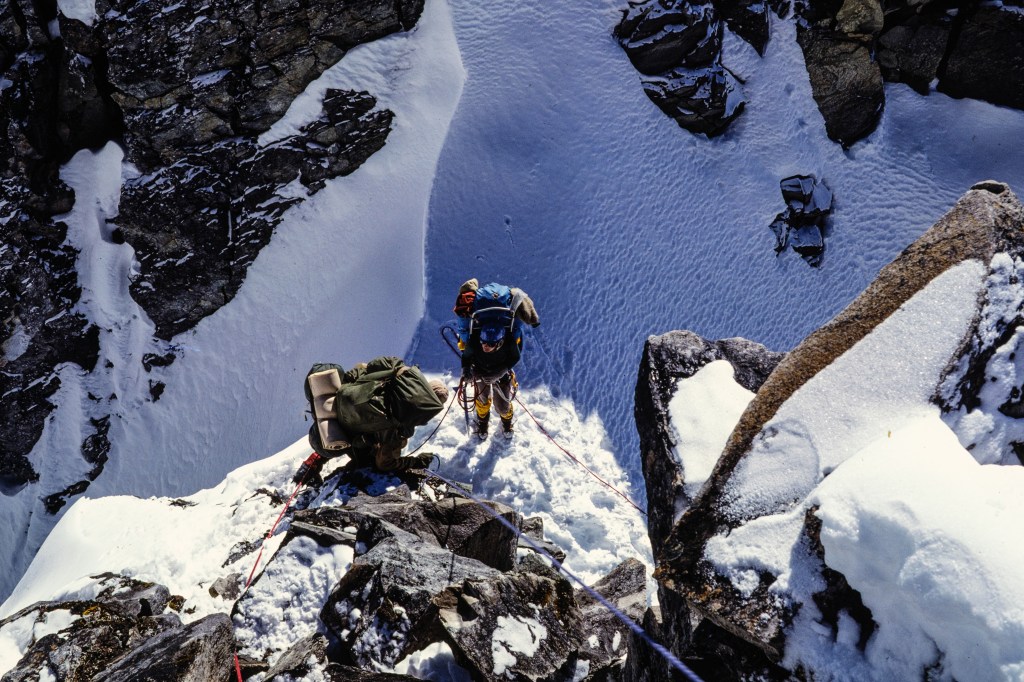
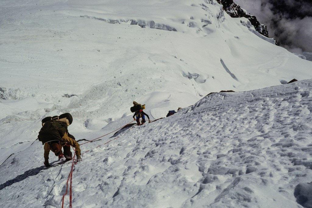
The photo below shows a climber who is pulling up on a rope that is anchored to the rock. Simonson, Wilson, and I carried up hundreds of feet of rope and attached this to steep parts of the route. We anchored this “fixed line” to rock or snow using ice screws, snow pickets, pitons, nuts, and slings. Climbers use a clamp, called an ascender or jumar, that grips the fixed line and is attached to the climber. This makes for safer travel when shuttling loads on steep terrain. It means the clients do not always have to be attached to the guides – instead, they are attached to the fixed line.

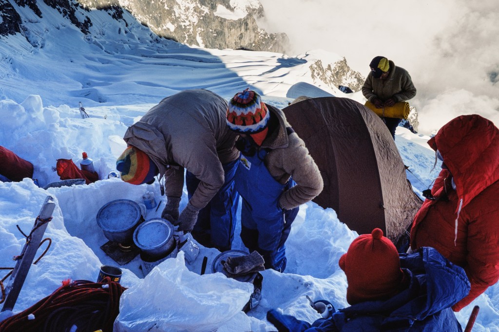
At Camp 1, Simonson stirs a pot of “food.” Looks yummy!

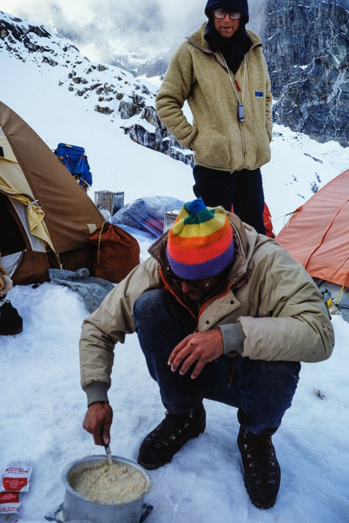
Our first evening meal at Camp 1.

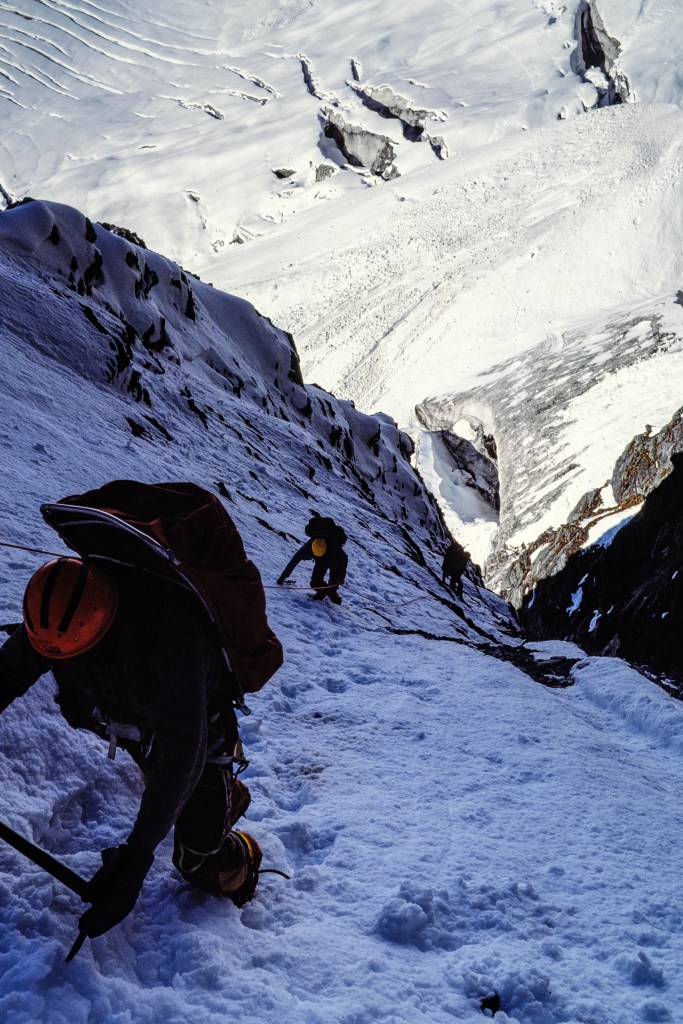
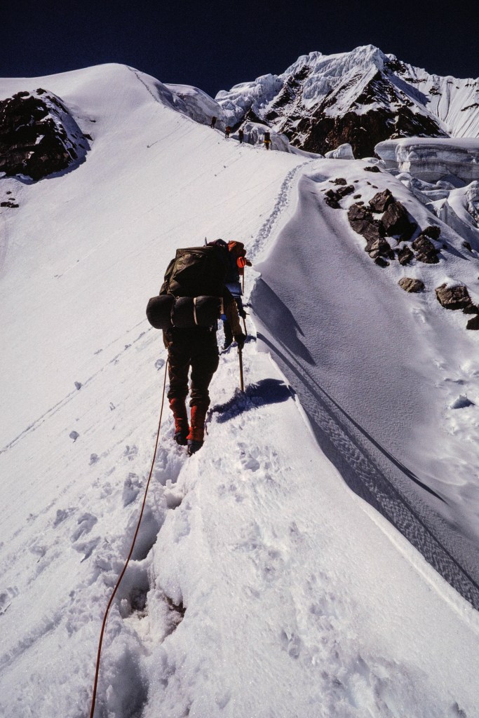
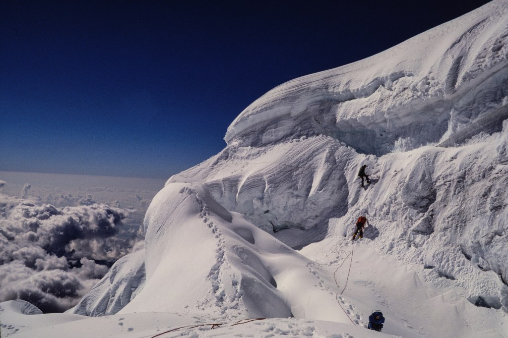
In addition to installing fixed line, guides provide two additional services. First, guides find the route. Guides lead up the steep sections. We find a path through the fields of crevasses. Route finding is a physical and mental drain; the person leading must constantly decide where to go. Those that follow just have to put their feet where the guide stepped. Second, we kick the steps. Walking in deep snow is work. At altitude, this is a penance. Experienced leaders learn to set a steady pace; step and breath, pause, step and breath, pause… Endless. One hundred steps, one hundred more. Over and over. The work that the first person performs is enormous. A good leader sets a pace that everyone can follow, without needing a rest, for an hour or so.

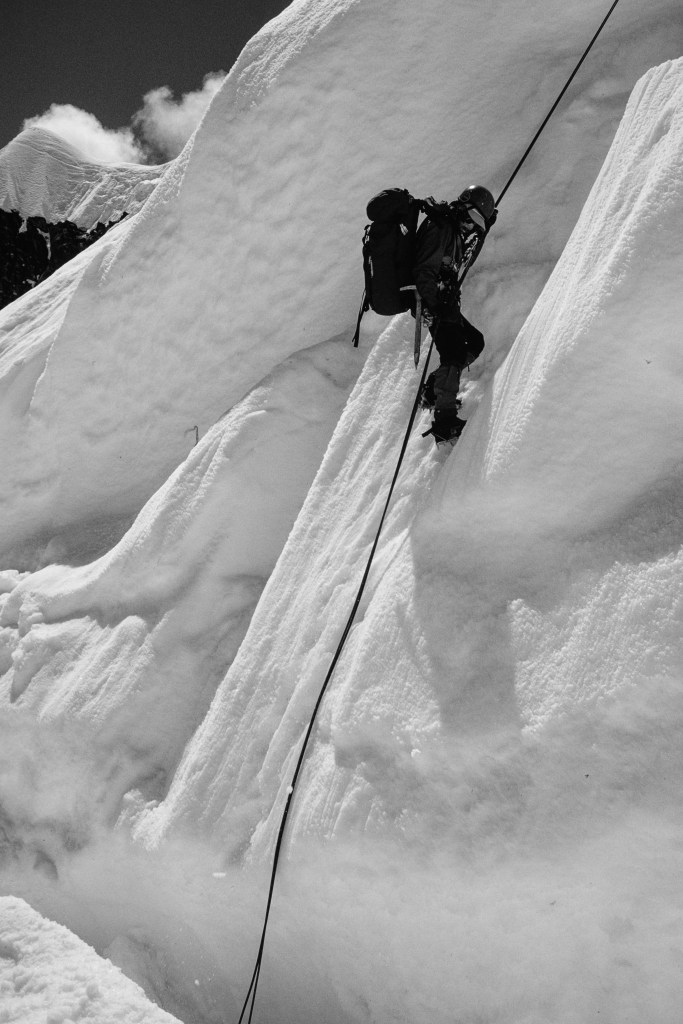
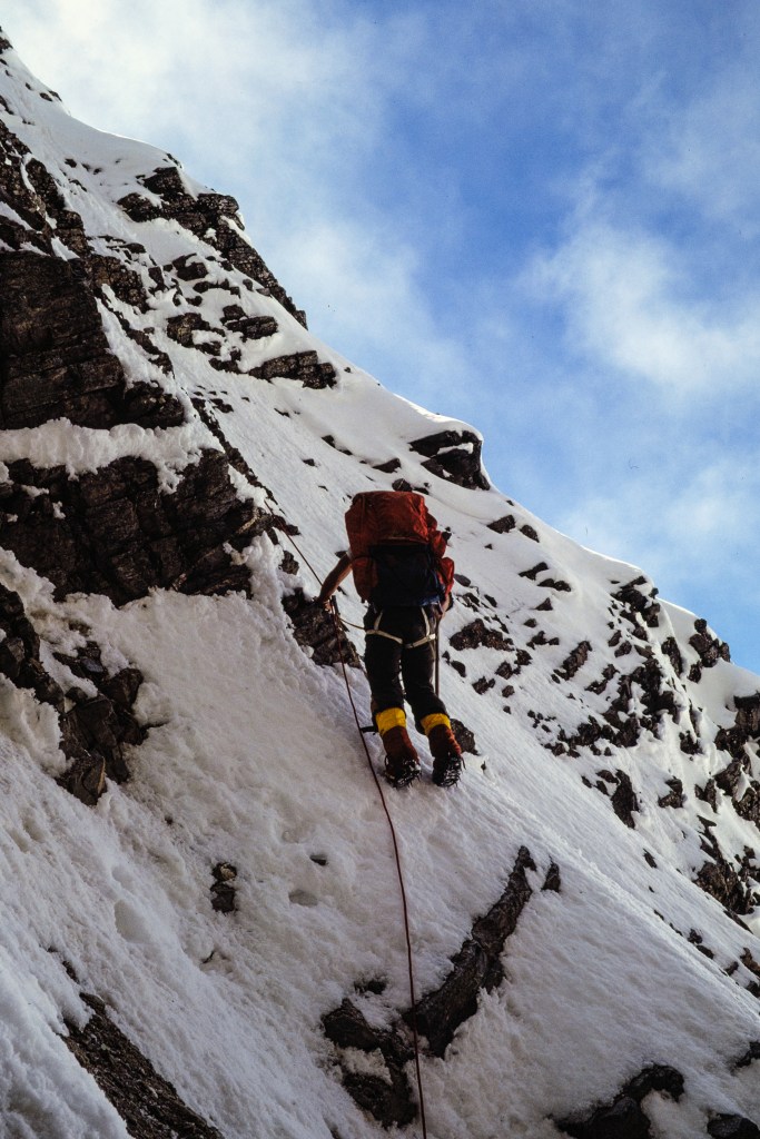
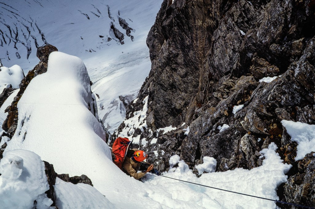
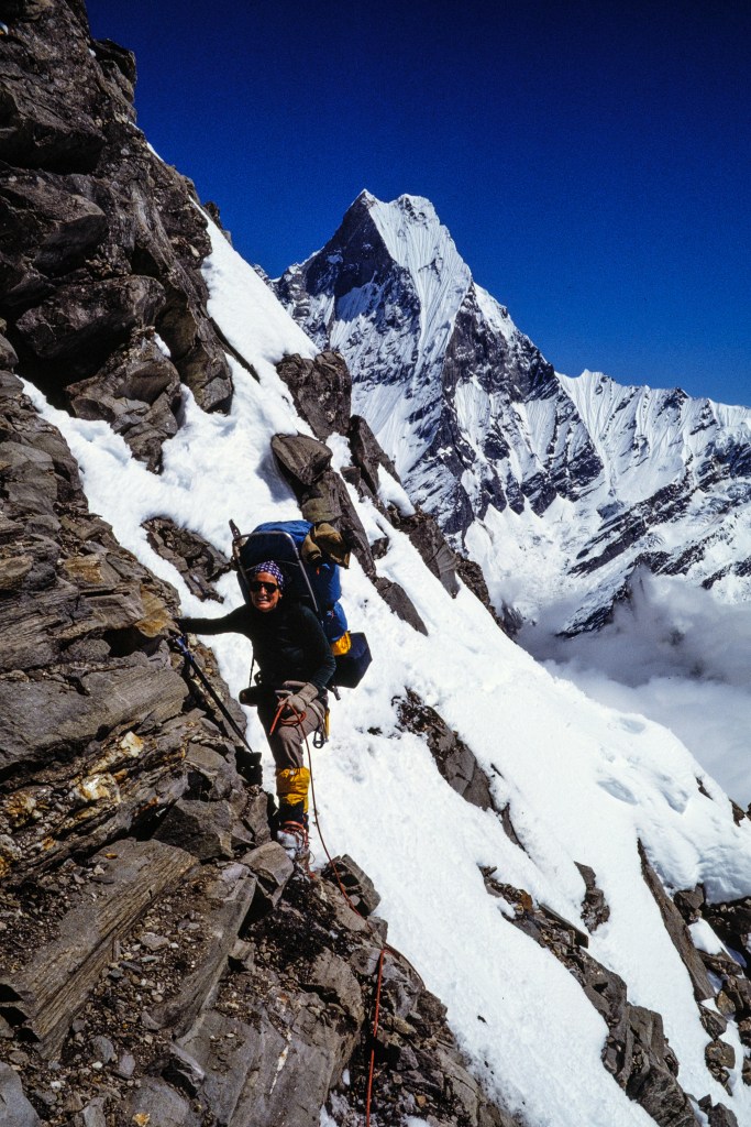
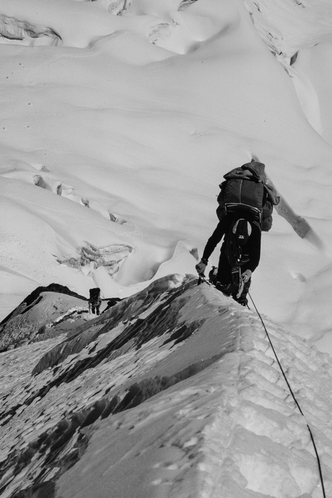
Parts of the climb were steep with lots of air below. The Nepalese government classifies Hiunchuli as a “trekking peak,” but it is harder than most peaks in this category and involves serious risk. A fatal fall is possible and other hazards included falling rock (note the helmets in some photos), snow and rock avalanches, and crevasse falls. Even though the guides try to protect the clients, this is not a safe endeavor.

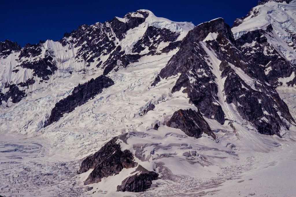
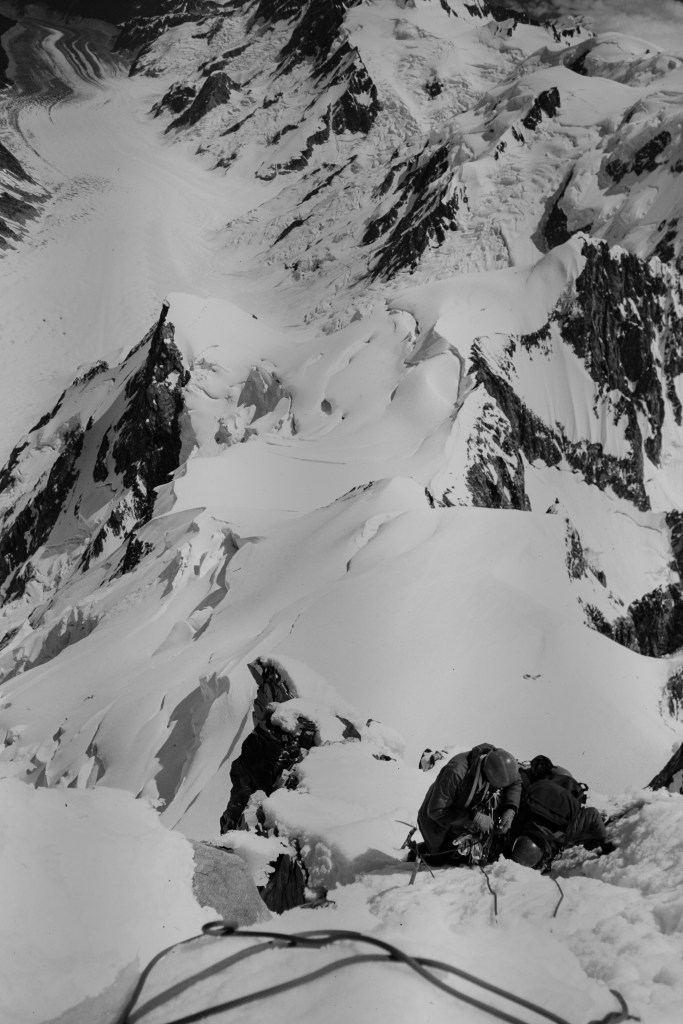
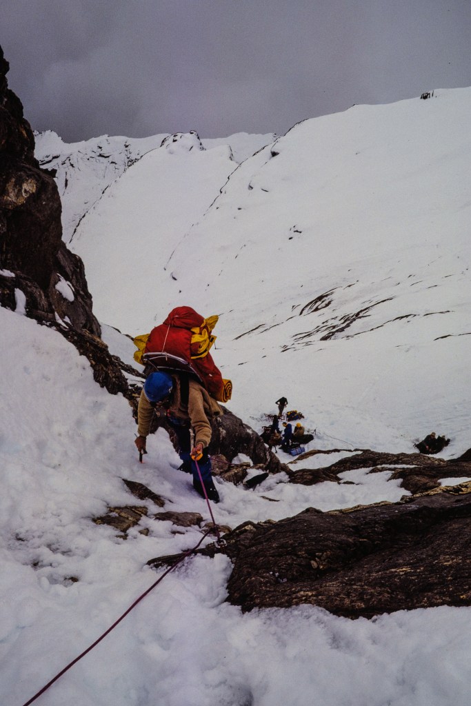
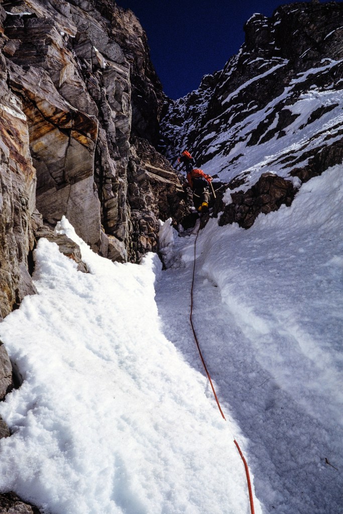
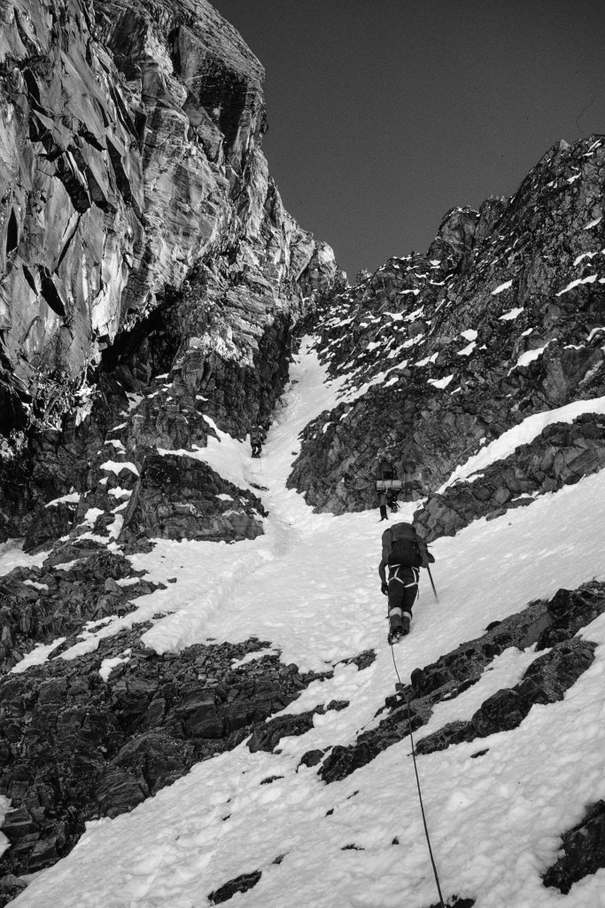
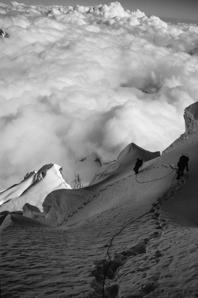
On Oct 2, Simonson, Wilson, and I placed fixed line in a steep, diagonal gully. The next photo shows the location of our 3 camps and the route, including the diagonal gully.

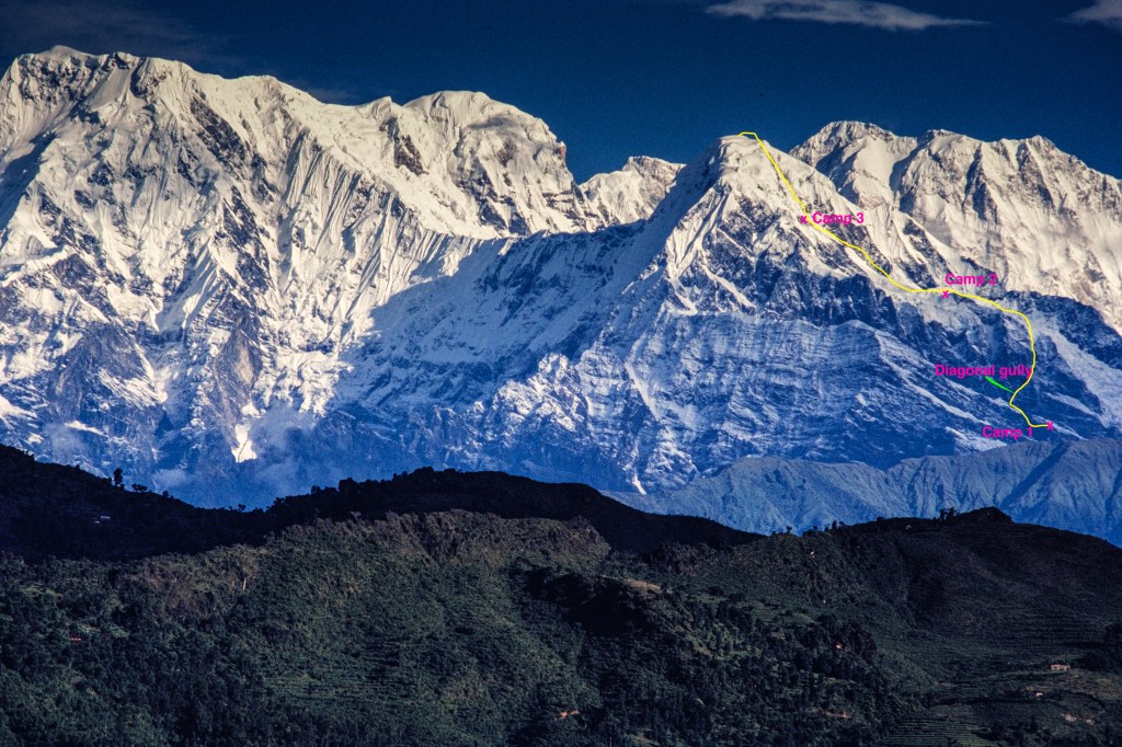
The diagonal gully is on left side of the next picture, our Camp 1 can be seen near the middle.

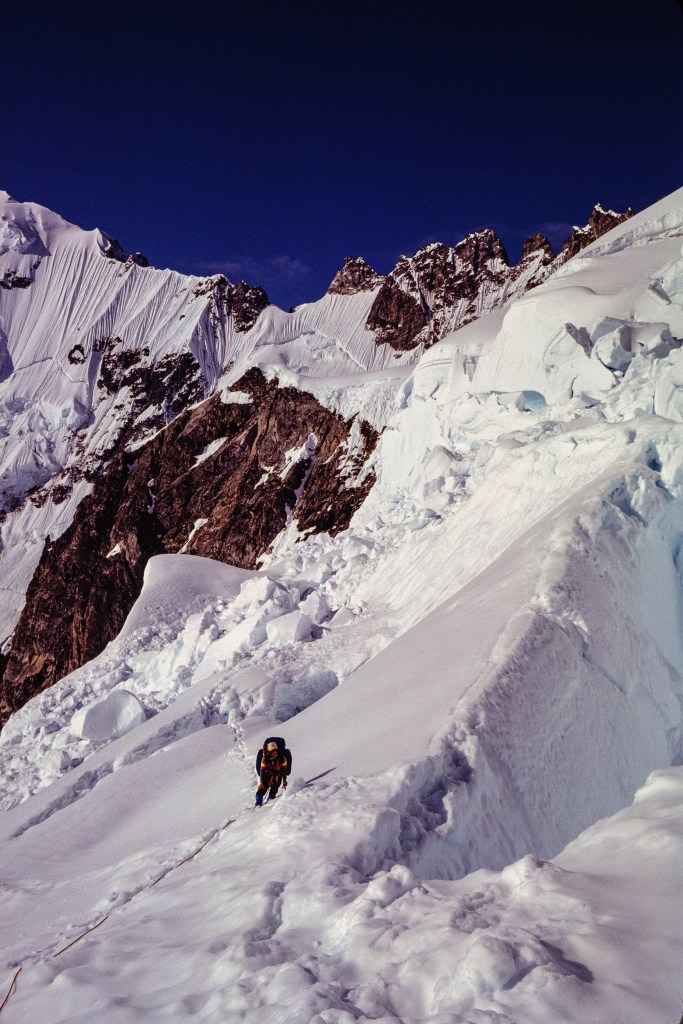
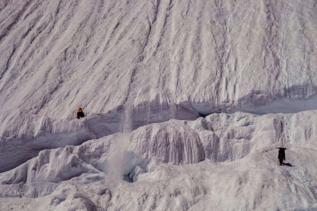
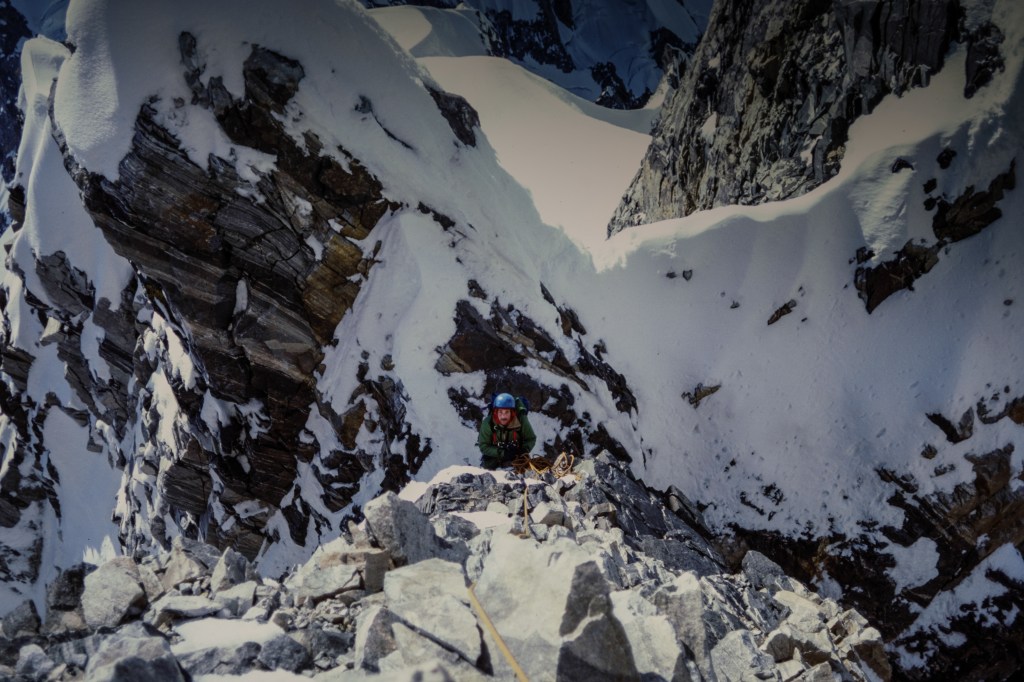
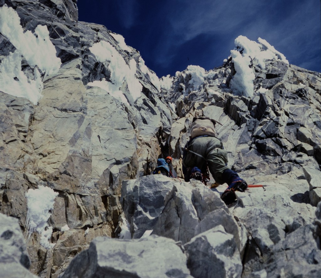
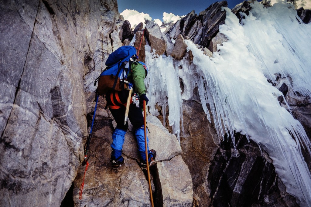
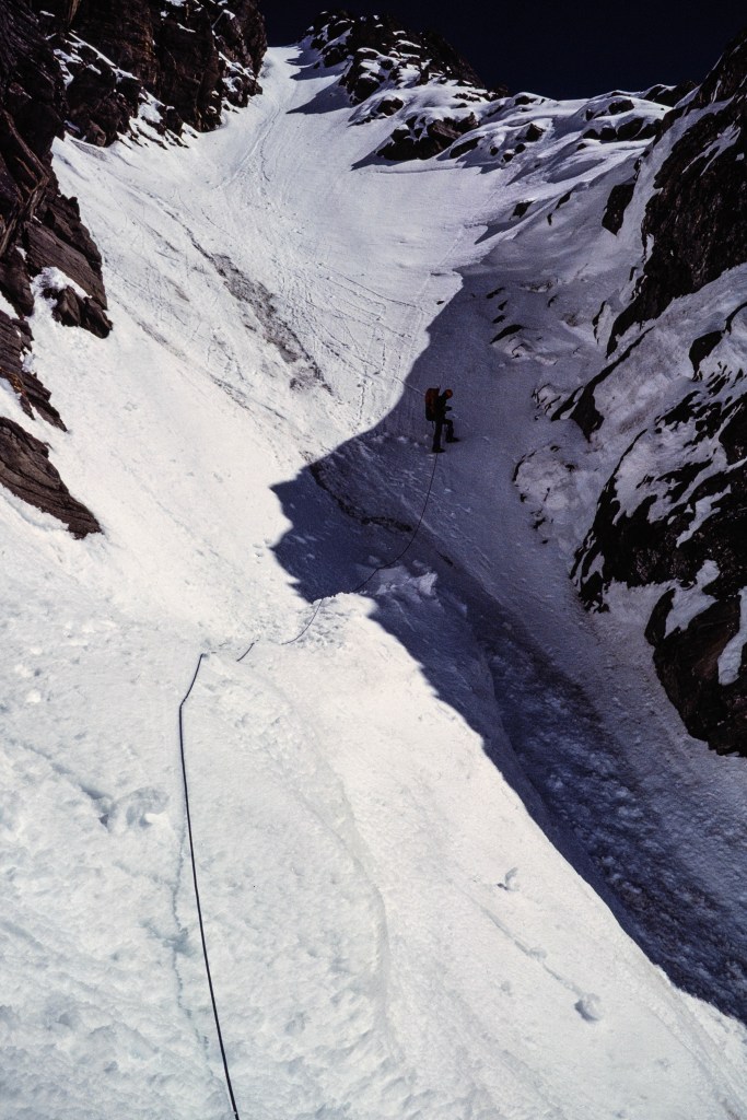
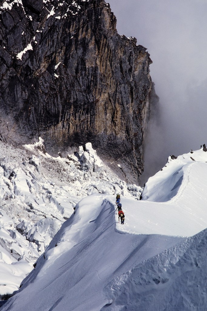
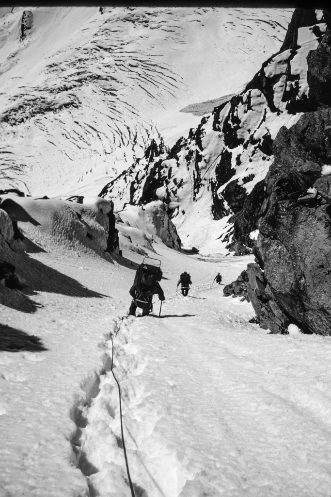
The next several pictures show climbers approaching the gully, crossing an avalanche area, entering the gully, and climbing up to a ridge.

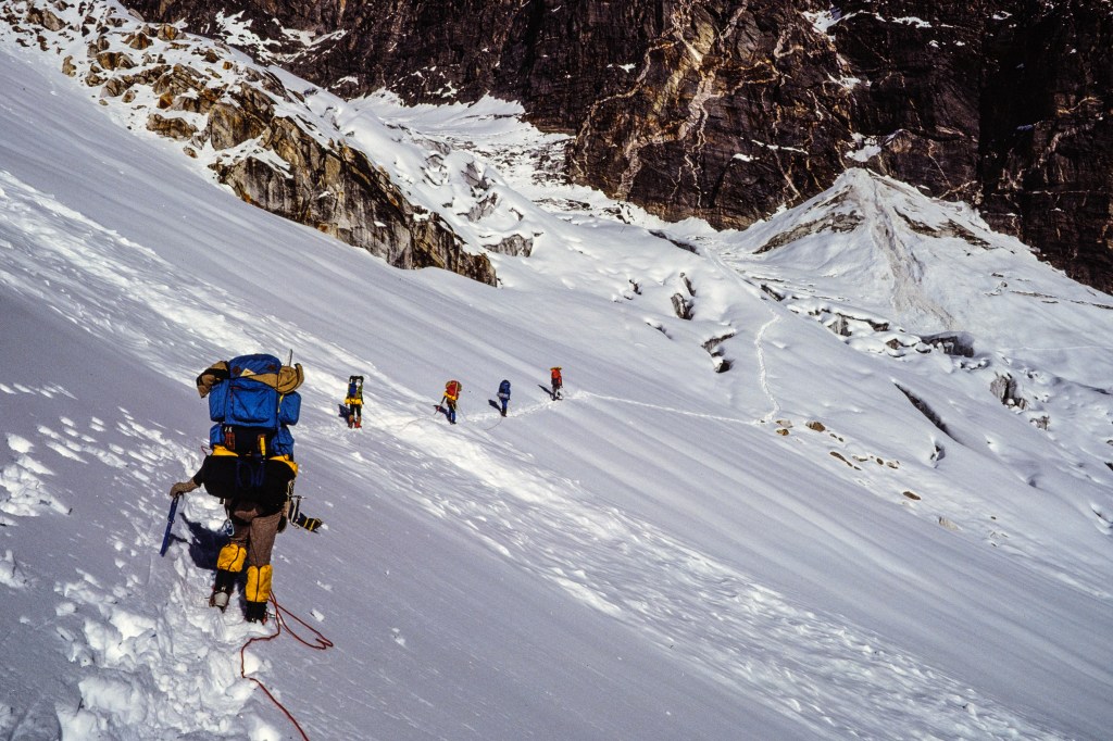
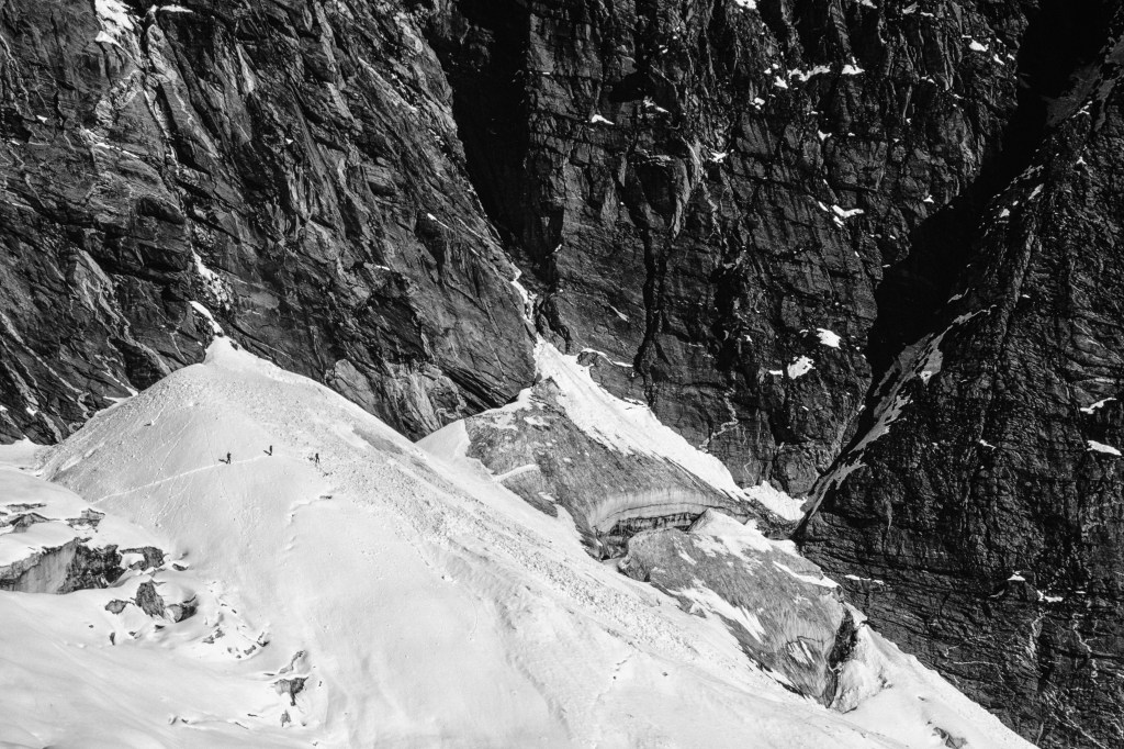
In the photo below, 3 climbers on the left have stopped just before they have to cross debris from an avalanche. The diagonal gully is on the right.

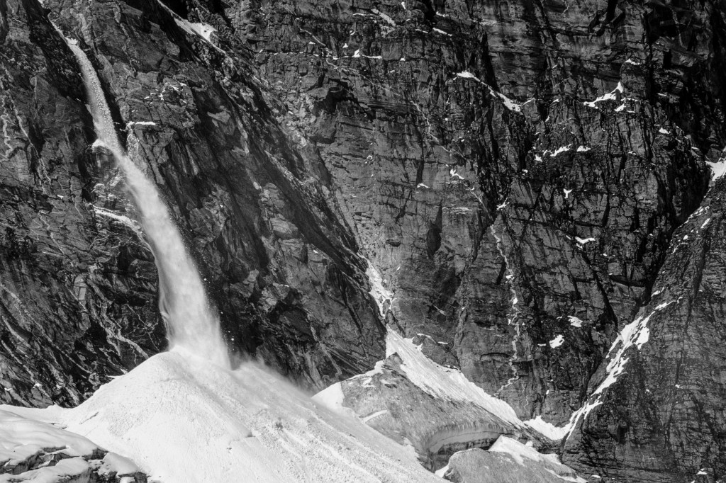
In the photo below, an avalanche comes down near where the climbers were in the previous photo.

In picture below, the avalanche debris is right in front of the climbers. The gully is further away in shadow.

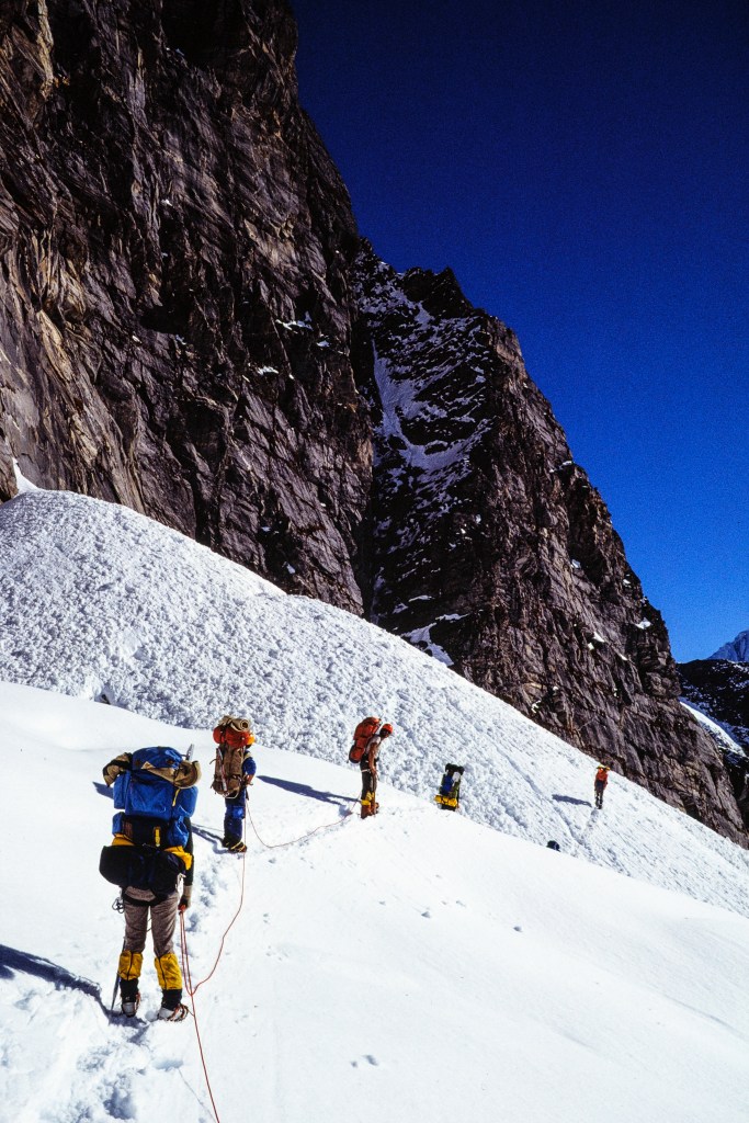
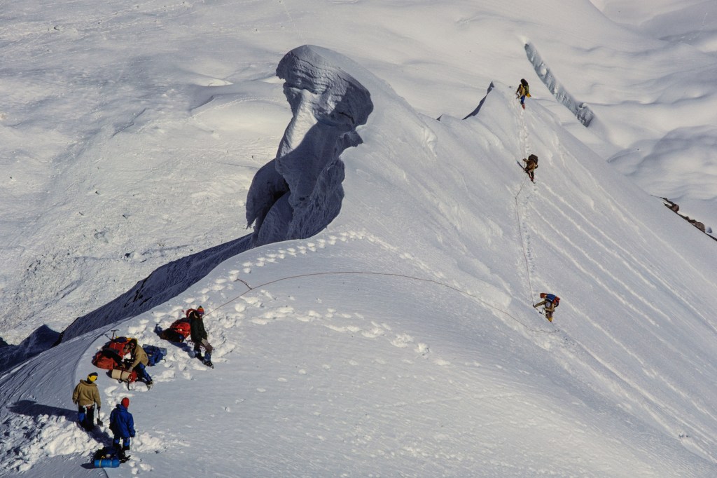
Below, you can see three climbers about to enter the diagonal gully.

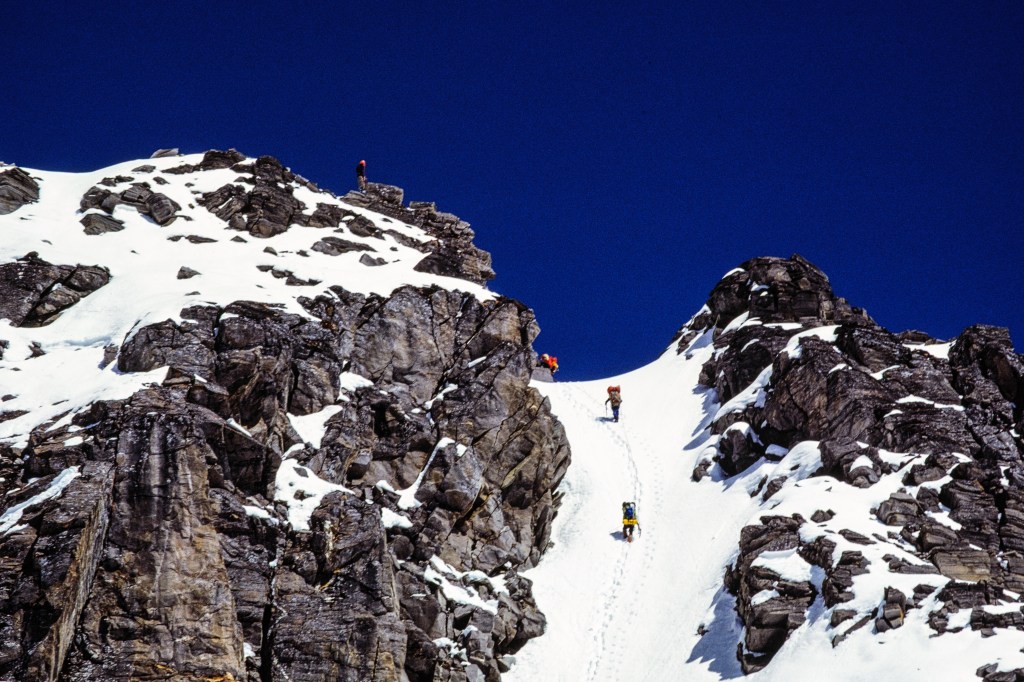
Finally we emerged on a ridge of snow and rock. 

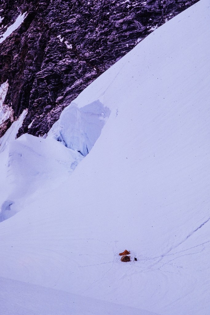
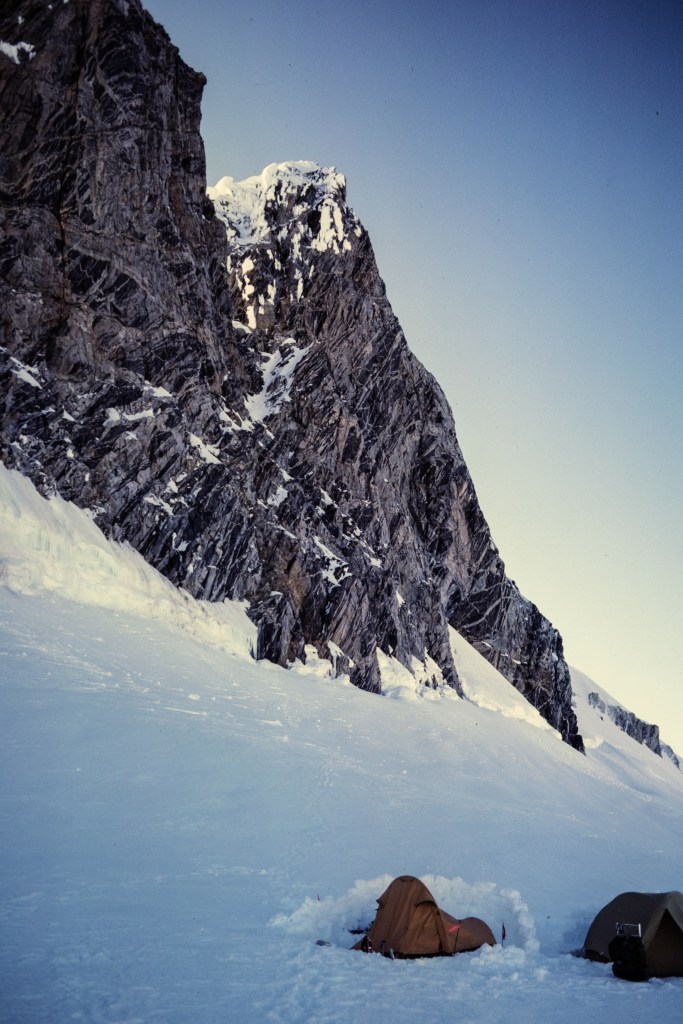
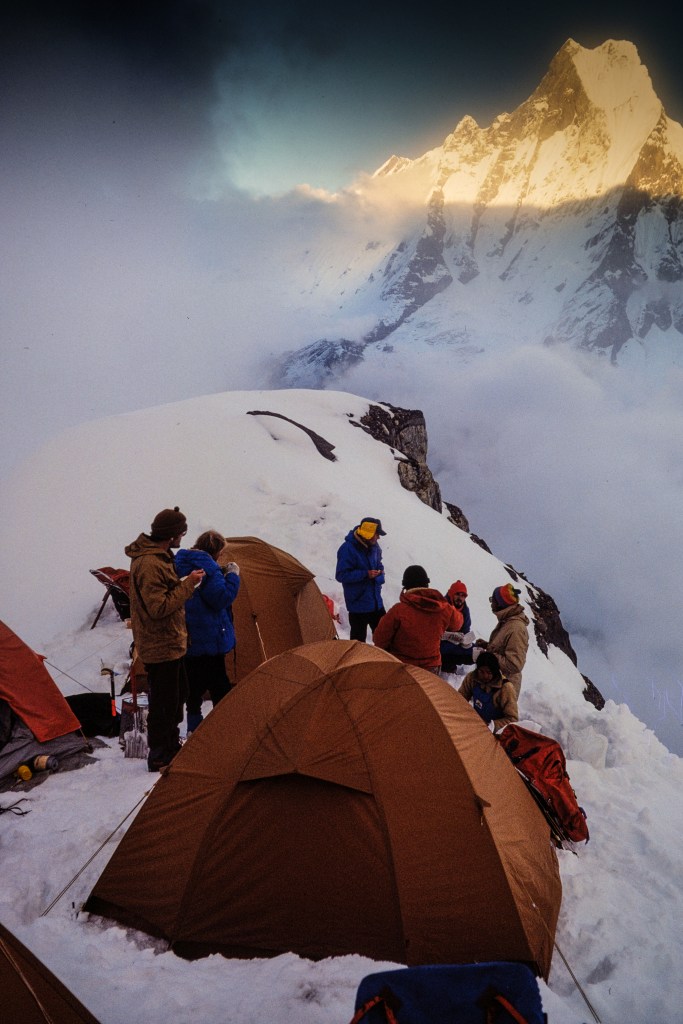
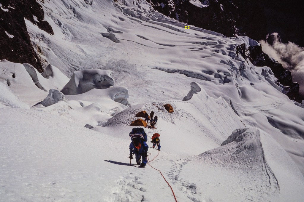
On Oct 3 we moved into Camp 2 at 17,300 feet.

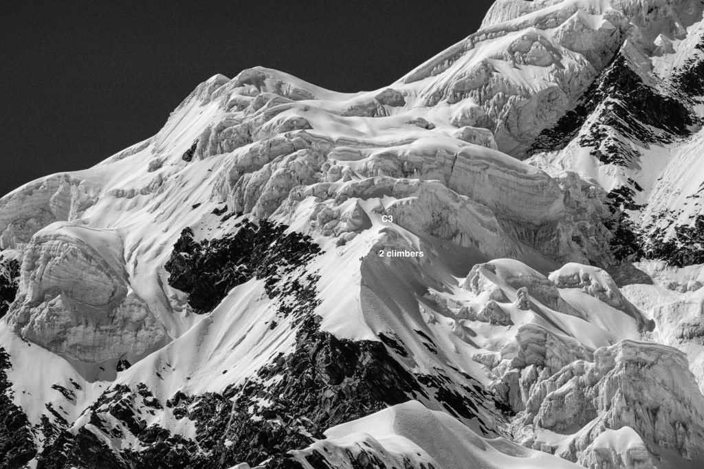
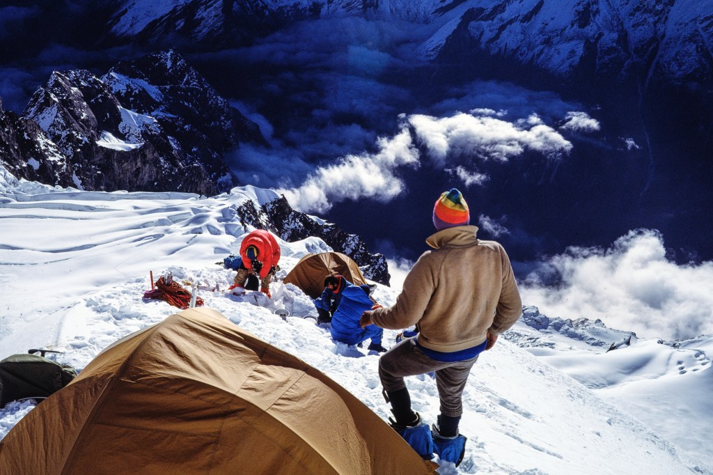
The photo below shows Camp 2, with the location of our future Camp 3 marked in upper left.

The photo below shows Simonson and Wilson putting in fixed line on the route to Camp 3.

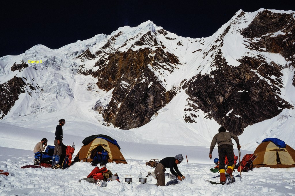
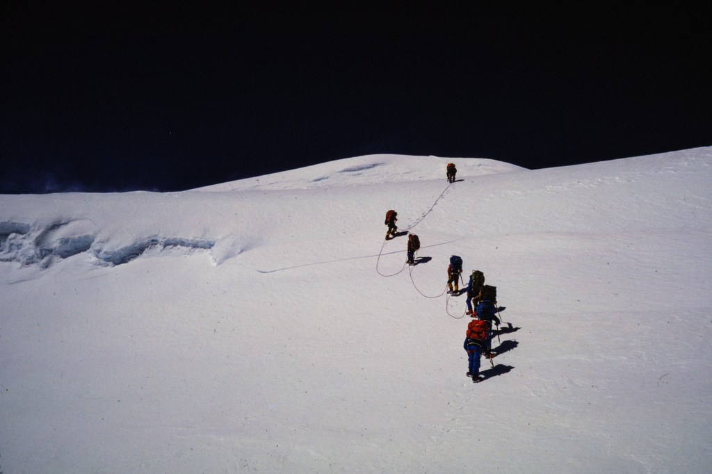
The next set of photos shows our move up to Camp 3, 18,700 feet, on Oct 7.

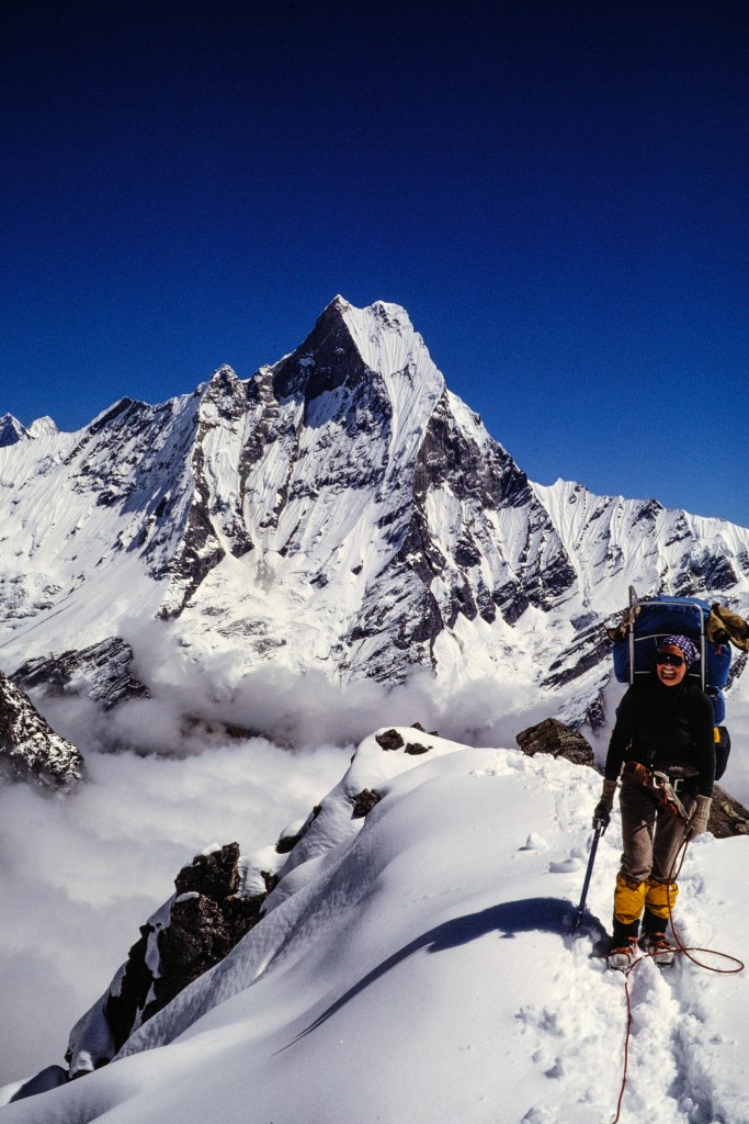
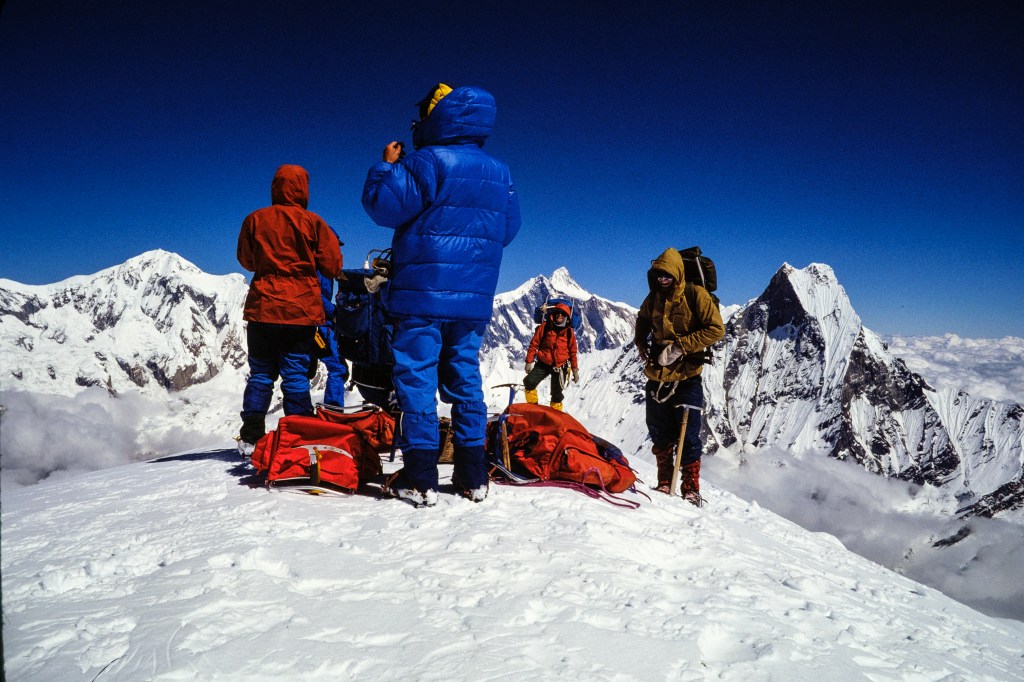
On Oct 8 we set out for the summit: 21,132 feet.

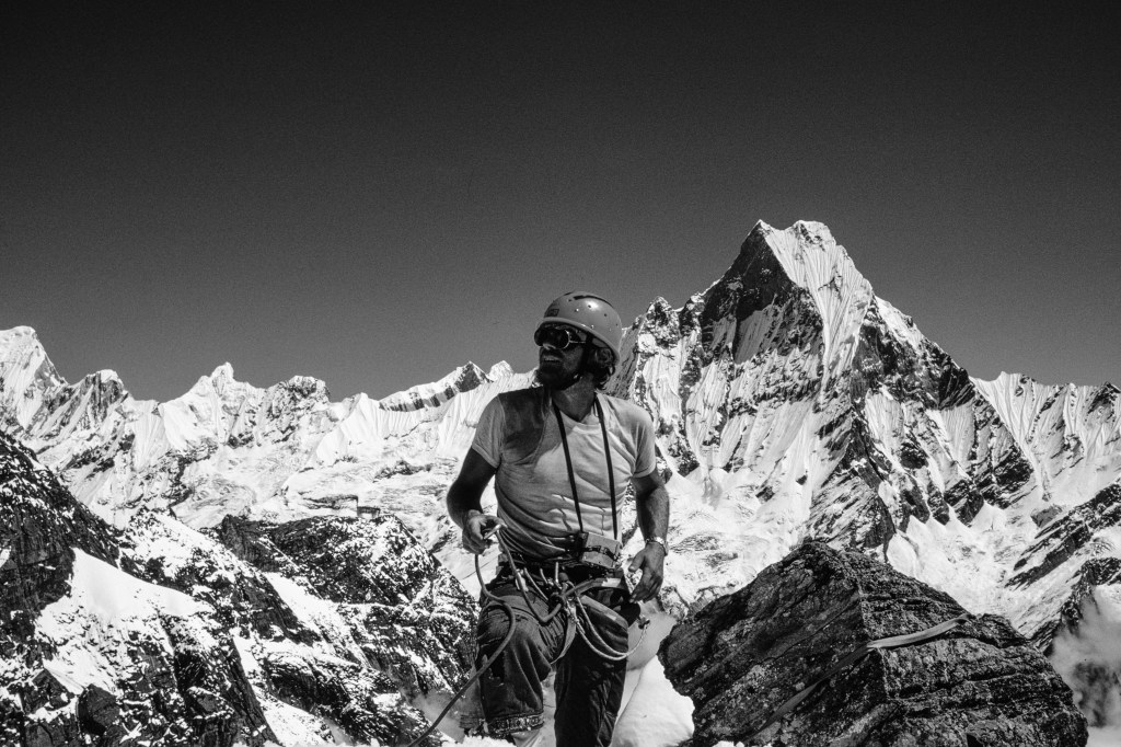
Next photo shows us on top.

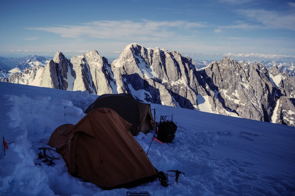
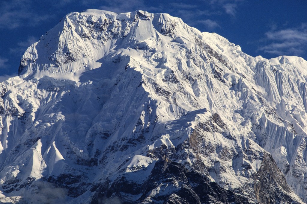
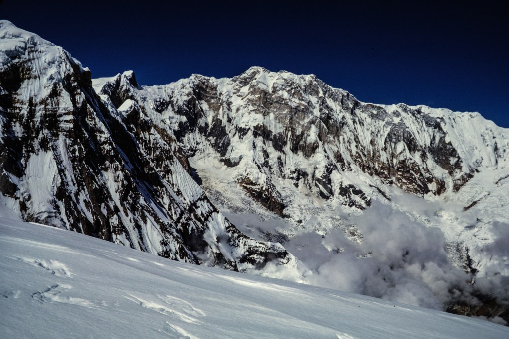
A view of Annapurna’s great south face.

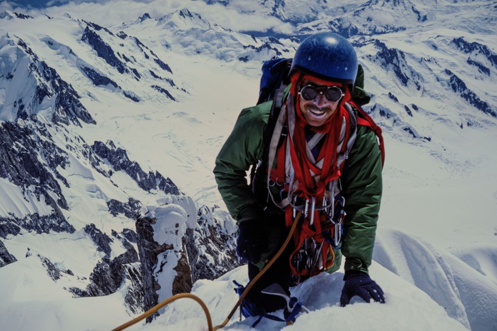
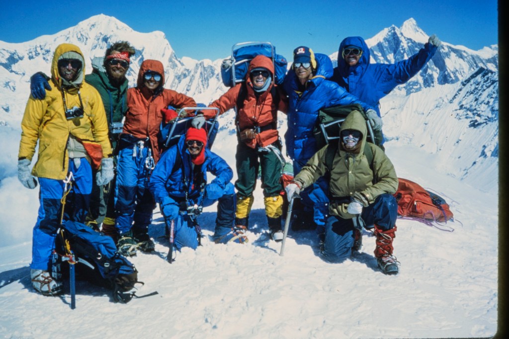
Group picture on top. I am in the yellow parka with the camera hanging around my neck.

THE DESCENT

The next photo shows the area where an avalanche killed three climbers in 1979. We always tried to cross this quickly. Note the fresh blocks of snow and ice that fell while we were up on the mountain.
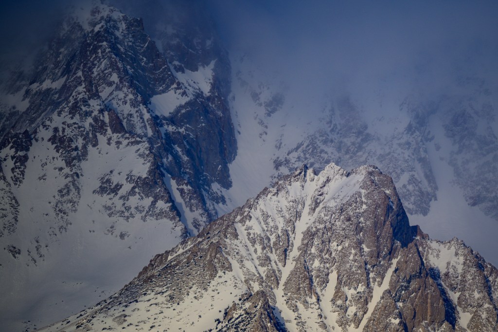
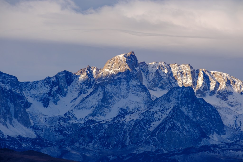
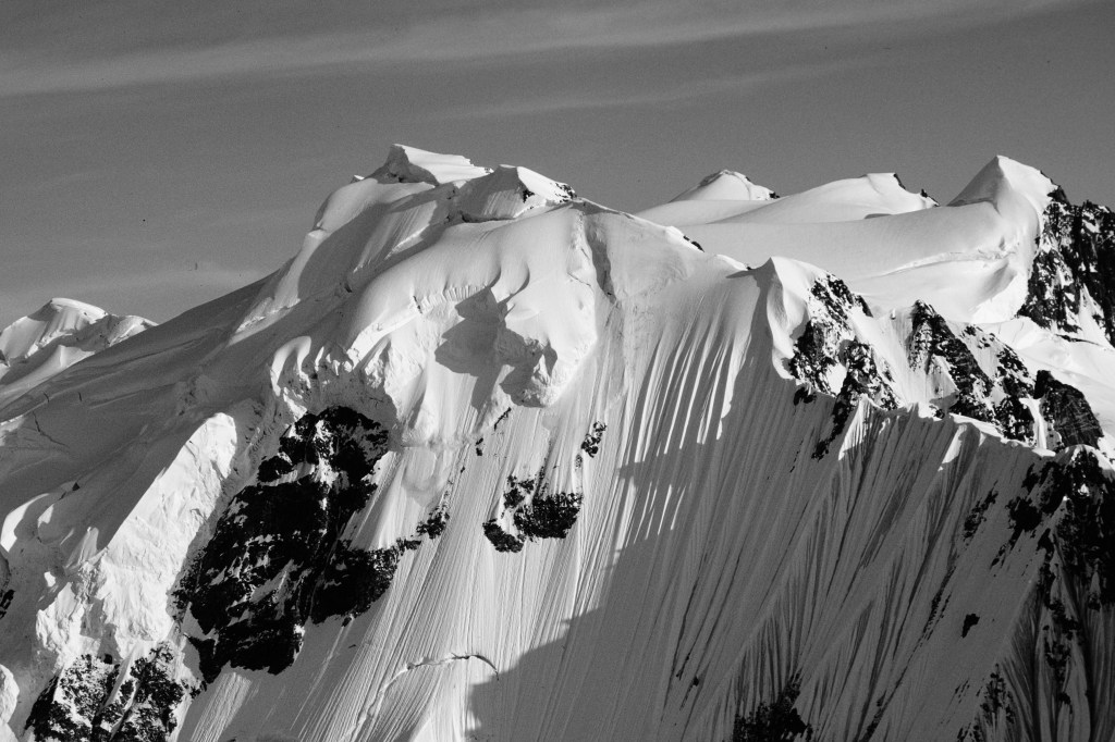
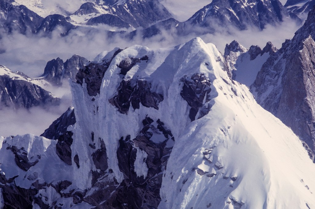
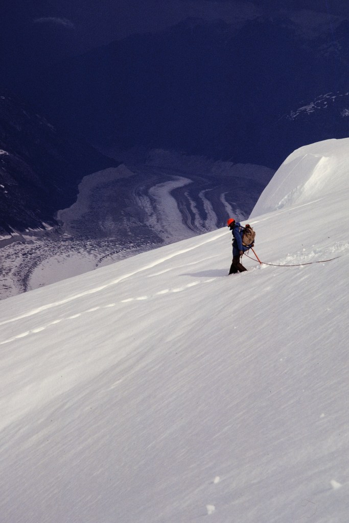
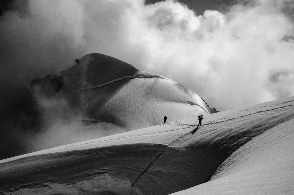
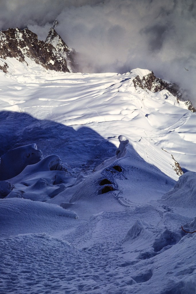
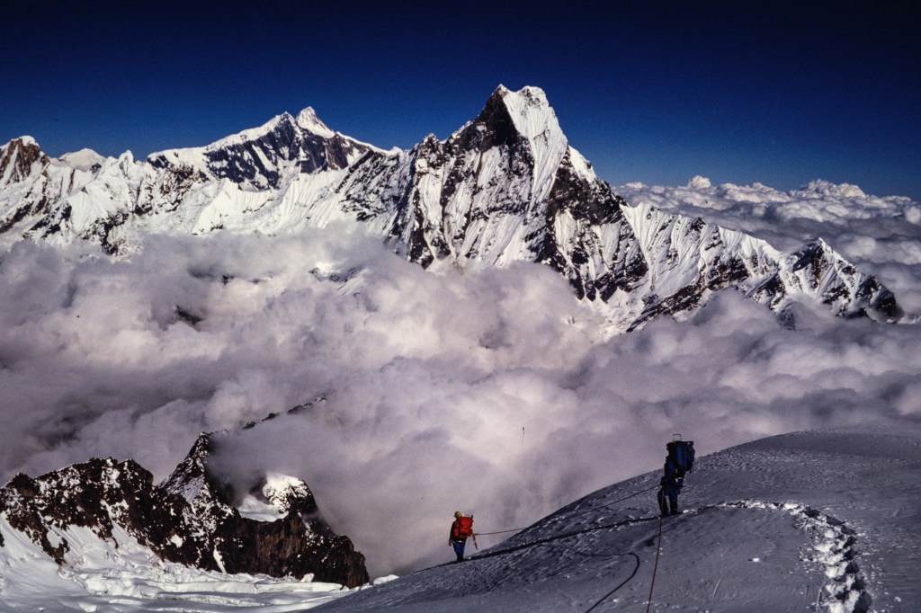
Two final views.

A FEW FINAL COMMENTS

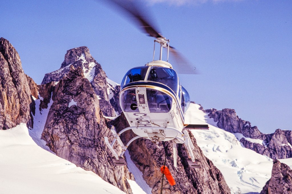
By Oct 12 we were back to the Modi Khola, safely off the mountain. I detoured upstream to the Annapurna Sanctuary for a night, then back downstream to rejoin the group. I contracted giardia on this detour and had a tough hike back to Kathmandu. You don’t need the details. I was back in the USA by Oct 20. This was a fun climb for me and I think most of the clients enjoyed it as well. I feel bad for the three clients who turned around; this must have been very disappointing for them.

Simonson was an excellent leader; strong, relaxed, confident. The food was not great, but sufficient. Up high we cooked ramen noodles for supper, throwing in cans of tuna or chicken. This was filling, easy, and quick to make, and provided necessary liquid. The cooking and clean-up chores were rotated across the group, a style I liked. The clients were generally strong. Aside from one client, most had little climbing skill. But they all pulled their weight. Considering how scary this must have been for some of them, they did well. I’ve searched on the internet and cannot find any evidence that anyone has successfully summited Hiunchuli after our climb. Is that true?

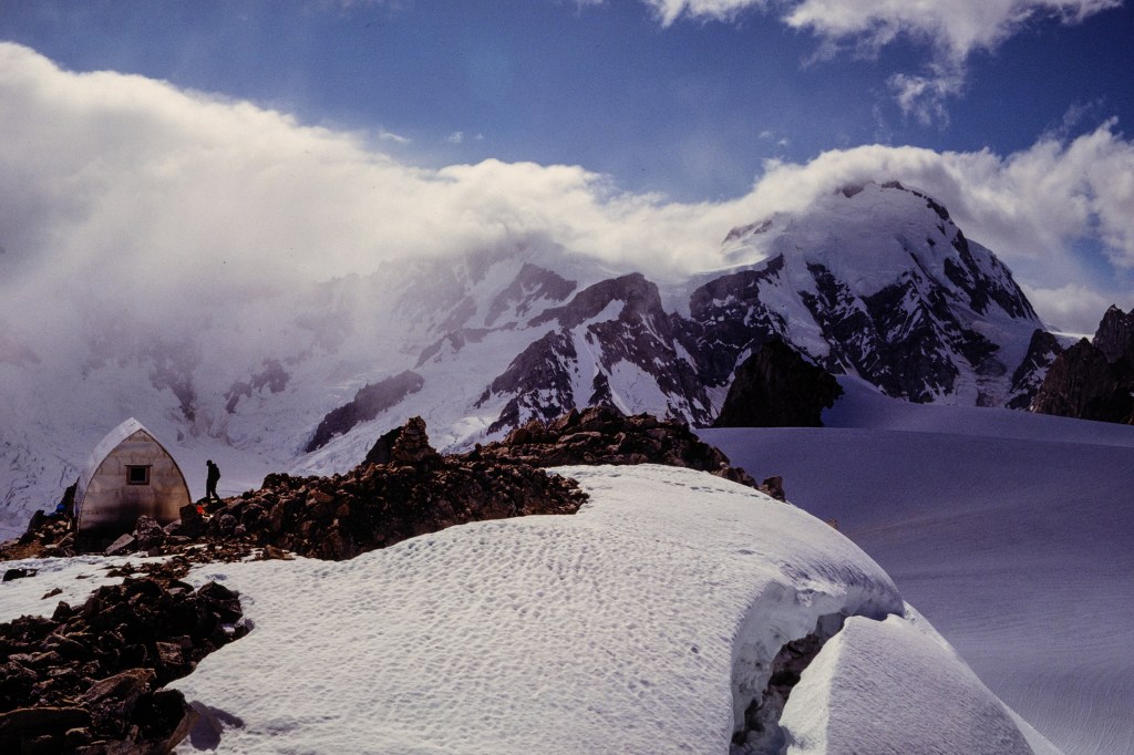
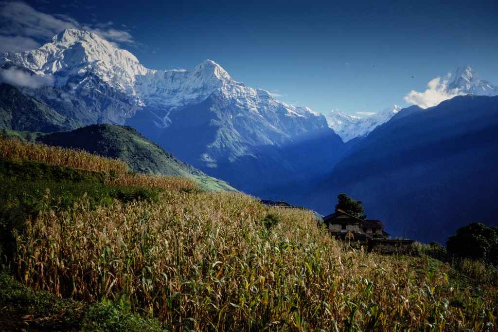
In 1998 I returned to this area with Roberta and some friends; Mike Jauregui, Susan Olson, their 10 year-old son, Kevin, and Mike’s older boys, Phillip and John. We all hiked up through the Modi Khola gorge to camp in the Annapurna Sanctuary, a spectacular location.

COMMENTS ABOUT THE PICTURES

The original photographs for this show were my Kodachrome slides, taken on the climb in 1981. I later photographed those slides with a digital camera and processed the electronic images in Lightroom. I edited some pictures into black & white for variety. You may notice marks left by dust in some pictures; I try to remove dust before photographing the slides, but it is hard to get all of it.

You may have noticed that a lot of the pictures in this show used a vertical or “portrait” mode format. That format was more popular before computer screens encouraged a wide or “landscape” framing.

Whitney Sunrise

This blog shows photos of sunrise on the peaks near Mt Whitney (14,505 feet), the tallest US summit outside of Alaska. Some tourist spots offer “light shows” using electric lights on natural features. The eastern Sierra has a free light show every morning.

The Sierra Nevada extends north-south for 400 miles. It separates California’s Great Central Valley from the Great Basin. No road crosses the range from Sherman Pass Road in the south to Yosemite’s Highway 120 in the north; the Pacific Crest Trail between these roads is 240 miles long. Near my home, the Sierra crest is generally higher than 13,000 feet, a steep wall over 150 miles long.

Roberta and I sometimes photograph the sunrise on the Sierra. I pick locations on the east side of the Owens Valley, 8 to 15 miles from the nearest Sierra summits. We get up at 4 am, eat, fill a thermos with coffee, and head out. We arrive in the dark and sit in the car, letting our eyes adjust and getting caffeinated. Then I get out, bundled in warm cloths, and use a headlamp to set up two cameras on tripods in the sagebrush. I get back into the car to warm up.

In morning twilight the peaks become brighter for half an hour. The range has a subdued look as I start taking pictures. Then sunlight reaches the summits around 6:30 AM and for half an hour the light moves down the slopes to the Valley floor. This early light is often tinged with red. By 8 AM the best colors are gone. We pack up the cameras and head home.

The air is usually calm and clear in early morning, so photographs have a lot of detail despite distances up to 15 miles. I used telephoto lenses equivalent to full-frame (35mm) focal lengths of 75 to 600mm. Consequently the images are “magnified” about 2 to 12 times, compared with the view without a camera. Cropping on the computer doubles the magnification of some pictures. Camera exposure times range from 3 seconds during twilight to 1/1000 second when the sun is fully up. 

All photos in this post were taken from a spot on highway 136, south-east of the town of Lone Pine, at elevation 3600 ft. They were taken on March 1, 2023, February 24, 2024, and April 1, 2024. I’ve sorted them into groups from south to north, then ordered them by date and then by time, so you see images from twilight to full sun for each group of peaks on each day.

Panoramic Photographs

In the days of film, it was a big deal to take photos that could be stitched together into a wide panorama. This is easy with digital photos. You can move your camera from left to right and take multiple pictures that are joined into a single, wide shot, with lots of detail. This can be done within the camera or by taking several photos and combining them in software. To orient you to the peaks near Mt Whitney, below is a panoramic image that extends from Mt Langley (14,042 feet) on the left to Lone Pine Peak (12,944 feet) on the right. The smaller rocky summits in the foreground, still in shadow, are the Alabama Hills.

3/7/23. 6:18 AM.

Next you can see summits from Lone Pine Peak to Tunnabora. Whitney is labeled; its enormous east face is in sunlight.

3/7/23. 6:17 AM.

Next I show all these peaks, from the Corcoran group to Carillon.

4/1/24. 6:48 AM

Mt Langley

I’ll start at the southern end of this group. To the south of the peaks I’ve already shown, is the road to Cottonwood Lakes. It switchbacks up from 3500 feet to over 10,000 feet. After big rain storms, parts this road may be covered in rocks and sand; sometimes sections of the road are washed away. 

3/7/23. 6:09 AM

Next is Mt Langley (14,042 ft).

3/7/23. 6:04 AM

3/7/23. 6:12 AM

3/7/23. 6:32 AM

Looking a bit further north, the next photo shows Langley and the summits near Corcoran.

3/7/23. 6:32 AM

Mt Corcoran and Nearby Peaks

Mt Corcoran is a long ridge with several summits. The branches of Tuttle Creek bracket this collection of peaks.

3/7/23. 5:51 AM

3/7/23. 6:04 AM

3/7/23. 6:12 AM

3/7/23. 6:14 AM

3/7/23. 6:24 AM

A closer look at Peak 4151 meters.

3/7/23. 6:25 AM

Details of Sharktooth, Corcoran, and LeConte (13,960 feet)

3/7/23. 6:28 AM

3/7/23. 6:32 AM

In the next photo, Langley and the Corcoran group have subdued colors due to clouds.

2/24/24. 6:46 AM

Next we see sunrise on April 1, 2024. The colors change quickly as the sun comes up.

4/1/24. 6:34 AM

4/1/24. 6:39 AM.

4/1/24. 6:47 AM.

4/1/24. 6:55 AM.

A close-up of Sharktooth, Corcoran, and LeConte.

4/1/24. 7:04 AM.

Peak 4151 meters (left) and Sharktooth (right)

4/1/24. 7:04 AM.

4/1/24. 7:05 AM.

Lone Pine Peak

Because Lone Pine Peak is so much closer to the town of Lone Pine, it looks bigger than Whitney. It is slightly lower than 13,000 feet, lower than the other summits in this blog. Additional, higher summits (Mt Mallory and Mt Irvine) are blocked from view behind this peak.

3/7/23. 6:03 AM.

3/7/23. 6:15 AM.

3/7/23. 6:24 AM.

A closer view of the south face of Lone Pine Peak: a 3,000 foot wall with many climbing routes.

3/7/23. 6:29 AM.

3/7/23. 6:32 AM.

Another sunrise on 4/1/24.

4/1/24. 6:34 AM.

4/1/24. 6:46 AM.

4/1/24. 6:45 AM.

Mount Whitney

My first climb of Whitney was in 1971. I drove to Lone Pine and picked up a permit for the Mountaineer’s Route in May. My climbing partner and I saw no one on our climb and met only four people on the summit. But that ship has sailed. Because this is the tallest US summit aside from peaks in Alaska, the demand for permits has surged in the last 25 years. Most people use the trail to the top; 11 miles with 6000 feet of uphill. For hiking permits during the period May 1 to November 1, people must now enter a lottery in February. There are 100 permit spots each day for people who want to try to reach the summit without camping, 60 spots for people willing to camp overnight along the trail. In 2023 there were 26,219 permit applications for about 115,000 people; 27% of the applications were granted, so about 31,000 individuals had permit spots to go up Whitney. Some of these people never went and many others failed to reach the top; it is estimated that about 10,000 people reach the summit each year.

You cannot see the trail to the summit in photos from the valley. The trail is hidden behind Lone Pine Peak and behind Whitney’s long south ridge.

3/7/23. 5:56 AM.

3/7/23. 6:15 AM.

3/7/23. 6:18 AM.

3/7/23. 6:24 AM.

Whitney’s east face has routes popular with climbers. To the left of the summit you can see Keeler Needle (14,240 feet). Crooks Peak (14,080 feet) is further left.

3/7/23. 6:29 AM.

In the photo below, Crooks Peak, Keeler Needle, Mt Whitney, and Mt Russell are all taller than 14,000 feet. Lone Pine Peak on the left looks taller, because it is closer, but it is actually shorter than 13,000 feet. 

3/7/23. 6:33 AM.

2/24/24. 6:26 AM.

2/24/24. 6:46 AM.

Below, see how much the light changes in 1 minute, from 6:35 to 6:36 AM.

4/1/24. 6:35 AM.

4/1/24. 6:36 AM.

4/1/24. 6:39 AM.

4/1/24. 6:46 AM.

4/1/24. 6:54 AM.

The photo below shows Crooks Peak, Keeler Needle, and Whitney’s east face. I have marked two climbing routes on the photo. In May of 1971 I climbed Whitney via the Mountaineer’s Route. That route goes up a long snow gully, then turns left and out of sight to climb icy rocks to the top. In June of ’81, I climbed the East Face Route.

4/1/24. 7:03 AM.

Peaks North of Whitney

Below, the moon sets behind Mt Carillon (13,552 feet), with Mt Russell left of the moon.

3/7/23. 5:54 AM.

3/7/23. 6:02 AM.

Below you can see Russell, Carillon, and Tunnabora.

Another moonset.

2/24/24. 6:05 AM.

In the lower part of the photo below you can see fir trees covered in ice.

4/1/24. 6:54 AM.

The deep canyon that slopes from lower right to upper left, in the next picture, contains Lone Pine Creek. It also contains the road to Whitney Portal, the trailhead used for the hike to the summit. You can see part of the road in the lower right of the photo.

4/1/24. 7:02 AM

Farther north is Mt Williamson (14,375), California’s second highest peak. 

4/1/24. 7:01 AM

My Climbs on Whitney

I first climbed Whitney in May of 1971, using the Mountaineer’s Route. John Muir made the first ascent of this route in 1873.

I climbed Whitney again in June of 1981, using the East Face Route. Before the climb I was lounging near my tent at Iceberg Lake, reading Wilderness and the American Mind by Roderick Nash. Another climber strolled up to me and I felt miffed that my reading was interrupted. That stranger was Bart O’Brien and soon we were discussing Nash’s book and other areas of interest that we shared. We went on to become close friends. We’ve done more than 160 climbs together on 4 continents.

In 1982, Roberta decided to climb Whitney. We did a 6-day hike, first up the trail to Consultation Lake, then over Arc Pass to Rock Creek. We used the PCT to reach Guitar Lake on Whitney’s west side. On September 12 we reached the summit before anyone else, then we descended the usual trail.

In January 1988, Leni Reeves and I climbed Whitney. Due to snow, we had to park at 6500 feet on the approach road. We took 2 days to walk and snowshoe to a camp above Consultation Lake. After a rest day, we climbed up a gully north of the switchbacks, then followed the trail to the top. A line of black clouds approached as we raced back to camp. High winds damaged our tent that night. After 4am we had to sit up and use our backs to brace the tent wall against the storm winds. At first light we packed up and hiked down to the car. We met no one else on this climb.

Mount Humphreys

            The Owens Valley is about 100 miles long and 10 miles wide. This long trench is oriented north to south. Bishop lies roughly in the center. The Sierra Nevada forms the west wall of this ditch, the Inyo and White Mountains form the east side. The Sierra Nevada has 12 summits higher than 14,000 feet. These high summits are 15 to 60 miles south of Bishop. From Bishop we can see only one summit higher than 14,000 feet: White Mountain Peak (14,252) in the White Mountains, to the northeast. West of Bishop is Mount Humphreys (13,992 ft), the highest Sierra Nevada summit below 14,000 feet in elevation.

            I photographed mountains long before I started bird photography. On my bird walks, I continue to collect mountain images. One of the fun things about our walks is that the mountain scenery is always there, even if no birds appear. For this blog, I decided to focus (a pun!) on Mount Humphreys. I selected pictures that show how the appearance of this mountain is changed by snow, clouds, light conditions, and my vantage point. Photo locations range from 5 to 20 miles east of Humphreys’s summit.

Mountain Panorama from Bishop

            In the photo below, December snow covers sagebrush near Bishop. Mount Humphreys is in the left side of the picture. Basin Mountain (13,187 feet) and Mount Tom (13,658 feet) are lower summits, but they seem taller than Humphreys because they are closer to Bishop. I also labeled “Peaklet” (12,160 feet), a lesser summit that appears in many of my photos because it lies in front of Humphreys. Bishop’s elevation is 4000 feet, so the top of Humphreys is nearly two miles above us.

In January, dawn light (7am) touches the top of Humphreys on the left and Mount Tom on the right. Basin Mountain, left of center, is still in shadow because it is lower.

Welder Jon Vandehoven created a metal sculpture for the Bishop Airport, showing the three summits on the Bishop horizon. Even “Peaklet” appears in his design. His rendition seems a bit abstract at first, but he captures many details that you can see in my pictures.

Artist David Titus imagined how these peaks look from the door of a tent; this fun painting covers a wall in Looney Bean of Bishop, a local coffee house.

Several years ago, the Bishop Chamber of Commerce had a contest for a short description of our town. The winning slogan was “Small Town with a Big Backyard.” Good choice.

            Mount Humphreys was named for Andrew A. Humphreys, a Union General during the Civil War. He later became chief engineer of the United States Army. His many achievements in war and engineering are described in a Wikipedia article: https://en.wikipedia.org/wiki/Andrew_A._Humphreys. Three summits bear his name; the peak above Bishop, the highest mountain in Arizona, and a third in Yellowstone. He had no personal connection with any of these mountains. His name is entangled with the politics of military base titles. During World War I the Army established Camp A. A. Andrews in Virginia. Later, Congressman Howard A. Smith of Virginia, a pro-segregation Democrat, resented having a military base in his district named for a Union officer; he had the name changed to Fort Belvoir in 1935, honoring the large Belvoir slave planation that existed earlier on the same land.

            Mount Humphreys was first climbed in 1904 by James and Edward Hutchinson, two brothers from San Francisco. This was a difficult and notable climb for that era.

I will group subsequent pictures according to the location from which they were taken and the approximate distance from Humphreys’s summit. I will give a date for each photo, but omit the year.

The Pipelines, 5 miles

            Water that drains from Mount Humphreys will eventually reach Los Angeles via the LA Aqueduct. Aside, of course, for a dribble that sustains Bishop. Los Angeles Department of Water and Power doesn’t care how that water gets to the valley; their intakes collect from all the streams. But Southern California Edison does care; they built large pipelines to move water from the slopes of Mount Humphreys into Bishop Creek, where it flows through power stations to create the juice that lights our town. The first set of photos was taken from roads near those pipelines. The shot below is from early November. Humphreys is just right of center. The pipeline is about six feet high.

The second picture shows the same view in late November, after the first snow.

The next photo shows more detail of Humphreys before any snowfall. To the left of Humphreys, a massive tower of gray sedimentary rock reaches the skyline, sandwiched between layers of red rock. In some photos you can see the sedimentary layers have been upended ninety degrees. The Sierra is mostly granite, but throughout the range are slabs of layered rock that have been twisted by colossal forces.

Below is the same view, with snow.

The next photo was taken further north from a higher spot. The red towers of the Piute Crags are on the left. Gray Mount Emerson is above them. In the center is Mount Locke. Humphreys is further right. From this vantage, Peaklet, on the far right, reaches the skyline.

The April view below is centered on the gray sedimentary tower.

The last photo in this group was taken further south. Mount Humphreys is right of center and looks quite different from this angle.

Buttermilk Road, 5 miles

The sagebrush flat in the foreground is at 7500 feet on the Buttermilk Road. A view in April. Humphreys near the center, Basin Mountain on the far right. Peak on the far left is Checkered Demon.

Ed Powers Road, 12 miles

In winter, Roberta and I visited nearby Ed Powers Road to photograph the sunrise on Humphreys. I used a tripod for shots in low light. The first photo (7:03 am, January 3) shows, from left to right, Mount Emerson, Mount Locke, Checkered Demon, Humphreys and Basin.

At 7:08, there is more light on Humphreys. Peaklet is now in the light.

The 3rd image was at 7:13 am.

We returned on January 12. The first photo shows Peaklet at 6:53 am.

The sky turns pink at 7 am.

At 7:05 the light has almost reached Peaklet.

(Full disclosure: For years I thought Ed Powers was an early Bishop settler. I finally realized that the name refers to Southern California Edison, which operates the power plants near Bishop. So I am not always the sharpest tool in the shed.)

Riata Road, 13 miles

At 7:10 am in November, Humphreys was in clouds. The details on Peaklet were especially clear.

Barlow Lane, 15 miles

Two March photos at 8:52 am.

Conservation Open Space Area (COSA), 16 miles

The COSA is right downtown. In March I took shots of Humphreys and Peaklet.

Bishop Creek Canal, 18 miles

In June, dramatic clouds cast a shadow on Humphreys’s summit.

In September one year, wildfire smoke created a strange sky color in the next two photos. 

Morning clouds cast a shadow, but Peaklet remained in the spotlight below.

In November, cottonwoods were still yellow

December light below.

Fresh snow and clouds on Dec 31, 9:17 am.

May 30, at 6:05 am, created yellow-golden light.

On June 30, at 5:37 am, the light was red. Foreground still in shadow.

Dixon Lane, 18 miles

Both photos below were taken in late April. The clouds and vantage point make Humphreys and Peaklet look mysterious and draw our attention to features that we might otherwise overlook.

Airport Road South, 19 miles.

Three more images are affected by clouds. The first photo was taken in June.

The next two photos were from late March.

Buckley Ponds, 20 miles.

The Buckley Ponds are about 20 miles from Humphreys. It is amazing that a modern camera can capture so much detail through 20 miles of air. All these photos were taken without a tripod.

Below are the Ponds in late March at 9 am.

Next are the Ponds in early November. The birds in the water are American Coots; they hang here in winter. Several trees in this photo are now gone, ravaged by fire and beavers.

The next two images were taken using a wide-angle lens. I was just a little north of the Ponds on the Rawson Canal. Humphreys is visible, but the foreground and the sky dominate the pictures.

The next photo was shot in August at 6:37, as clouds built up.

In late September I shot two pictures using my Nikon Z8 full-frame camera. The level of detail is outstanding.

On the day after Christmas, at 8:48 am, a wispy band of cloud hovers above the peak.

Humphreys with Birds

When I track a flying bird, the background sometimes includes distant peaks. In these pictures, the bird is perhaps a 100 yards away, while Humphreys is about 20 miles off. First, a Great Blue Heron flies near the Bishop Creek Canal.

The next shot shows a female Northern Harrier at the Ponds.

And the last shows a Great Blue Heron at the Ponds.

The West Side

To see the west side of Mount Humphreys, it is easiest to hike over Piute Pass and drop into Humphreys Basin, a tableland of lakes, rocks, and meadows. The first photo shows Humphreys near the center, at 7 pm.

A band of old, dark metamorphic rock, much of it loose, extends horizontally across the middle of the photo below. On the far right, partly hidden by a pine tree, is a purple field of lupine.

I climbed Humphreys in 1988 with my friend David Harden. We climbed the Southeast Buttress and then followed the south ridge to the top. Our ascent route is marked in green. Then we descended the Northwest Face and the Southwest Slope, following the red line. A fun day.

The last photo shows detail of the Northwest Face; this is the usual way up. We descended this face in 1988.

An anecdote: David and I downclimbed Humphreys without using a rope. As you can see in the previous photo, some cliffs near the top are steep. I got stuck part way down and asked David to help me find placements for my feet; he is a much better rock climber than I am. David wisecracked “Cummings, for someone who does so much climbing, you’d think you would be better at it.” I told this to Roberta; she thought David’s quip was harsh. I thought it was pretty funny. And true.

Mount Waddington — The worst night, the best day

I’ve photographed birds for 5 years. Previously, for decades, I spent time as a mountain climber/photographer. I’ve done over a thousand climbs and I spent years shooting Kodachrome slides on five continents. This article is about Mt. Waddington, my favorite climb.

            Mt. Waddington is in the British Columbia Coast Range, between the Klinaklini and Homathko Rivers. Bad weather and the remote location conceal the peak; it was not discovered until 1925. At 13,186 ft, it is higher than any peak in the better-known Canadian Rockies. For a decade, climbers from the US and Canada attempted to reach the summit. The peak was known to climbers during this competitive era and it is featured in books about the history of climbing in North America. Two US climbers, Fritz Weissner and Bill House, reached the top in 1936. Many climbers today are unaware of this isolated area. This is a region of dangerous rivers, dense forests, giant glaciers, and grizzly bears.

Waddington rises 7000 feet above the Tiedemann Glacier


The usual route to the top is marked.
View of our route from where the helicopter landed.
The upper part of the mountain. Central summit tower is about 1000 feet tall.

The map below shows Waddington is about 100 miles northwest of Vancouver. To get there in 1980, you had to drive about 500 miles; first east on Highway 1, then north to Williams Lake, then west on gravel road to Tatla Lake, past towns with Russian-style churches, then south to the helicopter service owned by Mike King.

Our 1980 attempt

       I learned of Waddington when I started climbing in 1967. By July 1980, I had 100 climbs under my belt, including Denali and big peaks in Peru and Asia. Chris LaRocca (then a college student) and I decided to tackle Waddington. We flew by helicopter to the Tiedemann Glacier at the base of our route. As the chopper circled to land, I saw a world of rock and ice; stunning, but intimidating. No plants, little color, no life. This was before satellite phones and personal locator beacons; if we had trouble, no one was going to help us. I considered asking the pilot to just fly us back out. But we stayed for 2 weeks.

I am in the blue shirt. The other guy is Chris. We both have zinc oxide on our noses. This portrait taken at the Plummer hut, after our time on Waddington.
Mike King of White Saddle Helicopters
The helicopter flew over this terrain. To get there on foot would be a nightmare.
Rainy knob is the low hill of rock and ice in middle foreground. Behind it is the Bravo Icefall.
Tent, gear, and Chris, on Rainy Knob.

For the next two days we weaved through the crevasses and seracs of the Bravo Glacier. Four Canadians died here in 1960, crushed by falling ice.

Bravo Icefall. Try to follow our track. Can you find one of our dead-ends — look in upper center
This was our high point — we gave up here in 1980.

Although we crossed the Bravo Icefall, we failed to get very far above it. We retreated, crossed the Tiedemann Glacier, and climbed up to the Plummer Hut. We managed to do three climbs from there.

We climbed this slope to the Plummer Hut, which is out of sight in upper right.
Chris carries a heavy load.
Plummer Hut, built by climbers, in the middle. We climbed Claw Peak, the rock tower on the left.
Tiedemann Glacier on left.
The hut and a sea of summits.
Is this cobbler? Or cheesecake? We were hungry!
Crevasses everywhere.
Tiedemann Glacier below the hut.

Our 1981 attempt.

After our 1980 failure, we gathered more information and plotted a return in 1981. We invited Gus Benner and Joe Davidson to join us; they foolishly agreed.

Fine dining at White Saddle Helicopters. Gus mugs for the camera on left, Joe stirs his tea, Chris seems lost in thought.
We climb up to Rainy Knob. Note how deep my footprints are.
Camp on Rainy Knob.
Telephoto view of upper part of Bravo Icefall. Long, diagonal gash in the snow near middle of photo is the bergschrund. We must cross this and climb to the ridge above.
I am trying to cross the bergschrund on the left. I could see way down into the dark depths of the glacier. Gus belays me at the right.
I’m up! Note the small avalanches coming down.
Our tents near Bravo Peak. Elevation. 9800 feet.

The Worst Night

July 17-18. The worst night – pure misery. My diary notes (written July 19) describe this: “We left camp at 5:15am, hoping to make the top. The route winds up steep, crevassed snow slopes. By 10am we were at the base of the summit tower…. We climb about 700 feet of rock and ice, protecting ourselves with ice screws, nuts, and pitons…. At 5pm we made the bad decision to bivy [bivouac = sleep in the open]. Chris and I shared a small ledge. It started to snow heavily at 6pm. We and our gear were tied off to the rock. Chris sat on the pack and I sat on the rope. [In the photo below, we were sitting on the summit tower, to the right of the gap between the Tooth and the Summit.]

            “What followed was the most miserable night of my life. It snowed steadily to 9pm, then fitfully to 2am. My wool knickers were soaked and so was part of my parka. The wind was the worst, bringing unbearable chill. Leaning against the rock wall was too cold, so I sat hunched over my knees all night.

            “…Had the storm gone on full force all night, some or all of us would probably have died from hypothermia. I cannot express in words how agonizing the cold was. All night I shivered on and off, and my teeth chattered. I did exercises to stay warm and used mental games to pass the time. Whenever I checked my watch, only 15 minutes had gone by – I tried to wait longer, but the elapsed time was always just 15 minutes. Chris was the youngest and I think he suffered the most. He asked if we would die. I said ‘absolutely not’ with all the authority I could muster, but I doubt he was convinced.

            “At 4am the sun began to lighten the sky and it was clear we would survive… the sun did not really warm us until 6am and around 7 we slowly stood up and moved about. No one suggested going up. We set up the first rappel and started down about 8:30am. I was still shivering. By 2pm we were off the rock tower. For 3 more hours we slogged back to the tents in wet snow. We repeatedly sank to our crotches and set off wet avalanches. Melted snow and drank the water, then slept for 13 hours.”

Telephoto view of the SE ridge, on left, and Tooth, Summit, and NW summit towers. Dusk.

July 19. We rested. Chris and I climbed nearby Bravo Peak. On July 20 we moved our camp to the base of the final tower, about 11,800. Because of wind, we built snow walls around our tents.

SE ridge and summit tower.
SE ridge, the Tooth, and Summit. Tracks from failed effort are visible.
Joe moving camp up the SE ridge. Bravo Peak in upper right corner of photo.
Chris moving up.
New high camp with snow walls. Route to the top lies near center of rock tower.
Mts Combatant, Tiedemann, and Asperity in background.
Mt Munday
Summit. Route goes up the snow gully in lower middle, then into the shadowed rock cleft in center.

The Best Day

Diary entry: “July 21. Awake 2am. Ready to go by 4, but still too dark — we catnap with our boots on until 5:30. Then we start. As soon as we go my mood changes – I am excited, happy, and feel strong. Up to the notch between the main summit and the Tooth. Into a long rock gully. We are climbing on both rock and ice, wearing crampons which scrape on the rock. We protect ourselves with pitons and nuts in rock, screws in the ice. A chockstone blocks progress in the gully – we quickly overcome this by stepping up on nylon sling. Exit the gully on a ledge to left, then up and back right into the slot. Then the slope breaks back and we are on easier mixed rock and snow. I hear Gus call out – he is on top, 2pm. The top is a tiny snow tower; only two can go up at a time – are we actually standing on anything solid? Peaks stretch away for miles. Lovely sun. Then down and down and down, a mix of rappels and downclimbing with ice tools. At 9:30pm we are back at the tents. Water, food. I am smiling as I fall asleep.”

Chris. Note tents above his helmet. Bravo Peak in upper left.
Gap between Tooth and summit.
Gus and Joe. Chockstone above Gus’s orange helmet.
The Tooth. We are almost level with its summit.
I am on top. Gus and Joe are just below, starting descent. Our tents are on snow above their heads.
Chris joins me on top. A happy fellow. The Tooth is below his right elbow.
The NW summit.
Rappeling down.
Chris rappels. Note crampons on his feet.
Descending the next day.
Gus and Joe. Bravo Peak in background.
Rappel to the bergschrund. Avalanche debris below.
Crossing the bergschrund.

Aftermath

We hiked up to the Plummer Hut and climbed additional peaks (Heartstone, Dentiform, Serra III).

Gus and Joe approach the hut.
Hut on left, Bravo Peak in middle, Waddington in cloud on right.
Avalanche pours off Waddington.
Dawn view from the hut.
Summits everywhere.
Mount Heartstone.
Climbing Heartstone.
Heartstone.
Descending a slope.
Dentiform. We climbed this.
Serra III; highest point near middle. Gus and I climbed this.
Serra III from Tellot Glacier. Route goes to snow notch on left, then right up ridge.
Gus coming up Serra III. My boot is in lower left.
View from Serra III.
Our taxi arrives. Time to go home.